OGC API Features#
Overview#
This notebook explains the use of the OGC API Features [RD20] interface with GeoJSON and other response formats. It uses the OWSLib [RD31] library to access part of the interface. The visualisation of search results is borrowed from the ODC notebook available at [RD19].
URL_LANDING_PAGE = 'https://eocat.esa.int/eo-catalogue/'
w = ApiFeatures(URL_LANDING_PAGE)
w.url
'https://eocat.esa.int/eo-catalogue/'
Conformance#
The conformance classes supported by OGC API Features interface are listed at https://eocat.esa.int/eo-catalogue/conformance.
conformance = w.conformance()
conformance
{'conformsTo': ['http://www.opengis.net/spec/owc-geojson/1.0/conf/core',
'http://www.opengis.net/spec/os-geojson/1.0/conf/core',
'http://www.opengis.net/spec/eopad-geojson/1.0/conf/core',
'http://www.opengis.net/spec/ogcapi-features-1/1.0/conf/core',
'http://www.opengis.net/spec/ogcapi-features-1/1.0/conf/oas30',
'http://www.opengis.net/spec/ogcapi-features-1/1.0/conf/geojson',
'http://www.opengis.net/spec/ogcapi-features-3/1.0/conf/queryables',
'http://www.opengis.net/spec/ogcapi-features-3/1.0/conf/queryables-query-parameters',
'http://www.opengis.net/spec/ogcapi-features-3/1.0/conf/filter',
'http://www.opengis.net/spec/ogcapi-features-3/1.0/conf/features-filter',
'http://www.opengis.net/spec/ogcapi-records-1/1.0/conf/core',
'http://www.opengis.net/spec/ogcapi-records-1/1.0/conf/record-collection',
'http://www.opengis.net/spec/ogcapi-records-1/1.0/conf/record-api',
'http://www.opengis.net/spec/ogcapi-records-1/1.0/conf/cql',
'http://www.opengis.net/spec/ogcapi-records-1/1.0/conf/json',
'http://www.opengis.net/spec/ogcapi-records-1/1.0/conf/html',
'http://www.opengis.net/spec/ogcapi-common-1/1.0/conf/core',
'http://www.opengis.net/spec/ogcapi-common-2/1.0/conf/collections',
'http://www.opengis.net/spec/ogcapi-common-2/1.0/conf/simple-query',
'http://www.opengis.net/spec/cql2/1.0/conf/basic-cql2',
'http://www.opengis.net/spec/cql2/1.0/conf/cql2-text']}
Same request with curl.
curl -X GET -G https://eocat.esa.int/eo-catalogue/conformance
The conformance response lists supported conformance classes. For example:
http://www.opengis.net/spec/ogcapi-features-3/1.0/conf/queryablesfrom OGC API Features Part 3 [RD21] indicates that collection-specific search parameters are advertised at/collections/{collection-id}/queryables.http://www.opengis.net/spec/ogcapi-features-3/1.0/conf/queryables-query-parametersfrom OGC API Features Part 3 [RD21] indicates that queryables advertised at/collections/{collection-id}/queryablescan be used as HTTP query parameter.http://www.opengis.net/spec/ogcapi-features-3/1.0/conf/filterfrom OGC API Features Part 3 [RD21] indicates that queryables advertised at/collections/{collection-id}/queryablescan be used in a CQL2 filter expression.
These conformance classes have an equivalent conformance class declared by the STAC API. The STAC conformance classes are reported inside the Landing Page.
Access API Description#
curl -X GET -G https://eocat.esa.int/eo-catalogue/api
# Get OpenAPI definition
jstr = json.dumps(w.api(), indent=3)
md("```json\n" + jstr + "\n```\n")
{
"x-@context": {
"geo": "http://a9.com/-/opensearch/extensions/geo/1.0/",
"semantic": "http://a9.com/-/opensearch/extensions/semantic/1.0/",
"referrer": "http://a9.com/-/opensearch/extensions/referrer/1.0/",
"os": "http://a9.com/-/spec/opensearch/1.1/",
"sru": "http://a9.com/-/opensearch/extensions/sru/2.0/",
"eo": "http://a9.com/-/opensearch/extensions/eo/1.0/",
"time": "http://a9.com/-/opensearch/extensions/time/1.0/",
"dc": "http://purl.org/dc/elements/1.1/",
"eocat": "https://earth.esa.int/eocat"
},
"components": {
"schemas": {
"MultiPoint": {
"additionalProperties": false,
"title": "MultiPoint",
"type": "object",
"properties": {
"coordinates": {
"minItems": 1,
"description": "Array of positions",
"title": "coordinates",
"type": "array",
"items": {
"minItems": 2,
"maxItems": 2,
"description": "One position",
"type": "array",
"items": {
"type": "number"
}
}
},
"type": {
"type": "string",
"enum": [
"MultiPoint"
]
}
},
"required": [
"coordinates",
"type"
]
},
"extent": {
"type": "object",
"properties": {
"trs": {
"default": "http://www.opengis.net/def/uom/ISO-8601/0/Gregorian",
"description": "Temporal reference system of the coordinates in the temporal extent (property `temporal`). In the Core, only the Gregorian calendar is supported. Extensions may support additional temporal reference systems.",
"type": "string",
"enum": [
"http://www.opengis.net/def/uom/ISO-8601/0/Gregorian"
]
},
"crs": {
"default": "http://www.opengis.net/def/crs/OGC/1.3/CRS84",
"description": "Coordinate reference system of the coordinates in the spatial extent (property `spatial`). In the Core, only WGS84 longitude/latitude is supported. Extensions may support additional coordinate reference systems.",
"type": "string",
"enum": [
"http://www.opengis.net/def/crs/OGC/1.3/CRS84"
]
},
"spatial": {
"minItems": 4,
"maxItems": 4,
"description": "West, south, east, north edges of the spatial extent. The minimum and maximum values apply to the coordinate reference system WGS84 longitude/latitude that is supported in the Core. If, for example, a projected coordinate reference system is used, the minimum and maximum values need to be adjusted.",
"type": "array",
"items": {
"maximum": 180,
"type": "number",
"minimum": -180
},
"example": [
-180,
-90,
180,
90
]
},
"temporal": {
"minItems": 2,
"maxItems": 2,
"description": "Begin and end times of the temporal extent.",
"type": "array",
"items": {
"format": "dateTime",
"type": "string"
},
"example": [
"2011-11-11T12:22:11Z",
"2012-11-24T12:32:43Z"
]
}
}
},
"MultiLineString": {
"additionalProperties": false,
"title": "MultiLineString",
"type": "object",
"properties": {
"coordinates": {
"minItems": 1,
"description": "Array of linestring",
"title": "coordinates",
"type": "array",
"items": {
"minItems": 2,
"description": "Linestring, i.e. array of positions",
"type": "array",
"items": {
"minItems": 2,
"maxItems": 2,
"description": "Position (longitude, lattitude)",
"type": "array",
"items": {
"type": "number"
}
}
}
},
"type": {
"type": "string",
"enum": [
"MultiLineString"
]
}
},
"required": [
"coordinates",
"type"
]
},
"Queries": {
"description": "Object with queries grouped by \"role\". See also http://www.opensearch.org/Specifications/OpenSearch/1.1#OpenSearch_Query_element",
"additionalProperties": {
"minItems": 1,
"description": "Additional role values as per http://www.opensearch.org/Specifications/OpenSearch/1.1#Role_values.",
"type": "array",
"items": {
"$ref": "#/components/schemas/Query"
}
},
"type": "object",
"properties": {
"type": {
"type": "string",
"enum": [
"Queries"
]
},
"@context": {
"type": "object"
}
}
},
"Category": {
"description": "OGC 14-055r2 \u00a77.1.1.15",
"additionalProperties": false,
"type": "object",
"properties": {
"scheme": {
"format": "uri",
"type": "string"
},
"term": {
"type": "string"
},
"label": {
"type": "string"
},
"type": {
"type": "string",
"enum": [
"Category"
]
}
},
"required": [
"term"
]
},
"Query": {
"description": "OpenSearch Query element as defined at http://www.opensearch.org/Specifications/OpenSearch/1.1#OpenSearch_Query_element.",
"additionalProperties": true,
"type": "object",
"properties": {
"inputEncoding": {
"type": "string"
},
"totalResults": {
"type": "integer",
"minimum": 0
},
"startIndex": {
"type": "integer",
"minimum": 0
},
"startPage": {
"type": "integer",
"minimum": 0
},
"outputEncoding": {
"type": "string"
},
"searchTerms": {
"type": "string"
},
"count": {
"type": "integer",
"minimum": 0
},
"language": {
"type": "string"
},
"type": {
"type": "string",
"enum": [
"Query"
]
},
"title": {
"type": "string"
}
}
},
"ExceptionReport": {
"description": "OGC 06-121r9",
"type": "object",
"properties": {
"type": {
"type": "string",
"enum": [
"ExceptionReport"
]
},
"exceptions": {
"type": "array",
"items": {
"$ref": "#/components/schemas/Exception"
}
}
}
},
"link": {
"type": "object",
"required": [
"href"
],
"properties": {
"hreflang": {
"type": "string",
"example": "en"
},
"rel": {
"type": "string",
"example": "prev"
},
"href": {
"type": "string"
},
"type": {
"type": "string",
"example": "application/geo+json"
},
"title": {
"type": "string",
"example": "previous page"
}
}
},
"req-classes": {
"type": "object",
"required": [
"conformsTo"
],
"properties": {
"conformsTo": {
"type": "array",
"items": {
"type": "string"
},
"example": [
"http://www.opengis.net/spec/eopad-geojson/1.0/req/core",
"http://www.opengis.net/spec/os-geojson/1.0/req/core",
"http://www.opengis.net/spec/owc-geojson/1.0/req/core"
]
}
}
},
"Properties": {
"allOf": [
{
"type": "object",
"properties": {
"creator": {
"description": "OGC 14-055r2",
"type": "string"
},
"subtitle": {
"description": "OGC 14-055r2",
"type": "string"
},
"generator": {
"$ref": "#/components/schemas/Agent"
},
"links": {
"$ref": "#/components/schemas/Links"
},
"lang": {
"minLength": 2,
"description": "OGC 14-055r2",
"type": "string"
}
},
"required": [
"lang",
"links"
]
},
{
"$ref": "#/components/schemas/CommonProperties"
}
],
"title": "Properties",
"type": "object"
},
"Feature": {
"description": "GeoJSON Feature",
"type": "object",
"properties": {
"bbox": {
"minItems": 4,
"maxItems": 4,
"type": "array",
"items": {
"type": "number"
}
},
"geometry": {
"oneOf": [
{
"$ref": "#/components/schemas/Geometry"
}
],
"nullable": true
},
"id": {
"format": "uri",
"type": "string"
},
"type": {
"title": "type",
"type": "string",
"enum": [
"Feature"
]
},
"properties": {
"$ref": "#/components/schemas/Properties_"
}
},
"required": [
"type",
"id",
"properties"
]
},
"collections": {
"type": "array",
"items": {
"$ref": "#/components/schemas/collection"
}
},
"root": {
"type": "object",
"required": [
"links"
],
"properties": {
"links": {
"type": "array",
"items": {
"$ref": "#/components/schemas/link"
}
}
}
},
"ControlInformation": {
"type": "object",
"properties": {
"totalResults": {
"type": "integer",
"minimum": 0
},
"startIndex": {
"type": "integer",
"minimum": 0
},
"itemsPerPage": {
"type": "integer",
"minimum": 0
},
"queries": {
"$ref": "#/components/schemas/Queries"
}
},
"required": [
"totalResults",
"startIndex",
"itemsPerPage"
]
},
"Polygon": {
"additionalProperties": false,
"title": "Polygon",
"type": "object",
"properties": {
"coordinates": {
"minItems": 1,
"description": "Array of linestrings",
"title": "coordinates",
"type": "array",
"items": {
"minItems": 1,
"description": "Linear ring, i.e. linestring or array of positions",
"type": "array",
"items": {
"minItems": 2,
"maxItems": 2,
"description": "One position",
"type": "array",
"items": {
"type": "number"
}
}
}
},
"type": {
"type": "string",
"enum": [
"Polygon"
]
}
},
"required": [
"coordinates",
"type"
]
},
"Agent": {
"description": "RFC4287 \ufffd3.2 and OGC 14-055r2 \ufffd7.1.1.7, \ufffd7.1.8",
"type": "object",
"properties": {
"name": {
"type": "string"
},
"type": {
"type": "string",
"enum": [
"Agent",
"Person",
"Organization"
]
},
"title": {
"description": "OGC 14-055r2 \u00a77.1.8",
"type": "string"
},
"uri": {
"format": "uri",
"type": "string"
},
"version": {
"description": "OGC 14-055r2 \u00a77.1.8",
"type": "string"
},
"email": {
"format": "email",
"type": "string"
}
},
"minProperties": 1
},
"Properties_": {},
"Point": {
"additionalProperties": false,
"title": "Point",
"type": "object",
"properties": {
"coordinates": {
"minItems": 2,
"maxItems": 2,
"description": "One position (longitude, latitude)",
"title": "coordinates",
"type": "array",
"items": {
"type": "number"
}
},
"type": {
"type": "string",
"enum": [
"Point"
]
}
},
"required": [
"coordinates",
"type"
]
},
"collection": {
"type": "object",
"required": [
"id",
"links"
],
"properties": {
"extent": {
"$ref": "#/components/schemas/extent"
},
"crs": {
"default": [
"http://www.opengis.net/def/crs/OGC/1.3/CRS84"
],
"description": "the list of coordinate reference systems supported by the API; the first item is the default coordinate reference system",
"type": "array",
"items": {
"type": "string"
},
"example": [
"http://www.opengis.net/def/crs/OGC/1.3/CRS84",
"http://www.opengis.net/def/crs/EPSG/0/4326"
]
},
"description": {
"type": "string"
},
"links": {
"type": "array",
"items": {
"$ref": "#/components/schemas/link"
}
},
"id": {
"type": "string"
},
"title": {
"type": "string"
}
}
},
"Offering": {
"description": "Offering as defined in OGC 14-055r2",
"title": "Offering",
"type": "object",
"properties": {
"code": {
"format": "uri",
"type": "string"
},
"operations": {
"type": "array",
"items": {
"type": "object"
}
},
"contents": {
"type": "array",
"items": {
"type": "object"
}
},
"styles": {
"type": "array",
"items": {
"type": "object"
}
}
},
"required": [
"code"
]
},
"CommonProperties": {
"type": "object",
"properties": {
"date": {
"description": "OGC 14-055r2",
"type": "string"
},
"rights": {
"description": "OGC 14-055r2",
"type": "string"
},
"publisher": {
"description": "OGC 14-055r2",
"type": "string"
},
"categories": {
"minItems": 1,
"description": "OGC 14-055r2",
"type": "array",
"items": {
"$ref": "#/components/schemas/Category"
}
},
"type": {
"type": "string",
"enum": [
"Properties"
]
},
"title": {
"description": "OGC 14-055r2",
"type": "string"
},
"updated": {
"format": "date-time",
"description": "OGC 14-055r2",
"type": "string"
},
"authors": {
"minItems": 1,
"description": "OGC 14-055r2",
"type": "array",
"items": {
"$ref": "#/components/schemas/Agent"
}
}
},
"required": [
"title",
"updated"
]
},
"Exception": {
"description": "OGC 06-121r9",
"additionalProperties": false,
"type": "object",
"properties": {
"exceptionText": {
"description": "Represents ows:exceptionText",
"type": "string"
},
"exceptionCode": {
"format": "uri",
"description": "Represents ows:exceptionCode",
"type": "string"
},
"locator": {
"description": "Represents ows:locator.",
"type": "string"
}
},
"required": [
"exceptionCode"
]
},
"Geometry": {
"oneOf": [
{
"$ref": "#/components/schemas/Point"
},
{
"$ref": "#/components/schemas/MultiPoint"
},
{
"$ref": "#/components/schemas/LineString"
},
{
"$ref": "#/components/schemas/MultiLineString"
},
{
"$ref": "#/components/schemas/Polygon"
},
{
"$ref": "#/components/schemas/MultiPolygon"
}
],
"title": "Geometry",
"type": "object"
},
"LineString": {
"additionalProperties": false,
"title": "LineString",
"type": "object",
"properties": {
"coordinates": {
"minItems": 2,
"description": "Array of positions",
"title": "coordinates",
"type": "array",
"items": {
"minItems": 2,
"maxItems": 2,
"description": "One position",
"type": "array",
"items": {
"type": "number"
}
}
},
"type": {
"type": "string",
"enum": [
"LineString"
]
}
},
"required": [
"coordinates",
"type"
]
},
"MultiPolygon": {
"additionalProperties": false,
"title": "MultiPolygon",
"type": "object",
"properties": {
"coordinates": {
"minItems": 1,
"description": "Array of Polygons",
"title": "coordinates",
"type": "array",
"items": {
"minItems": 1,
"description": "Array of linestrings",
"type": "array",
"items": {
"description": "Linear ring, i.e. linestring or array of positions",
"type": "array",
"items": {
"minItems": 2,
"maxItems": 2,
"description": "One position",
"type": "array",
"items": {
"type": "number"
}
}
}
}
},
"type": {
"type": "string",
"enum": [
"MultiPolygon"
]
}
},
"required": [
"coordinates",
"type"
]
},
"FeatureCollection": {
"allOf": [
{
"type": "object",
"properties": {
"features": {
"minItems": 0,
"type": "array",
"items": {
"$ref": "#/components/schemas/Feature"
}
},
"bbox": {
"type": "array",
"items": {
"type": "object"
}
},
"id": {
"format": "uri",
"description": "OGC 14-055r2",
"type": "string"
},
"type": {
"description": "OGC 14-055r2",
"type": "string",
"enum": [
"FeatureCollection"
]
},
"@context": {
"type": "string"
},
"properties": {
"$ref": "#/components/schemas/Properties"
},
"exceptions": {
"minItems": 1,
"type": "array",
"items": {
"$ref": "#/components/schemas/Exception"
}
}
},
"required": [
"type",
"id",
"features"
]
},
{
"$ref": "#/components/schemas/ControlInformation"
}
],
"description": "GeoJSON FeatureCollection",
"type": "object"
},
"Links": {
"description": "OGC 14-055r2",
"additionalProperties": {
"minItems": 1,
"type": "array",
"items": {
"$ref": "#/components/schemas/Link"
}
},
"title": "Links",
"type": "object",
"properties": {
"next": {
"minItems": 1,
"type": "array",
"items": {
"$ref": "#/components/schemas/Link"
}
},
"search": {
"minItems": 1,
"type": "array",
"items": {
"$ref": "#/components/schemas/Link"
}
},
"related": {
"minItems": 1,
"description": "OGC 14-055r2",
"type": "array",
"items": {
"$ref": "#/components/schemas/Link"
}
},
"last": {
"minItems": 1,
"type": "array",
"items": {
"$ref": "#/components/schemas/Link"
}
},
"previous": {
"minItems": 1,
"type": "array",
"items": {
"$ref": "#/components/schemas/Link"
}
},
"profiles": {
"minItems": 1,
"description": "OGC 14-055r2",
"type": "array",
"items": {
"$ref": "#/components/schemas/Link"
}
},
"describedby": {
"minItems": 1,
"type": "array",
"items": {
"$ref": "#/components/schemas/Link"
}
},
"type": {
"type": "string",
"enum": [
"Links"
]
},
"alternates": {
"minItems": 1,
"description": "OGC 14-055r2",
"type": "array",
"items": {
"$ref": "#/components/schemas/Link"
}
},
"first": {
"minItems": 1,
"type": "array",
"items": {
"$ref": "#/components/schemas/Link"
}
},
"via": {
"minItems": 1,
"description": "OGC 14-055r2",
"type": "array",
"items": {
"$ref": "#/components/schemas/Link"
}
}
}
},
"Link": {
"description": "OGC 14-055r2",
"type": "object",
"properties": {
"length": {
"type": "integer",
"exclusiveMinimum": true,
"minimum": 0
},
"href": {
"format": "uri",
"type": "string"
},
"type": {
"description": "MIME type",
"type": "string"
},
"title": {
"type": "string"
},
"lang": {
"description": "RFC-3066",
"type": "string"
}
},
"required": [
"href"
]
}
},
"securitySchemes": {
"BasicAuth": {
"scheme": "basic",
"type": "http"
}
}
},
"servers": [
{
"url": "https://eocat.esa.int/eo-catalogue"
}
],
"openapi": "3.0.0",
"x-queries": {
"example": [
{
"eo:parentIdentifier": "TropForest",
"time:start": "2009-04-01T00:00:00Z",
"time:end": "2009-04-10T00:00:00Z"
}
]
},
"paths": {
"/collections/datasets/items": {
"post": {
"security": [
{
"BasicAuth": []
}
],
"requestBody": {
"description": "Insert a new dataset in the catalogue.",
"required": true,
"content": {
"application/xml": {
"schema": {}
},
"application/gml+xml": {
"schema": {}
},
"application/gml+xml;profile=\"http://www.opengis.net/spec/EOMPOM/1.1\"": {
"schema": {}
},
"application/gml+xml;profile=\"http://www.opengis.net/spec/EOMPOM/1.0\"": {
"schema": {}
},
"application/zip": {
"schema": {}
},
"application/geo+json": {
"schema": {
"$ref": "#/components/schemas/Feature"
}
}
}
},
"description": "Insert a new dataset in the catalogue.",
"operationId": "Insert",
"responses": {
"201": {
"description": "Datasets have been successfully inserted."
},
"400": {
"description": "Bad request."
},
"401": {
"description": "Unauthorized."
},
"500": {
"description": "Unexpected error."
},
"415": {
"description": "Unsupported Media Type."
}
},
"parameters": [
{
"schema": {
"type": "string"
},
"examples": {
"LANDSAT.ETM.GTC": {
"summary": "LANDSAT.ETM.GTC",
"value": "LANDSAT.ETM.GTC"
}
},
"in": "query",
"name": "parentIdentifier",
"description": "Series identifier.",
"x-value": "{eo:parentIdentifier}",
"required": false
}
],
"tags": [
"Datasets"
]
},
"get": {
"summary": "Dataset search (rel=\"results\")",
"description": "The endpoint returns information about the *EO* dataset matching specific filtering criteria such as platform, instrument and lists the datasets .\n",
"responses": {
"200": {
"description": "An array of datasets",
"content": {
"application/ld+json": {
"schema": {}
},
"application/atom+xml": {
"schema": {}
},
"text/turtle;profile=\"https://schema.org\"": {
"schema": {}
},
"application/rdf+xml": {
"schema": {}
},
"application/ld+json;profile=\"http://www.opengis.net/spec/os-geojson/1.0\"": {
"schema": {}
},
"application/geo+json;profile=\"https://stacspec.org\"": {
"schema": {}
},
"application/rdf+xml;profile=\"http://www.opengis.net/spec/os-geojson/1.0\"": {
"schema": {}
},
"text/turtle": {
"schema": {}
},
"text/turtle;profile=\"http://www.opengis.net/spec/os-geojson/1.0\"": {
"schema": {}
},
"application/geo+json;profile=\"http://www.opengis.net/spec/ogcapi-features-1/1.0\"": {
"schema": {}
},
"application/rdf+xml;profile=\"http://data.europa.eu/930/\"": {
"schema": {}
},
"text/html": {
"schema": {}
},
"text/turtle;profile=\"http://data.europa.eu/930/\"": {
"schema": {}
},
"application/ld+json;profile=\"https://schema.org\"": {
"schema": {}
},
"application/geo+json;profile=\"http://www.opengis.net/spec/os-geojson/1.0\"": {
"schema": {}
},
"application/rdf+xml;profile=\"https://schema.org\"": {
"schema": {}
},
"application/geo+json": {
"schema": {}
},
"application/ld+json;profile=\"http://data.europa.eu/930/\"": {
"schema": {}
}
}
},
"400": {
"description": "Bad request"
},
"500": {
"description": "Unexpected error"
},
"415": {
"description": "Unsupported Media Type."
}
},
"parameters": [
{
"schema": {
"default": "application/geo+json",
"type": "string",
"enum": [
"application/atom+xml",
"application/geo+json",
"application/geo+json;profile=\"http://www.opengis.net/spec/ogcapi-features-1/1.0\"",
"application/geo+json;profile=\"http://www.opengis.net/spec/os-geojson/1.0\"",
"application/geo+json;profile=\"https://stacspec.org\"",
"application/ld+json",
"application/ld+json;profile=\"http://data.europa.eu/930/\"",
"application/ld+json;profile=\"http://www.opengis.net/spec/os-geojson/1.0\"",
"application/ld+json;profile=\"https://schema.org\"",
"application/rdf+xml",
"application/rdf+xml;profile=\"http://data.europa.eu/930/\"",
"application/rdf+xml;profile=\"http://www.opengis.net/spec/os-geojson/1.0\"",
"application/rdf+xml;profile=\"https://schema.org\"",
"text/html",
"text/turtle",
"text/turtle;profile=\"http://data.europa.eu/930/\"",
"text/turtle;profile=\"http://www.opengis.net/spec/os-geojson/1.0\"",
"text/turtle;profile=\"https://schema.org\""
]
},
"in": "query",
"name": "httpAccept",
"description": "Query parameter to define expected response type.",
"required": false
},
{
"schema": {
"exclusiveMaximum": false,
"default": 10,
"format": "int32",
"maximum": 50,
"type": "integer",
"exclusiveMinimum": false,
"minimum": 0
},
"in": "query",
"name": "limit",
"description": "Number of records {os:count}.",
"x-value": "{count}",
"required": false
},
{
"schema": {
"type": "string"
},
"in": "query",
"name": "acquisitionSubType",
"description": "Acquisition sub type {eo:acquisitionSubType}.",
"x-value": "{eo:acquisitionSubType}",
"required": false
},
{
"schema": {
"type": "string"
},
"in": "query",
"name": "offering",
"description": "offering {eo:offering}.",
"x-value": "{eo:offering}",
"required": false
},
{
"schema": {
"type": "string"
},
"in": "query",
"name": "track",
"description": "Track {eo:track}.",
"x-value": "{eo:track}",
"required": false
},
{
"schema": {
"type": "string",
"enum": [
"dataset"
]
},
"in": "query",
"name": "type",
"description": "Query parameter to define which type of resource to be retrieved {dc:type}.",
"x-value": "{dc:type}",
"required": false
},
{
"schema": {
"type": "string"
},
"in": "query",
"name": "spectralRange",
"description": "Spectral range {eo:spectralRange}.",
"x-value": "{eo:spectralRange}",
"required": false
},
{
"schema": {
"type": "string"
},
"in": "query",
"name": "source",
"description": "source {referrer:source}.",
"x-value": "{referrer:source}",
"required": false
},
{
"schema": {
"type": "string"
},
"in": "query",
"name": "processingCenter",
"description": "Processing center {eo:processingCenter}.",
"x-value": "{eo:processingCenter}",
"required": false
},
{
"schema": {
"type": "string"
},
"in": "query",
"name": "doi",
"description": "Doi {eo:doi}.",
"x-value": "{eo:doi}",
"required": false
},
{
"schema": {
"format": "double",
"type": "number"
},
"in": "query",
"name": "lowestLocation",
"description": "Lowest location {eo:lowestLocation}.",
"x-value": "{eo:lowestLocation}",
"required": false
},
{
"schema": {
"type": "array",
"items": {
"type": "string"
}
},
"in": "query",
"explode": false,
"name": "q",
"description": "Free text search {API Records}.",
"required": false
},
{
"schema": {
"type": "string",
"enum": [
"NOMINAL",
"CALIBRATION",
"OTHER"
]
},
"in": "query",
"name": "acquisitionType",
"description": "{eo:acquisitionType}",
"x-value": "{eo:acquisitionType}",
"required": false
},
{
"schema": {
"type": "string"
},
"in": "query",
"allowEmptyValue": true,
"name": "datetime",
"description": "Start and(or) end datetime of temporal constraint {time:start}/{time:end}.",
"x-value": "{time:start}/{time:end}",
"required": false
},
{
"schema": {
"type": "string"
},
"in": "query",
"name": "query",
"description": "Free text search term {os:searchTerms}.",
"x-value": "{searchTerms}",
"required": false
},
{
"schema": {
"type": "string"
},
"in": "query",
"name": "sensorType",
"description": "{eo:sensorType}",
"x-value": "{eo:sensorType}",
"required": false
},
{
"schema": {
"exclusiveMaximum": false,
"format": "double",
"maximum": 180,
"type": "number",
"exclusiveMinimum": false,
"minimum": -180
},
"in": "query",
"name": "lon",
"description": "Longitude of center of area of interest {geo:lon}.",
"x-value": "{geo:lon}",
"required": false
},
{
"schema": {
"format": "date-time",
"type": "string"
},
"in": "query",
"name": "modificationDate",
"description": "Modification date of the series/services/dataset metadata {eo:modificationDate}.",
"x-value": "{eo:modificationDate}",
"required": false
},
{
"schema": {
"type": "string"
},
"in": "query",
"name": "availabilityTime",
"description": "Availability time {eo:availabilityTime}.",
"x-value": "{eo:availabilityTime}",
"required": false
},
{
"schema": {
"type": "string"
},
"in": "query",
"name": "facetLimit",
"description": "facetLimit {sru:facetLimit}.",
"x-value": "{sru:facetLimit}",
"required": false
},
{
"schema": {
"format": "double",
"type": "number"
},
"in": "query",
"name": "illuminationZenithAngle",
"description": "Illumination zenit angle {eo:illuminationZenithAngle}.",
"x-value": "{eo:illuminationZenithAngle}",
"required": false
},
{
"schema": {
"type": "string"
},
"in": "query",
"name": "frame",
"description": "Frame {eo:frame}.",
"x-value": "{eo:frame}",
"required": false
},
{
"schema": {
"type": "string"
},
"in": "query",
"name": "nativeProductFormat",
"description": "Native product format",
"x-value": "{eo:nativeProductFormat}",
"required": false
},
{
"schema": {
"type": "string"
},
"in": "query",
"name": "filter",
"description": "filter expression applied when retrieving resources",
"required": false
},
{
"schema": {
"type": "string"
},
"in": "query",
"name": "swathIdentifier",
"description": "Swath identifier {eo:swathIdentifier}.",
"x-value": "{eo:swathIdentifier}",
"required": false
},
{
"schema": {
"type": "string"
},
"in": "query",
"name": "processorName",
"description": "Processor mame {eo:processorName}.",
"x-value": "{eo:processorName}",
"required": false
},
{
"schema": {
"type": "string"
},
"in": "query",
"name": "processingLevel",
"description": "Processing level {eo:processingLevel}.",
"x-value": "{eo:processingLevel}",
"required": false
},
{
"schema": {
"type": "string"
},
"in": "query",
"name": "uid",
"description": "Local identifier {geo:uid} of the series/service/dataset returned as dc:identifier in response.",
"x-value": "{geo:uid}",
"required": false
},
{
"schema": {
"type": "string"
},
"in": "query",
"name": "instrument",
"description": "Instrument name {eo:instrument}.",
"x-value": "{eo:instrument}",
"required": false
},
{
"schema": {
"format": "uri",
"type": "string"
},
"in": "query",
"name": "classifiedAs",
"description": "Keyword URI appearing in metadata record {semantic:classifiedAs}.",
"x-value": "{semantic:classifiedAs}",
"required": false
},
{
"schema": {
"type": "string"
},
"in": "query",
"name": "parentIdentifier",
"description": "Parent identifier {eo:parentIdentifier}.",
"x-value": "{eo:parentIdentifier}",
"required": false
},
{
"schema": {
"type": "string"
},
"in": "query",
"name": "orbitType",
"description": "Orbit type {eo:orbitType}.",
"x-value": "{eo:orbitType}",
"required": false
},
{
"schema": {
"type": "string",
"enum": [
"om",
"om10",
"om11",
"server-choice",
"http://www.opengis.net/eop/2.0",
"http://www.opengis.net/eop/2.1"
]
},
"in": "query",
"name": "recordSchema",
"description": "Record schema {sru:recordSchema}.",
"x-value": "{sru:recordSchema}",
"required": false
},
{
"schema": {
"format": "double",
"type": "number"
},
"in": "query",
"name": "illuminationAzimuthAngle",
"description": "Illumination azimuth angle {eo:illuminationAzimuthAngle}.",
"x-value": "{eo:illuminationAzimuthAngle}",
"required": false
},
{
"schema": {
"type": "string"
},
"in": "query",
"name": "bbox",
"description": "Area of interest {geo:box}.",
"x-value": "{geo:box}",
"required": false
},
{
"schema": {
"format": "double",
"type": "number"
},
"in": "query",
"name": "highestLocation",
"description": "Highest location {eo:highestLocation}.",
"x-value": "{eo:highestLocation}",
"required": false
},
{
"schema": {
"type": "string"
},
"in": "query",
"name": "compositeType",
"description": "Composite type {eo:compositeType}.",
"x-value": "{eo:compositeType}",
"required": false
},
{
"schema": {
"type": "string"
},
"in": "query",
"name": "productQualityDegradationTag",
"description": "Product quality degradation tag {eo:productQualityDegradationTag}.",
"x-value": "{eo:productQualityDegradationTag}",
"required": false
},
{
"schema": {
"format": "date-time",
"type": "string"
},
"in": "query",
"name": "creationDate",
"description": "Creation date of the series/services/dataset metadata {eo:creationDate}.",
"x-value": "{eo:creationDate}",
"required": false
},
{
"schema": {
"type": "string",
"enum": [
"ARCHIVED",
"ACQUIRED",
"CANCELLED",
"FAILED",
"PLANNED",
"POTENTIAL",
"REJECTED",
"QUALITYDEGRADED"
]
},
"in": "query",
"name": "productionStatus",
"description": "Status of the datasets {eo:productionStatus}.",
"x-value": "{eo:productionStatus}",
"required": false
},
{
"schema": {
"type": "string"
},
"in": "query",
"name": "platformSerialIdentifier",
"description": "Satellite serial identifier {eo:platformSerialIdentifier}.",
"x-value": "{eo:platformSerialIdentifier}",
"required": false
},
{
"schema": {
"type": "string"
},
"in": "query",
"name": "processingMode",
"description": "Processing mode {eo:processingMode}.",
"x-value": "{eo:processingMode}",
"required": false
},
{
"schema": {
"type": "array",
"items": {
"type": "string"
}
},
"in": "query",
"explode": false,
"name": "externalId",
"description": "Search by external identifier {API Records}.",
"required": false
},
{
"schema": {
"type": "string"
},
"in": "query",
"name": "archivingCenter",
"description": "Archiving center {eo:archivingCenter}.",
"x-value": "{eo:archivingCenter}",
"required": false
},
{
"schema": {
"format": "double",
"type": "number",
"exclusiveMinimum": false,
"minimum": 0
},
"in": "query",
"name": "radius",
"description": "Radius of area of interest {geo:radius} in meters. Is combined with {geo:lon} and {geo:lat} or {geo:name}.",
"x-value": "{geo:radius}",
"required": false
},
{
"schema": {
"format": "double",
"type": "number"
},
"in": "query",
"name": "resolution",
"description": "{eo:resolution}",
"x-value": "{eo:resolution}",
"required": false
},
{
"schema": {
"type": "string"
},
"in": "query",
"name": "name",
"description": "Name of area of interest {geo:name}.",
"x-value": "{geo:name}",
"required": false
},
{
"schema": {
"type": "string"
},
"in": "query",
"name": "sensorMode",
"description": "Sensor mode {eo:sensorMode}.",
"x-value": "{eo:sensorMode}",
"required": false
},
{
"schema": {
"format": "double",
"type": "number"
},
"in": "query",
"name": "completionTimeFromAscendingNode",
"description": "Completion time from ascending node {eo:completionTimeFromAscendingNode}.",
"x-value": "{eo:completionTimeFromAscendingNode}",
"required": false
},
{
"schema": {
"format": "double",
"type": "number"
},
"in": "query",
"name": "illuminationElevationAngle",
"description": "Illumination elevation angle {eo:illuminationElevationAngle}.",
"x-value": "{eo:illuminationElevationAngle}",
"required": false
},
{
"schema": {
"format": "int32",
"type": "integer"
},
"in": "query",
"name": "wavelengths",
"description": "Wavre length {eo:wavelengths}.",
"x-value": "{eo:wavelengths}",
"required": false
},
{
"schema": {
"type": "string"
},
"in": "query",
"name": "acquisitionStation",
"description": "Acquisition station {eo:acquisitionStation}.",
"x-value": "{eo:acquisitionStation}",
"required": false
},
{
"schema": {
"type": "string"
},
"in": "query",
"name": "platform",
"description": "Satellite name {eo:platform}.",
"x-value": "{eo:platform}",
"required": false
},
{
"schema": {
"default": 1,
"format": "int32",
"type": "integer",
"minimum": 1
},
"in": "query",
"name": "startPage",
"description": "Start index of first result page {os:startPage}.",
"x-value": "{startPage}",
"required": false
},
{
"schema": {
"type": "string",
"enum": [
"cql2-text"
]
},
"in": "query",
"name": "filter-lang",
"description": "specific language that is being used for filtering",
"required": false
},
{
"schema": {
"format": "double",
"type": "number"
},
"in": "query",
"name": "startTimeFromAscendingNode",
"description": "Start time from ascending node {eo:startTimeFromAscendingNode}.",
"x-value": "{eo:startTimeFromAscendingNode}",
"required": false
},
{
"schema": {
"format": "int32",
"type": "integer"
},
"in": "query",
"name": "orbitNumber",
"description": "Orbit number {eo:orbitNumber}.",
"x-value": "{eo:orbitNumber}",
"required": false
},
{
"schema": {
"type": "string"
},
"in": "query",
"name": "productQualityStatus",
"description": "Product quality status {eo:productQualityStatus}.",
"x-value": "{eo:productQualityStatus}",
"required": false
},
{
"schema": {
"type": "string",
"enum": [
"ASCENDING",
"DESCENDING"
]
},
"in": "query",
"name": "orbitDirection",
"description": "Orbit direction{eo:orbitDirection}.",
"x-value": "{eo:orbitDirection}",
"required": false
},
{
"schema": {
"exclusiveMaximum": false,
"format": "double",
"maximum": 90,
"type": "number",
"exclusiveMinimum": false,
"minimum": -90
},
"in": "query",
"name": "lat",
"description": "Latitude of center of area of interest {geo:lat}.",
"x-value": "{geo:lat}",
"required": false
},
{
"schema": {
"type": "string"
},
"in": "query",
"name": "productVersion",
"description": "Product version {eo:productVersion}.",
"x-value": "{eo:productVersion}",
"required": false
},
{
"schema": {
"type": "string"
},
"in": "query",
"name": "productType",
"description": "Product Type {eo:productType}.",
"x-value": "{eo:productType}",
"required": false
},
{
"schema": {
"format": "date-time",
"type": "string"
},
"in": "query",
"name": "processingDate",
"description": "Processing date {eo:processingDate}.",
"x-value": "{eo:processingDate}",
"required": false
},
{
"schema": {
"type": "string"
},
"in": "query",
"name": "sortKeys",
"description": "sortKeys {sru:sortKeys}.",
"x-value": "{sru:sortKeys}",
"required": false
},
{
"schema": {
"type": "string"
},
"in": "query",
"name": "geometry",
"description": "Area of interest in WKT format {geo:geometry}.",
"x-value": "{geo:geometry}",
"required": false
},
{
"schema": {
"default": 1,
"format": "int32",
"type": "integer",
"minimum": 1
},
"in": "query",
"name": "startRecord",
"description": "Start index of first result {os:startIndex}.",
"x-value": "{startIndex}",
"required": false
},
{
"schema": {
"format": "double",
"type": "number"
},
"in": "query",
"name": "cloudCover",
"description": "Cloud cover {eo:cloudCover}.",
"x-value": "{eo:cloudCover}",
"required": false
},
{
"schema": {
"format": "double",
"type": "number"
},
"in": "query",
"name": "snowCover",
"description": "Snow cover {eo:snowCover}.",
"x-value": "{eo:snowCover}",
"required": false
},
{
"schema": {
"format": "double",
"type": "number"
},
"in": "query",
"name": "dopplerFrequency",
"description": "Doppler frequency {eo:dopplerFrequency}.",
"x-value": "{eo:dopplerFrequency}",
"required": false
},
{
"schema": {
"format": "double",
"type": "number"
},
"in": "query",
"name": "maximumIncidenceAngle",
"description": "Maximum incidence angle {eo:maximumIncidenceAngle}.",
"x-value": "{eo:maximumIncidenceAngle}",
"required": false
},
{
"schema": {
"format": "double",
"type": "number"
},
"in": "query",
"name": "incidenceAngleVariation",
"description": "Incidence angle variation {eo:incidenceAngleVariation}.",
"x-value": "{eo:incidenceAngleVariation}",
"required": false
},
{
"schema": {
"type": "string"
},
"in": "query",
"name": "polarisationChannels",
"description": "Polarisation Channels {eo:polarisationChannels}.",
"x-value": "{eo:polarisationChannels}",
"required": false
},
{
"schema": {
"type": "string",
"enum": [
"S",
"D",
"Q",
"UNDEFINED"
]
},
"in": "query",
"name": "polarisationMode",
"description": "Polarisation Mode {eo:polarisationMode}.\"",
"x-value": "{eo:polarisationMode}",
"required": false
},
{
"schema": {
"type": "string",
"enum": [
"LEFT",
"RIGHT"
]
},
"in": "query",
"name": "antennaLookDirection",
"description": "Antenna look direction {eo:antennaLookDirection}.",
"x-value": "{eo:antennaLookDirection}",
"required": false
},
{
"schema": {
"format": "double",
"type": "number"
},
"in": "query",
"name": "minimumIncidenceAngle",
"description": "Minimum incidence angle {eo:minimumIncidenceAngle}.",
"x-value": "{eo:minimumIncidenceAngle}",
"required": false
},
{
"schema": {
"type": "string"
},
"in": "query",
"name": "globalCoverageID",
"description": "Global coverage id {eocat:globalCoverageID}.",
"x-value": "{eocat:globalCoverageID}",
"required": false
},
{
"schema": {
"type": "string"
},
"in": "query",
"name": "repeatCycleID",
"pattern": "[A-B]*",
"description": "Repeat cycle id {eocat:repeatCycleID}.",
"x-value": "{eocat:repeatCycleID}",
"required": false
},
{
"schema": {
"type": "string"
},
"in": "query",
"name": "orbitDriftFlag",
"description": "Orbit drift flag id {eocat:orbitDriftFlag}.",
"x-value": "{eocat:orbitDriftFlag}",
"required": false
},
{
"schema": {
"format": "int32",
"type": "integer"
},
"exclusiveMaximum": "false",
"in": "query",
"name": "dataTakeID",
"description": "Data take id {eocat:dataTakeID}.",
"maximum": "20",
"exclusiveMinimum": "false",
"minimum": "10",
"x-value": "{eocat:dataTakeID}",
"required": false
},
{
"schema": {
"type": "string"
},
"in": "query",
"name": "missionPhase",
"description": "Mission phase {eocat:missionPhase}.",
"x-value": "{eocat:missionPhase}",
"required": false
},
{
"schema": {
"type": "string"
},
"in": "query",
"name": "majorCycleID",
"description": "Major cycle id {eocat:majorCycleID}.",
"x-value": "{eocat:majorCycleID}",
"required": false
}
],
"tags": [
"Datasets"
]
},
"delete": {
"security": [
{
"BasicAuth": []
}
],
"description": "Delete all datasets of a dataset series.",
"responses": {
"401": {
"description": "Unauthorized."
},
"500": {
"description": "Unexpected error"
},
"204": {
"description": "Dataset has been deleted."
}
},
"parameters": [
{
"schema": {
"type": "string"
},
"in": "query",
"name": "parentIdentifier",
"description": "Series identifier.",
"x-value": "{eo:parentIdentifier}",
"required": false
}
],
"tags": [
"Datasets"
]
}
},
"/collections/{collectionId}/queryables": {
"get": {
"summary": "Queryables supported by a collection",
"description": "Queryables supported by a collection.",
"responses": {
"200": {
"description": "Queryables supported by a collection is successfully returned",
"content": {
"application/schema+json": {
"schema": {}
}
}
},
"500": {
"description": "Unexpected error"
}
},
"parameters": [
{
"schema": {
"type": "string"
},
"in": "path",
"name": "collectionId",
"description": "Collection identifier.",
"required": true
}
],
"tags": [
"Collections"
]
}
},
"/search": {
"post": {
"summary": "Dataset search.",
"security": [
{
"BasicAuth": []
}
],
"requestBody": {
"description": "JSON object representing a query and filter.",
"required": true,
"content": {
"application/json": {
"schema": {}
}
}
},
"description": "The endpoint returns information about the *EO* dataset matching specific filtering criteria such as datetime, bbox and lists the datasets .\n",
"responses": {
"200": {
"description": "An array of datasets",
"content": {
"application/ld+json": {
"schema": {}
},
"application/atom+xml": {
"schema": {}
},
"text/turtle;profile=\"https://schema.org\"": {
"schema": {}
},
"application/rdf+xml": {
"schema": {}
},
"application/ld+json;profile=\"http://www.opengis.net/spec/os-geojson/1.0\"": {
"schema": {}
},
"application/geo+json;profile=\"https://stacspec.org\"": {
"schema": {}
},
"application/rdf+xml;profile=\"http://www.opengis.net/spec/os-geojson/1.0\"": {
"schema": {}
},
"text/turtle": {
"schema": {}
},
"text/turtle;profile=\"http://www.opengis.net/spec/os-geojson/1.0\"": {
"schema": {}
},
"application/geo+json;profile=\"http://www.opengis.net/spec/ogcapi-features-1/1.0\"": {
"schema": {}
},
"application/rdf+xml;profile=\"http://data.europa.eu/930/\"": {
"schema": {}
},
"text/html": {
"schema": {}
},
"text/turtle;profile=\"http://data.europa.eu/930/\"": {
"schema": {}
},
"application/ld+json;profile=\"https://schema.org\"": {
"schema": {}
},
"application/geo+json;profile=\"http://www.opengis.net/spec/os-geojson/1.0\"": {
"schema": {}
},
"application/rdf+xml;profile=\"https://schema.org\"": {
"schema": {}
},
"application/geo+json": {
"schema": {}
},
"application/ld+json;profile=\"http://data.europa.eu/930/\"": {
"schema": {}
}
}
},
"400": {
"description": "Bad request"
},
"500": {
"description": "Unexpected error"
},
"415": {
"description": "Unsupported Media Type."
}
},
"tags": [
"Datasets",
"Search"
]
},
"get": {
"summary": "Dataset search.",
"description": "The endpoint returns information about the *EO* dataset matching specific filtering criteria such as platform, instrument and lists the datasets .\n",
"responses": {
"200": {
"description": "An array of datasets",
"content": {
"application/ld+json": {
"schema": {}
},
"application/atom+xml": {
"schema": {}
},
"text/turtle;profile=\"https://schema.org\"": {
"schema": {}
},
"application/rdf+xml": {
"schema": {}
},
"application/ld+json;profile=\"http://www.opengis.net/spec/os-geojson/1.0\"": {
"schema": {}
},
"application/geo+json;profile=\"https://stacspec.org\"": {
"schema": {}
},
"application/rdf+xml;profile=\"http://www.opengis.net/spec/os-geojson/1.0\"": {
"schema": {}
},
"text/turtle": {
"schema": {}
},
"text/turtle;profile=\"http://www.opengis.net/spec/os-geojson/1.0\"": {
"schema": {}
},
"application/geo+json;profile=\"http://www.opengis.net/spec/ogcapi-features-1/1.0\"": {
"schema": {}
},
"application/rdf+xml;profile=\"http://data.europa.eu/930/\"": {
"schema": {}
},
"text/html": {
"schema": {}
},
"text/turtle;profile=\"http://data.europa.eu/930/\"": {
"schema": {}
},
"application/ld+json;profile=\"https://schema.org\"": {
"schema": {}
},
"application/geo+json;profile=\"http://www.opengis.net/spec/os-geojson/1.0\"": {
"schema": {}
},
"application/rdf+xml;profile=\"https://schema.org\"": {
"schema": {}
},
"application/geo+json": {
"schema": {}
},
"application/ld+json;profile=\"http://data.europa.eu/930/\"": {
"schema": {}
}
}
},
"400": {
"description": "Bad request"
},
"500": {
"description": "Unexpected error"
},
"415": {
"description": "Unsupported Media Type."
}
},
"parameters": [
{
"schema": {
"default": "application/geo+json;profile=\"https://stacspec.org\"",
"type": "string",
"enum": [
"application/atom+xml",
"application/geo+json",
"application/geo+json;profile=\"http://www.opengis.net/spec/ogcapi-features-1/1.0\"",
"application/geo+json;profile=\"http://www.opengis.net/spec/os-geojson/1.0\"",
"application/geo+json;profile=\"https://stacspec.org\"",
"application/ld+json",
"application/ld+json;profile=\"http://data.europa.eu/930/\"",
"application/ld+json;profile=\"http://www.opengis.net/spec/os-geojson/1.0\"",
"application/ld+json;profile=\"https://schema.org\"",
"application/rdf+xml",
"application/rdf+xml;profile=\"http://data.europa.eu/930/\"",
"application/rdf+xml;profile=\"http://www.opengis.net/spec/os-geojson/1.0\"",
"application/rdf+xml;profile=\"https://schema.org\"",
"text/html",
"text/turtle",
"text/turtle;profile=\"http://data.europa.eu/930/\"",
"text/turtle;profile=\"http://www.opengis.net/spec/os-geojson/1.0\"",
"text/turtle;profile=\"https://schema.org\""
]
},
"in": "query",
"name": "httpAccept",
"description": "Query parameter to define expected response type.",
"required": false
},
{
"schema": {
"exclusiveMaximum": false,
"default": 10,
"format": "int32",
"maximum": 50,
"type": "integer",
"exclusiveMinimum": false,
"minimum": 0
},
"in": "query",
"name": "limit",
"description": "Number of records {os:count}.",
"x-value": "{count}",
"required": false
},
{
"schema": {
"type": "string"
},
"in": "query",
"name": "acquisitionSubType",
"description": "Acquisition sub type {eo:acquisitionSubType}.",
"x-value": "{eo:acquisitionSubType}",
"required": false
},
{
"schema": {
"type": "string"
},
"in": "query",
"name": "offering",
"description": "offering {eo:offering}.",
"x-value": "{eo:offering}",
"required": false
},
{
"schema": {
"type": "string"
},
"in": "query",
"name": "track",
"description": "Track {eo:track}.",
"x-value": "{eo:track}",
"required": false
},
{
"schema": {
"type": "string"
},
"in": "query",
"name": "spectralRange",
"description": "Spectral range {eo:spectralRange}.",
"x-value": "{eo:spectralRange}",
"required": false
},
{
"schema": {
"type": "string"
},
"in": "query",
"name": "source",
"description": "source {referrer:source}.",
"x-value": "{referrer:source}",
"required": false
},
{
"schema": {
"type": "string"
},
"in": "query",
"name": "processingCenter",
"description": "Processing center {eo:processingCenter}.",
"x-value": "{eo:processingCenter}",
"required": false
},
{
"schema": {
"type": "string"
},
"in": "query",
"name": "doi",
"description": "Doi {eo:doi}.",
"x-value": "{eo:doi}",
"required": false
},
{
"schema": {
"format": "double",
"type": "number"
},
"in": "query",
"name": "lowestLocation",
"description": "Lowest location {eo:lowestLocation}.",
"x-value": "{eo:lowestLocation}",
"required": false
},
{
"schema": {
"type": "array",
"items": {
"type": "string"
}
},
"in": "query",
"explode": false,
"name": "q",
"description": "Free text search {API Records}.",
"required": false
},
{
"schema": {
"type": "string",
"enum": [
"NOMINAL",
"CALIBRATION",
"OTHER"
]
},
"in": "query",
"name": "acquisitionType",
"description": "{eo:acquisitionType}",
"x-value": "{eo:acquisitionType}",
"required": false
},
{
"schema": {
"type": "string"
},
"in": "query",
"allowEmptyValue": true,
"name": "datetime",
"description": "Start and(or) end datetime of temporal constraint {time:start}/{time:end}.",
"x-value": "{time:start}/{time:end}",
"required": false
},
{
"schema": {
"type": "string"
},
"in": "query",
"name": "query",
"description": "Free text search term {os:searchTerms}.",
"x-value": "{searchTerms}",
"required": false
},
{
"schema": {
"type": "string"
},
"in": "query",
"name": "ids",
"description": "Local identifiers of the datasets returned as dc:identifier in response.",
"required": false
},
{
"schema": {
"type": "string"
},
"in": "query",
"name": "sensorType",
"description": "{eo:sensorType}",
"x-value": "{eo:sensorType}",
"required": false
},
{
"schema": {
"exclusiveMaximum": false,
"format": "double",
"maximum": 180,
"type": "number",
"exclusiveMinimum": false,
"minimum": -180
},
"in": "query",
"name": "lon",
"description": "Longitude of center of area of interest {geo:lon}.",
"x-value": "{geo:lon}",
"required": false
},
{
"schema": {
"format": "date-time",
"type": "string"
},
"in": "query",
"name": "modificationDate",
"description": "Modification date of the series/services/dataset metadata {eo:modificationDate}.",
"x-value": "{eo:modificationDate}",
"required": false
},
{
"schema": {
"type": "string"
},
"in": "query",
"name": "availabilityTime",
"description": "Availability time {eo:availabilityTime}.",
"x-value": "{eo:availabilityTime}",
"required": false
},
{
"schema": {
"format": "double",
"type": "number"
},
"in": "query",
"name": "illuminationZenithAngle",
"description": "Illumination zenit angle {eo:illuminationZenithAngle}.",
"x-value": "{eo:illuminationZenithAngle}",
"required": false
},
{
"schema": {
"type": "string"
},
"in": "query",
"name": "frame",
"description": "Frame {eo:frame}.",
"x-value": "{eo:frame}",
"required": false
},
{
"schema": {
"type": "string"
},
"in": "query",
"name": "nativeProductFormat",
"description": "Native product format",
"x-value": "{eo:nativeProductFormat}",
"required": false
},
{
"schema": {
"type": "string"
},
"in": "query",
"name": "filter",
"description": "filter expression applied when retrieving resources",
"required": false
},
{
"schema": {
"type": "string"
},
"in": "query",
"name": "swathIdentifier",
"description": "Swath identifier {eo:swathIdentifier}.",
"x-value": "{eo:swathIdentifier}",
"required": false
},
{
"schema": {
"type": "string"
},
"in": "query",
"name": "processorName",
"description": "Processor mame {eo:processorName}.",
"x-value": "{eo:processorName}",
"required": false
},
{
"schema": {
"type": "string"
},
"in": "query",
"name": "processingLevel",
"description": "Processing level {eo:processingLevel}.",
"x-value": "{eo:processingLevel}",
"required": false
},
{
"schema": {
"type": "string"
},
"in": "query",
"name": "uid",
"description": "Local identifier {geo:uid} of the series/service/dataset returned as dc:identifier in response.",
"x-value": "{geo:uid}",
"required": false
},
{
"schema": {
"type": "string"
},
"in": "query",
"name": "instrument",
"description": "Instrument name {eo:instrument}.",
"x-value": "{eo:instrument}",
"required": false
},
{
"schema": {
"format": "uri",
"type": "string"
},
"in": "query",
"name": "classifiedAs",
"description": "Keyword URI appearing in metadata record {semantic:classifiedAs}.",
"x-value": "{semantic:classifiedAs}",
"required": false
},
{
"schema": {
"type": "string"
},
"in": "query",
"name": "parentIdentifier",
"description": "Parent identifier {eo:parentIdentifier}.",
"x-value": "{eo:parentIdentifier}",
"required": false
},
{
"schema": {
"type": "string"
},
"in": "query",
"name": "orbitType",
"description": "Orbit type {eo:orbitType}.",
"x-value": "{eo:orbitType}",
"required": false
},
{
"schema": {
"format": "double",
"type": "number"
},
"in": "query",
"name": "illuminationAzimuthAngle",
"description": "Illumination azimuth angle {eo:illuminationAzimuthAngle}.",
"x-value": "{eo:illuminationAzimuthAngle}",
"required": false
},
{
"schema": {
"type": "string"
},
"in": "query",
"name": "bbox",
"description": "Area of interest {geo:box}.",
"x-value": "{geo:box}",
"required": false
},
{
"schema": {
"format": "double",
"type": "number"
},
"in": "query",
"name": "highestLocation",
"description": "Highest location {eo:highestLocation}.",
"x-value": "{eo:highestLocation}",
"required": false
},
{
"schema": {
"type": "string"
},
"in": "query",
"name": "compositeType",
"description": "Composite type {eo:compositeType}.",
"x-value": "{eo:compositeType}",
"required": false
},
{
"schema": {
"type": "string"
},
"in": "query",
"name": "productQualityDegradationTag",
"description": "Product quality degradation tag {eo:productQualityDegradationTag}.",
"x-value": "{eo:productQualityDegradationTag}",
"required": false
},
{
"schema": {
"format": "date-time",
"type": "string"
},
"in": "query",
"name": "creationDate",
"description": "Creation date of the series/services/dataset metadata {eo:creationDate}.",
"x-value": "{eo:creationDate}",
"required": false
},
{
"schema": {
"type": "string",
"enum": [
"ARCHIVED",
"ACQUIRED",
"CANCELLED",
"FAILED",
"PLANNED",
"POTENTIAL",
"REJECTED",
"QUALITYDEGRADED"
]
},
"in": "query",
"name": "productionStatus",
"description": "Status of the datasets {eo:productionStatus}.",
"x-value": "{eo:productionStatus}",
"required": false
},
{
"schema": {
"type": "string"
},
"in": "query",
"name": "intersects",
"description": "GeoJSON Geometry that the dataset should intersec with",
"required": false
},
{
"schema": {
"type": "string"
},
"in": "query",
"name": "platformSerialIdentifier",
"description": "Satellite serial identifier {eo:platformSerialIdentifier}.",
"x-value": "{eo:platformSerialIdentifier}",
"required": false
},
{
"schema": {
"type": "string"
},
"in": "query",
"name": "processingMode",
"description": "Processing mode {eo:processingMode}.",
"x-value": "{eo:processingMode}",
"required": false
},
{
"schema": {
"type": "array",
"items": {
"type": "string"
}
},
"in": "query",
"explode": false,
"name": "externalId",
"description": "Search by external identifier {API Records}.",
"required": false
},
{
"schema": {
"type": "string"
},
"in": "query",
"name": "collections",
"description": "Identifiers of collections that the datasets belong to.",
"required": false
},
{
"schema": {
"type": "string"
},
"in": "query",
"name": "archivingCenter",
"description": "Archiving center {eo:archivingCenter}.",
"x-value": "{eo:archivingCenter}",
"required": false
},
{
"schema": {
"format": "double",
"type": "number",
"exclusiveMinimum": false,
"minimum": 0
},
"in": "query",
"name": "radius",
"description": "Radius of area of interest {geo:radius} in meters. Is combined with {geo:lon} and {geo:lat} or {geo:name}.",
"x-value": "{geo:radius}",
"required": false
},
{
"schema": {
"format": "double",
"type": "number"
},
"in": "query",
"name": "resolution",
"description": "{eo:resolution}",
"x-value": "{eo:resolution}",
"required": false
},
{
"schema": {
"type": "string"
},
"in": "query",
"name": "name",
"description": "Name of area of interest {geo:name}.",
"x-value": "{geo:name}",
"required": false
},
{
"schema": {
"type": "string"
},
"in": "query",
"name": "sensorMode",
"description": "Sensor mode {eo:sensorMode}.",
"x-value": "{eo:sensorMode}",
"required": false
},
{
"schema": {
"format": "double",
"type": "number"
},
"in": "query",
"name": "completionTimeFromAscendingNode",
"description": "Completion time from ascending node {eo:completionTimeFromAscendingNode}.",
"x-value": "{eo:completionTimeFromAscendingNode}",
"required": false
},
{
"schema": {
"format": "double",
"type": "number"
},
"in": "query",
"name": "illuminationElevationAngle",
"description": "Illumination elevation angle {eo:illuminationElevationAngle}.",
"x-value": "{eo:illuminationElevationAngle}",
"required": false
},
{
"schema": {
"format": "int32",
"type": "integer"
},
"in": "query",
"name": "wavelengths",
"description": "Wavre length {eo:wavelengths}.",
"x-value": "{eo:wavelengths}",
"required": false
},
{
"schema": {
"type": "string"
},
"in": "query",
"name": "acquisitionStation",
"description": "Acquisition station {eo:acquisitionStation}.",
"x-value": "{eo:acquisitionStation}",
"required": false
},
{
"schema": {
"type": "string"
},
"in": "query",
"name": "platform",
"description": "Satellite name {eo:platform}.",
"x-value": "{eo:platform}",
"required": false
},
{
"schema": {
"default": 1,
"format": "int32",
"type": "integer",
"minimum": 1
},
"in": "query",
"name": "startPage",
"description": "Start index of first result page {os:startPage}.",
"x-value": "{startPage}",
"required": false
},
{
"schema": {
"type": "string",
"enum": [
"cql2-text"
]
},
"in": "query",
"name": "filter-lang",
"description": "specific language that is being used for filtering",
"required": false
},
{
"schema": {
"format": "double",
"type": "number"
},
"in": "query",
"name": "startTimeFromAscendingNode",
"description": "Start time from ascending node {eo:startTimeFromAscendingNode}.",
"x-value": "{eo:startTimeFromAscendingNode}",
"required": false
},
{
"schema": {
"format": "int32",
"type": "integer"
},
"in": "query",
"name": "orbitNumber",
"description": "Orbit number {eo:orbitNumber}.",
"x-value": "{eo:orbitNumber}",
"required": false
},
{
"schema": {
"type": "string"
},
"in": "query",
"name": "productQualityStatus",
"description": "Product quality status {eo:productQualityStatus}.",
"x-value": "{eo:productQualityStatus}",
"required": false
},
{
"schema": {
"type": "string",
"enum": [
"ASCENDING",
"DESCENDING"
]
},
"in": "query",
"name": "orbitDirection",
"description": "Orbit direction{eo:orbitDirection}.",
"x-value": "{eo:orbitDirection}",
"required": false
},
{
"schema": {
"exclusiveMaximum": false,
"format": "double",
"maximum": 90,
"type": "number",
"exclusiveMinimum": false,
"minimum": -90
},
"in": "query",
"name": "lat",
"description": "Latitude of center of area of interest {geo:lat}.",
"x-value": "{geo:lat}",
"required": false
},
{
"schema": {
"type": "string"
},
"in": "query",
"name": "productVersion",
"description": "Product version {eo:productVersion}.",
"x-value": "{eo:productVersion}",
"required": false
},
{
"schema": {
"type": "string"
},
"in": "query",
"name": "productType",
"description": "Product Type {eo:productType}.",
"x-value": "{eo:productType}",
"required": false
},
{
"schema": {
"format": "date-time",
"type": "string"
},
"in": "query",
"name": "processingDate",
"description": "Processing date {eo:processingDate}.",
"x-value": "{eo:processingDate}",
"required": false
},
{
"schema": {
"type": "string"
},
"in": "query",
"name": "sortKeys",
"description": "sortKeys {sru:sortKeys}.",
"x-value": "{sru:sortKeys}",
"required": false
},
{
"schema": {
"type": "string"
},
"in": "query",
"name": "geometry",
"description": "Area of interest in WKT format {geo:geometry}.",
"x-value": "{geo:geometry}",
"required": false
},
{
"schema": {
"default": 1,
"format": "int32",
"type": "integer",
"minimum": 1
},
"in": "query",
"name": "startRecord",
"description": "Start index of first result {os:startIndex}.",
"x-value": "{startIndex}",
"required": false
},
{
"schema": {
"format": "double",
"type": "number"
},
"in": "query",
"name": "cloudCover",
"description": "Cloud cover {eo:cloudCover}.",
"x-value": "{eo:cloudCover}",
"required": false
},
{
"schema": {
"format": "double",
"type": "number"
},
"in": "query",
"name": "snowCover",
"description": "Snow cover {eo:snowCover}.",
"x-value": "{eo:snowCover}",
"required": false
},
{
"schema": {
"format": "double",
"type": "number"
},
"in": "query",
"name": "dopplerFrequency",
"description": "Doppler frequency {eo:dopplerFrequency}.",
"x-value": "{eo:dopplerFrequency}",
"required": false
},
{
"schema": {
"format": "double",
"type": "number"
},
"in": "query",
"name": "maximumIncidenceAngle",
"description": "Maximum incidence angle {eo:maximumIncidenceAngle}.",
"x-value": "{eo:maximumIncidenceAngle}",
"required": false
},
{
"schema": {
"format": "double",
"type": "number"
},
"in": "query",
"name": "incidenceAngleVariation",
"description": "Incidence angle variation {eo:incidenceAngleVariation}.",
"x-value": "{eo:incidenceAngleVariation}",
"required": false
},
{
"schema": {
"type": "string"
},
"in": "query",
"name": "polarisationChannels",
"description": "Polarisation Channels {eo:polarisationChannels}.",
"x-value": "{eo:polarisationChannels}",
"required": false
},
{
"schema": {
"type": "string",
"enum": [
"S",
"D",
"Q",
"UNDEFINED"
]
},
"in": "query",
"name": "polarisationMode",
"description": "Polarisation Mode {eo:polarisationMode}.\"",
"x-value": "{eo:polarisationMode}",
"required": false
},
{
"schema": {
"type": "string",
"enum": [
"LEFT",
"RIGHT"
]
},
"in": "query",
"name": "antennaLookDirection",
"description": "Antenna look direction {eo:antennaLookDirection}.",
"x-value": "{eo:antennaLookDirection}",
"required": false
},
{
"schema": {
"format": "double",
"type": "number"
},
"in": "query",
"name": "minimumIncidenceAngle",
"description": "Minimum incidence angle {eo:minimumIncidenceAngle}.",
"x-value": "{eo:minimumIncidenceAngle}",
"required": false
},
{
"schema": {
"type": "string"
},
"in": "query",
"name": "globalCoverageID",
"description": "Global coverage id {eocat:globalCoverageID}.",
"x-value": "{eocat:globalCoverageID}",
"required": false
},
{
"schema": {
"type": "string"
},
"in": "query",
"name": "repeatCycleID",
"pattern": "[A-B]*",
"description": "Repeat cycle id {eocat:repeatCycleID}.",
"x-value": "{eocat:repeatCycleID}",
"required": false
},
{
"schema": {
"type": "string"
},
"in": "query",
"name": "orbitDriftFlag",
"description": "Orbit drift flag id {eocat:orbitDriftFlag}.",
"x-value": "{eocat:orbitDriftFlag}",
"required": false
},
{
"schema": {
"format": "int32",
"type": "integer"
},
"exclusiveMaximum": "false",
"in": "query",
"name": "dataTakeID",
"description": "Data take id {eocat:dataTakeID}.",
"maximum": "20",
"exclusiveMinimum": "false",
"minimum": "10",
"x-value": "{eocat:dataTakeID}",
"required": false
},
{
"schema": {
"type": "string"
},
"in": "query",
"name": "missionPhase",
"description": "Mission phase {eocat:missionPhase}.",
"x-value": "{eocat:missionPhase}",
"required": false
},
{
"schema": {
"type": "string"
},
"in": "query",
"name": "majorCycleID",
"description": "Major cycle id {eocat:majorCycleID}.",
"x-value": "{eocat:majorCycleID}",
"required": false
}
],
"tags": [
"Datasets",
"Search"
]
}
},
"/collections/series/items/{seriesId}": {
"get": {
"description": "Search a series from the catalogue.",
"responses": {
"200": {
"description": "The requested series.",
"content": {
"application/vnd.iso.19139+xml": {
"schema": {}
},
"application/xml": {
"schema": {}
},
"application/ld+json": {
"schema": {}
},
"application/json": {
"schema": {}
},
"application/atom+xml": {
"schema": {}
},
"application/geo+json;profile=\"http://www.opengis.net/spec/eoc-geojson/1.0\"": {
"schema": {}
},
"text/turtle;profile=\"https://schema.org\"": {
"schema": {}
},
"application/rdf+xml": {
"schema": {}
},
"text/turtle": {
"schema": {}
},
"application/geo+json;profile=\"http://www.opengis.net/spec/ogcapi-features-1/1.0\"": {
"schema": {}
},
"application/rdf+xml;profile=\"http://data.europa.eu/930/\"": {
"schema": {}
},
"application/dif10+xml": {
"schema": {}
},
"text/html": {
"schema": {}
},
"text/turtle;profile=\"http://data.europa.eu/930/\"": {
"schema": {}
},
"application/vnd.iso.19115-3+xml": {
"schema": {}
},
"application/ld+json;profile=\"https://schema.org\"": {
"schema": {}
},
"application/vnd.iso.19139-2+xml": {
"schema": {}
},
"application/rdf+xml;profile=\"https://schema.org\"": {
"schema": {}
},
"application/geo+json": {
"schema": {}
},
"application/ld+json;profile=\"http://data.europa.eu/930/\"": {
"schema": {}
}
}
},
"400": {
"description": "Bad request."
},
"500": {
"description": "Unexpected error."
},
"404": {
"description": "Series not found"
},
"415": {
"description": "Unsupported Media Type."
}
},
"parameters": [
{
"schema": {
"type": "string"
},
"in": "path",
"name": "seriesId",
"description": "series identifier.",
"x-value": "{geo:uid}",
"required": true
},
{
"schema": {
"default": "application/geo+json",
"type": "string",
"enum": [
"application/atom+xml",
"application/dif10+xml",
"application/geo+json",
"application/geo+json;profile=\"http://www.opengis.net/spec/eoc-geojson/1.0\"",
"application/geo+json;profile=\"http://www.opengis.net/spec/ogcapi-features-1/1.0\"",
"application/json",
"application/ld+json",
"application/ld+json;profile=\"http://data.europa.eu/930/\"",
"application/ld+json;profile=\"https://schema.org\"",
"application/rdf+xml",
"application/rdf+xml;profile=\"http://data.europa.eu/930/\"",
"application/rdf+xml;profile=\"https://schema.org\"",
"application/vnd.iso.19115-3+xml",
"application/vnd.iso.19139+xml",
"application/vnd.iso.19139-2+xml",
"application/xml",
"text/html",
"text/turtle",
"text/turtle;profile=\"http://data.europa.eu/930/\"",
"text/turtle;profile=\"https://schema.org\""
]
},
"in": "query",
"name": "httpAccept",
"description": "Query parameter to define expected response type.",
"required": false
}
],
"tags": [
"aSeries"
]
},
"delete": {
"security": [
{
"BasicAuth": []
}
],
"description": "Delete a series.",
"responses": {
"401": {
"description": "Unauthorized."
},
"500": {
"description": "Unexpected error"
},
"204": {
"description": "Series has been deleted."
}
},
"parameters": [
{
"schema": {
"type": "string"
},
"in": "path",
"name": "seriesId",
"description": "series identifier.",
"x-value": "{geo:uid}",
"required": true
}
],
"tags": [
"aSeries"
]
},
"put": {
"security": [
{
"BasicAuth": []
}
],
"requestBody": {
"description": "Update a series in the catalogue.",
"required": true,
"content": {
"application/xml": {
"schema": {}
},
"application/vnd.iso.19139+xml": {
"schema": {}
},
"application/vnd.iso.19139-2+xml": {
"schema": {}
},
"application/geo+json": {
"schema": {
"$ref": "#/components/schemas/Feature"
}
}
}
},
"description": "Update a series in the catalogue.",
"responses": {
"200": {
"description": "Series has been successfully updated."
},
"400": {
"description": "Bad request."
},
"401": {
"description": "Unauthorized."
},
"500": {
"description": "Unexpected error"
},
"404": {
"description": "Series not found."
},
"415": {
"description": "Unsupported Media Type."
}
},
"parameters": [
{
"schema": {
"type": "string"
},
"in": "path",
"name": "seriesId",
"description": "series identifier.",
"x-value": "{geo:uid}",
"required": true
}
],
"tags": [
"aSeries"
]
}
},
"/collections/{collectionId}": {
"get": {
"summary": "Metadata about a collection",
"description": "Metadata about a collection.",
"responses": {
"200": {
"description": "metadata about a collection is successfully returned",
"content": {
"application/vnd.iso.19139+xml": {
"schema": {}
},
"application/xml": {
"schema": {}
},
"application/ld+json": {
"schema": {}
},
"application/json": {
"schema": {}
},
"application/atom+xml": {
"schema": {}
},
"application/geo+json;profile=\"http://www.opengis.net/spec/eoc-geojson/1.0\"": {
"schema": {}
},
"text/turtle;profile=\"https://schema.org\"": {
"schema": {}
},
"application/rdf+xml": {
"schema": {}
},
"text/turtle": {
"schema": {}
},
"application/geo+json;profile=\"http://www.opengis.net/spec/ogcapi-features-1/1.0\"": {
"schema": {}
},
"application/rdf+xml;profile=\"http://data.europa.eu/930/\"": {
"schema": {}
},
"application/dif10+xml": {
"schema": {}
},
"text/html": {
"schema": {}
},
"text/turtle;profile=\"http://data.europa.eu/930/\"": {
"schema": {}
},
"application/vnd.iso.19115-3+xml": {
"schema": {}
},
"application/ld+json;profile=\"https://schema.org\"": {
"schema": {}
},
"application/vnd.iso.19139-2+xml": {
"schema": {}
},
"application/rdf+xml;profile=\"https://schema.org\"": {
"schema": {}
},
"application/geo+json": {
"schema": {}
},
"application/ld+json;profile=\"http://data.europa.eu/930/\"": {
"schema": {}
}
}
},
"500": {
"description": "Unexpected error"
},
"415": {
"description": "Unsupported Media Type."
}
},
"parameters": [
{
"schema": {
"type": "string"
},
"in": "path",
"name": "collectionId",
"description": "Collection identifier.",
"required": true
},
{
"schema": {
"default": "application/json",
"type": "string",
"enum": [
"application/atom+xml",
"application/dif10+xml",
"application/geo+json",
"application/geo+json;profile=\"http://www.opengis.net/spec/eoc-geojson/1.0\"",
"application/geo+json;profile=\"http://www.opengis.net/spec/ogcapi-features-1/1.0\"",
"application/json",
"application/ld+json",
"application/ld+json;profile=\"http://data.europa.eu/930/\"",
"application/ld+json;profile=\"https://schema.org\"",
"application/rdf+xml",
"application/rdf+xml;profile=\"http://data.europa.eu/930/\"",
"application/rdf+xml;profile=\"https://schema.org\"",
"application/vnd.iso.19115-3+xml",
"application/vnd.iso.19139+xml",
"application/vnd.iso.19139-2+xml",
"application/xml",
"text/html",
"text/turtle",
"text/turtle;profile=\"http://data.europa.eu/930/\"",
"text/turtle;profile=\"https://schema.org\""
]
},
"in": "query",
"name": "httpAccept",
"description": "Query parameter to define expected response type.",
"required": false
}
],
"tags": [
"Collections"
]
}
},
"/collections/series/items/{seriesId}/api": {
"get": {
"description": "Get OSDD of a series.",
"responses": {
"200": {
"description": "OSDD is successfully returned"
},
"400": {
"description": "Bad request."
},
"500": {
"description": "Unexpected error"
},
"404": {
"description": "Dataset series not searchable."
},
"415": {
"description": "Unsupported Media Type."
}
},
"parameters": [
{
"schema": {
"type": "string"
},
"in": "path",
"name": "seriesId",
"description": "Series identifier.",
"x-value": "{eo:parentIdentifier}",
"required": true
}
],
"tags": [
"APIDefinition"
]
}
},
"/": {
"get": {
"summary": "provide landing page (rel=\"self\").",
"description": "Get Landing Page.",
"responses": {
"200": {
"description": "Landing Page is successfully returned",
"content": {
"application/rdf+xml;profile=\"http://data.europa.eu/930/\"": {
"schema": {}
},
"application/ld+json": {
"schema": {
"$ref": "#/components/schemas/root"
}
},
"text/html": {
"schema": {}
},
"application/json": {
"schema": {
"$ref": "#/components/schemas/root"
}
},
"text/turtle;profile=\"http://data.europa.eu/930/\"": {
"schema": {}
},
"text/turtle;profile=\"https://schema.org\"": {
"schema": {}
},
"application/rdf+xml": {
"schema": {}
},
"application/ld+json;profile=\"https://schema.org\"": {
"schema": {
"$ref": "#/components/schemas/root"
}
},
"text/turtle": {
"schema": {}
},
"application/rdf+xml;profile=\"https://schema.org\"": {
"schema": {}
},
"application/ld+json;profile=\"http://data.europa.eu/930/\"": {
"schema": {}
}
}
},
"500": {
"description": "Unexpected error"
},
"415": {
"description": "Unsupported Media Type."
}
},
"parameters": [
{
"schema": {
"default": "application/json",
"type": "string",
"enum": [
"application/json",
"text/html",
"application/ld+json",
"application/ld+json;profile=\"https://schema.org\"",
"application/ld+json;profile=\"http://data.europa.eu/930/\"",
"application/rdf+xml",
"application/rdf+xml;profile=\"https://schema.org\"",
"application/rdf+xml;profile=\"http://data.europa.eu/930/\"",
"text/turtle",
"text/turtle;profile=\"https://schema.org\"",
"text/turtle;profile=\"http://data.europa.eu/930/\""
]
},
"in": "query",
"name": "httpAccept",
"description": "Query parameter to define expected response type.",
"required": false
}
],
"tags": [
"LandingPage"
]
}
},
"/collections/services/items/{serviceId}": {
"get": {
"description": "Search a service rom the catalogue.",
"responses": {
"200": {
"description": "The requested service.",
"content": {
"application/vnd.iso.19139+xml": {
"schema": {}
},
"application/ld+json": {
"schema": {}
},
"application/atom+xml": {
"schema": {}
},
"text/turtle;profile=\"https://schema.org\"": {
"schema": {}
},
"application/rdf+xml": {
"schema": {}
},
"text/turtle": {
"schema": {}
},
"application/geo+json;profile=\"http://www.opengis.net/spec/ogcapi-features-1/1.0\"": {
"schema": {}
},
"application/rdf+xml;profile=\"http://data.europa.eu/930/\"": {
"schema": {}
},
"text/html": {
"schema": {}
},
"text/turtle;profile=\"http://data.europa.eu/930/\"": {
"schema": {}
},
"application/ld+json;profile=\"https://schema.org\"": {
"schema": {}
},
"application/rdf+xml;profile=\"https://schema.org\"": {
"schema": {}
},
"application/geo+json": {
"schema": {}
},
"application/ld+json;profile=\"http://data.europa.eu/930/\"": {
"schema": {}
},
"application/geo+json;profile=\"http://www.opengis.net/spec/eopad-geojson/1.0\"": {
"schema": {}
}
}
},
"400": {
"description": "Bad request."
},
"500": {
"description": "Unexpected error."
},
"404": {
"description": "Service not found"
},
"415": {
"description": "Unsupported Media Type."
}
},
"parameters": [
{
"schema": {
"type": "string"
},
"in": "path",
"name": "serviceId",
"description": "service identifier.",
"x-value": "{geo:uid}",
"required": true
},
{
"schema": {
"default": "application/geo+json",
"type": "string",
"enum": [
"application/atom+xml",
"application/geo+json",
"application/geo+json;profile=\"http://www.opengis.net/spec/eopad-geojson/1.0\"",
"application/geo+json;profile=\"http://www.opengis.net/spec/ogcapi-features-1/1.0\"",
"application/ld+json",
"application/ld+json;profile=\"http://data.europa.eu/930/\"",
"application/ld+json;profile=\"https://schema.org\"",
"application/rdf+xml",
"application/rdf+xml;profile=\"http://data.europa.eu/930/\"",
"application/rdf+xml;profile=\"https://schema.org\"",
"application/vnd.iso.19139+xml",
"text/html",
"text/turtle",
"text/turtle;profile=\"http://data.europa.eu/930/\"",
"text/turtle;profile=\"https://schema.org\""
]
},
"in": "query",
"name": "httpAccept",
"description": "Query parameter to define expected response type.",
"required": false
}
],
"tags": [
"Service"
]
},
"delete": {
"security": [
{
"BasicAuth": []
}
],
"description": "Delete a service.",
"responses": {
"401": {
"description": "Unauthorized."
},
"500": {
"description": "Unexpected error"
},
"204": {
"description": "Service has been deleted."
}
},
"parameters": [
{
"schema": {
"type": "string"
},
"in": "path",
"name": "serviceId",
"description": "service identifier.",
"x-value": "{geo:uid}",
"required": true
}
],
"tags": [
"Service"
]
},
"put": {
"security": [
{
"BasicAuth": []
}
],
"requestBody": {
"description": "Update a service in the catalogue.",
"required": true,
"content": {
"application/xml": {
"schema": {}
},
"application/vnd.iso.19139+xml": {
"schema": {}
},
"application/geo+json": {
"schema": {
"$ref": "#/components/schemas/Feature"
}
}
}
},
"description": "Update a service in the catalogue.",
"responses": {
"200": {
"description": "Service has been successfully updated."
},
"400": {
"description": "Bad request."
},
"401": {
"description": "Unauthorized."
},
"500": {
"description": "Unexpected error"
},
"404": {
"description": "Service not found."
},
"415": {
"description": "Unsupported Media Type."
}
},
"parameters": [
{
"schema": {
"type": "string"
},
"in": "path",
"name": "serviceId",
"description": "service identifier.",
"x-value": "{geo:uid}",
"required": true
}
],
"tags": [
"Service"
]
}
},
"/conformance": {
"get": {
"summary": "provide conformance class information (rel=\"conformance\").",
"description": "Get conformance class information.",
"responses": {
"200": {
"description": "conformance class information is successfully returned",
"content": {
"application/ld+json": {
"schema": {}
},
"text/html": {
"schema": {}
},
"application/json": {
"schema": {
"$ref": "#/components/schemas/req-classes"
},
"example": {
"conformsTo": [
"http://www.opengis.net/spec/eopad-geojson/1.0/req/core",
"http://www.opengis.net/spec/os-geojson/1.0/req/core",
"http://www.opengis.net/spec/owc-geojson/1.0/req/core"
]
}
}
}
},
"500": {
"description": "Unexpected error"
},
"415": {
"description": "Unsupported Media Type."
}
},
"parameters": [
{
"schema": {
"default": "application/json",
"type": "string",
"enum": [
"application/json",
"text/html"
]
},
"in": "query",
"name": "httpAccept",
"description": "Query parameter to define expected response type.",
"required": false
}
],
"tags": [
"Conformance"
]
}
},
"/collections/{seriesId}/items": {
"get": {
"description": "The endpoint returns information about the *EO* dataset matching specific filtering criteria such as platform, instrument and lists the datasets .\n",
"responses": {
"200": {
"description": "An array of datasets",
"content": {
"application/ld+json": {
"schema": {}
},
"application/atom+xml": {
"schema": {}
},
"text/turtle;profile=\"https://schema.org\"": {
"schema": {}
},
"application/rdf+xml": {
"schema": {}
},
"application/ld+json;profile=\"http://www.opengis.net/spec/os-geojson/1.0\"": {
"schema": {}
},
"application/geo+json;profile=\"https://stacspec.org\"": {
"schema": {}
},
"application/rdf+xml;profile=\"http://www.opengis.net/spec/os-geojson/1.0\"": {
"schema": {}
},
"text/turtle": {
"schema": {}
},
"text/turtle;profile=\"http://www.opengis.net/spec/os-geojson/1.0\"": {
"schema": {}
},
"application/geo+json;profile=\"http://www.opengis.net/spec/ogcapi-features-1/1.0\"": {
"schema": {}
},
"application/rdf+xml;profile=\"http://data.europa.eu/930/\"": {
"schema": {}
},
"text/html": {
"schema": {}
},
"text/turtle;profile=\"http://data.europa.eu/930/\"": {
"schema": {}
},
"application/ld+json;profile=\"https://schema.org\"": {
"schema": {}
},
"application/geo+json;profile=\"http://www.opengis.net/spec/os-geojson/1.0\"": {
"schema": {}
},
"application/rdf+xml;profile=\"https://schema.org\"": {
"schema": {}
},
"application/geo+json": {
"schema": {}
},
"application/ld+json;profile=\"http://data.europa.eu/930/\"": {
"schema": {}
}
}
},
"400": {
"description": "Bad request"
},
"500": {
"description": "Unexpected error"
},
"415": {
"description": "Unsupported Media Type."
}
},
"parameters": [
{
"schema": {
"default": "application/geo+json",
"type": "string",
"enum": [
"application/atom+xml",
"application/geo+json",
"application/geo+json;profile=\"http://www.opengis.net/spec/ogcapi-features-1/1.0\"",
"application/geo+json;profile=\"http://www.opengis.net/spec/os-geojson/1.0\"",
"application/geo+json;profile=\"https://stacspec.org\"",
"application/ld+json",
"application/ld+json;profile=\"http://data.europa.eu/930/\"",
"application/ld+json;profile=\"http://www.opengis.net/spec/os-geojson/1.0\"",
"application/ld+json;profile=\"https://schema.org\"",
"application/rdf+xml",
"application/rdf+xml;profile=\"http://data.europa.eu/930/\"",
"application/rdf+xml;profile=\"http://www.opengis.net/spec/os-geojson/1.0\"",
"application/rdf+xml;profile=\"https://schema.org\"",
"text/html",
"text/turtle",
"text/turtle;profile=\"http://data.europa.eu/930/\"",
"text/turtle;profile=\"http://www.opengis.net/spec/os-geojson/1.0\"",
"text/turtle;profile=\"https://schema.org\""
]
},
"in": "query",
"name": "httpAccept",
"description": "Query parameter to define expected response type.",
"required": false
},
{
"schema": {
"type": "string"
},
"in": "path",
"name": "seriesId",
"description": "Series identifier.",
"x-value": "{eo:parentIdentifier}",
"required": true
},
{
"schema": {
"exclusiveMaximum": false,
"default": 10,
"format": "int32",
"maximum": 50,
"type": "integer",
"exclusiveMinimum": false,
"minimum": 0
},
"in": "query",
"name": "limit",
"description": "Number of records {os:count}.",
"x-value": "{count}",
"required": false
},
{
"schema": {
"type": "string"
},
"in": "query",
"name": "acquisitionSubType",
"description": "Acquisition sub type {eo:acquisitionSubType}.",
"x-value": "{eo:acquisitionSubType}",
"required": false
},
{
"schema": {
"type": "string"
},
"in": "query",
"name": "offering",
"description": "offering {eo:offering}.",
"x-value": "{eo:offering}",
"required": false
},
{
"schema": {
"type": "string"
},
"in": "query",
"name": "track",
"description": "Track {eo:track}.",
"x-value": "{eo:track}",
"required": false
},
{
"schema": {
"type": "string",
"enum": [
"dataset"
]
},
"in": "query",
"name": "type",
"description": "Query parameter to define which type of resource to be retrieved {dc:type}.",
"x-value": "{dc:type}",
"required": false
},
{
"schema": {
"type": "string"
},
"in": "query",
"name": "spectralRange",
"description": "Spectral range {eo:spectralRange}.",
"x-value": "{eo:spectralRange}",
"required": false
},
{
"schema": {
"type": "string"
},
"in": "query",
"name": "source",
"description": "source {referrer:source}.",
"x-value": "{referrer:source}",
"required": false
},
{
"schema": {
"type": "string"
},
"in": "query",
"name": "processingCenter",
"description": "Processing center {eo:processingCenter}.",
"x-value": "{eo:processingCenter}",
"required": false
},
{
"schema": {
"type": "string"
},
"in": "query",
"name": "doi",
"description": "Doi {eo:doi}.",
"x-value": "{eo:doi}",
"required": false
},
{
"schema": {
"format": "double",
"type": "number"
},
"in": "query",
"name": "lowestLocation",
"description": "Lowest location {eo:lowestLocation}.",
"x-value": "{eo:lowestLocation}",
"required": false
},
{
"schema": {
"type": "array",
"items": {
"type": "string"
}
},
"in": "query",
"explode": false,
"name": "q",
"description": "Free text search {API Records}.",
"required": false
},
{
"schema": {
"type": "string",
"enum": [
"NOMINAL",
"CALIBRATION",
"OTHER"
]
},
"in": "query",
"name": "acquisitionType",
"description": "{eo:acquisitionType}",
"x-value": "{eo:acquisitionType}",
"required": false
},
{
"schema": {
"type": "string"
},
"in": "query",
"allowEmptyValue": true,
"name": "datetime",
"description": "Start and(or) end datetime of temporal constraint {time:start}/{time:end}.",
"x-value": "{time:start}/{time:end}",
"required": false
},
{
"schema": {
"type": "string"
},
"in": "query",
"name": "query",
"description": "Free text search term {os:searchTerms}.",
"x-value": "{searchTerms}",
"required": false
},
{
"schema": {
"type": "string"
},
"in": "query",
"name": "sensorType",
"description": "{eo:sensorType}",
"x-value": "{eo:sensorType}",
"required": false
},
{
"schema": {
"exclusiveMaximum": false,
"format": "double",
"maximum": 180,
"type": "number",
"exclusiveMinimum": false,
"minimum": -180
},
"in": "query",
"name": "lon",
"description": "Longitude of center of area of interest {geo:lon}.",
"x-value": "{geo:lon}",
"required": false
},
{
"schema": {
"format": "date-time",
"type": "string"
},
"in": "query",
"name": "modificationDate",
"description": "Modification date of the series/services/dataset metadata {eo:modificationDate}.",
"x-value": "{eo:modificationDate}",
"required": false
},
{
"schema": {
"type": "string"
},
"in": "query",
"name": "availabilityTime",
"description": "Availability time {eo:availabilityTime}.",
"x-value": "{eo:availabilityTime}",
"required": false
},
{
"schema": {
"type": "string"
},
"in": "query",
"name": "facetLimit",
"description": "facetLimit {sru:facetLimit}.",
"x-value": "{sru:facetLimit}",
"required": false
},
{
"schema": {
"format": "double",
"type": "number"
},
"in": "query",
"name": "illuminationZenithAngle",
"description": "Illumination zenit angle {eo:illuminationZenithAngle}.",
"x-value": "{eo:illuminationZenithAngle}",
"required": false
},
{
"schema": {
"type": "string"
},
"in": "query",
"name": "frame",
"description": "Frame {eo:frame}.",
"x-value": "{eo:frame}",
"required": false
},
{
"schema": {
"type": "string"
},
"in": "query",
"name": "nativeProductFormat",
"description": "Native product format",
"x-value": "{eo:nativeProductFormat}",
"required": false
},
{
"schema": {
"type": "string"
},
"in": "query",
"name": "filter",
"description": "filter expression applied when retrieving resources",
"required": false
},
{
"schema": {
"type": "string"
},
"in": "query",
"name": "swathIdentifier",
"description": "Swath identifier {eo:swathIdentifier}.",
"x-value": "{eo:swathIdentifier}",
"required": false
},
{
"schema": {
"type": "string"
},
"in": "query",
"name": "processorName",
"description": "Processor mame {eo:processorName}.",
"x-value": "{eo:processorName}",
"required": false
},
{
"schema": {
"type": "string"
},
"in": "query",
"name": "processingLevel",
"description": "Processing level {eo:processingLevel}.",
"x-value": "{eo:processingLevel}",
"required": false
},
{
"schema": {
"type": "string"
},
"in": "query",
"name": "uid",
"description": "Local identifier {geo:uid} of the series/service/dataset returned as dc:identifier in response.",
"x-value": "{geo:uid}",
"required": false
},
{
"schema": {
"type": "string"
},
"in": "query",
"name": "instrument",
"description": "Instrument name {eo:instrument}.",
"x-value": "{eo:instrument}",
"required": false
},
{
"schema": {
"format": "uri",
"type": "string"
},
"in": "query",
"name": "classifiedAs",
"description": "Keyword URI appearing in metadata record {semantic:classifiedAs}.",
"x-value": "{semantic:classifiedAs}",
"required": false
},
{
"schema": {
"type": "string"
},
"in": "query",
"name": "orbitType",
"description": "Orbit type {eo:orbitType}.",
"x-value": "{eo:orbitType}",
"required": false
},
{
"schema": {
"type": "string",
"enum": [
"om",
"om10",
"om11",
"server-choice",
"http://www.opengis.net/eop/2.0",
"http://www.opengis.net/eop/2.1"
]
},
"in": "query",
"name": "recordSchema",
"description": "Record schema {sru:recordSchema}.",
"x-value": "{sru:recordSchema}",
"required": false
},
{
"schema": {
"format": "double",
"type": "number"
},
"in": "query",
"name": "illuminationAzimuthAngle",
"description": "Illumination azimuth angle {eo:illuminationAzimuthAngle}.",
"x-value": "{eo:illuminationAzimuthAngle}",
"required": false
},
{
"schema": {
"type": "string"
},
"in": "query",
"name": "bbox",
"description": "Area of interest {geo:box}.",
"x-value": "{geo:box}",
"required": false
},
{
"schema": {
"format": "double",
"type": "number"
},
"in": "query",
"name": "highestLocation",
"description": "Highest location {eo:highestLocation}.",
"x-value": "{eo:highestLocation}",
"required": false
},
{
"schema": {
"type": "string"
},
"in": "query",
"name": "compositeType",
"description": "Composite type {eo:compositeType}.",
"x-value": "{eo:compositeType}",
"required": false
},
{
"schema": {
"type": "string"
},
"in": "query",
"name": "productQualityDegradationTag",
"description": "Product quality degradation tag {eo:productQualityDegradationTag}.",
"x-value": "{eo:productQualityDegradationTag}",
"required": false
},
{
"schema": {
"format": "date-time",
"type": "string"
},
"in": "query",
"name": "creationDate",
"description": "Creation date of the series/services/dataset metadata {eo:creationDate}.",
"x-value": "{eo:creationDate}",
"required": false
},
{
"schema": {
"type": "string",
"enum": [
"ARCHIVED",
"ACQUIRED",
"CANCELLED",
"FAILED",
"PLANNED",
"POTENTIAL",
"REJECTED",
"QUALITYDEGRADED"
]
},
"in": "query",
"name": "productionStatus",
"description": "Status of the datasets {eo:productionStatus}.",
"x-value": "{eo:productionStatus}",
"required": false
},
{
"schema": {
"type": "string"
},
"in": "query",
"name": "platformSerialIdentifier",
"description": "Satellite serial identifier {eo:platformSerialIdentifier}.",
"x-value": "{eo:platformSerialIdentifier}",
"required": false
},
{
"schema": {
"type": "string"
},
"in": "query",
"name": "processingMode",
"description": "Processing mode {eo:processingMode}.",
"x-value": "{eo:processingMode}",
"required": false
},
{
"schema": {
"type": "array",
"items": {
"type": "string"
}
},
"in": "query",
"explode": false,
"name": "externalId",
"description": "Search by external identifier {API Records}.",
"required": false
},
{
"schema": {
"type": "string"
},
"in": "query",
"name": "archivingCenter",
"description": "Archiving center {eo:archivingCenter}.",
"x-value": "{eo:archivingCenter}",
"required": false
},
{
"schema": {
"format": "double",
"type": "number",
"exclusiveMinimum": false,
"minimum": 0
},
"in": "query",
"name": "radius",
"description": "Radius of area of interest {geo:radius} in meters. Is combined with {geo:lon} and {geo:lat} or {geo:name}.",
"x-value": "{geo:radius}",
"required": false
},
{
"schema": {
"format": "double",
"type": "number"
},
"in": "query",
"name": "resolution",
"description": "{eo:resolution}",
"x-value": "{eo:resolution}",
"required": false
},
{
"schema": {
"type": "string"
},
"in": "query",
"name": "name",
"description": "Name of area of interest {geo:name}.",
"x-value": "{geo:name}",
"required": false
},
{
"schema": {
"type": "string"
},
"in": "query",
"name": "sensorMode",
"description": "Sensor mode {eo:sensorMode}.",
"x-value": "{eo:sensorMode}",
"required": false
},
{
"schema": {
"format": "double",
"type": "number"
},
"in": "query",
"name": "completionTimeFromAscendingNode",
"description": "Completion time from ascending node {eo:completionTimeFromAscendingNode}.",
"x-value": "{eo:completionTimeFromAscendingNode}",
"required": false
},
{
"schema": {
"format": "double",
"type": "number"
},
"in": "query",
"name": "illuminationElevationAngle",
"description": "Illumination elevation angle {eo:illuminationElevationAngle}.",
"x-value": "{eo:illuminationElevationAngle}",
"required": false
},
{
"schema": {
"format": "int32",
"type": "integer"
},
"in": "query",
"name": "wavelengths",
"description": "Wavre length {eo:wavelengths}.",
"x-value": "{eo:wavelengths}",
"required": false
},
{
"schema": {
"type": "string"
},
"in": "query",
"name": "acquisitionStation",
"description": "Acquisition station {eo:acquisitionStation}.",
"x-value": "{eo:acquisitionStation}",
"required": false
},
{
"schema": {
"type": "string"
},
"in": "query",
"name": "platform",
"description": "Satellite name {eo:platform}.",
"x-value": "{eo:platform}",
"required": false
},
{
"schema": {
"default": 1,
"format": "int32",
"type": "integer",
"minimum": 1
},
"in": "query",
"name": "startPage",
"description": "Start index of first result page {os:startPage}.",
"x-value": "{startPage}",
"required": false
},
{
"schema": {
"type": "string",
"enum": [
"cql2-text"
]
},
"in": "query",
"name": "filter-lang",
"description": "specific language that is being used for filtering",
"required": false
},
{
"schema": {
"format": "double",
"type": "number"
},
"in": "query",
"name": "startTimeFromAscendingNode",
"description": "Start time from ascending node {eo:startTimeFromAscendingNode}.",
"x-value": "{eo:startTimeFromAscendingNode}",
"required": false
},
{
"schema": {
"format": "int32",
"type": "integer"
},
"in": "query",
"name": "orbitNumber",
"description": "Orbit number {eo:orbitNumber}.",
"x-value": "{eo:orbitNumber}",
"required": false
},
{
"schema": {
"type": "string"
},
"in": "query",
"name": "productQualityStatus",
"description": "Product quality status {eo:productQualityStatus}.",
"x-value": "{eo:productQualityStatus}",
"required": false
},
{
"schema": {
"type": "string",
"enum": [
"ASCENDING",
"DESCENDING"
]
},
"in": "query",
"name": "orbitDirection",
"description": "Orbit direction{eo:orbitDirection}.",
"x-value": "{eo:orbitDirection}",
"required": false
},
{
"schema": {
"exclusiveMaximum": false,
"format": "double",
"maximum": 90,
"type": "number",
"exclusiveMinimum": false,
"minimum": -90
},
"in": "query",
"name": "lat",
"description": "Latitude of center of area of interest {geo:lat}.",
"x-value": "{geo:lat}",
"required": false
},
{
"schema": {
"type": "string"
},
"in": "query",
"name": "productVersion",
"description": "Product version {eo:productVersion}.",
"x-value": "{eo:productVersion}",
"required": false
},
{
"schema": {
"type": "string"
},
"in": "query",
"name": "productType",
"description": "Product Type {eo:productType}.",
"x-value": "{eo:productType}",
"required": false
},
{
"schema": {
"format": "date-time",
"type": "string"
},
"in": "query",
"name": "processingDate",
"description": "Processing date {eo:processingDate}.",
"x-value": "{eo:processingDate}",
"required": false
},
{
"schema": {
"type": "string"
},
"in": "query",
"name": "sortKeys",
"description": "sortKeys {sru:sortKeys}.",
"x-value": "{sru:sortKeys}",
"required": false
},
{
"schema": {
"type": "string"
},
"in": "query",
"name": "geometry",
"description": "Area of interest in WKT format {geo:geometry}.",
"x-value": "{geo:geometry}",
"required": false
},
{
"schema": {
"default": 1,
"format": "int32",
"type": "integer",
"minimum": 1
},
"in": "query",
"name": "startRecord",
"description": "Start index of first result {os:startIndex}.",
"x-value": "{startIndex}",
"required": false
},
{
"schema": {
"format": "double",
"type": "number"
},
"in": "query",
"name": "cloudCover",
"description": "Cloud cover {eo:cloudCover}.",
"x-value": "{eo:cloudCover}",
"required": false
},
{
"schema": {
"format": "double",
"type": "number"
},
"in": "query",
"name": "snowCover",
"description": "Snow cover {eo:snowCover}.",
"x-value": "{eo:snowCover}",
"required": false
},
{
"schema": {
"format": "double",
"type": "number"
},
"in": "query",
"name": "dopplerFrequency",
"description": "Doppler frequency {eo:dopplerFrequency}.",
"x-value": "{eo:dopplerFrequency}",
"required": false
},
{
"schema": {
"format": "double",
"type": "number"
},
"in": "query",
"name": "maximumIncidenceAngle",
"description": "Maximum incidence angle {eo:maximumIncidenceAngle}.",
"x-value": "{eo:maximumIncidenceAngle}",
"required": false
},
{
"schema": {
"format": "double",
"type": "number"
},
"in": "query",
"name": "incidenceAngleVariation",
"description": "Incidence angle variation {eo:incidenceAngleVariation}.",
"x-value": "{eo:incidenceAngleVariation}",
"required": false
},
{
"schema": {
"type": "string"
},
"in": "query",
"name": "polarisationChannels",
"description": "Polarisation Channels {eo:polarisationChannels}.",
"x-value": "{eo:polarisationChannels}",
"required": false
},
{
"schema": {
"type": "string",
"enum": [
"S",
"D",
"Q",
"UNDEFINED"
]
},
"in": "query",
"name": "polarisationMode",
"description": "Polarisation Mode {eo:polarisationMode}.\"",
"x-value": "{eo:polarisationMode}",
"required": false
},
{
"schema": {
"type": "string",
"enum": [
"LEFT",
"RIGHT"
]
},
"in": "query",
"name": "antennaLookDirection",
"description": "Antenna look direction {eo:antennaLookDirection}.",
"x-value": "{eo:antennaLookDirection}",
"required": false
},
{
"schema": {
"format": "double",
"type": "number"
},
"in": "query",
"name": "minimumIncidenceAngle",
"description": "Minimum incidence angle {eo:minimumIncidenceAngle}.",
"x-value": "{eo:minimumIncidenceAngle}",
"required": false
},
{
"schema": {
"type": "string"
},
"in": "query",
"name": "globalCoverageID",
"description": "Global coverage id {eocat:globalCoverageID}.",
"x-value": "{eocat:globalCoverageID}",
"required": false
},
{
"schema": {
"type": "string"
},
"in": "query",
"name": "repeatCycleID",
"pattern": "[A-B]*",
"description": "Repeat cycle id {eocat:repeatCycleID}.",
"x-value": "{eocat:repeatCycleID}",
"required": false
},
{
"schema": {
"type": "string"
},
"in": "query",
"name": "orbitDriftFlag",
"description": "Orbit drift flag id {eocat:orbitDriftFlag}.",
"x-value": "{eocat:orbitDriftFlag}",
"required": false
},
{
"schema": {
"format": "int32",
"type": "integer"
},
"exclusiveMaximum": "false",
"in": "query",
"name": "dataTakeID",
"description": "Data take id {eocat:dataTakeID}.",
"maximum": "20",
"exclusiveMinimum": "false",
"minimum": "10",
"x-value": "{eocat:dataTakeID}",
"required": false
},
{
"schema": {
"type": "string"
},
"in": "query",
"name": "missionPhase",
"description": "Mission phase {eocat:missionPhase}.",
"x-value": "{eocat:missionPhase}",
"required": false
},
{
"schema": {
"type": "string"
},
"in": "query",
"name": "majorCycleID",
"description": "Major cycle id {eocat:majorCycleID}.",
"x-value": "{eocat:majorCycleID}",
"required": false
}
],
"tags": [
"Datasets"
]
}
},
"/collections/{seriesId}/items/{datasetId}": {
"get": {
"description": "Search a dataset of a collection from the catalogue.",
"operationId": "Search",
"responses": {
"200": {
"description": "The requested dataset",
"content": {
"application/vnd.iso.19139+xml": {
"schema": {}
},
"application/gml+xml": {
"schema": {}
},
"application/ld+json": {
"schema": {}
},
"application/gml+xml;profile=\"http://www.opengis.net/spec/EOMPOM/1.1\"": {
"schema": {}
},
"application/atom+xml": {
"schema": {}
},
"application/gml+xml;profile=\"http://www.opengis.net/spec/EOMPOM/1.0\"": {
"schema": {}
},
"text/turtle;profile=\"https://schema.org\"": {
"schema": {}
},
"application/rdf+xml": {
"schema": {}
},
"application/geo+json;profile=\"http://www.opengis.net/spec/eo-geojson/1.0\"": {
"schema": {}
},
"application/geo+json;profile=\"https://stacspec.org\"": {
"schema": {}
},
"text/turtle": {
"schema": {}
},
"application/geo+json;profile=\"http://www.opengis.net/spec/ogcapi-features-1/1.0\"": {
"schema": {}
},
"application/rdf+xml;profile=\"http://data.europa.eu/930/\"": {
"schema": {}
},
"text/html": {
"schema": {}
},
"text/turtle;profile=\"http://data.europa.eu/930/\"": {
"schema": {}
},
"application/ld+json;profile=\"https://schema.org\"": {
"schema": {}
},
"application/rdf+xml;profile=\"https://schema.org\"": {
"schema": {}
},
"application/geo+json": {
"schema": {}
},
"application/ld+json;profile=\"http://data.europa.eu/930/\"": {
"schema": {}
}
}
},
"400": {
"description": "Bad request"
},
"500": {
"description": "Unexpected error"
},
"404": {
"description": "Dataset not found"
},
"415": {
"description": "Unsupported Media Type."
}
},
"parameters": [
{
"schema": {
"type": "string"
},
"in": "path",
"name": "seriesId",
"description": "Series identifier.",
"x-value": "{eo:parentIdentifier}",
"required": true
},
{
"schema": {
"type": "string"
},
"in": "path",
"name": "datasetId",
"description": "Dataset identifier.",
"x-value": "{geo:uid}",
"required": true
},
{
"schema": {
"default": "application/geo+json",
"type": "string",
"enum": [
"application/atom+xml",
"application/geo+json",
"application/geo+json;profile=\"http://www.opengis.net/spec/eo-geojson/1.0\"",
"application/geo+json;profile=\"http://www.opengis.net/spec/ogcapi-features-1/1.0\"",
"application/geo+json;profile=\"https://stacspec.org\"",
"application/gml+xml",
"application/gml+xml;profile=\"http://www.opengis.net/spec/EOMPOM/1.0\"",
"application/gml+xml;profile=\"http://www.opengis.net/spec/EOMPOM/1.1\"",
"application/ld+json",
"application/ld+json;profile=\"http://data.europa.eu/930/\"",
"application/ld+json;profile=\"https://schema.org\"",
"application/rdf+xml",
"application/rdf+xml;profile=\"http://data.europa.eu/930/\"",
"application/rdf+xml;profile=\"https://schema.org\"",
"application/vnd.iso.19139+xml",
"text/html",
"text/turtle",
"text/turtle;profile=\"http://data.europa.eu/930/\"",
"text/turtle;profile=\"https://schema.org\""
]
},
"in": "query",
"name": "httpAccept",
"description": "Query parameter to define expected response type.",
"required": false
}
],
"tags": [
"Dataset"
]
}
},
"/collections/series/items": {
"post": {
"security": [
{
"BasicAuth": []
}
],
"requestBody": {
"description": "Insert a new series in the catalogue.",
"required": true,
"content": {
"application/xml": {
"schema": {}
},
"application/vnd.iso.19139+xml": {
"schema": {}
},
"application/vnd.iso.19139-2+xml": {
"schema": {}
},
"application/zip": {
"schema": {}
},
"application/geo+json": {
"schema": {
"$ref": "#/components/schemas/Feature"
}
}
}
},
"description": "Insert a new series in the catalogue.",
"responses": {
"201": {
"description": "Series have been successfully inserted."
},
"400": {
"description": "Bad request."
},
"401": {
"description": "Unauthorized."
},
"500": {
"description": "Unexpected error."
},
"415": {
"description": "Unsupported Media Type."
}
},
"tags": [
"Series"
]
},
"get": {
"description": "Search for series from the catalogue.",
"responses": {
"200": {
"description": "An array of series",
"content": {
"application/ld+json": {
"schema": {}
},
"application/atom+xml": {
"schema": {}
},
"text/turtle;profile=\"https://schema.org\"": {
"schema": {}
},
"application/rdf+xml": {
"schema": {}
},
"application/ld+json;profile=\"http://www.opengis.net/spec/os-geojson/1.0\"": {
"schema": {}
},
"application/geo+json;profile=\"https://stacspec.org\"": {
"schema": {}
},
"application/rdf+xml;profile=\"http://www.opengis.net/spec/os-geojson/1.0\"": {
"schema": {}
},
"text/turtle": {
"schema": {}
},
"text/turtle;profile=\"http://www.opengis.net/spec/os-geojson/1.0\"": {
"schema": {}
},
"application/geo+json;profile=\"http://www.opengis.net/spec/ogcapi-features-1/1.0\"": {
"schema": {}
},
"application/rdf+xml;profile=\"http://data.europa.eu/930/\"": {
"schema": {}
},
"text/html": {
"schema": {}
},
"text/turtle;profile=\"http://data.europa.eu/930/\"": {
"schema": {}
},
"application/ld+json;profile=\"https://schema.org\"": {
"schema": {}
},
"application/geo+json;profile=\"http://www.opengis.net/spec/os-geojson/1.0\"": {
"schema": {}
},
"application/rdf+xml;profile=\"https://schema.org\"": {
"schema": {}
},
"application/geo+json": {
"schema": {}
},
"application/ld+json;profile=\"http://data.europa.eu/930/\"": {
"schema": {}
}
}
},
"400": {
"description": "Bad request."
},
"500": {
"description": "Unexpected error."
},
"415": {
"description": "Unsupported Media Type."
}
},
"parameters": [
{
"schema": {
"default": "application/geo+json",
"type": "string",
"enum": [
"application/atom+xml",
"application/geo+json",
"application/geo+json;profile=\"http://www.opengis.net/spec/ogcapi-features-1/1.0\"",
"application/geo+json;profile=\"http://www.opengis.net/spec/os-geojson/1.0\"",
"application/geo+json;profile=\"https://stacspec.org\"",
"application/ld+json",
"application/ld+json;profile=\"http://data.europa.eu/930/\"",
"application/ld+json;profile=\"http://www.opengis.net/spec/os-geojson/1.0\"",
"application/ld+json;profile=\"https://schema.org\"",
"application/rdf+xml",
"application/rdf+xml;profile=\"http://data.europa.eu/930/\"",
"application/rdf+xml;profile=\"http://www.opengis.net/spec/os-geojson/1.0\"",
"application/rdf+xml;profile=\"https://schema.org\"",
"text/html",
"text/turtle",
"text/turtle;profile=\"http://data.europa.eu/930/\"",
"text/turtle;profile=\"http://www.opengis.net/spec/os-geojson/1.0\"",
"text/turtle;profile=\"https://schema.org\""
]
},
"in": "query",
"name": "httpAccept",
"description": "Query parameter to define expected response type.",
"required": false
},
{
"schema": {
"exclusiveMaximum": false,
"default": 10,
"format": "int32",
"maximum": 50,
"type": "integer",
"exclusiveMinimum": false,
"minimum": 0
},
"in": "query",
"name": "limit",
"description": "Number of records {os:count}.",
"x-value": "{count}",
"required": false
},
{
"schema": {
"type": "string"
},
"in": "query",
"name": "offering",
"description": "offering {eo:offering}.",
"x-value": "{eo:offering}",
"required": false
},
{
"schema": {
"type": "string",
"enum": [
"collection"
]
},
"in": "query",
"name": "type",
"description": "Query parameter to define which type of resource to be retrieved {dc:type}.",
"x-value": "{dc:type}",
"required": false
},
{
"schema": {
"type": "string"
},
"in": "query",
"name": "source",
"description": "source {referrer:source}.",
"x-value": "{referrer:source}",
"required": false
},
{
"schema": {
"type": "string"
},
"in": "query",
"name": "organisationName",
"description": "Name of data provider {eo:organisationName}.",
"x-value": "{eo:organisationName}",
"required": false
},
{
"schema": {
"type": "string"
},
"in": "query",
"name": "doi",
"description": "Doi {eo:doi}.",
"x-value": "{eo:doi}",
"required": false
},
{
"schema": {
"type": "array",
"items": {
"type": "string"
}
},
"in": "query",
"explode": false,
"name": "q",
"description": "Free text search {API Records}.",
"required": false
},
{
"schema": {
"type": "string"
},
"in": "query",
"allowEmptyValue": true,
"name": "datetime",
"description": "Start and(or) end datetime of temporal constraint {time:start}/{time:end}.",
"x-value": "{time:start}/{time:end}",
"required": false
},
{
"schema": {
"type": "string"
},
"in": "query",
"name": "query",
"description": "Free text search term {os:searchTerms}.",
"x-value": "{searchTerms}",
"required": false
},
{
"schema": {
"type": "string"
},
"in": "query",
"name": "sensorType",
"description": "{eo:sensorType}",
"x-value": "{eo:sensorType}",
"required": false
},
{
"schema": {
"exclusiveMaximum": false,
"format": "double",
"maximum": 180,
"type": "number",
"exclusiveMinimum": false,
"minimum": -180
},
"in": "query",
"name": "lon",
"description": "Longitude of center of area of interest {geo:lon}.",
"x-value": "{geo:lon}",
"required": false
},
{
"schema": {
"format": "date-time",
"type": "string"
},
"in": "query",
"name": "modificationDate",
"description": "Modification date of the series/services/dataset metadata {eo:modificationDate}.",
"x-value": "{eo:modificationDate}",
"required": false
},
{
"schema": {
"type": "string"
},
"in": "query",
"name": "facetLimit",
"description": "facetLimit {sru:facetLimit}.",
"x-value": "{sru:facetLimit}",
"required": false
},
{
"schema": {
"type": "string"
},
"in": "query",
"name": "filter",
"description": "filter expression applied when retrieving resources",
"required": false
},
{
"schema": {
"type": "string"
},
"in": "query",
"name": "processingLevel",
"description": "Processing level {eo:processingLevel}.",
"x-value": "{eo:processingLevel}",
"required": false
},
{
"schema": {
"type": "string"
},
"in": "query",
"name": "uid",
"description": "Local identifier {geo:uid} of the series/service/dataset returned as dc:identifier in response.",
"x-value": "{geo:uid}",
"required": false
},
{
"schema": {
"type": "string"
},
"in": "query",
"name": "instrument",
"description": "Instrument name {eo:instrument}.",
"x-value": "{eo:instrument}",
"required": false
},
{
"schema": {
"format": "uri",
"type": "string"
},
"in": "query",
"name": "classifiedAs",
"description": "Keyword URI appearing in metadata record {semantic:classifiedAs}.",
"x-value": "{semantic:classifiedAs}",
"required": false
},
{
"schema": {
"type": "string"
},
"in": "query",
"name": "parentIdentifier",
"description": "Parent identifier {eo:parentIdentifier}.",
"x-value": "{eo:parentIdentifier}",
"required": false
},
{
"schema": {
"type": "string",
"enum": [
"iso",
"iso19139",
"iso19139-2",
"iso19115-3",
"dc",
"dif10",
"server-choice",
"http://www.isotc211.org/2005/gmi",
"http://www.isotc211.org/2005/gmd",
"info:srw/schema/1/dc-v1.1",
"https://cdn.earthdata.nasa.gov/dif/10.x",
"http://standards.iso.org/iso/19115/-3/mdb/1.0"
]
},
"in": "query",
"name": "recordSchema",
"description": "Record schema {sru:recordSchema}.",
"x-value": "{sru:recordSchema}",
"required": false
},
{
"schema": {
"type": "string"
},
"in": "query",
"name": "bbox",
"description": "Area of interest {geo:box}.",
"x-value": "{geo:box}",
"required": false
},
{
"schema": {
"type": "string"
},
"in": "query",
"name": "useLimitation",
"description": "use limitation {eo:useLimitation}.",
"x-value": "{eo:useLimitation}",
"required": false
},
{
"schema": {
"type": "array",
"items": {
"type": "string"
}
},
"in": "query",
"explode": false,
"name": "externalId",
"description": "Search by external identifier {API Records}.",
"required": false
},
{
"schema": {
"type": "string"
},
"in": "query",
"name": "otherConstraint",
"description": "other constraint {eo:otherConstraint}.",
"x-value": "{eo:otherConstraint}",
"required": false
},
{
"schema": {
"type": "string"
},
"in": "query",
"name": "publisher",
"description": "Name of data provider {dc:publisher}.",
"x-value": "{dc:publisher}",
"required": false
},
{
"schema": {
"format": "double",
"type": "number",
"exclusiveMinimum": false,
"minimum": 0
},
"in": "query",
"name": "radius",
"description": "Radius of area of interest {geo:radius} in meters. Is combined with {geo:lon} and {geo:lat} or {geo:name}.",
"x-value": "{geo:radius}",
"required": false
},
{
"schema": {
"type": "string"
},
"in": "query",
"name": "name",
"description": "Name of area of interest {geo:name}.",
"x-value": "{geo:name}",
"required": false
},
{
"schema": {
"type": "string"
},
"in": "query",
"name": "platform",
"description": "Satellite name {eo:platform}.",
"x-value": "{eo:platform}",
"required": false
},
{
"schema": {
"default": 1,
"format": "int32",
"type": "integer",
"minimum": 1
},
"in": "query",
"name": "startPage",
"description": "Start index of first result page {os:startPage}.",
"x-value": "{startPage}",
"required": false
},
{
"schema": {
"type": "string"
},
"in": "query",
"name": "title",
"description": "Metadata record title {dc:title}.",
"x-value": "{dc:title}",
"required": false
},
{
"schema": {
"type": "string",
"enum": [
"cql2-text"
]
},
"in": "query",
"name": "filter-lang",
"description": "specific language that is being used for filtering",
"required": false
},
{
"schema": {
"type": "string"
},
"in": "query",
"name": "language",
"description": "{dc:language}",
"x-value": "{dc:language}",
"required": false
},
{
"schema": {
"exclusiveMaximum": false,
"format": "double",
"maximum": 90,
"type": "number",
"exclusiveMinimum": false,
"minimum": -90
},
"in": "query",
"name": "lat",
"description": "Latitude of center of area of interest {geo:lat}.",
"x-value": "{geo:lat}",
"required": false
},
{
"schema": {
"type": "string"
},
"in": "query",
"name": "subject",
"description": "Keyword appearing in metadata record {dc:subject}.",
"x-value": "{dc:subject}",
"required": false
},
{
"schema": {
"type": "string"
},
"in": "query",
"name": "sortKeys",
"description": "sortKeys {sru:sortKeys}.",
"x-value": "{sru:sortKeys}",
"required": false
},
{
"schema": {
"type": "string"
},
"in": "query",
"name": "geometry",
"description": "Area of interest in WKT format {geo:geometry}.",
"x-value": "{geo:geometry}",
"required": false
},
{
"schema": {
"default": 1,
"format": "int32",
"type": "integer",
"minimum": 1
},
"in": "query",
"name": "startRecord",
"description": "Start index of first result {os:startIndex}.",
"x-value": "{startIndex}",
"required": false
}
],
"tags": [
"Series"
]
},
"delete": {
"security": [
{
"BasicAuth": []
}
],
"description": "Delete series.",
"responses": {
"401": {
"description": "Unauthorized."
},
"500": {
"description": "Unexpected error"
},
"204": {
"description": "Series has been deleted."
}
},
"parameters": [
{
"schema": {
"type": "string"
},
"in": "query",
"name": "parentIdentifier",
"description": "parent (endpoint) identifier.",
"x-value": "{eo:parentIdentifier}",
"required": false
}
],
"tags": [
"Series"
]
}
},
"/collections/datasets/items/{datasetId}": {
"get": {
"description": "Search a dataset from the catalogue.",
"operationId": "Search",
"responses": {
"200": {
"description": "The requested dataset",
"content": {
"application/vnd.iso.19139+xml": {
"schema": {}
},
"application/gml+xml": {
"schema": {}
},
"application/ld+json": {
"schema": {}
},
"application/gml+xml;profile=\"http://www.opengis.net/spec/EOMPOM/1.1\"": {
"schema": {}
},
"application/atom+xml": {
"schema": {}
},
"application/gml+xml;profile=\"http://www.opengis.net/spec/EOMPOM/1.0\"": {
"schema": {}
},
"text/turtle;profile=\"https://schema.org\"": {
"schema": {}
},
"application/rdf+xml": {
"schema": {}
},
"application/geo+json;profile=\"http://www.opengis.net/spec/eo-geojson/1.0\"": {
"schema": {}
},
"application/geo+json;profile=\"https://stacspec.org\"": {
"schema": {}
},
"text/turtle": {
"schema": {}
},
"application/geo+json;profile=\"http://www.opengis.net/spec/ogcapi-features-1/1.0\"": {
"schema": {}
},
"application/rdf+xml;profile=\"http://data.europa.eu/930/\"": {
"schema": {}
},
"text/html": {
"schema": {}
},
"text/turtle;profile=\"http://data.europa.eu/930/\"": {
"schema": {}
},
"application/ld+json;profile=\"https://schema.org\"": {
"schema": {}
},
"application/rdf+xml;profile=\"https://schema.org\"": {
"schema": {}
},
"application/geo+json": {
"schema": {}
},
"application/ld+json;profile=\"http://data.europa.eu/930/\"": {
"schema": {}
}
}
},
"400": {
"description": "Bad request"
},
"500": {
"description": "Unexpected error"
},
"404": {
"description": "Dataset not found"
},
"415": {
"description": "Unsupported Media Type."
}
},
"parameters": [
{
"schema": {
"type": "string"
},
"in": "path",
"name": "datasetId",
"description": "Dataset identifier.",
"x-value": "{geo:uid}",
"required": true
},
{
"schema": {
"default": "application/geo+json",
"type": "string",
"enum": [
"application/atom+xml",
"application/geo+json",
"application/geo+json;profile=\"http://www.opengis.net/spec/eo-geojson/1.0\"",
"application/geo+json;profile=\"http://www.opengis.net/spec/ogcapi-features-1/1.0\"",
"application/geo+json;profile=\"https://stacspec.org\"",
"application/gml+xml",
"application/gml+xml;profile=\"http://www.opengis.net/spec/EOMPOM/1.0\"",
"application/gml+xml;profile=\"http://www.opengis.net/spec/EOMPOM/1.1\"",
"application/ld+json",
"application/ld+json;profile=\"http://data.europa.eu/930/\"",
"application/ld+json;profile=\"https://schema.org\"",
"application/rdf+xml",
"application/rdf+xml;profile=\"http://data.europa.eu/930/\"",
"application/rdf+xml;profile=\"https://schema.org\"",
"application/vnd.iso.19139+xml",
"text/html",
"text/turtle",
"text/turtle;profile=\"http://data.europa.eu/930/\"",
"text/turtle;profile=\"https://schema.org\""
]
},
"in": "query",
"name": "httpAccept",
"description": "Query parameter to define expected response type.",
"required": false
}
],
"tags": [
"Dataset"
]
},
"delete": {
"security": [
{
"BasicAuth": []
}
],
"description": "Delete a dataset from the catalogue.",
"operationId": "Delete",
"responses": {
"401": {
"description": "Unauthorized."
},
"500": {
"description": "Unexpected error"
},
"204": {
"description": "Dataset has been deleted."
}
},
"parameters": [
{
"schema": {
"type": "string"
},
"in": "path",
"name": "datasetId",
"description": "Dataset identifier.",
"x-value": "{geo:uid}",
"required": true
}
],
"tags": [
"Dataset"
]
},
"put": {
"security": [
{
"BasicAuth": []
}
],
"requestBody": {
"description": "Update a dataset in the catalogue.",
"required": true,
"content": {
"application/xml": {
"schema": {}
},
"application/gml+xml": {
"schema": {}
},
"application/gml+xml;profile=\"http://www.opengis.net/spec/EOMPOM/1.1\"": {
"schema": {}
},
"application/gml+xml;profile=\"http://www.opengis.net/spec/EOMPOM/1.0\"": {
"schema": {}
},
"application/geo+json": {
"schema": {
"$ref": "#/components/schemas/Feature"
}
}
}
},
"description": "Update a dataset in the catalogue.",
"operationId": "Update",
"responses": {
"200": {
"description": "Dataset has been successfully updated."
},
"400": {
"description": "Bad request."
},
"401": {
"description": "Unauthorized."
},
"500": {
"description": "Unexpected error"
},
"404": {
"description": "Dataset not found."
},
"415": {
"description": "Unsupported Media Type."
}
},
"parameters": [
{
"schema": {
"type": "string"
},
"in": "path",
"name": "datasetId",
"description": "Dataset identifier.",
"x-value": "{geo:uid}",
"required": true
}
],
"tags": [
"Dataset"
]
}
},
"/collections": {
"get": {
"summary": "Metadata about the feature collections",
"description": "Metadata about the feature collections.",
"responses": {
"200": {
"description": "metadata about the feature collections is successfully returned",
"content": {
"application/ld+json": {
"schema": {}
},
"application/atom+xml": {
"schema": {}
},
"text/turtle;profile=\"https://schema.org\"": {
"schema": {}
},
"application/rdf+xml": {
"schema": {}
},
"application/ld+json;profile=\"http://www.opengis.net/spec/os-geojson/1.0\"": {
"schema": {}
},
"application/geo+json;profile=\"https://stacspec.org\"": {
"schema": {}
},
"application/rdf+xml;profile=\"http://www.opengis.net/spec/os-geojson/1.0\"": {
"schema": {}
},
"text/turtle": {
"schema": {}
},
"text/turtle;profile=\"http://www.opengis.net/spec/os-geojson/1.0\"": {
"schema": {}
},
"application/geo+json;profile=\"http://www.opengis.net/spec/ogcapi-features-1/1.0\"": {
"schema": {}
},
"application/rdf+xml;profile=\"http://data.europa.eu/930/\"": {
"schema": {}
},
"text/html": {
"schema": {}
},
"text/turtle;profile=\"http://data.europa.eu/930/\"": {
"schema": {}
},
"application/ld+json;profile=\"https://schema.org\"": {
"schema": {}
},
"application/geo+json;profile=\"http://www.opengis.net/spec/os-geojson/1.0\"": {
"schema": {}
},
"application/rdf+xml;profile=\"https://schema.org\"": {
"schema": {}
},
"application/geo+json": {
"schema": {}
},
"application/ld+json;profile=\"http://data.europa.eu/930/\"": {
"schema": {}
}
}
},
"500": {
"description": "Unexpected error"
},
"415": {
"description": "Unsupported Media Type."
}
},
"parameters": [
{
"schema": {
"default": "application/json",
"type": "string",
"enum": [
"application/atom+xml",
"application/geo+json",
"application/geo+json;profile=\"http://www.opengis.net/spec/ogcapi-features-1/1.0\"",
"application/geo+json;profile=\"http://www.opengis.net/spec/os-geojson/1.0\"",
"application/geo+json;profile=\"https://stacspec.org\"",
"application/ld+json",
"application/ld+json;profile=\"http://data.europa.eu/930/\"",
"application/ld+json;profile=\"http://www.opengis.net/spec/os-geojson/1.0\"",
"application/ld+json;profile=\"https://schema.org\"",
"application/rdf+xml",
"application/rdf+xml;profile=\"http://data.europa.eu/930/\"",
"application/rdf+xml;profile=\"http://www.opengis.net/spec/os-geojson/1.0\"",
"application/rdf+xml;profile=\"https://schema.org\"",
"text/html",
"text/turtle",
"text/turtle;profile=\"http://data.europa.eu/930/\"",
"text/turtle;profile=\"http://www.opengis.net/spec/os-geojson/1.0\"",
"text/turtle;profile=\"https://schema.org\""
]
},
"in": "query",
"name": "httpAccept",
"description": "Query parameter to define expected response type.",
"required": false
},
{
"schema": {
"exclusiveMaximum": false,
"default": 10,
"format": "int32",
"maximum": 50,
"type": "integer",
"exclusiveMinimum": false,
"minimum": 0
},
"in": "query",
"name": "limit",
"description": "Number of records {os:count}.",
"x-value": "{count}",
"required": false
},
{
"schema": {
"type": "string"
},
"in": "query",
"name": "offering",
"description": "offering {eo:offering}.",
"x-value": "{eo:offering}",
"required": false
},
{
"schema": {
"type": "string"
},
"in": "query",
"name": "source",
"description": "source {referrer:source}.",
"x-value": "{referrer:source}",
"required": false
},
{
"schema": {
"type": "string"
},
"in": "query",
"name": "organisationName",
"description": "Name of data provider {eo:organisationName}.",
"x-value": "{eo:organisationName}",
"required": false
},
{
"schema": {
"type": "string"
},
"in": "query",
"name": "doi",
"description": "Doi {eo:doi}.",
"x-value": "{eo:doi}",
"required": false
},
{
"schema": {
"type": "array",
"items": {
"type": "string"
}
},
"in": "query",
"explode": false,
"name": "q",
"description": "Free text search {API Records}.",
"required": false
},
{
"schema": {
"type": "string"
},
"in": "query",
"allowEmptyValue": true,
"name": "datetime",
"description": "Start and(or) end datetime of temporal constraint {time:start}/{time:end}.",
"x-value": "{time:start}/{time:end}",
"required": false
},
{
"schema": {
"type": "string"
},
"in": "query",
"name": "query",
"description": "Free text search term {os:searchTerms}.",
"x-value": "{searchTerms}",
"required": false
},
{
"schema": {
"type": "string"
},
"in": "query",
"name": "sensorType",
"description": "{eo:sensorType}",
"x-value": "{eo:sensorType}",
"required": false
},
{
"schema": {
"exclusiveMaximum": false,
"format": "double",
"maximum": 180,
"type": "number",
"exclusiveMinimum": false,
"minimum": -180
},
"in": "query",
"name": "lon",
"description": "Longitude of center of area of interest {geo:lon}.",
"x-value": "{geo:lon}",
"required": false
},
{
"schema": {
"format": "date-time",
"type": "string"
},
"in": "query",
"name": "modificationDate",
"description": "Modification date of the series/services/dataset metadata {eo:modificationDate}.",
"x-value": "{eo:modificationDate}",
"required": false
},
{
"schema": {
"type": "string"
},
"in": "query",
"name": "filter",
"description": "filter expression applied when retrieving resources",
"required": false
},
{
"schema": {
"type": "string"
},
"in": "query",
"name": "processingLevel",
"description": "Processing level {eo:processingLevel}.",
"x-value": "{eo:processingLevel}",
"required": false
},
{
"schema": {
"type": "string"
},
"in": "query",
"name": "uid",
"description": "Local identifier {geo:uid} of the series/service/dataset returned as dc:identifier in response.",
"x-value": "{geo:uid}",
"required": false
},
{
"schema": {
"type": "string"
},
"in": "query",
"name": "instrument",
"description": "Instrument name {eo:instrument}.",
"x-value": "{eo:instrument}",
"required": false
},
{
"schema": {
"format": "uri",
"type": "string"
},
"in": "query",
"name": "classifiedAs",
"description": "Keyword URI appearing in metadata record {semantic:classifiedAs}.",
"x-value": "{semantic:classifiedAs}",
"required": false
},
{
"schema": {
"type": "string"
},
"in": "query",
"name": "parentIdentifier",
"description": "Parent identifier {eo:parentIdentifier}.",
"x-value": "{eo:parentIdentifier}",
"required": false
},
{
"schema": {
"type": "string"
},
"in": "query",
"name": "bbox",
"description": "Area of interest {geo:box}.",
"x-value": "{geo:box}",
"required": false
},
{
"schema": {
"type": "string"
},
"in": "query",
"name": "useLimitation",
"description": "use limitation {eo:useLimitation}.",
"x-value": "{eo:useLimitation}",
"required": false
},
{
"schema": {
"type": "array",
"items": {
"type": "string"
}
},
"in": "query",
"explode": false,
"name": "externalId",
"description": "Search by external identifier {API Records}.",
"required": false
},
{
"schema": {
"type": "string"
},
"in": "query",
"name": "otherConstraint",
"description": "other constraint {eo:otherConstraint}.",
"x-value": "{eo:otherConstraint}",
"required": false
},
{
"schema": {
"type": "string"
},
"in": "query",
"name": "publisher",
"description": "Name of data provider {dc:publisher}.",
"x-value": "{dc:publisher}",
"required": false
},
{
"schema": {
"format": "double",
"type": "number",
"exclusiveMinimum": false,
"minimum": 0
},
"in": "query",
"name": "radius",
"description": "Radius of area of interest {geo:radius} in meters. Is combined with {geo:lon} and {geo:lat} or {geo:name}.",
"x-value": "{geo:radius}",
"required": false
},
{
"schema": {
"type": "string"
},
"in": "query",
"name": "name",
"description": "Name of area of interest {geo:name}.",
"x-value": "{geo:name}",
"required": false
},
{
"schema": {
"type": "string"
},
"in": "query",
"name": "platform",
"description": "Satellite name {eo:platform}.",
"x-value": "{eo:platform}",
"required": false
},
{
"schema": {
"default": 1,
"format": "int32",
"type": "integer",
"minimum": 1
},
"in": "query",
"name": "startPage",
"description": "Start index of first result page {os:startPage}.",
"x-value": "{startPage}",
"required": false
},
{
"schema": {
"type": "string"
},
"in": "query",
"name": "title",
"description": "Metadata record title {dc:title}.",
"x-value": "{dc:title}",
"required": false
},
{
"schema": {
"type": "string",
"enum": [
"cql2-text"
]
},
"in": "query",
"name": "filter-lang",
"description": "specific language that is being used for filtering",
"required": false
},
{
"schema": {
"type": "string"
},
"in": "query",
"name": "language",
"description": "{dc:language}",
"x-value": "{dc:language}",
"required": false
},
{
"schema": {
"exclusiveMaximum": false,
"format": "double",
"maximum": 90,
"type": "number",
"exclusiveMinimum": false,
"minimum": -90
},
"in": "query",
"name": "lat",
"description": "Latitude of center of area of interest {geo:lat}.",
"x-value": "{geo:lat}",
"required": false
},
{
"schema": {
"type": "string"
},
"in": "query",
"name": "subject",
"description": "Keyword appearing in metadata record {dc:subject}.",
"x-value": "{dc:subject}",
"required": false
},
{
"schema": {
"type": "string"
},
"in": "query",
"name": "sortKeys",
"description": "sortKeys {sru:sortKeys}.",
"x-value": "{sru:sortKeys}",
"required": false
},
{
"schema": {
"type": "string"
},
"in": "query",
"name": "geometry",
"description": "Area of interest in WKT format {geo:geometry}.",
"x-value": "{geo:geometry}",
"required": false
},
{
"schema": {
"default": 1,
"format": "int32",
"type": "integer",
"minimum": 1
},
"in": "query",
"name": "startRecord",
"description": "Start index of first result {os:startIndex}.",
"x-value": "{startIndex}",
"required": false
}
],
"tags": [
"Collections"
]
}
},
"/api": {
"get": {
"summary": "Describe the catalogue interface (rel=\"service-desc\")",
"description": "Get catalogue interface description.",
"operationId": "Describe",
"responses": {
"200": {
"description": "OSDD is successfully returned",
"content": {
"application/opensearchdescription+xml": {},
"application/openapi+json;version=3.0": {},
"application/sru+xml": {},
"application/json;profile=http://explain.z3950.org/dtd/2.0/": {}
}
},
"400": {
"description": "Bad request."
},
"500": {
"description": "Unexpected error"
},
"415": {
"description": "Unsupported Media Type."
}
},
"parameters": [
{
"schema": {
"default": "application/openapi+json;version=3.0",
"type": "string",
"enum": [
"application/opensearchdescription+xml",
"application/sru+xml",
"application/json;profile=http://explain.z3950.org/dtd/2.0/",
"application/openapi+json;version=3.0"
]
},
"in": "query",
"name": "httpAccept",
"description": "Query parameter to define expected response type.",
"required": false
},
{
"schema": {
"type": "string"
},
"in": "query",
"name": "source",
"description": "source {referrer:source}.",
"x-value": "{referrer:source}",
"required": false
}
],
"tags": [
"APIDefinition"
]
}
},
"/collections/services/items": {
"post": {
"security": [
{
"BasicAuth": []
}
],
"requestBody": {
"description": "Insert a new service in the catalogue.",
"required": true,
"content": {
"application/xml": {
"schema": {}
},
"application/vnd.iso.19139+xml": {
"schema": {}
},
"application/zip": {
"schema": {}
},
"application/geo+json": {
"schema": {
"$ref": "#/components/schemas/Feature"
}
}
}
},
"description": "Insert a new service in the catalogue.",
"responses": {
"201": {
"description": "Services have been successfully inserted."
},
"400": {
"description": "Bad request."
},
"401": {
"description": "Unauthorized."
},
"500": {
"description": "Unexpected error."
},
"415": {
"description": "Unsupported Media Type."
}
},
"tags": [
"Services"
]
},
"get": {
"description": "Search for service from the catalogue.",
"responses": {
"200": {
"description": "An array of services",
"content": {
"application/ld+json": {
"schema": {}
},
"application/atom+xml": {
"schema": {}
},
"text/turtle;profile=\"https://schema.org\"": {
"schema": {}
},
"application/rdf+xml": {
"schema": {}
},
"application/ld+json;profile=\"http://www.opengis.net/spec/os-geojson/1.0\"": {
"schema": {}
},
"application/geo+json;profile=\"https://stacspec.org\"": {
"schema": {}
},
"application/rdf+xml;profile=\"http://www.opengis.net/spec/os-geojson/1.0\"": {
"schema": {}
},
"text/turtle": {
"schema": {}
},
"text/turtle;profile=\"http://www.opengis.net/spec/os-geojson/1.0\"": {
"schema": {}
},
"application/geo+json;profile=\"http://www.opengis.net/spec/ogcapi-features-1/1.0\"": {
"schema": {}
},
"application/rdf+xml;profile=\"http://data.europa.eu/930/\"": {
"schema": {}
},
"text/html": {
"schema": {}
},
"text/turtle;profile=\"http://data.europa.eu/930/\"": {
"schema": {}
},
"application/ld+json;profile=\"https://schema.org\"": {
"schema": {}
},
"application/geo+json;profile=\"http://www.opengis.net/spec/os-geojson/1.0\"": {
"schema": {}
},
"application/rdf+xml;profile=\"https://schema.org\"": {
"schema": {}
},
"application/geo+json": {
"schema": {}
},
"application/ld+json;profile=\"http://data.europa.eu/930/\"": {
"schema": {}
}
}
},
"400": {
"description": "Bad request."
},
"500": {
"description": "Unexpected error."
},
"415": {
"description": "Unsupported Media Type."
}
},
"parameters": [
{
"schema": {
"default": "application/geo+json",
"type": "string",
"enum": [
"application/atom+xml",
"application/geo+json",
"application/geo+json;profile=\"http://www.opengis.net/spec/ogcapi-features-1/1.0\"",
"application/geo+json;profile=\"http://www.opengis.net/spec/os-geojson/1.0\"",
"application/geo+json;profile=\"https://stacspec.org\"",
"application/ld+json",
"application/ld+json;profile=\"http://data.europa.eu/930/\"",
"application/ld+json;profile=\"http://www.opengis.net/spec/os-geojson/1.0\"",
"application/ld+json;profile=\"https://schema.org\"",
"application/rdf+xml",
"application/rdf+xml;profile=\"http://data.europa.eu/930/\"",
"application/rdf+xml;profile=\"http://www.opengis.net/spec/os-geojson/1.0\"",
"application/rdf+xml;profile=\"https://schema.org\"",
"text/html",
"text/turtle",
"text/turtle;profile=\"http://data.europa.eu/930/\"",
"text/turtle;profile=\"http://www.opengis.net/spec/os-geojson/1.0\"",
"text/turtle;profile=\"https://schema.org\""
]
},
"in": "query",
"name": "httpAccept",
"description": "Query parameter to define expected response type.",
"required": false
},
{
"schema": {
"exclusiveMaximum": false,
"default": 10,
"format": "int32",
"maximum": 50,
"type": "integer",
"exclusiveMinimum": false,
"minimum": 0
},
"in": "query",
"name": "limit",
"description": "Number of records {os:count}.",
"x-value": "{count}",
"required": false
},
{
"schema": {
"type": "string"
},
"in": "query",
"name": "offering",
"description": "offering {eo:offering}.",
"x-value": "{eo:offering}",
"required": false
},
{
"schema": {
"type": "string",
"enum": [
"service"
]
},
"in": "query",
"name": "type",
"description": "Query parameter to define which type of resource to be retrieved {dc:type}.",
"x-value": "{dc:type}",
"required": false
},
{
"schema": {
"type": "string"
},
"in": "query",
"name": "source",
"description": "source {referrer:source}.",
"x-value": "{referrer:source}",
"required": false
},
{
"schema": {
"type": "string"
},
"in": "query",
"name": "organisationName",
"description": "Name of data provider {eo:organisationName}.",
"x-value": "{eo:organisationName}",
"required": false
},
{
"schema": {
"type": "string"
},
"in": "query",
"allowEmptyValue": true,
"name": "datetime",
"description": "Start and(or) end datetime of temporal constraint {time:start}/{time:end}.",
"x-value": "{time:start}/{time:end}",
"required": false
},
{
"schema": {
"type": "string"
},
"in": "query",
"name": "query",
"description": "Free text search term {os:searchTerms}.",
"x-value": "{searchTerms}",
"required": false
},
{
"schema": {
"type": "string"
},
"in": "query",
"name": "sensorType",
"description": "{eo:sensorType}",
"x-value": "{eo:sensorType}",
"required": false
},
{
"schema": {
"exclusiveMaximum": false,
"format": "double",
"maximum": 180,
"type": "number",
"exclusiveMinimum": false,
"minimum": -180
},
"in": "query",
"name": "lon",
"description": "Longitude of center of area of interest {geo:lon}.",
"x-value": "{geo:lon}",
"required": false
},
{
"schema": {
"format": "date-time",
"type": "string"
},
"in": "query",
"name": "modificationDate",
"description": "Modification date of the series/services/dataset metadata {eo:modificationDate}.",
"x-value": "{eo:modificationDate}",
"required": false
},
{
"schema": {
"type": "string"
},
"in": "query",
"name": "facetLimit",
"description": "facetLimit {sru:facetLimit}.",
"x-value": "{sru:facetLimit}",
"required": false
},
{
"schema": {
"type": "string"
},
"in": "query",
"name": "filter",
"description": "filter expression applied when retrieving resources",
"required": false
},
{
"schema": {
"type": "string"
},
"in": "query",
"name": "uid",
"description": "Local identifier {geo:uid} of the series/service/dataset returned as dc:identifier in response.",
"x-value": "{geo:uid}",
"required": false
},
{
"schema": {
"type": "string"
},
"in": "query",
"name": "instrument",
"description": "Instrument name {eo:instrument}.",
"x-value": "{eo:instrument}",
"required": false
},
{
"schema": {
"format": "uri",
"type": "string"
},
"in": "query",
"name": "classifiedAs",
"description": "Keyword URI appearing in metadata record {semantic:classifiedAs}.",
"x-value": "{semantic:classifiedAs}",
"required": false
},
{
"schema": {
"type": "string",
"enum": [
"iso",
"iso19139",
"server-choice"
]
},
"in": "query",
"name": "recordSchema",
"description": "Record schema {sru:recordSchema}.",
"x-value": "{sru:recordSchema}",
"required": false
},
{
"schema": {
"type": "string"
},
"in": "query",
"name": "bbox",
"description": "Area of interest {geo:box}.",
"x-value": "{geo:box}",
"required": false
},
{
"schema": {
"type": "string"
},
"in": "query",
"name": "useLimitation",
"description": "use limitation {eo:useLimitation}.",
"x-value": "{eo:useLimitation}",
"required": false
},
{
"schema": {
"type": "string"
},
"in": "query",
"name": "otherConstraint",
"description": "other constraint {eo:otherConstraint}.",
"x-value": "{eo:otherConstraint}",
"required": false
},
{
"schema": {
"type": "string"
},
"in": "query",
"name": "publisher",
"description": "Name of data provider {dc:publisher}.",
"x-value": "{dc:publisher}",
"required": false
},
{
"schema": {
"format": "double",
"type": "number",
"exclusiveMinimum": false,
"minimum": 0
},
"in": "query",
"name": "radius",
"description": "Radius of area of interest {geo:radius} in meters. Is combined with {geo:lon} and {geo:lat} or {geo:name}.",
"x-value": "{geo:radius}",
"required": false
},
{
"schema": {
"type": "string"
},
"in": "query",
"name": "name",
"description": "Name of area of interest {geo:name}.",
"x-value": "{geo:name}",
"required": false
},
{
"schema": {
"type": "string"
},
"in": "query",
"name": "platform",
"description": "Satellite name {eo:platform}.",
"x-value": "{eo:platform}",
"required": false
},
{
"schema": {
"default": 1,
"format": "int32",
"type": "integer",
"minimum": 1
},
"in": "query",
"name": "startPage",
"description": "Start index of first result page {os:startPage}.",
"x-value": "{startPage}",
"required": false
},
{
"schema": {
"type": "string"
},
"in": "query",
"name": "title",
"description": "Metadata record title {dc:title}.",
"x-value": "{dc:title}",
"required": false
},
{
"schema": {
"type": "string",
"enum": [
"cql2-text"
]
},
"in": "query",
"name": "filter-lang",
"description": "specific language that is being used for filtering",
"required": false
},
{
"schema": {
"type": "string"
},
"in": "query",
"name": "language",
"description": "{dc:language}",
"x-value": "{dc:language}",
"required": false
},
{
"schema": {
"exclusiveMaximum": false,
"format": "double",
"maximum": 90,
"type": "number",
"exclusiveMinimum": false,
"minimum": -90
},
"in": "query",
"name": "lat",
"description": "Latitude of center of area of interest {geo:lat}.",
"x-value": "{geo:lat}",
"required": false
},
{
"schema": {
"type": "string"
},
"in": "query",
"name": "subject",
"description": "Keyword appearing in metadata record {dc:subject}.",
"x-value": "{dc:subject}",
"required": false
},
{
"schema": {
"type": "string"
},
"in": "query",
"name": "sortKeys",
"description": "sortKeys {sru:sortKeys}.",
"x-value": "{sru:sortKeys}",
"required": false
},
{
"schema": {
"type": "string"
},
"in": "query",
"name": "geometry",
"description": "Area of interest in WKT format {geo:geometry}.",
"x-value": "{geo:geometry}",
"required": false
},
{
"schema": {
"default": 1,
"format": "int32",
"type": "integer",
"minimum": 1
},
"in": "query",
"name": "startRecord",
"description": "Start index of first result {os:startIndex}.",
"x-value": "{startIndex}",
"required": false
}
],
"tags": [
"Services"
]
},
"delete": {
"security": [
{
"BasicAuth": []
}
],
"description": "Delete services.",
"responses": {
"401": {
"description": "Unauthorized."
},
"500": {
"description": "Unexpected error"
},
"204": {
"description": "Services has been deleted."
}
},
"tags": [
"Services"
]
}
}
},
"info": {
"x-providerName": "Copyright 2017-2023, European Space Agency.",
"contact": {
"name": "European Space Agency",
"url": "https://esa.int",
"email": "eohelp@eo.esa.int"
},
"description": "ESA Catalog provides interoperable access, following ISO/OGC interface guidelines, to Earth Observation metadata.\nYou can try all HTTP operations described in this OpenAPI 3.0 specification.",
"x-serviceName": "ESA Catalog",
"title": "ESA Catalog",
"x-origin": [
{
"format": "OpenSearch Description Document",
"url": "https://eocat.esa.int/eo-catalogue/api"
}
],
"version": "1.0.0"
},
"tags": [
{
"name": "LandingPage",
"description": "Provide Landing page of the catalog."
},
{
"name": "Conformance",
"description": "Provide conformance class information."
},
{
"name": "APIDefinition",
"description": "Describe the catalogue interface."
},
{
"name": "Collections",
"description": "Metadata about the feature collections."
},
{
"name": "Series",
"description": "Operations for series."
},
{
"name": "aSeries",
"description": "Operations for a series."
},
{
"name": "Services",
"description": "Operations for services."
},
{
"name": "Service",
"description": "Operations for a service."
},
{
"name": "Datasets",
"description": "Operations for datasets."
},
{
"name": "Dataset",
"description": "Operations for a dataset."
}
]
}
Collections#
Collections are accessible at the endpoint identified via rel=”data” in the landing page.
collections = w.collections()
collections
{'collections': [{'extent': {'spatial': {'bbox': [[-180, -90, 180, 90]]},
'temporal': {'interval': [[None, None]]}},
'stac_version': '1.0.0',
'license': 'various',
'itemType': 'feature',
'description': 'Metadata records representing EO series (a.k.a. EO collections).',
'links': [{'rel': 'self',
'href': 'https://eocat.esa.int/eo-catalogue/collections/series',
'type': 'application/json'},
{'rel': 'root',
'href': 'https://eocat.esa.int/eo-catalogue',
'type': 'application/json',
'title': 'ESA Catalog'},
{'rel': 'parent',
'href': 'https://eocat.esa.int/eo-catalogue',
'type': 'application/json',
'title': 'ESA Catalog'},
{'rel': 'items',
'href': 'https://eocat.esa.int/eo-catalogue/collections/series/items',
'type': 'application/geo+json',
'title': 'Series'},
{'rel': 'alternate',
'href': 'https://eocat.esa.int/eo-catalogue/collections/series?httpAccept=text/html',
'type': 'text/html',
'title': 'Self as HTML'},
{'rel': 'alternate',
'href': 'https://eocat.esa.int/eo-catalogue/collections/series?httpAccept=application/ld%2Bjson',
'type': 'application/ld+json',
'title': 'Self as JSON-LD'},
{'rel': 'http://www.opengis.net/def/rel/ogc/1.0/queryables',
'href': 'https://eocat.esa.int/eo-catalogue/collections/series/queryables',
'type': 'application/schema+json',
'title': 'Queryables for series'},
{'rel': 'describedBy',
'href': 'http://schemas.opengis.net/eoc-geojson/1.0/eoc-geojson-schema.json',
'type': 'application/schema+json',
'title': 'JSON schema for items belonging to this collection'}],
'id': 'series',
'title': 'EO Series',
'type': 'Collection'},
{'extent': {'spatial': {'bbox': [[-180, -90, 180, 90]]},
'temporal': {'interval': [[None, None]]}},
'stac_version': '1.0.0',
'license': 'various',
'itemType': 'feature',
'description': 'Metadata records representing EO datasets (a.k.a. EO products)',
'links': [{'rel': 'self',
'href': 'https://eocat.esa.int/eo-catalogue/collections/datasets',
'type': 'application/json'},
{'rel': 'root',
'href': 'https://eocat.esa.int/eo-catalogue',
'type': 'application/json',
'title': 'ESA Catalog'},
{'rel': 'parent',
'href': 'https://eocat.esa.int/eo-catalogue',
'type': 'application/json',
'title': 'ESA Catalog'},
{'rel': 'items',
'href': 'https://eocat.esa.int/eo-catalogue/collections/datasets/items',
'type': 'application/geo+json',
'title': 'Datasets'},
{'rel': 'alternate',
'href': 'https://eocat.esa.int/eo-catalogue/collections/datasets?httpAccept=text/html',
'type': 'text/html',
'title': 'Self as HTML'},
{'rel': 'alternate',
'href': 'https://eocat.esa.int/eo-catalogue/collections/datasets?httpAccept=application/ld%2Bjson',
'type': 'application/ld+json',
'title': 'Self as JSON-LD'},
{'rel': 'describedBy',
'href': 'http://schemas.opengis.net/eo-geojson/1.0/eo-geojson-schema.json',
'type': 'application/schema+json',
'title': 'JSON schema for items belonging to this collection'}],
'id': 'datasets',
'title': 'EO Products',
'type': 'Collection'},
{'extent': {'spatial': {'bbox': [[-180, -90, 180, 90]]},
'temporal': {'interval': [[None, None]]}},
'stac_version': '1.0.0',
'license': 'various',
'itemType': 'feature',
'description': 'Metadata records representing EO services and applications',
'links': [{'rel': 'self',
'href': 'https://eocat.esa.int/eo-catalogue/collections/services',
'type': 'application/json'},
{'rel': 'root',
'href': 'https://eocat.esa.int/eo-catalogue',
'type': 'application/json',
'title': 'ESA Catalog'},
{'rel': 'parent',
'href': 'https://eocat.esa.int/eo-catalogue',
'type': 'application/json',
'title': 'ESA Catalog'},
{'rel': 'items',
'href': 'https://eocat.esa.int/eo-catalogue/collections/services/items',
'type': 'application/geo+json',
'title': 'Services and applications'},
{'rel': 'alternate',
'href': 'https://eocat.esa.int/eo-catalogue/collections/services?httpAccept=text/html',
'type': 'text/html',
'title': 'Self as HTML'},
{'rel': 'alternate',
'href': 'https://eocat.esa.int/eo-catalogue/collections/services?httpAccept=application/ld%2Bjson',
'type': 'application/ld+json',
'title': 'Self as JSON-LD'},
{'rel': 'http://www.opengis.net/def/rel/ogc/1.0/queryables',
'href': 'https://eocat.esa.int/eo-catalogue/collections/services/queryables',
'type': 'application/schema+json',
'title': 'Queryables for services'},
{'rel': 'describedBy',
'href': 'http://schemas.opengis.net/eopad-geojson/1.0/eopad-geojson-schema.json',
'type': 'application/schema+json',
'title': 'JSON schema for items belonging to this collection'}],
'id': 'services',
'title': 'EO services and applications',
'type': 'Collection'},
{'extent': {'spatial': {'bbox': [[-180, -82, 180, 82]]},
'temporal': {'interval': [['1991-08-01T00:00:00.000Z',
'2011-07-04T23:59:59.999Z']]}},
'stac_version': '1.0.0',
'sci:doi': '10.57780/ers-ee9aba7',
'keywords': ['World',
'Natural Hazards and Disaster Risk',
'Atmosphere',
'Atmospheric Winds',
'Snow and Ice',
'Sea Ice',
'EARTH SCIENCE > HUMAN DIMENSIONS > NATURAL HAZARDS',
'EARTH SCIENCE > ATMOSPHERE',
'EARTH SCIENCE > ATMOSPHERE > ATMOSPHERIC WINDS',
'EARTH SCIENCE > CRYOSPHERE > SNOW/ICE',
'EARTH SCIENCE > TERRESTRIAL HYDROSPHERE > SNOW/ICE',
'EARTH SCIENCE > CRYOSPHERE > SEA ICE',
'EARTH SCIENCE > OCEANS > SEA ICE',
'Sun-synchronous',
'ASPS 10.04',
'782 to 785 km',
'5 km',
'Scatterometers',
'ERS-1',
'ERS-2',
'AMI/Scatterometer'],
'description': 'Surface soil moisture records are derived from the backscatter coefficient measured by the Scatterometer on-board the European Remote Sensing satellite (ERS-2) using the Technische Universität (TU) Wien soil moisture retrieval algorithm called WARP (WAter Retrieval Package).\r\rIn the WARP algorithm, the relative surface soil moisture estimates, given in degree of saturation Sd, range between 0% and 100% are derived by scaling the normalized backscatter between the lowest/highest backscatter values corresponding to the driest/wettest soil conditions.\r\rSurface Soil Moisture - Time Series product:\r\rThe products generated are the surface soil moisture time series, where for each grid point defined in a DGG (Discrete Global Grid) is stored the time series of soil moisture and its noise, the surface state flag, the geolocation and the satellite parameters.\r\rThe spatial resolution of the products is about 25 km x 25 km (high resolution) or 50 km x 50 km (nominal resolution) geo-referenced on the WARP grid. The location of the points can be viewed interactively with the tool _$$DGG Point Locator$$ https://dgg.geo.tuwien.ac.at/ .\r\rSurface Soil Moisture - Orbit product:\r\rIn addition to WARP, a second software package, referred to as WARP orbit, was developed in response to the strong demand of soil moisture estimates in satellite orbit geometry.\rThe Level 2 soil moisture orbit product contains a series of Level 1 data information, such as the backscatter, the incidence angle and the azimuth angle for each triplet together with the surface soil moisture and its noise, normalized backscatter at 40° incidence angle, parameters useful for soil moisture, the geolocation and the satellite parameters. The soil moisture orbit product is available in two spatial resolutions with different spatial sampling distances:\r\rSpatial sampling on a regular 12.5 km grid in orbit geometry with a spatial resolution of about 25 km x 25 km (High resolution)\rSpatial sampling on a regular 25 km grid in orbit geometry with a spatial resolution of about 50 km x 50 km (Nominal resolution)\rThe spatial resolution is defined by the Hamming window function, which is used for re-sample of raw backscatter measurements to the orbit grid in the Level-1 ground processor.\r\rPlease consult the Product Quality _$$Readme$$ https://earth.esa.int/eogateway/documents/20142/37627/ERS_WS_Soil_Moisture_Readme-ESA-EOPG-EBA-TN-2_issue1.0.pdf file before using the ERS-2 Surface Soil Moisture data.',
'type': 'Collection',
'title': 'ERS-1/2 SCATTEROMETER Ocean Wind field and Sea Ice probability [ASPS20.H/ASPS20.N]',
'license': 'various',
'assets': {'metadata_ogc_17_069r3': {'roles': ['metadata'],
'href': 'https://eocat.esa.int/eo-catalogue/collections/ERS.ASPS20',
'type': 'application/geo+json;profile="http://www.opengis.net/spec/ogcapi-features-1/1.0"',
'title': 'OGC 17-069r3 metadata'},
'metadata_iso_19139': {'roles': ['metadata'],
'href': 'https://eocat.esa.int/eo-catalogue/collections/ERS.ASPS20?httpAccept=application/vnd.iso.19139%2Bxml',
'title': 'ISO 19139 metadata',
'type': 'application/vnd.iso.19139+xml'},
'metadata_iso_19139_2': {'roles': ['metadata'],
'href': 'https://eocat.esa.int/eo-catalogue/collections/ERS.ASPS20?httpAccept=application/vnd.iso.19139-2%2Bxml',
'title': 'ISO 19139-2 metadata',
'type': 'application/vnd.iso.19139-2+xml'},
'metadata_dif_10': {'roles': ['metadata'],
'href': 'https://eocat.esa.int/eo-catalogue/collections/ERS.ASPS20?httpAccept=application/dif10%2Bxml',
'title': 'DIF-10 metadata',
'type': 'application/dif10+xml'},
'metadata_iso_19115_3': {'roles': ['metadata'],
'href': 'https://eocat.esa.int/eo-catalogue/collections/ERS.ASPS20?httpAccept=application/vnd.iso.19115-3%2Bxml',
'title': 'ISO 19115-3 metadata',
'type': 'application/vnd.iso.19115-3+xml'},
'metadata_ogc_17_084r1': {'roles': ['metadata'],
'href': 'https://eocat.esa.int/eo-catalogue/collections/ERS.ASPS20?mode=owc',
'title': 'OGC 17-084r1 metadata',
'type': 'application/geo+json;profile="http://www.opengis.net/spec/eoc-geojson/1.0"'},
'metadata_html': {'roles': ['metadata'],
'href': 'https://eocat.esa.int/eo-catalogue/collections/ERS.ASPS20?httpAccept=text/html',
'title': 'HTML',
'type': 'text/html'}},
'links': [{'rel': 'self',
'href': 'https://eocat.esa.int/eo-catalogue/collections/ERS.ASPS20',
'type': 'application/json'},
{'rel': 'root',
'href': 'https://eocat.esa.int/eo-catalogue',
'type': 'application/json',
'title': 'ESA Catalog'},
{'rel': 'parent',
'href': 'https://eocat.esa.int/eo-catalogue',
'title': 'collections',
'type': 'application/json'},
{'rel': 'cite-as',
'href': 'https://doi.org/10.57780/ers-ee9aba7',
'type': 'text/html',
'title': 'Landing page'},
{'rel': 'describedby',
'href': 'https://earth.esa.int/eogateway/instruments/ws/products-information',
'type': 'text/html',
'title': 'Documentation related to SCATTEROMETER data - Product Specifications'},
{'rel': 'describedby',
'href': 'https://earth.esa.int/web/sppa/mission-performance/esa-missions/ers-2/scatterometer/quality-control-reports',
'type': 'text/html',
'title': 'SCATTEROMETER Quality Information - Product Specifications'},
{'rel': 'describedby',
'href': 'https://earth.esa.int/eogateway/search?skipDetection=true&text=&category=Document%20library&filter=ami-scatterometer',
'type': 'text/html',
'title': 'All SCATTEROMETER documents - Product Specifications'},
{'rel': 'describedby',
'href': 'https://esatellus.service-now.com/csp?id=esa_simple_request',
'type': 'text/html',
'title': 'Get Help? - ESA Earth Observation User Services Portal'},
{'rel': 'alternate',
'href': 'https://eocat.esa.int/eo-catalogue/collections/ERS.ASPS20?httpAccept=application/atom%2Bxml',
'type': 'application/atom+xml',
'title': 'Atom format'},
{'rel': 'alternate',
'href': 'https://eocat.esa.int/eo-catalogue/collections/ERS.ASPS20',
'type': 'application/geo+json;profile="http://www.opengis.net/spec/ogcapi-features-1/1.0"',
'title': 'OGC 17-069r3 metadata'},
{'rel': 'alternate',
'href': 'https://eocat.esa.int/eo-catalogue/collections/ERS.ASPS20?httpAccept=application/vnd.iso.19139%2Bxml',
'type': 'application/vnd.iso.19139+xml',
'title': 'ISO 19139 metadata'},
{'rel': 'alternate',
'href': 'https://eocat.esa.int/eo-catalogue/collections/ERS.ASPS20?httpAccept=application/vnd.iso.19139-2%2Bxml',
'type': 'application/vnd.iso.19139-2+xml',
'title': 'ISO 19139-2 metadata'},
{'rel': 'alternate',
'href': 'https://eocat.esa.int/eo-catalogue/collections/ERS.ASPS20?httpAccept=application/vnd.iso.19115-3%2Bxml',
'type': 'application/vnd.iso.19115-3+xml',
'title': 'ISO 19115-3 metadata'},
{'rel': 'alternate',
'href': 'https://eocat.esa.int/eo-catalogue/collections/ERS.ASPS20?httpAccept=application/dif10%2Bxml',
'type': 'application/dif10+xml',
'title': 'DIF-10 metadata'},
{'rel': 'alternate',
'href': 'https://eocat.esa.int/eo-catalogue/collections/ERS.ASPS20?httpAccept=application/xml',
'type': 'application/xml',
'title': 'Dublin Core metadata'},
{'rel': 'alternate',
'href': 'https://eocat.esa.int/eo-catalogue/collections/ERS.ASPS20?mode=owc',
'type': 'application/geo+json;profile="http://www.opengis.net/spec/eoc-geojson/1.0"',
'title': 'OGC 17-084r1 metadata'},
{'rel': 'alternate',
'href': 'https://eocat.esa.int/eo-catalogue/collections/ERS.ASPS20?httpAccept=application/ld%2Bjson',
'type': 'application/ld+json',
'title': 'JSON-LD metadata'},
{'rel': 'alternate',
'href': 'https://eocat.esa.int/eo-catalogue/collections/ERS.ASPS20?httpAccept=application/ld%2Bjson;profile=https://schema.org',
'type': 'application/ld+json;profile="https://schema.org"',
'title': 'JSON-LD (schema.org) metadata'},
{'rel': 'alternate',
'href': 'https://eocat.esa.int/eo-catalogue/collections/ERS.ASPS20?httpAccept=application/ld%2Bjson;profile=http://data.europa.eu/930/',
'type': 'application/ld+json;profile="http://data.europa.eu/930/"',
'title': 'JSON-LD (GeoDCAT-AP) metadata'},
{'rel': 'alternate',
'href': 'https://eocat.esa.int/eo-catalogue/collections/ERS.ASPS20?httpAccept=application/rdf%2Bxml',
'type': 'application/rdf+xml',
'title': 'RDF/XML metadata'},
{'rel': 'alternate',
'href': 'https://eocat.esa.int/eo-catalogue/collections/ERS.ASPS20?httpAccept=application/rdf%2Bxml;profile=https://schema.org',
'type': 'application/rdf+xml;profile="https://schema.org"',
'title': 'RDF/XML (schema.org) metadata'},
{'rel': 'alternate',
'href': 'https://eocat.esa.int/eo-catalogue/collections/ERS.ASPS20?httpAccept=application/rdf%2Bxml;profile=http://data.europa.eu/930/',
'type': 'application/rdf+xml;profile="http://data.europa.eu/930/"',
'title': 'RDF/XML (GeoDCAT-AP) metadata'},
{'rel': 'alternate',
'href': 'https://eocat.esa.int/eo-catalogue/collections/ERS.ASPS20?httpAccept=text/turtle',
'type': 'text/turtle',
'title': 'Turtle metadata'},
{'rel': 'alternate',
'href': 'https://eocat.esa.int/eo-catalogue/collections/ERS.ASPS20?httpAccept=text/turtle;profile=https://schema.org',
'type': 'text/turtle;profile="https://schema.org"',
'title': 'Turtle (schema.org) metadata'},
{'rel': 'alternate',
'href': 'https://eocat.esa.int/eo-catalogue/collections/ERS.ASPS20?httpAccept=text/turtle;profile=http://data.europa.eu/930/',
'type': 'text/turtle;profile="http://data.europa.eu/930/"',
'title': 'Turtle (GeoDCAT-AP) metadata'},
{'rel': 'alternate',
'href': 'https://eocat.esa.int/eo-catalogue/collections/ERS.ASPS20?httpAccept=text/html',
'type': 'text/html',
'title': 'HTML'}],
'id': 'ERS.ASPS20',
'stac_extensions': ['https://stac-extensions.github.io/scientific/v1.0.0/schema.json'],
'providers': [{'roles': ['producer'],
'name': 'ESA/ESRIN',
'url': 'http://www.esa.int'},
{'roles': ['host'],
'name': 'ESA Catalog',
'url': 'https://eocat.esa.int/eo-catalogue/readme.html'}],
'summaries': {'instruments': ['AMI/Scatterometer', 'AMI/Scatterometer'],
'platform': ['ERS-1', 'ERS-2']}},
{'extent': {'spatial': {'bbox': [[-180, -90, 180, 90]]},
'temporal': {'interval': [['2002-05-14T00:00:00.000Z',
'2012-04-08T23:59:59.999Z']]}},
'stac_version': '1.0.0',
'sci:doi': '10.5270/EN1-ajb696a',
'keywords': ['World',
'Land Surface',
'Topography',
'Cryosphere',
'Snow and Ice',
'Oceans',
'Ocean Waves',
'Sea Surface Topography',
'Atmosphere',
'Atmospheric Winds',
'EARTH SCIENCE > LAND SURFACE',
'EARTH SCIENCE > LAND SURFACE > TOPOGRAPHY',
'EARTH SCIENCE > CRYOSPHERE',
'EARTH SCIENCE > CRYOSPHERE > SNOW/ICE',
'EARTH SCIENCE > TERRESTRIAL HYDROSPHERE > SNOW/ICE',
'EARTH SCIENCE > OCEANS',
'EARTH SCIENCE > OCEANS > OCEAN WAVES',
'EARTH SCIENCE > OCEANS > SEA SURFACE TOPOGRAPHY',
'EARTH SCIENCE > ATMOSPHERE',
'EARTH SCIENCE > ATMOSPHERE > ATMOSPHERIC WINDS',
'Sun-synchronous',
'800 km',
'5 - 1150 km',
'Radar Altimeters',
'Envisat',
'RA-2'],
'description': 'This is a RA-2 Geophysical Data Record (GDR) Full Mission Reprocessing (FMR) v3 product containing radar range and orbital altitude, wind speed, wave height, water vapour from the MWR and geophysical corrections. This FMR follows the first Envisat Altimetry reprocessing Version (V2.1) completed in 2012. The GDR and S-GDR data products were reprocessed for all cycles from 6 to 113 (May 2002 to April 2012) into a homogeneous standard in NetCDF format (close to Sentinel-3). For many aspects, the V3.0 reprocessed data are better than the previous dataset: - In terms of available and valid data, the coverage is better, notably thanks to a better availability of MWR data at the beginning of the mission - In terms of performance at cross-overs, the quality is improved: the annual signal and average of Mean SSH is decreased, as well as the standard deviation - The new MWR characteristics were shown to improve largely the global quality of data. As well as the new tide model, the new MSS and the new orbit standard - The Global and regional Mean Sea Level trend is very weakly impacted though the effort was put, this time, on the mesoscale restitution, rather than long term drift, as during V2.1 reprocessing Please consult the Envisat RA-2/MWR Product Quality Readme file pdf before using the data.',
'type': 'Collection',
'title': 'Envisat RA-2 Geophysical Data Record - GDR [RA2_GDR__2P]',
'license': 'various',
'assets': {'metadata_ogc_17_069r3': {'roles': ['metadata'],
'href': 'https://eocat.esa.int/eo-catalogue/collections/ENVISAT.RA2.GDR_2P',
'type': 'application/geo+json;profile="http://www.opengis.net/spec/ogcapi-features-1/1.0"',
'title': 'OGC 17-069r3 metadata'},
'metadata_iso_19139': {'roles': ['metadata'],
'href': 'https://eocat.esa.int/eo-catalogue/collections/ENVISAT.RA2.GDR_2P?httpAccept=application/vnd.iso.19139%2Bxml',
'title': 'ISO 19139 metadata',
'type': 'application/vnd.iso.19139+xml'},
'metadata_iso_19139_2': {'roles': ['metadata'],
'href': 'https://eocat.esa.int/eo-catalogue/collections/ENVISAT.RA2.GDR_2P?httpAccept=application/vnd.iso.19139-2%2Bxml',
'title': 'ISO 19139-2 metadata',
'type': 'application/vnd.iso.19139-2+xml'},
'metadata_dif_10': {'roles': ['metadata'],
'href': 'https://eocat.esa.int/eo-catalogue/collections/ENVISAT.RA2.GDR_2P?httpAccept=application/dif10%2Bxml',
'title': 'DIF-10 metadata',
'type': 'application/dif10+xml'},
'metadata_iso_19115_3': {'roles': ['metadata'],
'href': 'https://eocat.esa.int/eo-catalogue/collections/ENVISAT.RA2.GDR_2P?httpAccept=application/vnd.iso.19115-3%2Bxml',
'title': 'ISO 19115-3 metadata',
'type': 'application/vnd.iso.19115-3+xml'},
'metadata_ogc_17_084r1': {'roles': ['metadata'],
'href': 'https://eocat.esa.int/eo-catalogue/collections/ENVISAT.RA2.GDR_2P?mode=owc',
'title': 'OGC 17-084r1 metadata',
'type': 'application/geo+json;profile="http://www.opengis.net/spec/eoc-geojson/1.0"'},
'metadata_html': {'roles': ['metadata'],
'href': 'https://eocat.esa.int/eo-catalogue/collections/ENVISAT.RA2.GDR_2P?httpAccept=text/html',
'title': 'HTML',
'type': 'text/html'}},
'links': [{'rel': 'self',
'href': 'https://eocat.esa.int/eo-catalogue/collections/ENVISAT.RA2.GDR_2P',
'type': 'application/json'},
{'rel': 'root',
'href': 'https://eocat.esa.int/eo-catalogue',
'type': 'application/json',
'title': 'ESA Catalog'},
{'rel': 'parent',
'href': 'https://eocat.esa.int/eo-catalogue',
'title': 'collections',
'type': 'application/json'},
{'rel': 'cite-as',
'href': 'https://doi.org/10.5270/EN1-ajb696a',
'type': 'text/html',
'title': 'Landing page'},
{'rel': 'describedby',
'href': 'https://earth.esa.int/web/sppa/mission-performance/esa-missions/envisat/ra2/products-and-algorithms/products-information/aux',
'type': 'text/html',
'title': 'RA2-MWR Auxiliary Data - Auxiliary Data'},
{'rel': 'describedby',
'href': 'https://earth.esa.int/eogateway/instruments/ra2/products-information',
'type': 'text/html',
'title': 'Envisat RA-2 MWR Sensor Performance, Products and Algorithms - Product Information'},
{'rel': 'describedby',
'href': 'https://earth.esa.int/eogateway/documents/20142/37627/Envisat-RA-2-Level-2-Product-Handbook.pdf',
'type': 'application/pdf',
'title': 'RA-2 Product Handbook - User Manual'},
{'rel': 'describedby',
'href': 'https://earth.esa.int/eogateway/documents/20142/37627/Envisat-RA-2-product-specifications.pdf',
'type': 'application/pdf',
'title': 'RA-2 Product Specifications - Product Specifications'},
{'rel': 'describedby',
'href': 'https://earth.esa.int/eogateway/documents/20142/37627/Envisat-RA-2-MWR-Level-2-Product-Readme-3.pdf',
'type': 'application/pdf',
'title': 'ReadMe file - Product Specifications'},
{'rel': 'describedby',
'href': 'https://earth.esa.int/eogateway/documents/20142/37627/Error-Budget-Envisat-Altimetry-Mission.pdf',
'type': 'application/pdf',
'title': 'Envisat Altimetry Error Budget - Technical Note'},
{'rel': 'describedby',
'href': 'https://earth.esa.int/eogateway/search?text=&category=Tools%20and%20toolboxes&filter=ra2-mwr',
'type': 'text/html',
'title': 'RA-2 Software Tools - Tools'},
{'rel': 'describedby',
'href': 'https://esatellus.service-now.com/csp?id=esa_simple_request',
'type': 'text/html',
'title': 'Get Help? - ESA Earth Observation User Services Portal'},
{'rel': 'alternate',
'href': 'https://eocat.esa.int/eo-catalogue/collections/ENVISAT.RA2.GDR_2P?httpAccept=application/atom%2Bxml',
'type': 'application/atom+xml',
'title': 'Atom format'},
{'rel': 'alternate',
'href': 'https://eocat.esa.int/eo-catalogue/collections/ENVISAT.RA2.GDR_2P',
'type': 'application/geo+json;profile="http://www.opengis.net/spec/ogcapi-features-1/1.0"',
'title': 'OGC 17-069r3 metadata'},
{'rel': 'alternate',
'href': 'https://eocat.esa.int/eo-catalogue/collections/ENVISAT.RA2.GDR_2P?httpAccept=application/vnd.iso.19139%2Bxml',
'type': 'application/vnd.iso.19139+xml',
'title': 'ISO 19139 metadata'},
{'rel': 'alternate',
'href': 'https://eocat.esa.int/eo-catalogue/collections/ENVISAT.RA2.GDR_2P?httpAccept=application/vnd.iso.19139-2%2Bxml',
'type': 'application/vnd.iso.19139-2+xml',
'title': 'ISO 19139-2 metadata'},
{'rel': 'alternate',
'href': 'https://eocat.esa.int/eo-catalogue/collections/ENVISAT.RA2.GDR_2P?httpAccept=application/vnd.iso.19115-3%2Bxml',
'type': 'application/vnd.iso.19115-3+xml',
'title': 'ISO 19115-3 metadata'},
{'rel': 'alternate',
'href': 'https://eocat.esa.int/eo-catalogue/collections/ENVISAT.RA2.GDR_2P?httpAccept=application/dif10%2Bxml',
'type': 'application/dif10+xml',
'title': 'DIF-10 metadata'},
{'rel': 'alternate',
'href': 'https://eocat.esa.int/eo-catalogue/collections/ENVISAT.RA2.GDR_2P?httpAccept=application/xml',
'type': 'application/xml',
'title': 'Dublin Core metadata'},
{'rel': 'alternate',
'href': 'https://eocat.esa.int/eo-catalogue/collections/ENVISAT.RA2.GDR_2P?mode=owc',
'type': 'application/geo+json;profile="http://www.opengis.net/spec/eoc-geojson/1.0"',
'title': 'OGC 17-084r1 metadata'},
{'rel': 'alternate',
'href': 'https://eocat.esa.int/eo-catalogue/collections/ENVISAT.RA2.GDR_2P?httpAccept=application/ld%2Bjson',
'type': 'application/ld+json',
'title': 'JSON-LD metadata'},
{'rel': 'alternate',
'href': 'https://eocat.esa.int/eo-catalogue/collections/ENVISAT.RA2.GDR_2P?httpAccept=application/ld%2Bjson;profile=https://schema.org',
'type': 'application/ld+json;profile="https://schema.org"',
'title': 'JSON-LD (schema.org) metadata'},
{'rel': 'alternate',
'href': 'https://eocat.esa.int/eo-catalogue/collections/ENVISAT.RA2.GDR_2P?httpAccept=application/ld%2Bjson;profile=http://data.europa.eu/930/',
'type': 'application/ld+json;profile="http://data.europa.eu/930/"',
'title': 'JSON-LD (GeoDCAT-AP) metadata'},
{'rel': 'alternate',
'href': 'https://eocat.esa.int/eo-catalogue/collections/ENVISAT.RA2.GDR_2P?httpAccept=application/rdf%2Bxml',
'type': 'application/rdf+xml',
'title': 'RDF/XML metadata'},
{'rel': 'alternate',
'href': 'https://eocat.esa.int/eo-catalogue/collections/ENVISAT.RA2.GDR_2P?httpAccept=application/rdf%2Bxml;profile=https://schema.org',
'type': 'application/rdf+xml;profile="https://schema.org"',
'title': 'RDF/XML (schema.org) metadata'},
{'rel': 'alternate',
'href': 'https://eocat.esa.int/eo-catalogue/collections/ENVISAT.RA2.GDR_2P?httpAccept=application/rdf%2Bxml;profile=http://data.europa.eu/930/',
'type': 'application/rdf+xml;profile="http://data.europa.eu/930/"',
'title': 'RDF/XML (GeoDCAT-AP) metadata'},
{'rel': 'alternate',
'href': 'https://eocat.esa.int/eo-catalogue/collections/ENVISAT.RA2.GDR_2P?httpAccept=text/turtle',
'type': 'text/turtle',
'title': 'Turtle metadata'},
{'rel': 'alternate',
'href': 'https://eocat.esa.int/eo-catalogue/collections/ENVISAT.RA2.GDR_2P?httpAccept=text/turtle;profile=https://schema.org',
'type': 'text/turtle;profile="https://schema.org"',
'title': 'Turtle (schema.org) metadata'},
{'rel': 'alternate',
'href': 'https://eocat.esa.int/eo-catalogue/collections/ENVISAT.RA2.GDR_2P?httpAccept=text/turtle;profile=http://data.europa.eu/930/',
'type': 'text/turtle;profile="http://data.europa.eu/930/"',
'title': 'Turtle (GeoDCAT-AP) metadata'},
{'rel': 'alternate',
'href': 'https://eocat.esa.int/eo-catalogue/collections/ENVISAT.RA2.GDR_2P?httpAccept=text/html',
'type': 'text/html',
'title': 'HTML'}],
'id': 'ENVISAT.RA2.GDR_2P',
'stac_extensions': ['https://stac-extensions.github.io/scientific/v1.0.0/schema.json'],
'providers': [{'roles': ['producer'],
'name': 'ESA/ESRIN',
'url': 'http://www.esa.int'},
{'roles': ['host'],
'name': 'ESA Catalog',
'url': 'https://eocat.esa.int/eo-catalogue/readme.html'}],
'summaries': {'instruments': ['RA-2'], 'platform': ['Envisat']}},
{'extent': {'spatial': {'bbox': [[-180, -90, 180, 90]]},
'temporal': {'interval': [['2005-06-01T00:00:00.000Z',
'2019-02-01T23:59:59.999Z']]}},
'stac_version': '1.0.0',
'license': 'various',
'assets': {'metadata_ogc_17_069r3': {'roles': ['metadata'],
'href': 'https://eocat.esa.int/eo-catalogue/collections/CartoSat-1.archive.and.Euro-Maps.3D.Digital.Surface.Model',
'type': 'application/geo+json;profile="http://www.opengis.net/spec/ogcapi-features-1/1.0"',
'title': 'OGC 17-069r3 metadata'},
'metadata_iso_19139': {'roles': ['metadata'],
'href': 'https://eocat.esa.int/eo-catalogue/collections/CartoSat-1.archive.and.Euro-Maps.3D.Digital.Surface.Model?httpAccept=application/vnd.iso.19139%2Bxml',
'title': 'ISO 19139 metadata',
'type': 'application/vnd.iso.19139+xml'},
'metadata_iso_19139_2': {'roles': ['metadata'],
'href': 'https://eocat.esa.int/eo-catalogue/collections/CartoSat-1.archive.and.Euro-Maps.3D.Digital.Surface.Model?httpAccept=application/vnd.iso.19139-2%2Bxml',
'title': 'ISO 19139-2 metadata',
'type': 'application/vnd.iso.19139-2+xml'},
'metadata_dif_10': {'roles': ['metadata'],
'href': 'https://eocat.esa.int/eo-catalogue/collections/CartoSat-1.archive.and.Euro-Maps.3D.Digital.Surface.Model?httpAccept=application/dif10%2Bxml',
'title': 'DIF-10 metadata',
'type': 'application/dif10+xml'},
'metadata_iso_19115_3': {'roles': ['metadata'],
'href': 'https://eocat.esa.int/eo-catalogue/collections/CartoSat-1.archive.and.Euro-Maps.3D.Digital.Surface.Model?httpAccept=application/vnd.iso.19115-3%2Bxml',
'title': 'ISO 19115-3 metadata',
'type': 'application/vnd.iso.19115-3+xml'},
'metadata_ogc_17_084r1': {'roles': ['metadata'],
'href': 'https://eocat.esa.int/eo-catalogue/collections/CartoSat-1.archive.and.Euro-Maps.3D.Digital.Surface.Model?mode=owc',
'title': 'OGC 17-084r1 metadata',
'type': 'application/geo+json;profile="http://www.opengis.net/spec/eoc-geojson/1.0"'},
'metadata_html': {'roles': ['metadata'],
'href': 'https://eocat.esa.int/eo-catalogue/collections/CartoSat-1.archive.and.Euro-Maps.3D.Digital.Surface.Model?httpAccept=text/html',
'title': 'HTML',
'type': 'text/html'}},
'keywords': ['World',
'pancromatic',
'DSM',
'IRS',
'ResourceSat',
'Indian Data',
'GAF',
'Mapping and Cartography',
'Topography',
'EARTH SCIENCE > LAND SURFACE > TOPOGRAPHY',
'VIS (0.40 - 0.75 µm)',
'Sun-synchronous',
'Very High Resolution - VHR (0 - 5m)',
'618 km',
'30km PAN-Fore; 27km PAN-Aft',
'Cameras',
'IRS-P5',
'PAN'],
'description': 'CartoSat-1 (also known as IRS-P5) archive products are available as PAN-Aft (backward), PAN-Fore (forward) and Stereo (PAN-Aft and PAN-Fore). - Sensor: PAN - Products: PAN-Aft (backward), PAN-Fore (forward), Stereo (PAN-Aft+PAN-Fore) - Type: Panchromatic - Resolution (m): 2.5 - Coverage (km x km): 27 x 27 - System or radiometrically corrected - Ortho corrected (DN) - Neustralitz archive: 2007 - 2016 - Global archive: 2005 - 2019 Note: - Resolution 2.5 m. - Coverage 27 km x 27 km. - System or radiometrically corrected. For Ortho corrected products: If unavailable, user has to supply ground control information and DEM in suitable quality, - For Stereo ortho corrected: only one of the datasets will be ortho corrected. Euro-Maps 3D is a homogeneous, 5 m spaced digital surface model (DSM) semi-automatically derived from 2.5 m in-flight stereo data provided by IRS-P5 CartoSat-1 and developed in cooperation with the German Aerospace Center, DLR. The very detailed and accurate representation of the surface is achieved by using a sophisticated and well adapted algorithm implemented on the basis of the Semi-Global Matching approach. In addition, the final product includes detailed flanking information consisting of several pixel-based quality and traceability layers also including an ortho layer. Product Overview: - Post spacing: 5m - Spatial reference system: DD, UTM or other projections on WGS84 - Height reference system: EGM96 - Absolute vertical accuracy: LE90 5-10 m - Absolute Horizontal Accuracy: CE90 5-10 m - Relative vertical accuracy: LE90 2.5 m - File format: GeoTIFF, 16 bit - Tiling: 0.5° x 0.5° - Ortho Layer Pixel Size: 2.5 m The CartoSat-1 products and Euro-Maps 3D are available as part of the GAF Imagery products from the Indian missions: IRS-1C, IRS-1D, CartoSat-1 (IRS-P5), ResourceSat-1 (IRS-P6) and ResourceSat-2 (IRS-R2) missions. ‘Cartosat-1 archive’ collection has worldwide coverage: for data acquired over Neustrelitz footprint, the users can browse the EOWEB GeoPortal catalogue (http://www.euromap.de/products/serv_003.html) to search archived products; worldwide data (out the Neustrelitz footprint) as well as Euro-Maps 3D DSM products can be requested by contacting GAF user support to check the readiness since no catalogue is available. All details about the data provision, data access conditions and quota assignment procedure are described into the Terms of Applicability available in Resources section.',
'links': [{'rel': 'self',
'href': 'https://eocat.esa.int/eo-catalogue/collections/CartoSat-1.archive.and.Euro-Maps.3D.Digital.Surface.Model',
'type': 'application/json'},
{'rel': 'root',
'href': 'https://eocat.esa.int/eo-catalogue',
'type': 'application/json',
'title': 'ESA Catalog'},
{'rel': 'parent',
'href': 'https://eocat.esa.int/eo-catalogue',
'title': 'collections',
'type': 'application/json'},
{'rel': 'describedby',
'href': 'https://earth.esa.int/eogateway/documents/20142/0/CartoSat-1-Data-User-Handbook.pdf',
'type': 'application/pdf',
'title': 'CartoSat-1 data user handbook - Product Specifications'},
{'rel': 'describedby',
'href': 'https://earth.esa.int/eogateway/documents/20142/1723482/cartosat-1-irs-p5-stereo-data-map-tm.jpg',
'title': 'Euro-Maps 3D available data map - Map'},
{'rel': 'describedby',
'href': 'https://earth.esa.int/eogateway/documents/20142/37627/EM3D-productdescription-v3.1.pdf',
'type': 'application/pdf',
'title': 'Euro-Maps 3D product description - Product Specifications'},
{'rel': 'describedby',
'href': 'https://earth.esa.int/eogateway/documents/20142/37627/GAF.EM3DPF-EM3D-product-format-v1.0-20200821.pdf',
'type': 'application/pdf',
'title': 'Euro-Maps 3D product format and naming conventions - Product Specifications'},
{'rel': 'describedby',
'href': 'https://earth.esa.int/eogateway/documents/20142/0/Euro-Maps-Product-Format.pdf',
'type': 'application/pdf',
'title': 'Cartosat-1 L1 and L2 product format - Product Specifications'},
{'rel': 'describedby',
'href': 'http://euro-maps.gaf.de/products/serv_003.html',
'type': 'text/html',
'title': 'EOWEB GeoPortal Catalogue - Catalogue'},
{'rel': 'describedby',
'href': 'https://earth.esa.int/eogateway/documents/20142/37627/Indian-Data-Terms-Of-Applicability.pdf',
'type': 'application/pdf',
'title': 'Indian Data Terms of Applicability - Access guide'},
{'rel': 'describedby',
'href': 'https://esatellus.service-now.com/csp?id=esa_simple_request',
'type': 'text/html',
'title': 'Get Help? - ESA Earth Observation User Services Portal'},
{'rel': 'alternate',
'href': 'https://eocat.esa.int/eo-catalogue/collections/CartoSat-1.archive.and.Euro-Maps.3D.Digital.Surface.Model?httpAccept=application/atom%2Bxml',
'type': 'application/atom+xml',
'title': 'Atom format'},
{'rel': 'alternate',
'href': 'https://eocat.esa.int/eo-catalogue/collections/CartoSat-1.archive.and.Euro-Maps.3D.Digital.Surface.Model',
'type': 'application/geo+json;profile="http://www.opengis.net/spec/ogcapi-features-1/1.0"',
'title': 'OGC 17-069r3 metadata'},
{'rel': 'alternate',
'href': 'https://eocat.esa.int/eo-catalogue/collections/CartoSat-1.archive.and.Euro-Maps.3D.Digital.Surface.Model?httpAccept=application/vnd.iso.19139%2Bxml',
'type': 'application/vnd.iso.19139+xml',
'title': 'ISO 19139 metadata'},
{'rel': 'alternate',
'href': 'https://eocat.esa.int/eo-catalogue/collections/CartoSat-1.archive.and.Euro-Maps.3D.Digital.Surface.Model?httpAccept=application/vnd.iso.19139-2%2Bxml',
'type': 'application/vnd.iso.19139-2+xml',
'title': 'ISO 19139-2 metadata'},
{'rel': 'alternate',
'href': 'https://eocat.esa.int/eo-catalogue/collections/CartoSat-1.archive.and.Euro-Maps.3D.Digital.Surface.Model?httpAccept=application/vnd.iso.19115-3%2Bxml',
'type': 'application/vnd.iso.19115-3+xml',
'title': 'ISO 19115-3 metadata'},
{'rel': 'alternate',
'href': 'https://eocat.esa.int/eo-catalogue/collections/CartoSat-1.archive.and.Euro-Maps.3D.Digital.Surface.Model?httpAccept=application/dif10%2Bxml',
'type': 'application/dif10+xml',
'title': 'DIF-10 metadata'},
{'rel': 'alternate',
'href': 'https://eocat.esa.int/eo-catalogue/collections/CartoSat-1.archive.and.Euro-Maps.3D.Digital.Surface.Model?httpAccept=application/xml',
'type': 'application/xml',
'title': 'Dublin Core metadata'},
{'rel': 'alternate',
'href': 'https://eocat.esa.int/eo-catalogue/collections/CartoSat-1.archive.and.Euro-Maps.3D.Digital.Surface.Model?mode=owc',
'type': 'application/geo+json;profile="http://www.opengis.net/spec/eoc-geojson/1.0"',
'title': 'OGC 17-084r1 metadata'},
{'rel': 'alternate',
'href': 'https://eocat.esa.int/eo-catalogue/collections/CartoSat-1.archive.and.Euro-Maps.3D.Digital.Surface.Model?httpAccept=application/ld%2Bjson',
'type': 'application/ld+json',
'title': 'JSON-LD metadata'},
{'rel': 'alternate',
'href': 'https://eocat.esa.int/eo-catalogue/collections/CartoSat-1.archive.and.Euro-Maps.3D.Digital.Surface.Model?httpAccept=application/ld%2Bjson;profile=https://schema.org',
'type': 'application/ld+json;profile="https://schema.org"',
'title': 'JSON-LD (schema.org) metadata'},
{'rel': 'alternate',
'href': 'https://eocat.esa.int/eo-catalogue/collections/CartoSat-1.archive.and.Euro-Maps.3D.Digital.Surface.Model?httpAccept=application/ld%2Bjson;profile=http://data.europa.eu/930/',
'type': 'application/ld+json;profile="http://data.europa.eu/930/"',
'title': 'JSON-LD (GeoDCAT-AP) metadata'},
{'rel': 'alternate',
'href': 'https://eocat.esa.int/eo-catalogue/collections/CartoSat-1.archive.and.Euro-Maps.3D.Digital.Surface.Model?httpAccept=application/rdf%2Bxml',
'type': 'application/rdf+xml',
'title': 'RDF/XML metadata'},
{'rel': 'alternate',
'href': 'https://eocat.esa.int/eo-catalogue/collections/CartoSat-1.archive.and.Euro-Maps.3D.Digital.Surface.Model?httpAccept=application/rdf%2Bxml;profile=https://schema.org',
'type': 'application/rdf+xml;profile="https://schema.org"',
'title': 'RDF/XML (schema.org) metadata'},
{'rel': 'alternate',
'href': 'https://eocat.esa.int/eo-catalogue/collections/CartoSat-1.archive.and.Euro-Maps.3D.Digital.Surface.Model?httpAccept=application/rdf%2Bxml;profile=http://data.europa.eu/930/',
'type': 'application/rdf+xml;profile="http://data.europa.eu/930/"',
'title': 'RDF/XML (GeoDCAT-AP) metadata'},
{'rel': 'alternate',
'href': 'https://eocat.esa.int/eo-catalogue/collections/CartoSat-1.archive.and.Euro-Maps.3D.Digital.Surface.Model?httpAccept=text/turtle',
'type': 'text/turtle',
'title': 'Turtle metadata'},
{'rel': 'alternate',
'href': 'https://eocat.esa.int/eo-catalogue/collections/CartoSat-1.archive.and.Euro-Maps.3D.Digital.Surface.Model?httpAccept=text/turtle;profile=https://schema.org',
'type': 'text/turtle;profile="https://schema.org"',
'title': 'Turtle (schema.org) metadata'},
{'rel': 'alternate',
'href': 'https://eocat.esa.int/eo-catalogue/collections/CartoSat-1.archive.and.Euro-Maps.3D.Digital.Surface.Model?httpAccept=text/turtle;profile=http://data.europa.eu/930/',
'type': 'text/turtle;profile="http://data.europa.eu/930/"',
'title': 'Turtle (GeoDCAT-AP) metadata'},
{'rel': 'alternate',
'href': 'https://eocat.esa.int/eo-catalogue/collections/CartoSat-1.archive.and.Euro-Maps.3D.Digital.Surface.Model?httpAccept=text/html',
'type': 'text/html',
'title': 'HTML'}],
'id': 'CartoSat-1.archive.and.Euro-Maps.3D.Digital.Surface.Model',
'type': 'Collection',
'title': 'CartoSat-1 archive and Euro-Maps 3D Digital Surface Model',
'providers': [{'roles': ['producer'],
'name': 'ESA/ESRIN',
'url': 'http://www.esa.int'},
{'roles': ['host'],
'name': 'ESA Catalog',
'url': 'https://eocat.esa.int/eo-catalogue/readme.html'}],
'summaries': {'instruments': ['PAN'], 'platform': ['IRS-P5']}},
{'extent': {'spatial': {'bbox': [[-180, -90, 180, -50]]},
'temporal': {'interval': [['2008-07-25T00:00:00.000Z',
'2010-03-31T23:59:59.999Z']]}},
'stac_version': '1.0.0',
'sci:doi': '10.5270/AL1-b459f4e',
'keywords': ['Antarctica',
'ScanSAR',
'JAXA',
'Solid Earth',
'Oceans',
'Snow and Ice',
'EARTH SCIENCE > SOLID EARTH',
'EARTH SCIENCE > OCEANS',
'EARTH SCIENCE > CRYOSPHERE > SNOW/ICE',
'EARTH SCIENCE > TERRESTRIAL HYDROSPHERE > SNOW/ICE',
'L-Band (19.4 - 76.9 cm)',
'Sun-synchronous',
'Medium Resolution - MR (20 - 500 m)',
'PSR_WB1_15',
'691.65 km',
'250 - 360 km',
'Imaging Radars',
'ALOS-1',
'PALSAR'],
'description': 'International Polar Year (IPY), focusing on the north and south polar regions, aimed to investigate the impact of how changes to the ice sheets affect ocean and climate change to the habitats in these regions. IPY was a collaborative project involving over sixty countries for two years from March 2007 to March 2009. To meet the project goal, world space agencies observed these regions intensively using their own Earth observation satellites. One of these satellites, ALOS - with the PALSAR (Phased Array type L-band Synthetic Aperture Radar) sensor - observed these regions independently from day-night conditions or weather conditions. Carrying on this initiative, ESA is providing the ALOS PALSAR IPY Antarctica dataset, which consists of full resolution ALOS PALSAR ScanSAR WB1 products (100m spatial resolution) over Antarctica from July 2008 (cycle 21) to December 2008 (Cycle 24) and from May 2009 (cycle 27) to March 2010 (cycle 31). Missing products between the two periods above is due to L0 data over Antarctica not being available in ADEN archives and not processed to L1. Spatial coverage: Check the spatial coverage of the collection on a _$$map$$ https://tpm-ds.eo.esa.int/smcat/ALOSIPY/ available on the Third Party Missions Dissemination Service.',
'type': 'Collection',
'title': 'ALOS PALSAR International Polar Year Antarctica',
'license': 'various',
'assets': {'search': {'roles': ['search'],
'href': 'https://fedeo-client.ceos.org?url=https%3A%2F%2Feocat.esa.int/eo-catalogue%2Fapi%3FhttpAccept%3Dapplication%2Fopensearchdescription%2Bxml+uid=ALOSIPY',
'type': 'text/html',
'title': 'Search client'},
'metadata_ogc_17_069r3': {'roles': ['metadata'],
'href': 'https://eocat.esa.int/eo-catalogue/collections/ALOSIPY',
'type': 'application/geo+json;profile="http://www.opengis.net/spec/ogcapi-features-1/1.0"',
'title': 'OGC 17-069r3 metadata'},
'metadata_iso_19139': {'roles': ['metadata'],
'href': 'https://eocat.esa.int/eo-catalogue/collections/ALOSIPY?httpAccept=application/vnd.iso.19139%2Bxml',
'title': 'ISO 19139 metadata',
'type': 'application/vnd.iso.19139+xml'},
'metadata_iso_19139_2': {'roles': ['metadata'],
'href': 'https://eocat.esa.int/eo-catalogue/collections/ALOSIPY?httpAccept=application/vnd.iso.19139-2%2Bxml',
'title': 'ISO 19139-2 metadata',
'type': 'application/vnd.iso.19139-2+xml'},
'metadata_dif_10': {'roles': ['metadata'],
'href': 'https://eocat.esa.int/eo-catalogue/collections/ALOSIPY?httpAccept=application/dif10%2Bxml',
'title': 'DIF-10 metadata',
'type': 'application/dif10+xml'},
'metadata_iso_19115_3': {'roles': ['metadata'],
'href': 'https://eocat.esa.int/eo-catalogue/collections/ALOSIPY?httpAccept=application/vnd.iso.19115-3%2Bxml',
'title': 'ISO 19115-3 metadata',
'type': 'application/vnd.iso.19115-3+xml'},
'metadata_ogc_17_084r1': {'roles': ['metadata'],
'href': 'https://eocat.esa.int/eo-catalogue/collections/ALOSIPY?mode=owc',
'title': 'OGC 17-084r1 metadata',
'type': 'application/geo+json;profile="http://www.opengis.net/spec/eoc-geojson/1.0"'},
'metadata_html': {'roles': ['metadata'],
'href': 'https://eocat.esa.int/eo-catalogue/collections/ALOSIPY?httpAccept=text/html',
'title': 'HTML',
'type': 'text/html'}},
'links': [{'rel': 'self',
'href': 'https://eocat.esa.int/eo-catalogue/collections/ALOSIPY',
'type': 'application/json'},
{'rel': 'root',
'href': 'https://eocat.esa.int/eo-catalogue',
'type': 'application/json',
'title': 'ESA Catalog'},
{'rel': 'parent',
'href': 'https://eocat.esa.int/eo-catalogue',
'title': 'collections',
'type': 'application/json'},
{'rel': 'items',
'href': 'https://eocat.esa.int/eo-catalogue/collections/ALOSIPY/items?httpAccept=application/geo%2Bjson;profile=https://stacspec.org',
'type': 'application/geo+json',
'title': 'Datasets search for the series ALOSIPY'},
{'rel': 'http://www.opengis.net/def/rel/ogc/1.0/queryables',
'href': 'https://eocat.esa.int/eo-catalogue/collections/ALOSIPY/queryables',
'type': 'application/schema+json',
'title': 'Queryables for ALOSIPY'},
{'rel': 'cite-as',
'href': 'https://doi.org/10.5270/AL1-b459f4e',
'type': 'text/html',
'title': 'Landing page'},
{'rel': 'search',
'href': 'https://eocat.esa.int/eo-catalogue/collections/series/items/ALOSIPY/api',
'type': 'application/opensearchdescription+xml',
'title': 'OpenSearch Description Document'},
{'rel': 'describedby',
'href': 'https://earth.esa.int/eogateway/documents/20142/37627/ALOS-PALSAR-Product-Format-Description-Level-1-1.5.pdf',
'type': 'application/pdf',
'title': 'ALOS/PALSAR Level 1.1/1.5 product Format description - Product Specifications'},
{'rel': 'describedby',
'href': 'https://earth.esa.int/eogateway/documents/20142/37627/ALOS-user-handbook.pdf',
'type': 'application/pdf',
'title': 'ALOS User Handbook - Product Specifications'},
{'rel': 'describedby',
'href': 'https://esatellus.service-now.com/csp?id=esa_simple_request',
'type': 'text/html',
'title': 'Get Help? - ESA Earth Observation User Services Portal'},
{'rel': 'alternate',
'href': 'https://eocat.esa.int/eo-catalogue/collections/ALOSIPY?httpAccept=application/atom%2Bxml',
'type': 'application/atom+xml',
'title': 'Atom format'},
{'rel': 'alternate',
'href': 'https://eocat.esa.int/eo-catalogue/collections/ALOSIPY',
'type': 'application/geo+json;profile="http://www.opengis.net/spec/ogcapi-features-1/1.0"',
'title': 'OGC 17-069r3 metadata'},
{'rel': 'alternate',
'href': 'https://eocat.esa.int/eo-catalogue/collections/ALOSIPY?httpAccept=application/vnd.iso.19139%2Bxml',
'type': 'application/vnd.iso.19139+xml',
'title': 'ISO 19139 metadata'},
{'rel': 'alternate',
'href': 'https://eocat.esa.int/eo-catalogue/collections/ALOSIPY?httpAccept=application/vnd.iso.19139-2%2Bxml',
'type': 'application/vnd.iso.19139-2+xml',
'title': 'ISO 19139-2 metadata'},
{'rel': 'alternate',
'href': 'https://eocat.esa.int/eo-catalogue/collections/ALOSIPY?httpAccept=application/vnd.iso.19115-3%2Bxml',
'type': 'application/vnd.iso.19115-3+xml',
'title': 'ISO 19115-3 metadata'},
{'rel': 'alternate',
'href': 'https://eocat.esa.int/eo-catalogue/collections/ALOSIPY?httpAccept=application/dif10%2Bxml',
'type': 'application/dif10+xml',
'title': 'DIF-10 metadata'},
{'rel': 'alternate',
'href': 'https://eocat.esa.int/eo-catalogue/collections/ALOSIPY?httpAccept=application/xml',
'type': 'application/xml',
'title': 'Dublin Core metadata'},
{'rel': 'alternate',
'href': 'https://eocat.esa.int/eo-catalogue/collections/ALOSIPY?mode=owc',
'type': 'application/geo+json;profile="http://www.opengis.net/spec/eoc-geojson/1.0"',
'title': 'OGC 17-084r1 metadata'},
{'rel': 'alternate',
'href': 'https://eocat.esa.int/eo-catalogue/collections/ALOSIPY?httpAccept=application/ld%2Bjson',
'type': 'application/ld+json',
'title': 'JSON-LD metadata'},
{'rel': 'alternate',
'href': 'https://eocat.esa.int/eo-catalogue/collections/ALOSIPY?httpAccept=application/ld%2Bjson;profile=https://schema.org',
'type': 'application/ld+json;profile="https://schema.org"',
'title': 'JSON-LD (schema.org) metadata'},
{'rel': 'alternate',
'href': 'https://eocat.esa.int/eo-catalogue/collections/ALOSIPY?httpAccept=application/ld%2Bjson;profile=http://data.europa.eu/930/',
'type': 'application/ld+json;profile="http://data.europa.eu/930/"',
'title': 'JSON-LD (GeoDCAT-AP) metadata'},
{'rel': 'alternate',
'href': 'https://eocat.esa.int/eo-catalogue/collections/ALOSIPY?httpAccept=application/rdf%2Bxml',
'type': 'application/rdf+xml',
'title': 'RDF/XML metadata'},
{'rel': 'alternate',
'href': 'https://eocat.esa.int/eo-catalogue/collections/ALOSIPY?httpAccept=application/rdf%2Bxml;profile=https://schema.org',
'type': 'application/rdf+xml;profile="https://schema.org"',
'title': 'RDF/XML (schema.org) metadata'},
{'rel': 'alternate',
'href': 'https://eocat.esa.int/eo-catalogue/collections/ALOSIPY?httpAccept=application/rdf%2Bxml;profile=http://data.europa.eu/930/',
'type': 'application/rdf+xml;profile="http://data.europa.eu/930/"',
'title': 'RDF/XML (GeoDCAT-AP) metadata'},
{'rel': 'alternate',
'href': 'https://eocat.esa.int/eo-catalogue/collections/ALOSIPY?httpAccept=text/turtle',
'type': 'text/turtle',
'title': 'Turtle metadata'},
{'rel': 'alternate',
'href': 'https://eocat.esa.int/eo-catalogue/collections/ALOSIPY?httpAccept=text/turtle;profile=https://schema.org',
'type': 'text/turtle;profile="https://schema.org"',
'title': 'Turtle (schema.org) metadata'},
{'rel': 'alternate',
'href': 'https://eocat.esa.int/eo-catalogue/collections/ALOSIPY?httpAccept=text/turtle;profile=http://data.europa.eu/930/',
'type': 'text/turtle;profile="http://data.europa.eu/930/"',
'title': 'Turtle (GeoDCAT-AP) metadata'},
{'rel': 'alternate',
'href': 'https://eocat.esa.int/eo-catalogue/collections/ALOSIPY?httpAccept=text/html',
'type': 'text/html',
'title': 'HTML'}],
'id': 'ALOSIPY',
'stac_extensions': ['https://stac-extensions.github.io/scientific/v1.0.0/schema.json'],
'providers': [{'roles': ['producer'],
'name': 'ESA/ESRIN',
'url': 'http://www.esa.int'},
{'roles': ['host'],
'name': 'ESA Catalog',
'url': 'https://eocat.esa.int/eo-catalogue/readme.html'}],
'summaries': {'instruments': ['PALSAR'], 'platform': ['ALOS-1']}},
{'extent': {'spatial': {'bbox': [[-180, -90, 180, 90]]},
'temporal': {'interval': [['2002-12-10T00:00:00.000Z',
'2012-04-08T23:59:59.999Z']]}},
'stac_version': '1.0.0',
'license': 'various',
'assets': {'metadata_ogc_17_069r3': {'roles': ['metadata'],
'href': 'https://eocat.esa.int/eo-catalogue/collections/ENVISAT.ASA.WVS_1P',
'type': 'application/geo+json;profile="http://www.opengis.net/spec/ogcapi-features-1/1.0"',
'title': 'OGC 17-069r3 metadata'},
'metadata_iso_19139': {'roles': ['metadata'],
'href': 'https://eocat.esa.int/eo-catalogue/collections/ENVISAT.ASA.WVS_1P?httpAccept=application/vnd.iso.19139%2Bxml',
'title': 'ISO 19139 metadata',
'type': 'application/vnd.iso.19139+xml'},
'metadata_iso_19139_2': {'roles': ['metadata'],
'href': 'https://eocat.esa.int/eo-catalogue/collections/ENVISAT.ASA.WVS_1P?httpAccept=application/vnd.iso.19139-2%2Bxml',
'title': 'ISO 19139-2 metadata',
'type': 'application/vnd.iso.19139-2+xml'},
'metadata_dif_10': {'roles': ['metadata'],
'href': 'https://eocat.esa.int/eo-catalogue/collections/ENVISAT.ASA.WVS_1P?httpAccept=application/dif10%2Bxml',
'title': 'DIF-10 metadata',
'type': 'application/dif10+xml'},
'metadata_iso_19115_3': {'roles': ['metadata'],
'href': 'https://eocat.esa.int/eo-catalogue/collections/ENVISAT.ASA.WVS_1P?httpAccept=application/vnd.iso.19115-3%2Bxml',
'title': 'ISO 19115-3 metadata',
'type': 'application/vnd.iso.19115-3+xml'},
'metadata_ogc_17_084r1': {'roles': ['metadata'],
'href': 'https://eocat.esa.int/eo-catalogue/collections/ENVISAT.ASA.WVS_1P?mode=owc',
'title': 'OGC 17-084r1 metadata',
'type': 'application/geo+json;profile="http://www.opengis.net/spec/eoc-geojson/1.0"'},
'metadata_html': {'roles': ['metadata'],
'href': 'https://eocat.esa.int/eo-catalogue/collections/ENVISAT.ASA.WVS_1P?httpAccept=text/html',
'title': 'HTML',
'type': 'text/html'}},
'keywords': ['World',
'Oceans',
'Ocean Chemistry',
'Sea Surface Topography',
'Ocean Temperature',
'Ocean Waves',
'Coastal Processes',
'EARTH SCIENCE > OCEANS',
'EARTH SCIENCE > OCEANS > OCEAN CHEMISTRY',
'EARTH SCIENCE > OCEANS > SEA SURFACE TOPOGRAPHY',
'EARTH SCIENCE > OCEANS > OCEAN TEMPERATURE',
'EARTH SCIENCE > OCEANS > OCEAN WAVES',
'EARTH SCIENCE > OCEANS > MARINE ENVIRONMENT MONITORING > MARINE OBSTRUCTIONS',
'EARTH SCIENCE > LAND SURFACE > GEOMORPHIC LANDFORMS/PROCESSES > COASTAL PROCESSES',
'Sun-synchronous',
'800 km',
'5 - 1150 km',
'Imaging Radars',
'Envisat',
'ASAR'],
'description': 'This ASAR Wave product is extracted from the combined SLC and Cross Spectra product ASA_WVI_1P generated from data collected when the instrument was in Wave Mode using the Cross Spectra methodology. The product is meant for Meteo users. The spatial coverage is up to 20 spectra acquired every 100 km, with a minimum coverage of 5km x 5km. The file size has a maximum of 0.2 Mbytes. Auxiliary data include Orbit state vector, Time correlation parameters, Wave Processing parameters ADS, Wave Geolocation ADS, SQ ADS. This product provides a continuation of the ERS-SAR wave mode data. Output: Wavelength range from 20 to 1000 m in 24 logarithmic steps.',
'links': [{'rel': 'self',
'href': 'https://eocat.esa.int/eo-catalogue/collections/ENVISAT.ASA.WVS_1P',
'type': 'application/json'},
{'rel': 'root',
'href': 'https://eocat.esa.int/eo-catalogue',
'type': 'application/json',
'title': 'ESA Catalog'},
{'rel': 'parent',
'href': 'https://eocat.esa.int/eo-catalogue',
'title': 'collections',
'type': 'application/json'},
{'rel': 'describedby',
'href': 'https://earth.esa.int/eogateway/instruments/asar/auxiliary-data',
'type': 'text/html',
'title': 'ASAR auxiliary data - Auxiliary Data'},
{'rel': 'describedby',
'href': 'https://earth.esa.int/eogateway/documents/20142/37627/Envisat%20ASAR%20products%20specification',
'type': 'application/pdf',
'title': 'ASAR Products Specification - Revision C - Product Specifications'},
{'rel': 'describedby',
'href': 'https://earth.esa.int/eogateway/instruments/asar/products-information',
'type': 'text/html',
'title': 'Envisat ASAR Sensor Performance, Products and Algorithms - Product Information'},
{'rel': 'describedby',
'href': 'https://earth.esa.int/eogateway/documents/20142/37627/Envisat-ASAR-science-and-applications.pdf',
'type': 'application/pdf',
'title': 'Envisat ASAR Science and Applications - Technical Note'},
{'rel': 'describedby',
'href': 'https://earth.esa.int/eogateway/documents/20142/37627/ASAR-Product-Handbook.pdf',
'type': 'application/pdf',
'title': 'ASAR Product Handbook - User Manual'},
{'rel': 'describedby',
'href': 'https://earth.esa.int/eogateway/search?text=&category=Document%20library&filter=asar',
'type': 'text/html',
'title': 'More ASAR Documents - Product Specifications'},
{'rel': 'describedby',
'href': 'https://earth.esa.int/eogateway/search?skipDetection=true&text=&category=Tools%20and%20toolboxes&filter=asar',
'type': 'text/html',
'title': 'ASAR Software Tools - Tools'},
{'rel': 'describedby',
'href': 'https://esatellus.service-now.com/csp?id=esa_simple_request',
'type': 'text/html',
'title': 'Get Help? - ESA Earth Observation User Services Portal'},
{'rel': 'alternate',
'href': 'https://eocat.esa.int/eo-catalogue/collections/ENVISAT.ASA.WVS_1P?httpAccept=application/atom%2Bxml',
'type': 'application/atom+xml',
'title': 'Atom format'},
{'rel': 'alternate',
'href': 'https://eocat.esa.int/eo-catalogue/collections/ENVISAT.ASA.WVS_1P',
'type': 'application/geo+json;profile="http://www.opengis.net/spec/ogcapi-features-1/1.0"',
'title': 'OGC 17-069r3 metadata'},
{'rel': 'alternate',
'href': 'https://eocat.esa.int/eo-catalogue/collections/ENVISAT.ASA.WVS_1P?httpAccept=application/vnd.iso.19139%2Bxml',
'type': 'application/vnd.iso.19139+xml',
'title': 'ISO 19139 metadata'},
{'rel': 'alternate',
'href': 'https://eocat.esa.int/eo-catalogue/collections/ENVISAT.ASA.WVS_1P?httpAccept=application/vnd.iso.19139-2%2Bxml',
'type': 'application/vnd.iso.19139-2+xml',
'title': 'ISO 19139-2 metadata'},
{'rel': 'alternate',
'href': 'https://eocat.esa.int/eo-catalogue/collections/ENVISAT.ASA.WVS_1P?httpAccept=application/vnd.iso.19115-3%2Bxml',
'type': 'application/vnd.iso.19115-3+xml',
'title': 'ISO 19115-3 metadata'},
{'rel': 'alternate',
'href': 'https://eocat.esa.int/eo-catalogue/collections/ENVISAT.ASA.WVS_1P?httpAccept=application/dif10%2Bxml',
'type': 'application/dif10+xml',
'title': 'DIF-10 metadata'},
{'rel': 'alternate',
'href': 'https://eocat.esa.int/eo-catalogue/collections/ENVISAT.ASA.WVS_1P?httpAccept=application/xml',
'type': 'application/xml',
'title': 'Dublin Core metadata'},
{'rel': 'alternate',
'href': 'https://eocat.esa.int/eo-catalogue/collections/ENVISAT.ASA.WVS_1P?mode=owc',
'type': 'application/geo+json;profile="http://www.opengis.net/spec/eoc-geojson/1.0"',
'title': 'OGC 17-084r1 metadata'},
{'rel': 'alternate',
'href': 'https://eocat.esa.int/eo-catalogue/collections/ENVISAT.ASA.WVS_1P?httpAccept=application/ld%2Bjson',
'type': 'application/ld+json',
'title': 'JSON-LD metadata'},
{'rel': 'alternate',
'href': 'https://eocat.esa.int/eo-catalogue/collections/ENVISAT.ASA.WVS_1P?httpAccept=application/ld%2Bjson;profile=https://schema.org',
'type': 'application/ld+json;profile="https://schema.org"',
'title': 'JSON-LD (schema.org) metadata'},
{'rel': 'alternate',
'href': 'https://eocat.esa.int/eo-catalogue/collections/ENVISAT.ASA.WVS_1P?httpAccept=application/ld%2Bjson;profile=http://data.europa.eu/930/',
'type': 'application/ld+json;profile="http://data.europa.eu/930/"',
'title': 'JSON-LD (GeoDCAT-AP) metadata'},
{'rel': 'alternate',
'href': 'https://eocat.esa.int/eo-catalogue/collections/ENVISAT.ASA.WVS_1P?httpAccept=application/rdf%2Bxml',
'type': 'application/rdf+xml',
'title': 'RDF/XML metadata'},
{'rel': 'alternate',
'href': 'https://eocat.esa.int/eo-catalogue/collections/ENVISAT.ASA.WVS_1P?httpAccept=application/rdf%2Bxml;profile=https://schema.org',
'type': 'application/rdf+xml;profile="https://schema.org"',
'title': 'RDF/XML (schema.org) metadata'},
{'rel': 'alternate',
'href': 'https://eocat.esa.int/eo-catalogue/collections/ENVISAT.ASA.WVS_1P?httpAccept=application/rdf%2Bxml;profile=http://data.europa.eu/930/',
'type': 'application/rdf+xml;profile="http://data.europa.eu/930/"',
'title': 'RDF/XML (GeoDCAT-AP) metadata'},
{'rel': 'alternate',
'href': 'https://eocat.esa.int/eo-catalogue/collections/ENVISAT.ASA.WVS_1P?httpAccept=text/turtle',
'type': 'text/turtle',
'title': 'Turtle metadata'},
{'rel': 'alternate',
'href': 'https://eocat.esa.int/eo-catalogue/collections/ENVISAT.ASA.WVS_1P?httpAccept=text/turtle;profile=https://schema.org',
'type': 'text/turtle;profile="https://schema.org"',
'title': 'Turtle (schema.org) metadata'},
{'rel': 'alternate',
'href': 'https://eocat.esa.int/eo-catalogue/collections/ENVISAT.ASA.WVS_1P?httpAccept=text/turtle;profile=http://data.europa.eu/930/',
'type': 'text/turtle;profile="http://data.europa.eu/930/"',
'title': 'Turtle (GeoDCAT-AP) metadata'},
{'rel': 'alternate',
'href': 'https://eocat.esa.int/eo-catalogue/collections/ENVISAT.ASA.WVS_1P?httpAccept=text/html',
'type': 'text/html',
'title': 'HTML'}],
'id': 'ENVISAT.ASA.WVS_1P',
'type': 'Collection',
'title': 'Envisat ASAR Wave Imagette Cross Spectra L1 [ASA_WVS_P]',
'providers': [{'roles': ['producer'],
'name': 'ESA/ESRIN',
'url': 'http://www.esa.int'},
{'roles': ['host'],
'name': 'ESA Catalog',
'url': 'https://eocat.esa.int/eo-catalogue/readme.html'}],
'summaries': {'instruments': ['ASAR'], 'platform': ['Envisat']}},
{'extent': {'spatial': {'bbox': [[-33, 27, 47, 72]]},
'temporal': {'interval': [['2019-11-12T00:00:00.000Z',
'2022-11-08T23:59:59.999Z']]}},
'stac_version': '1.0.0',
'license': 'various',
'assets': {'search': {'roles': ['search'],
'href': 'https://fedeo-client.ceos.org?url=https%3A%2F%2Feocat.esa.int/eo-catalogue%2Fapi%3FhttpAccept%3Dapplication%2Fopensearchdescription%2Bxml+uid=Cartosat-1.Euro-Maps.3D',
'type': 'text/html',
'title': 'Search client'},
'metadata_ogc_17_069r3': {'roles': ['metadata'],
'href': 'https://eocat.esa.int/eo-catalogue/collections/Cartosat-1.Euro-Maps.3D',
'type': 'application/geo+json;profile="http://www.opengis.net/spec/ogcapi-features-1/1.0"',
'title': 'OGC 17-069r3 metadata'},
'metadata_iso_19139': {'roles': ['metadata'],
'href': 'https://eocat.esa.int/eo-catalogue/collections/Cartosat-1.Euro-Maps.3D?httpAccept=application/vnd.iso.19139%2Bxml',
'title': 'ISO 19139 metadata',
'type': 'application/vnd.iso.19139+xml'},
'metadata_iso_19139_2': {'roles': ['metadata'],
'href': 'https://eocat.esa.int/eo-catalogue/collections/Cartosat-1.Euro-Maps.3D?httpAccept=application/vnd.iso.19139-2%2Bxml',
'title': 'ISO 19139-2 metadata',
'type': 'application/vnd.iso.19139-2+xml'},
'metadata_dif_10': {'roles': ['metadata'],
'href': 'https://eocat.esa.int/eo-catalogue/collections/Cartosat-1.Euro-Maps.3D?httpAccept=application/dif10%2Bxml',
'title': 'DIF-10 metadata',
'type': 'application/dif10+xml'},
'metadata_iso_19115_3': {'roles': ['metadata'],
'href': 'https://eocat.esa.int/eo-catalogue/collections/Cartosat-1.Euro-Maps.3D?httpAccept=application/vnd.iso.19115-3%2Bxml',
'title': 'ISO 19115-3 metadata',
'type': 'application/vnd.iso.19115-3+xml'},
'metadata_ogc_17_084r1': {'roles': ['metadata'],
'href': 'https://eocat.esa.int/eo-catalogue/collections/Cartosat-1.Euro-Maps.3D?mode=owc',
'title': 'OGC 17-084r1 metadata',
'type': 'application/geo+json;profile="http://www.opengis.net/spec/eoc-geojson/1.0"'},
'metadata_html': {'roles': ['metadata'],
'href': 'https://eocat.esa.int/eo-catalogue/collections/Cartosat-1.Euro-Maps.3D?httpAccept=text/html',
'title': 'HTML',
'type': 'text/html'}},
'keywords': ['Diseases and Pests',
'Invasive Species',
'EARTH SCIENCE > AGRICULTURE > AGRICULTURAL PLANT SCIENCE > PLANT DISEASES/DISORDERS/PESTS',
'EARTH SCIENCE > AGRICULTURE > AGRICULTURAL PLANT SCIENCE > WEEDS, NOXIOUS PLANTS OR INVASIVE PLANTS',
'VIS (0.40 - 0.75 µm)',
'Sun-synchronous',
'Very High Resolution - VHR (0 - 5 m)',
'PAN_PAM_3O',
'DSM_DEM_3D',
'618 km',
'27km',
'Cameras',
'IRS-P5',
'PAN'],
'description': 'A large number of European cities are covered by this dataset; for each city you can find one or more Cartosat-1 ortho image products and one or more Euro-Maps 3D DSM tiles clipped to the extent of the ortho coverage. The Euro-Maps 3D DSM data is a homogeneous, 5 m spaced Digital Surface Model semi-automatically derived from 2.5 m in-flight stereo data with a vertical accuracy of 10m. The very detailed and accurate representation of the surface is achieved by using a sophisticated and well adapted algorithm implemented on the basis of the Semi-Global Matching approach. The final product includes several pixel-based quality and traceability layers: •\tThe dsm layer (dsm.tif) contains the elevation heights as a geocoded raster file •\tThe source layer (src.tif) contains information about the data source for each height value/pixel •\tThe number layer (num.tif) contains for each height value/pixel the number of IRS-P5 Cartosat-1 stereo pairs used for the generation of the DEM •\tThe quality layer (qc.tif) is set to 1 for each height/pixel value derived from IRS-P5 Cartosat-1 data and which meets or exceeds the product specifications •\tThe accuracy vertical layer (acv.tif) contains the absolute vertical accuracy for each quality controlled height value/pixel. The ortho image is a Panchromatic image at 2.5m resolution. The following table defines the offered product types EO-SIP product type\tDescription PAN_PAM_3O\tIRS-P5 Cartosat-1 ortho image DSM_DEM_3D\tIRS-P5 Cartosat-1 DSM ESA offers registered users the access to the Online Dissemination server to the following data collections * European Cities: Cartosat-1 Euro-Maps 3D [link to https://earth.esa.int/eogateway/catalog/cartosat-1-euro-maps-3d]',
'links': [{'rel': 'self',
'href': 'https://eocat.esa.int/eo-catalogue/collections/Cartosat-1.Euro-Maps.3D',
'type': 'application/json'},
{'rel': 'root',
'href': 'https://eocat.esa.int/eo-catalogue',
'type': 'application/json',
'title': 'ESA Catalog'},
{'rel': 'parent',
'href': 'https://eocat.esa.int/eo-catalogue',
'title': 'collections',
'type': 'application/json'},
{'rel': 'items',
'href': 'https://eocat.esa.int/eo-catalogue/collections/Cartosat-1.Euro-Maps.3D/items?httpAccept=application/geo%2Bjson;profile=https://stacspec.org',
'type': 'application/geo+json',
'title': 'Datasets search for the series Cartosat-1.Euro-Maps.3D'},
{'rel': 'http://www.opengis.net/def/rel/ogc/1.0/queryables',
'href': 'https://eocat.esa.int/eo-catalogue/collections/Cartosat-1.Euro-Maps.3D/queryables',
'type': 'application/schema+json',
'title': 'Queryables for Cartosat-1.Euro-Maps.3D'},
{'rel': 'search',
'href': 'https://eocat.esa.int/eo-catalogue/collections/series/items/Cartosat-1.Euro-Maps.3D/api',
'type': 'application/opensearchdescription+xml',
'title': 'OpenSearch Description Document'},
{'rel': 'describedby',
'href': 'https://earth.esa.int/eogateway/documents/20142/37627/EM3D-productdescription-v3.1.pdf',
'type': 'application/pdf',
'title': 'Euro-Maps 3D product description - Product Specifications'},
{'rel': 'describedby',
'href': 'https://esatellus.service-now.com/csp?id=esa_simple_request',
'type': 'text/html',
'title': 'Get Help? - ESA Earth Observation User Services Portal'},
{'rel': 'alternate',
'href': 'https://eocat.esa.int/eo-catalogue/collections/Cartosat-1.Euro-Maps.3D?httpAccept=application/atom%2Bxml',
'type': 'application/atom+xml',
'title': 'Atom format'},
{'rel': 'alternate',
'href': 'https://eocat.esa.int/eo-catalogue/collections/Cartosat-1.Euro-Maps.3D',
'type': 'application/geo+json;profile="http://www.opengis.net/spec/ogcapi-features-1/1.0"',
'title': 'OGC 17-069r3 metadata'},
{'rel': 'alternate',
'href': 'https://eocat.esa.int/eo-catalogue/collections/Cartosat-1.Euro-Maps.3D?httpAccept=application/vnd.iso.19139%2Bxml',
'type': 'application/vnd.iso.19139+xml',
'title': 'ISO 19139 metadata'},
{'rel': 'alternate',
'href': 'https://eocat.esa.int/eo-catalogue/collections/Cartosat-1.Euro-Maps.3D?httpAccept=application/vnd.iso.19139-2%2Bxml',
'type': 'application/vnd.iso.19139-2+xml',
'title': 'ISO 19139-2 metadata'},
{'rel': 'alternate',
'href': 'https://eocat.esa.int/eo-catalogue/collections/Cartosat-1.Euro-Maps.3D?httpAccept=application/vnd.iso.19115-3%2Bxml',
'type': 'application/vnd.iso.19115-3+xml',
'title': 'ISO 19115-3 metadata'},
{'rel': 'alternate',
'href': 'https://eocat.esa.int/eo-catalogue/collections/Cartosat-1.Euro-Maps.3D?httpAccept=application/dif10%2Bxml',
'type': 'application/dif10+xml',
'title': 'DIF-10 metadata'},
{'rel': 'alternate',
'href': 'https://eocat.esa.int/eo-catalogue/collections/Cartosat-1.Euro-Maps.3D?httpAccept=application/xml',
'type': 'application/xml',
'title': 'Dublin Core metadata'},
{'rel': 'alternate',
'href': 'https://eocat.esa.int/eo-catalogue/collections/Cartosat-1.Euro-Maps.3D?mode=owc',
'type': 'application/geo+json;profile="http://www.opengis.net/spec/eoc-geojson/1.0"',
'title': 'OGC 17-084r1 metadata'},
{'rel': 'alternate',
'href': 'https://eocat.esa.int/eo-catalogue/collections/Cartosat-1.Euro-Maps.3D?httpAccept=application/ld%2Bjson',
'type': 'application/ld+json',
'title': 'JSON-LD metadata'},
{'rel': 'alternate',
'href': 'https://eocat.esa.int/eo-catalogue/collections/Cartosat-1.Euro-Maps.3D?httpAccept=application/ld%2Bjson;profile=https://schema.org',
'type': 'application/ld+json;profile="https://schema.org"',
'title': 'JSON-LD (schema.org) metadata'},
{'rel': 'alternate',
'href': 'https://eocat.esa.int/eo-catalogue/collections/Cartosat-1.Euro-Maps.3D?httpAccept=application/ld%2Bjson;profile=http://data.europa.eu/930/',
'type': 'application/ld+json;profile="http://data.europa.eu/930/"',
'title': 'JSON-LD (GeoDCAT-AP) metadata'},
{'rel': 'alternate',
'href': 'https://eocat.esa.int/eo-catalogue/collections/Cartosat-1.Euro-Maps.3D?httpAccept=application/rdf%2Bxml',
'type': 'application/rdf+xml',
'title': 'RDF/XML metadata'},
{'rel': 'alternate',
'href': 'https://eocat.esa.int/eo-catalogue/collections/Cartosat-1.Euro-Maps.3D?httpAccept=application/rdf%2Bxml;profile=https://schema.org',
'type': 'application/rdf+xml;profile="https://schema.org"',
'title': 'RDF/XML (schema.org) metadata'},
{'rel': 'alternate',
'href': 'https://eocat.esa.int/eo-catalogue/collections/Cartosat-1.Euro-Maps.3D?httpAccept=application/rdf%2Bxml;profile=http://data.europa.eu/930/',
'type': 'application/rdf+xml;profile="http://data.europa.eu/930/"',
'title': 'RDF/XML (GeoDCAT-AP) metadata'},
{'rel': 'alternate',
'href': 'https://eocat.esa.int/eo-catalogue/collections/Cartosat-1.Euro-Maps.3D?httpAccept=text/turtle',
'type': 'text/turtle',
'title': 'Turtle metadata'},
{'rel': 'alternate',
'href': 'https://eocat.esa.int/eo-catalogue/collections/Cartosat-1.Euro-Maps.3D?httpAccept=text/turtle;profile=https://schema.org',
'type': 'text/turtle;profile="https://schema.org"',
'title': 'Turtle (schema.org) metadata'},
{'rel': 'alternate',
'href': 'https://eocat.esa.int/eo-catalogue/collections/Cartosat-1.Euro-Maps.3D?httpAccept=text/turtle;profile=http://data.europa.eu/930/',
'type': 'text/turtle;profile="http://data.europa.eu/930/"',
'title': 'Turtle (GeoDCAT-AP) metadata'},
{'rel': 'alternate',
'href': 'https://eocat.esa.int/eo-catalogue/collections/Cartosat-1.Euro-Maps.3D?httpAccept=text/html',
'type': 'text/html',
'title': 'HTML'}],
'id': 'Cartosat-1.Euro-Maps.3D',
'type': 'Collection',
'title': 'Cartosat-1 Euro-Maps 3D',
'providers': [{'roles': ['producer'],
'name': 'ESA/ESRIN',
'url': 'http://www.esa.int'},
{'roles': ['host'],
'name': 'ESA Catalog',
'url': 'https://eocat.esa.int/eo-catalogue/readme.html'}],
'summaries': {'instruments': ['PAN'], 'platform': ['IRS-P5']}},
{'extent': {'spatial': {'bbox': [[-180, -90, 180, 90]]},
'temporal': {'interval': [['2010-06-01T00:00:00.000Z', None]]}},
'stac_version': '1.0.0',
'license': 'various',
'assets': {'search': {'roles': ['search'],
'href': 'https://fedeo-client.ceos.org?url=https%3A%2F%2Feocat.esa.int/eo-catalogue%2Fapi%3FhttpAccept%3Dapplication%2Fopensearchdescription%2Bxml+uid=AUX_Dynamic_Open',
'type': 'text/html',
'title': 'Search client'},
'metadata_ogc_17_069r3': {'roles': ['metadata'],
'href': 'https://eocat.esa.int/eo-catalogue/collections/AUX_Dynamic_Open',
'type': 'application/geo+json;profile="http://www.opengis.net/spec/ogcapi-features-1/1.0"',
'title': 'OGC 17-069r3 metadata'},
'metadata_iso_19139': {'roles': ['metadata'],
'href': 'https://eocat.esa.int/eo-catalogue/collections/AUX_Dynamic_Open?httpAccept=application/vnd.iso.19139%2Bxml',
'title': 'ISO 19139 metadata',
'type': 'application/vnd.iso.19139+xml'},
'metadata_iso_19139_2': {'roles': ['metadata'],
'href': 'https://eocat.esa.int/eo-catalogue/collections/AUX_Dynamic_Open?httpAccept=application/vnd.iso.19139-2%2Bxml',
'title': 'ISO 19139-2 metadata',
'type': 'application/vnd.iso.19139-2+xml'},
'metadata_dif_10': {'roles': ['metadata'],
'href': 'https://eocat.esa.int/eo-catalogue/collections/AUX_Dynamic_Open?httpAccept=application/dif10%2Bxml',
'title': 'DIF-10 metadata',
'type': 'application/dif10+xml'},
'metadata_iso_19115_3': {'roles': ['metadata'],
'href': 'https://eocat.esa.int/eo-catalogue/collections/AUX_Dynamic_Open?httpAccept=application/vnd.iso.19115-3%2Bxml',
'title': 'ISO 19115-3 metadata',
'type': 'application/vnd.iso.19115-3+xml'},
'metadata_ogc_17_084r1': {'roles': ['metadata'],
'href': 'https://eocat.esa.int/eo-catalogue/collections/AUX_Dynamic_Open?mode=owc',
'title': 'OGC 17-084r1 metadata',
'type': 'application/geo+json;profile="http://www.opengis.net/spec/eoc-geojson/1.0"'},
'metadata_html': {'roles': ['metadata'],
'href': 'https://eocat.esa.int/eo-catalogue/collections/AUX_Dynamic_Open?httpAccept=text/html',
'title': 'HTML',
'type': 'text/html'}},
'keywords': ['World',
'Land Surface',
'Soils',
'Soil Moisture',
'Oceans',
'Salinity and Density',
'EARTH SCIENCE > LAND SURFACE',
'EARTH SCIENCE > AGRICULTURE > SOILS',
'EARTH SCIENCE > LAND SURFACE > SOILS',
'EARTH SCIENCE > AGRICULTURE > SOILS > SOIL MOISTURE/WATER CONTENT',
'EARTH SCIENCE > OCEANS',
'EARTH SCIENCE > OCEANS > SALINITY/DENSITY',
'Sun-synchronous',
'758 km',
'1000 km',
'Interferometric Radiometers',
'SMOS',
'MIRAS'],
'description': 'The Level 2 ECMWF SMOS Auxiliary data product, openly available to all users, contains ECMWF data on the ISEA 4-9 DGG corresponding to SMOS half-orbit. It is used by both the ocean salinity and soil moisture operational processors to store the geophysical parameters from ECMWF forecasts. Access to other SMOS Level 1 and Level 2 "dynamic" and "static" auxiliary datasets is restricted to Cal/Val users. The detailed content of the SMOS Auxiliary Data Files (ADF) is described in the Products Specification documents available in the Resources section below.',
'links': [{'rel': 'self',
'href': 'https://eocat.esa.int/eo-catalogue/collections/AUX_Dynamic_Open',
'type': 'application/json'},
{'rel': 'root',
'href': 'https://eocat.esa.int/eo-catalogue',
'type': 'application/json',
'title': 'ESA Catalog'},
{'rel': 'parent',
'href': 'https://eocat.esa.int/eo-catalogue',
'title': 'collections',
'type': 'application/json'},
{'rel': 'items',
'href': 'https://eocat.esa.int/eo-catalogue/collections/AUX_Dynamic_Open/items?httpAccept=application/geo%2Bjson;profile=https://stacspec.org',
'type': 'application/geo+json',
'title': 'Datasets search for the series AUX_Dynamic_Open'},
{'rel': 'http://www.opengis.net/def/rel/ogc/1.0/queryables',
'href': 'https://eocat.esa.int/eo-catalogue/collections/AUX_Dynamic_Open/queryables',
'type': 'application/schema+json',
'title': 'Queryables for AUX_Dynamic_Open'},
{'rel': 'search',
'href': 'https://eocat.esa.int/eo-catalogue/collections/series/items/AUX_Dynamic_Open/api',
'type': 'application/opensearchdescription+xml',
'title': 'OpenSearch Description Document'},
{'rel': 'describedby',
'href': 'https://earth.esa.int/eogateway/documents/20142/37627/SMOS-L1-Aux-Data-Product-Specification.pdf',
'type': 'application/pdf',
'title': 'SMOS Level 1 and Auxiliary Data Products Specification - Product Specifications'},
{'rel': 'describedby',
'href': 'https://earth.esa.int/eogateway/documents/20142/0/SMOS-L2-Aux-Data-Product-Specification.pdf',
'type': 'application/pdf',
'title': 'SMOS Level 2 and Auxiliary Data Products Specification - Product Specifications'},
{'rel': 'describedby',
'href': 'https://esatellus.service-now.com/csp?id=esa_simple_request',
'type': 'text/html',
'title': 'Get Help? - ESA Earth Observation User Services Portal'},
{'rel': 'alternate',
'href': 'https://eocat.esa.int/eo-catalogue/collections/AUX_Dynamic_Open?httpAccept=application/atom%2Bxml',
'type': 'application/atom+xml',
'title': 'Atom format'},
{'rel': 'alternate',
'href': 'https://eocat.esa.int/eo-catalogue/collections/AUX_Dynamic_Open',
'type': 'application/geo+json;profile="http://www.opengis.net/spec/ogcapi-features-1/1.0"',
'title': 'OGC 17-069r3 metadata'},
{'rel': 'alternate',
'href': 'https://eocat.esa.int/eo-catalogue/collections/AUX_Dynamic_Open?httpAccept=application/vnd.iso.19139%2Bxml',
'type': 'application/vnd.iso.19139+xml',
'title': 'ISO 19139 metadata'},
{'rel': 'alternate',
'href': 'https://eocat.esa.int/eo-catalogue/collections/AUX_Dynamic_Open?httpAccept=application/vnd.iso.19139-2%2Bxml',
'type': 'application/vnd.iso.19139-2+xml',
'title': 'ISO 19139-2 metadata'},
{'rel': 'alternate',
'href': 'https://eocat.esa.int/eo-catalogue/collections/AUX_Dynamic_Open?httpAccept=application/vnd.iso.19115-3%2Bxml',
'type': 'application/vnd.iso.19115-3+xml',
'title': 'ISO 19115-3 metadata'},
{'rel': 'alternate',
'href': 'https://eocat.esa.int/eo-catalogue/collections/AUX_Dynamic_Open?httpAccept=application/dif10%2Bxml',
'type': 'application/dif10+xml',
'title': 'DIF-10 metadata'},
{'rel': 'alternate',
'href': 'https://eocat.esa.int/eo-catalogue/collections/AUX_Dynamic_Open?httpAccept=application/xml',
'type': 'application/xml',
'title': 'Dublin Core metadata'},
{'rel': 'alternate',
'href': 'https://eocat.esa.int/eo-catalogue/collections/AUX_Dynamic_Open?mode=owc',
'type': 'application/geo+json;profile="http://www.opengis.net/spec/eoc-geojson/1.0"',
'title': 'OGC 17-084r1 metadata'},
{'rel': 'alternate',
'href': 'https://eocat.esa.int/eo-catalogue/collections/AUX_Dynamic_Open?httpAccept=application/ld%2Bjson',
'type': 'application/ld+json',
'title': 'JSON-LD metadata'},
{'rel': 'alternate',
'href': 'https://eocat.esa.int/eo-catalogue/collections/AUX_Dynamic_Open?httpAccept=application/ld%2Bjson;profile=https://schema.org',
'type': 'application/ld+json;profile="https://schema.org"',
'title': 'JSON-LD (schema.org) metadata'},
{'rel': 'alternate',
'href': 'https://eocat.esa.int/eo-catalogue/collections/AUX_Dynamic_Open?httpAccept=application/ld%2Bjson;profile=http://data.europa.eu/930/',
'type': 'application/ld+json;profile="http://data.europa.eu/930/"',
'title': 'JSON-LD (GeoDCAT-AP) metadata'},
{'rel': 'alternate',
'href': 'https://eocat.esa.int/eo-catalogue/collections/AUX_Dynamic_Open?httpAccept=application/rdf%2Bxml',
'type': 'application/rdf+xml',
'title': 'RDF/XML metadata'},
{'rel': 'alternate',
'href': 'https://eocat.esa.int/eo-catalogue/collections/AUX_Dynamic_Open?httpAccept=application/rdf%2Bxml;profile=https://schema.org',
'type': 'application/rdf+xml;profile="https://schema.org"',
'title': 'RDF/XML (schema.org) metadata'},
{'rel': 'alternate',
'href': 'https://eocat.esa.int/eo-catalogue/collections/AUX_Dynamic_Open?httpAccept=application/rdf%2Bxml;profile=http://data.europa.eu/930/',
'type': 'application/rdf+xml;profile="http://data.europa.eu/930/"',
'title': 'RDF/XML (GeoDCAT-AP) metadata'},
{'rel': 'alternate',
'href': 'https://eocat.esa.int/eo-catalogue/collections/AUX_Dynamic_Open?httpAccept=text/turtle',
'type': 'text/turtle',
'title': 'Turtle metadata'},
{'rel': 'alternate',
'href': 'https://eocat.esa.int/eo-catalogue/collections/AUX_Dynamic_Open?httpAccept=text/turtle;profile=https://schema.org',
'type': 'text/turtle;profile="https://schema.org"',
'title': 'Turtle (schema.org) metadata'},
{'rel': 'alternate',
'href': 'https://eocat.esa.int/eo-catalogue/collections/AUX_Dynamic_Open?httpAccept=text/turtle;profile=http://data.europa.eu/930/',
'type': 'text/turtle;profile="http://data.europa.eu/930/"',
'title': 'Turtle (GeoDCAT-AP) metadata'},
{'rel': 'alternate',
'href': 'https://eocat.esa.int/eo-catalogue/collections/AUX_Dynamic_Open?httpAccept=text/html',
'type': 'text/html',
'title': 'HTML'}],
'id': 'AUX_Dynamic_Open',
'type': 'Collection',
'title': 'SMOS Auxiliary Data',
'providers': [{'roles': ['producer'],
'name': 'ESA/ESRIN',
'url': 'https://www.esa.int'},
{'roles': ['host'],
'name': 'ESA Catalog',
'url': 'https://eocat.esa.int/eo-catalogue/readme.html'}],
'summaries': {'instruments': ['MIRAS'], 'platform': ['SMOS']}}],
'numberReturned': 10,
'links': [{'rel': 'self',
'href': 'https://eocat.esa.int/eo-catalogue/collections',
'type': 'application/json',
'title': 'This document'},
{'rel': 'next',
'href': 'https://eocat.esa.int/eo-catalogue/collections?startRecord=11',
'type': 'application/json',
'title': 'Next results'},
{'rel': 'http://www.opengis.net/def/rel/ogc/1.0/queryables',
'href': 'https://eocat.esa.int/eo-catalogue/collections/queryables',
'type': 'application/schema+json',
'title': 'Queryables for collection search'}],
'numberMatched': 187}
print(f"{collections['numberMatched']} items found.")
187 items found.
df = pd.json_normalize(collections, record_path=['collections'], max_level = 0)
df[['id', 'title']]
# df
| id | title | |
|---|---|---|
| 0 | series | EO Series |
| 1 | datasets | EO Products |
| 2 | services | EO services and applications |
| 3 | ERS.ASPS20 | ERS-1/2 SCATTEROMETER Ocean Wind field and Sea... |
| 4 | ENVISAT.RA2.GDR_2P | Envisat RA-2 Geophysical Data Record - GDR [RA... |
| 5 | CartoSat-1.archive.and.Euro-Maps.3D.Digital.Su... | CartoSat-1 archive and Euro-Maps 3D Digital Su... |
| 6 | ALOSIPY | ALOS PALSAR International Polar Year Antarctica |
| 7 | ENVISAT.ASA.WVS_1P | Envisat ASAR Wave Imagette Cross Spectra L1 [A... |
| 8 | Cartosat-1.Euro-Maps.3D | Cartosat-1 Euro-Maps 3D |
| 9 | AUX_Dynamic_Open | SMOS Auxiliary Data |
# Collections with itemType = 'feature'
feature_collections = w.feature_collections()
feature_collections
['series', 'datasets', 'services']
Collection#
fc = w.collection('series')
fc['id']
'series'
fc
{'extent': {'spatial': {'bbox': [[-180, -90, 180, 90]]},
'temporal': {'interval': [[None, None]]}},
'stac_version': '1.0.0',
'license': 'various',
'itemType': 'feature',
'description': 'Metadata records representing EO series (a.k.a. EO collections).',
'links': [{'rel': 'self',
'href': 'https://eocat.esa.int/eo-catalogue/collections/series',
'type': 'application/json'},
{'rel': 'root',
'href': 'https://eocat.esa.int/eo-catalogue',
'type': 'application/json',
'title': 'ESA Catalog'},
{'rel': 'parent',
'href': 'https://eocat.esa.int/eo-catalogue',
'type': 'application/json',
'title': 'ESA Catalog'},
{'rel': 'items',
'href': 'https://eocat.esa.int/eo-catalogue/collections/series/items',
'type': 'application/geo+json',
'title': 'Series'},
{'rel': 'alternate',
'href': 'https://eocat.esa.int/eo-catalogue/collections/series?httpAccept=text/html',
'type': 'text/html',
'title': 'Self as HTML'},
{'rel': 'alternate',
'href': 'https://eocat.esa.int/eo-catalogue/collections/series?httpAccept=application/ld%2Bjson',
'type': 'application/ld+json',
'title': 'Self as JSON-LD'},
{'rel': 'http://www.opengis.net/def/rel/ogc/1.0/queryables',
'href': 'https://eocat.esa.int/eo-catalogue/collections/series/queryables',
'type': 'application/schema+json',
'title': 'Queryables for series'},
{'rel': 'describedBy',
'href': 'http://schemas.opengis.net/eoc-geojson/1.0/eoc-geojson-schema.json',
'type': 'application/schema+json',
'title': 'JSON schema for items belonging to this collection'}],
'id': 'series',
'title': 'EO Series',
'type': 'Collection'}
The Python library provides access to collection_queryables which correspond to the queryables that can be used inside filter expressions.
# query parameters for 'series' collection.
w.collection_queryables('series')
{'$schema': 'https://json-schema.org/draft/2019-09/schema',
'description': 'Queryable names for the STAC API Item Search filter.',
'type': 'object',
'title': 'Queryables for the STAC API',
'properties': {'subject': {'description': '{dc:subject}',
'title': 'Subject',
'type': 'string'},
'query': {'description': '{os:searchTerms}',
'title': 'Query',
'type': 'string'},
'parentIdentifier': {'description': '{eo:parentIdentifier}',
'title': 'Parent identifier',
'type': 'string'},
'externalId': {'description': 'Search by external identifier {API Records}',
'title': 'External identifiers',
'type': 'string'},
'instrument': {'description': '{eo:instrument}',
'title': 'Instrument',
'type': 'string',
'enum': ['AATSR',
'ACC',
'ACE-FTS',
'ACGS',
'AIRSAFE',
'ALADIN',
'AMI/SAR',
'AMI/Scatterometer',
'ASAR',
'ASM',
'ATSR-1',
'ATSR-2',
'AVHRR',
'AVNIR-2',
'AwiFS',
'BGI',
'CAPI',
'CHRIS',
'CSG-SAR',
'DORIS',
'EFI',
'EGG',
'EOC',
'ETM',
'GIS',
'GOME',
'GOMOS',
'GPSR',
'GRACE ACC',
'GRACE INTERFEROMETER',
'GRACE LRR',
'GRACE SCA',
'HRC',
'HRG',
'HRS',
'HRV',
'HRVIR',
'HiRAIS',
'HiRI',
'HyperScout-2',
'KBR',
'LISS-3',
'LISS-4',
'LRR',
'MAESTRO',
'MERIS',
'MESSR',
'MGM',
'MIPAS',
'MIRAS',
'MODIS',
'MSC',
'MSI',
'MSS',
'MWR',
'NAOMI',
'OCM-2',
'OLI',
'OMI',
'OPS',
'OSA',
'OSIRIS',
'P-SAR',
'PALSAR',
'PAN',
'PAZ-SAR',
'PNEO',
'PRARE',
'PRISM',
'PlanetScope Camera',
'RA',
'RA-2',
'RBV',
'SAOCOM-SAR',
'SAR',
'SCIAMACHY',
'SENSE',
'SIRAL',
'SLIM6',
'SMR',
'SSTI',
'SSTL S1-4',
'STR',
'STRATOS',
'SeaWiFS',
'SeaWinds',
'SkySat Camera',
'SpaceView-110',
'TANSO-CAI',
'TANSO-CAI-2',
'TANSO-FTS',
'TANSO-FTS-2',
'TDX-1',
'TIRS',
'TM',
'TSX-1',
'VFM',
'VGT',
'VTIR',
'WAF-P',
'WV110',
'WV60',
'X-SAR']},
'title': {'description': '{dc:title}', 'title': 'Title', 'type': 'string'},
'otherConstraint': {'description': '{eo:otherConstraint}',
'title': 'Other constraint',
'type': 'string'},
'platform': {'description': '{eo:platform}',
'title': 'Platform',
'type': 'string',
'enum': ['ALOS-1',
'AQUA',
'Aeolus',
'Aura',
'Beijing-1',
'Biomass',
'COSMO-SkyMed Second Generation',
'COSMO-SkyMed',
'CryoSat-2',
'ERS-1',
'ERS-2',
'Envisat',
'FFSCat',
'GEOSAT-1',
'GEOSAT-2',
'GHGSat-C1',
'GHGSat-C2',
'GOCE',
'GOSAT-1',
'GOSAT-2',
'GRACE',
'GeoEye-1',
'ICEYE',
'IKONOS-2',
'IRS-1C',
'IRS-1D',
'IRS-P5',
'IRS-P6',
'IRS-R2',
'JERS-1',
'KOMPSAT-1',
'KOMPSAT-2',
'Landsat-1',
'Landsat-2',
'Landsat-3',
'Landsat-4',
'Landsat-5',
'Landsat-7',
'Landsat-8',
'MOS-1',
'MOS-1B',
'Metop',
'NOAA POES',
'NigeriaSat-1',
'ODIN',
'OceanSat-2',
'OrbView-2',
'PAZ',
'PROBA-1',
'PROBA-V',
'PlanetScope',
'Pleiades Neo',
'Pleiades',
'Pleiades-1A',
'Pleiades-1B',
'QuickBird-2',
'QuikSCAT',
'RADARSAT-1',
'RADARSAT-2',
'RapidEye',
'SAOCOM-1A',
'SAOCOM-1B',
'SCISAT-1',
'SMOS',
'SPOT 1',
'SPOT 2',
'SPOT 3',
'SPOT 4',
'SPOT 5',
'SPOT 6',
'SPOT 7',
'Seasat',
'SkySat',
'Spire',
'Swarm',
'TERRA',
'TanDEM-X',
'TanSat',
'TerraSAR-X',
'UK-DMC-1',
'Vision-1',
'WorldView-1',
'WorldView-2',
'WorldView-3',
'WorldView-4']},
'organisationName': {'description': '{eo:organisationName}',
'title': 'Organisation name',
'type': 'string',
'enum': ['ESA/ESRIN']},
'modificationDate': {'format': 'date-time',
'description': '{eo:modificationDate}',
'title': 'Modification date',
'type': 'string'},
'processingLevel': {'description': '{eo:processingLevel}',
'title': 'Processing level',
'type': 'string',
'enum': ['level 0',
'level 1',
'level 1.5',
'level 1a',
'level 1b',
'level 1b+',
'level 1c',
'level 1d',
'level 1g',
'level 1gt',
'level 1r',
'level 1t',
'level 2',
'level 2a',
'level 2b',
'level 2c',
'level 3',
'level 3a',
'level 3b',
'level 4',
'level-a',
'level-a+',
'multiple']},
'useLimitation': {'description': '{eo:useLimitation}',
'title': 'Use limitation',
'type': 'string',
'enum': ['data service request',
'eo sign in authentication (open)',
'eo sign in authentication',
'external data',
'fast registration with approval',
'fast registration with immediate access',
'open access',
'project proposal (restrained)',
'project proposal',
'restrained data']},
'offering': {'description': '{eo:offering}',
'title': 'Offering',
'type': 'string'},
'publisher': {'description': '{dc:publisher}',
'title': 'Publisher',
'type': 'string'},
'doi': {'description': '{eo:doi}', 'title': 'Doi', 'type': 'string'},
'classifiedAs': {'format': 'uri',
'description': '{semantic:classifiedAs}',
'title': 'Classified as',
'type': 'string'}},
'$id': 'https://eocat.esa.int/eo-catalogue/collections/series/queryables'}
fc = w.collection('datasets')
fc['id']
'datasets'
services = w.collection('services')
services['id']
'services'
services['title']
'EO services and applications'
services['description']
'Metadata records representing EO services and applications'
w.collection_queryables('services')
{'$schema': 'https://json-schema.org/draft/2019-09/schema',
'description': 'Queryable names for the STAC API Item Search filter.',
'type': 'object',
'title': 'Queryables for the STAC API',
'properties': {'q': {'description': 'Free text search {API Records}',
'title': 'API Records Query',
'type': 'string'},
'externalId': {'description': 'Search by external identifier {API Records}',
'title': 'External identifiers',
'type': 'string'}},
'$id': 'https://eocat.esa.int/eo-catalogue/collections/services/queryables'}
Item Search (Collections)#
Access API description#
The following search parameters for series (collections) are declared in the /collections/series/items section of the OpenAPI definition. The x-value column provides the name of the corresponding OpenSearch parameter.
| name | description | x-value | |
|---|---|---|---|
| 21 | bbox | Area of interest {geo:box}. | {geo:box} |
| 18 | classifiedAs | Keyword URI appearing in metadata record {sema... | {semantic:classifiedAs} |
| 8 | datetime | Start and(or) end datetime of temporal constra... | {time:start}/{time:end} |
| 6 | doi | Doi {eo:doi}. | {eo:doi} |
| 23 | externalId | Search by external identifier {API Records}. | NaN |
| 13 | facetLimit | facetLimit {sru:facetLimit}. | {sru:facetLimit} |
| 14 | filter | filter expression applied when retrieving reso... | NaN |
| 31 | filter-lang | specific language that is being used for filte... | NaN |
| 36 | geometry | Area of interest in WKT format {geo:geometry}. | {geo:geometry} |
| 0 | httpAccept | Query parameter to define expected response type. | NaN |
| 17 | instrument | Instrument name {eo:instrument}. | {eo:instrument} |
| 32 | language | {dc:language} | {dc:language} |
| 33 | lat | Latitude of center of area of interest {geo:lat}. | {geo:lat} |
| 1 | limit | Number of records {os:count}. | {count} |
| 11 | lon | Longitude of center of area of interest {geo:l... | {geo:lon} |
| 12 | modificationDate | Modification date of the series/services/datas... | {eo:modificationDate} |
| 27 | name | Name of area of interest {geo:name}. | {geo:name} |
| 2 | offering | offering {eo:offering}. | {eo:offering} |
| 5 | organisationName | Name of data provider {eo:organisationName}. | {eo:organisationName} |
| 24 | otherConstraint | other constraint {eo:otherConstraint}. | {eo:otherConstraint} |
| 19 | parentIdentifier | Parent identifier {eo:parentIdentifier}. | {eo:parentIdentifier} |
| 28 | platform | Satellite name {eo:platform}. | {eo:platform} |
| 15 | processingLevel | Processing level {eo:processingLevel}. | {eo:processingLevel} |
| 25 | publisher | Name of data provider {dc:publisher}. | {dc:publisher} |
| 7 | q | Free text search {API Records}. | NaN |
| 9 | query | Free text search term {os:searchTerms}. | {searchTerms} |
| 26 | radius | Radius of area of interest {geo:radius} in met... | {geo:radius} |
| 20 | recordSchema | Record schema {sru:recordSchema}. | {sru:recordSchema} |
| 10 | sensorType | {eo:sensorType} | {eo:sensorType} |
| 35 | sortKeys | sortKeys {sru:sortKeys}. | {sru:sortKeys} |
| 4 | source | source {referrer:source}. | {referrer:source} |
| 29 | startPage | Start index of first result page {os:startPage}. | {startPage} |
| 37 | startRecord | Start index of first result {os:startIndex}. | {startIndex} |
| 34 | subject | Keyword appearing in metadata record {dc:subje... | {dc:subject} |
| 30 | title | Metadata record title {dc:title}. | {dc:title} |
| 3 | type | Query parameter to define which type of resour... | {dc:type} |
| 16 | uid | Local identifier {geo:uid} of the series/servi... | {geo:uid} |
| 22 | useLimitation | use limitation {eo:useLimitation}. | {eo:useLimitation} |
Search response formats#
The following response formats (media types) for series (collections) are declared in the /collections/series/items section of the OpenAPI definition. The media type can be requested via the Accept header parameter or the httpAccept query parameter.
ref = apidoc['paths']['/collections/series/items']['get']['responses']['200']['content']
df = pd.json_normalize(ref, max_level = 0)
sorted(ref.keys())
['application/atom+xml',
'application/geo+json',
'application/geo+json;profile="http://www.opengis.net/spec/ogcapi-features-1/1.0"',
'application/geo+json;profile="http://www.opengis.net/spec/os-geojson/1.0"',
'application/geo+json;profile="https://stacspec.org"',
'application/ld+json',
'application/ld+json;profile="http://data.europa.eu/930/"',
'application/ld+json;profile="http://www.opengis.net/spec/os-geojson/1.0"',
'application/ld+json;profile="https://schema.org"',
'application/rdf+xml',
'application/rdf+xml;profile="http://data.europa.eu/930/"',
'application/rdf+xml;profile="http://www.opengis.net/spec/os-geojson/1.0"',
'application/rdf+xml;profile="https://schema.org"',
'text/html',
'text/turtle',
'text/turtle;profile="http://data.europa.eu/930/"',
'text/turtle;profile="http://www.opengis.net/spec/os-geojson/1.0"',
'text/turtle;profile="https://schema.org"']
Search by free text#
Example: 1.1
Search collections by free text (
query).
results = w.collection_items(
collection_id = 'series',
limit = 10,
query = 'temperature'
)
curl -X GET -G https://eocat.esa.int/eo-catalogue/collections/series/items \
--data-urlencode "limit=10" \
--data-urlencode "query=temperature"
print(f"{results['numberMatched']} items found.")
30 items found.
gdf = gpd.GeoDataFrame.from_features(results)
gdf[['title','abstract']]
| title | abstract | |
|---|---|---|
| 0 | Envisat ASAR Wave Imagette Cross Spectra L1 [A... | {'text/plain': 'This ASAR Wave product is extr... |
| 1 | ERS-1/2 ATSR ARC L2P/L3U [UPA-L2P_GHRSST/L3U_G... | {'text/plain': 'The L2P product contains full ... |
| 2 | ERS-1/2 ATSR Meteo Product [AT1/AT2_MET_2P] | {'text/plain': 'The data is a fast delivery Me... |
| 3 | ERS-1/2 ATSR ARC Level 3 products [AT1/AT2_AV... | {'text/plain': 'The recommended ATSR Level 3 p... |
| 4 | AVHRR Level-1B Local Area Coverage Imagery | {'text/plain': 'This collection is composed of... |
| 5 | SMOS Soil Freeze and Thaw State | {'text/plain': 'The SMOS Level 3 Freeze and Th... |
| 6 | Spire live and historical data | {'text/plain': 'The data collected by Spire fr... |
| 7 | ERS-1/2 Radar Altimeter REAPER METEO Product -... | {'text/plain': 'This is a RA Meteo product con... |
| 8 | ERS-1/2 ATSR Averaged Surface Temperature [AT1... | {'text/plain': 'The Averaged Surface Temperatu... |
| 9 | ERS-1/2 ATSR Gridded Surface Temperature [AT1/... | {'text/plain': 'The Gridded Surface Temperatur... |
jstr = json.dumps(results, indent=3)
md("```json\n" + jstr + "\n```\n")
{
"features": [
{
"geometry": {
"coordinates": [
[
[
-180,
-90
],
[
180,
-90
],
[
180,
90
],
[
-180,
90
],
[
-180,
-90
]
]
],
"type": "Polygon"
},
"links": [
{
"rel": "self",
"href": "https://eocat.esa.int/eo-catalogue/collections/series/items/ENVISAT.ASA.WVS_1P",
"type": "application/geo+json"
},
{
"rel": "collection",
"href": "https://eocat.esa.int/eo-catalogue/collections/series",
"type": "application/json",
"title": "the collection document"
},
{
"rel": "describedby",
"href": "https://earth.esa.int/eogateway/instruments/asar/auxiliary-data",
"type": "text/html",
"title": "ASAR auxiliary data - Auxiliary Data"
},
{
"rel": "describedby",
"href": "https://earth.esa.int/eogateway/documents/20142/37627/Envisat%20ASAR%20products%20specification",
"type": "application/pdf",
"title": "ASAR Products Specification - Revision C - Product Specifications"
},
{
"rel": "describedby",
"href": "https://earth.esa.int/eogateway/instruments/asar/products-information",
"type": "text/html",
"title": "Envisat ASAR Sensor Performance, Products and Algorithms - Product Information"
},
{
"rel": "describedby",
"href": "https://earth.esa.int/eogateway/documents/20142/37627/Envisat-ASAR-science-and-applications.pdf",
"type": "application/pdf",
"title": "Envisat ASAR Science and Applications - Technical Note"
},
{
"rel": "describedby",
"href": "https://earth.esa.int/eogateway/documents/20142/37627/ASAR-Product-Handbook.pdf",
"type": "application/pdf",
"title": "ASAR Product Handbook - User Manual"
},
{
"rel": "describedby",
"href": "https://earth.esa.int/eogateway/search?text=&category=Document%20library&filter=asar",
"type": "text/html",
"title": "More ASAR Documents - Product Specifications"
},
{
"rel": "describedby",
"href": "https://earth.esa.int/eogateway/search?skipDetection=true&text=&category=Tools%20and%20toolboxes&filter=asar",
"type": "text/html",
"title": "ASAR Software Tools - Tools"
},
{
"rel": "describedby",
"href": "https://esatellus.service-now.com/csp?id=esa_simple_request",
"type": "text/html",
"title": "Get Help? - ESA Earth Observation User Services Portal"
},
{
"rel": "alternate",
"href": "https://eocat.esa.int/eo-catalogue/collections/series/items/ENVISAT.ASA.WVS_1P?httpAccept=application/atom%2Bxml",
"type": "application/atom+xml",
"title": "Atom format"
},
{
"rel": "alternate",
"href": "https://eocat.esa.int/eo-catalogue/collections/series/items/ENVISAT.ASA.WVS_1P?httpAccept=application/vnd.iso.19139%2Bxml",
"type": "application/vnd.iso.19139+xml",
"title": "ISO 19139 metadata"
},
{
"rel": "alternate",
"href": "https://eocat.esa.int/eo-catalogue/collections/series/items/ENVISAT.ASA.WVS_1P?httpAccept=application/vnd.iso.19139-2%2Bxml",
"type": "application/vnd.iso.19139-2+xml",
"title": "ISO 19139-2 metadata"
},
{
"rel": "alternate",
"href": "https://eocat.esa.int/eo-catalogue/collections/series/items/ENVISAT.ASA.WVS_1P?httpAccept=application/vnd.iso.19115-3%2Bxml",
"type": "application/vnd.iso.19115-3+xml",
"title": "ISO 19115-3 metadata"
},
{
"rel": "alternate",
"href": "https://eocat.esa.int/eo-catalogue/collections/series/items/ENVISAT.ASA.WVS_1P?httpAccept=application/dif10%2Bxml",
"type": "application/dif10+xml",
"title": "DIF-10 metadata"
},
{
"rel": "alternate",
"href": "https://eocat.esa.int/eo-catalogue/collections/series/items/ENVISAT.ASA.WVS_1P?httpAccept=application/xml",
"type": "application/xml",
"title": "Dublin Core metadata"
},
{
"rel": "alternate",
"href": "https://eocat.esa.int/eo-catalogue/collections/series/items/ENVISAT.ASA.WVS_1P?mode=owc",
"type": "application/geo+json;profile=\"http://www.opengis.net/spec/eoc-geojson/1.0\"",
"title": "OGC 17-084r1 metadata"
},
{
"rel": "alternate",
"href": "https://eocat.esa.int/eo-catalogue/collections/series/items/ENVISAT.ASA.WVS_1P?httpAccept=application/json",
"type": "application/json",
"title": "STAC metadata"
},
{
"rel": "alternate",
"href": "https://eocat.esa.int/eo-catalogue/collections/series/items/ENVISAT.ASA.WVS_1P?httpAccept=application/ld%2Bjson",
"type": "application/ld+json",
"title": "JSON-LD metadata"
},
{
"rel": "alternate",
"href": "https://eocat.esa.int/eo-catalogue/collections/series/items/ENVISAT.ASA.WVS_1P?httpAccept=application/ld%2Bjson;profile=https://schema.org",
"type": "application/ld+json;profile=\"https://schema.org\"",
"title": "JSON-LD (schema.org) metadata"
},
{
"rel": "alternate",
"href": "https://eocat.esa.int/eo-catalogue/collections/series/items/ENVISAT.ASA.WVS_1P?httpAccept=application/ld%2Bjson;profile=http://data.europa.eu/930/",
"type": "application/ld+json;profile=\"http://data.europa.eu/930/\"",
"title": "JSON-LD (GeoDCAT-AP) metadata"
},
{
"rel": "alternate",
"href": "https://eocat.esa.int/eo-catalogue/collections/series/items/ENVISAT.ASA.WVS_1P?httpAccept=application/rdf%2Bxml",
"type": "application/rdf+xml",
"title": "RDF/XML metadata"
},
{
"rel": "alternate",
"href": "https://eocat.esa.int/eo-catalogue/collections/series/items/ENVISAT.ASA.WVS_1P?httpAccept=application/rdf%2Bxml;profile=https://schema.org",
"type": "application/rdf+xml;profile=\"https://schema.org\"",
"title": "RDF/XML (schema.org) metadata"
},
{
"rel": "alternate",
"href": "https://eocat.esa.int/eo-catalogue/collections/series/items/ENVISAT.ASA.WVS_1P?httpAccept=application/rdf%2Bxml;profile=http://data.europa.eu/930/",
"type": "application/rdf+xml;profile=\"http://data.europa.eu/930/\"",
"title": "RDF/XML (GeoDCAT-AP) metadata"
},
{
"rel": "alternate",
"href": "https://eocat.esa.int/eo-catalogue/collections/series/items/ENVISAT.ASA.WVS_1P?httpAccept=text/turtle",
"type": "text/turtle",
"title": "Turtle metadata"
},
{
"rel": "alternate",
"href": "https://eocat.esa.int/eo-catalogue/collections/series/items/ENVISAT.ASA.WVS_1P?httpAccept=text/turtle;profile=https://schema.org",
"type": "text/turtle;profile=\"https://schema.org\"",
"title": "Turtle (schema.org) metadata"
},
{
"rel": "alternate",
"href": "https://eocat.esa.int/eo-catalogue/collections/series/items/ENVISAT.ASA.WVS_1P?httpAccept=text/turtle;profile=http://data.europa.eu/930/",
"type": "text/turtle;profile=\"http://data.europa.eu/930/\"",
"title": "Turtle (GeoDCAT-AP) metadata"
},
{
"rel": "alternate",
"href": "https://eocat.esa.int/eo-catalogue/collections/series/items/ENVISAT.ASA.WVS_1P?httpAccept=text/html",
"type": "text/html",
"title": "HTML"
}
],
"id": "ENVISAT.ASA.WVS_1P",
"collection": "series",
"type": "Feature",
"properties": {
"date": "2002-12-10T00:00:00.000Z/2012-04-08T23:59:59.999Z",
"contactPoint": [
{
"hasAddress": {
"postal-code": "00044",
"street-address": "Largo Galileo Galilei 1",
"locality": "Frascati (Roma)",
"country-name": "Italy"
},
"phone": "tel:+3906941801",
"name": "ESA/ESRIN",
"type": "Organization",
"uri": "http://www.esa.int",
"email": "eohelp@esa.int"
}
],
"kind": "http://purl.org/dc/dcmitype/Collection",
"created": "2019-05-30T00:00:00.000Z",
"subject": [
{
"term": "http://inspire.ec.europa.eu/metadata-codelist/TopicCategory/imageryBaseMapsEarthCover",
"label": "Imagery Base Maps Earth Cover"
}
],
"abstract": {
"text/plain": "This ASAR Wave product is extracted from the combined SLC and Cross Spectra product ASA_WVI_1P generated from data collected when the instrument was in Wave Mode using the Cross Spectra methodology. The product is meant for Meteo users. The spatial coverage is up to 20 spectra acquired every 100 km, with a minimum coverage of 5km x 5km. The file size has a maximum of 0.2 Mbytes. Auxiliary data include Orbit state vector, Time correlation parameters, Wave Processing parameters ADS, Wave Geolocation ADS, SQ ADS. This product provides a continuation of the ERS-SAR wave mode data. Output: Wavelength range from 20 to 1000 m in 24 logarithmic steps."
},
"title": "Envisat ASAR Wave Imagette Cross Spectra L1 [ASA_WVS_P]",
"license": [
{
"label": "Utilisation of this data is subject to ESA's Earth Observation Terms and Conditions https://earth.esa.int/eogateway/documents/20142/1564626/Terms-and-Conditions-for-the-use-of-ESA-Data.pdf",
"type": "LicenseDocument"
}
],
"categories": [
{
"scheme": "https://earth.esa.int/concepts/concept_scheme/earth-topics",
"term": "https://earth.esa.int/concept/8dc47b68-6cad-59ce-836f-7328372de417",
"label": "Oceans"
},
{
"scheme": "https://earth.esa.int/concepts/concept_scheme/earth-topics",
"term": "https://earth.esa.int/concept/c4386b8f-77d3-55a3-949e-ab4dd68c3786",
"label": "Ocean Chemistry"
},
{
"scheme": "https://earth.esa.int/concepts/concept_scheme/earth-topics",
"term": "https://earth.esa.int/concept/3e46a23c-66b7-544a-87a7-2785e840bc5b",
"label": "Sea Surface Topography"
},
{
"scheme": "https://earth.esa.int/concepts/concept_scheme/earth-topics",
"term": "https://earth.esa.int/concept/e087f008-815f-5a21-a175-9b62a8cf8c9e",
"label": "Ocean Temperature"
},
{
"scheme": "https://earth.esa.int/concepts/concept_scheme/earth-topics",
"term": "https://earth.esa.int/concept/312fe245-e4fe-5842-af14-e2bc11bb60eb",
"label": "Ocean Waves"
},
{
"scheme": "https://earth.esa.int/concepts/concept_scheme/earth-topics",
"term": "https://earth.esa.int/concept/8708840c-9978-56e1-bd80-096b7d861cb0",
"label": "Coastal Processes"
},
{
"scheme": "https://gcmd.earthdata.nasa.gov/kms/concepts/concept_scheme/sciencekeywords",
"term": "https://gcmd.earthdata.nasa.gov/kms/concept/91697b7d-8f2b-4954-850e-61d5f61c867d",
"label": "EARTH SCIENCE > OCEANS"
},
{
"scheme": "https://gcmd.earthdata.nasa.gov/kms/concepts/concept_scheme/sciencekeywords",
"term": "https://gcmd.earthdata.nasa.gov/kms/concept/6eb3919b-85ce-4988-8b78-9d0018fd8089",
"label": "EARTH SCIENCE > OCEANS > OCEAN CHEMISTRY"
},
{
"scheme": "https://gcmd.earthdata.nasa.gov/kms/concepts/concept_scheme/sciencekeywords",
"term": "https://gcmd.earthdata.nasa.gov/kms/concept/68f93a0c-1525-4f5a-9545-5d94191a3dbf",
"label": "EARTH SCIENCE > OCEANS > SEA SURFACE TOPOGRAPHY"
},
{
"scheme": "https://gcmd.earthdata.nasa.gov/kms/concepts/concept_scheme/sciencekeywords",
"term": "https://gcmd.earthdata.nasa.gov/kms/concept/251c87cd-03b3-464f-8390-8ede2fec28fc",
"label": "EARTH SCIENCE > OCEANS > OCEAN TEMPERATURE"
},
{
"scheme": "https://gcmd.earthdata.nasa.gov/kms/concepts/concept_scheme/sciencekeywords",
"term": "https://gcmd.earthdata.nasa.gov/kms/concept/a04804d5-1064-48fd-a7a7-8da8e10399e1",
"label": "EARTH SCIENCE > OCEANS > OCEAN WAVES"
},
{
"scheme": "https://gcmd.earthdata.nasa.gov/kms/concepts/concept_scheme/sciencekeywords",
"term": "https://gcmd.earthdata.nasa.gov/kms/concept/56e4dd42-e393-4aa2-b4d9-9e96d85c9768",
"label": "EARTH SCIENCE > OCEANS > MARINE ENVIRONMENT MONITORING > MARINE OBSTRUCTIONS"
},
{
"scheme": "https://gcmd.earthdata.nasa.gov/kms/concepts/concept_scheme/sciencekeywords",
"term": "https://gcmd.earthdata.nasa.gov/kms/concept/e26803a0-82ea-40c4-a41a-9e222c9bd09a",
"label": "EARTH SCIENCE > LAND SURFACE > GEOMORPHIC LANDFORMS/PROCESSES > COASTAL PROCESSES"
},
{
"scheme": "http://www.opengis.net/eop/2.1/",
"term": "http://www.opengis.net/eop/2.1/orbitType",
"label": "Sun-synchronous"
},
{
"scheme": "https://earth.esa.int/eop-ext/",
"term": "https://earth.esa.int/eop-ext/orbitHeight",
"label": "800 km"
},
{
"scheme": "https://earth.esa.int/eop-ext/",
"term": "https://earth.esa.int/eop-ext/swathWidth",
"label": "5 - 1150 km"
},
{
"scheme": "https://earth.esa.int/concepts/concept_scheme/instruments",
"term": "https://earth.esa.int/concept/8f86e1ce-97c3-534d-b370-2692352992fe",
"label": "Imaging Radars"
},
{
"scheme": "https://earth.esa.int/concepts/concept_scheme/platforms",
"term": "https://earth.esa.int/concept/11ea961b-1d0b-5d6d-a55a-b58aed01d430",
"label": "Envisat"
},
{
"scheme": "https://earth.esa.int/concepts/concept_scheme/instruments",
"term": "https://earth.esa.int/concept/ef96a1b4-a13f-5c0a-a67a-6589f9bdb833",
"label": "ASAR"
}
],
"accessRights": [
{
"label": "Fast Registration with immediate access",
"type": "RightsStatement"
},
{
"label": "Open Data",
"type": "RightsStatement"
},
{
"label": "Fast Registration with Immediate Access (Open) 1. Go to the _$$ESA User Services Portal$$ https://esatellus.service-now.com/csp?id=dar_fast&dataset=ENVISAT.ASA.WVS_1P 2. Register or log in to EO Sign In 3. Submit the form for accessing the data 4. You will receive an email with your user name 5. A second email will follow with your password to download the data from _$$ftp://envwave-ftp-ds.eo.esa.int/$$ ftp://envwave-ftp-ds.eo.esa.int/ via a FTP client.",
"type": "RightsStatement"
},
{
"label": "For further information about the EO Sign In Service you can visit _$$TellUs$$ https://esatellus.service-now.com/csp?id=esa_faq&kb_category=3e0b38dedb212700ee849785ca96194e . Should you need support to access the data, please contact _$$EOHelp$$ https://esatellus.service-now.com/csp?id=esa_simple_request&sys_id=f27b38f9dbdffe40e3cedb11ce961958 .",
"type": "RightsStatement"
},
{
"label": "Available to residents of the following countries:",
"type": "RightsStatement"
}
],
"isPrimaryTopicOf": {
"created": "2019-05-30T00:00:00.00Z",
"conformsTo": {
"versionInfo": "2005/Cor.1:2006",
"type": "Standard",
"title": "ISO19115"
},
"type": "CatalogRecord",
"lang": "en",
"updated": "2023-06-13T13:23:40Z"
},
"keyword": [
"World"
],
"updated": "2019-05-30T00:00:00.000Z",
"qualifiedAttribution": [
{
"agent": [
{
"hasAddress": {
"postal-code": "00044",
"street-address": "Largo Galileo Galilei 1",
"locality": "Frascati (Roma)",
"country-name": "Italy"
},
"phone": "tel:+3906941801",
"name": "ESA/ESRIN",
"type": "Organization",
"uri": "http://www.esa.int",
"email": "eohelp@esa.int"
}
],
"role": "originator",
"type": "Attribution"
}
],
"acquisitionInformation": [
{
"instrument": {
"instrumentShortName": "ASAR",
"id": "https://earth.esa.int/concept/ef96a1b4-a13f-5c0a-a67a-6589f9bdb833"
},
"platform": {
"platformShortName": "Envisat",
"id": "https://earth.esa.int/concept/11ea961b-1d0b-5d6d-a55a-b58aed01d430"
}
}
]
}
},
{
"geometry": {
"coordinates": [
[
[
-180,
-82
],
[
180,
-82
],
[
180,
82
],
[
-180,
82
],
[
-180,
-82
]
]
],
"type": "Polygon"
},
"links": [
{
"rel": "self",
"href": "https://eocat.esa.int/eo-catalogue/collections/series/items/ERS.UPA-L2P-L3U",
"type": "application/geo+json"
},
{
"rel": "collection",
"href": "https://eocat.esa.int/eo-catalogue/collections/series",
"type": "application/json",
"title": "the collection document"
},
{
"rel": "describedby",
"href": "https://earth.esa.int/eogateway/documents/20142/37627/L2P-Product-Description.pdf",
"type": "application/pdf",
"title": "(A)ATSR SST L2P/L3U Product User Guide - Product Specifications"
},
{
"rel": "describedby",
"href": "https://www.ghrsst.org/about-ghrsst/governance-documents/",
"type": "text/html",
"title": "GHRSST data specifications - Product Specifications"
},
{
"rel": "describedby",
"href": "https://earth.esa.int/eogateway/search?text=&category=Document%20library&filter=atsr-1,atsr-2",
"type": "text/html",
"title": "More ATSR Documents - Product Specifications"
},
{
"rel": "describedby",
"href": "https://earth.esa.int/eogateway/search?skipDetection=true&text=&category=Tools%20and%20toolboxes&filter=atsr-1,atsr-2",
"type": "text/html",
"title": "(A)ATSR Software Tools - Tools"
},
{
"rel": "describedby",
"href": "https://esatellus.service-now.com/csp?id=esa_simple_request",
"type": "text/html",
"title": "Get Help? - ESA Earth Observation User Services Portal"
},
{
"rel": "alternate",
"href": "https://eocat.esa.int/eo-catalogue/collections/series/items/ERS.UPA-L2P-L3U?httpAccept=application/atom%2Bxml",
"type": "application/atom+xml",
"title": "Atom format"
},
{
"rel": "alternate",
"href": "https://eocat.esa.int/eo-catalogue/collections/series/items/ERS.UPA-L2P-L3U?httpAccept=application/vnd.iso.19139%2Bxml",
"type": "application/vnd.iso.19139+xml",
"title": "ISO 19139 metadata"
},
{
"rel": "alternate",
"href": "https://eocat.esa.int/eo-catalogue/collections/series/items/ERS.UPA-L2P-L3U?httpAccept=application/vnd.iso.19139-2%2Bxml",
"type": "application/vnd.iso.19139-2+xml",
"title": "ISO 19139-2 metadata"
},
{
"rel": "alternate",
"href": "https://eocat.esa.int/eo-catalogue/collections/series/items/ERS.UPA-L2P-L3U?httpAccept=application/vnd.iso.19115-3%2Bxml",
"type": "application/vnd.iso.19115-3+xml",
"title": "ISO 19115-3 metadata"
},
{
"rel": "alternate",
"href": "https://eocat.esa.int/eo-catalogue/collections/series/items/ERS.UPA-L2P-L3U?httpAccept=application/dif10%2Bxml",
"type": "application/dif10+xml",
"title": "DIF-10 metadata"
},
{
"rel": "alternate",
"href": "https://eocat.esa.int/eo-catalogue/collections/series/items/ERS.UPA-L2P-L3U?httpAccept=application/xml",
"type": "application/xml",
"title": "Dublin Core metadata"
},
{
"rel": "alternate",
"href": "https://eocat.esa.int/eo-catalogue/collections/series/items/ERS.UPA-L2P-L3U?mode=owc",
"type": "application/geo+json;profile=\"http://www.opengis.net/spec/eoc-geojson/1.0\"",
"title": "OGC 17-084r1 metadata"
},
{
"rel": "alternate",
"href": "https://eocat.esa.int/eo-catalogue/collections/series/items/ERS.UPA-L2P-L3U?httpAccept=application/json",
"type": "application/json",
"title": "STAC metadata"
},
{
"rel": "alternate",
"href": "https://eocat.esa.int/eo-catalogue/collections/series/items/ERS.UPA-L2P-L3U?httpAccept=application/ld%2Bjson",
"type": "application/ld+json",
"title": "JSON-LD metadata"
},
{
"rel": "alternate",
"href": "https://eocat.esa.int/eo-catalogue/collections/series/items/ERS.UPA-L2P-L3U?httpAccept=application/ld%2Bjson;profile=https://schema.org",
"type": "application/ld+json;profile=\"https://schema.org\"",
"title": "JSON-LD (schema.org) metadata"
},
{
"rel": "alternate",
"href": "https://eocat.esa.int/eo-catalogue/collections/series/items/ERS.UPA-L2P-L3U?httpAccept=application/ld%2Bjson;profile=http://data.europa.eu/930/",
"type": "application/ld+json;profile=\"http://data.europa.eu/930/\"",
"title": "JSON-LD (GeoDCAT-AP) metadata"
},
{
"rel": "alternate",
"href": "https://eocat.esa.int/eo-catalogue/collections/series/items/ERS.UPA-L2P-L3U?httpAccept=application/rdf%2Bxml",
"type": "application/rdf+xml",
"title": "RDF/XML metadata"
},
{
"rel": "alternate",
"href": "https://eocat.esa.int/eo-catalogue/collections/series/items/ERS.UPA-L2P-L3U?httpAccept=application/rdf%2Bxml;profile=https://schema.org",
"type": "application/rdf+xml;profile=\"https://schema.org\"",
"title": "RDF/XML (schema.org) metadata"
},
{
"rel": "alternate",
"href": "https://eocat.esa.int/eo-catalogue/collections/series/items/ERS.UPA-L2P-L3U?httpAccept=application/rdf%2Bxml;profile=http://data.europa.eu/930/",
"type": "application/rdf+xml;profile=\"http://data.europa.eu/930/\"",
"title": "RDF/XML (GeoDCAT-AP) metadata"
},
{
"rel": "alternate",
"href": "https://eocat.esa.int/eo-catalogue/collections/series/items/ERS.UPA-L2P-L3U?httpAccept=text/turtle",
"type": "text/turtle",
"title": "Turtle metadata"
},
{
"rel": "alternate",
"href": "https://eocat.esa.int/eo-catalogue/collections/series/items/ERS.UPA-L2P-L3U?httpAccept=text/turtle;profile=https://schema.org",
"type": "text/turtle;profile=\"https://schema.org\"",
"title": "Turtle (schema.org) metadata"
},
{
"rel": "alternate",
"href": "https://eocat.esa.int/eo-catalogue/collections/series/items/ERS.UPA-L2P-L3U?httpAccept=text/turtle;profile=http://data.europa.eu/930/",
"type": "text/turtle;profile=\"http://data.europa.eu/930/\"",
"title": "Turtle (GeoDCAT-AP) metadata"
},
{
"rel": "alternate",
"href": "https://eocat.esa.int/eo-catalogue/collections/series/items/ERS.UPA-L2P-L3U?httpAccept=text/html",
"type": "text/html",
"title": "HTML"
}
],
"id": "ERS.UPA-L2P-L3U",
"collection": "series",
"type": "Feature",
"properties": {
"date": "1991-08-01T00:00:00.000Z/2003-06-22T23:59:59.999Z",
"contactPoint": [
{
"hasAddress": {
"postal-code": "00044",
"street-address": "Largo Galileo Galilei 1",
"locality": "Frascati (Roma)",
"country-name": "Italy"
},
"phone": "tel:+3906941801",
"name": "ESA/ESRIN",
"type": "Organization",
"uri": "http://www.esa.int",
"email": "eohelp@esa.int"
}
],
"kind": "http://purl.org/dc/dcmitype/Collection",
"created": "2019-05-29T00:00:00.000Z",
"subject": [
{
"term": "http://inspire.ec.europa.eu/metadata-codelist/TopicCategory/climatologyMeteorologyAtmosphere",
"label": "Climatology Meteorology Atmosphere"
}
],
"abstract": {
"text/plain": "The L2P product contains full resolution dual-view Sea Surface Temperature (SST) values. These SST use the ARC SST retrieval and cloud screening which differ from the methods used to produce the Gridded Surface Temperature (ATS_NR__2P) products. In addition to SST, the L2P products contain the ATSR Saharan Dust Index (ASDI) and the clear-sky probability estimated by the ARC cloud detection algorithm. The L2P processor also generates L3U products; these are the L2P products averaged onto a regular grid at 0.1 degree resolution (they are therefore similar to the AR / Meteo Envisat-format products). The L2P and L3U products are provided in NetCDF-4 format following GHRSST Data Specifications (GDS) v2. The L2P/L3U archive has been reprocessed with a new processor based upon the ARC SST; the changes are outlined in full in the L2P Reprocessing User Note. https://earth.esa.int/eogateway/documents/20142/37627/User%20Note%20for%20%28A%29ATSR%20L2P%20Reprocessing"
},
"title": "ERS-1/2 ATSR ARC L2P/L3U [UPA-L2P_GHRSST/L3U_GHRSST]",
"license": [
{
"label": "Utilisation of this data is subject to ESA's Earth Observation Terms and Conditions https://earth.esa.int/eogateway/documents/20142/1564626/Terms-and-Conditions-for-the-use-of-ESA-Data.pdf",
"type": "LicenseDocument"
}
],
"categories": [
{
"scheme": "https://earth.esa.int/concepts/concept_scheme/earth-topics",
"term": "https://earth.esa.int/concept/8dc47b68-6cad-59ce-836f-7328372de417",
"label": "Oceans"
},
{
"scheme": "https://earth.esa.int/concepts/concept_scheme/earth-topics",
"term": "https://earth.esa.int/concept/e087f008-815f-5a21-a175-9b62a8cf8c9e",
"label": "Ocean Temperature"
},
{
"scheme": "https://gcmd.earthdata.nasa.gov/kms/concepts/concept_scheme/sciencekeywords",
"term": "https://gcmd.earthdata.nasa.gov/kms/concept/91697b7d-8f2b-4954-850e-61d5f61c867d",
"label": "EARTH SCIENCE > OCEANS"
},
{
"scheme": "https://gcmd.earthdata.nasa.gov/kms/concepts/concept_scheme/sciencekeywords",
"term": "https://gcmd.earthdata.nasa.gov/kms/concept/251c87cd-03b3-464f-8390-8ede2fec28fc",
"label": "EARTH SCIENCE > OCEANS > OCEAN TEMPERATURE"
},
{
"scheme": "http://www.opengis.net/eop/2.1/",
"term": "http://www.opengis.net/eop/2.1/orbitType",
"label": "Sun-synchronous"
},
{
"scheme": "https://earth.esa.int/eop-ext/",
"term": "https://earth.esa.int/eop-ext/orbitHeight",
"label": "782 to 785 km"
},
{
"scheme": "https://earth.esa.int/eop-ext/",
"term": "https://earth.esa.int/eop-ext/swathWidth",
"label": "5 km"
},
{
"scheme": "https://earth.esa.int/concepts/concept_scheme/instruments",
"term": "https://earth.esa.int/concept/66ab957a-0434-5953-8b33-be95150a9ecb",
"label": "Imaging Spectrometers/Radiometers"
},
{
"scheme": "https://earth.esa.int/concepts/concept_scheme/platforms",
"term": "https://earth.esa.int/concept/41660a0e-b024-5f96-bac7-03d20444800b",
"label": "ERS-1"
},
{
"scheme": "https://earth.esa.int/concepts/concept_scheme/platforms",
"term": "https://earth.esa.int/concept/ccf4c4fa-e698-5c16-a074-f958ccabce5e",
"label": "ERS-2"
},
{
"scheme": "https://earth.esa.int/concepts/concept_scheme/instruments",
"term": "https://earth.esa.int/concept/93343b90-3e9f-5830-abe7-151cc69401c1",
"label": "ATSR-1"
},
{
"scheme": "https://earth.esa.int/concepts/concept_scheme/instruments",
"term": "https://earth.esa.int/concept/f3ef7078-65ef-5dee-8c5c-61f9706a34ad",
"label": "ATSR-2"
}
],
"accessRights": [
{
"label": "Fast Registration with Approval",
"type": "RightsStatement"
},
{
"label": "Restrained Data",
"type": "RightsStatement"
},
{
"label": "Fast registration with approval (Restrained) 1.\u00a0\u00a0\u00a0\u00a0\u00a0 Go to the _$$ESA User Services Portal$$ https://esatellus.service-now.com/csp?id=dar&dataset=ERS.UPA-L2P-L3U 2.\u00a0\u00a0\u00a0\u00a0\u00a0 Register or log in to EO Sign In 3.\u00a0\u00a0\u00a0\u00a0\u00a0 Submit the form for accessing the data 4.\u00a0\u00a0\u00a0\u00a0\u00a0 The request will be evaluated by ESA, which normally takes up to 2 days 5.\u00a0\u00a0\u00a0\u00a0\u00a0 Upon successful evaluation, you will receive a confirmation email 6.\u00a0\u00a0\u00a0\u00a0\u00a0 A second email will follow with details of where to download the data 7.\u00a0\u00a0\u00a0\u00a0\u00a0 Download the products from _$$ftp://ats-ftp-ds.eo.esa.int/$$ ftp://ats-ftp-ds.eo.esa.int/ via a FTP client",
"type": "RightsStatement"
},
{
"label": "New users can register an account on EO Sign In. For further information about the EO Sign In Service you can visit _$$TellUs$$ https://esatellus.service-now.com/csp?id=esa_faq&kb_category=3e0b38dedb212700ee849785ca96194e . Should you need support to access the data, please contact _$$EOHelp$$ https://esatellus.service-now.com/csp?id=esa_simple_request&sys_id=f27b38f9dbdffe40e3cedb11ce961958 .",
"type": "RightsStatement"
},
{
"label": "Available to residents of the following countries:",
"type": "RightsStatement"
}
],
"isPrimaryTopicOf": {
"created": "2019-05-29T00:00:00.00Z",
"conformsTo": {
"versionInfo": "2005/Cor.1:2006",
"type": "Standard",
"title": "ISO19115"
},
"type": "CatalogRecord",
"lang": "en",
"updated": "2023-06-13T13:23:39Z"
},
"keyword": [
"World"
],
"updated": "2019-05-29T00:00:00.000Z",
"qualifiedAttribution": [
{
"agent": [
{
"hasAddress": {
"postal-code": "00044",
"street-address": "Largo Galileo Galilei 1",
"locality": "Frascati (Roma)",
"country-name": "Italy"
},
"phone": "tel:+3906941801",
"name": "ESA/ESRIN",
"type": "Organization",
"uri": "http://www.esa.int",
"email": "eohelp@esa.int"
}
],
"role": "originator",
"type": "Attribution"
}
],
"acquisitionInformation": [
{
"instrument": {
"instrumentShortName": "ATSR-1",
"id": "https://earth.esa.int/concept/93343b90-3e9f-5830-abe7-151cc69401c1"
},
"platform": {
"platformShortName": "ERS-1",
"id": "https://earth.esa.int/concept/41660a0e-b024-5f96-bac7-03d20444800b"
}
},
{
"instrument": {
"instrumentShortName": "ATSR-2",
"id": "https://earth.esa.int/concept/f3ef7078-65ef-5dee-8c5c-61f9706a34ad"
},
"platform": {
"platformShortName": "ERS-2",
"id": "https://earth.esa.int/concept/ccf4c4fa-e698-5c16-a074-f958ccabce5e"
}
}
]
}
},
{
"geometry": {
"coordinates": [
[
[
-180,
-82
],
[
180,
-82
],
[
180,
82
],
[
-180,
82
],
[
-180,
-82
]
]
],
"type": "Polygon"
},
"links": [
{
"rel": "self",
"href": "https://eocat.esa.int/eo-catalogue/collections/series/items/ERS.AT_MET_2P",
"type": "application/geo+json"
},
{
"rel": "collection",
"href": "https://eocat.esa.int/eo-catalogue/collections/series",
"type": "application/json",
"title": "the collection document"
},
{
"rel": "describedby",
"href": "https://earth.esa.int/eogateway/documents/20142/37627/Envisat-style%20products%20for%20ATSR-1%20and%20ATSR-2%20data",
"type": "application/pdf",
"title": "Envisat-style products for ATSR-1 and ATSR-2 data - Product Specifications"
},
{
"rel": "describedby",
"href": "https://earth.esa.int/eogateway/documents/20142/37627/ENVISAT-1%20PRODUCTS%20SPECIFICATIONS%20-%20VOLUME%207-%20AATSR%20PRODUCTS%20SPECIFICATIONS",
"type": "application/pdf",
"title": "AATSR Product Specifications - Product Specifications"
},
{
"rel": "describedby",
"href": "https://earth.esa.int/eogateway/instruments/atsr/products-information",
"type": "text/html",
"title": "ATSR-1/2 Product Information - Product Information"
},
{
"rel": "describedby",
"href": "https://www.ghrsst.org/about-ghrsst/governance-documents/",
"type": "text/html",
"title": "GHRSST data specifications - Product Specifications"
},
{
"rel": "describedby",
"href": "https://earth.esa.int/eogateway/search?text=&category=Document%20library&filter=atsr-1,atsr-2",
"type": "text/html",
"title": "More ATSR Documents - Documents"
},
{
"rel": "describedby",
"href": "https://earth.esa.int/eogateway/search?skipDetection=true&text=&category=Tools%20and%20toolboxes&filter=atsr-1,atsr-2",
"type": "text/html",
"title": "(A)ATSR Software Tools - Tools"
},
{
"rel": "describedby",
"href": "https://esatellus.service-now.com/csp?id=esa_simple_request",
"type": "text/html",
"title": "Get Help? - ESA Earth Observation User Services Portal"
},
{
"rel": "alternate",
"href": "https://eocat.esa.int/eo-catalogue/collections/series/items/ERS.AT_MET_2P?httpAccept=application/atom%2Bxml",
"type": "application/atom+xml",
"title": "Atom format"
},
{
"rel": "alternate",
"href": "https://eocat.esa.int/eo-catalogue/collections/series/items/ERS.AT_MET_2P?httpAccept=application/vnd.iso.19139%2Bxml",
"type": "application/vnd.iso.19139+xml",
"title": "ISO 19139 metadata"
},
{
"rel": "alternate",
"href": "https://eocat.esa.int/eo-catalogue/collections/series/items/ERS.AT_MET_2P?httpAccept=application/vnd.iso.19139-2%2Bxml",
"type": "application/vnd.iso.19139-2+xml",
"title": "ISO 19139-2 metadata"
},
{
"rel": "alternate",
"href": "https://eocat.esa.int/eo-catalogue/collections/series/items/ERS.AT_MET_2P?httpAccept=application/vnd.iso.19115-3%2Bxml",
"type": "application/vnd.iso.19115-3+xml",
"title": "ISO 19115-3 metadata"
},
{
"rel": "alternate",
"href": "https://eocat.esa.int/eo-catalogue/collections/series/items/ERS.AT_MET_2P?httpAccept=application/dif10%2Bxml",
"type": "application/dif10+xml",
"title": "DIF-10 metadata"
},
{
"rel": "alternate",
"href": "https://eocat.esa.int/eo-catalogue/collections/series/items/ERS.AT_MET_2P?httpAccept=application/xml",
"type": "application/xml",
"title": "Dublin Core metadata"
},
{
"rel": "alternate",
"href": "https://eocat.esa.int/eo-catalogue/collections/series/items/ERS.AT_MET_2P?mode=owc",
"type": "application/geo+json;profile=\"http://www.opengis.net/spec/eoc-geojson/1.0\"",
"title": "OGC 17-084r1 metadata"
},
{
"rel": "alternate",
"href": "https://eocat.esa.int/eo-catalogue/collections/series/items/ERS.AT_MET_2P?httpAccept=application/json",
"type": "application/json",
"title": "STAC metadata"
},
{
"rel": "alternate",
"href": "https://eocat.esa.int/eo-catalogue/collections/series/items/ERS.AT_MET_2P?httpAccept=application/ld%2Bjson",
"type": "application/ld+json",
"title": "JSON-LD metadata"
},
{
"rel": "alternate",
"href": "https://eocat.esa.int/eo-catalogue/collections/series/items/ERS.AT_MET_2P?httpAccept=application/ld%2Bjson;profile=https://schema.org",
"type": "application/ld+json;profile=\"https://schema.org\"",
"title": "JSON-LD (schema.org) metadata"
},
{
"rel": "alternate",
"href": "https://eocat.esa.int/eo-catalogue/collections/series/items/ERS.AT_MET_2P?httpAccept=application/ld%2Bjson;profile=http://data.europa.eu/930/",
"type": "application/ld+json;profile=\"http://data.europa.eu/930/\"",
"title": "JSON-LD (GeoDCAT-AP) metadata"
},
{
"rel": "alternate",
"href": "https://eocat.esa.int/eo-catalogue/collections/series/items/ERS.AT_MET_2P?httpAccept=application/rdf%2Bxml",
"type": "application/rdf+xml",
"title": "RDF/XML metadata"
},
{
"rel": "alternate",
"href": "https://eocat.esa.int/eo-catalogue/collections/series/items/ERS.AT_MET_2P?httpAccept=application/rdf%2Bxml;profile=https://schema.org",
"type": "application/rdf+xml;profile=\"https://schema.org\"",
"title": "RDF/XML (schema.org) metadata"
},
{
"rel": "alternate",
"href": "https://eocat.esa.int/eo-catalogue/collections/series/items/ERS.AT_MET_2P?httpAccept=application/rdf%2Bxml;profile=http://data.europa.eu/930/",
"type": "application/rdf+xml;profile=\"http://data.europa.eu/930/\"",
"title": "RDF/XML (GeoDCAT-AP) metadata"
},
{
"rel": "alternate",
"href": "https://eocat.esa.int/eo-catalogue/collections/series/items/ERS.AT_MET_2P?httpAccept=text/turtle",
"type": "text/turtle",
"title": "Turtle metadata"
},
{
"rel": "alternate",
"href": "https://eocat.esa.int/eo-catalogue/collections/series/items/ERS.AT_MET_2P?httpAccept=text/turtle;profile=https://schema.org",
"type": "text/turtle;profile=\"https://schema.org\"",
"title": "Turtle (schema.org) metadata"
},
{
"rel": "alternate",
"href": "https://eocat.esa.int/eo-catalogue/collections/series/items/ERS.AT_MET_2P?httpAccept=text/turtle;profile=http://data.europa.eu/930/",
"type": "text/turtle;profile=\"http://data.europa.eu/930/\"",
"title": "Turtle (GeoDCAT-AP) metadata"
},
{
"rel": "alternate",
"href": "https://eocat.esa.int/eo-catalogue/collections/series/items/ERS.AT_MET_2P?httpAccept=text/html",
"type": "text/html",
"title": "HTML"
}
],
"id": "ERS.AT_MET_2P",
"collection": "series",
"type": "Feature",
"properties": {
"date": "1991-08-01T00:00:00.000Z/2003-06-22T23:59:59.999Z",
"contactPoint": [
{
"hasAddress": {
"postal-code": "00044",
"street-address": "Largo Galileo Galilei 1",
"locality": "Frascati (Roma)",
"country-name": "Italy"
},
"phone": "tel:+3906941801",
"name": "ESA/ESRIN",
"type": "Organization",
"uri": "http://www.esa.int",
"email": "eohelp@esa.int"
}
],
"kind": "http://purl.org/dc/dcmitype/Collection",
"created": "2019-05-29T00:00:00.000Z",
"subject": [
{
"term": "http://inspire.ec.europa.eu/metadata-codelist/TopicCategory/climatologyMeteorologyAtmosphere",
"label": "Climatology Meteorology Atmosphere"
}
],
"abstract": {
"text/plain": "The data is a fast delivery Meteo product designed for use by meteorological offices, and contains averaged BT and SST at 10 arc minute resolution. The single MDS comprises the fields of MDS#3 (SST record, 10 arc min cell) of the AST product, with the addition of Average Brightness Temperature (ABT) fields (BT/TOA sea record, 10 arc min cell) to make it more self-contained. The 3rd reprocessing of ATSR data was performed in 2013; the processing updates that have been put in place and the scientific improvements are outlined in full in the User Summary Note for the Third ERS ATSR Reprocessing (https://earth.esa.int/eogateway/documents/20142/37627/IDEAS-VEG-OQC-REP-2148-%28A%29ATSR-Third+Reprocessing-Dataset-User-Summary-v1-0.pdf)."
},
"title": "ERS-1/2 ATSR Meteo Product [AT1/AT2_MET_2P]",
"license": [
{
"label": "Utilisation of this data is subject to ESA's Earth Observation Terms and Conditions https://earth.esa.int/eogateway/documents/20142/1564626/Terms-and-Conditions-for-the-use-of-ESA-Data.pdf",
"type": "LicenseDocument"
}
],
"categories": [
{
"scheme": "https://earth.esa.int/concepts/concept_scheme/earth-topics",
"term": "https://earth.esa.int/concept/8dc47b68-6cad-59ce-836f-7328372de417",
"label": "Oceans"
},
{
"scheme": "https://earth.esa.int/concepts/concept_scheme/earth-topics",
"term": "https://earth.esa.int/concept/e087f008-815f-5a21-a175-9b62a8cf8c9e",
"label": "Ocean Temperature"
},
{
"scheme": "https://gcmd.earthdata.nasa.gov/kms/concepts/concept_scheme/sciencekeywords",
"term": "https://gcmd.earthdata.nasa.gov/kms/concept/91697b7d-8f2b-4954-850e-61d5f61c867d",
"label": "EARTH SCIENCE > OCEANS"
},
{
"scheme": "https://gcmd.earthdata.nasa.gov/kms/concepts/concept_scheme/sciencekeywords",
"term": "https://gcmd.earthdata.nasa.gov/kms/concept/251c87cd-03b3-464f-8390-8ede2fec28fc",
"label": "EARTH SCIENCE > OCEANS > OCEAN TEMPERATURE"
},
{
"scheme": "http://www.opengis.net/eop/2.1/",
"term": "http://www.opengis.net/eop/2.1/orbitType",
"label": "Sun-synchronous"
},
{
"scheme": "https://earth.esa.int/eop-ext/",
"term": "https://earth.esa.int/eop-ext/orbitHeight",
"label": "782 to 785 km"
},
{
"scheme": "https://earth.esa.int/eop-ext/",
"term": "https://earth.esa.int/eop-ext/swathWidth",
"label": "5 km"
},
{
"scheme": "https://earth.esa.int/concepts/concept_scheme/instruments",
"term": "https://earth.esa.int/concept/66ab957a-0434-5953-8b33-be95150a9ecb",
"label": "Imaging Spectrometers/Radiometers"
},
{
"scheme": "https://earth.esa.int/concepts/concept_scheme/platforms",
"term": "https://earth.esa.int/concept/41660a0e-b024-5f96-bac7-03d20444800b",
"label": "ERS-1"
},
{
"scheme": "https://earth.esa.int/concepts/concept_scheme/platforms",
"term": "https://earth.esa.int/concept/ccf4c4fa-e698-5c16-a074-f958ccabce5e",
"label": "ERS-2"
},
{
"scheme": "https://earth.esa.int/concepts/concept_scheme/instruments",
"term": "https://earth.esa.int/concept/93343b90-3e9f-5830-abe7-151cc69401c1",
"label": "ATSR-1"
},
{
"scheme": "https://earth.esa.int/concepts/concept_scheme/instruments",
"term": "https://earth.esa.int/concept/f3ef7078-65ef-5dee-8c5c-61f9706a34ad",
"label": "ATSR-2"
}
],
"accessRights": [
{
"label": "Fast Registration with Approval",
"type": "RightsStatement"
},
{
"label": "Restrained Data",
"type": "RightsStatement"
},
{
"label": "Fast registration with approval (Restrained) 1.\u00a0\u00a0\u00a0\u00a0\u00a0 Go to the _$$ESA User Services Portal$$ https://esatellus.service-now.com/csp?id=dar&dataset=ERS.AT_MET_2P 2.\u00a0\u00a0\u00a0\u00a0\u00a0 Register or log in to EO Sign In 3.\u00a0\u00a0\u00a0\u00a0\u00a0 Submit the form for accessing the data 4.\u00a0\u00a0\u00a0\u00a0\u00a0 The request will be evaluated by ESA, which normally takes up to 2 days 5.\u00a0\u00a0\u00a0\u00a0\u00a0 Upon successful evaluation, you will receive a confirmation email 6.\u00a0\u00a0\u00a0\u00a0\u00a0 A second email will follow with details of where to download the data 7.\u00a0\u00a0\u00a0\u00a0\u00a0Download the products from _$$ftp://ats-ftp-ds.eo.esa.int/$$ ftp://ats-ftp-ds.eo.esa.int/ via an FTP client",
"type": "RightsStatement"
},
{
"label": "New users can register an account on EO Sign In. For further information about the EO Sign In Service you can visit _$$TellUs$$ https://esatellus.service-now.com/csp?id=esa_faq&kb_category=3e0b38dedb212700ee849785ca96194e . Should you need support to access the data, please contact _$$EOHelp$$ https://esatellus.service-now.com/csp?id=esa_simple_request&sys_id=f27b38f9dbdffe40e3cedb11ce961958",
"type": "RightsStatement"
},
{
"label": "Available to residents of the following countries:",
"type": "RightsStatement"
}
],
"isPrimaryTopicOf": {
"created": "2019-05-29T00:00:00.00Z",
"conformsTo": {
"versionInfo": "2005/Cor.1:2006",
"type": "Standard",
"title": "ISO19115"
},
"type": "CatalogRecord",
"lang": "en",
"updated": "2023-06-13T13:23:39Z"
},
"keyword": [
"World"
],
"updated": "2019-05-29T00:00:00.000Z",
"qualifiedAttribution": [
{
"agent": [
{
"hasAddress": {
"postal-code": "00044",
"street-address": "Largo Galileo Galilei 1",
"locality": "Frascati (Roma)",
"country-name": "Italy"
},
"phone": "tel:+3906941801",
"name": "ESA/ESRIN",
"type": "Organization",
"uri": "http://www.esa.int",
"email": "eohelp@esa.int"
}
],
"role": "originator",
"type": "Attribution"
}
],
"acquisitionInformation": [
{
"instrument": {
"instrumentShortName": "ATSR-1",
"id": "https://earth.esa.int/concept/93343b90-3e9f-5830-abe7-151cc69401c1"
},
"platform": {
"platformShortName": "ERS-1",
"id": "https://earth.esa.int/concept/41660a0e-b024-5f96-bac7-03d20444800b"
}
},
{
"instrument": {
"instrumentShortName": "ATSR-2",
"id": "https://earth.esa.int/concept/f3ef7078-65ef-5dee-8c5c-61f9706a34ad"
},
"platform": {
"platformShortName": "ERS-2",
"id": "https://earth.esa.int/concept/ccf4c4fa-e698-5c16-a074-f958ccabce5e"
}
}
]
}
},
{
"geometry": {
"coordinates": [
[
[
-180,
-78
],
[
180,
-78
],
[
180,
85
],
[
-180,
85
],
[
-180,
-78
]
]
],
"type": "Polygon"
},
"links": [
{
"rel": "self",
"href": "https://eocat.esa.int/eo-catalogue/collections/series/items/ERS.ATS_AVG_3PAARC",
"type": "application/geo+json"
},
{
"rel": "collection",
"href": "https://eocat.esa.int/eo-catalogue/collections/series",
"type": "application/json",
"title": "the collection document"
},
{
"rel": "describedby",
"href": "https://catalogue.ceda.ac.uk/uuid/ff8a7f27b827c108dd9756adffaaa942",
"type": "text/html",
"title": "ATSR ARC Level 3 products documentation - CEDA Archive Website"
},
{
"rel": "describedby",
"href": "https://earth.esa.int/eogateway/search?text=&category=Document%20library&filter=atsr-1,atsr-2",
"type": "text/html",
"title": "More ATSR Documents - Product Specifications"
},
{
"rel": "describedby",
"href": "https://esatellus.service-now.com/csp?id=esa_simple_request",
"type": "text/html",
"title": "Get Help? - ESA Earth Observation User Services Portal"
},
{
"rel": "alternate",
"href": "https://eocat.esa.int/eo-catalogue/collections/series/items/ERS.ATS_AVG_3PAARC?httpAccept=application/atom%2Bxml",
"type": "application/atom+xml",
"title": "Atom format"
},
{
"rel": "alternate",
"href": "https://eocat.esa.int/eo-catalogue/collections/series/items/ERS.ATS_AVG_3PAARC?httpAccept=application/vnd.iso.19139%2Bxml",
"type": "application/vnd.iso.19139+xml",
"title": "ISO 19139 metadata"
},
{
"rel": "alternate",
"href": "https://eocat.esa.int/eo-catalogue/collections/series/items/ERS.ATS_AVG_3PAARC?httpAccept=application/vnd.iso.19139-2%2Bxml",
"type": "application/vnd.iso.19139-2+xml",
"title": "ISO 19139-2 metadata"
},
{
"rel": "alternate",
"href": "https://eocat.esa.int/eo-catalogue/collections/series/items/ERS.ATS_AVG_3PAARC?httpAccept=application/vnd.iso.19115-3%2Bxml",
"type": "application/vnd.iso.19115-3+xml",
"title": "ISO 19115-3 metadata"
},
{
"rel": "alternate",
"href": "https://eocat.esa.int/eo-catalogue/collections/series/items/ERS.ATS_AVG_3PAARC?httpAccept=application/dif10%2Bxml",
"type": "application/dif10+xml",
"title": "DIF-10 metadata"
},
{
"rel": "alternate",
"href": "https://eocat.esa.int/eo-catalogue/collections/series/items/ERS.ATS_AVG_3PAARC?httpAccept=application/xml",
"type": "application/xml",
"title": "Dublin Core metadata"
},
{
"rel": "alternate",
"href": "https://eocat.esa.int/eo-catalogue/collections/series/items/ERS.ATS_AVG_3PAARC?mode=owc",
"type": "application/geo+json;profile=\"http://www.opengis.net/spec/eoc-geojson/1.0\"",
"title": "OGC 17-084r1 metadata"
},
{
"rel": "alternate",
"href": "https://eocat.esa.int/eo-catalogue/collections/series/items/ERS.ATS_AVG_3PAARC?httpAccept=application/json",
"type": "application/json",
"title": "STAC metadata"
},
{
"rel": "alternate",
"href": "https://eocat.esa.int/eo-catalogue/collections/series/items/ERS.ATS_AVG_3PAARC?httpAccept=application/ld%2Bjson",
"type": "application/ld+json",
"title": "JSON-LD metadata"
},
{
"rel": "alternate",
"href": "https://eocat.esa.int/eo-catalogue/collections/series/items/ERS.ATS_AVG_3PAARC?httpAccept=application/ld%2Bjson;profile=https://schema.org",
"type": "application/ld+json;profile=\"https://schema.org\"",
"title": "JSON-LD (schema.org) metadata"
},
{
"rel": "alternate",
"href": "https://eocat.esa.int/eo-catalogue/collections/series/items/ERS.ATS_AVG_3PAARC?httpAccept=application/ld%2Bjson;profile=http://data.europa.eu/930/",
"type": "application/ld+json;profile=\"http://data.europa.eu/930/\"",
"title": "JSON-LD (GeoDCAT-AP) metadata"
},
{
"rel": "alternate",
"href": "https://eocat.esa.int/eo-catalogue/collections/series/items/ERS.ATS_AVG_3PAARC?httpAccept=application/rdf%2Bxml",
"type": "application/rdf+xml",
"title": "RDF/XML metadata"
},
{
"rel": "alternate",
"href": "https://eocat.esa.int/eo-catalogue/collections/series/items/ERS.ATS_AVG_3PAARC?httpAccept=application/rdf%2Bxml;profile=https://schema.org",
"type": "application/rdf+xml;profile=\"https://schema.org\"",
"title": "RDF/XML (schema.org) metadata"
},
{
"rel": "alternate",
"href": "https://eocat.esa.int/eo-catalogue/collections/series/items/ERS.ATS_AVG_3PAARC?httpAccept=application/rdf%2Bxml;profile=http://data.europa.eu/930/",
"type": "application/rdf+xml;profile=\"http://data.europa.eu/930/\"",
"title": "RDF/XML (GeoDCAT-AP) metadata"
},
{
"rel": "alternate",
"href": "https://eocat.esa.int/eo-catalogue/collections/series/items/ERS.ATS_AVG_3PAARC?httpAccept=text/turtle",
"type": "text/turtle",
"title": "Turtle metadata"
},
{
"rel": "alternate",
"href": "https://eocat.esa.int/eo-catalogue/collections/series/items/ERS.ATS_AVG_3PAARC?httpAccept=text/turtle;profile=https://schema.org",
"type": "text/turtle;profile=\"https://schema.org\"",
"title": "Turtle (schema.org) metadata"
},
{
"rel": "alternate",
"href": "https://eocat.esa.int/eo-catalogue/collections/series/items/ERS.ATS_AVG_3PAARC?httpAccept=text/turtle;profile=http://data.europa.eu/930/",
"type": "text/turtle;profile=\"http://data.europa.eu/930/\"",
"title": "Turtle (GeoDCAT-AP) metadata"
},
{
"rel": "alternate",
"href": "https://eocat.esa.int/eo-catalogue/collections/series/items/ERS.ATS_AVG_3PAARC?httpAccept=text/html",
"type": "text/html",
"title": "HTML"
}
],
"id": "ERS.ATS_AVG_3PAARC",
"collection": "series",
"type": "Feature",
"properties": {
"date": "1991-08-01T00:00:00.000Z/2003-06-22T23:59:59.999Z",
"contactPoint": [
{
"hasAddress": {
"postal-code": "00044",
"street-address": "Largo Galileo Galilei 1",
"locality": "Frascati (Roma)",
"country-name": "Italy"
},
"phone": "tel:+3906941801",
"name": "ESA/ESRIN",
"type": "Organization",
"uri": "http://www.esa.int",
"email": "eohelp@esa.int"
}
],
"kind": "http://purl.org/dc/dcmitype/Collection",
"created": "2019-05-29T00:00:00.000Z",
"subject": [
{
"term": "http://inspire.ec.europa.eu/metadata-codelist/TopicCategory/imageryBaseMapsEarthCover",
"label": "Imagery Base Maps Earth Cover"
}
],
"abstract": {
"text/plain": "The recommended ATSR Level 3 products for Sea Surface Temperature (SST) applications are the ARC (ATSR Re-processing for Climate) Level 3 products. ARC reprocesses the ATSR multi-mission archive using new cloud detection and SST retrievals to produce a homogenous record of sea surface temperature. The main ARC objective is to reduce regional biases in retrieved SST to less than 0.1 K for all global oceans while creating a very homogenous record with a stability (lack of drift in the observing system and analysis) of 0.05 K per decade. ARC products are available for ATSR-1, ATSR-2 and AATSR. ARC products are provided in netCDF format and contain data for both the skin SST and the SST estimated for depths of 0.2 and 1.0 m (corresponding approximately to drifter and moored buoy depths). The AATSR estimated depth SSTs are adjusted to a local equatorial crossing time of 10:30 (approximately half an hour after observation), to provide continuity with ATSR-1 and ATSR-2 data. The ARC project was led by Chris Merchant (University of Reading, formerly of the University of Edinburgh) and funded by NERC and the UK Government."
},
"title": "ERS-1/2 ATSR ARC Level 3 products [AT1/AT2_AVG_3PAARC]",
"license": [
{
"label": "External Data",
"type": "LicenseDocument"
},
{
"label": "Restrained Data",
"type": "LicenseDocument"
},
{
"label": "External Data (Restrained) The data is offered through the University of Leicester\u2019s CEDA service. 1. Go to the _$$CEDA archive$$ http://catalogue.ceda.ac.uk/uuid/ff8a7f27b827c108dd9756adffaaa942 2. Follow the steps described on the website to access the data.",
"type": "LicenseDocument"
},
{
"label": "Should you need support to access the data, please contact _$$EOHelp$$ https://esatellus.service-now.com/csp?id=esa_simple_request&sys_id=f27b38f9dbdffe40e3cedb11ce961958 .",
"type": "LicenseDocument"
},
{
"label": "Available to residents of the following countries:",
"type": "LicenseDocument"
}
],
"categories": [
{
"scheme": "https://earth.esa.int/concepts/concept_scheme/earth-topics",
"term": "https://earth.esa.int/concept/8dc47b68-6cad-59ce-836f-7328372de417",
"label": "Oceans"
},
{
"scheme": "https://earth.esa.int/concepts/concept_scheme/earth-topics",
"term": "https://earth.esa.int/concept/e087f008-815f-5a21-a175-9b62a8cf8c9e",
"label": "Ocean Temperature"
},
{
"scheme": "https://gcmd.earthdata.nasa.gov/kms/concepts/concept_scheme/sciencekeywords",
"term": "https://gcmd.earthdata.nasa.gov/kms/concept/91697b7d-8f2b-4954-850e-61d5f61c867d",
"label": "EARTH SCIENCE > OCEANS"
},
{
"scheme": "https://gcmd.earthdata.nasa.gov/kms/concepts/concept_scheme/sciencekeywords",
"term": "https://gcmd.earthdata.nasa.gov/kms/concept/251c87cd-03b3-464f-8390-8ede2fec28fc",
"label": "EARTH SCIENCE > OCEANS > OCEAN TEMPERATURE"
},
{
"scheme": "http://www.opengis.net/eop/2.1/",
"term": "http://www.opengis.net/eop/2.1/orbitType",
"label": "Sun-synchronous"
},
{
"scheme": "https://earth.esa.int/eop-ext/",
"term": "https://earth.esa.int/eop-ext/orbitHeight",
"label": "782 to 785 km"
},
{
"scheme": "https://earth.esa.int/eop-ext/",
"term": "https://earth.esa.int/eop-ext/swathWidth",
"label": "5 km"
},
{
"scheme": "https://earth.esa.int/concepts/concept_scheme/instruments",
"term": "https://earth.esa.int/concept/66ab957a-0434-5953-8b33-be95150a9ecb",
"label": "Imaging Spectrometers/Radiometers"
},
{
"scheme": "https://earth.esa.int/concepts/concept_scheme/platforms",
"term": "https://earth.esa.int/concept/41660a0e-b024-5f96-bac7-03d20444800b",
"label": "ERS-1"
},
{
"scheme": "https://earth.esa.int/concepts/concept_scheme/platforms",
"term": "https://earth.esa.int/concept/ccf4c4fa-e698-5c16-a074-f958ccabce5e",
"label": "ERS-2"
},
{
"scheme": "https://earth.esa.int/concepts/concept_scheme/instruments",
"term": "https://earth.esa.int/concept/93343b90-3e9f-5830-abe7-151cc69401c1",
"label": "ATSR-1"
},
{
"scheme": "https://earth.esa.int/concepts/concept_scheme/instruments",
"term": "https://earth.esa.int/concept/f3ef7078-65ef-5dee-8c5c-61f9706a34ad",
"label": "ATSR-2"
}
],
"isPrimaryTopicOf": {
"created": "2019-05-29T00:00:00.00Z",
"conformsTo": {
"versionInfo": "2005/Cor.1:2006",
"type": "Standard",
"title": "ISO19115"
},
"type": "CatalogRecord",
"lang": "en",
"updated": "2023-06-13T13:23:39Z"
},
"keyword": [
"World"
],
"updated": "2019-05-29T00:00:00.000Z",
"qualifiedAttribution": [
{
"agent": [
{
"hasAddress": {
"postal-code": "00044",
"street-address": "Largo Galileo Galilei 1",
"locality": "Frascati (Roma)",
"country-name": "Italy"
},
"phone": "tel:+3906941801",
"name": "ESA/ESRIN",
"type": "Organization",
"uri": "http://www.esa.int",
"email": "eohelp@esa.int"
}
],
"role": "originator",
"type": "Attribution"
}
],
"acquisitionInformation": [
{
"instrument": {
"instrumentShortName": "ATSR-1",
"id": "https://earth.esa.int/concept/93343b90-3e9f-5830-abe7-151cc69401c1"
},
"platform": {
"platformShortName": "ERS-1",
"id": "https://earth.esa.int/concept/41660a0e-b024-5f96-bac7-03d20444800b"
}
},
{
"instrument": {
"instrumentShortName": "ATSR-2",
"id": "https://earth.esa.int/concept/f3ef7078-65ef-5dee-8c5c-61f9706a34ad"
},
"platform": {
"platformShortName": "ERS-2",
"id": "https://earth.esa.int/concept/ccf4c4fa-e698-5c16-a074-f958ccabce5e"
}
}
]
}
},
{
"geometry": {
"coordinates": [
[
[
-30,
35
],
[
70,
35
],
[
70,
90
],
[
-30,
90
],
[
-30,
35
]
]
],
"type": "Polygon"
},
"links": [
{
"rel": "self",
"href": "https://eocat.esa.int/eo-catalogue/collections/series/items/NOAA_AVHRR_L1B_LAC",
"type": "application/geo+json"
},
{
"rel": "collection",
"href": "https://eocat.esa.int/eo-catalogue/collections/series",
"type": "application/json",
"title": "the collection document"
},
{
"rel": "search",
"href": "https://eocat.esa.int/eo-catalogue/collections/series/items/NOAA_AVHRR_L1B_LAC/api",
"type": "application/opensearchdescription+xml",
"title": "OpenSearch Description Document"
},
{
"rel": "describedby",
"href": "https://earth.esa.int/eogateway/documents/20142/37627/AVHRR-Handbook.pdf",
"type": "application/pdf",
"title": "AVHRR handbook - AVHRR handbook"
},
{
"rel": "describedby",
"href": "https://www1.ncdc.noaa.gov/pub/data/satellite/publications/podguides/",
"type": "text/html",
"title": "NOAA product format description - NOAA product format description"
},
{
"rel": "describedby",
"href": "https://esatellus.service-now.com/csp?id=esa_simple_request",
"type": "text/html",
"title": "Get Help? - ESA Earth Observation User Services Portal"
},
{
"rel": "alternate",
"href": "https://eocat.esa.int/eo-catalogue/collections/series/items/NOAA_AVHRR_L1B_LAC?httpAccept=application/atom%2Bxml",
"type": "application/atom+xml",
"title": "Atom format"
},
{
"rel": "alternate",
"href": "https://eocat.esa.int/eo-catalogue/collections/series/items/NOAA_AVHRR_L1B_LAC?httpAccept=application/vnd.iso.19139%2Bxml",
"type": "application/vnd.iso.19139+xml",
"title": "ISO 19139 metadata"
},
{
"rel": "alternate",
"href": "https://eocat.esa.int/eo-catalogue/collections/series/items/NOAA_AVHRR_L1B_LAC?httpAccept=application/vnd.iso.19139-2%2Bxml",
"type": "application/vnd.iso.19139-2+xml",
"title": "ISO 19139-2 metadata"
},
{
"rel": "alternate",
"href": "https://eocat.esa.int/eo-catalogue/collections/series/items/NOAA_AVHRR_L1B_LAC?httpAccept=application/vnd.iso.19115-3%2Bxml",
"type": "application/vnd.iso.19115-3+xml",
"title": "ISO 19115-3 metadata"
},
{
"rel": "alternate",
"href": "https://eocat.esa.int/eo-catalogue/collections/series/items/NOAA_AVHRR_L1B_LAC?httpAccept=application/dif10%2Bxml",
"type": "application/dif10+xml",
"title": "DIF-10 metadata"
},
{
"rel": "alternate",
"href": "https://eocat.esa.int/eo-catalogue/collections/series/items/NOAA_AVHRR_L1B_LAC?httpAccept=application/xml",
"type": "application/xml",
"title": "Dublin Core metadata"
},
{
"rel": "alternate",
"href": "https://eocat.esa.int/eo-catalogue/collections/series/items/NOAA_AVHRR_L1B_LAC?mode=owc",
"type": "application/geo+json;profile=\"http://www.opengis.net/spec/eoc-geojson/1.0\"",
"title": "OGC 17-084r1 metadata"
},
{
"rel": "alternate",
"href": "https://eocat.esa.int/eo-catalogue/collections/series/items/NOAA_AVHRR_L1B_LAC?httpAccept=application/json",
"type": "application/json",
"title": "STAC metadata"
},
{
"rel": "alternate",
"href": "https://eocat.esa.int/eo-catalogue/collections/series/items/NOAA_AVHRR_L1B_LAC?httpAccept=application/ld%2Bjson",
"type": "application/ld+json",
"title": "JSON-LD metadata"
},
{
"rel": "alternate",
"href": "https://eocat.esa.int/eo-catalogue/collections/series/items/NOAA_AVHRR_L1B_LAC?httpAccept=application/ld%2Bjson;profile=https://schema.org",
"type": "application/ld+json;profile=\"https://schema.org\"",
"title": "JSON-LD (schema.org) metadata"
},
{
"rel": "alternate",
"href": "https://eocat.esa.int/eo-catalogue/collections/series/items/NOAA_AVHRR_L1B_LAC?httpAccept=application/ld%2Bjson;profile=http://data.europa.eu/930/",
"type": "application/ld+json;profile=\"http://data.europa.eu/930/\"",
"title": "JSON-LD (GeoDCAT-AP) metadata"
},
{
"rel": "alternate",
"href": "https://eocat.esa.int/eo-catalogue/collections/series/items/NOAA_AVHRR_L1B_LAC?httpAccept=application/rdf%2Bxml",
"type": "application/rdf+xml",
"title": "RDF/XML metadata"
},
{
"rel": "alternate",
"href": "https://eocat.esa.int/eo-catalogue/collections/series/items/NOAA_AVHRR_L1B_LAC?httpAccept=application/rdf%2Bxml;profile=https://schema.org",
"type": "application/rdf+xml;profile=\"https://schema.org\"",
"title": "RDF/XML (schema.org) metadata"
},
{
"rel": "alternate",
"href": "https://eocat.esa.int/eo-catalogue/collections/series/items/NOAA_AVHRR_L1B_LAC?httpAccept=application/rdf%2Bxml;profile=http://data.europa.eu/930/",
"type": "application/rdf+xml;profile=\"http://data.europa.eu/930/\"",
"title": "RDF/XML (GeoDCAT-AP) metadata"
},
{
"rel": "alternate",
"href": "https://eocat.esa.int/eo-catalogue/collections/series/items/NOAA_AVHRR_L1B_LAC?httpAccept=text/turtle",
"type": "text/turtle",
"title": "Turtle metadata"
},
{
"rel": "alternate",
"href": "https://eocat.esa.int/eo-catalogue/collections/series/items/NOAA_AVHRR_L1B_LAC?httpAccept=text/turtle;profile=https://schema.org",
"type": "text/turtle;profile=\"https://schema.org\"",
"title": "Turtle (schema.org) metadata"
},
{
"rel": "alternate",
"href": "https://eocat.esa.int/eo-catalogue/collections/series/items/NOAA_AVHRR_L1B_LAC?httpAccept=text/turtle;profile=http://data.europa.eu/930/",
"type": "text/turtle;profile=\"http://data.europa.eu/930/\"",
"title": "Turtle (GeoDCAT-AP) metadata"
},
{
"rel": "alternate",
"href": "https://eocat.esa.int/eo-catalogue/collections/series/items/NOAA_AVHRR_L1B_LAC?httpAccept=text/html",
"type": "text/html",
"title": "HTML"
}
],
"id": "NOAA_AVHRR_L1B_LAC",
"collection": "series",
"type": "Feature",
"properties": {
"date": "1981-01-01T00:00:00.000Z/2020-12-31T23:59:59.999Z",
"contactPoint": [
{
"hasAddress": {
"postal-code": "00044",
"street-address": "Largo Galileo Galilei 1",
"locality": "Frascati (Roma)",
"country-name": "Italy"
},
"phone": "tel:+3906941801",
"name": "ESA/ESRIN",
"type": "Organization",
"uri": "http://www.esa.int",
"email": "eohelp@esa.int"
}
],
"kind": "http://purl.org/dc/dcmitype/Collection",
"created": "2020-05-21T00:00:00.000Z",
"subject": [
{
"term": "http://inspire.ec.europa.eu/metadata-codelist/TopicCategory/climatologyMeteorologyAtmosphere",
"label": "Climatology Meteorology Atmosphere"
}
],
"abstract": {
"text/plain": "This collection is composed of AVHRR L1B products (1.1 km) reprocessed from the NOAA POES and Metop AVHRR sensors data acquired at the University of Dundee and University of Bern ground stations and from the ESA and University of Bern data historical archive. The product format is the NOAA AVHRR Level 1B that combines the AVHRR data from the HRPT stream with ancillary information like Earth location and calibration data which can be applied by the user. Other appended parameters are time codes, quality indicators, solar and satellite angles and telemetry. Two data collections cover the Europe and the neighbouring regions in the period of 1 January 1981 to 31 December 2020 and the acquired data in the context of the 1-KM project in the \u201890s. During the early 1990\u2019s various groups, including the International Geosphere-Biosphere Programme (IGBP), the Commission of the European Communities (CEC), the Moderate Resolution Imaging Spectrometer (MODIS) Science Team and ESA concluded that a global land 1-KM AVHRR data set would have been crucial to study and develop algorithms for several land products for the Earth Observing System. USGS, NOAA, ESA and other non-U.S. AVHRR receiving stations endorsed the initiative to collect a global land 1-km multi-temporal AVHRR data set over all land surfaces using NOAA's TIROS "afternoon" polar-orbiting satellite. On the 1st of April 1992, the project officially began up to the end of 1999 with the utilisation of 23 stations worldwide plus the NOAA local area coverage (LAC) on-board recorders. The global land 1-km AVHRR dataset is composed of 5 channels, raw AVHRR dataset at 1.1km resolution from the NOAA-11 and NOAA-14 satellites covering land surfaces, inland water and coastal areas. Spatial coverage: Check the spatial coverage of the collection on a map available on the Third Party Missions Dissemination Service: _$$AVHRR L1B 1.1 KM$$ https://tpm-ds.eo.esa.int/socat/AVHRR_L1B_1_1KM _$$AVHRR L1B LAC Out-of-Europe$$ https://tpm-ds.eo.esa.int/socat/NOAA_AVHRR_L1B_LAC_out-of-Europe"
},
"title": "AVHRR Level-1B Local Area Coverage Imagery",
"license": [
{
"label": "Utilisation of this data is subject to the Terms and Conditions for ESA's Third Party Missions scheme https://earth.esa.int/eogateway/documents/20142/1560778/ESA-Third-Party-Missions-Terms-and-Conditions.pdf",
"type": "LicenseDocument"
}
],
"categories": [
{
"scheme": "https://earth.esa.int/concepts/concept_scheme/earth-topics",
"term": "https://earth.esa.int/concept/3d7a9d24-8706-536f-a5b8-b03aa6478e47",
"label": "Essential Climate Variables"
},
{
"scheme": "https://earth.esa.int/concepts/concept_scheme/earth-topics",
"term": "https://earth.esa.int/concept/55f485ec-f6d6-5154-9335-f9e9d8ee0324",
"label": "Clouds"
},
{
"scheme": "https://earth.esa.int/concepts/concept_scheme/earth-topics",
"term": "https://earth.esa.int/concept/e087f008-815f-5a21-a175-9b62a8cf8c9e",
"label": "Ocean Temperature"
},
{
"scheme": "https://earth.esa.int/concepts/concept_scheme/earth-topics",
"term": "https://earth.esa.int/concept/87ad9b0f-dd65-5ced-8131-9fb51a4e46b6",
"label": "Snow and Ice"
},
{
"scheme": "https://earth.esa.int/concepts/concept_scheme/earth-topics",
"term": "https://earth.esa.int/concept/3bf4cc22-5dad-5652-8575-8347564c4a0c",
"label": "Vegetation"
},
{
"scheme": "https://gcmd.earthdata.nasa.gov/kms/concepts/concept_scheme/sciencekeywords",
"term": "https://gcmd.earthdata.nasa.gov/kms/concept/162e2243-3266-4999-b352-d8a1a9dc82ac",
"label": "EARTH SCIENCE > ATMOSPHERE > CLOUDS"
},
{
"scheme": "https://gcmd.earthdata.nasa.gov/kms/concepts/concept_scheme/sciencekeywords",
"term": "https://gcmd.earthdata.nasa.gov/kms/concept/251c87cd-03b3-464f-8390-8ede2fec28fc",
"label": "EARTH SCIENCE > OCEANS > OCEAN TEMPERATURE"
},
{
"scheme": "https://gcmd.earthdata.nasa.gov/kms/concepts/concept_scheme/sciencekeywords",
"term": "https://gcmd.earthdata.nasa.gov/kms/concept/aa35a52f-e3d9-41bd-abd2-ec7e1a8101d1",
"label": "EARTH SCIENCE > CRYOSPHERE > SNOW/ICE"
},
{
"scheme": "https://gcmd.earthdata.nasa.gov/kms/concepts/concept_scheme/sciencekeywords",
"term": "https://gcmd.earthdata.nasa.gov/kms/concept/50b8fe04-9149-4b7f-a8b2-b33b1e3aa192",
"label": "EARTH SCIENCE > TERRESTRIAL HYDROSPHERE > SNOW/ICE"
},
{
"scheme": "https://gcmd.earthdata.nasa.gov/kms/concepts/concept_scheme/sciencekeywords",
"term": "https://gcmd.earthdata.nasa.gov/kms/concept/c7b5c02c-724d-4a19-b824-98180f3900c9",
"label": "EARTH SCIENCE > BIOSPHERE > VEGETATION"
},
{
"scheme": "http://www.opengis.net/eop/2.1/",
"term": "http://www.opengis.net/eop/2.1/wavelengthInformation",
"label": "VIS (0.40 - 0.75 \u00b5m)"
},
{
"scheme": "http://www.opengis.net/eop/2.1/",
"term": "http://www.opengis.net/eop/2.1/wavelengthInformation",
"label": "NIR (0.75 - 1.30 \u00b5m)"
},
{
"scheme": "http://www.opengis.net/eop/2.1/",
"term": "http://www.opengis.net/eop/2.1/wavelengthInformation",
"label": "SWIR (1.3 - 3.0 \u00b5m)"
},
{
"scheme": "http://www.opengis.net/eop/2.1/",
"term": "http://www.opengis.net/eop/2.1/wavelengthInformation",
"label": "MWIR (3.0 - 6.0 \u00b5m)"
},
{
"scheme": "http://www.opengis.net/eop/2.1/",
"term": "http://www.opengis.net/eop/2.1/wavelengthInformation",
"label": "TIR (6.0 - 15.0 \u00b5nm)"
},
{
"scheme": "http://www.opengis.net/eop/2.1/",
"term": "http://www.opengis.net/eop/2.1/orbitType",
"label": "Sun-synchronous"
},
{
"scheme": "http://www.opengis.net/eop/2.1/",
"term": "http://www.opengis.net/eop/2.1/processorVersion",
"label": "1.0"
},
{
"scheme": "http://www.opengis.net/eop/2.1/",
"term": "http://www.opengis.net/eop/2.1/resolution",
"label": "Low Resolution - LR (500 - 1200 m)"
},
{
"scheme": "http://www.opengis.net/eop/2.1/",
"term": "http://www.opengis.net/eop/2.1/productType",
"label": "AVH_L1B_1P"
},
{
"scheme": "https://earth.esa.int/eop-ext/",
"term": "https://earth.esa.int/eop-ext/orbitHeight",
"label": "804 - 870 km"
},
{
"scheme": "https://earth.esa.int/eop-ext/",
"term": "https://earth.esa.int/eop-ext/swathWidth",
"label": "3000 km"
},
{
"scheme": "https://earth.esa.int/concepts/concept_scheme/instruments",
"term": "https://earth.esa.int/concept/66ab957a-0434-5953-8b33-be95150a9ecb",
"label": "Imaging Spectrometers/Radiometers"
},
{
"scheme": "https://earth.esa.int/concepts/concept_scheme/platforms",
"term": "https://earth.esa.int/concept/b3a528be-763a-5803-8a5e-b93392495609",
"label": "NOAA POES"
},
{
"scheme": "https://earth.esa.int/concepts/concept_scheme/platforms",
"term": "https://earth.esa.int/concept/05978483-178f-56a2-ad45-2d0d77860a9f",
"label": "Metop"
},
{
"scheme": "https://earth.esa.int/concepts/concept_scheme/instruments",
"term": "https://earth.esa.int/concept/168847ad-fc84-5532-8608-3c3eb632f7e2",
"label": "AVHRR"
}
],
"accessRights": [
{
"label": "EO Sign In Authentication",
"type": "RightsStatement"
},
{
"label": "Open Data",
"type": "RightsStatement"
},
{
"label": "EO Sign In Authentication (Open) 1. Go to the Dissemination Service a. _$$1981-2020 over Europe$$ https://tpm-ds.eo.esa.int/socat/AVHRR_L1B_1_1KM b. _$$1989-1997 1 KM-project out-of-Europe$$ https://tpm-ds.eo.esa.int/socat/NOAA_AVHRR_L1B_LAC_out-of-Europe 2. Find the product you want 3. Register or log in to EO Sign In 4. Download",
"type": "RightsStatement"
},
{
"label": "The products are available for download via the following interfaces: _$$ESA EO Multimission Catalogue (EO CAT)$$ https://eocat.esa.int/sec/#data-services-area/search?osParameters=%7B%22EOCAT-NOAA_AVHRR_L1B_LAC%22%3A%22%22%2C%22commonCriteria%22%3A%22start%3D2019-12-01T00%3A00%3A00.000Z%26stop%3D2019-12-31T23%3A59%3A59.999Z%26bbox%3D-120.94%2C-6.37%2C104.06%2C76.25%22%7D - Allows users to discover and search products among the available datasets from ESA and Third Party Missions and instruments, using various criteria (spatial, temporal, specific). New users can register an account on EO Sign In. For further information about the EO Sign In Service you can visit _$$TellUs$$ https://esatellus.service-now.com/csp?id=esa_faq&kb_category=3e0b38dedb212700ee849785ca96194e. ESA internal users can use their ESAAD account. Should you need support please contact _$$EOHelp$$ https://esatellus.service-now.com/csp?id=esa_simple_request&sys_id=f27b38f9dbdffe40e3cedb11ce961958",
"type": "RightsStatement"
},
{
"label": "Available to residents of the following countries:",
"type": "RightsStatement"
}
],
"isPrimaryTopicOf": {
"created": "2020-05-21T00:00:00.00Z",
"conformsTo": {
"versionInfo": "2005/Cor.1:2006",
"type": "Standard",
"title": "ISO19115"
},
"type": "CatalogRecord",
"lang": "en",
"updated": "2023-06-13T13:23:41Z"
},
"keyword": [
"Europe"
],
"updated": "2020-05-21T00:00:00.000Z",
"qualifiedAttribution": [
{
"agent": [
{
"hasAddress": {
"postal-code": "00044",
"street-address": "Largo Galileo Galilei 1",
"locality": "Frascati (Roma)",
"country-name": "Italy"
},
"phone": "tel:+3906941801",
"name": "ESA/ESRIN",
"type": "Organization",
"uri": "http://www.esa.int",
"email": "eohelp@esa.int"
}
],
"role": "originator",
"type": "Attribution"
}
],
"acquisitionInformation": [
{
"instrument": {
"instrumentShortName": "AVHRR",
"id": "https://earth.esa.int/concept/168847ad-fc84-5532-8608-3c3eb632f7e2"
},
"platform": {
"platformShortName": "NOAA POES",
"id": "https://earth.esa.int/concept/b3a528be-763a-5803-8a5e-b93392495609"
}
},
{
"instrument": {
"instrumentShortName": "AVHRR",
"id": "https://earth.esa.int/concept/168847ad-fc84-5532-8608-3c3eb632f7e2"
},
"platform": {
"platformShortName": "Metop",
"id": "https://earth.esa.int/concept/05978483-178f-56a2-ad45-2d0d77860a9f"
}
}
],
"doi": "10.5270/AVH-f1i8784"
}
},
{
"geometry": {
"coordinates": [
[
[
-180,
0
],
[
180,
0
],
[
180,
85
],
[
-180,
85
],
[
-180,
0
]
]
],
"type": "Polygon"
},
"links": [
{
"rel": "self",
"href": "https://eocat.esa.int/eo-catalogue/collections/series/items/L3_FT_Open",
"type": "application/geo+json"
},
{
"rel": "collection",
"href": "https://eocat.esa.int/eo-catalogue/collections/series",
"type": "application/json",
"title": "the collection document"
},
{
"rel": "describedby",
"href": "http://nsdc.fmi.fi/services/SMOSService/",
"type": "text/html",
"title": "SMOS Level 3 Soil F/T Service at the Finnish Meteorological Institute (FMI) - External resources"
},
{
"rel": "describedby",
"href": "https://earth.esa.int/eogateway/documents/20142/37627/SMOS-Freeze-and-Thaw-PDD.pdf",
"type": "application/pdf",
"title": "SMOS Level 3 Soil F/T Products Description Document - Product Specifications"
},
{
"rel": "describedby",
"href": "https://earth.esa.int/eogateway/documents/20142/37627/SMOS-FTS-Read-me-first.pdf",
"type": "application/pdf",
"title": "Read-me-first note for the release of SMOS Level 3 Soil F/T data products - Release Note"
},
{
"rel": "describedby",
"href": "https://esatellus.service-now.com/csp?id=esa_simple_request",
"type": "text/html",
"title": "Get Help? - ESA Earth Observation User Services Portal"
},
{
"rel": "alternate",
"href": "https://eocat.esa.int/eo-catalogue/collections/series/items/L3_FT_Open?httpAccept=application/atom%2Bxml",
"type": "application/atom+xml",
"title": "Atom format"
},
{
"rel": "alternate",
"href": "https://eocat.esa.int/eo-catalogue/collections/series/items/L3_FT_Open?httpAccept=application/vnd.iso.19139%2Bxml",
"type": "application/vnd.iso.19139+xml",
"title": "ISO 19139 metadata"
},
{
"rel": "alternate",
"href": "https://eocat.esa.int/eo-catalogue/collections/series/items/L3_FT_Open?httpAccept=application/vnd.iso.19139-2%2Bxml",
"type": "application/vnd.iso.19139-2+xml",
"title": "ISO 19139-2 metadata"
},
{
"rel": "alternate",
"href": "https://eocat.esa.int/eo-catalogue/collections/series/items/L3_FT_Open?httpAccept=application/vnd.iso.19115-3%2Bxml",
"type": "application/vnd.iso.19115-3+xml",
"title": "ISO 19115-3 metadata"
},
{
"rel": "alternate",
"href": "https://eocat.esa.int/eo-catalogue/collections/series/items/L3_FT_Open?httpAccept=application/dif10%2Bxml",
"type": "application/dif10+xml",
"title": "DIF-10 metadata"
},
{
"rel": "alternate",
"href": "https://eocat.esa.int/eo-catalogue/collections/series/items/L3_FT_Open?httpAccept=application/xml",
"type": "application/xml",
"title": "Dublin Core metadata"
},
{
"rel": "alternate",
"href": "https://eocat.esa.int/eo-catalogue/collections/series/items/L3_FT_Open?mode=owc",
"type": "application/geo+json;profile=\"http://www.opengis.net/spec/eoc-geojson/1.0\"",
"title": "OGC 17-084r1 metadata"
},
{
"rel": "alternate",
"href": "https://eocat.esa.int/eo-catalogue/collections/series/items/L3_FT_Open?httpAccept=application/json",
"type": "application/json",
"title": "STAC metadata"
},
{
"rel": "alternate",
"href": "https://eocat.esa.int/eo-catalogue/collections/series/items/L3_FT_Open?httpAccept=application/ld%2Bjson",
"type": "application/ld+json",
"title": "JSON-LD metadata"
},
{
"rel": "alternate",
"href": "https://eocat.esa.int/eo-catalogue/collections/series/items/L3_FT_Open?httpAccept=application/ld%2Bjson;profile=https://schema.org",
"type": "application/ld+json;profile=\"https://schema.org\"",
"title": "JSON-LD (schema.org) metadata"
},
{
"rel": "alternate",
"href": "https://eocat.esa.int/eo-catalogue/collections/series/items/L3_FT_Open?httpAccept=application/ld%2Bjson;profile=http://data.europa.eu/930/",
"type": "application/ld+json;profile=\"http://data.europa.eu/930/\"",
"title": "JSON-LD (GeoDCAT-AP) metadata"
},
{
"rel": "alternate",
"href": "https://eocat.esa.int/eo-catalogue/collections/series/items/L3_FT_Open?httpAccept=application/rdf%2Bxml",
"type": "application/rdf+xml",
"title": "RDF/XML metadata"
},
{
"rel": "alternate",
"href": "https://eocat.esa.int/eo-catalogue/collections/series/items/L3_FT_Open?httpAccept=application/rdf%2Bxml;profile=https://schema.org",
"type": "application/rdf+xml;profile=\"https://schema.org\"",
"title": "RDF/XML (schema.org) metadata"
},
{
"rel": "alternate",
"href": "https://eocat.esa.int/eo-catalogue/collections/series/items/L3_FT_Open?httpAccept=application/rdf%2Bxml;profile=http://data.europa.eu/930/",
"type": "application/rdf+xml;profile=\"http://data.europa.eu/930/\"",
"title": "RDF/XML (GeoDCAT-AP) metadata"
},
{
"rel": "alternate",
"href": "https://eocat.esa.int/eo-catalogue/collections/series/items/L3_FT_Open?httpAccept=text/turtle",
"type": "text/turtle",
"title": "Turtle metadata"
},
{
"rel": "alternate",
"href": "https://eocat.esa.int/eo-catalogue/collections/series/items/L3_FT_Open?httpAccept=text/turtle;profile=https://schema.org",
"type": "text/turtle;profile=\"https://schema.org\"",
"title": "Turtle (schema.org) metadata"
},
{
"rel": "alternate",
"href": "https://eocat.esa.int/eo-catalogue/collections/series/items/L3_FT_Open?httpAccept=text/turtle;profile=http://data.europa.eu/930/",
"type": "text/turtle;profile=\"http://data.europa.eu/930/\"",
"title": "Turtle (GeoDCAT-AP) metadata"
},
{
"rel": "alternate",
"href": "https://eocat.esa.int/eo-catalogue/collections/series/items/L3_FT_Open?httpAccept=text/html",
"type": "text/html",
"title": "HTML"
}
],
"id": "L3_FT_Open",
"collection": "series",
"type": "Feature",
"properties": {
"date": "2010-07-01T00:00:00.000Z/",
"contactPoint": [
{
"hasAddress": {
"postal-code": "00044",
"street-address": "Largo Galileo Galilei 1",
"locality": "Frascati (Roma)",
"country-name": "Italy"
},
"phone": "tel:+3906941801",
"name": "ESA/ESRIN",
"type": "Organization",
"uri": "http://www.esa.int",
"email": "eohelp@esa.int"
}
],
"kind": "http://purl.org/dc/dcmitype/Collection",
"created": "2019-05-31T00:00:00.000Z",
"subject": [
{
"term": "http://inspire.ec.europa.eu/metadata-codelist/TopicCategory/climatologyMeteorologyAtmosphere",
"label": "Climatology Meteorology Atmosphere"
}
],
"abstract": {
"text/plain": "The SMOS Level 3 Freeze and Thaw (F/T) product provides daily information on the soil state in the Northern Hemisphere based on SMOS observations and associated ancillary data. Daily products, in NetCDF format, are generated by the Finnish Meteorological Institute (FMI) and are available from 2010 onwards. The processing algorithm makes use of gridded Level 3 brightness temperatures provided by CATDS (https://www.catds.fr). The data is provided in the Equal-Area Scalable Earth Grid (EASE2-Grid), at 25 km x 25 km resolution. For an optimal exploitation of this dataset, please refer to the Resources section below to access Product Specifications, read-me-first notes, etc."
},
"title": "SMOS Soil Freeze and Thaw State",
"license": [
{
"label": "Utilisation of this data is subject to ESA's Earth Observation Terms and Conditions https://earth.esa.int/eogateway/documents/20142/1564626/Terms-and-Conditions-for-the-use-of-ESA-Data.pdf",
"type": "LicenseDocument"
}
],
"categories": [
{
"scheme": "https://earth.esa.int/concepts/concept_scheme/earth-topics",
"term": "https://earth.esa.int/concept/e4d01e03-0ef5-5b4c-b40f-2b5f49667f53",
"label": "Land Surface"
},
{
"scheme": "https://earth.esa.int/concepts/concept_scheme/earth-topics",
"term": "https://earth.esa.int/concept/d4691dc9-d1e7-58c5-a653-bfd255473fc2",
"label": "Frozen Ground and Permafrost"
},
{
"scheme": "https://gcmd.earthdata.nasa.gov/kms/concepts/concept_scheme/sciencekeywords",
"term": "https://gcmd.earthdata.nasa.gov/kms/concept/6a426480-c58f-4b6b-8e35-0975b7f6edb5",
"label": "EARTH SCIENCE > LAND SURFACE"
},
{
"scheme": "https://gcmd.earthdata.nasa.gov/kms/concepts/concept_scheme/sciencekeywords",
"term": "https://gcmd.earthdata.nasa.gov/kms/concept/376a1d5c-2496-4381-981f-bc047af92044",
"label": "EARTH SCIENCE > CRYOSPHERE > FROZEN GROUND"
},
{
"scheme": "https://gcmd.earthdata.nasa.gov/kms/concepts/concept_scheme/sciencekeywords",
"term": "https://gcmd.earthdata.nasa.gov/kms/concept/8073b62d-a2f3-4ad9-b619-de26f28877a7",
"label": "EARTH SCIENCE > LAND SURFACE > FROZEN GROUND"
},
{
"scheme": "http://www.opengis.net/eop/2.1/",
"term": "http://www.opengis.net/eop/2.1/wavelengthInformation",
"label": "L-Band (19.4 - 76.9 cm)"
},
{
"scheme": "http://www.opengis.net/eop/2.1/",
"term": "http://www.opengis.net/eop/2.1/orbitType",
"label": "Sun-synchronous"
},
{
"scheme": "http://www.opengis.net/eop/2.1/",
"term": "http://www.opengis.net/eop/2.1/processorVersion",
"label": "201"
},
{
"scheme": "https://earth.esa.int/eop-ext/",
"term": "https://earth.esa.int/eop-ext/orbitHeight",
"label": "758 km"
},
{
"scheme": "https://earth.esa.int/eop-ext/",
"term": "https://earth.esa.int/eop-ext/swathWidth",
"label": "1000 km"
},
{
"scheme": "https://earth.esa.int/concepts/concept_scheme/instruments",
"term": "https://earth.esa.int/concept/dc948e0f-27fa-5a02-b8ef-66a5119dec83",
"label": "Interferometric Radiometers"
},
{
"scheme": "https://earth.esa.int/concepts/concept_scheme/platforms",
"term": "https://earth.esa.int/concept/7eb92e2a-7b12-56a7-be1a-a71c97778559",
"label": "SMOS"
},
{
"scheme": "https://earth.esa.int/concepts/concept_scheme/instruments",
"term": "https://earth.esa.int/concept/5cda1e1d-7fb8-59c0-8a37-eaceff0ce027",
"label": "MIRAS"
}
],
"accessRights": [
{
"label": "EO Sign In Authentication",
"type": "RightsStatement"
},
{
"label": "Open Data",
"type": "RightsStatement"
},
{
"label": "EO Sign In Authentication (Open) Access via HTTPS 1. Go to the _$$Dissemination Service$$ https://smos-diss.eo.esa.int/ 2. Find the product you want 3. Register or log in to EO Sign In 4. Download",
"type": "RightsStatement"
},
{
"label": "Access via FTP 1. Open ftps://smos-diss.eo.esa.int/ via an _$$FTP$$ ftps://smos-diss.eo.esa.int/ client 2. Log in with an active EO Sign In account 3. Find the product you want 4. Download All SMOS products are freely accessible in accordance with ESA\u2019s Earth observation data policy. An active EO Sign In account is required to download the products. New users can register an account on EO Sign In. For further information about the EO Sign In Service you can visit _$$TellUs$$ https://esatellus.service-now.com/csp?id=esa_faq&kb_category=3e0b38dedb212700ee849785ca96194e. Should you need support please contact _$$EOHelp$$ https://esatellus.service-now.com/csp?id=esa_simple_request&sys_id=f27b38f9dbdffe40e3cedb11ce961958",
"type": "RightsStatement"
},
{
"label": "Available to residents of the following countries: Worldwide",
"type": "RightsStatement"
}
],
"isPrimaryTopicOf": {
"created": "2019-05-31T00:00:00.00Z",
"conformsTo": {
"versionInfo": "2005/Cor.1:2006",
"type": "Standard",
"title": "ISO19115"
},
"type": "CatalogRecord",
"lang": "en",
"updated": "2023-06-13T13:23:42Z"
},
"keyword": [
"Northern Hemisphere"
],
"updated": "2019-05-31T00:00:00.000Z",
"qualifiedAttribution": [
{
"agent": [
{
"hasAddress": {
"postal-code": "00044",
"street-address": "Largo Galileo Galilei 1",
"locality": "Frascati (Roma)",
"country-name": "Italy"
},
"phone": "tel:+3906941801",
"name": "ESA/ESRIN",
"type": "Organization",
"uri": "http://www.esa.int",
"email": "eohelp@esa.int"
}
],
"role": "originator",
"type": "Attribution"
}
],
"acquisitionInformation": [
{
"instrument": {
"instrumentShortName": "MIRAS",
"id": "https://earth.esa.int/concept/5cda1e1d-7fb8-59c0-8a37-eaceff0ce027"
},
"platform": {
"platformShortName": "SMOS",
"id": "https://earth.esa.int/concept/7eb92e2a-7b12-56a7-be1a-a71c97778559"
}
}
]
}
},
{
"geometry": {
"coordinates": [
[
[
-180,
-90
],
[
180,
-90
],
[
180,
90
],
[
-180,
90
],
[
-180,
-90
]
]
],
"type": "Polygon"
},
"links": [
{
"rel": "self",
"href": "https://eocat.esa.int/eo-catalogue/collections/series/items/Spire.live.and.historical.data",
"type": "application/geo+json"
},
{
"rel": "collection",
"href": "https://eocat.esa.int/eo-catalogue/collections/series",
"type": "application/json",
"title": "the collection document"
},
{
"rel": "describedby",
"href": "https://earth.esa.int/eogateway/documents/20142/37627/Spire-Product-Guide.pdf",
"type": "application/pdf",
"title": "Spire Product Guide - Product Description"
},
{
"rel": "describedby",
"href": "https://earth.esa.int/eogateway/documents/20142/37627/SPIRE-Terms-Of-Applicability.pdf",
"type": "application/pdf",
"title": "Spire Terms of Applicability - Access Guide"
},
{
"rel": "describedby",
"href": "https://esatellus.service-now.com/csp?id=esa_simple_request",
"type": "text/html",
"title": "Get Help? - ESA Earth Observation User Services Portal"
},
{
"rel": "alternate",
"href": "https://eocat.esa.int/eo-catalogue/collections/series/items/Spire.live.and.historical.data?httpAccept=application/atom%2Bxml",
"type": "application/atom+xml",
"title": "Atom format"
},
{
"rel": "alternate",
"href": "https://eocat.esa.int/eo-catalogue/collections/series/items/Spire.live.and.historical.data?httpAccept=application/vnd.iso.19139%2Bxml",
"type": "application/vnd.iso.19139+xml",
"title": "ISO 19139 metadata"
},
{
"rel": "alternate",
"href": "https://eocat.esa.int/eo-catalogue/collections/series/items/Spire.live.and.historical.data?httpAccept=application/vnd.iso.19139-2%2Bxml",
"type": "application/vnd.iso.19139-2+xml",
"title": "ISO 19139-2 metadata"
},
{
"rel": "alternate",
"href": "https://eocat.esa.int/eo-catalogue/collections/series/items/Spire.live.and.historical.data?httpAccept=application/vnd.iso.19115-3%2Bxml",
"type": "application/vnd.iso.19115-3+xml",
"title": "ISO 19115-3 metadata"
},
{
"rel": "alternate",
"href": "https://eocat.esa.int/eo-catalogue/collections/series/items/Spire.live.and.historical.data?httpAccept=application/dif10%2Bxml",
"type": "application/dif10+xml",
"title": "DIF-10 metadata"
},
{
"rel": "alternate",
"href": "https://eocat.esa.int/eo-catalogue/collections/series/items/Spire.live.and.historical.data?httpAccept=application/xml",
"type": "application/xml",
"title": "Dublin Core metadata"
},
{
"rel": "alternate",
"href": "https://eocat.esa.int/eo-catalogue/collections/series/items/Spire.live.and.historical.data?mode=owc",
"type": "application/geo+json;profile=\"http://www.opengis.net/spec/eoc-geojson/1.0\"",
"title": "OGC 17-084r1 metadata"
},
{
"rel": "alternate",
"href": "https://eocat.esa.int/eo-catalogue/collections/series/items/Spire.live.and.historical.data?httpAccept=application/json",
"type": "application/json",
"title": "STAC metadata"
},
{
"rel": "alternate",
"href": "https://eocat.esa.int/eo-catalogue/collections/series/items/Spire.live.and.historical.data?httpAccept=application/ld%2Bjson",
"type": "application/ld+json",
"title": "JSON-LD metadata"
},
{
"rel": "alternate",
"href": "https://eocat.esa.int/eo-catalogue/collections/series/items/Spire.live.and.historical.data?httpAccept=application/ld%2Bjson;profile=https://schema.org",
"type": "application/ld+json;profile=\"https://schema.org\"",
"title": "JSON-LD (schema.org) metadata"
},
{
"rel": "alternate",
"href": "https://eocat.esa.int/eo-catalogue/collections/series/items/Spire.live.and.historical.data?httpAccept=application/ld%2Bjson;profile=http://data.europa.eu/930/",
"type": "application/ld+json;profile=\"http://data.europa.eu/930/\"",
"title": "JSON-LD (GeoDCAT-AP) metadata"
},
{
"rel": "alternate",
"href": "https://eocat.esa.int/eo-catalogue/collections/series/items/Spire.live.and.historical.data?httpAccept=application/rdf%2Bxml",
"type": "application/rdf+xml",
"title": "RDF/XML metadata"
},
{
"rel": "alternate",
"href": "https://eocat.esa.int/eo-catalogue/collections/series/items/Spire.live.and.historical.data?httpAccept=application/rdf%2Bxml;profile=https://schema.org",
"type": "application/rdf+xml;profile=\"https://schema.org\"",
"title": "RDF/XML (schema.org) metadata"
},
{
"rel": "alternate",
"href": "https://eocat.esa.int/eo-catalogue/collections/series/items/Spire.live.and.historical.data?httpAccept=application/rdf%2Bxml;profile=http://data.europa.eu/930/",
"type": "application/rdf+xml;profile=\"http://data.europa.eu/930/\"",
"title": "RDF/XML (GeoDCAT-AP) metadata"
},
{
"rel": "alternate",
"href": "https://eocat.esa.int/eo-catalogue/collections/series/items/Spire.live.and.historical.data?httpAccept=text/turtle",
"type": "text/turtle",
"title": "Turtle metadata"
},
{
"rel": "alternate",
"href": "https://eocat.esa.int/eo-catalogue/collections/series/items/Spire.live.and.historical.data?httpAccept=text/turtle;profile=https://schema.org",
"type": "text/turtle;profile=\"https://schema.org\"",
"title": "Turtle (schema.org) metadata"
},
{
"rel": "alternate",
"href": "https://eocat.esa.int/eo-catalogue/collections/series/items/Spire.live.and.historical.data?httpAccept=text/turtle;profile=http://data.europa.eu/930/",
"type": "text/turtle;profile=\"http://data.europa.eu/930/\"",
"title": "Turtle (GeoDCAT-AP) metadata"
},
{
"rel": "alternate",
"href": "https://eocat.esa.int/eo-catalogue/collections/series/items/Spire.live.and.historical.data?httpAccept=text/html",
"type": "text/html",
"title": "HTML"
}
],
"id": "Spire.live.and.historical.data",
"collection": "series",
"type": "Feature",
"properties": {
"date": "2016-06-01T00:00:00.000Z/",
"contactPoint": [
{
"hasAddress": {
"postal-code": "00044",
"street-address": "Largo Galileo Galilei 1",
"locality": "Frascati (Roma)",
"country-name": "Italy"
},
"phone": "tel:+3906941801",
"name": "ESA/ESRIN",
"type": "Organization",
"uri": "http://www.esa.int",
"email": "eohelp@esa.int"
}
],
"kind": "http://purl.org/dc/dcmitype/Collection",
"created": "2020-09-04T00:00:00.000Z",
"subject": [
{
"term": "http://inspire.ec.europa.eu/metadata-codelist/TopicCategory/imageryBaseMapsEarthCover",
"label": "Imagery Base Maps Earth Cover"
}
],
"abstract": {
"text/plain": "The data collected by Spire from it's 110 satellites launched into Low Earth Orbit (LEO) has a diverse range of applications, from analysis of global trade patterns and commodity flows to aircraft routing to weather forecasting. The data also provides interesting research opportunities on topics as varied as ocean currents and GNSS-based planetary boundary layer height. The following products can be requested: ADS-B Data Stream Global ADS-B satellite data observed by Spire satellites and processed through the ground stations network. Historical ADS-B data older than 6 months can be delivered as data cuts containing CSV file(s) accessible through a Web Service or Cloud storage solutions. Live ADS-B data is available through a streaming API, and recent historical data can be accessed through a REST API. Data is distributed as a monthly subscription: historical data can be requested starting from 3 December 2008, the time period for live data starts from a user-defined date and continues for 30 days. AIS AIS messages include satellite AIS (S-AIS) as observed by Spire satellites and terrestrial AIS (T-AIS) from third party sensor stations (up to 40 million messages per day). Historical AIS data are delivered as a cvs file with availability back to June 2016 or via Historical API from December 2018; live AIS data are pushed to end users via TCP or through Messages API. Data is distributed as a monthly subscription, from a user-defined date and continues for a 30 day period. GNSS-Radio Occultation GNSS Radio Occultation (GNSS-RO) measurements are collected globally on a continuous basis, generating profiles of the Earth\u2019s atmosphere. Derived Level 1 and Level 2 products include both atmospheric and ionospheric products. Historical data for most of the GNSS-RO products are available from December 2018 to the present. Near real-time (within 90 minutes or less latency from collection to delivery) GNSS-RO profiles are also available upon request. GNSS Reflectometry GNSS Reflectometry (GNSS-R) is a technique to measure Earth\u2019s surface properties using reflections of GNSS signals in the form of a bistatic radar. Spire collects two types of GNSS-R data: conventional, near-nadir incidence LHCP reflections collected by the Spire GNSS-R satellites (e.g., Spire GNSS-R \u201cBatch-1\u201d satellites) and grazing angle (i.e., low elevation angle) RHCP reflections collected by the Spire GNSS-RO satellites. Derived Level 1 and Level 2 products are available, as well as some special Level 0 raw intermediate frequency (IF) data. Historical grazing angle GNSS-R data are available from May 2019 to the present, while conventional GNSS-R data are available from December 2020 to the present. Name: Automatic Identification System (AIS) Description: The automatic identification system (AIS) is an automatic tracking system that uses transponders on ships and is used by vessel traffic services. Spire data includes satellite AIS (S-AIS) as observed by Spire satellites and terrestrial AIS (T-AIS) from third party sensor stations. Data format and content: .parquet.gz files The AIS files contain time-series data on received AIS messages, both the raw NMEA message and added post-processing data for each message. Application: Supply chain analysis, commodity trading, identification of illegal fishing or dark targets, ship route and fuel use optimization, analysis of global trade patterns, anti-piracy, autonomous vessel software, ocean currents. Name: Automatic Dependent Surveillance-Broadcast (ADS-B) Description: Spire AirSafe ADS-B products give access to satellite and terrestrial ADS-B data from captured aircrafts. Data format and content: .csv.gz files The decompressed csv file contains a list of hexadecimal representations of ADS-B messages associated with the timestamp they were received on the satellite. Application: Fleet management, ICAO regulatory compliance, route optimization, predictive maintenance, global airspace, domain awareness. Name: Global Navigation Satellite System Radio Occultation (GNSS-RO) Description: GNSS atmospheric radio occultation (GNSS-RO) relies on the detection of a change in a radio signal as it passes through a planet's atmosphere, i.e. as it is refracted by the atmosphere. This data set contains precise orbit determination (POD) solutions, satellite attitude information, high-rate occultation observations, excess phase, and derived atmospheric dry temperature profiles. Data format and content: podObs*.rnx This file contains raw pseudorange, carrier phase, Doppler frequency, and signal-to-noise measurements for each observed GPS signal from a single Spire satellite which allow to estimate the positions and velocities of each Spire satellite and also used to derive ionospheric total electron content data. leoOrb*.sp3 This file contains the estimated position, velocity and receiver clock error of a given Spire satellite after processing of the POD observation file leoAtt*.log It contains 1 Hz rate quaternion information measured from a single Spire satellite describing the satellite orientation. opnGns*ro.bin, opnGns*rst.bin these files contain raw measurements from the occulting GNSS satellite (one for each signal frequency) and raw phase data from one or more reference GNSS satellites. atmPhs* The file contains occultation excess phase delay. Also contains SNR values, ransmitter and receiver positions and open loop model information. atmPrf*.nc The file contains profiles of atmospheric dry pressure, dry temperature and neutral refractivity as a function of altitude produced from full processing of one occultation event. bfrPrf*.bufr The file contains derived profiles of dry pressure, dry temperature, refractivity and bending angle for each occultation. Application:\tAtmospheric profiles of pressure, dry temperature, bending angle, and refractivity used in numerical weather prediction data assimilation and climate change studies. Name: Raw IF samples from GNSS-RO satellites Description: Raw intermediate frequency (IF) sampled data (I/Q) from the GNSS receiver front-end of GNSS-RO satellites. Data format and content: rocRIF*.zip Binary raw IF data and associated ancillary data (e.g., POD data) in a zip archive per collection event. Application: GNSS-RO studies, GNSS RFI and jamming monitoring, research. Name: Raw IF samples from GNSS-R satellites Description: Raw intermediate frequency (IF) sampled data (I/Q) from the GNSS receiver front-end of conventional GNSS-R satellites. Data format and content: gbrRIF*.zip Binary raw IF data and associated ancillary data (e.g., POD data) in a zip archive per collection event. Application: GNSS-R studies, GNSS RFI and jamming monitoring, research, etc. Name: Grazing angle GNSS-R observations Description: During grazing angle GNSS-R events, signal reflection at two frequencies is observed through the limb-facing antenna and is trackedusing an open-loop tracking technique thatrelies on a model topredict the propagationdelay and Doppler of thereflected signal. Simultaneous open-looptracking of the signaldirectly along theline-of-sight from thetransmitter to thereceiver is alsoperformed to provideadditional data that maybenecessary for signalcalibration. The mainoutput of the open-looptracking are in-phase (I)and quadrature (Q)accumulation samples(nominally at 50 Hz),which represent the residual Doppler (phase) from the model. Data format and content: grzObs*.nc L1A filecontains rawopen loopcarrier phasemeasurementsat 50 Hzsampling forgrazingangleGNSS-Rreflectionscaptured in the GNSS-RO RHC Pantennas, (bothdirect andreflectedsignals) on GNSS-RO satellites. Application: Sea surface and sea ice height extent, and classification. Name: Georeferenced grazing angle GNSS-R observations Description: The low-levelobservations of the high-rate grazing angle GNSS-R observationsbut withthegeoreferenced bistatic radar parameters of the satellite receiver,specular reflection, and GNSS transmitter included. Data format and content: grzRfl*.nc L1B file contains the georeferenced grazing angle GNSS-R data collected by Spire GNSS-RO satellites, including the low-level observables and bistatic radar geometries (e.g., receiver, specular reflection, and the transmitter locations). Application: Sea surface and sea ice height extent, and classification Name: GNSS-R calibrated bistatic radar reflectivities Description: Higher level product used to derive land-surface reflectivity. Data format and content: gbrRfl*.nc L1A along-track calibrated relative power between reflected and direct signals (e.g., bistatic radar reflectivities) measured by Spire conventional GNSS-R satellites. Application: GNSS-R studies, soil moisture, ocean wind, and sea ice applications Name: GNSS-R calibrated bistatic radar cross-sections Description: Higher level product used to derive ocean surface roughness products. Data format and content: gbrRCS*.nc L1B along-track calibrated and normalized bistatic radar cross-sections measured by Spire conventional GNSS-R satellites. Application: GNSS-R studies, ocean wind and sea ice applications Name: Combined Surface Soil Moisture Description: Combined CYGNSS and SMAP soil moisture data are provided as a combined surface soil moisture (COMB-SSM) product in two data level formats: L2U1 and L3U1. 6 x 6 km grid cell. L-band measurements of surface soil moisture benefit from better vegetation penetration in comparison to traditional C-band measurements. Data format and content: COMB-SSM.nc This file contains the combined data product containing measurements from both CYGNSS and SMAP reported on a 6 km global Equi7Grid grid. Application: Agriculture, crop insurance, farming solutions, climatology, terrain awareness, peatlands and wetlands monitoring etc. Name: Ionosphere total electron content Description: Spire routinely collects and processes a large volume of total electron content (TEC) data, representing the line-of-sight integration of electron density between a Spire satellite and a GNSS satellite. Each file contains line-of-sight ionospheric total electron content (TEC) estimates derived for a \u2018single viewing arc\u2019 contained in the POD observation file. Viewing arcs are at least 10 minutes in duration. Data format and content: podTec*.nc This file contains the line-of-sight total electron content with associated orbital information. Application: Space weather research, tsunamigenic earthquakes, weather applications, space situational awareness (SSA), autonomous vehicles etc Name: Ionosphere scintillation Description: The scintillation index for each GNSS frequency is computed onboard the spacecraft. This index provides a measure of the fluctuations of the GNSS signal over the course of 10 seconds caused by propagation of the radio signals through electron density irregularities in the ionosphere. After the raw indices are downlinked to the ground, they are packaged along with associated metadata such as orbit position to create the final scintillation data product. Data format and content: scnLv1*.nc This file contains on-board computed scintillation data (S4 only) with associated orbital information Application: Space weather research, solar events, TIDs, weather applications positioning and navigation, communications etc. Name: Electron density profile Description: Electron density profiles are retrieved as a function of altitude. Electron density profiles are processed from podTec netcdf files, which span a sufficient elevation angle range. A standard Abel inversion algorithm is applied to retrieve the profiles. Data format and content: ionPrf*.nc This file contains electron density profile retrieved from podTec files spanning appropriate elevation angle range Application: Space weather research, solar events, TIDs, weather applications positioning and navigation, communications. The products are available as part of the Spire provision with worldwide coverage. All details about the data provision, data access conditions and quota assignment procedure are described in the Terms of Applicability (https://earth.esa.int/eogateway/documents/20142/37627/SPIRE-Terms-Of-Applicability.pdf/0dd8b3e8-05fe-3312-6471-a417c6503639)."
},
"title": "Spire live and historical data",
"license": [
{
"label": "Project Proposal (Restrained) https://earth.esa.int/aos/spire.submit",
"type": "LicenseDocument"
},
{
"label": "Restrained Data",
"type": "LicenseDocument"
},
{
"label": "The Spire mission is currently under assessment for ESA's Third Party Missions programme. Access to the data is temporarily closed.",
"type": "LicenseDocument"
}
],
"categories": [
{
"scheme": "https://earth.esa.int/concepts/concept_scheme/earth-topics",
"term": "https://earth.esa.int/concept/0d2133c5-b0bb-5ce2-b000-243ade6a65b8",
"label": "Atmosphere"
},
{
"scheme": "https://earth.esa.int/concepts/concept_scheme/earth-topics",
"term": "https://earth.esa.int/concept/0d9061d7-d35c-5853-99c4-4825215bcb2f",
"label": "Ionosphere and Magnetosphere Dynamics"
},
{
"scheme": "https://earth.esa.int/concepts/concept_scheme/earth-topics",
"term": "https://earth.esa.int/concept/adb1a3b9-bf2b-5d0f-9626-fdc0a278f1f2",
"label": "Weather Events"
},
{
"scheme": "https://earth.esa.int/concepts/concept_scheme/earth-topics",
"term": "https://earth.esa.int/concept/8dc47b68-6cad-59ce-836f-7328372de417",
"label": "Oceans"
},
{
"scheme": "https://gcmd.earthdata.nasa.gov/kms/concepts/concept_scheme/sciencekeywords",
"term": "https://gcmd.earthdata.nasa.gov/kms/concept/c47f6052-634e-40ef-a5ac-13f69f6f4c2a",
"label": "EARTH SCIENCE > ATMOSPHERE"
},
{
"scheme": "https://gcmd.earthdata.nasa.gov/kms/concepts/concept_scheme/sciencekeywords",
"term": "https://gcmd.earthdata.nasa.gov/kms/concept/3a942e8a-d2f2-42bf-9e83-b7b3793b100e",
"label": "EARTH SCIENCE > SUN-EARTH INTERACTIONS > IONOSPHERE/MAGNETOSPHERE DYNAMICS"
},
{
"scheme": "https://gcmd.earthdata.nasa.gov/kms/concepts/concept_scheme/sciencekeywords",
"term": "https://gcmd.earthdata.nasa.gov/kms/concept/b7d562cf-9b9b-4461-900b-50423a8c4d29",
"label": "EARTH SCIENCE > ATMOSPHERE > WEATHER EVENTS"
},
{
"scheme": "https://gcmd.earthdata.nasa.gov/kms/concepts/concept_scheme/sciencekeywords",
"term": "https://gcmd.earthdata.nasa.gov/kms/concept/91697b7d-8f2b-4954-850e-61d5f61c867d",
"label": "EARTH SCIENCE > OCEANS"
},
{
"scheme": "http://www.opengis.net/eop/2.1/",
"term": "http://www.opengis.net/eop/2.1/orbitType",
"label": "Sun-synchronous"
},
{
"scheme": "https://earth.esa.int/eop-ext/",
"term": "https://earth.esa.int/eop-ext/orbitHeight",
"label": "500 km"
},
{
"scheme": "https://earth.esa.int/concepts/concept_scheme/instruments",
"term": "https://earth.esa.int/concept/66ab957a-0434-5953-8b33-be95150a9ecb",
"label": "Imaging Spectrometers/Radiometers"
},
{
"scheme": "https://earth.esa.int/concepts/concept_scheme/platforms",
"term": "https://earth.esa.int/concept/2ad310f4-958b-5333-853b-c095beb7e283",
"label": "Spire"
},
{
"scheme": "https://earth.esa.int/concepts/concept_scheme/instruments",
"term": "https://earth.esa.int/concept/11f58510-1770-53a7-9b13-5a5564b4e9c2",
"label": "AIRSAFE"
},
{
"scheme": "https://earth.esa.int/concepts/concept_scheme/instruments",
"term": "https://earth.esa.int/concept/e5735a20-bdb8-5cff-b385-c16c84c855f4",
"label": "SENSE"
},
{
"scheme": "https://earth.esa.int/concepts/concept_scheme/instruments",
"term": "https://earth.esa.int/concept/1c3bd49f-bdc9-5c33-a273-2f0f7a5b3f88",
"label": "STRATOS"
}
],
"isPrimaryTopicOf": {
"created": "2020-09-04T00:00:00.00Z",
"conformsTo": {
"versionInfo": "2005/Cor.1:2006",
"type": "Standard",
"title": "ISO19115"
},
"type": "CatalogRecord",
"lang": "en",
"updated": "2023-06-13T13:23:42Z"
},
"keyword": [
"World",
"GNSS",
"AIS",
"ADS-B"
],
"updated": "2020-09-04T00:00:00.000Z",
"qualifiedAttribution": [
{
"agent": [
{
"hasAddress": {
"postal-code": "00044",
"street-address": "Largo Galileo Galilei 1",
"locality": "Frascati (Roma)",
"country-name": "Italy"
},
"phone": "tel:+3906941801",
"name": "ESA/ESRIN",
"type": "Organization",
"uri": "http://www.esa.int",
"email": "eohelp@esa.int"
}
],
"role": "originator",
"type": "Attribution"
}
],
"acquisitionInformation": [
{
"instrument": {
"instrumentShortName": "STRATOS",
"id": "https://earth.esa.int/concept/1c3bd49f-bdc9-5c33-a273-2f0f7a5b3f88"
},
"platform": {
"platformShortName": "Spire",
"id": "https://earth.esa.int/concept/2ad310f4-958b-5333-853b-c095beb7e283"
}
}
]
}
},
{
"geometry": {
"coordinates": [
[
[
-180,
-82
],
[
180,
-82
],
[
180,
82
],
[
-180,
82
],
[
-180,
-82
]
]
],
"type": "Polygon"
},
"links": [
{
"rel": "self",
"href": "https://eocat.esa.int/eo-catalogue/collections/series/items/ERS_ALT_2M",
"type": "application/geo+json"
},
{
"rel": "collection",
"href": "https://eocat.esa.int/eo-catalogue/collections/series",
"type": "application/json",
"title": "the collection document"
},
{
"rel": "describedby",
"href": "https://earth.esa.int/eogateway/activities/reaper",
"type": "text/html",
"title": "ERS Reaper Activity - Product Specifications"
},
{
"rel": "describedby",
"href": "https://earth.esa.int/eogateway/instruments/ra-ers/products-information",
"type": "text/html",
"title": "Envisat RA Sensor Performance, Products and Algorithms - Product Information"
},
{
"rel": "describedby",
"href": "https://earth.esa.int/eogateway/search?text=&category=Document%20library&filter=ra",
"type": "text/html",
"title": "More RA Documents - Product Specifications"
},
{
"rel": "describedby",
"href": "http://www.altimetry.info/toolbox/",
"type": "text/html",
"title": "RA Software Tools - Tools"
},
{
"rel": "describedby",
"href": "https://esatellus.service-now.com/csp?id=esa_simple_request",
"type": "text/html",
"title": "Get Help? - ESA Earth Observation User Services Portal"
},
{
"rel": "alternate",
"href": "https://eocat.esa.int/eo-catalogue/collections/series/items/ERS_ALT_2M?httpAccept=application/atom%2Bxml",
"type": "application/atom+xml",
"title": "Atom format"
},
{
"rel": "alternate",
"href": "https://eocat.esa.int/eo-catalogue/collections/series/items/ERS_ALT_2M?httpAccept=application/vnd.iso.19139%2Bxml",
"type": "application/vnd.iso.19139+xml",
"title": "ISO 19139 metadata"
},
{
"rel": "alternate",
"href": "https://eocat.esa.int/eo-catalogue/collections/series/items/ERS_ALT_2M?httpAccept=application/vnd.iso.19139-2%2Bxml",
"type": "application/vnd.iso.19139-2+xml",
"title": "ISO 19139-2 metadata"
},
{
"rel": "alternate",
"href": "https://eocat.esa.int/eo-catalogue/collections/series/items/ERS_ALT_2M?httpAccept=application/vnd.iso.19115-3%2Bxml",
"type": "application/vnd.iso.19115-3+xml",
"title": "ISO 19115-3 metadata"
},
{
"rel": "alternate",
"href": "https://eocat.esa.int/eo-catalogue/collections/series/items/ERS_ALT_2M?httpAccept=application/dif10%2Bxml",
"type": "application/dif10+xml",
"title": "DIF-10 metadata"
},
{
"rel": "alternate",
"href": "https://eocat.esa.int/eo-catalogue/collections/series/items/ERS_ALT_2M?httpAccept=application/xml",
"type": "application/xml",
"title": "Dublin Core metadata"
},
{
"rel": "alternate",
"href": "https://eocat.esa.int/eo-catalogue/collections/series/items/ERS_ALT_2M?mode=owc",
"type": "application/geo+json;profile=\"http://www.opengis.net/spec/eoc-geojson/1.0\"",
"title": "OGC 17-084r1 metadata"
},
{
"rel": "alternate",
"href": "https://eocat.esa.int/eo-catalogue/collections/series/items/ERS_ALT_2M?httpAccept=application/json",
"type": "application/json",
"title": "STAC metadata"
},
{
"rel": "alternate",
"href": "https://eocat.esa.int/eo-catalogue/collections/series/items/ERS_ALT_2M?httpAccept=application/ld%2Bjson",
"type": "application/ld+json",
"title": "JSON-LD metadata"
},
{
"rel": "alternate",
"href": "https://eocat.esa.int/eo-catalogue/collections/series/items/ERS_ALT_2M?httpAccept=application/ld%2Bjson;profile=https://schema.org",
"type": "application/ld+json;profile=\"https://schema.org\"",
"title": "JSON-LD (schema.org) metadata"
},
{
"rel": "alternate",
"href": "https://eocat.esa.int/eo-catalogue/collections/series/items/ERS_ALT_2M?httpAccept=application/ld%2Bjson;profile=http://data.europa.eu/930/",
"type": "application/ld+json;profile=\"http://data.europa.eu/930/\"",
"title": "JSON-LD (GeoDCAT-AP) metadata"
},
{
"rel": "alternate",
"href": "https://eocat.esa.int/eo-catalogue/collections/series/items/ERS_ALT_2M?httpAccept=application/rdf%2Bxml",
"type": "application/rdf+xml",
"title": "RDF/XML metadata"
},
{
"rel": "alternate",
"href": "https://eocat.esa.int/eo-catalogue/collections/series/items/ERS_ALT_2M?httpAccept=application/rdf%2Bxml;profile=https://schema.org",
"type": "application/rdf+xml;profile=\"https://schema.org\"",
"title": "RDF/XML (schema.org) metadata"
},
{
"rel": "alternate",
"href": "https://eocat.esa.int/eo-catalogue/collections/series/items/ERS_ALT_2M?httpAccept=application/rdf%2Bxml;profile=http://data.europa.eu/930/",
"type": "application/rdf+xml;profile=\"http://data.europa.eu/930/\"",
"title": "RDF/XML (GeoDCAT-AP) metadata"
},
{
"rel": "alternate",
"href": "https://eocat.esa.int/eo-catalogue/collections/series/items/ERS_ALT_2M?httpAccept=text/turtle",
"type": "text/turtle",
"title": "Turtle metadata"
},
{
"rel": "alternate",
"href": "https://eocat.esa.int/eo-catalogue/collections/series/items/ERS_ALT_2M?httpAccept=text/turtle;profile=https://schema.org",
"type": "text/turtle;profile=\"https://schema.org\"",
"title": "Turtle (schema.org) metadata"
},
{
"rel": "alternate",
"href": "https://eocat.esa.int/eo-catalogue/collections/series/items/ERS_ALT_2M?httpAccept=text/turtle;profile=http://data.europa.eu/930/",
"type": "text/turtle;profile=\"http://data.europa.eu/930/\"",
"title": "Turtle (GeoDCAT-AP) metadata"
},
{
"rel": "alternate",
"href": "https://eocat.esa.int/eo-catalogue/collections/series/items/ERS_ALT_2M?httpAccept=text/html",
"type": "text/html",
"title": "HTML"
}
],
"id": "ERS_ALT_2M",
"collection": "series",
"type": "Feature",
"properties": {
"date": "1991-08-03T00:00:00.000Z/2003-07-02T23:59:59.999Z",
"contactPoint": [
{
"hasAddress": {
"postal-code": "00044",
"street-address": "Largo Galileo Galilei 1",
"locality": "Frascati (Roma)",
"country-name": "Italy"
},
"phone": "tel:+3906941801",
"name": "ESA/ESRIN",
"type": "Organization",
"uri": "http://www.esa.int",
"email": "eohelp@esa.int"
}
],
"kind": "http://purl.org/dc/dcmitype/Collection",
"created": "2019-05-29T00:00:00.000Z",
"subject": [
{
"term": "http://inspire.ec.europa.eu/metadata-codelist/TopicCategory/climatologyMeteorologyAtmosphere",
"label": "Climatology Meteorology Atmosphere"
}
],
"abstract": {
"text/plain": "This is a RA Meteo product containing only the 1 Hz parameters for altimeter (surface range, satellite altitude, wind speed and significant wave height at nadir) and MWR/MWS data (brightness temperature at 23.8 GHz and 36.5 GHz, water vapour content, liquid water content) used to correct altimeter measurements. It also contains the full geophysical corrections. This product corresponds to a subset of the REAPER GDR product (ERS_ALT_2_). The REAPER (REprocessing of Altimeter Products for ERS) product is generated by applying a similar processing as for Envisat RA-2 on the Level 1b consolidated waveforms using 4 different re-trackers, RA calibration improvement, new precise orbit solution (POD), new ionospheric corrections (NICO09 until 1998 and GIM up to 2003), ECMWF ERA-interim model and updated SSB tables. This product contains only the low rate of 1Hz data. The REAPER Meteo (ERS_ALT_2M) is a global product including data over ocean, ice and land. It should be noted that this product differs from the Envisat RA2 in the following ways: the product format; which is NetCDF (more details can be found in the Product Handbook https://earth.esa.int/eogateway/documents/20142/37627/reaper-product-handbook-for-ers-altimetry-reprocessed-products.pdf), and not PDS the product is delivered based on orbit acquisition and not per pass (pole-to-pole) This product is extended through Envisat RA-2 data"
},
"title": "ERS-1/2 Radar Altimeter REAPER METEO Product - [ERS_ALT_2M]",
"license": [
{
"label": "Utilisation of this data is subject to ESA's Earth Observation Terms and Conditions https://earth.esa.int/eogateway/documents/20142/1564626/Terms-and-Conditions-for-the-use-of-ESA-Data.pdf",
"type": "LicenseDocument"
}
],
"bibliographicCitation": "European Space Agency, 2014, ERS-1/2 Radar Altimeter REAPER METEO Product - [ERS_ALT_2M], Version 1.08.https://doi.org/10.57780/ers-a4fc002",
"categories": [
{
"scheme": "https://earth.esa.int/concepts/concept_scheme/earth-topics",
"term": "https://earth.esa.int/concept/e4d01e03-0ef5-5b4c-b40f-2b5f49667f53",
"label": "Land Surface"
},
{
"scheme": "https://earth.esa.int/concepts/concept_scheme/earth-topics",
"term": "https://earth.esa.int/concept/2b4b455b-1328-50fb-a57c-6832e12b2316",
"label": "Topography"
},
{
"scheme": "https://earth.esa.int/concepts/concept_scheme/earth-topics",
"term": "https://earth.esa.int/concept/8dc47b68-6cad-59ce-836f-7328372de417",
"label": "Oceans"
},
{
"scheme": "https://earth.esa.int/concepts/concept_scheme/earth-topics",
"term": "https://earth.esa.int/concept/3e46a23c-66b7-544a-87a7-2785e840bc5b",
"label": "Sea Surface Topography"
},
{
"scheme": "https://earth.esa.int/concepts/concept_scheme/earth-topics",
"term": "https://earth.esa.int/concept/1589db19-32b2-5945-ad4b-6c3b13713176",
"label": "Solid Earth"
},
{
"scheme": "https://earth.esa.int/concepts/concept_scheme/earth-topics",
"term": "https://earth.esa.int/concept/0d2133c5-b0bb-5ce2-b000-243ade6a65b8",
"label": "Atmosphere"
},
{
"scheme": "https://earth.esa.int/concepts/concept_scheme/earth-topics",
"term": "https://earth.esa.int/concept/b3125798-c99e-50e1-b109-ef54c38c61a9",
"label": "Atmospheric Winds"
},
{
"scheme": "https://gcmd.earthdata.nasa.gov/kms/concepts/concept_scheme/sciencekeywords",
"term": "https://gcmd.earthdata.nasa.gov/kms/concept/6a426480-c58f-4b6b-8e35-0975b7f6edb5",
"label": "EARTH SCIENCE > LAND SURFACE"
},
{
"scheme": "https://gcmd.earthdata.nasa.gov/kms/concepts/concept_scheme/sciencekeywords",
"term": "https://gcmd.earthdata.nasa.gov/kms/concept/3e822484-c94a-457b-a32f-376fcbd6fd35",
"label": "EARTH SCIENCE > LAND SURFACE > TOPOGRAPHY"
},
{
"scheme": "https://gcmd.earthdata.nasa.gov/kms/concepts/concept_scheme/sciencekeywords",
"term": "https://gcmd.earthdata.nasa.gov/kms/concept/91697b7d-8f2b-4954-850e-61d5f61c867d",
"label": "EARTH SCIENCE > OCEANS"
},
{
"scheme": "https://gcmd.earthdata.nasa.gov/kms/concepts/concept_scheme/sciencekeywords",
"term": "https://gcmd.earthdata.nasa.gov/kms/concept/68f93a0c-1525-4f5a-9545-5d94191a3dbf",
"label": "EARTH SCIENCE > OCEANS > SEA SURFACE TOPOGRAPHY"
},
{
"scheme": "https://gcmd.earthdata.nasa.gov/kms/concepts/concept_scheme/sciencekeywords",
"term": "https://gcmd.earthdata.nasa.gov/kms/concept/2b9ad978-d986-4d63-b477-0f5efc8ace72",
"label": "EARTH SCIENCE > SOLID EARTH"
},
{
"scheme": "https://gcmd.earthdata.nasa.gov/kms/concepts/concept_scheme/sciencekeywords",
"term": "https://gcmd.earthdata.nasa.gov/kms/concept/c47f6052-634e-40ef-a5ac-13f69f6f4c2a",
"label": "EARTH SCIENCE > ATMOSPHERE"
},
{
"scheme": "https://gcmd.earthdata.nasa.gov/kms/concepts/concept_scheme/sciencekeywords",
"term": "https://gcmd.earthdata.nasa.gov/kms/concept/df160e31-ae45-41a4-9093-a80fe5303cea",
"label": "EARTH SCIENCE > ATMOSPHERE > ATMOSPHERIC WINDS"
},
{
"scheme": "http://www.opengis.net/eop/2.1/",
"term": "http://www.opengis.net/eop/2.1/orbitType",
"label": "Sun-synchronous"
},
{
"scheme": "https://earth.esa.int/eop-ext/",
"term": "https://earth.esa.int/eop-ext/orbitHeight",
"label": "782 to 785 km"
},
{
"scheme": "https://earth.esa.int/eop-ext/",
"term": "https://earth.esa.int/eop-ext/swathWidth",
"label": "5 km"
},
{
"scheme": "https://earth.esa.int/concepts/concept_scheme/instruments",
"term": "https://earth.esa.int/concept/9a043c1c-b79e-56ea-8d29-ce17037667ef",
"label": "Radar Altimeters"
},
{
"scheme": "https://earth.esa.int/concepts/concept_scheme/instruments",
"term": "https://earth.esa.int/concept/66ab957a-0434-5953-8b33-be95150a9ecb",
"label": "Imaging Spectrometers/Radiometers"
},
{
"scheme": "https://earth.esa.int/concepts/concept_scheme/platforms",
"term": "https://earth.esa.int/concept/41660a0e-b024-5f96-bac7-03d20444800b",
"label": "ERS-1"
},
{
"scheme": "https://earth.esa.int/concepts/concept_scheme/platforms",
"term": "https://earth.esa.int/concept/ccf4c4fa-e698-5c16-a074-f958ccabce5e",
"label": "ERS-2"
},
{
"scheme": "https://earth.esa.int/concepts/concept_scheme/instruments",
"term": "https://earth.esa.int/concept/27547a00-7d37-5113-b10f-666ccbfd86d4",
"label": "RA"
},
{
"scheme": "https://earth.esa.int/concepts/concept_scheme/instruments",
"term": "https://earth.esa.int/concept/90c5a05d-6f00-5187-90b5-2963273124ed",
"label": "MWR"
}
],
"accessRights": [
{
"label": "Fast Registration with immediate access",
"type": "RightsStatement"
},
{
"label": "Open Data",
"type": "RightsStatement"
},
{
"label": "Fast Registration with Immediate Access (Open) 1. Go to the _$$ESA User Services Portal$$ https://esatellus.service-now.com/csp?id=dar_fast&dataset=ERS_ALT_2M 2. Register or log in to EO Sign In 3. Fill in and submit the form for accessing the data 4. You will receive an email with your user name 5. A second email will follow with your password to download the data from _$$ftp://ra-ftp-ds.eo.esa.int/$$ via an FTP client",
"type": "RightsStatement"
},
{
"label": "For further information about the EO Sign In Service you can visit _$$TellUs$$ https://esatellus.service-now.com/csp?id=esa_faq&kb_category=3e0b38dedb212700ee849785ca96194e Should you need support to access the data, please contact _$$EOHelp$$ https://esatellus.service-now.com/csp?id=esa_simple_request&sys_id=f27b38f9dbdffe40e3cedb11ce961958",
"type": "RightsStatement"
},
{
"label": "Available to residents of the following countries:",
"type": "RightsStatement"
}
],
"isPrimaryTopicOf": {
"created": "2019-05-29T00:00:00.00Z",
"conformsTo": {
"versionInfo": "2005/Cor.1:2006",
"type": "Standard",
"title": "ISO19115"
},
"type": "CatalogRecord",
"lang": "en",
"updated": "2023-06-13T13:23:41Z"
},
"keyword": [
"World"
],
"updated": "2019-05-29T00:00:00.000Z",
"qualifiedAttribution": [
{
"agent": [
{
"hasAddress": {
"postal-code": "00044",
"street-address": "Largo Galileo Galilei 1",
"locality": "Frascati (Roma)",
"country-name": "Italy"
},
"phone": "tel:+3906941801",
"name": "ESA/ESRIN",
"type": "Organization",
"uri": "http://www.esa.int",
"email": "eohelp@esa.int"
}
],
"role": "originator",
"type": "Attribution"
}
],
"acquisitionInformation": [
{
"instrument": {
"instrumentShortName": "MWR",
"id": "https://earth.esa.int/concept/90c5a05d-6f00-5187-90b5-2963273124ed"
},
"platform": {
"platformShortName": "ERS-1",
"id": "https://earth.esa.int/concept/41660a0e-b024-5f96-bac7-03d20444800b"
}
},
{
"instrument": {
"instrumentShortName": "MWR",
"id": "https://earth.esa.int/concept/90c5a05d-6f00-5187-90b5-2963273124ed"
},
"platform": {
"platformShortName": "ERS-2",
"id": "https://earth.esa.int/concept/ccf4c4fa-e698-5c16-a074-f958ccabce5e"
}
}
],
"doi": "10.57780/ers-a4fc002"
}
},
{
"geometry": {
"coordinates": [
[
[
-180,
-82
],
[
180,
-82
],
[
180,
82
],
[
-180,
82
],
[
-180,
-82
]
]
],
"type": "Polygon"
},
"links": [
{
"rel": "self",
"href": "https://eocat.esa.int/eo-catalogue/collections/series/items/ERS.AT_AR__2P",
"type": "application/geo+json"
},
{
"rel": "collection",
"href": "https://eocat.esa.int/eo-catalogue/collections/series",
"type": "application/json",
"title": "the collection document"
},
{
"rel": "describedby",
"href": "https://earth.esa.int/eogateway/documents/20142/37627/Envisat-style%20products%20for%20ATSR-1%20and%20ATSR-2%20data",
"type": "application/pdf",
"title": "Envisat-style products for ATSR-1 and ATSR-2 data - Products Specification"
},
{
"rel": "describedby",
"href": "https://earth.esa.int/eogateway/documents/20142/37627/ENVISAT-1%20PRODUCTS%20SPECIFICATIONS%20-%20VOLUME%207-%20AATSR%20PRODUCTS%20SPECIFICATIONS",
"type": "application/pdf",
"title": "AATSR Product Specifications - Products Specification"
},
{
"rel": "describedby",
"href": "https://earth.esa.int/eogateway/instruments/atsr/products-information",
"type": "text/html",
"title": "ATSR Product Information - Product Information"
},
{
"rel": "describedby",
"href": "https://earth.esa.int/eogateway/search?skipDetection=true&text=&category=Document%20library&filter=atsr-1,atsr-2",
"type": "text/html",
"title": "More ATSR Documents - Product Specifications"
},
{
"rel": "describedby",
"href": "https://earth.esa.int/eogateway/search?text=&category=Tools%20and%20toolboxes&filter=atsr-1,atsr-2",
"type": "text/html",
"title": "(A)ATSR Software Tools - Tools"
},
{
"rel": "describedby",
"href": "https://esatellus.service-now.com/csp?id=esa_simple_request",
"type": "text/html",
"title": "Get Help? - ESA Earth Observation User Services Portal"
},
{
"rel": "alternate",
"href": "https://eocat.esa.int/eo-catalogue/collections/series/items/ERS.AT_AR__2P?httpAccept=application/atom%2Bxml",
"type": "application/atom+xml",
"title": "Atom format"
},
{
"rel": "alternate",
"href": "https://eocat.esa.int/eo-catalogue/collections/series/items/ERS.AT_AR__2P?httpAccept=application/vnd.iso.19139%2Bxml",
"type": "application/vnd.iso.19139+xml",
"title": "ISO 19139 metadata"
},
{
"rel": "alternate",
"href": "https://eocat.esa.int/eo-catalogue/collections/series/items/ERS.AT_AR__2P?httpAccept=application/vnd.iso.19139-2%2Bxml",
"type": "application/vnd.iso.19139-2+xml",
"title": "ISO 19139-2 metadata"
},
{
"rel": "alternate",
"href": "https://eocat.esa.int/eo-catalogue/collections/series/items/ERS.AT_AR__2P?httpAccept=application/vnd.iso.19115-3%2Bxml",
"type": "application/vnd.iso.19115-3+xml",
"title": "ISO 19115-3 metadata"
},
{
"rel": "alternate",
"href": "https://eocat.esa.int/eo-catalogue/collections/series/items/ERS.AT_AR__2P?httpAccept=application/dif10%2Bxml",
"type": "application/dif10+xml",
"title": "DIF-10 metadata"
},
{
"rel": "alternate",
"href": "https://eocat.esa.int/eo-catalogue/collections/series/items/ERS.AT_AR__2P?httpAccept=application/xml",
"type": "application/xml",
"title": "Dublin Core metadata"
},
{
"rel": "alternate",
"href": "https://eocat.esa.int/eo-catalogue/collections/series/items/ERS.AT_AR__2P?mode=owc",
"type": "application/geo+json;profile=\"http://www.opengis.net/spec/eoc-geojson/1.0\"",
"title": "OGC 17-084r1 metadata"
},
{
"rel": "alternate",
"href": "https://eocat.esa.int/eo-catalogue/collections/series/items/ERS.AT_AR__2P?httpAccept=application/json",
"type": "application/json",
"title": "STAC metadata"
},
{
"rel": "alternate",
"href": "https://eocat.esa.int/eo-catalogue/collections/series/items/ERS.AT_AR__2P?httpAccept=application/ld%2Bjson",
"type": "application/ld+json",
"title": "JSON-LD metadata"
},
{
"rel": "alternate",
"href": "https://eocat.esa.int/eo-catalogue/collections/series/items/ERS.AT_AR__2P?httpAccept=application/ld%2Bjson;profile=https://schema.org",
"type": "application/ld+json;profile=\"https://schema.org\"",
"title": "JSON-LD (schema.org) metadata"
},
{
"rel": "alternate",
"href": "https://eocat.esa.int/eo-catalogue/collections/series/items/ERS.AT_AR__2P?httpAccept=application/ld%2Bjson;profile=http://data.europa.eu/930/",
"type": "application/ld+json;profile=\"http://data.europa.eu/930/\"",
"title": "JSON-LD (GeoDCAT-AP) metadata"
},
{
"rel": "alternate",
"href": "https://eocat.esa.int/eo-catalogue/collections/series/items/ERS.AT_AR__2P?httpAccept=application/rdf%2Bxml",
"type": "application/rdf+xml",
"title": "RDF/XML metadata"
},
{
"rel": "alternate",
"href": "https://eocat.esa.int/eo-catalogue/collections/series/items/ERS.AT_AR__2P?httpAccept=application/rdf%2Bxml;profile=https://schema.org",
"type": "application/rdf+xml;profile=\"https://schema.org\"",
"title": "RDF/XML (schema.org) metadata"
},
{
"rel": "alternate",
"href": "https://eocat.esa.int/eo-catalogue/collections/series/items/ERS.AT_AR__2P?httpAccept=application/rdf%2Bxml;profile=http://data.europa.eu/930/",
"type": "application/rdf+xml;profile=\"http://data.europa.eu/930/\"",
"title": "RDF/XML (GeoDCAT-AP) metadata"
},
{
"rel": "alternate",
"href": "https://eocat.esa.int/eo-catalogue/collections/series/items/ERS.AT_AR__2P?httpAccept=text/turtle",
"type": "text/turtle",
"title": "Turtle metadata"
},
{
"rel": "alternate",
"href": "https://eocat.esa.int/eo-catalogue/collections/series/items/ERS.AT_AR__2P?httpAccept=text/turtle;profile=https://schema.org",
"type": "text/turtle;profile=\"https://schema.org\"",
"title": "Turtle (schema.org) metadata"
},
{
"rel": "alternate",
"href": "https://eocat.esa.int/eo-catalogue/collections/series/items/ERS.AT_AR__2P?httpAccept=text/turtle;profile=http://data.europa.eu/930/",
"type": "text/turtle;profile=\"http://data.europa.eu/930/\"",
"title": "Turtle (GeoDCAT-AP) metadata"
},
{
"rel": "alternate",
"href": "https://eocat.esa.int/eo-catalogue/collections/series/items/ERS.AT_AR__2P?httpAccept=text/html",
"type": "text/html",
"title": "HTML"
}
],
"id": "ERS.AT_AR__2P",
"collection": "series",
"type": "Feature",
"properties": {
"date": "1991-08-01T00:00:00.000Z/2003-06-22T23:59:59.999Z",
"contactPoint": [
{
"hasAddress": {
"postal-code": "00044",
"street-address": "Largo Galileo Galilei 1",
"locality": "Frascati (Roma)",
"country-name": "Italy"
},
"phone": "tel:+3906941801",
"name": "ESA/ESRIN",
"type": "Organization",
"uri": "http://www.esa.int",
"email": "eohelp@esa.int"
}
],
"kind": "http://purl.org/dc/dcmitype/Collection",
"created": "2019-05-29T00:00:00.000Z",
"subject": [
{
"term": "http://inspire.ec.europa.eu/metadata-codelist/TopicCategory/climatologyMeteorologyAtmosphere",
"label": "Climatology Meteorology Atmosphere"
}
],
"abstract": {
"text/plain": "The Averaged Surface Temperature Product (AST) contains averaged geophysical data at two different resolutions, and with respect to two different averaging schemes: measurement data sets at resolutions of 0.5 by 0.5 degrees and 10 by 10 arcmin with respect to a latitude/longitude grid; other data sets contain data averaged over equal area cells of 50 by 50 km and 17 by 17 km aligned with the satellite ground track. Both top-of-atmosphere and surface data sets are provided. The surface temperature data sets provide, for sea cells, nadir and dual view sea surface temperatures, and for land cells, land surface temperature (currently 11 micron BT) and NDVI. Cloud data is also included. No ADS are included in the AST product; auxiliary data is contained within the MDS. The data sets of the AST product are arranged by surface type and resolution. The 3rd reprocessing of ATSR data was performed in 2013; the processing updates that have been put in place and the scientific improvements are outlined in full in the User Summary Note for the Third ERS ATSR Reprocessing (https://earth.esa.int/eogateway/documents/20142/37627/IDEAS-VEG-OQC-REP-2148-%28A%29ATSR-Third+Reprocessing-Dataset-User-Summary-v1-0.pdf)"
},
"title": "ERS-1/2 ATSR Averaged Surface Temperature [AT1/AT2_AR__2P]",
"license": [
{
"label": "Utilisation of this data is subject to ESA's Earth Observation Terms and Conditions https://earth.esa.int/eogateway/documents/20142/1564626/Terms-and-Conditions-for-the-use-of-ESA-Data.pdf",
"type": "LicenseDocument"
}
],
"categories": [
{
"scheme": "https://earth.esa.int/concepts/concept_scheme/earth-topics",
"term": "https://earth.esa.int/concept/bbe13d71-bea9-55c2-9b65-a24043c35937",
"label": "Agriculture"
},
{
"scheme": "https://earth.esa.int/concepts/concept_scheme/earth-topics",
"term": "https://earth.esa.int/concept/80694ace-7a2a-50b0-9c22-4a4b45c985a1",
"label": "Forestry"
},
{
"scheme": "https://earth.esa.int/concepts/concept_scheme/earth-topics",
"term": "https://earth.esa.int/concept/8dc47b68-6cad-59ce-836f-7328372de417",
"label": "Oceans"
},
{
"scheme": "https://earth.esa.int/concepts/concept_scheme/earth-topics",
"term": "https://earth.esa.int/concept/e087f008-815f-5a21-a175-9b62a8cf8c9e",
"label": "Ocean Temperature"
},
{
"scheme": "https://earth.esa.int/concepts/concept_scheme/earth-topics",
"term": "https://earth.esa.int/concept/e3666b36-a100-5e2c-b0c0-a24ed76f195e",
"label": "Natural Hazards and Disaster Risk"
},
{
"scheme": "https://earth.esa.int/concepts/concept_scheme/earth-topics",
"term": "https://earth.esa.int/concept/0d2133c5-b0bb-5ce2-b000-243ade6a65b8",
"label": "Atmosphere"
},
{
"scheme": "https://earth.esa.int/concepts/concept_scheme/earth-topics",
"term": "https://earth.esa.int/concept/55f485ec-f6d6-5154-9335-f9e9d8ee0324",
"label": "Clouds"
},
{
"scheme": "https://earth.esa.int/concepts/concept_scheme/earth-topics",
"term": "https://earth.esa.int/concept/30d3f34e-382e-5139-93b0-561541178cc4",
"label": "Precipitation"
},
{
"scheme": "https://gcmd.earthdata.nasa.gov/kms/concepts/concept_scheme/sciencekeywords",
"term": "https://gcmd.earthdata.nasa.gov/kms/concept/a956d045-3b12-441c-8a18-fac7d33b2b4e",
"label": "EARTH SCIENCE > AGRICULTURE"
},
{
"scheme": "https://gcmd.earthdata.nasa.gov/kms/concepts/concept_scheme/sciencekeywords",
"term": "https://gcmd.earthdata.nasa.gov/kms/concept/46e4aaa4-349c-4049-a910-035391360010",
"label": "EARTH SCIENCE > BIOSPHERE > ECOSYSTEMS > TERRESTRIAL ECOSYSTEMS > FORESTS"
},
{
"scheme": "https://gcmd.earthdata.nasa.gov/kms/concepts/concept_scheme/sciencekeywords",
"term": "https://gcmd.earthdata.nasa.gov/kms/concept/91697b7d-8f2b-4954-850e-61d5f61c867d",
"label": "EARTH SCIENCE > OCEANS"
},
{
"scheme": "https://gcmd.earthdata.nasa.gov/kms/concepts/concept_scheme/sciencekeywords",
"term": "https://gcmd.earthdata.nasa.gov/kms/concept/251c87cd-03b3-464f-8390-8ede2fec28fc",
"label": "EARTH SCIENCE > OCEANS > OCEAN TEMPERATURE"
},
{
"scheme": "https://gcmd.earthdata.nasa.gov/kms/concepts/concept_scheme/sciencekeywords",
"term": "https://gcmd.earthdata.nasa.gov/kms/concept/ec0e2762-f57a-4fdc-b395-c8d7d5590d18",
"label": "EARTH SCIENCE > HUMAN DIMENSIONS > NATURAL HAZARDS"
},
{
"scheme": "https://gcmd.earthdata.nasa.gov/kms/concepts/concept_scheme/sciencekeywords",
"term": "https://gcmd.earthdata.nasa.gov/kms/concept/c47f6052-634e-40ef-a5ac-13f69f6f4c2a",
"label": "EARTH SCIENCE > ATMOSPHERE"
},
{
"scheme": "https://gcmd.earthdata.nasa.gov/kms/concepts/concept_scheme/sciencekeywords",
"term": "https://gcmd.earthdata.nasa.gov/kms/concept/162e2243-3266-4999-b352-d8a1a9dc82ac",
"label": "EARTH SCIENCE > ATMOSPHERE > CLOUDS"
},
{
"scheme": "https://gcmd.earthdata.nasa.gov/kms/concepts/concept_scheme/sciencekeywords",
"term": "https://gcmd.earthdata.nasa.gov/kms/concept/1532e590-a62d-46e3-8d03-2351bc48166a",
"label": "EARTH SCIENCE > ATMOSPHERE > PRECIPITATION"
},
{
"scheme": "http://www.opengis.net/eop/2.1/",
"term": "http://www.opengis.net/eop/2.1/orbitType",
"label": "Sun-synchronous"
},
{
"scheme": "https://earth.esa.int/eop-ext/",
"term": "https://earth.esa.int/eop-ext/orbitHeight",
"label": "782 to 785 km"
},
{
"scheme": "https://earth.esa.int/eop-ext/",
"term": "https://earth.esa.int/eop-ext/swathWidth",
"label": "5 km"
},
{
"scheme": "https://earth.esa.int/concepts/concept_scheme/instruments",
"term": "https://earth.esa.int/concept/66ab957a-0434-5953-8b33-be95150a9ecb",
"label": "Imaging Spectrometers/Radiometers"
},
{
"scheme": "https://earth.esa.int/concepts/concept_scheme/platforms",
"term": "https://earth.esa.int/concept/41660a0e-b024-5f96-bac7-03d20444800b",
"label": "ERS-1"
},
{
"scheme": "https://earth.esa.int/concepts/concept_scheme/platforms",
"term": "https://earth.esa.int/concept/ccf4c4fa-e698-5c16-a074-f958ccabce5e",
"label": "ERS-2"
},
{
"scheme": "https://earth.esa.int/concepts/concept_scheme/instruments",
"term": "https://earth.esa.int/concept/93343b90-3e9f-5830-abe7-151cc69401c1",
"label": "ATSR-1"
},
{
"scheme": "https://earth.esa.int/concepts/concept_scheme/instruments",
"term": "https://earth.esa.int/concept/f3ef7078-65ef-5dee-8c5c-61f9706a34ad",
"label": "ATSR-2"
}
],
"accessRights": [
{
"label": "Fast Registration with Approval",
"type": "RightsStatement"
},
{
"label": "Restrained Data",
"type": "RightsStatement"
},
{
"label": "Fast registration with approval (Restrained) 1.\u00a0\u00a0\u00a0\u00a0\u00a0 Go to the _$$ESA User Services Portal$$ https://esatellus.service-now.com/csp?id=dar&dataset=ERS.AT_AR__2P 2.\u00a0\u00a0\u00a0\u00a0\u00a0 Register or log in to EO Sign In 3.\u00a0\u00a0\u00a0\u00a0\u00a0 Submit the form for accessing the data 4.\u00a0\u00a0\u00a0\u00a0\u00a0 The request will be evaluated by ESA, which normally takes up to 2 days 5.\u00a0\u00a0\u00a0\u00a0\u00a0 Upon successful evaluation, you will receive a confirmation email 6.\u00a0\u00a0\u00a0\u00a0\u00a0 A second email will follow with details of where to download the data 7.\u00a0\u00a0\u00a0\u00a0\u00a0 Download the products from _$$ftp://ats-ftp-ds.eo.esa.int/$$ ftp://ats-ftp-ds.eo.esa.int/ via an FTP client",
"type": "RightsStatement"
},
{
"label": "New users can register an account on EO Sign In. For further information about the EO Sign In Service you can visit _$$TellUs$$ https://esatellus.service-now.com/csp?id=esa_faq&kb_category=3e0b38dedb212700ee849785ca96194e . Should you need support to access the data, please contact _$$EOHelp$$ https://esatellus.service-now.com/csp?id=esa_simple_request&sys_id=f27b38f9dbdffe40e3cedb11ce961958",
"type": "RightsStatement"
},
{
"label": "Available to residents of the following countries:",
"type": "RightsStatement"
}
],
"isPrimaryTopicOf": {
"created": "2019-05-29T00:00:00.00Z",
"conformsTo": {
"versionInfo": "2005/Cor.1:2006",
"type": "Standard",
"title": "ISO19115"
},
"type": "CatalogRecord",
"lang": "en",
"updated": "2023-06-13T13:23:39Z"
},
"keyword": [
"World"
],
"updated": "2019-05-29T00:00:00.000Z",
"qualifiedAttribution": [
{
"agent": [
{
"hasAddress": {
"postal-code": "00044",
"street-address": "Largo Galileo Galilei 1",
"locality": "Frascati (Roma)",
"country-name": "Italy"
},
"phone": "tel:+3906941801",
"name": "ESA/ESRIN",
"type": "Organization",
"uri": "http://www.esa.int",
"email": "eohelp@esa.int"
}
],
"role": "originator",
"type": "Attribution"
}
],
"acquisitionInformation": [
{
"instrument": {
"instrumentShortName": "ATSR-1",
"id": "https://earth.esa.int/concept/93343b90-3e9f-5830-abe7-151cc69401c1"
},
"platform": {
"platformShortName": "ERS-1",
"id": "https://earth.esa.int/concept/41660a0e-b024-5f96-bac7-03d20444800b"
}
},
{
"instrument": {
"instrumentShortName": "ATSR-2",
"id": "https://earth.esa.int/concept/f3ef7078-65ef-5dee-8c5c-61f9706a34ad"
},
"platform": {
"platformShortName": "ERS-2",
"id": "https://earth.esa.int/concept/ccf4c4fa-e698-5c16-a074-f958ccabce5e"
}
}
]
}
},
{
"geometry": {
"coordinates": [
[
[
-180,
-82
],
[
180,
-82
],
[
180,
82
],
[
-180,
82
],
[
-180,
-82
]
]
],
"type": "Polygon"
},
"links": [
{
"rel": "self",
"href": "https://eocat.esa.int/eo-catalogue/collections/series/items/ERS.AT_NR__2P",
"type": "application/geo+json"
},
{
"rel": "collection",
"href": "https://eocat.esa.int/eo-catalogue/collections/series",
"type": "application/json",
"title": "the collection document"
},
{
"rel": "describedby",
"href": "https://earth.esa.int/eogateway/documents/20142/37627/Envisat-style%20products%20for%20ATSR-1%20and%20ATSR-2%20data",
"type": "application/pdf",
"title": "Envisat-style products for ATSR-1 and ATSR-2 data - Products Specification"
},
{
"rel": "describedby",
"href": "https://earth.esa.int/eogateway/documents/20142/37627/ENVISAT-1%20PRODUCTS%20SPECIFICATIONS%20-%20VOLUME%207-%20AATSR%20PRODUCTS%20SPECIFICATIONS",
"type": "application/pdf",
"title": "AATSR Product Specifications - Products Specification"
},
{
"rel": "describedby",
"href": "https://earth.esa.int/eogateway/instruments/atsr/products-information",
"type": "text/html",
"title": "ATSR Product Information - Product Information"
},
{
"rel": "describedby",
"href": "https://earth.esa.int/eogateway/search?text=&category=Document%20library&filter=atsr-1,atsr-2",
"type": "text/html",
"title": "More ATSR Documents - Product Specifications"
},
{
"rel": "describedby",
"href": "https://earth.esa.int/eogateway/search?skipDetection=true&text=&category=Tools%20and%20toolboxes&filter=atsr-1,atsr-2",
"type": "text/html",
"title": "(A)ATSR Software Tools - Tools"
},
{
"rel": "describedby",
"href": "https://esatellus.service-now.com/csp?id=esa_simple_request",
"type": "text/html",
"title": "Get Help? - ESA Earth Observation User Services Portal"
},
{
"rel": "alternate",
"href": "https://eocat.esa.int/eo-catalogue/collections/series/items/ERS.AT_NR__2P?httpAccept=application/atom%2Bxml",
"type": "application/atom+xml",
"title": "Atom format"
},
{
"rel": "alternate",
"href": "https://eocat.esa.int/eo-catalogue/collections/series/items/ERS.AT_NR__2P?httpAccept=application/vnd.iso.19139%2Bxml",
"type": "application/vnd.iso.19139+xml",
"title": "ISO 19139 metadata"
},
{
"rel": "alternate",
"href": "https://eocat.esa.int/eo-catalogue/collections/series/items/ERS.AT_NR__2P?httpAccept=application/vnd.iso.19139-2%2Bxml",
"type": "application/vnd.iso.19139-2+xml",
"title": "ISO 19139-2 metadata"
},
{
"rel": "alternate",
"href": "https://eocat.esa.int/eo-catalogue/collections/series/items/ERS.AT_NR__2P?httpAccept=application/vnd.iso.19115-3%2Bxml",
"type": "application/vnd.iso.19115-3+xml",
"title": "ISO 19115-3 metadata"
},
{
"rel": "alternate",
"href": "https://eocat.esa.int/eo-catalogue/collections/series/items/ERS.AT_NR__2P?httpAccept=application/dif10%2Bxml",
"type": "application/dif10+xml",
"title": "DIF-10 metadata"
},
{
"rel": "alternate",
"href": "https://eocat.esa.int/eo-catalogue/collections/series/items/ERS.AT_NR__2P?httpAccept=application/xml",
"type": "application/xml",
"title": "Dublin Core metadata"
},
{
"rel": "alternate",
"href": "https://eocat.esa.int/eo-catalogue/collections/series/items/ERS.AT_NR__2P?mode=owc",
"type": "application/geo+json;profile=\"http://www.opengis.net/spec/eoc-geojson/1.0\"",
"title": "OGC 17-084r1 metadata"
},
{
"rel": "alternate",
"href": "https://eocat.esa.int/eo-catalogue/collections/series/items/ERS.AT_NR__2P?httpAccept=application/json",
"type": "application/json",
"title": "STAC metadata"
},
{
"rel": "alternate",
"href": "https://eocat.esa.int/eo-catalogue/collections/series/items/ERS.AT_NR__2P?httpAccept=application/ld%2Bjson",
"type": "application/ld+json",
"title": "JSON-LD metadata"
},
{
"rel": "alternate",
"href": "https://eocat.esa.int/eo-catalogue/collections/series/items/ERS.AT_NR__2P?httpAccept=application/ld%2Bjson;profile=https://schema.org",
"type": "application/ld+json;profile=\"https://schema.org\"",
"title": "JSON-LD (schema.org) metadata"
},
{
"rel": "alternate",
"href": "https://eocat.esa.int/eo-catalogue/collections/series/items/ERS.AT_NR__2P?httpAccept=application/ld%2Bjson;profile=http://data.europa.eu/930/",
"type": "application/ld+json;profile=\"http://data.europa.eu/930/\"",
"title": "JSON-LD (GeoDCAT-AP) metadata"
},
{
"rel": "alternate",
"href": "https://eocat.esa.int/eo-catalogue/collections/series/items/ERS.AT_NR__2P?httpAccept=application/rdf%2Bxml",
"type": "application/rdf+xml",
"title": "RDF/XML metadata"
},
{
"rel": "alternate",
"href": "https://eocat.esa.int/eo-catalogue/collections/series/items/ERS.AT_NR__2P?httpAccept=application/rdf%2Bxml;profile=https://schema.org",
"type": "application/rdf+xml;profile=\"https://schema.org\"",
"title": "RDF/XML (schema.org) metadata"
},
{
"rel": "alternate",
"href": "https://eocat.esa.int/eo-catalogue/collections/series/items/ERS.AT_NR__2P?httpAccept=application/rdf%2Bxml;profile=http://data.europa.eu/930/",
"type": "application/rdf+xml;profile=\"http://data.europa.eu/930/\"",
"title": "RDF/XML (GeoDCAT-AP) metadata"
},
{
"rel": "alternate",
"href": "https://eocat.esa.int/eo-catalogue/collections/series/items/ERS.AT_NR__2P?httpAccept=text/turtle",
"type": "text/turtle",
"title": "Turtle metadata"
},
{
"rel": "alternate",
"href": "https://eocat.esa.int/eo-catalogue/collections/series/items/ERS.AT_NR__2P?httpAccept=text/turtle;profile=https://schema.org",
"type": "text/turtle;profile=\"https://schema.org\"",
"title": "Turtle (schema.org) metadata"
},
{
"rel": "alternate",
"href": "https://eocat.esa.int/eo-catalogue/collections/series/items/ERS.AT_NR__2P?httpAccept=text/turtle;profile=http://data.europa.eu/930/",
"type": "text/turtle;profile=\"http://data.europa.eu/930/\"",
"title": "Turtle (GeoDCAT-AP) metadata"
},
{
"rel": "alternate",
"href": "https://eocat.esa.int/eo-catalogue/collections/series/items/ERS.AT_NR__2P?httpAccept=text/html",
"type": "text/html",
"title": "HTML"
}
],
"id": "ERS.AT_NR__2P",
"collection": "series",
"type": "Feature",
"properties": {
"date": "1991-08-01T00:00:00.000Z/2003-06-22T23:59:59.999Z",
"contactPoint": [
{
"hasAddress": {
"postal-code": "00044",
"street-address": "Largo Galileo Galilei 1",
"locality": "Frascati (Roma)",
"country-name": "Italy"
},
"phone": "tel:+3906941801",
"name": "ESA/ESRIN",
"type": "Organization",
"uri": "http://www.esa.int",
"email": "eohelp@esa.int"
}
],
"kind": "http://purl.org/dc/dcmitype/Collection",
"created": "2019-05-29T00:00:00.000Z",
"subject": [
{
"term": "http://inspire.ec.europa.eu/metadata-codelist/TopicCategory/climatologyMeteorologyAtmosphere",
"label": "Climatology Meteorology Atmosphere"
}
],
"abstract": {
"text/plain": "The Gridded Surface Temperature (GST) Product is the Level 2 full resolution geophysical product. The product contains gridded sea-surface temperature images using both nadir and dual view retrieval algorithms. The product includes pixel latitude/longitude positions, X/Y offset and the results of the cloud-clearing/land-flagging. It contains a single measurement data set the content of which is switchable, that is to say, the content of each pixel field will depend on the surface type. Specifically, the contents of the data fields will depend on the setting of the forward and nadir cloud flags and the land flag. The 3rd reprocessing of ATSR data was performed in 2013; the processing updates that have been put in place and the scientific improvements are outlined in full in the User Summary Note for the Third ERS ATSR Reprocessing (https://earth.esa.int/eogateway/documents/20142/37627/IDEAS-VEG-OQC-REP-2148-%28A%29ATSR-Third+Reprocessing-Dataset-User-Summary-v1-0.pdf)."
},
"title": "ERS-1/2 ATSR Gridded Surface Temperature [AT1/AT2_NR__2P]",
"license": [
{
"label": "Utilisation of this data is subject to ESA's Earth Observation Terms and Conditions https://earth.esa.int/eogateway/documents/20142/1564626/Terms-and-Conditions-for-the-use-of-ESA-Data.pdf",
"type": "LicenseDocument"
}
],
"categories": [
{
"scheme": "https://earth.esa.int/concepts/concept_scheme/earth-topics",
"term": "https://earth.esa.int/concept/bbe13d71-bea9-55c2-9b65-a24043c35937",
"label": "Agriculture"
},
{
"scheme": "https://earth.esa.int/concepts/concept_scheme/earth-topics",
"term": "https://earth.esa.int/concept/80694ace-7a2a-50b0-9c22-4a4b45c985a1",
"label": "Forestry"
},
{
"scheme": "https://earth.esa.int/concepts/concept_scheme/earth-topics",
"term": "https://earth.esa.int/concept/8dc47b68-6cad-59ce-836f-7328372de417",
"label": "Oceans"
},
{
"scheme": "https://earth.esa.int/concepts/concept_scheme/earth-topics",
"term": "https://earth.esa.int/concept/e087f008-815f-5a21-a175-9b62a8cf8c9e",
"label": "Ocean Temperature"
},
{
"scheme": "https://earth.esa.int/concepts/concept_scheme/earth-topics",
"term": "https://earth.esa.int/concept/e3666b36-a100-5e2c-b0c0-a24ed76f195e",
"label": "Natural Hazards and Disaster Risk"
},
{
"scheme": "https://earth.esa.int/concepts/concept_scheme/earth-topics",
"term": "https://earth.esa.int/concept/0d2133c5-b0bb-5ce2-b000-243ade6a65b8",
"label": "Atmosphere"
},
{
"scheme": "https://earth.esa.int/concepts/concept_scheme/earth-topics",
"term": "https://earth.esa.int/concept/55f485ec-f6d6-5154-9335-f9e9d8ee0324",
"label": "Clouds"
},
{
"scheme": "https://earth.esa.int/concepts/concept_scheme/earth-topics",
"term": "https://earth.esa.int/concept/30d3f34e-382e-5139-93b0-561541178cc4",
"label": "Precipitation"
},
{
"scheme": "https://gcmd.earthdata.nasa.gov/kms/concepts/concept_scheme/sciencekeywords",
"term": "https://gcmd.earthdata.nasa.gov/kms/concept/a956d045-3b12-441c-8a18-fac7d33b2b4e",
"label": "EARTH SCIENCE > AGRICULTURE"
},
{
"scheme": "https://gcmd.earthdata.nasa.gov/kms/concepts/concept_scheme/sciencekeywords",
"term": "https://gcmd.earthdata.nasa.gov/kms/concept/46e4aaa4-349c-4049-a910-035391360010",
"label": "EARTH SCIENCE > BIOSPHERE > ECOSYSTEMS > TERRESTRIAL ECOSYSTEMS > FORESTS"
},
{
"scheme": "https://gcmd.earthdata.nasa.gov/kms/concepts/concept_scheme/sciencekeywords",
"term": "https://gcmd.earthdata.nasa.gov/kms/concept/91697b7d-8f2b-4954-850e-61d5f61c867d",
"label": "EARTH SCIENCE > OCEANS"
},
{
"scheme": "https://gcmd.earthdata.nasa.gov/kms/concepts/concept_scheme/sciencekeywords",
"term": "https://gcmd.earthdata.nasa.gov/kms/concept/251c87cd-03b3-464f-8390-8ede2fec28fc",
"label": "EARTH SCIENCE > OCEANS > OCEAN TEMPERATURE"
},
{
"scheme": "https://gcmd.earthdata.nasa.gov/kms/concepts/concept_scheme/sciencekeywords",
"term": "https://gcmd.earthdata.nasa.gov/kms/concept/ec0e2762-f57a-4fdc-b395-c8d7d5590d18",
"label": "EARTH SCIENCE > HUMAN DIMENSIONS > NATURAL HAZARDS"
},
{
"scheme": "https://gcmd.earthdata.nasa.gov/kms/concepts/concept_scheme/sciencekeywords",
"term": "https://gcmd.earthdata.nasa.gov/kms/concept/c47f6052-634e-40ef-a5ac-13f69f6f4c2a",
"label": "EARTH SCIENCE > ATMOSPHERE"
},
{
"scheme": "https://gcmd.earthdata.nasa.gov/kms/concepts/concept_scheme/sciencekeywords",
"term": "https://gcmd.earthdata.nasa.gov/kms/concept/162e2243-3266-4999-b352-d8a1a9dc82ac",
"label": "EARTH SCIENCE > ATMOSPHERE > CLOUDS"
},
{
"scheme": "https://gcmd.earthdata.nasa.gov/kms/concepts/concept_scheme/sciencekeywords",
"term": "https://gcmd.earthdata.nasa.gov/kms/concept/1532e590-a62d-46e3-8d03-2351bc48166a",
"label": "EARTH SCIENCE > ATMOSPHERE > PRECIPITATION"
},
{
"scheme": "http://www.opengis.net/eop/2.1/",
"term": "http://www.opengis.net/eop/2.1/orbitType",
"label": "Sun-synchronous"
},
{
"scheme": "https://earth.esa.int/eop-ext/",
"term": "https://earth.esa.int/eop-ext/orbitHeight",
"label": "782 to 785 km"
},
{
"scheme": "https://earth.esa.int/eop-ext/",
"term": "https://earth.esa.int/eop-ext/swathWidth",
"label": "5 km"
},
{
"scheme": "https://earth.esa.int/concepts/concept_scheme/instruments",
"term": "https://earth.esa.int/concept/66ab957a-0434-5953-8b33-be95150a9ecb",
"label": "Imaging Spectrometers/Radiometers"
},
{
"scheme": "https://earth.esa.int/concepts/concept_scheme/platforms",
"term": "https://earth.esa.int/concept/41660a0e-b024-5f96-bac7-03d20444800b",
"label": "ERS-1"
},
{
"scheme": "https://earth.esa.int/concepts/concept_scheme/platforms",
"term": "https://earth.esa.int/concept/ccf4c4fa-e698-5c16-a074-f958ccabce5e",
"label": "ERS-2"
},
{
"scheme": "https://earth.esa.int/concepts/concept_scheme/instruments",
"term": "https://earth.esa.int/concept/93343b90-3e9f-5830-abe7-151cc69401c1",
"label": "ATSR-1"
},
{
"scheme": "https://earth.esa.int/concepts/concept_scheme/instruments",
"term": "https://earth.esa.int/concept/f3ef7078-65ef-5dee-8c5c-61f9706a34ad",
"label": "ATSR-2"
}
],
"accessRights": [
{
"label": "Fast Registration with Approval",
"type": "RightsStatement"
},
{
"label": "Restrained Data",
"type": "RightsStatement"
},
{
"label": "Fast registration with approval (Restrained) 1.\u00a0\u00a0\u00a0\u00a0\u00a0 Go to the _$$ESA User Services Portal$$ https://esatellus.service-now.com/csp?id=dar&dataset=ERS.AT_NR__2P 2.\u00a0\u00a0\u00a0\u00a0\u00a0 Register or log in to EO Sign In 3.\u00a0\u00a0\u00a0\u00a0\u00a0 Submit the form for accessing the data 4.\u00a0\u00a0\u00a0\u00a0\u00a0 The request will be evaluated by ESA, which normally takes up to 2 days 5.\u00a0\u00a0\u00a0\u00a0\u00a0 Upon successful evaluation, you will receive a confirmation email 6.\u00a0\u00a0\u00a0\u00a0\u00a0 A second email will follow with details of where to download the data 7.\u00a0\u00a0\u00a0\u00a0\u00a0 Download the products from _$$ftp://ats-ftp-ds.eo.esa.int/$$ ftp://ats-ftp-ds.eo.esa.int/ via an FTP client",
"type": "RightsStatement"
},
{
"label": "New users can register an account on EO Sign In. For further information about the EO Sign In Service you can visit _$$TellUs$$ https://esatellus.service-now.com/csp?id=esa_faq&kb_category=3e0b38dedb212700ee849785ca96194e . Should you need support to access the data, please contact _$$EOHelp$$ https://esatellus.service-now.com/csp?id=esa_simple_request&sys_id=f27b38f9dbdffe40e3cedb11ce961958 .",
"type": "RightsStatement"
},
{
"label": "Available to residents of the following countries:",
"type": "RightsStatement"
}
],
"isPrimaryTopicOf": {
"created": "2019-05-29T00:00:00.00Z",
"conformsTo": {
"versionInfo": "2005/Cor.1:2006",
"type": "Standard",
"title": "ISO19115"
},
"type": "CatalogRecord",
"lang": "en",
"updated": "2023-06-13T13:23:39Z"
},
"keyword": [
"World"
],
"updated": "2019-05-29T00:00:00.000Z",
"qualifiedAttribution": [
{
"agent": [
{
"hasAddress": {
"postal-code": "00044",
"street-address": "Largo Galileo Galilei 1",
"locality": "Frascati (Roma)",
"country-name": "Italy"
},
"phone": "tel:+3906941801",
"name": "ESA/ESRIN",
"type": "Organization",
"uri": "http://www.esa.int",
"email": "eohelp@esa.int"
}
],
"role": "originator",
"type": "Attribution"
}
],
"acquisitionInformation": [
{
"instrument": {
"instrumentShortName": "ATSR-1",
"id": "https://earth.esa.int/concept/93343b90-3e9f-5830-abe7-151cc69401c1"
},
"platform": {
"platformShortName": "ERS-1",
"id": "https://earth.esa.int/concept/41660a0e-b024-5f96-bac7-03d20444800b"
}
},
{
"instrument": {
"instrumentShortName": "ATSR-2",
"id": "https://earth.esa.int/concept/f3ef7078-65ef-5dee-8c5c-61f9706a34ad"
},
"platform": {
"platformShortName": "ERS-2",
"id": "https://earth.esa.int/concept/ccf4c4fa-e698-5c16-a074-f958ccabce5e"
}
}
]
}
}
],
"numberReturned": 10,
"links": [
{
"rel": "self",
"href": "https://eocat.esa.int/eo-catalogue/collections/series/items?limit=10&query=temperature",
"type": "application/geo+json"
},
{
"rel": "next",
"href": "https://eocat.esa.int/eo-catalogue/collections/series/items?limit=10&query=temperature&startRecord=11",
"type": "application/geo+json",
"title": "next results"
},
{
"rel": "search",
"href": "https://eocat.esa.int/eo-catalogue/api?httpAccept=application/opensearchdescription%2Bxml",
"type": "application/opensearchdescription+xml",
"title": "OpenSearch Description Document"
},
{
"rel": "last",
"href": "https://eocat.esa.int/eo-catalogue/collections/series/items?limit=10&query=temperature&startRecord=1",
"type": "application/geo+json",
"title": "last results"
},
{
"rel": "alternate",
"href": "https://eocat.esa.int/eo-catalogue/collections/series/items?limit=10&query=temperature&httpAccept=application/atom%2Bxml",
"type": "application/atom+xml"
},
{
"rel": "alternate",
"href": "https://eocat.esa.int/eo-catalogue/collections/series/items?limit=10&query=temperature&mode=owc",
"type": "application/geo+json;profile=\"http://www.opengis.net/spec/os-geojson/1.0\""
},
{
"rel": "alternate",
"href": "https://eocat.esa.int/eo-catalogue/collections/series/items?limit=10&query=temperature&httpAccept=application/geo%2Bjson;profile=https://stacspec.org",
"type": "application/geo+json;profile=\"https://stacspec.org\""
},
{
"rel": "first",
"href": "https://eocat.esa.int/eo-catalogue/collections/series/items?limit=10&query=temperature&startRecord=1",
"type": "application/geo+json",
"title": "first results"
}
],
"id": "https://eocat.esa.int/eo-catalogue/collections/series/items",
"type": "FeatureCollection",
"numberMatched": 30
}
Search by title#
Example: 1.2
Search collections by title (
title).
results = w.collection_items(
collection_id = 'series',
limit = 10,
title = 'Total column'
)
curl -X GET -G https://eocat.esa.int/eo-catalogue/collections/series/items \
--data-urlencode "limit=10" \
--data-urlencode "title=Total column"
print(f"{results['numberMatched']} items found.")
3 items found.
gdf = gpd.GeoDataFrame.from_features(results)
gdf[['title']]
| title | |
|---|---|
| 0 | ERS-2 GOME Total Column Amount of Trace Gases ... |
| 1 | GOME Total Column Water Vapour Climate product |
| 2 | Envisat SCIAMACHY Total column densities and s... |
Search by platform#
Example: 1.3
Search collections by platform (
platform).
results = w.collection_items(
collection_id = 'series',
limit = 50,
platform = 'PROBA-1'
)
curl -X GET -G https://eocat.esa.int/eo-catalogue/collections/series/items \
--data-urlencode "limit=50" \
--data-urlencode "platform=PROBA-1"
print(f"{results['numberMatched']} items found.")
2 items found.
gdf = gpd.GeoDataFrame.from_features(results)
gdf[['title','abstract']]
| title | abstract | |
|---|---|---|
| 0 | Proba HRC | {'text/plain': 'The HRC Level 1A product is an... |
| 1 | Proba CHRIS Level 1A | {'text/plain': 'CHRIS acquires a set of up to ... |
Search by organisation#
Example: 1.3
Search collections by organisation (
organisationName).
results = w.collection_items(
collection_id = 'series',
limit = 20,
platform = 'PROBA-1',
organisationName = 'ESA/ESRIN'
)
curl -X GET -G https://eocat.esa.int/eo-catalogue/collections/series/items \
--data-urlencode "limit=20" \
--data-urlencode "platform=PROBA-1" \
--data-urlencode "organisationName=ESA/ESRIN"
print(f"{results['numberMatched']} items found.")
2 items found.
gdf = gpd.GeoDataFrame.from_features(results)
gdf[['title','abstract']]
| title | abstract | |
|---|---|---|
| 0 | Proba HRC | {'text/plain': 'The HRC Level 1A product is an... |
| 1 | Proba CHRIS Level 1A | {'text/plain': 'CHRIS acquires a set of up to ... |
Search by identifier#
Example: 1.4
Search collections by identifier.
'PROBA.HRC.1A'
results = w.collection_item(
collection_id = 'series',
identifier = series_id
)
curl -X GET -G https://eocat.esa.int/eo-catalogue/collections/series/items/PROBA.HRC.1A
results['properties']['title']
'Proba HRC'
Search by DOI#
Example: 1.5
Search collections by DOI (
doi).
results = w.collection_items(
collection_id = 'series',
limit = 20,
doi = '10.5270/esa-qoe849q', # TropForest
)
curl -X GET -G https://eocat.esa.int/eo-catalogue/collections/series/items \
--data-urlencode "limit=20" \
--data-urlencode "doi=10.5270/esa-qoe849q"
print(f"{results['numberMatched']} items found.")
1 items found.
gdf = gpd.GeoDataFrame.from_features(results)
gdf[['title']]
| title | |
|---|---|
| 0 | TropForest- ALOS, GEOSAT-1 & KOMPSAT-2 opt... |
Search by concept#
Example: 1.6
Search collections by concept (
classifiedAs).
Collection metadata includes platform, instrument and science keywords, including the URI of these concepts expressed in the ESA Thesauri and NASA GCMD thesauri. The URI of these concepts can be used as search parameter.
results = w.collection_items(
collection_id = 'series',
limit = 20,
classifiedAs = 'https://earth.esa.int/concept/b3979ff2-d27d-5f22-9e06-a18c5759d9a5', # PROBA-1
organisationName = 'ESA/ESRIN'
)
curl -X GET -G https://eocat.esa.int/eo-catalogue/collections/series/items \
--data-urlencode "limit=20" \
--data-urlencode "classifiedAs=https://earth.esa.int/concept/b3979ff2-d27d-5f22-9e06-a18c5759d9a5" \
--data-urlencode "organisationName=ESA/ESRIN"
print(f"{results['numberMatched']} items found.")
2 items found.
gdf = gpd.GeoDataFrame.from_features(results)
gdf[['title','abstract']]
| title | abstract | |
|---|---|---|
| 0 | Proba HRC | {'text/plain': 'The HRC Level 1A product is an... |
| 1 | Proba CHRIS Level 1A | {'text/plain': 'CHRIS acquires a set of up to ... |
Search by keyword#
Example: 1.7
Search collections by keyword (
subject).
results = w.collection_items(
collection_id = 'series',
limit = 5,
subject = 'ice',
organisationName = 'ESA/ESRIN'
)
curl -X GET -G https://eocat.esa.int/eo-catalogue/collections/series/items \
--data-urlencode "limit=5" \
--data-urlencode "subject=ice" \
--data-urlencode "organisationName=ESA/ESRIN"
print(f"{results['numberMatched']} items found.")
43 items found.
gdf = gpd.GeoDataFrame.from_features(results)
gdf[['title','categories']]
# gdf
| title | categories | |
|---|---|---|
| 0 | ERS-1/2 SCATTEROMETER Ocean Wind field and Sea... | [{'scheme': 'https://earth.esa.int/concepts/co... |
| 1 | Envisat RA-2 Geophysical Data Record - GDR [RA... | [{'scheme': 'https://earth.esa.int/concepts/co... |
| 2 | ALOS PALSAR International Polar Year Antarctica | [{'scheme': 'https://earth.esa.int/concepts/co... |
| 3 | MOS-1/1B ESA System Corrected VTIR Products [V... | [{'scheme': 'https://earth.esa.int/concepts/co... |
| 4 | AVHRR Level-1B Local Area Coverage Imagery | [{'scheme': 'https://earth.esa.int/concepts/co... |
Item Search (Services)#
Access API description#
The following search parameters for services (services and applications) are declared in the /collections/services/items section of the OpenAPI definition. The x-value column provides the name of the corresponding OpenSearch parameter.
'https://eocat.esa.int/eo-catalogue/api'
Request using curl.
curl -X GET -G https://eocat.esa.int/eo-catalogue/api
| name | description | x-value | |
|---|---|---|---|
| 17 | bbox | Area of interest {geo:box}. | {geo:box} |
| 15 | classifiedAs | Keyword URI appearing in metadata record {sema... | {semantic:classifiedAs} |
| 6 | datetime | Start and(or) end datetime of temporal constra... | {time:start}/{time:end} |
| 11 | facetLimit | facetLimit {sru:facetLimit}. | {sru:facetLimit} |
| 12 | filter | filter expression applied when retrieving reso... | NaN |
| 26 | filter-lang | specific language that is being used for filte... | NaN |
| 31 | geometry | Area of interest in WKT format {geo:geometry}. | {geo:geometry} |
| 0 | httpAccept | Query parameter to define expected response type. | NaN |
| 14 | instrument | Instrument name {eo:instrument}. | {eo:instrument} |
| 27 | language | {dc:language} | {dc:language} |
| 28 | lat | Latitude of center of area of interest {geo:lat}. | {geo:lat} |
| 1 | limit | Number of records {os:count}. | {count} |
| 9 | lon | Longitude of center of area of interest {geo:l... | {geo:lon} |
| 10 | modificationDate | Modification date of the series/services/datas... | {eo:modificationDate} |
| 22 | name | Name of area of interest {geo:name}. | {geo:name} |
| 2 | offering | offering {eo:offering}. | {eo:offering} |
| 5 | organisationName | Name of data provider {eo:organisationName}. | {eo:organisationName} |
| 19 | otherConstraint | other constraint {eo:otherConstraint}. | {eo:otherConstraint} |
| 23 | platform | Satellite name {eo:platform}. | {eo:platform} |
| 20 | publisher | Name of data provider {dc:publisher}. | {dc:publisher} |
| 7 | query | Free text search term {os:searchTerms}. | {searchTerms} |
| 21 | radius | Radius of area of interest {geo:radius} in met... | {geo:radius} |
| 16 | recordSchema | Record schema {sru:recordSchema}. | {sru:recordSchema} |
| 8 | sensorType | {eo:sensorType} | {eo:sensorType} |
| 30 | sortKeys | sortKeys {sru:sortKeys}. | {sru:sortKeys} |
| 4 | source | source {referrer:source}. | {referrer:source} |
| 24 | startPage | Start index of first result page {os:startPage}. | {startPage} |
| 32 | startRecord | Start index of first result {os:startIndex}. | {startIndex} |
| 29 | subject | Keyword appearing in metadata record {dc:subje... | {dc:subject} |
| 25 | title | Metadata record title {dc:title}. | {dc:title} |
| 3 | type | Query parameter to define which type of resour... | {dc:type} |
| 13 | uid | Local identifier {geo:uid} of the series/servi... | {geo:uid} |
| 18 | useLimitation | use limitation {eo:useLimitation}. | {eo:useLimitation} |
[
{
"schema": {
"default": "application/geo+json",
"type": "string",
"enum": [
"application/atom+xml",
"application/geo+json",
"application/geo+json;profile=\"http://www.opengis.net/spec/ogcapi-features-1/1.0\"",
"application/geo+json;profile=\"http://www.opengis.net/spec/os-geojson/1.0\"",
"application/geo+json;profile=\"https://stacspec.org\"",
"application/ld+json",
"application/ld+json;profile=\"http://data.europa.eu/930/\"",
"application/ld+json;profile=\"http://www.opengis.net/spec/os-geojson/1.0\"",
"application/ld+json;profile=\"https://schema.org\"",
"application/rdf+xml",
"application/rdf+xml;profile=\"http://data.europa.eu/930/\"",
"application/rdf+xml;profile=\"http://www.opengis.net/spec/os-geojson/1.0\"",
"application/rdf+xml;profile=\"https://schema.org\"",
"text/html",
"text/turtle",
"text/turtle;profile=\"http://data.europa.eu/930/\"",
"text/turtle;profile=\"http://www.opengis.net/spec/os-geojson/1.0\"",
"text/turtle;profile=\"https://schema.org\""
]
},
"in": "query",
"name": "httpAccept",
"description": "Query parameter to define expected response type.",
"required": false
},
{
"schema": {
"exclusiveMaximum": false,
"default": 10,
"format": "int32",
"maximum": 50,
"type": "integer",
"exclusiveMinimum": false,
"minimum": 0
},
"in": "query",
"name": "limit",
"description": "Number of records {os:count}.",
"x-value": "{count}",
"required": false
},
{
"schema": {
"type": "string"
},
"in": "query",
"name": "offering",
"description": "offering {eo:offering}.",
"x-value": "{eo:offering}",
"required": false
},
{
"schema": {
"type": "string",
"enum": [
"service"
]
},
"in": "query",
"name": "type",
"description": "Query parameter to define which type of resource to be retrieved {dc:type}.",
"x-value": "{dc:type}",
"required": false
},
{
"schema": {
"type": "string"
},
"in": "query",
"name": "source",
"description": "source {referrer:source}.",
"x-value": "{referrer:source}",
"required": false
},
{
"schema": {
"type": "string"
},
"in": "query",
"name": "organisationName",
"description": "Name of data provider {eo:organisationName}.",
"x-value": "{eo:organisationName}",
"required": false
},
{
"schema": {
"type": "string"
},
"in": "query",
"allowEmptyValue": true,
"name": "datetime",
"description": "Start and(or) end datetime of temporal constraint {time:start}/{time:end}.",
"x-value": "{time:start}/{time:end}",
"required": false
},
{
"schema": {
"type": "string"
},
"in": "query",
"name": "query",
"description": "Free text search term {os:searchTerms}.",
"x-value": "{searchTerms}",
"required": false
},
{
"schema": {
"type": "string"
},
"in": "query",
"name": "sensorType",
"description": "{eo:sensorType}",
"x-value": "{eo:sensorType}",
"required": false
},
{
"schema": {
"exclusiveMaximum": false,
"format": "double",
"maximum": 180,
"type": "number",
"exclusiveMinimum": false,
"minimum": -180
},
"in": "query",
"name": "lon",
"description": "Longitude of center of area of interest {geo:lon}.",
"x-value": "{geo:lon}",
"required": false
},
{
"schema": {
"format": "date-time",
"type": "string"
},
"in": "query",
"name": "modificationDate",
"description": "Modification date of the series/services/dataset metadata {eo:modificationDate}.",
"x-value": "{eo:modificationDate}",
"required": false
},
{
"schema": {
"type": "string"
},
"in": "query",
"name": "facetLimit",
"description": "facetLimit {sru:facetLimit}.",
"x-value": "{sru:facetLimit}",
"required": false
},
{
"schema": {
"type": "string"
},
"in": "query",
"name": "filter",
"description": "filter expression applied when retrieving resources",
"required": false
},
{
"schema": {
"type": "string"
},
"in": "query",
"name": "uid",
"description": "Local identifier {geo:uid} of the series/service/dataset returned as dc:identifier in response.",
"x-value": "{geo:uid}",
"required": false
},
{
"schema": {
"type": "string"
},
"in": "query",
"name": "instrument",
"description": "Instrument name {eo:instrument}.",
"x-value": "{eo:instrument}",
"required": false
},
{
"schema": {
"format": "uri",
"type": "string"
},
"in": "query",
"name": "classifiedAs",
"description": "Keyword URI appearing in metadata record {semantic:classifiedAs}.",
"x-value": "{semantic:classifiedAs}",
"required": false
},
{
"schema": {
"type": "string",
"enum": [
"iso",
"iso19139",
"server-choice"
]
},
"in": "query",
"name": "recordSchema",
"description": "Record schema {sru:recordSchema}.",
"x-value": "{sru:recordSchema}",
"required": false
},
{
"schema": {
"type": "string"
},
"in": "query",
"name": "bbox",
"description": "Area of interest {geo:box}.",
"x-value": "{geo:box}",
"required": false
},
{
"schema": {
"type": "string"
},
"in": "query",
"name": "useLimitation",
"description": "use limitation {eo:useLimitation}.",
"x-value": "{eo:useLimitation}",
"required": false
},
{
"schema": {
"type": "string"
},
"in": "query",
"name": "otherConstraint",
"description": "other constraint {eo:otherConstraint}.",
"x-value": "{eo:otherConstraint}",
"required": false
},
{
"schema": {
"type": "string"
},
"in": "query",
"name": "publisher",
"description": "Name of data provider {dc:publisher}.",
"x-value": "{dc:publisher}",
"required": false
},
{
"schema": {
"format": "double",
"type": "number",
"exclusiveMinimum": false,
"minimum": 0
},
"in": "query",
"name": "radius",
"description": "Radius of area of interest {geo:radius} in meters. Is combined with {geo:lon} and {geo:lat} or {geo:name}.",
"x-value": "{geo:radius}",
"required": false
},
{
"schema": {
"type": "string"
},
"in": "query",
"name": "name",
"description": "Name of area of interest {geo:name}.",
"x-value": "{geo:name}",
"required": false
},
{
"schema": {
"type": "string"
},
"in": "query",
"name": "platform",
"description": "Satellite name {eo:platform}.",
"x-value": "{eo:platform}",
"required": false
},
{
"schema": {
"default": 1,
"format": "int32",
"type": "integer",
"minimum": 1
},
"in": "query",
"name": "startPage",
"description": "Start index of first result page {os:startPage}.",
"x-value": "{startPage}",
"required": false
},
{
"schema": {
"type": "string"
},
"in": "query",
"name": "title",
"description": "Metadata record title {dc:title}.",
"x-value": "{dc:title}",
"required": false
},
{
"schema": {
"type": "string",
"enum": [
"cql2-text"
]
},
"in": "query",
"name": "filter-lang",
"description": "specific language that is being used for filtering",
"required": false
},
{
"schema": {
"type": "string"
},
"in": "query",
"name": "language",
"description": "{dc:language}",
"x-value": "{dc:language}",
"required": false
},
{
"schema": {
"exclusiveMaximum": false,
"format": "double",
"maximum": 90,
"type": "number",
"exclusiveMinimum": false,
"minimum": -90
},
"in": "query",
"name": "lat",
"description": "Latitude of center of area of interest {geo:lat}.",
"x-value": "{geo:lat}",
"required": false
},
{
"schema": {
"type": "string"
},
"in": "query",
"name": "subject",
"description": "Keyword appearing in metadata record {dc:subject}.",
"x-value": "{dc:subject}",
"required": false
},
{
"schema": {
"type": "string"
},
"in": "query",
"name": "sortKeys",
"description": "sortKeys {sru:sortKeys}.",
"x-value": "{sru:sortKeys}",
"required": false
},
{
"schema": {
"type": "string"
},
"in": "query",
"name": "geometry",
"description": "Area of interest in WKT format {geo:geometry}.",
"x-value": "{geo:geometry}",
"required": false
},
{
"schema": {
"default": 1,
"format": "int32",
"type": "integer",
"minimum": 1
},
"in": "query",
"name": "startRecord",
"description": "Start index of first result {os:startIndex}.",
"x-value": "{startIndex}",
"required": false
}
]
Search response formats#
The following response formats (media types) for services (granules) are declared in the /collections/services/items section of the OpenAPI definition. The media type can be requested via the Accept header parameter or the httpAccept query parameter.
ref = apidoc['paths']['/collections/services/items']['get']['responses']['200']['content']
df = pd.json_normalize(ref, max_level = 0)
sorted(ref.keys())
['application/atom+xml',
'application/geo+json',
'application/geo+json;profile="http://www.opengis.net/spec/ogcapi-features-1/1.0"',
'application/geo+json;profile="http://www.opengis.net/spec/os-geojson/1.0"',
'application/geo+json;profile="https://stacspec.org"',
'application/ld+json',
'application/ld+json;profile="http://data.europa.eu/930/"',
'application/ld+json;profile="http://www.opengis.net/spec/os-geojson/1.0"',
'application/ld+json;profile="https://schema.org"',
'application/rdf+xml',
'application/rdf+xml;profile="http://data.europa.eu/930/"',
'application/rdf+xml;profile="http://www.opengis.net/spec/os-geojson/1.0"',
'application/rdf+xml;profile="https://schema.org"',
'text/html',
'text/turtle',
'text/turtle;profile="http://data.europa.eu/930/"',
'text/turtle;profile="http://www.opengis.net/spec/os-geojson/1.0"',
'text/turtle;profile="https://schema.org"']
Search by free text#
Example: 2.1
Search services by free text (
query). Thequeryparameter is defined in the SRU specification [RD07].
results = w.collection_items(
collection_id = 'services',
limit = 20,
query = 'toolbox'
)
curl -X GET -G https://eocat.esa.int/eo-catalogue/collections/services/items \
--data-urlencode "limit=20" \
--data-urlencode "query=toolbox"
print(f"{results['numberMatched']} items found.")
17 items found.
gdf = gpd.GeoDataFrame.from_features(results)
gdf[['title','abstract']]
| title | abstract | |
|---|---|---|
| 0 | Orfeo Toolbox | Orfeo ToolBox (OTB) is an open-source project ... |
| 1 | SNAP | SNAP is ESA?s SentiNel Application Platform. T... |
| 2 | Basic Radar Altimetry Toolbox (BRAT) | The Broadview Radar Altimetry Toolbox is a too... |
| 3 | GeoDMA | GeoDMA is a toolbox for integrating remote sen... |
| 4 | Devis Tuia Codes | MATLAB Active Learning Toolbox for Remote Sens... |
| 5 | Sentinel -2 Toolbox | The Sentinel-2 Toolbox consists of a rich set ... |
| 6 | RITSAR | Synthetic Aperture Radar (SAR) Image Processin... |
| 7 | Basic Envisat Atmospheric Toolbox (BEAT) | The ESA Atmospheric Toolbox project (BEAT) aim... |
| 8 | (CATE) CCI Toolbox | The CATE is a software environment for ingesti... |
| 9 | Polarimetric SAR Data Processing and Education... | The Polarimetric SAR Data Processing and Educa... |
| 10 | Proba-V Toolbox | The Proba-V Toolbox for SNAP has been brought ... |
| 11 | BEAM | BEAM is a toolbox for viewing, analyzing and p... |
| 12 | Sentinel -3 Toolbox | The Sentinel-3 Toolbox consists of a rich set ... |
| 13 | Sentinel -1 Toolbox | The SENTINEL-1 Toolbox (S1TBX) consists of a c... |
| 14 | SMOS Toolbox | The project SMOS Toolbox for SNAP (SMOS-Box) h... |
| 15 | GOCE User Toolbox | {'text/markdown': ['The GOCE User Toolbox (GUT... |
| 16 | TRAIN | Toolbox for Reducing Atmospheric InSAR Noise. ... |
jstr = json.dumps(results, indent=3)
md("```json\n" + jstr + "\n```\n")
{
"features": [
{
"geometry": null,
"links": [
{
"rel": "self",
"href": "https://eocat.esa.int/eo-catalogue/collections/services/items/orfeo-toolbox",
"type": "application/geo+json"
},
{
"rel": "collection",
"href": "https://eocat.esa.int/eo-catalogue/collections/services",
"type": "application/json",
"title": "the collection document"
},
{
"rel": "enclosure",
"href": "https://www.orfeo-toolbox.org/download/",
"title": "Storage Physical Location"
},
{
"rel": "profile",
"href": "http://www.opengis.net/spec/owc-geojson/1.0/req/core"
},
{
"rel": "describedby",
"href": "https://www.orfeo-toolbox.org/documentation/",
"title": "Documents Linked"
},
{
"rel": "alternate",
"href": "https://eocat.esa.int/eo-catalogue/collections/services/items/orfeo-toolbox?httpAccept=application/atom%2Bxml",
"type": "application/atom+xml",
"title": "Atom format"
},
{
"rel": "alternate",
"href": "https://eocat.esa.int/eo-catalogue/collections/services/items/orfeo-toolbox?httpAccept=application/vnd.iso.19139%2Bxml",
"type": "application/vnd.iso.19139+xml",
"title": "ISO 19139 metadata"
},
{
"rel": "alternate",
"href": "https://eocat.esa.int/eo-catalogue/collections/services/items/orfeo-toolbox?mode=owc",
"type": "application/geo+json;profile=\"http://www.opengis.net/spec/eopad-geojson/1.0\"",
"title": "OGC 19-020r1 metadata"
},
{
"rel": "alternate",
"href": "https://eocat.esa.int/eo-catalogue/collections/services/items/orfeo-toolbox?httpAccept=application/ld%2Bjson",
"type": "application/ld+json",
"title": "JSON-LD metadata"
},
{
"rel": "alternate",
"href": "https://eocat.esa.int/eo-catalogue/collections/services/items/orfeo-toolbox?httpAccept=application/ld%2Bjson;profile=https://schema.org",
"type": "application/ld+json;profile=\"https://schema.org\"",
"title": "JSON-LD (schema.org) metadata"
},
{
"rel": "alternate",
"href": "https://eocat.esa.int/eo-catalogue/collections/services/items/orfeo-toolbox?httpAccept=application/ld%2Bjson;profile=http://data.europa.eu/930/",
"type": "application/ld+json;profile=\"http://data.europa.eu/930/\"",
"title": "JSON-LD (GeoDCAT-AP) metadata"
},
{
"rel": "alternate",
"href": "https://eocat.esa.int/eo-catalogue/collections/services/items/orfeo-toolbox?httpAccept=application/rdf%2Bxml",
"type": "application/rdf+xml",
"title": "RDF/XML metadata"
},
{
"rel": "alternate",
"href": "https://eocat.esa.int/eo-catalogue/collections/services/items/orfeo-toolbox?httpAccept=application/rdf%2Bxml;profile=https://schema.org",
"type": "application/rdf+xml;profile=\"https://schema.org\"",
"title": "RDF/XML (schema.org) metadata"
},
{
"rel": "alternate",
"href": "https://eocat.esa.int/eo-catalogue/collections/services/items/orfeo-toolbox?httpAccept=application/rdf%2Bxml;profile=http://data.europa.eu/930/",
"type": "application/rdf+xml;profile=\"http://data.europa.eu/930/\"",
"title": "RDF/XML (GeoDCAT-AP) metadata"
},
{
"rel": "alternate",
"href": "https://eocat.esa.int/eo-catalogue/collections/services/items/orfeo-toolbox?httpAccept=text/turtle",
"type": "text/turtle",
"title": "Turtle metadata"
},
{
"rel": "alternate",
"href": "https://eocat.esa.int/eo-catalogue/collections/services/items/orfeo-toolbox?httpAccept=text/turtle;profile=https://schema.org",
"type": "text/turtle;profile=\"https://schema.org\"",
"title": "Turtle (schema.org) metadata"
},
{
"rel": "alternate",
"href": "https://eocat.esa.int/eo-catalogue/collections/services/items/orfeo-toolbox?httpAccept=text/turtle;profile=http://data.europa.eu/930/",
"type": "text/turtle;profile=\"http://data.europa.eu/930/\"",
"title": "Turtle (GeoDCAT-AP) metadata"
},
{
"rel": "alternate",
"href": "https://eocat.esa.int/eo-catalogue/collections/services/items/orfeo-toolbox?httpAccept=text/html",
"type": "text/html",
"title": "HTML"
}
],
"id": "orfeo-toolbox",
"collection": "services",
"type": "Feature",
"properties": {
"date": "2018-12-12T00:00:00Z",
"contactPoint": [
{
"type": "Organization",
"uri": "https://www.orfeo-toolbox.org/community/"
}
],
"kind": "http://purl.org/dc/dcmitype/Service",
"abstract": "Orfeo ToolBox (OTB) is an open-source project for state-of-the-art remote sensing. It is developped by CNES in the frame of the ORFEO program.Built on the shoulders of the open-source geospatial community, it can process high resolution optical, multispectral and radar images at the terabyte scale. A wide variety of applications are available: from ortho-rectification or pansharpening, all the way to classification, SAR processing, and much more!",
"versionInfo": "6.6.1",
"published": "2018-12-12T00:00:00Z",
"title": "Orfeo Toolbox",
"categories": [
{
"scheme": "https://earth.esa.int/concepts/concept_scheme/platforms",
"term": "https://earth.esa.int/concept/quickbird-2",
"label": "QuickBird-2"
},
{
"scheme": "https://earth.esa.int/concepts/concept_scheme/platforms",
"term": "https://earth.esa.int/concept/ikonos-2",
"label": "IKONOS-2"
},
{
"scheme": "https://earth.esa.int/concepts/concept_scheme/platforms",
"term": "https://earth.esa.int/concept/cosmo-skymed",
"label": "COSMO-SkyMed"
},
{
"scheme": "https://earth.esa.int/concepts/concept_scheme/platforms",
"term": "https://earth.esa.int/concept/landsat",
"label": "Landsat"
},
{
"scheme": "https://earth.esa.int/concepts/concept_scheme/platforms",
"term": "https://earth.esa.int/concept/pleiades",
"label": "Pleiades"
},
{
"scheme": "https://earth.esa.int/concepts/concept_scheme/platforms",
"term": "https://earth.esa.int/concept/spot",
"label": "SPOT"
},
{
"scheme": "https://earth.esa.int/concepts/concept_scheme/platforms",
"term": "https://earth.esa.int/concept/ers",
"label": "ERS"
},
{
"scheme": "https://earth.esa.int/concepts/concept_scheme/tools",
"term": "https://earth.esa.int/concept/processing",
"label": "Processing"
}
],
"isPrimaryTopicOf": {
"created": "2018-12-12T00:00:00Z",
"type": "CatalogRecord",
"lang": "en",
"updated": "2018-12-12T00:00:00Z"
},
"keyword": [
"CEOS",
"SW and Tools Survey v1.0",
"Open Source",
"Worldview",
"TerraSarX",
"Hyperion",
"PALSAR",
"SAR",
"OPTICAL",
"Multispectral",
"Other",
"Windows, Linux and Mac OS X"
],
"acquisitionInformation": [
{
"platform": {
"platformShortName": "QuickBird-2",
"id": "https://earth.esa.int/concept/quickbird-2"
}
},
{
"platform": {
"platformShortName": "Pleiades",
"id": "https://earth.esa.int/concept/pleiades"
}
},
{
"platform": {
"platformShortName": "ERS",
"id": "https://earth.esa.int/concept/ers"
}
},
{
"platform": {
"platformShortName": "IKONOS-2",
"id": "https://earth.esa.int/concept/ikonos-2"
}
},
{
"platform": {
"platformShortName": "Landsat",
"id": "https://earth.esa.int/concept/landsat"
}
},
{
"platform": {
"platformShortName": "COSMO-SkyMed",
"id": "https://earth.esa.int/concept/cosmo-skymed"
}
},
{
"platform": {
"platformShortName": "SPOT",
"id": "https://earth.esa.int/concept/spot"
}
}
],
"updated": "2018-12-12T00:00:00Z",
"authors": [
{
"name": "CNES",
"type": "Organization"
}
]
}
},
{
"geometry": null,
"links": [
{
"rel": "self",
"href": "https://eocat.esa.int/eo-catalogue/collections/services/items/snap",
"type": "application/geo+json"
},
{
"rel": "collection",
"href": "https://eocat.esa.int/eo-catalogue/collections/services",
"type": "application/json",
"title": "the collection document"
},
{
"rel": "enclosure",
"href": "http://step.esa.int/main/download/",
"title": "Storage Physical Location"
},
{
"rel": "profile",
"href": "http://www.opengis.net/spec/owc-geojson/1.0/req/core"
},
{
"rel": "describedby",
"href": "http://step.esa.int/main/toolboxes/snap/",
"title": "Documents Linked"
},
{
"rel": "alternate",
"href": "https://eocat.esa.int/eo-catalogue/collections/services/items/snap?httpAccept=application/atom%2Bxml",
"type": "application/atom+xml",
"title": "Atom format"
},
{
"rel": "alternate",
"href": "https://eocat.esa.int/eo-catalogue/collections/services/items/snap?httpAccept=application/vnd.iso.19139%2Bxml",
"type": "application/vnd.iso.19139+xml",
"title": "ISO 19139 metadata"
},
{
"rel": "alternate",
"href": "https://eocat.esa.int/eo-catalogue/collections/services/items/snap?mode=owc",
"type": "application/geo+json;profile=\"http://www.opengis.net/spec/eopad-geojson/1.0\"",
"title": "OGC 19-020r1 metadata"
},
{
"rel": "alternate",
"href": "https://eocat.esa.int/eo-catalogue/collections/services/items/snap?httpAccept=application/ld%2Bjson",
"type": "application/ld+json",
"title": "JSON-LD metadata"
},
{
"rel": "alternate",
"href": "https://eocat.esa.int/eo-catalogue/collections/services/items/snap?httpAccept=application/ld%2Bjson;profile=https://schema.org",
"type": "application/ld+json;profile=\"https://schema.org\"",
"title": "JSON-LD (schema.org) metadata"
},
{
"rel": "alternate",
"href": "https://eocat.esa.int/eo-catalogue/collections/services/items/snap?httpAccept=application/ld%2Bjson;profile=http://data.europa.eu/930/",
"type": "application/ld+json;profile=\"http://data.europa.eu/930/\"",
"title": "JSON-LD (GeoDCAT-AP) metadata"
},
{
"rel": "alternate",
"href": "https://eocat.esa.int/eo-catalogue/collections/services/items/snap?httpAccept=application/rdf%2Bxml",
"type": "application/rdf+xml",
"title": "RDF/XML metadata"
},
{
"rel": "alternate",
"href": "https://eocat.esa.int/eo-catalogue/collections/services/items/snap?httpAccept=application/rdf%2Bxml;profile=https://schema.org",
"type": "application/rdf+xml;profile=\"https://schema.org\"",
"title": "RDF/XML (schema.org) metadata"
},
{
"rel": "alternate",
"href": "https://eocat.esa.int/eo-catalogue/collections/services/items/snap?httpAccept=application/rdf%2Bxml;profile=http://data.europa.eu/930/",
"type": "application/rdf+xml;profile=\"http://data.europa.eu/930/\"",
"title": "RDF/XML (GeoDCAT-AP) metadata"
},
{
"rel": "alternate",
"href": "https://eocat.esa.int/eo-catalogue/collections/services/items/snap?httpAccept=text/turtle",
"type": "text/turtle",
"title": "Turtle metadata"
},
{
"rel": "alternate",
"href": "https://eocat.esa.int/eo-catalogue/collections/services/items/snap?httpAccept=text/turtle;profile=https://schema.org",
"type": "text/turtle;profile=\"https://schema.org\"",
"title": "Turtle (schema.org) metadata"
},
{
"rel": "alternate",
"href": "https://eocat.esa.int/eo-catalogue/collections/services/items/snap?httpAccept=text/turtle;profile=http://data.europa.eu/930/",
"type": "text/turtle;profile=\"http://data.europa.eu/930/\"",
"title": "Turtle (GeoDCAT-AP) metadata"
},
{
"rel": "alternate",
"href": "https://eocat.esa.int/eo-catalogue/collections/services/items/snap?httpAccept=text/html",
"type": "text/html",
"title": "HTML"
}
],
"id": "snap",
"collection": "services",
"type": "Feature",
"properties": {
"contactPoint": [
{
"type": "Organization",
"uri": "http://step.esa.int/main/useful-links/contacts/"
}
],
"kind": "http://purl.org/dc/dcmitype/Service",
"abstract": "SNAP is ESA?s SentiNel Application Platform. This contains a number of toolboxes for processing data from various platforms. The SNAP architecture is ideal for Earth Observation processing and analysis due to the following technological innovations: Extensibility, Portability, Modular Rich Client Platform, Generic EO Data Abstraction, Tiled Memory Management, and a Graph Processing Framework.",
"versionInfo": "6.0.0",
"title": "SNAP",
"license": [
"https://spdx.org/licenses/GPL-3.0-only"
],
"categories": [
{
"scheme": "https://earth.esa.int/concepts/concept_scheme/tools",
"term": "https://earth.esa.int/concept/visualisation",
"label": "Visualisation"
}
],
"isPrimaryTopicOf": {
"created": "2022-05-02T11:21:29Z",
"type": "CatalogRecord",
"lang": "en",
"updated": "2022-05-02T11:21:29Z"
},
"keyword": [
"CEOS",
"SW and Tools Survey v1.0",
"Open Source",
"SAOCOM and Training",
"OPTICAL",
"Mission Implementation Stage",
"Windows, Mac OS X, Unix"
],
"updated": "2022-05-02T11:21:29Z",
"authors": [
{
"name": "STEP/ESA",
"type": "Organization"
}
]
}
},
{
"geometry": null,
"links": [
{
"rel": "self",
"href": "https://eocat.esa.int/eo-catalogue/collections/services/items/basic-radar-altimetry-toolbox--brat",
"type": "application/geo+json"
},
{
"rel": "collection",
"href": "https://eocat.esa.int/eo-catalogue/collections/services",
"type": "application/json",
"title": "the collection document"
},
{
"rel": "enclosure",
"href": "http://www.altimetry.info/toolbox/",
"title": "Storage Physical Location"
},
{
"rel": "profile",
"href": "http://www.opengis.net/spec/owc-geojson/1.0/req/core"
},
{
"rel": "describedby",
"href": "http://www.altimetry.info/toolbox/",
"title": "Documents Linked"
},
{
"rel": "alternate",
"href": "https://eocat.esa.int/eo-catalogue/collections/services/items/basic-radar-altimetry-toolbox--brat?httpAccept=application/atom%2Bxml",
"type": "application/atom+xml",
"title": "Atom format"
},
{
"rel": "alternate",
"href": "https://eocat.esa.int/eo-catalogue/collections/services/items/basic-radar-altimetry-toolbox--brat?httpAccept=application/vnd.iso.19139%2Bxml",
"type": "application/vnd.iso.19139+xml",
"title": "ISO 19139 metadata"
},
{
"rel": "alternate",
"href": "https://eocat.esa.int/eo-catalogue/collections/services/items/basic-radar-altimetry-toolbox--brat?mode=owc",
"type": "application/geo+json;profile=\"http://www.opengis.net/spec/eopad-geojson/1.0\"",
"title": "OGC 19-020r1 metadata"
},
{
"rel": "alternate",
"href": "https://eocat.esa.int/eo-catalogue/collections/services/items/basic-radar-altimetry-toolbox--brat?httpAccept=application/ld%2Bjson",
"type": "application/ld+json",
"title": "JSON-LD metadata"
},
{
"rel": "alternate",
"href": "https://eocat.esa.int/eo-catalogue/collections/services/items/basic-radar-altimetry-toolbox--brat?httpAccept=application/ld%2Bjson;profile=https://schema.org",
"type": "application/ld+json;profile=\"https://schema.org\"",
"title": "JSON-LD (schema.org) metadata"
},
{
"rel": "alternate",
"href": "https://eocat.esa.int/eo-catalogue/collections/services/items/basic-radar-altimetry-toolbox--brat?httpAccept=application/ld%2Bjson;profile=http://data.europa.eu/930/",
"type": "application/ld+json;profile=\"http://data.europa.eu/930/\"",
"title": "JSON-LD (GeoDCAT-AP) metadata"
},
{
"rel": "alternate",
"href": "https://eocat.esa.int/eo-catalogue/collections/services/items/basic-radar-altimetry-toolbox--brat?httpAccept=application/rdf%2Bxml",
"type": "application/rdf+xml",
"title": "RDF/XML metadata"
},
{
"rel": "alternate",
"href": "https://eocat.esa.int/eo-catalogue/collections/services/items/basic-radar-altimetry-toolbox--brat?httpAccept=application/rdf%2Bxml;profile=https://schema.org",
"type": "application/rdf+xml;profile=\"https://schema.org\"",
"title": "RDF/XML (schema.org) metadata"
},
{
"rel": "alternate",
"href": "https://eocat.esa.int/eo-catalogue/collections/services/items/basic-radar-altimetry-toolbox--brat?httpAccept=application/rdf%2Bxml;profile=http://data.europa.eu/930/",
"type": "application/rdf+xml;profile=\"http://data.europa.eu/930/\"",
"title": "RDF/XML (GeoDCAT-AP) metadata"
},
{
"rel": "alternate",
"href": "https://eocat.esa.int/eo-catalogue/collections/services/items/basic-radar-altimetry-toolbox--brat?httpAccept=text/turtle",
"type": "text/turtle",
"title": "Turtle metadata"
},
{
"rel": "alternate",
"href": "https://eocat.esa.int/eo-catalogue/collections/services/items/basic-radar-altimetry-toolbox--brat?httpAccept=text/turtle;profile=https://schema.org",
"type": "text/turtle;profile=\"https://schema.org\"",
"title": "Turtle (schema.org) metadata"
},
{
"rel": "alternate",
"href": "https://eocat.esa.int/eo-catalogue/collections/services/items/basic-radar-altimetry-toolbox--brat?httpAccept=text/turtle;profile=http://data.europa.eu/930/",
"type": "text/turtle;profile=\"http://data.europa.eu/930/\"",
"title": "Turtle (GeoDCAT-AP) metadata"
},
{
"rel": "alternate",
"href": "https://eocat.esa.int/eo-catalogue/collections/services/items/basic-radar-altimetry-toolbox--brat?httpAccept=text/html",
"type": "text/html",
"title": "HTML"
}
],
"id": "basic-radar-altimetry-toolbox--brat",
"collection": "services",
"type": "Feature",
"properties": {
"contactPoint": [
{
"type": "Organization",
"uri": "http://www.altimetry.info/helpdesk/"
}
],
"kind": "http://purl.org/dc/dcmitype/Service",
"abstract": "The Broadview Radar Altimetry Toolbox is a tool designed to use radar altimetry data. It is available in 32-bit and 64-bit versions for Windows, Mac OS X and Linux. The Broadview Radar Altimetry Tutorial and Toolbox is a joint project between ESA and CNES to develop an open source tool (GPL-3) freely available to all the altimetry community. The toolbox is able to:to read all altimetry data from official data centres, from ERS-1 and 2, Topex/Poseidon, Geosat Follow-on, Jason-1, Envisat, Jason-2, Cryosat and Sentinel-3, from Sensor Geophysical Data Record to gridded merged data to do some processing and computationsto visualise the results",
"versionInfo": "4.2.1",
"title": "Basic Radar Altimetry Toolbox (BRAT)",
"categories": [
{
"scheme": "https://earth.esa.int/concepts/concept_scheme/platforms",
"term": "https://earth.esa.int/concept/topexposeidon",
"label": "TOPEX/POSEIDON"
},
{
"scheme": "https://earth.esa.int/concepts/concept_scheme/platforms",
"term": "https://earth.esa.int/concept/cryosat",
"label": "CryoSat"
},
{
"scheme": "https://earth.esa.int/concepts/concept_scheme/platforms",
"term": "https://earth.esa.int/concept/envisat",
"label": "Envisat"
},
{
"scheme": "https://earth.esa.int/concepts/concept_scheme/tools",
"term": "https://earth.esa.int/concept/processing",
"label": "Processing"
}
],
"isPrimaryTopicOf": {
"created": "2022-05-02T11:21:30Z",
"type": "CatalogRecord",
"lang": "en",
"updated": "2022-05-02T11:21:30Z"
},
"keyword": [
"CEOS",
"SW and Tools Survey v1.0",
"Open Source",
"Geosat Follow-on",
"Jason-1/2",
"SENTINEL",
"ERS-1/2",
"Multiple",
"Post Mission Stage",
"Linux, MacOS or Windows"
],
"acquisitionInformation": [
{
"platform": {
"platformShortName": "Envisat",
"id": "https://earth.esa.int/concept/envisat"
}
},
{
"platform": {
"platformShortName": "TOPEX/POSEIDON",
"id": "https://earth.esa.int/concept/topexposeidon"
}
},
{
"platform": {
"platformShortName": "CryoSat",
"id": "https://earth.esa.int/concept/cryosat"
}
}
],
"updated": "2022-05-02T11:21:30Z",
"authors": [
{
"name": "ESA/CNES",
"type": "Organization"
}
]
}
},
{
"geometry": null,
"links": [
{
"rel": "self",
"href": "https://eocat.esa.int/eo-catalogue/collections/services/items/geodma",
"type": "application/geo+json"
},
{
"rel": "collection",
"href": "https://eocat.esa.int/eo-catalogue/collections/services",
"type": "application/json",
"title": "the collection document"
},
{
"rel": "enclosure",
"href": "http://wiki.dpi.inpe.br/doku.php?id=geodma#downloads",
"title": "Storage Physical Location"
},
{
"rel": "profile",
"href": "http://www.opengis.net/spec/owc-geojson/1.0/req/core"
},
{
"rel": "describedby",
"href": "http://www.sciencedirect.com/science/article/pii/S0098300413000538)",
"title": "Documents Linked"
},
{
"rel": "alternate",
"href": "https://eocat.esa.int/eo-catalogue/collections/services/items/geodma?httpAccept=application/atom%2Bxml",
"type": "application/atom+xml",
"title": "Atom format"
},
{
"rel": "alternate",
"href": "https://eocat.esa.int/eo-catalogue/collections/services/items/geodma?httpAccept=application/vnd.iso.19139%2Bxml",
"type": "application/vnd.iso.19139+xml",
"title": "ISO 19139 metadata"
},
{
"rel": "alternate",
"href": "https://eocat.esa.int/eo-catalogue/collections/services/items/geodma?mode=owc",
"type": "application/geo+json;profile=\"http://www.opengis.net/spec/eopad-geojson/1.0\"",
"title": "OGC 19-020r1 metadata"
},
{
"rel": "alternate",
"href": "https://eocat.esa.int/eo-catalogue/collections/services/items/geodma?httpAccept=application/ld%2Bjson",
"type": "application/ld+json",
"title": "JSON-LD metadata"
},
{
"rel": "alternate",
"href": "https://eocat.esa.int/eo-catalogue/collections/services/items/geodma?httpAccept=application/ld%2Bjson;profile=https://schema.org",
"type": "application/ld+json;profile=\"https://schema.org\"",
"title": "JSON-LD (schema.org) metadata"
},
{
"rel": "alternate",
"href": "https://eocat.esa.int/eo-catalogue/collections/services/items/geodma?httpAccept=application/ld%2Bjson;profile=http://data.europa.eu/930/",
"type": "application/ld+json;profile=\"http://data.europa.eu/930/\"",
"title": "JSON-LD (GeoDCAT-AP) metadata"
},
{
"rel": "alternate",
"href": "https://eocat.esa.int/eo-catalogue/collections/services/items/geodma?httpAccept=application/rdf%2Bxml",
"type": "application/rdf+xml",
"title": "RDF/XML metadata"
},
{
"rel": "alternate",
"href": "https://eocat.esa.int/eo-catalogue/collections/services/items/geodma?httpAccept=application/rdf%2Bxml;profile=https://schema.org",
"type": "application/rdf+xml;profile=\"https://schema.org\"",
"title": "RDF/XML (schema.org) metadata"
},
{
"rel": "alternate",
"href": "https://eocat.esa.int/eo-catalogue/collections/services/items/geodma?httpAccept=application/rdf%2Bxml;profile=http://data.europa.eu/930/",
"type": "application/rdf+xml;profile=\"http://data.europa.eu/930/\"",
"title": "RDF/XML (GeoDCAT-AP) metadata"
},
{
"rel": "alternate",
"href": "https://eocat.esa.int/eo-catalogue/collections/services/items/geodma?httpAccept=text/turtle",
"type": "text/turtle",
"title": "Turtle metadata"
},
{
"rel": "alternate",
"href": "https://eocat.esa.int/eo-catalogue/collections/services/items/geodma?httpAccept=text/turtle;profile=https://schema.org",
"type": "text/turtle;profile=\"https://schema.org\"",
"title": "Turtle (schema.org) metadata"
},
{
"rel": "alternate",
"href": "https://eocat.esa.int/eo-catalogue/collections/services/items/geodma?httpAccept=text/turtle;profile=http://data.europa.eu/930/",
"type": "text/turtle;profile=\"http://data.europa.eu/930/\"",
"title": "Turtle (GeoDCAT-AP) metadata"
},
{
"rel": "alternate",
"href": "https://eocat.esa.int/eo-catalogue/collections/services/items/geodma?httpAccept=text/html",
"type": "text/html",
"title": "HTML"
}
],
"id": "geodma",
"collection": "services",
"type": "Feature",
"properties": {
"date": "2018-07-05T00:00:00Z",
"contactPoint": [
{
"type": "Organization",
"email": "thales.korting@inpe.br"
}
],
"kind": "http://purl.org/dc/dcmitype/Service",
"abstract": "GeoDMA is a toolbox for integrating remote sensing imagery analysis methods with data mining techniques producing a user-centered, extensible, rich computational environment for information extraction and knowledge discovery over large geographic databases",
"versionInfo": "2.0.0 alpha 3",
"published": "2018-07-05T00:00:00Z",
"title": "GeoDMA",
"categories": [
{
"scheme": "https://earth.esa.int/concepts/concept_scheme/platforms",
"term": "https://earth.esa.int/concept/landsat",
"label": "Landsat"
},
{
"scheme": "https://earth.esa.int/concepts/concept_scheme/tools",
"term": "https://earth.esa.int/concept/processing",
"label": "Processing"
}
],
"isPrimaryTopicOf": {
"created": "2018-07-05T00:00:00Z",
"type": "CatalogRecord",
"lang": "en",
"updated": "2018-07-05T00:00:00Z"
},
"keyword": [
"CEOS",
"SW and Tools Survey v1.0",
"Open Source",
"CBERS",
"OLI",
"All",
"Post Mission Stage",
"Windows, Linux, Mac OS X"
],
"acquisitionInformation": [
{
"platform": {
"platformShortName": "Landsat",
"id": "https://earth.esa.int/concept/landsat"
}
}
],
"updated": "2018-07-05T00:00:00Z",
"authors": [
{
"name": "National Institute for Space Research (INPE), Brazil",
"type": "Organization"
}
]
}
},
{
"geometry": null,
"links": [
{
"rel": "self",
"href": "https://eocat.esa.int/eo-catalogue/collections/services/items/devis-tuia-codes",
"type": "application/geo+json"
},
{
"rel": "collection",
"href": "https://eocat.esa.int/eo-catalogue/collections/services",
"type": "application/json",
"title": "the collection document"
},
{
"rel": "enclosure",
"href": "https://wiki.epfl.ch/eo-adapt/code",
"title": "Storage Physical Location"
},
{
"rel": "profile",
"href": "http://www.opengis.net/spec/owc-geojson/1.0/req/core"
},
{
"rel": "describedby",
"href": "https://wiki.epfl.ch/eo-adapt/code",
"title": "Documents Linked"
},
{
"rel": "alternate",
"href": "https://eocat.esa.int/eo-catalogue/collections/services/items/devis-tuia-codes?httpAccept=application/atom%2Bxml",
"type": "application/atom+xml",
"title": "Atom format"
},
{
"rel": "alternate",
"href": "https://eocat.esa.int/eo-catalogue/collections/services/items/devis-tuia-codes?httpAccept=application/vnd.iso.19139%2Bxml",
"type": "application/vnd.iso.19139+xml",
"title": "ISO 19139 metadata"
},
{
"rel": "alternate",
"href": "https://eocat.esa.int/eo-catalogue/collections/services/items/devis-tuia-codes?mode=owc",
"type": "application/geo+json;profile=\"http://www.opengis.net/spec/eopad-geojson/1.0\"",
"title": "OGC 19-020r1 metadata"
},
{
"rel": "alternate",
"href": "https://eocat.esa.int/eo-catalogue/collections/services/items/devis-tuia-codes?httpAccept=application/ld%2Bjson",
"type": "application/ld+json",
"title": "JSON-LD metadata"
},
{
"rel": "alternate",
"href": "https://eocat.esa.int/eo-catalogue/collections/services/items/devis-tuia-codes?httpAccept=application/ld%2Bjson;profile=https://schema.org",
"type": "application/ld+json;profile=\"https://schema.org\"",
"title": "JSON-LD (schema.org) metadata"
},
{
"rel": "alternate",
"href": "https://eocat.esa.int/eo-catalogue/collections/services/items/devis-tuia-codes?httpAccept=application/ld%2Bjson;profile=http://data.europa.eu/930/",
"type": "application/ld+json;profile=\"http://data.europa.eu/930/\"",
"title": "JSON-LD (GeoDCAT-AP) metadata"
},
{
"rel": "alternate",
"href": "https://eocat.esa.int/eo-catalogue/collections/services/items/devis-tuia-codes?httpAccept=application/rdf%2Bxml",
"type": "application/rdf+xml",
"title": "RDF/XML metadata"
},
{
"rel": "alternate",
"href": "https://eocat.esa.int/eo-catalogue/collections/services/items/devis-tuia-codes?httpAccept=application/rdf%2Bxml;profile=https://schema.org",
"type": "application/rdf+xml;profile=\"https://schema.org\"",
"title": "RDF/XML (schema.org) metadata"
},
{
"rel": "alternate",
"href": "https://eocat.esa.int/eo-catalogue/collections/services/items/devis-tuia-codes?httpAccept=application/rdf%2Bxml;profile=http://data.europa.eu/930/",
"type": "application/rdf+xml;profile=\"http://data.europa.eu/930/\"",
"title": "RDF/XML (GeoDCAT-AP) metadata"
},
{
"rel": "alternate",
"href": "https://eocat.esa.int/eo-catalogue/collections/services/items/devis-tuia-codes?httpAccept=text/turtle",
"type": "text/turtle",
"title": "Turtle metadata"
},
{
"rel": "alternate",
"href": "https://eocat.esa.int/eo-catalogue/collections/services/items/devis-tuia-codes?httpAccept=text/turtle;profile=https://schema.org",
"type": "text/turtle;profile=\"https://schema.org\"",
"title": "Turtle (schema.org) metadata"
},
{
"rel": "alternate",
"href": "https://eocat.esa.int/eo-catalogue/collections/services/items/devis-tuia-codes?httpAccept=text/turtle;profile=http://data.europa.eu/930/",
"type": "text/turtle;profile=\"http://data.europa.eu/930/\"",
"title": "Turtle (GeoDCAT-AP) metadata"
},
{
"rel": "alternate",
"href": "https://eocat.esa.int/eo-catalogue/collections/services/items/devis-tuia-codes?httpAccept=text/html",
"type": "text/html",
"title": "HTML"
}
],
"id": "devis-tuia-codes",
"collection": "services",
"type": "Feature",
"properties": {
"kind": "http://purl.org/dc/dcmitype/Service",
"abstract": "MATLAB Active Learning Toolbox for Remote Sensing Image Classification, including: Semisupervised Manifold Alignment of Multimodal Remote Sensing Images, active set method, class-regularized optimal transport (python).",
"isPrimaryTopicOf": {
"created": "2022-05-02T11:21:29Z",
"type": "CatalogRecord",
"lang": "en",
"updated": "2022-05-02T11:21:29Z"
},
"title": "Devis Tuia Codes",
"keyword": [
"CEOS",
"SW and Tools Survey v1.0",
"Open Source",
"NA",
"NA",
"Post Mission Stage"
],
"updated": "2022-05-02T11:21:29Z",
"authors": [
{
"name": "EPFL",
"type": "Organization"
}
]
}
},
{
"geometry": null,
"links": [
{
"rel": "self",
"href": "https://eocat.esa.int/eo-catalogue/collections/services/items/sentinel--2-toolbox",
"type": "application/geo+json"
},
{
"rel": "collection",
"href": "https://eocat.esa.int/eo-catalogue/collections/services",
"type": "application/json",
"title": "the collection document"
},
{
"rel": "enclosure",
"href": "http://step.esa.int/main/download/",
"title": "Storage Physical Location"
},
{
"rel": "profile",
"href": "http://www.opengis.net/spec/owc-geojson/1.0/req/core"
},
{
"rel": "describedby",
"href": "http://step.esa.int/main/toolboxes/sentinel-2-toolbox/",
"title": "Documents Linked"
},
{
"rel": "alternate",
"href": "https://eocat.esa.int/eo-catalogue/collections/services/items/sentinel--2-toolbox?httpAccept=application/atom%2Bxml",
"type": "application/atom+xml",
"title": "Atom format"
},
{
"rel": "alternate",
"href": "https://eocat.esa.int/eo-catalogue/collections/services/items/sentinel--2-toolbox?httpAccept=application/vnd.iso.19139%2Bxml",
"type": "application/vnd.iso.19139+xml",
"title": "ISO 19139 metadata"
},
{
"rel": "alternate",
"href": "https://eocat.esa.int/eo-catalogue/collections/services/items/sentinel--2-toolbox?mode=owc",
"type": "application/geo+json;profile=\"http://www.opengis.net/spec/eopad-geojson/1.0\"",
"title": "OGC 19-020r1 metadata"
},
{
"rel": "alternate",
"href": "https://eocat.esa.int/eo-catalogue/collections/services/items/sentinel--2-toolbox?httpAccept=application/ld%2Bjson",
"type": "application/ld+json",
"title": "JSON-LD metadata"
},
{
"rel": "alternate",
"href": "https://eocat.esa.int/eo-catalogue/collections/services/items/sentinel--2-toolbox?httpAccept=application/ld%2Bjson;profile=https://schema.org",
"type": "application/ld+json;profile=\"https://schema.org\"",
"title": "JSON-LD (schema.org) metadata"
},
{
"rel": "alternate",
"href": "https://eocat.esa.int/eo-catalogue/collections/services/items/sentinel--2-toolbox?httpAccept=application/ld%2Bjson;profile=http://data.europa.eu/930/",
"type": "application/ld+json;profile=\"http://data.europa.eu/930/\"",
"title": "JSON-LD (GeoDCAT-AP) metadata"
},
{
"rel": "alternate",
"href": "https://eocat.esa.int/eo-catalogue/collections/services/items/sentinel--2-toolbox?httpAccept=application/rdf%2Bxml",
"type": "application/rdf+xml",
"title": "RDF/XML metadata"
},
{
"rel": "alternate",
"href": "https://eocat.esa.int/eo-catalogue/collections/services/items/sentinel--2-toolbox?httpAccept=application/rdf%2Bxml;profile=https://schema.org",
"type": "application/rdf+xml;profile=\"https://schema.org\"",
"title": "RDF/XML (schema.org) metadata"
},
{
"rel": "alternate",
"href": "https://eocat.esa.int/eo-catalogue/collections/services/items/sentinel--2-toolbox?httpAccept=application/rdf%2Bxml;profile=http://data.europa.eu/930/",
"type": "application/rdf+xml;profile=\"http://data.europa.eu/930/\"",
"title": "RDF/XML (GeoDCAT-AP) metadata"
},
{
"rel": "alternate",
"href": "https://eocat.esa.int/eo-catalogue/collections/services/items/sentinel--2-toolbox?httpAccept=text/turtle",
"type": "text/turtle",
"title": "Turtle metadata"
},
{
"rel": "alternate",
"href": "https://eocat.esa.int/eo-catalogue/collections/services/items/sentinel--2-toolbox?httpAccept=text/turtle;profile=https://schema.org",
"type": "text/turtle;profile=\"https://schema.org\"",
"title": "Turtle (schema.org) metadata"
},
{
"rel": "alternate",
"href": "https://eocat.esa.int/eo-catalogue/collections/services/items/sentinel--2-toolbox?httpAccept=text/turtle;profile=http://data.europa.eu/930/",
"type": "text/turtle;profile=\"http://data.europa.eu/930/\"",
"title": "Turtle (GeoDCAT-AP) metadata"
},
{
"rel": "alternate",
"href": "https://eocat.esa.int/eo-catalogue/collections/services/items/sentinel--2-toolbox?httpAccept=text/html",
"type": "text/html",
"title": "HTML"
}
],
"id": "sentinel--2-toolbox",
"collection": "services",
"type": "Feature",
"properties": {
"date": "2019-02-26T00:00:00Z",
"contactPoint": [
{
"type": "Organization",
"uri": "http://step.esa.int/main/useful-links/contacts/"
}
],
"kind": "http://purl.org/dc/dcmitype/Service",
"abstract": "The Sentinel-2 Toolbox consists of a rich set of visualisation, analysis and processing tools for the exploitation of optical high-resolution products including the upcoming Sentinel-2 MSI sensor. As a multi-mission remote sensing toolbox, it also provides support for third party data from RapidEye, SPOT, MODIS (Aqua and Terra), Landsat (TM) and others.",
"versionInfo": "6.0.4",
"published": "2019-02-26T00:00:00Z",
"title": "Sentinel -2 Toolbox",
"categories": [
{
"scheme": "https://earth.esa.int/concepts/concept_scheme/platforms",
"term": "https://earth.esa.int/concept/landsat-8",
"label": "Landsat-8"
},
{
"scheme": "https://earth.esa.int/concepts/concept_scheme/platforms",
"term": "https://earth.esa.int/concept/rapideye",
"label": "RapidEye"
},
{
"scheme": "https://earth.esa.int/concepts/concept_scheme/platforms",
"term": "https://earth.esa.int/concept/deimos",
"label": "Deimos"
},
{
"scheme": "https://earth.esa.int/concepts/concept_scheme/platforms",
"term": "https://earth.esa.int/concept/sentinel-2",
"label": "Sentinel-2"
}
],
"isPrimaryTopicOf": {
"created": "2019-02-26T00:00:00Z",
"type": "CatalogRecord",
"lang": "en",
"updated": "2019-02-26T00:00:00Z"
},
"keyword": [
"CEOS",
"SW and Tools Survey v1.0",
"Open Source",
"SPOT-4/5 Take5",
"SPOT-1 to SPOT-7",
"OPTICAL",
"Other",
"Windows, Mac OS X, Unix"
],
"acquisitionInformation": [
{
"platform": {
"platformShortName": "Sentinel-2",
"id": "https://earth.esa.int/concept/sentinel-2"
}
},
{
"platform": {
"platformShortName": "Landsat-8",
"id": "https://earth.esa.int/concept/landsat-8"
}
},
{
"platform": {
"platformShortName": "RapidEye",
"id": "https://earth.esa.int/concept/rapideye"
}
},
{
"platform": {
"platformShortName": "Deimos",
"id": "https://earth.esa.int/concept/deimos"
}
}
],
"updated": "2019-02-26T00:00:00Z",
"authors": [
{
"name": "European Space Agency (ESA)",
"type": "Organization"
}
]
}
},
{
"geometry": null,
"links": [
{
"rel": "self",
"href": "https://eocat.esa.int/eo-catalogue/collections/services/items/ritsar",
"type": "application/geo+json"
},
{
"rel": "collection",
"href": "https://eocat.esa.int/eo-catalogue/collections/services",
"type": "application/json",
"title": "the collection document"
},
{
"rel": "enclosure",
"href": "https://github.com/dm6718/RITSAR",
"title": "Storage Physical Location"
},
{
"rel": "profile",
"href": "http://www.opengis.net/spec/owc-geojson/1.0/req/core"
},
{
"rel": "describedby",
"href": "https://github.com/dm6718/RITSAR/tree/master/documentation",
"title": "Documents Linked"
},
{
"rel": "alternate",
"href": "https://eocat.esa.int/eo-catalogue/collections/services/items/ritsar?httpAccept=application/atom%2Bxml",
"type": "application/atom+xml",
"title": "Atom format"
},
{
"rel": "alternate",
"href": "https://eocat.esa.int/eo-catalogue/collections/services/items/ritsar?httpAccept=application/vnd.iso.19139%2Bxml",
"type": "application/vnd.iso.19139+xml",
"title": "ISO 19139 metadata"
},
{
"rel": "alternate",
"href": "https://eocat.esa.int/eo-catalogue/collections/services/items/ritsar?mode=owc",
"type": "application/geo+json;profile=\"http://www.opengis.net/spec/eopad-geojson/1.0\"",
"title": "OGC 19-020r1 metadata"
},
{
"rel": "alternate",
"href": "https://eocat.esa.int/eo-catalogue/collections/services/items/ritsar?httpAccept=application/ld%2Bjson",
"type": "application/ld+json",
"title": "JSON-LD metadata"
},
{
"rel": "alternate",
"href": "https://eocat.esa.int/eo-catalogue/collections/services/items/ritsar?httpAccept=application/ld%2Bjson;profile=https://schema.org",
"type": "application/ld+json;profile=\"https://schema.org\"",
"title": "JSON-LD (schema.org) metadata"
},
{
"rel": "alternate",
"href": "https://eocat.esa.int/eo-catalogue/collections/services/items/ritsar?httpAccept=application/ld%2Bjson;profile=http://data.europa.eu/930/",
"type": "application/ld+json;profile=\"http://data.europa.eu/930/\"",
"title": "JSON-LD (GeoDCAT-AP) metadata"
},
{
"rel": "alternate",
"href": "https://eocat.esa.int/eo-catalogue/collections/services/items/ritsar?httpAccept=application/rdf%2Bxml",
"type": "application/rdf+xml",
"title": "RDF/XML metadata"
},
{
"rel": "alternate",
"href": "https://eocat.esa.int/eo-catalogue/collections/services/items/ritsar?httpAccept=application/rdf%2Bxml;profile=https://schema.org",
"type": "application/rdf+xml;profile=\"https://schema.org\"",
"title": "RDF/XML (schema.org) metadata"
},
{
"rel": "alternate",
"href": "https://eocat.esa.int/eo-catalogue/collections/services/items/ritsar?httpAccept=application/rdf%2Bxml;profile=http://data.europa.eu/930/",
"type": "application/rdf+xml;profile=\"http://data.europa.eu/930/\"",
"title": "RDF/XML (GeoDCAT-AP) metadata"
},
{
"rel": "alternate",
"href": "https://eocat.esa.int/eo-catalogue/collections/services/items/ritsar?httpAccept=text/turtle",
"type": "text/turtle",
"title": "Turtle metadata"
},
{
"rel": "alternate",
"href": "https://eocat.esa.int/eo-catalogue/collections/services/items/ritsar?httpAccept=text/turtle;profile=https://schema.org",
"type": "text/turtle;profile=\"https://schema.org\"",
"title": "Turtle (schema.org) metadata"
},
{
"rel": "alternate",
"href": "https://eocat.esa.int/eo-catalogue/collections/services/items/ritsar?httpAccept=text/turtle;profile=http://data.europa.eu/930/",
"type": "text/turtle;profile=\"http://data.europa.eu/930/\"",
"title": "Turtle (GeoDCAT-AP) metadata"
},
{
"rel": "alternate",
"href": "https://eocat.esa.int/eo-catalogue/collections/services/items/ritsar?httpAccept=text/html",
"type": "text/html",
"title": "HTML"
}
],
"id": "ritsar",
"collection": "services",
"type": "Feature",
"properties": {
"kind": "http://purl.org/dc/dcmitype/Service",
"abstract": "Synthetic Aperture Radar (SAR) Image Processing Toolbox for Python. Current capabilities include modeling the phase history for a collection of point targets as well as processing phase histories using the polar format, backprojection, and omega-k algorithms. Autofocusing can also be performed using the Phase Gradient Algorithm. The current version can interface with AFRL Gotcha and DIRSIG data as well as a data set provided by Sandia.",
"versionInfo": "1.0",
"categories": [
{
"scheme": "https://earth.esa.int/concepts/concept_scheme/tools",
"term": "https://earth.esa.int/concept/processing",
"label": "Processing"
}
],
"isPrimaryTopicOf": {
"created": "2022-05-02T11:21:30Z",
"type": "CatalogRecord",
"lang": "en",
"updated": "2022-05-02T11:21:30Z"
},
"title": "RITSAR",
"keyword": [
"CEOS",
"SW and Tools Survey v1.0",
"Open Source",
"Other",
"NA"
],
"updated": "2022-05-02T11:21:30Z",
"authors": [
{
"name": "Douglas Macdonald",
"type": "Organization"
}
]
}
},
{
"geometry": null,
"links": [
{
"rel": "self",
"href": "https://eocat.esa.int/eo-catalogue/collections/services/items/basic-envisat-atmospheric-toolbox--beat",
"type": "application/geo+json"
},
{
"rel": "collection",
"href": "https://eocat.esa.int/eo-catalogue/collections/services",
"type": "application/json",
"title": "the collection document"
},
{
"rel": "enclosure",
"href": "http://www.stcorp.nl/beat/",
"title": "Storage Physical Location"
},
{
"rel": "profile",
"href": "http://www.opengis.net/spec/owc-geojson/1.0/req/core"
},
{
"rel": "describedby",
"href": "http://www.stcorp.nl/beat/",
"title": "Documents Linked"
},
{
"rel": "alternate",
"href": "https://eocat.esa.int/eo-catalogue/collections/services/items/basic-envisat-atmospheric-toolbox--beat?httpAccept=application/atom%2Bxml",
"type": "application/atom+xml",
"title": "Atom format"
},
{
"rel": "alternate",
"href": "https://eocat.esa.int/eo-catalogue/collections/services/items/basic-envisat-atmospheric-toolbox--beat?httpAccept=application/vnd.iso.19139%2Bxml",
"type": "application/vnd.iso.19139+xml",
"title": "ISO 19139 metadata"
},
{
"rel": "alternate",
"href": "https://eocat.esa.int/eo-catalogue/collections/services/items/basic-envisat-atmospheric-toolbox--beat?mode=owc",
"type": "application/geo+json;profile=\"http://www.opengis.net/spec/eopad-geojson/1.0\"",
"title": "OGC 19-020r1 metadata"
},
{
"rel": "alternate",
"href": "https://eocat.esa.int/eo-catalogue/collections/services/items/basic-envisat-atmospheric-toolbox--beat?httpAccept=application/ld%2Bjson",
"type": "application/ld+json",
"title": "JSON-LD metadata"
},
{
"rel": "alternate",
"href": "https://eocat.esa.int/eo-catalogue/collections/services/items/basic-envisat-atmospheric-toolbox--beat?httpAccept=application/ld%2Bjson;profile=https://schema.org",
"type": "application/ld+json;profile=\"https://schema.org\"",
"title": "JSON-LD (schema.org) metadata"
},
{
"rel": "alternate",
"href": "https://eocat.esa.int/eo-catalogue/collections/services/items/basic-envisat-atmospheric-toolbox--beat?httpAccept=application/ld%2Bjson;profile=http://data.europa.eu/930/",
"type": "application/ld+json;profile=\"http://data.europa.eu/930/\"",
"title": "JSON-LD (GeoDCAT-AP) metadata"
},
{
"rel": "alternate",
"href": "https://eocat.esa.int/eo-catalogue/collections/services/items/basic-envisat-atmospheric-toolbox--beat?httpAccept=application/rdf%2Bxml",
"type": "application/rdf+xml",
"title": "RDF/XML metadata"
},
{
"rel": "alternate",
"href": "https://eocat.esa.int/eo-catalogue/collections/services/items/basic-envisat-atmospheric-toolbox--beat?httpAccept=application/rdf%2Bxml;profile=https://schema.org",
"type": "application/rdf+xml;profile=\"https://schema.org\"",
"title": "RDF/XML (schema.org) metadata"
},
{
"rel": "alternate",
"href": "https://eocat.esa.int/eo-catalogue/collections/services/items/basic-envisat-atmospheric-toolbox--beat?httpAccept=application/rdf%2Bxml;profile=http://data.europa.eu/930/",
"type": "application/rdf+xml;profile=\"http://data.europa.eu/930/\"",
"title": "RDF/XML (GeoDCAT-AP) metadata"
},
{
"rel": "alternate",
"href": "https://eocat.esa.int/eo-catalogue/collections/services/items/basic-envisat-atmospheric-toolbox--beat?httpAccept=text/turtle",
"type": "text/turtle",
"title": "Turtle metadata"
},
{
"rel": "alternate",
"href": "https://eocat.esa.int/eo-catalogue/collections/services/items/basic-envisat-atmospheric-toolbox--beat?httpAccept=text/turtle;profile=https://schema.org",
"type": "text/turtle;profile=\"https://schema.org\"",
"title": "Turtle (schema.org) metadata"
},
{
"rel": "alternate",
"href": "https://eocat.esa.int/eo-catalogue/collections/services/items/basic-envisat-atmospheric-toolbox--beat?httpAccept=text/turtle;profile=http://data.europa.eu/930/",
"type": "text/turtle;profile=\"http://data.europa.eu/930/\"",
"title": "Turtle (GeoDCAT-AP) metadata"
},
{
"rel": "alternate",
"href": "https://eocat.esa.int/eo-catalogue/collections/services/items/basic-envisat-atmospheric-toolbox--beat?httpAccept=text/html",
"type": "text/html",
"title": "HTML"
}
],
"id": "basic-envisat-atmospheric-toolbox--beat",
"collection": "services",
"type": "Feature",
"properties": {
"contactPoint": [
{
"type": "Organization",
"email": "beat@stcorp.nl"
}
],
"kind": "http://purl.org/dc/dcmitype/Service",
"abstract": "The ESA Atmospheric Toolbox project (BEAT) aims to provide scientists with tools for ingesting, processing, and analyzing atmospheric remote sensing data.The project consists of several components, with the main components being CODA, HARP, and VISAN. These components are made available by means of several software packages. A full overview of the BEAT components and packages can be found below.",
"versionInfo": "3.19",
"title": "Basic Envisat Atmospheric Toolbox (BEAT)",
"categories": [
{
"scheme": "https://earth.esa.int/concepts/concept_scheme/platforms",
"term": "https://earth.esa.int/concept/sentinel-5p",
"label": "Sentinel-5P"
},
{
"scheme": "https://earth.esa.int/concepts/concept_scheme/instruments",
"term": "https://earth.esa.int/concept/s5p-tropomi",
"label": "TROPOMI"
},
{
"scheme": "https://earth.esa.int/concepts/concept_scheme/platforms",
"term": "https://earth.esa.int/concept/metop-a",
"label": "Metop-A"
},
{
"scheme": "https://earth.esa.int/concepts/concept_scheme/platforms",
"term": "https://earth.esa.int/concept/metop-b",
"label": "Metop-B"
},
{
"scheme": "https://earth.esa.int/concepts/concept_scheme/platforms",
"term": "https://earth.esa.int/concept/aura",
"label": "Aura"
},
{
"scheme": "https://earth.esa.int/concepts/concept_scheme/instruments",
"term": "https://earth.esa.int/concept/omi",
"label": "OMI"
},
{
"scheme": "https://earth.esa.int/concepts/concept_scheme/platforms",
"term": "https://earth.esa.int/concept/envisat",
"label": "Envisat"
},
{
"scheme": "https://earth.esa.int/concepts/concept_scheme/instruments",
"term": "https://earth.esa.int/concept/gomos",
"label": "GOMOS"
},
{
"scheme": "https://earth.esa.int/concepts/concept_scheme/instruments",
"term": "https://earth.esa.int/concept/mipas",
"label": "MIPAS"
},
{
"scheme": "https://earth.esa.int/concepts/concept_scheme/platforms",
"term": "https://earth.esa.int/concept/ers-2",
"label": "ERS-2"
},
{
"scheme": "https://earth.esa.int/concepts/concept_scheme/tools",
"term": "https://earth.esa.int/concept/processing",
"label": "Processing"
}
],
"isPrimaryTopicOf": {
"created": "2022-05-02T11:21:30Z",
"type": "CatalogRecord",
"lang": "en",
"updated": "2022-05-02T11:21:30Z"
},
"keyword": [
"CEOS",
"SW and Tools Survey v1.0",
"Open Source",
"GOME-2 IASI",
"TES MLS",
"GOME",
"SCIAMACHY",
"Post Mission Stage",
"Windows, Linux, Mac OS X"
],
"acquisitionInformation": [
{
"instrument": {
"instrumentShortName": "TROPOMI",
"id": "https://earth.esa.int/concept/s5p-tropomi"
},
"platform": {
"platformShortName": "Sentinel-5P",
"id": "https://earth.esa.int/concept/sentinel-5p"
}
},
{
"instrument": {
"instrumentShortName": "OMI",
"id": "https://earth.esa.int/concept/omi"
},
"platform": {
"platformShortName": "Aura",
"id": "https://earth.esa.int/concept/aura"
}
},
{
"instrument": {
"instrumentShortName": "GOMOS",
"id": "https://earth.esa.int/concept/gomos"
},
"platform": {
"platformShortName": "Envisat",
"id": "https://earth.esa.int/concept/envisat"
}
},
{
"instrument": {
"instrumentShortName": "MIPAS",
"id": "https://earth.esa.int/concept/mipas"
},
"platform": {
"platformShortName": "Envisat",
"id": "https://earth.esa.int/concept/envisat"
}
},
{
"platform": {
"platformShortName": "Metop-B",
"id": "https://earth.esa.int/concept/metop-b"
}
},
{
"platform": {
"platformShortName": "ERS-2",
"id": "https://earth.esa.int/concept/ers-2"
}
},
{
"platform": {
"platformShortName": "Metop-A",
"id": "https://earth.esa.int/concept/metop-a"
}
}
],
"updated": "2022-05-02T11:21:30Z",
"authors": [
{
"name": "ESA/EUMETSAT",
"type": "Organization"
}
]
}
},
{
"geometry": null,
"links": [
{
"rel": "self",
"href": "https://eocat.esa.int/eo-catalogue/collections/services/items/cate--cci-toolbox",
"type": "application/geo+json"
},
{
"rel": "collection",
"href": "https://eocat.esa.int/eo-catalogue/collections/services",
"type": "application/json",
"title": "the collection document"
},
{
"rel": "enclosure",
"href": "https://climatetoolbox.io/",
"title": "Storage Physical Location"
},
{
"rel": "profile",
"href": "http://www.opengis.net/spec/owc-geojson/1.0/req/core"
},
{
"rel": "describedby",
"href": "https://climatetoolbox.io/",
"title": "Documents Linked"
},
{
"rel": "alternate",
"href": "https://eocat.esa.int/eo-catalogue/collections/services/items/cate--cci-toolbox?httpAccept=application/atom%2Bxml",
"type": "application/atom+xml",
"title": "Atom format"
},
{
"rel": "alternate",
"href": "https://eocat.esa.int/eo-catalogue/collections/services/items/cate--cci-toolbox?httpAccept=application/vnd.iso.19139%2Bxml",
"type": "application/vnd.iso.19139+xml",
"title": "ISO 19139 metadata"
},
{
"rel": "alternate",
"href": "https://eocat.esa.int/eo-catalogue/collections/services/items/cate--cci-toolbox?mode=owc",
"type": "application/geo+json;profile=\"http://www.opengis.net/spec/eopad-geojson/1.0\"",
"title": "OGC 19-020r1 metadata"
},
{
"rel": "alternate",
"href": "https://eocat.esa.int/eo-catalogue/collections/services/items/cate--cci-toolbox?httpAccept=application/ld%2Bjson",
"type": "application/ld+json",
"title": "JSON-LD metadata"
},
{
"rel": "alternate",
"href": "https://eocat.esa.int/eo-catalogue/collections/services/items/cate--cci-toolbox?httpAccept=application/ld%2Bjson;profile=https://schema.org",
"type": "application/ld+json;profile=\"https://schema.org\"",
"title": "JSON-LD (schema.org) metadata"
},
{
"rel": "alternate",
"href": "https://eocat.esa.int/eo-catalogue/collections/services/items/cate--cci-toolbox?httpAccept=application/ld%2Bjson;profile=http://data.europa.eu/930/",
"type": "application/ld+json;profile=\"http://data.europa.eu/930/\"",
"title": "JSON-LD (GeoDCAT-AP) metadata"
},
{
"rel": "alternate",
"href": "https://eocat.esa.int/eo-catalogue/collections/services/items/cate--cci-toolbox?httpAccept=application/rdf%2Bxml",
"type": "application/rdf+xml",
"title": "RDF/XML metadata"
},
{
"rel": "alternate",
"href": "https://eocat.esa.int/eo-catalogue/collections/services/items/cate--cci-toolbox?httpAccept=application/rdf%2Bxml;profile=https://schema.org",
"type": "application/rdf+xml;profile=\"https://schema.org\"",
"title": "RDF/XML (schema.org) metadata"
},
{
"rel": "alternate",
"href": "https://eocat.esa.int/eo-catalogue/collections/services/items/cate--cci-toolbox?httpAccept=application/rdf%2Bxml;profile=http://data.europa.eu/930/",
"type": "application/rdf+xml;profile=\"http://data.europa.eu/930/\"",
"title": "RDF/XML (GeoDCAT-AP) metadata"
},
{
"rel": "alternate",
"href": "https://eocat.esa.int/eo-catalogue/collections/services/items/cate--cci-toolbox?httpAccept=text/turtle",
"type": "text/turtle",
"title": "Turtle metadata"
},
{
"rel": "alternate",
"href": "https://eocat.esa.int/eo-catalogue/collections/services/items/cate--cci-toolbox?httpAccept=text/turtle;profile=https://schema.org",
"type": "text/turtle;profile=\"https://schema.org\"",
"title": "Turtle (schema.org) metadata"
},
{
"rel": "alternate",
"href": "https://eocat.esa.int/eo-catalogue/collections/services/items/cate--cci-toolbox?httpAccept=text/turtle;profile=http://data.europa.eu/930/",
"type": "text/turtle;profile=\"http://data.europa.eu/930/\"",
"title": "Turtle (GeoDCAT-AP) metadata"
},
{
"rel": "alternate",
"href": "https://eocat.esa.int/eo-catalogue/collections/services/items/cate--cci-toolbox?httpAccept=text/html",
"type": "text/html",
"title": "HTML"
}
],
"id": "cate--cci-toolbox",
"collection": "services",
"type": "Feature",
"properties": {
"kind": "http://purl.org/dc/dcmitype/Service",
"abstract": "The CATE is a software environment for ingesting, operating on and visualising all ESA Climate Change Initiative data. The toolbox works by mashing ECV data into a Common Data Model.",
"versionInfo": "1.0",
"categories": [
{
"scheme": "https://earth.esa.int/concepts/concept_scheme/tools",
"term": "https://earth.esa.int/concept/visualisation",
"label": "Visualisation"
}
],
"isPrimaryTopicOf": {
"created": "2022-05-02T11:21:30Z",
"type": "CatalogRecord",
"lang": "en",
"updated": "2022-05-02T11:21:30Z"
},
"title": "(CATE) CCI Toolbox",
"keyword": [
"CEOS",
"SW and Tools Survey v1.0",
"Open Source",
"Other",
"Windows, Linux, Mac OS X"
],
"updated": "2022-05-02T11:21:30Z",
"authors": [
{
"name": "Collaboration ESA and industries",
"type": "Organization"
}
]
}
},
{
"geometry": null,
"links": [
{
"rel": "self",
"href": "https://eocat.esa.int/eo-catalogue/collections/services/items/polarimetric-sar-data-processing-and-educational-tool--polsarpro",
"type": "application/geo+json"
},
{
"rel": "collection",
"href": "https://eocat.esa.int/eo-catalogue/collections/services",
"type": "application/json",
"title": "the collection document"
},
{
"rel": "enclosure",
"href": "https://earth.esa.int/web/polsarpro/home",
"title": "Storage Physical Location"
},
{
"rel": "profile",
"href": "http://www.opengis.net/spec/owc-geojson/1.0/req/core"
},
{
"rel": "describedby",
"href": "https://earth.esa.int/web/polsarpro/home",
"title": "Documents Linked"
},
{
"rel": "alternate",
"href": "https://eocat.esa.int/eo-catalogue/collections/services/items/polarimetric-sar-data-processing-and-educational-tool--polsarpro?httpAccept=application/atom%2Bxml",
"type": "application/atom+xml",
"title": "Atom format"
},
{
"rel": "alternate",
"href": "https://eocat.esa.int/eo-catalogue/collections/services/items/polarimetric-sar-data-processing-and-educational-tool--polsarpro?httpAccept=application/vnd.iso.19139%2Bxml",
"type": "application/vnd.iso.19139+xml",
"title": "ISO 19139 metadata"
},
{
"rel": "alternate",
"href": "https://eocat.esa.int/eo-catalogue/collections/services/items/polarimetric-sar-data-processing-and-educational-tool--polsarpro?mode=owc",
"type": "application/geo+json;profile=\"http://www.opengis.net/spec/eopad-geojson/1.0\"",
"title": "OGC 19-020r1 metadata"
},
{
"rel": "alternate",
"href": "https://eocat.esa.int/eo-catalogue/collections/services/items/polarimetric-sar-data-processing-and-educational-tool--polsarpro?httpAccept=application/ld%2Bjson",
"type": "application/ld+json",
"title": "JSON-LD metadata"
},
{
"rel": "alternate",
"href": "https://eocat.esa.int/eo-catalogue/collections/services/items/polarimetric-sar-data-processing-and-educational-tool--polsarpro?httpAccept=application/ld%2Bjson;profile=https://schema.org",
"type": "application/ld+json;profile=\"https://schema.org\"",
"title": "JSON-LD (schema.org) metadata"
},
{
"rel": "alternate",
"href": "https://eocat.esa.int/eo-catalogue/collections/services/items/polarimetric-sar-data-processing-and-educational-tool--polsarpro?httpAccept=application/ld%2Bjson;profile=http://data.europa.eu/930/",
"type": "application/ld+json;profile=\"http://data.europa.eu/930/\"",
"title": "JSON-LD (GeoDCAT-AP) metadata"
},
{
"rel": "alternate",
"href": "https://eocat.esa.int/eo-catalogue/collections/services/items/polarimetric-sar-data-processing-and-educational-tool--polsarpro?httpAccept=application/rdf%2Bxml",
"type": "application/rdf+xml",
"title": "RDF/XML metadata"
},
{
"rel": "alternate",
"href": "https://eocat.esa.int/eo-catalogue/collections/services/items/polarimetric-sar-data-processing-and-educational-tool--polsarpro?httpAccept=application/rdf%2Bxml;profile=https://schema.org",
"type": "application/rdf+xml;profile=\"https://schema.org\"",
"title": "RDF/XML (schema.org) metadata"
},
{
"rel": "alternate",
"href": "https://eocat.esa.int/eo-catalogue/collections/services/items/polarimetric-sar-data-processing-and-educational-tool--polsarpro?httpAccept=application/rdf%2Bxml;profile=http://data.europa.eu/930/",
"type": "application/rdf+xml;profile=\"http://data.europa.eu/930/\"",
"title": "RDF/XML (GeoDCAT-AP) metadata"
},
{
"rel": "alternate",
"href": "https://eocat.esa.int/eo-catalogue/collections/services/items/polarimetric-sar-data-processing-and-educational-tool--polsarpro?httpAccept=text/turtle",
"type": "text/turtle",
"title": "Turtle metadata"
},
{
"rel": "alternate",
"href": "https://eocat.esa.int/eo-catalogue/collections/services/items/polarimetric-sar-data-processing-and-educational-tool--polsarpro?httpAccept=text/turtle;profile=https://schema.org",
"type": "text/turtle;profile=\"https://schema.org\"",
"title": "Turtle (schema.org) metadata"
},
{
"rel": "alternate",
"href": "https://eocat.esa.int/eo-catalogue/collections/services/items/polarimetric-sar-data-processing-and-educational-tool--polsarpro?httpAccept=text/turtle;profile=http://data.europa.eu/930/",
"type": "text/turtle;profile=\"http://data.europa.eu/930/\"",
"title": "Turtle (GeoDCAT-AP) metadata"
},
{
"rel": "alternate",
"href": "https://eocat.esa.int/eo-catalogue/collections/services/items/polarimetric-sar-data-processing-and-educational-tool--polsarpro?httpAccept=text/html",
"type": "text/html",
"title": "HTML"
}
],
"id": "polarimetric-sar-data-processing-and-educational-tool--polsarpro",
"collection": "services",
"type": "Feature",
"properties": {
"contactPoint": [
{
"type": "Organization",
"uri": "https://esatellus.service-now.com/csp"
}
],
"kind": "http://purl.org/dc/dcmitype/Service",
"abstract": "The Polarimetric SAR Data Processing and Educational Tool aims to facilitate the accessibility and exploitation of multi-polarised SAR datasets. A wide-range of tutorials and comprehensive documentation provide a grounding in polarimetry and polarimetric interferometry necessary to stimulate research and development of scientific applications that utilise such techniques; the toolbox of processing functions offers users the capability to implement them.",
"versionInfo": "5.0.4",
"title": "Polarimetric SAR Data Processing and Educational Tool (POLSARPRO)",
"categories": [
{
"scheme": "https://earth.esa.int/concepts/concept_scheme/platforms",
"term": "https://earth.esa.int/concept/envisat",
"label": "Envisat"
},
{
"scheme": "https://earth.esa.int/concepts/concept_scheme/platforms",
"term": "https://earth.esa.int/concept/cosmo-skymed",
"label": "COSMO-SkyMed"
},
{
"scheme": "https://earth.esa.int/concepts/concept_scheme/instruments",
"term": "https://earth.esa.int/concept/sar",
"label": "SAR"
},
{
"scheme": "https://earth.esa.int/concepts/concept_scheme/platforms",
"term": "https://earth.esa.int/concept/radarsat-2",
"label": "RADARSAT-2"
},
{
"scheme": "https://earth.esa.int/concepts/concept_scheme/platforms",
"term": "https://earth.esa.int/concept/tandem-x",
"label": "TanDEM-X"
},
{
"scheme": "https://earth.esa.int/concepts/concept_scheme/platforms",
"term": "https://earth.esa.int/concept/sentinel-1",
"label": "Sentinel-1"
},
{
"scheme": "https://earth.esa.int/concepts/concept_scheme/tools",
"term": "https://earth.esa.int/concept/processing",
"label": "Processing"
}
],
"isPrimaryTopicOf": {
"created": "2022-05-02T11:21:30Z",
"type": "CatalogRecord",
"lang": "en",
"updated": "2022-05-02T11:21:30Z"
},
"keyword": [
"CEOS",
"SW and Tools Survey v1.0",
"Open Source",
"TerraSarX",
"RISAT",
"ALOS-1/2",
"SAR",
"Post Mission Stage",
"Windows"
],
"acquisitionInformation": [
{
"instrument": {
"instrumentShortName": "SAR",
"id": "https://earth.esa.int/concept/sar"
},
"platform": {
"platformShortName": "COSMO-SkyMed",
"id": "https://earth.esa.int/concept/cosmo-skymed"
}
},
{
"instrument": {
"instrumentShortName": "SAR",
"id": "https://earth.esa.int/concept/sar"
},
"platform": {
"platformShortName": "RADARSAT-2",
"id": "https://earth.esa.int/concept/radarsat-2"
}
},
{
"platform": {
"platformShortName": "Envisat",
"id": "https://earth.esa.int/concept/envisat"
}
},
{
"platform": {
"platformShortName": "Sentinel-1",
"id": "https://earth.esa.int/concept/sentinel-1"
}
},
{
"platform": {
"platformShortName": "TanDEM-X",
"id": "https://earth.esa.int/concept/tandem-x"
}
}
],
"updated": "2022-05-02T11:21:30Z",
"authors": [
{
"name": "ESA/IETR (Institute of Electronics and Telecommunications of Rennes)",
"type": "Organization"
}
]
}
},
{
"geometry": null,
"links": [
{
"rel": "self",
"href": "https://eocat.esa.int/eo-catalogue/collections/services/items/proba-v-toolbox",
"type": "application/geo+json"
},
{
"rel": "collection",
"href": "https://eocat.esa.int/eo-catalogue/collections/services",
"type": "application/json",
"title": "the collection document"
},
{
"rel": "enclosure",
"href": "http://step.esa.int/main/download/ https://github.com/senbox-org/",
"title": "Storage Physical Location"
},
{
"rel": "profile",
"href": "http://www.opengis.net/spec/owc-geojson/1.0/req/core"
},
{
"rel": "describedby",
"href": "http://step.esa.int/main/toolboxes/probav-toolbox/",
"title": "Documents Linked"
},
{
"rel": "alternate",
"href": "https://eocat.esa.int/eo-catalogue/collections/services/items/proba-v-toolbox?httpAccept=application/atom%2Bxml",
"type": "application/atom+xml",
"title": "Atom format"
},
{
"rel": "alternate",
"href": "https://eocat.esa.int/eo-catalogue/collections/services/items/proba-v-toolbox?httpAccept=application/vnd.iso.19139%2Bxml",
"type": "application/vnd.iso.19139+xml",
"title": "ISO 19139 metadata"
},
{
"rel": "alternate",
"href": "https://eocat.esa.int/eo-catalogue/collections/services/items/proba-v-toolbox?mode=owc",
"type": "application/geo+json;profile=\"http://www.opengis.net/spec/eopad-geojson/1.0\"",
"title": "OGC 19-020r1 metadata"
},
{
"rel": "alternate",
"href": "https://eocat.esa.int/eo-catalogue/collections/services/items/proba-v-toolbox?httpAccept=application/ld%2Bjson",
"type": "application/ld+json",
"title": "JSON-LD metadata"
},
{
"rel": "alternate",
"href": "https://eocat.esa.int/eo-catalogue/collections/services/items/proba-v-toolbox?httpAccept=application/ld%2Bjson;profile=https://schema.org",
"type": "application/ld+json;profile=\"https://schema.org\"",
"title": "JSON-LD (schema.org) metadata"
},
{
"rel": "alternate",
"href": "https://eocat.esa.int/eo-catalogue/collections/services/items/proba-v-toolbox?httpAccept=application/ld%2Bjson;profile=http://data.europa.eu/930/",
"type": "application/ld+json;profile=\"http://data.europa.eu/930/\"",
"title": "JSON-LD (GeoDCAT-AP) metadata"
},
{
"rel": "alternate",
"href": "https://eocat.esa.int/eo-catalogue/collections/services/items/proba-v-toolbox?httpAccept=application/rdf%2Bxml",
"type": "application/rdf+xml",
"title": "RDF/XML metadata"
},
{
"rel": "alternate",
"href": "https://eocat.esa.int/eo-catalogue/collections/services/items/proba-v-toolbox?httpAccept=application/rdf%2Bxml;profile=https://schema.org",
"type": "application/rdf+xml;profile=\"https://schema.org\"",
"title": "RDF/XML (schema.org) metadata"
},
{
"rel": "alternate",
"href": "https://eocat.esa.int/eo-catalogue/collections/services/items/proba-v-toolbox?httpAccept=application/rdf%2Bxml;profile=http://data.europa.eu/930/",
"type": "application/rdf+xml;profile=\"http://data.europa.eu/930/\"",
"title": "RDF/XML (GeoDCAT-AP) metadata"
},
{
"rel": "alternate",
"href": "https://eocat.esa.int/eo-catalogue/collections/services/items/proba-v-toolbox?httpAccept=text/turtle",
"type": "text/turtle",
"title": "Turtle metadata"
},
{
"rel": "alternate",
"href": "https://eocat.esa.int/eo-catalogue/collections/services/items/proba-v-toolbox?httpAccept=text/turtle;profile=https://schema.org",
"type": "text/turtle;profile=\"https://schema.org\"",
"title": "Turtle (schema.org) metadata"
},
{
"rel": "alternate",
"href": "https://eocat.esa.int/eo-catalogue/collections/services/items/proba-v-toolbox?httpAccept=text/turtle;profile=http://data.europa.eu/930/",
"type": "text/turtle;profile=\"http://data.europa.eu/930/\"",
"title": "Turtle (GeoDCAT-AP) metadata"
},
{
"rel": "alternate",
"href": "https://eocat.esa.int/eo-catalogue/collections/services/items/proba-v-toolbox?httpAccept=text/html",
"type": "text/html",
"title": "HTML"
}
],
"id": "proba-v-toolbox",
"collection": "services",
"type": "Feature",
"properties": {
"date": "2017-07-31T00:00:00Z",
"contactPoint": [
{
"type": "Organization",
"uri": "http://step.esa.int/main/useful-links/contacts/"
}
],
"kind": "http://purl.org/dc/dcmitype/Service",
"abstract": "The Proba-V Toolbox for SNAP has been brought into life in order to support users to work with the data acquired by the Proba-V satellite. PROBA-V was developed as both a follow-up to the 15-year SPOT-VEGETATION mission, as well as a preparation for the recently launched ESA Sentinel-3 land and ocean observation satellite mission.SNAP and the Proba-V Toolbox are user tools which ESA/ESRIN and VITO Remote Sensing are providing free of charge to the Earth Observation Community. The Proba-V software is developed by Brockmann Consult under contract initiated by Dennis Clarijs (VITO).",
"versionInfo": "2.0",
"published": "2017-07-31T00:00:00Z",
"title": "Proba-V Toolbox",
"isPrimaryTopicOf": {
"created": "2017-07-31T00:00:00Z",
"type": "CatalogRecord",
"lang": "en",
"updated": "2017-07-31T00:00:00Z"
},
"keyword": [
"CEOS",
"SW and Tools Survey v1.0",
"Open Source",
"Probas-V",
"VGT-P",
"Mission Operations Stage",
"Windows, Mac OS X, Unix"
],
"updated": "2017-07-31T00:00:00Z",
"authors": [
{
"name": "European Space Agency (ESA)",
"type": "Organization"
}
]
}
},
{
"geometry": null,
"links": [
{
"rel": "self",
"href": "https://eocat.esa.int/eo-catalogue/collections/services/items/beam",
"type": "application/geo+json"
},
{
"rel": "collection",
"href": "https://eocat.esa.int/eo-catalogue/collections/services",
"type": "application/json",
"title": "the collection document"
},
{
"rel": "enclosure",
"href": "http://www.brockmann-consult.de/cms/web/beam/",
"title": "Storage Physical Location"
},
{
"rel": "profile",
"href": "http://www.opengis.net/spec/owc-geojson/1.0/req/core"
},
{
"rel": "describedby",
"href": "http://www.brockmann-consult.de/cms/web/beam/",
"title": "Documents Linked"
},
{
"rel": "alternate",
"href": "https://eocat.esa.int/eo-catalogue/collections/services/items/beam?httpAccept=application/atom%2Bxml",
"type": "application/atom+xml",
"title": "Atom format"
},
{
"rel": "alternate",
"href": "https://eocat.esa.int/eo-catalogue/collections/services/items/beam?httpAccept=application/vnd.iso.19139%2Bxml",
"type": "application/vnd.iso.19139+xml",
"title": "ISO 19139 metadata"
},
{
"rel": "alternate",
"href": "https://eocat.esa.int/eo-catalogue/collections/services/items/beam?mode=owc",
"type": "application/geo+json;profile=\"http://www.opengis.net/spec/eopad-geojson/1.0\"",
"title": "OGC 19-020r1 metadata"
},
{
"rel": "alternate",
"href": "https://eocat.esa.int/eo-catalogue/collections/services/items/beam?httpAccept=application/ld%2Bjson",
"type": "application/ld+json",
"title": "JSON-LD metadata"
},
{
"rel": "alternate",
"href": "https://eocat.esa.int/eo-catalogue/collections/services/items/beam?httpAccept=application/ld%2Bjson;profile=https://schema.org",
"type": "application/ld+json;profile=\"https://schema.org\"",
"title": "JSON-LD (schema.org) metadata"
},
{
"rel": "alternate",
"href": "https://eocat.esa.int/eo-catalogue/collections/services/items/beam?httpAccept=application/ld%2Bjson;profile=http://data.europa.eu/930/",
"type": "application/ld+json;profile=\"http://data.europa.eu/930/\"",
"title": "JSON-LD (GeoDCAT-AP) metadata"
},
{
"rel": "alternate",
"href": "https://eocat.esa.int/eo-catalogue/collections/services/items/beam?httpAccept=application/rdf%2Bxml",
"type": "application/rdf+xml",
"title": "RDF/XML metadata"
},
{
"rel": "alternate",
"href": "https://eocat.esa.int/eo-catalogue/collections/services/items/beam?httpAccept=application/rdf%2Bxml;profile=https://schema.org",
"type": "application/rdf+xml;profile=\"https://schema.org\"",
"title": "RDF/XML (schema.org) metadata"
},
{
"rel": "alternate",
"href": "https://eocat.esa.int/eo-catalogue/collections/services/items/beam?httpAccept=application/rdf%2Bxml;profile=http://data.europa.eu/930/",
"type": "application/rdf+xml;profile=\"http://data.europa.eu/930/\"",
"title": "RDF/XML (GeoDCAT-AP) metadata"
},
{
"rel": "alternate",
"href": "https://eocat.esa.int/eo-catalogue/collections/services/items/beam?httpAccept=text/turtle",
"type": "text/turtle",
"title": "Turtle metadata"
},
{
"rel": "alternate",
"href": "https://eocat.esa.int/eo-catalogue/collections/services/items/beam?httpAccept=text/turtle;profile=https://schema.org",
"type": "text/turtle;profile=\"https://schema.org\"",
"title": "Turtle (schema.org) metadata"
},
{
"rel": "alternate",
"href": "https://eocat.esa.int/eo-catalogue/collections/services/items/beam?httpAccept=text/turtle;profile=http://data.europa.eu/930/",
"type": "text/turtle;profile=\"http://data.europa.eu/930/\"",
"title": "Turtle (GeoDCAT-AP) metadata"
},
{
"rel": "alternate",
"href": "https://eocat.esa.int/eo-catalogue/collections/services/items/beam?httpAccept=text/html",
"type": "text/html",
"title": "HTML"
}
],
"id": "beam",
"collection": "services",
"type": "Feature",
"properties": {
"contactPoint": [
{
"type": "Organization",
"email": "info@brockmann-consult.de"
}
],
"kind": "http://purl.org/dc/dcmitype/Service",
"abstract": "BEAM is a toolbox for viewing, analyzing and processing of remote sensing data.",
"versionInfo": "2.7",
"title": "BEAM",
"categories": [
{
"scheme": "https://earth.esa.int/concepts/concept_scheme/platforms",
"term": "https://earth.esa.int/concept/envisat",
"label": "Envisat"
},
{
"scheme": "https://earth.esa.int/concepts/concept_scheme/instruments",
"term": "https://earth.esa.int/concept/meris",
"label": "MERIS"
},
{
"scheme": "https://earth.esa.int/concepts/concept_scheme/instruments",
"term": "https://earth.esa.int/concept/asar",
"label": "ASAR"
},
{
"scheme": "https://earth.esa.int/concepts/concept_scheme/platforms",
"term": "https://earth.esa.int/concept/proba-v",
"label": "PROBA-V"
},
{
"scheme": "https://earth.esa.int/concepts/concept_scheme/platforms",
"term": "https://earth.esa.int/concept/aqua",
"label": "AQUA"
},
{
"scheme": "https://earth.esa.int/concepts/concept_scheme/platforms",
"term": "https://earth.esa.int/concept/terra",
"label": "TERRA"
},
{
"scheme": "https://earth.esa.int/concepts/concept_scheme/platforms",
"term": "https://earth.esa.int/concept/landsat",
"label": "Landsat"
},
{
"scheme": "https://earth.esa.int/concepts/concept_scheme/platforms",
"term": "https://earth.esa.int/concept/sentinel-2",
"label": "Sentinel-2"
},
{
"scheme": "https://earth.esa.int/concepts/concept_scheme/platforms",
"term": "https://earth.esa.int/concept/spot",
"label": "SPOT"
},
{
"scheme": "https://earth.esa.int/concepts/concept_scheme/platforms",
"term": "https://earth.esa.int/concept/sentinel-3",
"label": "Sentinel-3"
},
{
"scheme": "https://earth.esa.int/concepts/concept_scheme/platforms",
"term": "https://earth.esa.int/concept/ers",
"label": "ERS"
},
{
"scheme": "https://earth.esa.int/concepts/concept_scheme/tools",
"term": "https://earth.esa.int/concept/processing",
"label": "Processing"
}
],
"isPrimaryTopicOf": {
"created": "2022-05-02T11:21:29Z",
"type": "CatalogRecord",
"lang": "en",
"updated": "2022-05-02T11:21:29Z"
},
"keyword": [
"CEOS",
"SW and Tools Survey v1.0",
"Open Source",
"KLM",
"AloS-1/2",
"ERS-1/2",
"ATSR",
"OLCI",
"MSS",
"TM",
"CHRIS",
"AVHRR",
"PRISM",
"VEGETATION",
"AVNIR",
"SAR",
"Mission Operations Stage"
],
"acquisitionInformation": [
{
"instrument": {
"instrumentShortName": "MERIS",
"id": "https://earth.esa.int/concept/meris"
},
"platform": {
"platformShortName": "Envisat",
"id": "https://earth.esa.int/concept/envisat"
}
},
{
"instrument": {
"instrumentShortName": "ASAR",
"id": "https://earth.esa.int/concept/asar"
},
"platform": {
"platformShortName": "Envisat",
"id": "https://earth.esa.int/concept/envisat"
}
},
{
"platform": {
"platformShortName": "PROBA-V",
"id": "https://earth.esa.int/concept/proba-v"
}
},
{
"platform": {
"platformShortName": "Sentinel-2",
"id": "https://earth.esa.int/concept/sentinel-2"
}
},
{
"platform": {
"platformShortName": "ERS",
"id": "https://earth.esa.int/concept/ers"
}
},
{
"platform": {
"platformShortName": "AQUA",
"id": "https://earth.esa.int/concept/aqua"
}
},
{
"platform": {
"platformShortName": "Landsat",
"id": "https://earth.esa.int/concept/landsat"
}
},
{
"platform": {
"platformShortName": "Sentinel-3",
"id": "https://earth.esa.int/concept/sentinel-3"
}
},
{
"platform": {
"platformShortName": "TERRA",
"id": "https://earth.esa.int/concept/terra"
}
},
{
"platform": {
"platformShortName": "SPOT",
"id": "https://earth.esa.int/concept/spot"
}
}
],
"updated": "2022-05-02T11:21:29Z",
"authors": [
{
"name": "Brockmann Consult",
"type": "Organization"
}
]
}
},
{
"geometry": null,
"links": [
{
"rel": "self",
"href": "https://eocat.esa.int/eo-catalogue/collections/services/items/sentinel--3-toolbox",
"type": "application/geo+json"
},
{
"rel": "collection",
"href": "https://eocat.esa.int/eo-catalogue/collections/services",
"type": "application/json",
"title": "the collection document"
},
{
"rel": "enclosure",
"href": "http://step.esa.int/main/download/",
"title": "Storage Physical Location"
},
{
"rel": "profile",
"href": "http://www.opengis.net/spec/owc-geojson/1.0/req/core"
},
{
"rel": "describedby",
"href": "http://step.esa.int/main/toolboxes/sentinel-3-toolbox/",
"title": "Documents Linked"
},
{
"rel": "alternate",
"href": "https://eocat.esa.int/eo-catalogue/collections/services/items/sentinel--3-toolbox?httpAccept=application/atom%2Bxml",
"type": "application/atom+xml",
"title": "Atom format"
},
{
"rel": "alternate",
"href": "https://eocat.esa.int/eo-catalogue/collections/services/items/sentinel--3-toolbox?httpAccept=application/vnd.iso.19139%2Bxml",
"type": "application/vnd.iso.19139+xml",
"title": "ISO 19139 metadata"
},
{
"rel": "alternate",
"href": "https://eocat.esa.int/eo-catalogue/collections/services/items/sentinel--3-toolbox?mode=owc",
"type": "application/geo+json;profile=\"http://www.opengis.net/spec/eopad-geojson/1.0\"",
"title": "OGC 19-020r1 metadata"
},
{
"rel": "alternate",
"href": "https://eocat.esa.int/eo-catalogue/collections/services/items/sentinel--3-toolbox?httpAccept=application/ld%2Bjson",
"type": "application/ld+json",
"title": "JSON-LD metadata"
},
{
"rel": "alternate",
"href": "https://eocat.esa.int/eo-catalogue/collections/services/items/sentinel--3-toolbox?httpAccept=application/ld%2Bjson;profile=https://schema.org",
"type": "application/ld+json;profile=\"https://schema.org\"",
"title": "JSON-LD (schema.org) metadata"
},
{
"rel": "alternate",
"href": "https://eocat.esa.int/eo-catalogue/collections/services/items/sentinel--3-toolbox?httpAccept=application/ld%2Bjson;profile=http://data.europa.eu/930/",
"type": "application/ld+json;profile=\"http://data.europa.eu/930/\"",
"title": "JSON-LD (GeoDCAT-AP) metadata"
},
{
"rel": "alternate",
"href": "https://eocat.esa.int/eo-catalogue/collections/services/items/sentinel--3-toolbox?httpAccept=application/rdf%2Bxml",
"type": "application/rdf+xml",
"title": "RDF/XML metadata"
},
{
"rel": "alternate",
"href": "https://eocat.esa.int/eo-catalogue/collections/services/items/sentinel--3-toolbox?httpAccept=application/rdf%2Bxml;profile=https://schema.org",
"type": "application/rdf+xml;profile=\"https://schema.org\"",
"title": "RDF/XML (schema.org) metadata"
},
{
"rel": "alternate",
"href": "https://eocat.esa.int/eo-catalogue/collections/services/items/sentinel--3-toolbox?httpAccept=application/rdf%2Bxml;profile=http://data.europa.eu/930/",
"type": "application/rdf+xml;profile=\"http://data.europa.eu/930/\"",
"title": "RDF/XML (GeoDCAT-AP) metadata"
},
{
"rel": "alternate",
"href": "https://eocat.esa.int/eo-catalogue/collections/services/items/sentinel--3-toolbox?httpAccept=text/turtle",
"type": "text/turtle",
"title": "Turtle metadata"
},
{
"rel": "alternate",
"href": "https://eocat.esa.int/eo-catalogue/collections/services/items/sentinel--3-toolbox?httpAccept=text/turtle;profile=https://schema.org",
"type": "text/turtle;profile=\"https://schema.org\"",
"title": "Turtle (schema.org) metadata"
},
{
"rel": "alternate",
"href": "https://eocat.esa.int/eo-catalogue/collections/services/items/sentinel--3-toolbox?httpAccept=text/turtle;profile=http://data.europa.eu/930/",
"type": "text/turtle;profile=\"http://data.europa.eu/930/\"",
"title": "Turtle (GeoDCAT-AP) metadata"
},
{
"rel": "alternate",
"href": "https://eocat.esa.int/eo-catalogue/collections/services/items/sentinel--3-toolbox?httpAccept=text/html",
"type": "text/html",
"title": "HTML"
}
],
"id": "sentinel--3-toolbox",
"collection": "services",
"type": "Feature",
"properties": {
"date": "2019-04-01T00:00:00Z",
"contactPoint": [
{
"type": "Organization",
"uri": "http://step.esa.int/main/useful-links/contacts/"
}
],
"kind": "http://purl.org/dc/dcmitype/Service",
"abstract": "The Sentinel-3 Toolbox consists of a rich set of visualisation, analysis and processing tools for the exploitation of OLCI and SLSTR data from the upcoming Sentinel-3 mission. As a multi-mission remote sensing toolbox, it also supports the ESA missions Envisat (MERIS & AATSR), ERS (ATSR), SMOS as well as third party data from MODIS (Aqua and Terra), Landsat (TM), ALOS (AVNIR & PRISM) and others. The various tools can be run from an intuitive desktop application or via a command-line interface. A rich application programming interface allows for development of plugins using Java or Python.",
"versionInfo": "6.0.6",
"published": "2019-04-01T00:00:00Z",
"title": "Sentinel -3 Toolbox",
"categories": [
{
"scheme": "https://earth.esa.int/concepts/concept_scheme/platforms",
"term": "https://earth.esa.int/concept/11ea961b-1d0b-5d6d-a55a-b58aed01d430",
"label": "Envisat"
},
{
"scheme": "https://earth.esa.int/concepts/concept_scheme/instruments",
"term": "https://earth.esa.int/concept/003ed1d0-9f6c-59cb-a427-1fa4c4a92107",
"label": "MERIS"
},
{
"scheme": "https://earth.esa.int/concepts/concept_scheme/instruments",
"term": "https://earth.esa.int/concept/702277a0-8a84-5af3-a8f4-31d712ff17c3",
"label": "AATSR"
},
{
"scheme": "https://earth.esa.int/concepts/concept_scheme/platforms",
"term": "https://earth.esa.int/concept/1a303b3a-0758-56b5-8cdf-b5e44cee907e",
"label": "PROBA-V"
},
{
"scheme": "https://earth.esa.int/concepts/concept_scheme/instruments",
"term": "https://earth.esa.int/concept/04d57324-90cd-5e3e-97cb-62893f81ec53",
"label": "VGT"
},
{
"scheme": "https://earth.esa.int/concepts/concept_scheme/platforms",
"term": "https://earth.esa.int/concept/fa4e3c89-5966-5617-b2cc-f6aad122e685",
"label": "ALOS-1"
},
{
"scheme": "https://earth.esa.int/concepts/concept_scheme/platforms",
"term": "https://earth.esa.int/concept/d75a762e-8a7e-5226-9278-c02df88723c8",
"label": "SPOT"
},
{
"scheme": "https://earth.esa.int/concepts/concept_scheme/platforms",
"term": "https://earth.esa.int/concept/48a68d1f-63e0-563a-b94e-67fee77706bb",
"label": "Sentinel-3"
}
],
"isPrimaryTopicOf": {
"created": "2019-04-01T00:00:00Z",
"type": "CatalogRecord",
"lang": "en",
"updated": "2019-04-01T00:00:00Z"
},
"keyword": [
"CEOS",
"SW and Tools Survey v1.0",
"Open Source",
"LANDSAT 4-8",
"SeaWIFS",
"VIRS AVHRR",
"MODIS",
"CHRIS",
"OLCI/SLSTR",
"Other",
"Windows, Mac OS X, Unix"
],
"acquisitionInformation": [
{
"instrument": {
"instrumentShortName": "MERIS",
"id": "https://earth.esa.int/concept/003ed1d0-9f6c-59cb-a427-1fa4c4a92107"
},
"platform": {
"platformShortName": "Envisat",
"id": "https://earth.esa.int/concept/11ea961b-1d0b-5d6d-a55a-b58aed01d430"
}
},
{
"instrument": {
"instrumentShortName": "AATSR",
"id": "https://earth.esa.int/concept/702277a0-8a84-5af3-a8f4-31d712ff17c3"
},
"platform": {
"platformShortName": "Envisat",
"id": "https://earth.esa.int/concept/11ea961b-1d0b-5d6d-a55a-b58aed01d430"
}
},
{
"instrument": {
"instrumentShortName": "VGT",
"id": "https://earth.esa.int/concept/04d57324-90cd-5e3e-97cb-62893f81ec53"
},
"platform": {
"platformShortName": "PROBA-V",
"id": "https://earth.esa.int/concept/1a303b3a-0758-56b5-8cdf-b5e44cee907e"
}
},
{
"platform": {
"platformShortName": "ALOS-1",
"id": "https://earth.esa.int/concept/fa4e3c89-5966-5617-b2cc-f6aad122e685"
}
},
{
"platform": {
"platformShortName": "Sentinel-3",
"id": "https://earth.esa.int/concept/48a68d1f-63e0-563a-b94e-67fee77706bb"
}
},
{
"platform": {
"platformShortName": "SPOT",
"id": "https://earth.esa.int/concept/d75a762e-8a7e-5226-9278-c02df88723c8"
}
}
],
"updated": "2019-04-01T00:00:00Z",
"authors": [
{
"name": "European Space Agency (ESA)",
"type": "Organization"
}
]
}
},
{
"geometry": null,
"links": [
{
"rel": "self",
"href": "https://eocat.esa.int/eo-catalogue/collections/services/items/sentinel--1-toolbox",
"type": "application/geo+json"
},
{
"rel": "collection",
"href": "https://eocat.esa.int/eo-catalogue/collections/services",
"type": "application/json",
"title": "the collection document"
},
{
"rel": "enclosure",
"href": "http://step.esa.int/main/download/",
"title": "Storage Physical Location"
},
{
"rel": "profile",
"href": "http://www.opengis.net/spec/owc-geojson/1.0/req/core"
},
{
"rel": "describedby",
"href": "http://step.esa.int/main/toolboxes/sentinel-1-toolbox/",
"title": "Documents Linked"
},
{
"rel": "alternate",
"href": "https://eocat.esa.int/eo-catalogue/collections/services/items/sentinel--1-toolbox?httpAccept=application/atom%2Bxml",
"type": "application/atom+xml",
"title": "Atom format"
},
{
"rel": "alternate",
"href": "https://eocat.esa.int/eo-catalogue/collections/services/items/sentinel--1-toolbox?httpAccept=application/vnd.iso.19139%2Bxml",
"type": "application/vnd.iso.19139+xml",
"title": "ISO 19139 metadata"
},
{
"rel": "alternate",
"href": "https://eocat.esa.int/eo-catalogue/collections/services/items/sentinel--1-toolbox?mode=owc",
"type": "application/geo+json;profile=\"http://www.opengis.net/spec/eopad-geojson/1.0\"",
"title": "OGC 19-020r1 metadata"
},
{
"rel": "alternate",
"href": "https://eocat.esa.int/eo-catalogue/collections/services/items/sentinel--1-toolbox?httpAccept=application/ld%2Bjson",
"type": "application/ld+json",
"title": "JSON-LD metadata"
},
{
"rel": "alternate",
"href": "https://eocat.esa.int/eo-catalogue/collections/services/items/sentinel--1-toolbox?httpAccept=application/ld%2Bjson;profile=https://schema.org",
"type": "application/ld+json;profile=\"https://schema.org\"",
"title": "JSON-LD (schema.org) metadata"
},
{
"rel": "alternate",
"href": "https://eocat.esa.int/eo-catalogue/collections/services/items/sentinel--1-toolbox?httpAccept=application/ld%2Bjson;profile=http://data.europa.eu/930/",
"type": "application/ld+json;profile=\"http://data.europa.eu/930/\"",
"title": "JSON-LD (GeoDCAT-AP) metadata"
},
{
"rel": "alternate",
"href": "https://eocat.esa.int/eo-catalogue/collections/services/items/sentinel--1-toolbox?httpAccept=application/rdf%2Bxml",
"type": "application/rdf+xml",
"title": "RDF/XML metadata"
},
{
"rel": "alternate",
"href": "https://eocat.esa.int/eo-catalogue/collections/services/items/sentinel--1-toolbox?httpAccept=application/rdf%2Bxml;profile=https://schema.org",
"type": "application/rdf+xml;profile=\"https://schema.org\"",
"title": "RDF/XML (schema.org) metadata"
},
{
"rel": "alternate",
"href": "https://eocat.esa.int/eo-catalogue/collections/services/items/sentinel--1-toolbox?httpAccept=application/rdf%2Bxml;profile=http://data.europa.eu/930/",
"type": "application/rdf+xml;profile=\"http://data.europa.eu/930/\"",
"title": "RDF/XML (GeoDCAT-AP) metadata"
},
{
"rel": "alternate",
"href": "https://eocat.esa.int/eo-catalogue/collections/services/items/sentinel--1-toolbox?httpAccept=text/turtle",
"type": "text/turtle",
"title": "Turtle metadata"
},
{
"rel": "alternate",
"href": "https://eocat.esa.int/eo-catalogue/collections/services/items/sentinel--1-toolbox?httpAccept=text/turtle;profile=https://schema.org",
"type": "text/turtle;profile=\"https://schema.org\"",
"title": "Turtle (schema.org) metadata"
},
{
"rel": "alternate",
"href": "https://eocat.esa.int/eo-catalogue/collections/services/items/sentinel--1-toolbox?httpAccept=text/turtle;profile=http://data.europa.eu/930/",
"type": "text/turtle;profile=\"http://data.europa.eu/930/\"",
"title": "Turtle (GeoDCAT-AP) metadata"
},
{
"rel": "alternate",
"href": "https://eocat.esa.int/eo-catalogue/collections/services/items/sentinel--1-toolbox?httpAccept=text/html",
"type": "text/html",
"title": "HTML"
}
],
"id": "sentinel--1-toolbox",
"collection": "services",
"type": "Feature",
"properties": {
"date": "2019-03-12T00:00:00Z",
"contactPoint": [
{
"type": "Organization",
"uri": "http://step.esa.int/main/useful-links/contacts/"
}
],
"kind": "http://purl.org/dc/dcmitype/Service",
"abstract": "The SENTINEL-1 Toolbox (S1TBX) consists of a collection of processing tools, data product readers and writers and a display and analysis application to support the large archive of data from ESA SAR missions including SENTINEL-1, ERS-1 & 2 and ENVISAT, as well as third party SAR data from ALOS PALSAR, TerraSAR-X, COSMO-SkyMed and RADARSAT-2. The various processing tools could be run independently from the command-line and also integrated within the graphical user interface. The Toolbox includes tools for calibration, speckle conversion, polarimetry and interferometry.",
"versionInfo": "6.0.6",
"published": "2019-03-12T00:00:00Z",
"title": "Sentinel -1 Toolbox",
"categories": [
{
"scheme": "https://earth.esa.int/concepts/concept_scheme/platforms",
"term": "https://earth.esa.int/concept/envisat",
"label": "Envisat"
},
{
"scheme": "https://earth.esa.int/concepts/concept_scheme/platforms",
"term": "https://earth.esa.int/concept/radarsat-2",
"label": "RADARSAT-2"
},
{
"scheme": "https://earth.esa.int/concepts/concept_scheme/instruments",
"term": "https://earth.esa.int/concept/sar",
"label": "SAR"
},
{
"scheme": "https://earth.esa.int/concepts/concept_scheme/platforms",
"term": "https://earth.esa.int/concept/cosmo-skymed",
"label": "COSMO-SkyMed"
},
{
"scheme": "https://earth.esa.int/concepts/concept_scheme/platforms",
"term": "https://earth.esa.int/concept/tandem-x",
"label": "TanDEM-X"
},
{
"scheme": "https://earth.esa.int/concepts/concept_scheme/platforms",
"term": "https://earth.esa.int/concept/sentinel-1",
"label": "Sentinel-1"
}
],
"isPrimaryTopicOf": {
"created": "2019-03-12T00:00:00Z",
"type": "CatalogRecord",
"lang": "en",
"updated": "2019-03-12T00:00:00Z"
},
"keyword": [
"CEOS",
"SW and Tools Survey v1.0",
"Open Source",
"TerraSarX",
"ALOS-1/2",
"ERS-1/2",
"SAR",
"Other",
"Windows, Mac OS X, Unix"
],
"acquisitionInformation": [
{
"instrument": {
"instrumentShortName": "SAR",
"id": "https://earth.esa.int/concept/sar"
},
"platform": {
"platformShortName": "RADARSAT-2",
"id": "https://earth.esa.int/concept/radarsat-2"
}
},
{
"instrument": {
"instrumentShortName": "SAR",
"id": "https://earth.esa.int/concept/sar"
},
"platform": {
"platformShortName": "COSMO-SkyMed",
"id": "https://earth.esa.int/concept/cosmo-skymed"
}
},
{
"platform": {
"platformShortName": "Envisat",
"id": "https://earth.esa.int/concept/envisat"
}
},
{
"platform": {
"platformShortName": "Sentinel-1",
"id": "https://earth.esa.int/concept/sentinel-1"
}
},
{
"platform": {
"platformShortName": "TanDEM-X",
"id": "https://earth.esa.int/concept/tandem-x"
}
}
],
"updated": "2019-03-12T00:00:00Z",
"authors": [
{
"name": "European Space Agency (ESA)",
"type": "Organization"
}
]
}
},
{
"geometry": null,
"links": [
{
"rel": "self",
"href": "https://eocat.esa.int/eo-catalogue/collections/services/items/smos-toolbox",
"type": "application/geo+json"
},
{
"rel": "collection",
"href": "https://eocat.esa.int/eo-catalogue/collections/services",
"type": "application/json",
"title": "the collection document"
},
{
"rel": "enclosure",
"href": "http://step.esa.int/main/download/ https://github.com/senbox-org/",
"title": "Storage Physical Location"
},
{
"rel": "profile",
"href": "http://www.opengis.net/spec/owc-geojson/1.0/req/core"
},
{
"rel": "describedby",
"href": "http://step.esa.int/main/toolboxes/smos-toolbox/",
"title": "Documents Linked"
},
{
"rel": "alternate",
"href": "https://eocat.esa.int/eo-catalogue/collections/services/items/smos-toolbox?httpAccept=application/atom%2Bxml",
"type": "application/atom+xml",
"title": "Atom format"
},
{
"rel": "alternate",
"href": "https://eocat.esa.int/eo-catalogue/collections/services/items/smos-toolbox?httpAccept=application/vnd.iso.19139%2Bxml",
"type": "application/vnd.iso.19139+xml",
"title": "ISO 19139 metadata"
},
{
"rel": "alternate",
"href": "https://eocat.esa.int/eo-catalogue/collections/services/items/smos-toolbox?mode=owc",
"type": "application/geo+json;profile=\"http://www.opengis.net/spec/eopad-geojson/1.0\"",
"title": "OGC 19-020r1 metadata"
},
{
"rel": "alternate",
"href": "https://eocat.esa.int/eo-catalogue/collections/services/items/smos-toolbox?httpAccept=application/ld%2Bjson",
"type": "application/ld+json",
"title": "JSON-LD metadata"
},
{
"rel": "alternate",
"href": "https://eocat.esa.int/eo-catalogue/collections/services/items/smos-toolbox?httpAccept=application/ld%2Bjson;profile=https://schema.org",
"type": "application/ld+json;profile=\"https://schema.org\"",
"title": "JSON-LD (schema.org) metadata"
},
{
"rel": "alternate",
"href": "https://eocat.esa.int/eo-catalogue/collections/services/items/smos-toolbox?httpAccept=application/ld%2Bjson;profile=http://data.europa.eu/930/",
"type": "application/ld+json;profile=\"http://data.europa.eu/930/\"",
"title": "JSON-LD (GeoDCAT-AP) metadata"
},
{
"rel": "alternate",
"href": "https://eocat.esa.int/eo-catalogue/collections/services/items/smos-toolbox?httpAccept=application/rdf%2Bxml",
"type": "application/rdf+xml",
"title": "RDF/XML metadata"
},
{
"rel": "alternate",
"href": "https://eocat.esa.int/eo-catalogue/collections/services/items/smos-toolbox?httpAccept=application/rdf%2Bxml;profile=https://schema.org",
"type": "application/rdf+xml;profile=\"https://schema.org\"",
"title": "RDF/XML (schema.org) metadata"
},
{
"rel": "alternate",
"href": "https://eocat.esa.int/eo-catalogue/collections/services/items/smos-toolbox?httpAccept=application/rdf%2Bxml;profile=http://data.europa.eu/930/",
"type": "application/rdf+xml;profile=\"http://data.europa.eu/930/\"",
"title": "RDF/XML (GeoDCAT-AP) metadata"
},
{
"rel": "alternate",
"href": "https://eocat.esa.int/eo-catalogue/collections/services/items/smos-toolbox?httpAccept=text/turtle",
"type": "text/turtle",
"title": "Turtle metadata"
},
{
"rel": "alternate",
"href": "https://eocat.esa.int/eo-catalogue/collections/services/items/smos-toolbox?httpAccept=text/turtle;profile=https://schema.org",
"type": "text/turtle;profile=\"https://schema.org\"",
"title": "Turtle (schema.org) metadata"
},
{
"rel": "alternate",
"href": "https://eocat.esa.int/eo-catalogue/collections/services/items/smos-toolbox?httpAccept=text/turtle;profile=http://data.europa.eu/930/",
"type": "text/turtle;profile=\"http://data.europa.eu/930/\"",
"title": "Turtle (GeoDCAT-AP) metadata"
},
{
"rel": "alternate",
"href": "https://eocat.esa.int/eo-catalogue/collections/services/items/smos-toolbox?httpAccept=text/html",
"type": "text/html",
"title": "HTML"
}
],
"id": "smos-toolbox",
"collection": "services",
"type": "Feature",
"properties": {
"date": "2017-07-31T00:00:00Z",
"contactPoint": [
{
"type": "Organization",
"uri": "http://step.esa.int/main/useful-links/contacts/"
}
],
"kind": "http://purl.org/dc/dcmitype/Service",
"abstract": "The project SMOS Toolbox for SNAP (SMOS-Box) has been brought into life in order to support users of data acquired by ESA?s Soil Moisture and Ocean Salinity (SMOS) mission.SNAP and the SMOS-Box are user tools which ESA/ESRIN is providing free of charge to the Earth Observation Community. The SMOS-Box software is developed by Brockmann Consult under ESA contract initiated by Steven Delwart (ESTEC) and coordinated by Peter Regner (ESRIN).",
"versionInfo": "5.5",
"published": "2017-07-31T00:00:00Z",
"title": "SMOS Toolbox",
"categories": [
{
"scheme": "https://earth.esa.int/concepts/concept_scheme/platforms",
"term": "https://earth.esa.int/concept/smos",
"label": "SMOS"
},
{
"scheme": "https://earth.esa.int/concepts/concept_scheme/instruments",
"term": "https://earth.esa.int/concept/miras",
"label": "MIRAS"
}
],
"isPrimaryTopicOf": {
"created": "2017-07-31T00:00:00Z",
"type": "CatalogRecord",
"lang": "en",
"updated": "2017-07-31T00:00:00Z"
},
"keyword": [
"CEOS",
"SW and Tools Survey v1.0",
"Open Source",
"Mission Operations Stage",
"Windows, Mac OS X, Unix"
],
"acquisitionInformation": [
{
"instrument": {
"instrumentShortName": "MIRAS",
"id": "https://earth.esa.int/concept/miras"
},
"platform": {
"platformShortName": "SMOS",
"id": "https://earth.esa.int/concept/smos"
}
}
],
"updated": "2017-07-31T00:00:00Z",
"authors": [
{
"name": "European Space Agency (ESA)",
"type": "Organization"
}
]
}
},
{
"geometry": {
"coordinates": [
[
[
-180,
-90
],
[
180,
-90
],
[
180,
90
],
[
-180,
90
],
[
-180,
-90
]
]
],
"type": "Polygon"
},
"links": [
{
"rel": "self",
"href": "https://eocat.esa.int/eo-catalogue/collections/services/items/goce-user-toolbox",
"type": "application/geo+json"
},
{
"rel": "collection",
"href": "https://eocat.esa.int/eo-catalogue/collections/services",
"type": "application/json",
"title": "the collection document"
},
{
"rel": "enclosure",
"href": "https://earth.esa.int/eogateway/gut-registration",
"title": "Download the GOCE User Toolbox"
},
{
"rel": "profile",
"href": "http://www.opengis.net/spec/owc-geojson/1.0/req/core"
},
{
"rel": "profile",
"href": "http://www.opengis.net/spec/eopad-geojson/1.0/req/core"
},
{
"rel": "alternate",
"href": "https://eocat.esa.int/eo-catalogue/collections/services/items/goce-user-toolbox?httpAccept=application/atom%2Bxml",
"type": "application/atom+xml",
"title": "Atom format"
},
{
"rel": "alternate",
"href": "https://eocat.esa.int/eo-catalogue/collections/services/items/goce-user-toolbox?httpAccept=application/vnd.iso.19139%2Bxml",
"type": "application/vnd.iso.19139+xml",
"title": "ISO 19139 metadata"
},
{
"rel": "alternate",
"href": "https://eocat.esa.int/eo-catalogue/collections/services/items/goce-user-toolbox?mode=owc",
"type": "application/geo+json;profile=\"http://www.opengis.net/spec/eopad-geojson/1.0\"",
"title": "OGC 19-020r1 metadata"
},
{
"rel": "alternate",
"href": "https://eocat.esa.int/eo-catalogue/collections/services/items/goce-user-toolbox?httpAccept=application/ld%2Bjson",
"type": "application/ld+json",
"title": "JSON-LD metadata"
},
{
"rel": "alternate",
"href": "https://eocat.esa.int/eo-catalogue/collections/services/items/goce-user-toolbox?httpAccept=application/ld%2Bjson;profile=https://schema.org",
"type": "application/ld+json;profile=\"https://schema.org\"",
"title": "JSON-LD (schema.org) metadata"
},
{
"rel": "alternate",
"href": "https://eocat.esa.int/eo-catalogue/collections/services/items/goce-user-toolbox?httpAccept=application/ld%2Bjson;profile=http://data.europa.eu/930/",
"type": "application/ld+json;profile=\"http://data.europa.eu/930/\"",
"title": "JSON-LD (GeoDCAT-AP) metadata"
},
{
"rel": "alternate",
"href": "https://eocat.esa.int/eo-catalogue/collections/services/items/goce-user-toolbox?httpAccept=application/rdf%2Bxml",
"type": "application/rdf+xml",
"title": "RDF/XML metadata"
},
{
"rel": "alternate",
"href": "https://eocat.esa.int/eo-catalogue/collections/services/items/goce-user-toolbox?httpAccept=application/rdf%2Bxml;profile=https://schema.org",
"type": "application/rdf+xml;profile=\"https://schema.org\"",
"title": "RDF/XML (schema.org) metadata"
},
{
"rel": "alternate",
"href": "https://eocat.esa.int/eo-catalogue/collections/services/items/goce-user-toolbox?httpAccept=application/rdf%2Bxml;profile=http://data.europa.eu/930/",
"type": "application/rdf+xml;profile=\"http://data.europa.eu/930/\"",
"title": "RDF/XML (GeoDCAT-AP) metadata"
},
{
"rel": "alternate",
"href": "https://eocat.esa.int/eo-catalogue/collections/services/items/goce-user-toolbox?httpAccept=text/turtle",
"type": "text/turtle",
"title": "Turtle metadata"
},
{
"rel": "alternate",
"href": "https://eocat.esa.int/eo-catalogue/collections/services/items/goce-user-toolbox?httpAccept=text/turtle;profile=https://schema.org",
"type": "text/turtle;profile=\"https://schema.org\"",
"title": "Turtle (schema.org) metadata"
},
{
"rel": "alternate",
"href": "https://eocat.esa.int/eo-catalogue/collections/services/items/goce-user-toolbox?httpAccept=text/turtle;profile=http://data.europa.eu/930/",
"type": "text/turtle;profile=\"http://data.europa.eu/930/\"",
"title": "Turtle (GeoDCAT-AP) metadata"
},
{
"rel": "alternate",
"href": "https://eocat.esa.int/eo-catalogue/collections/services/items/goce-user-toolbox?httpAccept=text/html",
"type": "text/html",
"title": "HTML"
}
],
"id": "goce-user-toolbox",
"collection": "services",
"type": "Feature",
"properties": {
"date": "1999-01-01T12:00:00.000Z/2003-12-31T11:59:59.000Z",
"contactPoint": [
{
"hasAddress": {
"postal-code": "00044",
"street-address": "Via Galileo Galilei CP. 64",
"locality": "Frascati",
"country-name": "Italy"
},
"phone": "tel:+390694180777",
"name": "ESA/ESRIN",
"type": "Organization",
"uri": "https://earth.esa.int",
"email": "eohelp@eo.esa.int"
}
],
"kind": "http://purl.org/dc/dcmitype/Service",
"abstract": {
"text/markdown": [
"The GOCE User Toolbox (GUT) is a compilation of tools for the utilisation and analysis of GOCE products. GUT supports applications in Geodesy, Oceanography and Solid Earth Physics."
],
"text/plain": "The GOCE User Toolbox (GUT) is a compilation of tools for the utilisation and analysis of GOCE products. GUT supports applications in Geodesy, Oceanography and Solid Earth Physics."
},
"isPrimaryTopicOf": {
"created": "2020-12-04T12:00:00.000Z",
"conformsTo": {
"versionInfo": "2005/Cor.1:2006",
"type": "Standard",
"title": "ISO19115"
},
"type": "CatalogRecord",
"lang": "en",
"updated": "2021-03-17T11:41:21Z"
},
"categories": [
{
"scheme": "https://earth.esa.int/concepts/concept_scheme/earth-topics",
"term": "https://earth.esa.int/concept/b39b03eb-85b0-56ab-b294-2ab4e176de64",
"label": "Gravity and Gravitational Field"
},
{
"scheme": "https://gcmd.earthdata.nasa.gov/kms/concepts/concept_scheme/sciencekeywords",
"term": "https://gcmd.earthdata.nasa.gov/kms/concept/221386f6-ef9b-4990-82b3-f990b0fe39fa",
"label": "EARTH SCIENCE > SOLID EARTH > GRAVITY/GRAVITATIONAL FIELD"
},
{
"scheme": "https://earth.esa.int/concepts/concept_scheme/earth-topics",
"term": "https://earth.esa.int/concept/1589db19-32b2-5945-ad4b-6c3b13713176",
"label": "Solid Earth"
},
{
"scheme": "https://gcmd.earthdata.nasa.gov/kms/concepts/concept_scheme/sciencekeywords",
"term": "https://gcmd.earthdata.nasa.gov/kms/concept/2b9ad978-d986-4d63-b477-0f5efc8ace72",
"label": "EARTH SCIENCE > SOLID EARTH"
},
{
"scheme": "https://earth.esa.int/concepts/concept_scheme/earth-topics",
"term": "https://earth.esa.int/concept/8dc47b68-6cad-59ce-836f-7328372de417",
"label": "Oceans"
},
{
"scheme": "https://gcmd.earthdata.nasa.gov/kms/concepts/concept_scheme/sciencekeywords",
"term": "https://gcmd.earthdata.nasa.gov/kms/concept/91697b7d-8f2b-4954-850e-61d5f61c867d",
"label": "EARTH SCIENCE > OCEANS"
},
{
"scheme": "https://earth.esa.int/concepts/concept_scheme/platforms",
"term": "https://earth.esa.int/concept/1abfac39-23bf-561f-a765-76da42a79d44",
"label": "GOCE"
},
{
"scheme": "https://gcmd.earthdata.nasa.gov/kms/concepts/concept_scheme/platforms",
"term": "https://gcmd.earthdata.nasa.gov/kms/concept/b4fc57c3-7f36-40dc-8067-8b1f4dff4e3d",
"label": "GOCE"
},
{
"scheme": "https://earth.esa.int/concepts/concept_scheme/instruments",
"term": "https://earth.esa.int/concept/03a1a96e-daa1-52e4-ab3f-508cbe9b5cf9",
"label": "SSTI"
},
{
"scheme": "https://earth.esa.int/concepts/concept_scheme/instruments",
"term": "https://earth.esa.int/concept/bc5654d6-8472-5509-8aa8-550a078dadd6",
"label": "EGG"
},
{
"scheme": "https://gcmd.earthdata.nasa.gov/kms/concepts/concept_scheme/instruments",
"term": "https://gcmd.earthdata.nasa.gov/kms/concept/11c1598b-d484-4c26-83ae-bc12af957b84",
"label": "EGG"
},
{
"scheme": "https://gcmd.earthdata.nasa.gov/kms/concepts/concept_scheme/instruments",
"term": "https://gcmd.earthdata.nasa.gov/kms/concept/d5ac2829-12b3-41c0-8ec1-c00ec8ad1a0d",
"label": "SSTI"
},
{
"scheme": "https://earth.esa.int/concepts/concept_scheme/tools",
"term": "https://earth.esa.int/concept/c048b773-1d6c-5cc3-b658-511365cfaa79",
"label": "Analysis"
},
{
"scheme": "https://earth.esa.int/concepts/concept_scheme/tools",
"term": "https://earth.esa.int/concept/21eb10ed-c6e3-5230-b6e2-6bdb8b4a57c3",
"label": "Processing"
}
],
"title": "GOCE User Toolbox",
"updated": "2021-03-17T11:41:21Z",
"acquisitionInformation": [
{
"instrument": {
"instrumentShortName": "SSTI",
"id": "https://earth.esa.int/concept/03a1a96e-daa1-52e4-ab3f-508cbe9b5cf9"
},
"platform": {
"platformShortName": "GOCE",
"id": "https://gcmd.earthdata.nasa.gov/kms/concept/b4fc57c3-7f36-40dc-8067-8b1f4dff4e3d"
}
}
],
"offerings": [
{
"code": "http://www.opengis.net/spec/eopad-geojson/1.0/req/docker/image",
"contents": [
{
"type": "text/plain",
"content": "docker.esa.int/goce-user-toolbox:latest"
}
],
"type": "Offering"
}
]
}
},
{
"geometry": null,
"links": [
{
"rel": "self",
"href": "https://eocat.esa.int/eo-catalogue/collections/services/items/train",
"type": "application/geo+json"
},
{
"rel": "collection",
"href": "https://eocat.esa.int/eo-catalogue/collections/services",
"type": "application/json",
"title": "the collection document"
},
{
"rel": "enclosure",
"href": "https://github.com/dbekaert/TRAIN",
"title": "Storage Physical Location"
},
{
"rel": "profile",
"href": "http://www.opengis.net/spec/owc-geojson/1.0/req/core"
},
{
"rel": "describedby",
"href": "https://github.com/dbekaert/TRAIN/raw/master/manual/TRAIN_manual.pdf",
"title": "Documents Linked"
},
{
"rel": "alternate",
"href": "https://eocat.esa.int/eo-catalogue/collections/services/items/train?httpAccept=application/atom%2Bxml",
"type": "application/atom+xml",
"title": "Atom format"
},
{
"rel": "alternate",
"href": "https://eocat.esa.int/eo-catalogue/collections/services/items/train?httpAccept=application/vnd.iso.19139%2Bxml",
"type": "application/vnd.iso.19139+xml",
"title": "ISO 19139 metadata"
},
{
"rel": "alternate",
"href": "https://eocat.esa.int/eo-catalogue/collections/services/items/train?mode=owc",
"type": "application/geo+json;profile=\"http://www.opengis.net/spec/eopad-geojson/1.0\"",
"title": "OGC 19-020r1 metadata"
},
{
"rel": "alternate",
"href": "https://eocat.esa.int/eo-catalogue/collections/services/items/train?httpAccept=application/ld%2Bjson",
"type": "application/ld+json",
"title": "JSON-LD metadata"
},
{
"rel": "alternate",
"href": "https://eocat.esa.int/eo-catalogue/collections/services/items/train?httpAccept=application/ld%2Bjson;profile=https://schema.org",
"type": "application/ld+json;profile=\"https://schema.org\"",
"title": "JSON-LD (schema.org) metadata"
},
{
"rel": "alternate",
"href": "https://eocat.esa.int/eo-catalogue/collections/services/items/train?httpAccept=application/ld%2Bjson;profile=http://data.europa.eu/930/",
"type": "application/ld+json;profile=\"http://data.europa.eu/930/\"",
"title": "JSON-LD (GeoDCAT-AP) metadata"
},
{
"rel": "alternate",
"href": "https://eocat.esa.int/eo-catalogue/collections/services/items/train?httpAccept=application/rdf%2Bxml",
"type": "application/rdf+xml",
"title": "RDF/XML metadata"
},
{
"rel": "alternate",
"href": "https://eocat.esa.int/eo-catalogue/collections/services/items/train?httpAccept=application/rdf%2Bxml;profile=https://schema.org",
"type": "application/rdf+xml;profile=\"https://schema.org\"",
"title": "RDF/XML (schema.org) metadata"
},
{
"rel": "alternate",
"href": "https://eocat.esa.int/eo-catalogue/collections/services/items/train?httpAccept=application/rdf%2Bxml;profile=http://data.europa.eu/930/",
"type": "application/rdf+xml;profile=\"http://data.europa.eu/930/\"",
"title": "RDF/XML (GeoDCAT-AP) metadata"
},
{
"rel": "alternate",
"href": "https://eocat.esa.int/eo-catalogue/collections/services/items/train?httpAccept=text/turtle",
"type": "text/turtle",
"title": "Turtle metadata"
},
{
"rel": "alternate",
"href": "https://eocat.esa.int/eo-catalogue/collections/services/items/train?httpAccept=text/turtle;profile=https://schema.org",
"type": "text/turtle;profile=\"https://schema.org\"",
"title": "Turtle (schema.org) metadata"
},
{
"rel": "alternate",
"href": "https://eocat.esa.int/eo-catalogue/collections/services/items/train?httpAccept=text/turtle;profile=http://data.europa.eu/930/",
"type": "text/turtle;profile=\"http://data.europa.eu/930/\"",
"title": "Turtle (GeoDCAT-AP) metadata"
},
{
"rel": "alternate",
"href": "https://eocat.esa.int/eo-catalogue/collections/services/items/train?httpAccept=text/html",
"type": "text/html",
"title": "HTML"
}
],
"id": "train",
"collection": "services",
"type": "Feature",
"properties": {
"contactPoint": [
{
"type": "Organization",
"uri": "http://davidbekaert.com/#contact"
}
],
"kind": "http://purl.org/dc/dcmitype/Service",
"abstract": "Toolbox for Reducing Atmospheric InSAR Noise. One of the main challenges in InSAR processing is related to atmospheric delays, especially tropospheric delays. Different correction methods are applied today based on auxiliary data, including GNSS, weather models (e.g. ECMWF ERA-I, WRF, NARR, etc), spectrometer data (MERIS and MODIS), or combinations of different sources. Alternative methods exist to estimate the tropospheric delays from the radar data themselves. The success rate of the different techniques is dependant on multiple factors like temporal and spatial resolution, cloud cover, signal contamination, local topography, etc. Below we provide a set of MATLAB tools that can be use to correct for tropospheric delays in InSAR data.",
"versionInfo": "v3.beta",
"title": "TRAIN",
"categories": [
{
"scheme": "https://earth.esa.int/concepts/concept_scheme/platforms",
"term": "https://earth.esa.int/concept/envisat",
"label": "Envisat"
},
{
"scheme": "https://earth.esa.int/concepts/concept_scheme/instruments",
"term": "https://earth.esa.int/concept/meris",
"label": "MERIS"
},
{
"scheme": "https://earth.esa.int/concepts/concept_scheme/platforms",
"term": "https://earth.esa.int/concept/terra",
"label": "TERRA"
},
{
"scheme": "https://earth.esa.int/concepts/concept_scheme/instruments",
"term": "https://earth.esa.int/concept/modis",
"label": "MODIS"
}
],
"isPrimaryTopicOf": {
"created": "2022-05-02T11:21:30Z",
"type": "CatalogRecord",
"lang": "en",
"updated": "2022-05-02T11:21:30Z"
},
"keyword": [
"CEOS",
"SW and Tools Survey v1.0",
"Open Source",
"Acqua",
"MODIS",
"Post Mission Stage",
"Windows, Linux, Mac OS X"
],
"acquisitionInformation": [
{
"instrument": {
"instrumentShortName": "MERIS",
"id": "https://earth.esa.int/concept/meris"
},
"platform": {
"platformShortName": "Envisat",
"id": "https://earth.esa.int/concept/envisat"
}
},
{
"instrument": {
"instrumentShortName": "MODIS",
"id": "https://earth.esa.int/concept/modis"
},
"platform": {
"platformShortName": "TERRA",
"id": "https://earth.esa.int/concept/terra"
}
}
],
"updated": "2022-05-02T11:21:30Z",
"authors": [
{
"name": "NA",
"type": "Organization"
}
]
}
}
],
"numberReturned": 17,
"links": [
{
"rel": "self",
"href": "https://eocat.esa.int/eo-catalogue/collections/services/items?limit=20&query=toolbox",
"type": "application/geo+json"
},
{
"rel": "search",
"href": "https://eocat.esa.int/eo-catalogue/api?httpAccept=application/opensearchdescription%2Bxml",
"type": "application/opensearchdescription+xml",
"title": "OpenSearch Description Document"
},
{
"rel": "last",
"href": "https://eocat.esa.int/eo-catalogue/collections/services/items?limit=20&query=toolbox&startRecord=1",
"type": "application/geo+json",
"title": "last results"
},
{
"rel": "alternate",
"href": "https://eocat.esa.int/eo-catalogue/collections/services/items?limit=20&query=toolbox&httpAccept=application/atom%2Bxml",
"type": "application/atom+xml"
},
{
"rel": "alternate",
"href": "https://eocat.esa.int/eo-catalogue/collections/services/items?limit=20&query=toolbox&mode=owc",
"type": "application/geo+json;profile=\"http://www.opengis.net/spec/os-geojson/1.0\""
},
{
"rel": "alternate",
"href": "https://eocat.esa.int/eo-catalogue/collections/services/items?limit=20&query=toolbox&httpAccept=application/geo%2Bjson;profile=https://stacspec.org",
"type": "application/geo+json;profile=\"https://stacspec.org\""
},
{
"rel": "first",
"href": "https://eocat.esa.int/eo-catalogue/collections/services/items?limit=20&query=toolbox&startRecord=1",
"type": "application/geo+json",
"title": "first results"
}
],
"id": "https://eocat.esa.int/eo-catalogue/collections/services/items",
"type": "FeatureCollection",
"numberMatched": 17
}
Search by title#
Example: 2.2
Search services by title (
title).
results = w.collection_items(
collection_id = 'services',
limit = 20,
title = 'Toolbox'
)
curl -X GET -G https://eocat.esa.int/eo-catalogue/collections/services/items \
--data-urlencode "limit=20" \
--data-urlencode "title=Toolbox"
print(f"{results['numberMatched']} items found.")
10 items found.
gdf = gpd.GeoDataFrame.from_features(results)
gdf[['title','abstract']]
| title | abstract | |
|---|---|---|
| 0 | Orfeo Toolbox | Orfeo ToolBox (OTB) is an open-source project ... |
| 1 | Basic Radar Altimetry Toolbox (BRAT) | The Broadview Radar Altimetry Toolbox is a too... |
| 2 | Sentinel -2 Toolbox | The Sentinel-2 Toolbox consists of a rich set ... |
| 3 | Basic Envisat Atmospheric Toolbox (BEAT) | The ESA Atmospheric Toolbox project (BEAT) aim... |
| 4 | (CATE) CCI Toolbox | The CATE is a software environment for ingesti... |
| 5 | Proba-V Toolbox | The Proba-V Toolbox for SNAP has been brought ... |
| 6 | Sentinel -3 Toolbox | The Sentinel-3 Toolbox consists of a rich set ... |
| 7 | Sentinel -1 Toolbox | The SENTINEL-1 Toolbox (S1TBX) consists of a c... |
| 8 | SMOS Toolbox | The project SMOS Toolbox for SNAP (SMOS-Box) h... |
| 9 | GOCE User Toolbox | {'text/markdown': ['The GOCE User Toolbox (GUT... |
Search by platform#
Example: 2.3
Search services by platform (
platform).
results = w.collection_items(
collection_id = 'services',
limit = 20,
platform = 'GOCE'
)
curl -X GET -G https://eocat.esa.int/eo-catalogue/collections/services/items \
--data-urlencode "limit=20" \
--data-urlencode "platform=GOCE"
print(f"{results['numberMatched']} items found.")
1 items found.
gdf = gpd.GeoDataFrame.from_features(results)
gdf[['title','abstract']]
| title | abstract | |
|---|---|---|
| 0 | GOCE User Toolbox | {'text/markdown': ['The GOCE User Toolbox (GUT... |
Search by organisation#
Example: 2.3
Search services by organisation (
organisationName).
results = w.collection_items(
collection_id = 'services',
limit = 20,
organisationName = 'ESA/ESRIN'
)
curl -X GET -G https://eocat.esa.int/eo-catalogue/collections/services/items \
--data-urlencode "limit=20" \
--data-urlencode "organisationName=ESA/ESRIN"
print(f"{results['numberMatched']} items found.")
3 items found.
gdf = gpd.GeoDataFrame.from_features(results)
gdf[['title','abstract']]
| title | abstract | |
|---|---|---|
| 0 | Landsat DataCube | {'text/markdown': ['ESA is pleased to announce... |
| 1 | PDGS DataCube | {'text/markdown': ['ESA is pleased to announce... |
| 2 | GOCE User Toolbox | {'text/markdown': ['The GOCE User Toolbox (GUT... |
Search by identifier#
Example: 2.4
Search services by identifier.
# Keep for future use.
service_id = results['features'][0]['id']
service_id
'eo-pdgs-landsat-datacube'
results = w.collection_item(
collection_id = 'services',
identifier = service_id
)
curl -X GET -G https://eocat.esa.int/eo-catalogue/collections/services/items/eo-pdgs-landsat-datacube
results['properties']['title']
'Landsat DataCube'
Search by concept#
Example: 2.5
Search services by concept (
classifiedAs).
Service metadata includes platform, instrument and science keywords, including the URI of these concepts expressed in the ESA thesauri and NASA GCMD thesauri. The URI of these concepts can be used as search parameter.
In the current version of the software, the following concept URIs are supported:
ESA thesaurus platform URI
ESA thesaurus instrument URI
ESA thesaurus earth topic URI
ESA thesaurus tool category URI (experimental)
GCMD platform URI
GCMD instrument URI
GCMD science keyword URI
results = w.collection_items(
collection_id = 'services',
limit = 20,
# GOCE toolbox, gravitational ...
# https://earth.esa.int/concept/bd09a085-0d60-5bad-abe4-a4555e80e9b9 # Tools / Visualisation
classifiedAs = 'https://earth.esa.int/concept/1abfac39-23bf-561f-a765-76da42a79d44', # GOCE
organisationName = 'ESA/ESRIN'
)
curl -X GET -G https://eocat.esa.int/eo-catalogue/collections/services/items \
--data-urlencode "limit=20" \
--data-urlencode "classifiedAs=https://earth.esa.int/concept/1abfac39-23bf-561f-a765-76da42a79d44" \
--data-urlencode "organisationName=ESA/ESRIN"
print(f"{results['numberMatched']} items found.")
1 items found.
gdf = gpd.GeoDataFrame.from_features(results)
gdf[['title','abstract']]
| title | abstract | |
|---|---|---|
| 0 | GOCE User Toolbox | {'text/markdown': ['The GOCE User Toolbox (GUT... |
Search by keyword#
Example: 2.6
Search services by keyword (
subject).
results = w.collection_items(
collection_id = 'services',
limit = 5,
subject = 'Solid Earth',
organisationName = 'ESA/ESRIN'
)
curl -X GET -G https://eocat.esa.int/eo-catalogue/collections/services/items \
--data-urlencode "limit=5" \
--data-urlencode "subject=Solid Earth" \
--data-urlencode "organisationName=ESA/ESRIN"
print(f"{results['numberMatched']} items found.")
1 items found.
gdf = gpd.GeoDataFrame.from_features(results)
gdf[['title','abstract']]
| title | abstract | |
|---|---|---|
| 0 | GOCE User Toolbox | {'text/markdown': ['The GOCE User Toolbox (GUT... |
Search by offering#
Example: 2.7
Search services by offering (
offering).
results = w.collection_items(
collection_id = 'services',
limit = 5,
# offering = 'http://www.opengis.net/spec/eopad-geojson/req/docker/image',
# offering = 'image',
offering = 'wcs',
# offering = 'docker', # no results
organisationName = 'ESA/ESRIN'
)
curl -X GET -G https://eocat.esa.int/eo-catalogue/collections/services/items \
--data-urlencode "limit=5" \
--data-urlencode "offering=wcs" \
--data-urlencode "organisationName=ESA/ESRIN"
print(f"{results['numberMatched']} items found.")
2 items found.
gdf = gpd.GeoDataFrame.from_features(results)
gdf[['title','abstract']]
| title | abstract | |
|---|---|---|
| 0 | Landsat DataCube | {'text/markdown': ['ESA is pleased to announce... |
| 1 | PDGS DataCube | {'text/markdown': ['ESA is pleased to announce... |
Item Search (Granules)#
Access API description#
The following search parameters for datasets (granules) are declared in the /collections/datasets/items section of the OpenAPI definition. The x-value column provides the name of the corresponding OpenSearch parameter. Not all search parameters are supported for a particular EO collection (parentIdentifier). The collection-specific OpenSearch Description Document (OSDD) provides the correct list. Future versions of the interface will support the /queryables response for each EO collections, facilitating access to the correct list.
| name | description | x-value | |
|---|---|---|---|
| 51 | acquisitionStation | Acquisition station {eo:acquisitionStation}. | {eo:acquisitionStation} |
| 2 | acquisitionSubType | Acquisition sub type {eo:acquisitionSubType}. | {eo:acquisitionSubType} |
| 12 | acquisitionType | {eo:acquisitionType} | {eo:acquisitionType} |
| 73 | antennaLookDirection | Antenna look direction {eo:antennaLookDirection}. | {eo:antennaLookDirection} |
| 43 | archivingCenter | Archiving center {eo:archivingCenter}. | {eo:archivingCenter} |
| ... | ... | ... | ... |
| 24 | swathIdentifier | Swath identifier {eo:swathIdentifier}. | {eo:swathIdentifier} |
| 4 | track | Track {eo:track}. | {eo:track} |
| 5 | type | Query parameter to define which type of resour... | {dc:type} |
| 27 | uid | Local identifier {geo:uid} of the series/servi... | {geo:uid} |
| 50 | wavelengths | Wavre length {eo:wavelengths}. | {eo:wavelengths} |
81 rows × 3 columns
[
{
"schema": {
"default": "application/geo+json",
"type": "string",
"enum": [
"application/atom+xml",
"application/geo+json",
"application/geo+json;profile=\"http://www.opengis.net/spec/ogcapi-features-1/1.0\"",
"application/geo+json;profile=\"http://www.opengis.net/spec/os-geojson/1.0\"",
"application/geo+json;profile=\"https://stacspec.org\"",
"application/ld+json",
"application/ld+json;profile=\"http://data.europa.eu/930/\"",
"application/ld+json;profile=\"http://www.opengis.net/spec/os-geojson/1.0\"",
"application/ld+json;profile=\"https://schema.org\"",
"application/rdf+xml",
"application/rdf+xml;profile=\"http://data.europa.eu/930/\"",
"application/rdf+xml;profile=\"http://www.opengis.net/spec/os-geojson/1.0\"",
"application/rdf+xml;profile=\"https://schema.org\"",
"text/html",
"text/turtle",
"text/turtle;profile=\"http://data.europa.eu/930/\"",
"text/turtle;profile=\"http://www.opengis.net/spec/os-geojson/1.0\"",
"text/turtle;profile=\"https://schema.org\""
]
},
"in": "query",
"name": "httpAccept",
"description": "Query parameter to define expected response type.",
"required": false
},
{
"schema": {
"exclusiveMaximum": false,
"default": 10,
"format": "int32",
"maximum": 50,
"type": "integer",
"exclusiveMinimum": false,
"minimum": 0
},
"in": "query",
"name": "limit",
"description": "Number of records {os:count}.",
"x-value": "{count}",
"required": false
},
{
"schema": {
"type": "string"
},
"in": "query",
"name": "acquisitionSubType",
"description": "Acquisition sub type {eo:acquisitionSubType}.",
"x-value": "{eo:acquisitionSubType}",
"required": false
},
{
"schema": {
"type": "string"
},
"in": "query",
"name": "offering",
"description": "offering {eo:offering}.",
"x-value": "{eo:offering}",
"required": false
},
{
"schema": {
"type": "string"
},
"in": "query",
"name": "track",
"description": "Track {eo:track}.",
"x-value": "{eo:track}",
"required": false
},
{
"schema": {
"type": "string",
"enum": [
"dataset"
]
},
"in": "query",
"name": "type",
"description": "Query parameter to define which type of resource to be retrieved {dc:type}.",
"x-value": "{dc:type}",
"required": false
},
{
"schema": {
"type": "string"
},
"in": "query",
"name": "spectralRange",
"description": "Spectral range {eo:spectralRange}.",
"x-value": "{eo:spectralRange}",
"required": false
},
{
"schema": {
"type": "string"
},
"in": "query",
"name": "source",
"description": "source {referrer:source}.",
"x-value": "{referrer:source}",
"required": false
},
{
"schema": {
"type": "string"
},
"in": "query",
"name": "processingCenter",
"description": "Processing center {eo:processingCenter}.",
"x-value": "{eo:processingCenter}",
"required": false
},
{
"schema": {
"type": "string"
},
"in": "query",
"name": "doi",
"description": "Doi {eo:doi}.",
"x-value": "{eo:doi}",
"required": false
},
{
"schema": {
"format": "double",
"type": "number"
},
"in": "query",
"name": "lowestLocation",
"description": "Lowest location {eo:lowestLocation}.",
"x-value": "{eo:lowestLocation}",
"required": false
},
{
"schema": {
"type": "array",
"items": {
"type": "string"
}
},
"in": "query",
"explode": false,
"name": "q",
"description": "Free text search {API Records}.",
"required": false
},
{
"schema": {
"type": "string",
"enum": [
"NOMINAL",
"CALIBRATION",
"OTHER"
]
},
"in": "query",
"name": "acquisitionType",
"description": "{eo:acquisitionType}",
"x-value": "{eo:acquisitionType}",
"required": false
},
{
"schema": {
"type": "string"
},
"in": "query",
"allowEmptyValue": true,
"name": "datetime",
"description": "Start and(or) end datetime of temporal constraint {time:start}/{time:end}.",
"x-value": "{time:start}/{time:end}",
"required": false
},
{
"schema": {
"type": "string"
},
"in": "query",
"name": "query",
"description": "Free text search term {os:searchTerms}.",
"x-value": "{searchTerms}",
"required": false
},
{
"schema": {
"type": "string"
},
"in": "query",
"name": "sensorType",
"description": "{eo:sensorType}",
"x-value": "{eo:sensorType}",
"required": false
},
{
"schema": {
"exclusiveMaximum": false,
"format": "double",
"maximum": 180,
"type": "number",
"exclusiveMinimum": false,
"minimum": -180
},
"in": "query",
"name": "lon",
"description": "Longitude of center of area of interest {geo:lon}.",
"x-value": "{geo:lon}",
"required": false
},
{
"schema": {
"format": "date-time",
"type": "string"
},
"in": "query",
"name": "modificationDate",
"description": "Modification date of the series/services/dataset metadata {eo:modificationDate}.",
"x-value": "{eo:modificationDate}",
"required": false
},
{
"schema": {
"type": "string"
},
"in": "query",
"name": "availabilityTime",
"description": "Availability time {eo:availabilityTime}.",
"x-value": "{eo:availabilityTime}",
"required": false
},
{
"schema": {
"type": "string"
},
"in": "query",
"name": "facetLimit",
"description": "facetLimit {sru:facetLimit}.",
"x-value": "{sru:facetLimit}",
"required": false
},
{
"schema": {
"format": "double",
"type": "number"
},
"in": "query",
"name": "illuminationZenithAngle",
"description": "Illumination zenit angle {eo:illuminationZenithAngle}.",
"x-value": "{eo:illuminationZenithAngle}",
"required": false
},
{
"schema": {
"type": "string"
},
"in": "query",
"name": "frame",
"description": "Frame {eo:frame}.",
"x-value": "{eo:frame}",
"required": false
},
{
"schema": {
"type": "string"
},
"in": "query",
"name": "nativeProductFormat",
"description": "Native product format",
"x-value": "{eo:nativeProductFormat}",
"required": false
},
{
"schema": {
"type": "string"
},
"in": "query",
"name": "filter",
"description": "filter expression applied when retrieving resources",
"required": false
},
{
"schema": {
"type": "string"
},
"in": "query",
"name": "swathIdentifier",
"description": "Swath identifier {eo:swathIdentifier}.",
"x-value": "{eo:swathIdentifier}",
"required": false
},
{
"schema": {
"type": "string"
},
"in": "query",
"name": "processorName",
"description": "Processor mame {eo:processorName}.",
"x-value": "{eo:processorName}",
"required": false
},
{
"schema": {
"type": "string"
},
"in": "query",
"name": "processingLevel",
"description": "Processing level {eo:processingLevel}.",
"x-value": "{eo:processingLevel}",
"required": false
},
{
"schema": {
"type": "string"
},
"in": "query",
"name": "uid",
"description": "Local identifier {geo:uid} of the series/service/dataset returned as dc:identifier in response.",
"x-value": "{geo:uid}",
"required": false
},
{
"schema": {
"type": "string"
},
"in": "query",
"name": "instrument",
"description": "Instrument name {eo:instrument}.",
"x-value": "{eo:instrument}",
"required": false
},
{
"schema": {
"format": "uri",
"type": "string"
},
"in": "query",
"name": "classifiedAs",
"description": "Keyword URI appearing in metadata record {semantic:classifiedAs}.",
"x-value": "{semantic:classifiedAs}",
"required": false
},
{
"schema": {
"type": "string"
},
"in": "query",
"name": "parentIdentifier",
"description": "Parent identifier {eo:parentIdentifier}.",
"x-value": "{eo:parentIdentifier}",
"required": false
},
{
"schema": {
"type": "string"
},
"in": "query",
"name": "orbitType",
"description": "Orbit type {eo:orbitType}.",
"x-value": "{eo:orbitType}",
"required": false
},
{
"schema": {
"type": "string",
"enum": [
"om",
"om10",
"om11",
"server-choice",
"http://www.opengis.net/eop/2.0",
"http://www.opengis.net/eop/2.1"
]
},
"in": "query",
"name": "recordSchema",
"description": "Record schema {sru:recordSchema}.",
"x-value": "{sru:recordSchema}",
"required": false
},
{
"schema": {
"format": "double",
"type": "number"
},
"in": "query",
"name": "illuminationAzimuthAngle",
"description": "Illumination azimuth angle {eo:illuminationAzimuthAngle}.",
"x-value": "{eo:illuminationAzimuthAngle}",
"required": false
},
{
"schema": {
"type": "string"
},
"in": "query",
"name": "bbox",
"description": "Area of interest {geo:box}.",
"x-value": "{geo:box}",
"required": false
},
{
"schema": {
"format": "double",
"type": "number"
},
"in": "query",
"name": "highestLocation",
"description": "Highest location {eo:highestLocation}.",
"x-value": "{eo:highestLocation}",
"required": false
},
{
"schema": {
"type": "string"
},
"in": "query",
"name": "compositeType",
"description": "Composite type {eo:compositeType}.",
"x-value": "{eo:compositeType}",
"required": false
},
{
"schema": {
"type": "string"
},
"in": "query",
"name": "productQualityDegradationTag",
"description": "Product quality degradation tag {eo:productQualityDegradationTag}.",
"x-value": "{eo:productQualityDegradationTag}",
"required": false
},
{
"schema": {
"format": "date-time",
"type": "string"
},
"in": "query",
"name": "creationDate",
"description": "Creation date of the series/services/dataset metadata {eo:creationDate}.",
"x-value": "{eo:creationDate}",
"required": false
},
{
"schema": {
"type": "string",
"enum": [
"ARCHIVED",
"ACQUIRED",
"CANCELLED",
"FAILED",
"PLANNED",
"POTENTIAL",
"REJECTED",
"QUALITYDEGRADED"
]
},
"in": "query",
"name": "productionStatus",
"description": "Status of the datasets {eo:productionStatus}.",
"x-value": "{eo:productionStatus}",
"required": false
},
{
"schema": {
"type": "string"
},
"in": "query",
"name": "platformSerialIdentifier",
"description": "Satellite serial identifier {eo:platformSerialIdentifier}.",
"x-value": "{eo:platformSerialIdentifier}",
"required": false
},
{
"schema": {
"type": "string"
},
"in": "query",
"name": "processingMode",
"description": "Processing mode {eo:processingMode}.",
"x-value": "{eo:processingMode}",
"required": false
},
{
"schema": {
"type": "array",
"items": {
"type": "string"
}
},
"in": "query",
"explode": false,
"name": "externalId",
"description": "Search by external identifier {API Records}.",
"required": false
},
{
"schema": {
"type": "string"
},
"in": "query",
"name": "archivingCenter",
"description": "Archiving center {eo:archivingCenter}.",
"x-value": "{eo:archivingCenter}",
"required": false
},
{
"schema": {
"format": "double",
"type": "number",
"exclusiveMinimum": false,
"minimum": 0
},
"in": "query",
"name": "radius",
"description": "Radius of area of interest {geo:radius} in meters. Is combined with {geo:lon} and {geo:lat} or {geo:name}.",
"x-value": "{geo:radius}",
"required": false
},
{
"schema": {
"format": "double",
"type": "number"
},
"in": "query",
"name": "resolution",
"description": "{eo:resolution}",
"x-value": "{eo:resolution}",
"required": false
},
{
"schema": {
"type": "string"
},
"in": "query",
"name": "name",
"description": "Name of area of interest {geo:name}.",
"x-value": "{geo:name}",
"required": false
},
{
"schema": {
"type": "string"
},
"in": "query",
"name": "sensorMode",
"description": "Sensor mode {eo:sensorMode}.",
"x-value": "{eo:sensorMode}",
"required": false
},
{
"schema": {
"format": "double",
"type": "number"
},
"in": "query",
"name": "completionTimeFromAscendingNode",
"description": "Completion time from ascending node {eo:completionTimeFromAscendingNode}.",
"x-value": "{eo:completionTimeFromAscendingNode}",
"required": false
},
{
"schema": {
"format": "double",
"type": "number"
},
"in": "query",
"name": "illuminationElevationAngle",
"description": "Illumination elevation angle {eo:illuminationElevationAngle}.",
"x-value": "{eo:illuminationElevationAngle}",
"required": false
},
{
"schema": {
"format": "int32",
"type": "integer"
},
"in": "query",
"name": "wavelengths",
"description": "Wavre length {eo:wavelengths}.",
"x-value": "{eo:wavelengths}",
"required": false
},
{
"schema": {
"type": "string"
},
"in": "query",
"name": "acquisitionStation",
"description": "Acquisition station {eo:acquisitionStation}.",
"x-value": "{eo:acquisitionStation}",
"required": false
},
{
"schema": {
"type": "string"
},
"in": "query",
"name": "platform",
"description": "Satellite name {eo:platform}.",
"x-value": "{eo:platform}",
"required": false
},
{
"schema": {
"default": 1,
"format": "int32",
"type": "integer",
"minimum": 1
},
"in": "query",
"name": "startPage",
"description": "Start index of first result page {os:startPage}.",
"x-value": "{startPage}",
"required": false
},
{
"schema": {
"type": "string",
"enum": [
"cql2-text"
]
},
"in": "query",
"name": "filter-lang",
"description": "specific language that is being used for filtering",
"required": false
},
{
"schema": {
"format": "double",
"type": "number"
},
"in": "query",
"name": "startTimeFromAscendingNode",
"description": "Start time from ascending node {eo:startTimeFromAscendingNode}.",
"x-value": "{eo:startTimeFromAscendingNode}",
"required": false
},
{
"schema": {
"format": "int32",
"type": "integer"
},
"in": "query",
"name": "orbitNumber",
"description": "Orbit number {eo:orbitNumber}.",
"x-value": "{eo:orbitNumber}",
"required": false
},
{
"schema": {
"type": "string"
},
"in": "query",
"name": "productQualityStatus",
"description": "Product quality status {eo:productQualityStatus}.",
"x-value": "{eo:productQualityStatus}",
"required": false
},
{
"schema": {
"type": "string",
"enum": [
"ASCENDING",
"DESCENDING"
]
},
"in": "query",
"name": "orbitDirection",
"description": "Orbit direction{eo:orbitDirection}.",
"x-value": "{eo:orbitDirection}",
"required": false
},
{
"schema": {
"exclusiveMaximum": false,
"format": "double",
"maximum": 90,
"type": "number",
"exclusiveMinimum": false,
"minimum": -90
},
"in": "query",
"name": "lat",
"description": "Latitude of center of area of interest {geo:lat}.",
"x-value": "{geo:lat}",
"required": false
},
{
"schema": {
"type": "string"
},
"in": "query",
"name": "productVersion",
"description": "Product version {eo:productVersion}.",
"x-value": "{eo:productVersion}",
"required": false
},
{
"schema": {
"type": "string"
},
"in": "query",
"name": "productType",
"description": "Product Type {eo:productType}.",
"x-value": "{eo:productType}",
"required": false
},
{
"schema": {
"format": "date-time",
"type": "string"
},
"in": "query",
"name": "processingDate",
"description": "Processing date {eo:processingDate}.",
"x-value": "{eo:processingDate}",
"required": false
},
{
"schema": {
"type": "string"
},
"in": "query",
"name": "sortKeys",
"description": "sortKeys {sru:sortKeys}.",
"x-value": "{sru:sortKeys}",
"required": false
},
{
"schema": {
"type": "string"
},
"in": "query",
"name": "geometry",
"description": "Area of interest in WKT format {geo:geometry}.",
"x-value": "{geo:geometry}",
"required": false
},
{
"schema": {
"default": 1,
"format": "int32",
"type": "integer",
"minimum": 1
},
"in": "query",
"name": "startRecord",
"description": "Start index of first result {os:startIndex}.",
"x-value": "{startIndex}",
"required": false
},
{
"schema": {
"format": "double",
"type": "number"
},
"in": "query",
"name": "cloudCover",
"description": "Cloud cover {eo:cloudCover}.",
"x-value": "{eo:cloudCover}",
"required": false
},
{
"schema": {
"format": "double",
"type": "number"
},
"in": "query",
"name": "snowCover",
"description": "Snow cover {eo:snowCover}.",
"x-value": "{eo:snowCover}",
"required": false
},
{
"schema": {
"format": "double",
"type": "number"
},
"in": "query",
"name": "dopplerFrequency",
"description": "Doppler frequency {eo:dopplerFrequency}.",
"x-value": "{eo:dopplerFrequency}",
"required": false
},
{
"schema": {
"format": "double",
"type": "number"
},
"in": "query",
"name": "maximumIncidenceAngle",
"description": "Maximum incidence angle {eo:maximumIncidenceAngle}.",
"x-value": "{eo:maximumIncidenceAngle}",
"required": false
},
{
"schema": {
"format": "double",
"type": "number"
},
"in": "query",
"name": "incidenceAngleVariation",
"description": "Incidence angle variation {eo:incidenceAngleVariation}.",
"x-value": "{eo:incidenceAngleVariation}",
"required": false
},
{
"schema": {
"type": "string"
},
"in": "query",
"name": "polarisationChannels",
"description": "Polarisation Channels {eo:polarisationChannels}.",
"x-value": "{eo:polarisationChannels}",
"required": false
},
{
"schema": {
"type": "string",
"enum": [
"S",
"D",
"Q",
"UNDEFINED"
]
},
"in": "query",
"name": "polarisationMode",
"description": "Polarisation Mode {eo:polarisationMode}.\"",
"x-value": "{eo:polarisationMode}",
"required": false
},
{
"schema": {
"type": "string",
"enum": [
"LEFT",
"RIGHT"
]
},
"in": "query",
"name": "antennaLookDirection",
"description": "Antenna look direction {eo:antennaLookDirection}.",
"x-value": "{eo:antennaLookDirection}",
"required": false
},
{
"schema": {
"format": "double",
"type": "number"
},
"in": "query",
"name": "minimumIncidenceAngle",
"description": "Minimum incidence angle {eo:minimumIncidenceAngle}.",
"x-value": "{eo:minimumIncidenceAngle}",
"required": false
},
{
"schema": {
"type": "string"
},
"in": "query",
"name": "globalCoverageID",
"description": "Global coverage id {eocat:globalCoverageID}.",
"x-value": "{eocat:globalCoverageID}",
"required": false
},
{
"schema": {
"type": "string"
},
"in": "query",
"name": "repeatCycleID",
"pattern": "[A-B]*",
"description": "Repeat cycle id {eocat:repeatCycleID}.",
"x-value": "{eocat:repeatCycleID}",
"required": false
},
{
"schema": {
"type": "string"
},
"in": "query",
"name": "orbitDriftFlag",
"description": "Orbit drift flag id {eocat:orbitDriftFlag}.",
"x-value": "{eocat:orbitDriftFlag}",
"required": false
},
{
"schema": {
"format": "int32",
"type": "integer"
},
"exclusiveMaximum": "false",
"in": "query",
"name": "dataTakeID",
"description": "Data take id {eocat:dataTakeID}.",
"maximum": "20",
"exclusiveMinimum": "false",
"minimum": "10",
"x-value": "{eocat:dataTakeID}",
"required": false
},
{
"schema": {
"type": "string"
},
"in": "query",
"name": "missionPhase",
"description": "Mission phase {eocat:missionPhase}.",
"x-value": "{eocat:missionPhase}",
"required": false
},
{
"schema": {
"type": "string"
},
"in": "query",
"name": "majorCycleID",
"description": "Major cycle id {eocat:majorCycleID}.",
"x-value": "{eocat:majorCycleID}",
"required": false
}
]
Search response formats#
The following response formats (media types) for datasets (granules) are declared in the /collections/datasets/items section of the OpenAPI definition. The media type can be requested via the Accept header parameter or the httpAccept query parameter.
ref = apidoc['paths']['/collections/datasets/items']['get']['responses']['200']['content']
df = pd.json_normalize(ref, max_level = 0)
sorted(ref.keys())
['application/atom+xml',
'application/geo+json',
'application/geo+json;profile="http://www.opengis.net/spec/ogcapi-features-1/1.0"',
'application/geo+json;profile="http://www.opengis.net/spec/os-geojson/1.0"',
'application/geo+json;profile="https://stacspec.org"',
'application/ld+json',
'application/ld+json;profile="http://data.europa.eu/930/"',
'application/ld+json;profile="http://www.opengis.net/spec/os-geojson/1.0"',
'application/ld+json;profile="https://schema.org"',
'application/rdf+xml',
'application/rdf+xml;profile="http://data.europa.eu/930/"',
'application/rdf+xml;profile="http://www.opengis.net/spec/os-geojson/1.0"',
'application/rdf+xml;profile="https://schema.org"',
'text/html',
'text/turtle',
'text/turtle;profile="http://data.europa.eu/930/"',
'text/turtle;profile="http://www.opengis.net/spec/os-geojson/1.0"',
'text/turtle;profile="https://schema.org"']
Search by collection#
The parentIdentifier parameter is mandatory for granule searches as not all granule metadata is available at a single location. It allows identifying the Earth Observation (EO) collection to which the granules belong. In most, but not all cases, the parentIdentifier corresponds to the fileIdentifier in the corresponding collection metadata representation in ISO19139(-2) metadata format. When using the API through the OpenSearch OSDD for granule search, the value of this API parameter is pre-filled automatically through the two-step search mechanism.
Example: 3.1
Search granules by (Earth observation) collection (
parentIdentifier) list.
results = w.collection_items(
collection_id = 'datasets',
limit = 5,
parentIdentifier=COLLECTION_ID1
)
curl -X GET -G https://eocat.esa.int/eo-catalogue/collections/datasets/items \
--data-urlencode "limit=5" \
--data-urlencode "parentIdentifier=PROBA.CHRIS.1A"
print(f"{results['numberMatched']} items found.")
8268 items found.
gdf = gpd.GeoDataFrame.from_features(results)
gdf[['date', 'title']]
| date | title | |
|---|---|---|
| 0 | 2002-06-12T10:25:00Z/2002-06-12T10:29:00Z | PR1_OPER_CHR_MO3_1P_20020612T102500_N48-008_E0... |
| 1 | 2002-06-04T18:17:00Z/2002-06-04T18:21:00Z | PR1_OPER_CHR_MO4_1P_20020604T181700_N50-055_W1... |
| 2 | 2002-06-21T10:53:00Z/2002-06-21T10:57:00Z | PR1_OPER_CHR_MO1_1P_20020621T105300_N51-028_E0... |
| 3 | 2002-07-26T10:54:00Z/2002-07-26T10:58:00Z | PR1_OPER_CHR_MO1_1P_20020726T105400_N51-028_E0... |
| 4 | 2002-07-10T10:28:00Z/2002-07-10T10:32:00Z | PR1_OPER_CHR_MO2_1P_20020710T102800_N45-018_E0... |
In newer versions of the software the parentIdentifier can also be directly used as identifier of the collection. The following request provides the same result.
results = w.collection_items(
collection_id = COLLECTION_ID1,
limit = 5
)
curl -X GET -G https://eocat.esa.int/eo-catalogue/collections/PROBA.CHRIS.1A/items \
--data-urlencode "limit=5"
print(f"{results['numberMatched']} items found.")
8268 items found.
Search by bounding box#
Example: 3.2
Search granules by bounding box (
bbox).
results = w.collection_items(
'datasets',
limit=10,
bbox=(14.90, 37.700, 14.99, 37.780), # Mount Etna
parentIdentifier=COLLECTION_ID1
)
curl -X GET -G https://eocat.esa.int/eo-catalogue/collections/datasets/items \
--data-urlencode "limit=10" \
--data-urlencode "bbox=14.9,37.7,14.99,37.78" \
--data-urlencode "parentIdentifier=PROBA.CHRIS.1A"
print(f"{results['numberMatched']} items found.")
10 items found.
gdf = gpd.GeoDataFrame.from_features(results)
gdf[['date', 'title']]
| date | title | |
|---|---|---|
| 0 | 2015-12-09T14:44:00Z/2015-12-09T14:48:00Z | PR1_OPER_CHR_MO2_1P_20151209T144400_N37-075_E0... |
| 1 | 2018-07-05T13:21:00Z/2018-07-05T13:25:00Z | PR1_OPER_CHR_MO1_1P_20180705T132100_N37-075_E0... |
| 2 | 2018-04-09T13:26:00Z/2018-04-09T13:30:00Z | PR1_OPER_CHR_MO1_1P_20180409T132600_N37-750_E0... |
| 3 | 2014-06-28T05:06:00Z/2014-06-28T05:10:00Z | PR1_OPER_CHR_MO1_1P_20140628T050600_N37-075_E0... |
| 4 | 2017-04-19T13:58:00Z/2017-04-19T13:02:00Z | PR1_OPER_CHR_MO1_1P_20170419T135800_N37-075_E0... |
| 5 | 2015-12-11T14:57:00Z/2015-12-11T15:01:00Z | PR1_OPER_CHR_MO2_1P_20151211T145700_N37-075_E0... |
| 6 | 2015-05-03T15:11:00Z/2015-05-03T15:15:00Z | PR1_OPER_CHR_MO1_1P_20150503T151100_N37-075_E0... |
| 7 | 2016-06-14T14:30:00Z/2016-06-14T14:34:00Z | PR1_OPER_CHR_MO1_1P_20160614T143000_N37-075_E0... |
| 8 | 2018-04-09T13:26:00Z/2018-04-09T13:30:00Z | PR1_OPER_CHR_MO1_1P_20180409T132600_N37-075_E0... |
| 9 | 2016-04-13T14:44:00Z/2016-04-13T14:48:00Z | PR1_OPER_CHR_MO1_1P_20160413T144400_N37-075_E0... |
jstr = json.dumps(results, indent=3)
md("```json\n" + jstr + "\n```\n")
{
"features": [
{
"bbox": [
14.89,
37.66,
15.09,
37.84
],
"geometry": {
"coordinates": [
[
[
15.06,
37.66
],
[
14.89,
37.7
],
[
14.94,
37.84
],
[
15.09,
37.82
],
[
15.06,
37.66
]
]
],
"type": "Polygon"
},
"links": [
{
"rel": "self",
"href": "https://eocat.esa.int/eo-catalogue/collections/PROBA.CHRIS.1A/items/PR1_OPER_CHR_MO2_1P_20151209T144400_N37-075_E015-015_0001",
"type": "application/geo+json"
},
{
"rel": "collection",
"href": "https://eocat.esa.int/eo-catalogue/collections/PROBA.CHRIS.1A?httpAccept=application/json",
"type": "application/json",
"title": "the collection document"
},
{
"rel": "enclosure",
"href": "https://tpm-ds.eo.esa.int/oads/data/PROBA1-CHRIS/PR1_OPER_CHR_MO2_1P_20151209T144400_N37-075_E015-015_0001.SIP.ZIP",
"type": "application/x-binary",
"title": "Download"
},
{
"rel": "icon",
"href": "http://tpm-ds.eo.esa.int/oads/meta/PROBA1-CHRIS/browse/PR1_OPER_CHR_MO2_1P_20151209T144400_N37-075_E015-015_0001.SIP.ZIP_BID.PNG",
"type": "image/png",
"title": "QUICKLOOK"
},
{
"rel": "icon",
"href": "http://tpm-ds.eo.esa.int/oads/meta/PROBA1-CHRIS/thumbnail/PR1_OPER_CHR_MO2_1P_20151209T144400_N37-075_E015-015_0001.SIP.ZIP_TIMG.jpg",
"type": "image/jpeg",
"title": "THUMBNAIL"
},
{
"rel": "up",
"href": "https://eocat.esa.int/eo-catalogue/collections/PROBA.CHRIS.1A",
"type": "application/geo+json",
"title": "OGC 17-069r3 metadata"
},
{
"rel": "alternate",
"href": "https://eocat.esa.int/eo-catalogue/collections/PROBA.CHRIS.1A/items/PR1_OPER_CHR_MO2_1P_20151209T144400_N37-075_E015-015_0001?httpAccept=application/atom%2Bxml",
"type": "application/atom+xml",
"title": "Atom format"
},
{
"rel": "alternate",
"href": "https://eocat.esa.int/eo-catalogue/collections/PROBA.CHRIS.1A/items/PR1_OPER_CHR_MO2_1P_20151209T144400_N37-075_E015-015_0001?httpAccept=application/gml%2Bxml&recordSchema=om",
"type": "application/gml+xml;profile=\"http://www.opengis.net/spec/EOMPOM/1.1\"",
"title": "OGC 10-157r4 metadata"
},
{
"rel": "alternate",
"href": "https://eocat.esa.int/eo-catalogue/collections/PROBA.CHRIS.1A/items/PR1_OPER_CHR_MO2_1P_20151209T144400_N37-075_E015-015_0001?httpAccept=application/gml%2Bxml&recordSchema=om10",
"type": "application/gml+xml;profile=\"http://www.opengis.net/spec/EOMPOM/1.0\"",
"title": "OGC 10-157r3 metadata"
},
{
"rel": "alternate",
"href": "https://eocat.esa.int/eo-catalogue/collections/PROBA.CHRIS.1A/items/PR1_OPER_CHR_MO2_1P_20151209T144400_N37-075_E015-015_0001?mode=owc",
"type": "application/geo+json;profile=\"http://www.opengis.net/spec/eo-geojson/1.0\"",
"title": "OGC 17-003r2 metadata"
},
{
"rel": "alternate",
"href": "https://eocat.esa.int/eo-catalogue/collections/PROBA.CHRIS.1A/items/PR1_OPER_CHR_MO2_1P_20151209T144400_N37-075_E015-015_0001?httpAccept=application/geo%2Bjson;profile=https://stacspec.org",
"type": "application/geo+json;profile=\"https://stacspec.org\"",
"title": "STAC metadata"
},
{
"rel": "alternate",
"href": "https://eocat.esa.int/eo-catalogue/collections/PROBA.CHRIS.1A/items/PR1_OPER_CHR_MO2_1P_20151209T144400_N37-075_E015-015_0001?httpAccept=application/vnd.iso.19139%2Bxml",
"type": "application/vnd.iso.19139+xml",
"title": "ISO 19139 metadata"
},
{
"rel": "alternate",
"href": "https://eocat.esa.int/eo-catalogue/collections/PROBA.CHRIS.1A/items/PR1_OPER_CHR_MO2_1P_20151209T144400_N37-075_E015-015_0001?httpAccept=application/ld%2Bjson",
"type": "application/ld+json",
"title": "JSON-LD metadata"
},
{
"rel": "alternate",
"href": "https://eocat.esa.int/eo-catalogue/collections/PROBA.CHRIS.1A/items/PR1_OPER_CHR_MO2_1P_20151209T144400_N37-075_E015-015_0001?httpAccept=application/ld%2Bjson;profile=https://schema.org",
"type": "application/ld+json;profile=\"https://schema.org\"",
"title": "JSON-LD (schema.org) metadata"
},
{
"rel": "alternate",
"href": "https://eocat.esa.int/eo-catalogue/collections/PROBA.CHRIS.1A/items/PR1_OPER_CHR_MO2_1P_20151209T144400_N37-075_E015-015_0001?httpAccept=application/ld%2Bjson;profile=http://data.europa.eu/930/",
"type": "application/ld+json;profile=\"http://data.europa.eu/930/\"",
"title": "JSON-LD (GeoDCAT-AP) metadata"
},
{
"rel": "alternate",
"href": "https://eocat.esa.int/eo-catalogue/collections/PROBA.CHRIS.1A/items/PR1_OPER_CHR_MO2_1P_20151209T144400_N37-075_E015-015_0001?httpAccept=application/rdf%2Bxml",
"type": "application/rdf+xml",
"title": "RDF/XML metadata"
},
{
"rel": "alternate",
"href": "https://eocat.esa.int/eo-catalogue/collections/PROBA.CHRIS.1A/items/PR1_OPER_CHR_MO2_1P_20151209T144400_N37-075_E015-015_0001?httpAccept=application/rdf%2Bxml;profile=https://schema.org",
"type": "application/rdf+xml;profile=\"https://schema.org\"",
"title": "RDF/XML (schema.org) metadata"
},
{
"rel": "alternate",
"href": "https://eocat.esa.int/eo-catalogue/collections/PROBA.CHRIS.1A/items/PR1_OPER_CHR_MO2_1P_20151209T144400_N37-075_E015-015_0001?httpAccept=application/rdf%2Bxml;profile=http://data.europa.eu/930/",
"type": "application/rdf+xml;profile=\"http://data.europa.eu/930/\"",
"title": "RDF/XML (GeoDCAT-AP) metadata"
},
{
"rel": "alternate",
"href": "https://eocat.esa.int/eo-catalogue/collections/PROBA.CHRIS.1A/items/PR1_OPER_CHR_MO2_1P_20151209T144400_N37-075_E015-015_0001?httpAccept=text/turtle",
"type": "text/turtle",
"title": "Turtle metadata"
},
{
"rel": "alternate",
"href": "https://eocat.esa.int/eo-catalogue/collections/PROBA.CHRIS.1A/items/PR1_OPER_CHR_MO2_1P_20151209T144400_N37-075_E015-015_0001?httpAccept=text/turtle;profile=https://schema.org",
"type": "text/turtle;profile=\"https://schema.org\"",
"title": "Turtle (schema.org) metadata"
},
{
"rel": "alternate",
"href": "https://eocat.esa.int/eo-catalogue/collections/PROBA.CHRIS.1A/items/PR1_OPER_CHR_MO2_1P_20151209T144400_N37-075_E015-015_0001?httpAccept=text/turtle;profile=http://data.europa.eu/930/",
"type": "text/turtle;profile=\"http://data.europa.eu/930/\"",
"title": "Turtle (GeoDCAT-AP) metadata"
},
{
"rel": "alternate",
"href": "https://eocat.esa.int/eo-catalogue/collections/PROBA.CHRIS.1A/items/PR1_OPER_CHR_MO2_1P_20151209T144400_N37-075_E015-015_0001?httpAccept=text/html",
"type": "text/html",
"title": "HTML"
}
],
"id": "PR1_OPER_CHR_MO2_1P_20151209T144400_N37-075_E015-015_0001",
"collection": "PROBA.CHRIS.1A",
"type": "Feature",
"properties": {
"date": "2015-12-09T14:44:00Z/2015-12-09T14:48:00Z",
"kind": "http://purl.org/dc/dcmitype/Dataset",
"productInformation": {
"referenceSystemIdentifier": "epsg:4326",
"size": 120152439,
"productType": "CHR_MO2_1P",
"availabilityTime": "2015-12-09T14:48:00Z"
},
"title": "PR1_OPER_CHR_MO2_1P_20151209T144400_N37-075_E015-015_0001",
"updated": "2023-08-25T14:56:19Z",
"acquisitionInformation": [
{
"acquisitionParameters": {
"operationalMode": "MODE-2",
"acquisitionType": "NOMINAL",
"beginningDateTime": "2015-12-09T14:44:00Z",
"wrsLongitudeGrid": "E015",
"wrsLatitudeGrid": "N37",
"acquisitionAngles": {
"illuminationAzimuthAngle": 80.35413856417087,
"illuminationElevationAngle": 81.534
},
"endingDateTime": "2015-12-09T14:48:00Z",
"orbitNumber": 0
},
"instrument": {
"instrumentShortName": "CHRIS",
"sensorType": "OPTICAL"
},
"platform": {
"platformShortName": "PROBA",
"platformSerialIdentifier": "1"
}
}
],
"status": "ARCHIVED"
}
},
{
"bbox": [
14.94,
37.69,
15.09,
37.79
],
"geometry": {
"coordinates": [
[
[
15.08,
37.71
],
[
15.09,
37.77
],
[
14.94,
37.79
],
[
14.96,
37.69
],
[
15.08,
37.71
]
]
],
"type": "Polygon"
},
"links": [
{
"rel": "self",
"href": "https://eocat.esa.int/eo-catalogue/collections/PROBA.CHRIS.1A/items/PR1_OPER_CHR_MO1_1P_20180705T132100_N37-075_E015-001_0001",
"type": "application/geo+json"
},
{
"rel": "collection",
"href": "https://eocat.esa.int/eo-catalogue/collections/PROBA.CHRIS.1A?httpAccept=application/json",
"type": "application/json",
"title": "the collection document"
},
{
"rel": "enclosure",
"href": "https://tpm-ds.eo.esa.int/oads/data/PROBA1-CHRIS/PR1_OPER_CHR_MO1_1P_20180705T132100_N37-075_E015-001_0001.SIP.ZIP",
"type": "application/x-binary",
"title": "Download"
},
{
"rel": "icon",
"href": "http://tpm-ds.eo.esa.int/oads/meta/PROBA1-CHRIS/browse/PR1_OPER_CHR_MO1_1P_20180705T132100_N37-075_E015-001_0001.SIP.ZIP_BID.PNG",
"type": "image/png",
"title": "QUICKLOOK"
},
{
"rel": "icon",
"href": "http://tpm-ds.eo.esa.int/oads/meta/PROBA1-CHRIS/thumbnail/PR1_OPER_CHR_MO1_1P_20180705T132100_N37-075_E015-001_0001.SIP.ZIP_TIMG.jpg",
"type": "image/jpeg",
"title": "THUMBNAIL"
},
{
"rel": "up",
"href": "https://eocat.esa.int/eo-catalogue/collections/PROBA.CHRIS.1A",
"type": "application/geo+json",
"title": "OGC 17-069r3 metadata"
},
{
"rel": "alternate",
"href": "https://eocat.esa.int/eo-catalogue/collections/PROBA.CHRIS.1A/items/PR1_OPER_CHR_MO1_1P_20180705T132100_N37-075_E015-001_0001?httpAccept=application/atom%2Bxml",
"type": "application/atom+xml",
"title": "Atom format"
},
{
"rel": "alternate",
"href": "https://eocat.esa.int/eo-catalogue/collections/PROBA.CHRIS.1A/items/PR1_OPER_CHR_MO1_1P_20180705T132100_N37-075_E015-001_0001?httpAccept=application/gml%2Bxml&recordSchema=om",
"type": "application/gml+xml;profile=\"http://www.opengis.net/spec/EOMPOM/1.1\"",
"title": "OGC 10-157r4 metadata"
},
{
"rel": "alternate",
"href": "https://eocat.esa.int/eo-catalogue/collections/PROBA.CHRIS.1A/items/PR1_OPER_CHR_MO1_1P_20180705T132100_N37-075_E015-001_0001?httpAccept=application/gml%2Bxml&recordSchema=om10",
"type": "application/gml+xml;profile=\"http://www.opengis.net/spec/EOMPOM/1.0\"",
"title": "OGC 10-157r3 metadata"
},
{
"rel": "alternate",
"href": "https://eocat.esa.int/eo-catalogue/collections/PROBA.CHRIS.1A/items/PR1_OPER_CHR_MO1_1P_20180705T132100_N37-075_E015-001_0001?mode=owc",
"type": "application/geo+json;profile=\"http://www.opengis.net/spec/eo-geojson/1.0\"",
"title": "OGC 17-003r2 metadata"
},
{
"rel": "alternate",
"href": "https://eocat.esa.int/eo-catalogue/collections/PROBA.CHRIS.1A/items/PR1_OPER_CHR_MO1_1P_20180705T132100_N37-075_E015-001_0001?httpAccept=application/geo%2Bjson;profile=https://stacspec.org",
"type": "application/geo+json;profile=\"https://stacspec.org\"",
"title": "STAC metadata"
},
{
"rel": "alternate",
"href": "https://eocat.esa.int/eo-catalogue/collections/PROBA.CHRIS.1A/items/PR1_OPER_CHR_MO1_1P_20180705T132100_N37-075_E015-001_0001?httpAccept=application/vnd.iso.19139%2Bxml",
"type": "application/vnd.iso.19139+xml",
"title": "ISO 19139 metadata"
},
{
"rel": "alternate",
"href": "https://eocat.esa.int/eo-catalogue/collections/PROBA.CHRIS.1A/items/PR1_OPER_CHR_MO1_1P_20180705T132100_N37-075_E015-001_0001?httpAccept=application/ld%2Bjson",
"type": "application/ld+json",
"title": "JSON-LD metadata"
},
{
"rel": "alternate",
"href": "https://eocat.esa.int/eo-catalogue/collections/PROBA.CHRIS.1A/items/PR1_OPER_CHR_MO1_1P_20180705T132100_N37-075_E015-001_0001?httpAccept=application/ld%2Bjson;profile=https://schema.org",
"type": "application/ld+json;profile=\"https://schema.org\"",
"title": "JSON-LD (schema.org) metadata"
},
{
"rel": "alternate",
"href": "https://eocat.esa.int/eo-catalogue/collections/PROBA.CHRIS.1A/items/PR1_OPER_CHR_MO1_1P_20180705T132100_N37-075_E015-001_0001?httpAccept=application/ld%2Bjson;profile=http://data.europa.eu/930/",
"type": "application/ld+json;profile=\"http://data.europa.eu/930/\"",
"title": "JSON-LD (GeoDCAT-AP) metadata"
},
{
"rel": "alternate",
"href": "https://eocat.esa.int/eo-catalogue/collections/PROBA.CHRIS.1A/items/PR1_OPER_CHR_MO1_1P_20180705T132100_N37-075_E015-001_0001?httpAccept=application/rdf%2Bxml",
"type": "application/rdf+xml",
"title": "RDF/XML metadata"
},
{
"rel": "alternate",
"href": "https://eocat.esa.int/eo-catalogue/collections/PROBA.CHRIS.1A/items/PR1_OPER_CHR_MO1_1P_20180705T132100_N37-075_E015-001_0001?httpAccept=application/rdf%2Bxml;profile=https://schema.org",
"type": "application/rdf+xml;profile=\"https://schema.org\"",
"title": "RDF/XML (schema.org) metadata"
},
{
"rel": "alternate",
"href": "https://eocat.esa.int/eo-catalogue/collections/PROBA.CHRIS.1A/items/PR1_OPER_CHR_MO1_1P_20180705T132100_N37-075_E015-001_0001?httpAccept=application/rdf%2Bxml;profile=http://data.europa.eu/930/",
"type": "application/rdf+xml;profile=\"http://data.europa.eu/930/\"",
"title": "RDF/XML (GeoDCAT-AP) metadata"
},
{
"rel": "alternate",
"href": "https://eocat.esa.int/eo-catalogue/collections/PROBA.CHRIS.1A/items/PR1_OPER_CHR_MO1_1P_20180705T132100_N37-075_E015-001_0001?httpAccept=text/turtle",
"type": "text/turtle",
"title": "Turtle metadata"
},
{
"rel": "alternate",
"href": "https://eocat.esa.int/eo-catalogue/collections/PROBA.CHRIS.1A/items/PR1_OPER_CHR_MO1_1P_20180705T132100_N37-075_E015-001_0001?httpAccept=text/turtle;profile=https://schema.org",
"type": "text/turtle;profile=\"https://schema.org\"",
"title": "Turtle (schema.org) metadata"
},
{
"rel": "alternate",
"href": "https://eocat.esa.int/eo-catalogue/collections/PROBA.CHRIS.1A/items/PR1_OPER_CHR_MO1_1P_20180705T132100_N37-075_E015-001_0001?httpAccept=text/turtle;profile=http://data.europa.eu/930/",
"type": "text/turtle;profile=\"http://data.europa.eu/930/\"",
"title": "Turtle (GeoDCAT-AP) metadata"
},
{
"rel": "alternate",
"href": "https://eocat.esa.int/eo-catalogue/collections/PROBA.CHRIS.1A/items/PR1_OPER_CHR_MO1_1P_20180705T132100_N37-075_E015-001_0001?httpAccept=text/html",
"type": "text/html",
"title": "HTML"
}
],
"id": "PR1_OPER_CHR_MO1_1P_20180705T132100_N37-075_E015-001_0001",
"collection": "PROBA.CHRIS.1A",
"type": "Feature",
"properties": {
"date": "2018-07-05T13:21:00Z/2018-07-05T13:25:00Z",
"kind": "http://purl.org/dc/dcmitype/Dataset",
"productInformation": {
"referenceSystemIdentifier": "epsg:4326",
"size": 629666477,
"productType": "CHR_MO1_1P",
"availabilityTime": "2018-07-05T13:25:00Z"
},
"title": "PR1_OPER_CHR_MO1_1P_20180705T132100_N37-075_E015-001_0001",
"updated": "2023-08-25T14:56:25Z",
"acquisitionInformation": [
{
"acquisitionParameters": {
"operationalMode": "MODE-1",
"acquisitionType": "NOMINAL",
"beginningDateTime": "2018-07-05T13:21:00Z",
"wrsLongitudeGrid": "E015",
"wrsLatitudeGrid": "N37",
"acquisitionAngles": {
"illuminationAzimuthAngle": 4.367066318451953,
"illuminationElevationAngle": 32.987
},
"endingDateTime": "2018-07-05T13:25:00Z",
"orbitNumber": 0
},
"instrument": {
"instrumentShortName": "CHRIS",
"sensorType": "OPTICAL"
},
"platform": {
"platformShortName": "PROBA",
"platformSerialIdentifier": "1"
}
}
],
"status": "ARCHIVED"
}
},
{
"bbox": [
14.94,
37.7,
15.09,
37.79
],
"geometry": {
"coordinates": [
[
[
15.08,
37.71
],
[
15.09,
37.77
],
[
14.94,
37.79
],
[
14.96,
37.7
],
[
15.08,
37.71
]
]
],
"type": "Polygon"
},
"links": [
{
"rel": "self",
"href": "https://eocat.esa.int/eo-catalogue/collections/PROBA.CHRIS.1A/items/PR1_OPER_CHR_MO1_1P_20180409T132600_N37-750_E015-010_0001",
"type": "application/geo+json"
},
{
"rel": "collection",
"href": "https://eocat.esa.int/eo-catalogue/collections/PROBA.CHRIS.1A?httpAccept=application/json",
"type": "application/json",
"title": "the collection document"
},
{
"rel": "enclosure",
"href": "https://tpm-ds.eo.esa.int/oads/data/PROBA1-CHRIS/PR1_OPER_CHR_MO1_1P_20180409T132600_N37-750_E015-010_0001.SIP.ZIP",
"type": "application/x-binary",
"title": "Download"
},
{
"rel": "icon",
"href": "http://tpm-ds.eo.esa.int/oads/meta/PROBA1-CHRIS/browse/PR1_OPER_CHR_MO1_1P_20180409T132600_N37-750_E015-010_0001.SIP.ZIP_BID.PNG",
"type": "image/png",
"title": "QUICKLOOK"
},
{
"rel": "icon",
"href": "http://tpm-ds.eo.esa.int/oads/meta/PROBA1-CHRIS/thumbnail/PR1_OPER_CHR_MO1_1P_20180409T132600_N37-750_E015-010_0001.SIP.ZIP_TIMG.jpg",
"type": "image/jpeg",
"title": "THUMBNAIL"
},
{
"rel": "up",
"href": "https://eocat.esa.int/eo-catalogue/collections/PROBA.CHRIS.1A",
"type": "application/geo+json",
"title": "OGC 17-069r3 metadata"
},
{
"rel": "alternate",
"href": "https://eocat.esa.int/eo-catalogue/collections/PROBA.CHRIS.1A/items/PR1_OPER_CHR_MO1_1P_20180409T132600_N37-750_E015-010_0001?httpAccept=application/atom%2Bxml",
"type": "application/atom+xml",
"title": "Atom format"
},
{
"rel": "alternate",
"href": "https://eocat.esa.int/eo-catalogue/collections/PROBA.CHRIS.1A/items/PR1_OPER_CHR_MO1_1P_20180409T132600_N37-750_E015-010_0001?httpAccept=application/gml%2Bxml&recordSchema=om",
"type": "application/gml+xml;profile=\"http://www.opengis.net/spec/EOMPOM/1.1\"",
"title": "OGC 10-157r4 metadata"
},
{
"rel": "alternate",
"href": "https://eocat.esa.int/eo-catalogue/collections/PROBA.CHRIS.1A/items/PR1_OPER_CHR_MO1_1P_20180409T132600_N37-750_E015-010_0001?httpAccept=application/gml%2Bxml&recordSchema=om10",
"type": "application/gml+xml;profile=\"http://www.opengis.net/spec/EOMPOM/1.0\"",
"title": "OGC 10-157r3 metadata"
},
{
"rel": "alternate",
"href": "https://eocat.esa.int/eo-catalogue/collections/PROBA.CHRIS.1A/items/PR1_OPER_CHR_MO1_1P_20180409T132600_N37-750_E015-010_0001?mode=owc",
"type": "application/geo+json;profile=\"http://www.opengis.net/spec/eo-geojson/1.0\"",
"title": "OGC 17-003r2 metadata"
},
{
"rel": "alternate",
"href": "https://eocat.esa.int/eo-catalogue/collections/PROBA.CHRIS.1A/items/PR1_OPER_CHR_MO1_1P_20180409T132600_N37-750_E015-010_0001?httpAccept=application/geo%2Bjson;profile=https://stacspec.org",
"type": "application/geo+json;profile=\"https://stacspec.org\"",
"title": "STAC metadata"
},
{
"rel": "alternate",
"href": "https://eocat.esa.int/eo-catalogue/collections/PROBA.CHRIS.1A/items/PR1_OPER_CHR_MO1_1P_20180409T132600_N37-750_E015-010_0001?httpAccept=application/vnd.iso.19139%2Bxml",
"type": "application/vnd.iso.19139+xml",
"title": "ISO 19139 metadata"
},
{
"rel": "alternate",
"href": "https://eocat.esa.int/eo-catalogue/collections/PROBA.CHRIS.1A/items/PR1_OPER_CHR_MO1_1P_20180409T132600_N37-750_E015-010_0001?httpAccept=application/ld%2Bjson",
"type": "application/ld+json",
"title": "JSON-LD metadata"
},
{
"rel": "alternate",
"href": "https://eocat.esa.int/eo-catalogue/collections/PROBA.CHRIS.1A/items/PR1_OPER_CHR_MO1_1P_20180409T132600_N37-750_E015-010_0001?httpAccept=application/ld%2Bjson;profile=https://schema.org",
"type": "application/ld+json;profile=\"https://schema.org\"",
"title": "JSON-LD (schema.org) metadata"
},
{
"rel": "alternate",
"href": "https://eocat.esa.int/eo-catalogue/collections/PROBA.CHRIS.1A/items/PR1_OPER_CHR_MO1_1P_20180409T132600_N37-750_E015-010_0001?httpAccept=application/ld%2Bjson;profile=http://data.europa.eu/930/",
"type": "application/ld+json;profile=\"http://data.europa.eu/930/\"",
"title": "JSON-LD (GeoDCAT-AP) metadata"
},
{
"rel": "alternate",
"href": "https://eocat.esa.int/eo-catalogue/collections/PROBA.CHRIS.1A/items/PR1_OPER_CHR_MO1_1P_20180409T132600_N37-750_E015-010_0001?httpAccept=application/rdf%2Bxml",
"type": "application/rdf+xml",
"title": "RDF/XML metadata"
},
{
"rel": "alternate",
"href": "https://eocat.esa.int/eo-catalogue/collections/PROBA.CHRIS.1A/items/PR1_OPER_CHR_MO1_1P_20180409T132600_N37-750_E015-010_0001?httpAccept=application/rdf%2Bxml;profile=https://schema.org",
"type": "application/rdf+xml;profile=\"https://schema.org\"",
"title": "RDF/XML (schema.org) metadata"
},
{
"rel": "alternate",
"href": "https://eocat.esa.int/eo-catalogue/collections/PROBA.CHRIS.1A/items/PR1_OPER_CHR_MO1_1P_20180409T132600_N37-750_E015-010_0001?httpAccept=application/rdf%2Bxml;profile=http://data.europa.eu/930/",
"type": "application/rdf+xml;profile=\"http://data.europa.eu/930/\"",
"title": "RDF/XML (GeoDCAT-AP) metadata"
},
{
"rel": "alternate",
"href": "https://eocat.esa.int/eo-catalogue/collections/PROBA.CHRIS.1A/items/PR1_OPER_CHR_MO1_1P_20180409T132600_N37-750_E015-010_0001?httpAccept=text/turtle",
"type": "text/turtle",
"title": "Turtle metadata"
},
{
"rel": "alternate",
"href": "https://eocat.esa.int/eo-catalogue/collections/PROBA.CHRIS.1A/items/PR1_OPER_CHR_MO1_1P_20180409T132600_N37-750_E015-010_0001?httpAccept=text/turtle;profile=https://schema.org",
"type": "text/turtle;profile=\"https://schema.org\"",
"title": "Turtle (schema.org) metadata"
},
{
"rel": "alternate",
"href": "https://eocat.esa.int/eo-catalogue/collections/PROBA.CHRIS.1A/items/PR1_OPER_CHR_MO1_1P_20180409T132600_N37-750_E015-010_0001?httpAccept=text/turtle;profile=http://data.europa.eu/930/",
"type": "text/turtle;profile=\"http://data.europa.eu/930/\"",
"title": "Turtle (GeoDCAT-AP) metadata"
},
{
"rel": "alternate",
"href": "https://eocat.esa.int/eo-catalogue/collections/PROBA.CHRIS.1A/items/PR1_OPER_CHR_MO1_1P_20180409T132600_N37-750_E015-010_0001?httpAccept=text/html",
"type": "text/html",
"title": "HTML"
}
],
"id": "PR1_OPER_CHR_MO1_1P_20180409T132600_N37-750_E015-010_0001",
"collection": "PROBA.CHRIS.1A",
"type": "Feature",
"properties": {
"date": "2018-04-09T13:26:00Z/2018-04-09T13:30:00Z",
"kind": "http://purl.org/dc/dcmitype/Dataset",
"productInformation": {
"referenceSystemIdentifier": "epsg:4326",
"size": 124211157,
"productType": "CHR_MO1_1P",
"availabilityTime": "2018-04-09T13:30:00Z"
},
"title": "PR1_OPER_CHR_MO1_1P_20180409T132600_N37-750_E015-010_0001",
"updated": "2023-08-25T14:56:28Z",
"acquisitionInformation": [
{
"acquisitionParameters": {
"operationalMode": "MODE-1",
"acquisitionType": "NOMINAL",
"beginningDateTime": "2018-04-09T13:26:00Z",
"wrsLongitudeGrid": "E015",
"wrsLatitudeGrid": "N37",
"acquisitionAngles": {
"illuminationAzimuthAngle": 44.51993583024314,
"illuminationElevationAngle": 44.324
},
"endingDateTime": "2018-04-09T13:30:00Z",
"orbitNumber": 0
},
"instrument": {
"instrumentShortName": "CHRIS",
"sensorType": "OPTICAL"
},
"platform": {
"platformShortName": "PROBA",
"platformSerialIdentifier": "1"
}
}
],
"status": "ARCHIVED"
}
},
{
"bbox": [
14.93,
37.68,
15.11,
37.8
],
"geometry": {
"coordinates": [
[
[
14.93,
37.8
],
[
14.95,
37.68
],
[
15.1,
37.7
],
[
15.11,
37.77
],
[
14.93,
37.8
]
]
],
"type": "Polygon"
},
"links": [
{
"rel": "self",
"href": "https://eocat.esa.int/eo-catalogue/collections/PROBA.CHRIS.1A/items/PR1_OPER_CHR_MO1_1P_20140628T050600_N37-075_E015-001_0001",
"type": "application/geo+json"
},
{
"rel": "collection",
"href": "https://eocat.esa.int/eo-catalogue/collections/PROBA.CHRIS.1A?httpAccept=application/json",
"type": "application/json",
"title": "the collection document"
},
{
"rel": "enclosure",
"href": "https://tpm-ds.eo.esa.int/oads/data/PROBA1-CHRIS/PR1_OPER_CHR_MO1_1P_20140628T050600_N37-075_E015-001_0001.SIP.ZIP",
"type": "application/x-binary",
"title": "Download"
},
{
"rel": "icon",
"href": "http://tpm-ds.eo.esa.int/oads/meta/PROBA1-CHRIS/browse/PR1_OPER_CHR_MO1_1P_20140628T050600_N37-075_E015-001_0001.SIP.ZIP_BID.PNG",
"type": "image/png",
"title": "QUICKLOOK"
},
{
"rel": "icon",
"href": "http://tpm-ds.eo.esa.int/oads/meta/PROBA1-CHRIS/thumbnail/PR1_OPER_CHR_MO1_1P_20140628T050600_N37-075_E015-001_0001.SIP.ZIP_TIMG.jpg",
"type": "image/jpeg",
"title": "THUMBNAIL"
},
{
"rel": "up",
"href": "https://eocat.esa.int/eo-catalogue/collections/PROBA.CHRIS.1A",
"type": "application/geo+json",
"title": "OGC 17-069r3 metadata"
},
{
"rel": "alternate",
"href": "https://eocat.esa.int/eo-catalogue/collections/PROBA.CHRIS.1A/items/PR1_OPER_CHR_MO1_1P_20140628T050600_N37-075_E015-001_0001?httpAccept=application/atom%2Bxml",
"type": "application/atom+xml",
"title": "Atom format"
},
{
"rel": "alternate",
"href": "https://eocat.esa.int/eo-catalogue/collections/PROBA.CHRIS.1A/items/PR1_OPER_CHR_MO1_1P_20140628T050600_N37-075_E015-001_0001?httpAccept=application/gml%2Bxml&recordSchema=om",
"type": "application/gml+xml;profile=\"http://www.opengis.net/spec/EOMPOM/1.1\"",
"title": "OGC 10-157r4 metadata"
},
{
"rel": "alternate",
"href": "https://eocat.esa.int/eo-catalogue/collections/PROBA.CHRIS.1A/items/PR1_OPER_CHR_MO1_1P_20140628T050600_N37-075_E015-001_0001?httpAccept=application/gml%2Bxml&recordSchema=om10",
"type": "application/gml+xml;profile=\"http://www.opengis.net/spec/EOMPOM/1.0\"",
"title": "OGC 10-157r3 metadata"
},
{
"rel": "alternate",
"href": "https://eocat.esa.int/eo-catalogue/collections/PROBA.CHRIS.1A/items/PR1_OPER_CHR_MO1_1P_20140628T050600_N37-075_E015-001_0001?mode=owc",
"type": "application/geo+json;profile=\"http://www.opengis.net/spec/eo-geojson/1.0\"",
"title": "OGC 17-003r2 metadata"
},
{
"rel": "alternate",
"href": "https://eocat.esa.int/eo-catalogue/collections/PROBA.CHRIS.1A/items/PR1_OPER_CHR_MO1_1P_20140628T050600_N37-075_E015-001_0001?httpAccept=application/geo%2Bjson;profile=https://stacspec.org",
"type": "application/geo+json;profile=\"https://stacspec.org\"",
"title": "STAC metadata"
},
{
"rel": "alternate",
"href": "https://eocat.esa.int/eo-catalogue/collections/PROBA.CHRIS.1A/items/PR1_OPER_CHR_MO1_1P_20140628T050600_N37-075_E015-001_0001?httpAccept=application/vnd.iso.19139%2Bxml",
"type": "application/vnd.iso.19139+xml",
"title": "ISO 19139 metadata"
},
{
"rel": "alternate",
"href": "https://eocat.esa.int/eo-catalogue/collections/PROBA.CHRIS.1A/items/PR1_OPER_CHR_MO1_1P_20140628T050600_N37-075_E015-001_0001?httpAccept=application/ld%2Bjson",
"type": "application/ld+json",
"title": "JSON-LD metadata"
},
{
"rel": "alternate",
"href": "https://eocat.esa.int/eo-catalogue/collections/PROBA.CHRIS.1A/items/PR1_OPER_CHR_MO1_1P_20140628T050600_N37-075_E015-001_0001?httpAccept=application/ld%2Bjson;profile=https://schema.org",
"type": "application/ld+json;profile=\"https://schema.org\"",
"title": "JSON-LD (schema.org) metadata"
},
{
"rel": "alternate",
"href": "https://eocat.esa.int/eo-catalogue/collections/PROBA.CHRIS.1A/items/PR1_OPER_CHR_MO1_1P_20140628T050600_N37-075_E015-001_0001?httpAccept=application/ld%2Bjson;profile=http://data.europa.eu/930/",
"type": "application/ld+json;profile=\"http://data.europa.eu/930/\"",
"title": "JSON-LD (GeoDCAT-AP) metadata"
},
{
"rel": "alternate",
"href": "https://eocat.esa.int/eo-catalogue/collections/PROBA.CHRIS.1A/items/PR1_OPER_CHR_MO1_1P_20140628T050600_N37-075_E015-001_0001?httpAccept=application/rdf%2Bxml",
"type": "application/rdf+xml",
"title": "RDF/XML metadata"
},
{
"rel": "alternate",
"href": "https://eocat.esa.int/eo-catalogue/collections/PROBA.CHRIS.1A/items/PR1_OPER_CHR_MO1_1P_20140628T050600_N37-075_E015-001_0001?httpAccept=application/rdf%2Bxml;profile=https://schema.org",
"type": "application/rdf+xml;profile=\"https://schema.org\"",
"title": "RDF/XML (schema.org) metadata"
},
{
"rel": "alternate",
"href": "https://eocat.esa.int/eo-catalogue/collections/PROBA.CHRIS.1A/items/PR1_OPER_CHR_MO1_1P_20140628T050600_N37-075_E015-001_0001?httpAccept=application/rdf%2Bxml;profile=http://data.europa.eu/930/",
"type": "application/rdf+xml;profile=\"http://data.europa.eu/930/\"",
"title": "RDF/XML (GeoDCAT-AP) metadata"
},
{
"rel": "alternate",
"href": "https://eocat.esa.int/eo-catalogue/collections/PROBA.CHRIS.1A/items/PR1_OPER_CHR_MO1_1P_20140628T050600_N37-075_E015-001_0001?httpAccept=text/turtle",
"type": "text/turtle",
"title": "Turtle metadata"
},
{
"rel": "alternate",
"href": "https://eocat.esa.int/eo-catalogue/collections/PROBA.CHRIS.1A/items/PR1_OPER_CHR_MO1_1P_20140628T050600_N37-075_E015-001_0001?httpAccept=text/turtle;profile=https://schema.org",
"type": "text/turtle;profile=\"https://schema.org\"",
"title": "Turtle (schema.org) metadata"
},
{
"rel": "alternate",
"href": "https://eocat.esa.int/eo-catalogue/collections/PROBA.CHRIS.1A/items/PR1_OPER_CHR_MO1_1P_20140628T050600_N37-075_E015-001_0001?httpAccept=text/turtle;profile=http://data.europa.eu/930/",
"type": "text/turtle;profile=\"http://data.europa.eu/930/\"",
"title": "Turtle (GeoDCAT-AP) metadata"
},
{
"rel": "alternate",
"href": "https://eocat.esa.int/eo-catalogue/collections/PROBA.CHRIS.1A/items/PR1_OPER_CHR_MO1_1P_20140628T050600_N37-075_E015-001_0001?httpAccept=text/html",
"type": "text/html",
"title": "HTML"
}
],
"id": "PR1_OPER_CHR_MO1_1P_20140628T050600_N37-075_E015-001_0001",
"collection": "PROBA.CHRIS.1A",
"type": "Feature",
"properties": {
"date": "2014-06-28T05:06:00Z/2014-06-28T05:10:00Z",
"kind": "http://purl.org/dc/dcmitype/Dataset",
"productInformation": {
"referenceSystemIdentifier": "epsg:4326",
"size": 505498879,
"productType": "CHR_MO1_1P",
"availabilityTime": "2014-06-28T05:10:00Z"
},
"title": "PR1_OPER_CHR_MO1_1P_20140628T050600_N37-075_E015-001_0001",
"updated": "2023-08-25T14:56:19Z",
"acquisitionInformation": [
{
"acquisitionParameters": {
"operationalMode": "MODE-1",
"acquisitionType": "NOMINAL",
"beginningDateTime": "2014-06-28T05:06:00Z",
"wrsLongitudeGrid": "E015",
"wrsLatitudeGrid": "N37",
"acquisitionAngles": {
"illuminationAzimuthAngle": 53.73919812878585,
"illuminationElevationAngle": 75.229
},
"endingDateTime": "2014-06-28T05:10:00Z",
"orbitNumber": 0
},
"instrument": {
"instrumentShortName": "CHRIS",
"sensorType": "OPTICAL"
},
"platform": {
"platformShortName": "PROBA",
"platformSerialIdentifier": "1"
}
}
],
"status": "ARCHIVED"
}
},
{
"bbox": [
14.94,
37.69,
15.09,
37.79
],
"geometry": {
"coordinates": [
[
[
15.08,
37.71
],
[
15.09,
37.77
],
[
14.94,
37.79
],
[
14.96,
37.69
],
[
15.08,
37.71
]
]
],
"type": "Polygon"
},
"links": [
{
"rel": "self",
"href": "https://eocat.esa.int/eo-catalogue/collections/PROBA.CHRIS.1A/items/PR1_OPER_CHR_MO1_1P_20170419T135800_N37-075_E015-001_0001",
"type": "application/geo+json"
},
{
"rel": "collection",
"href": "https://eocat.esa.int/eo-catalogue/collections/PROBA.CHRIS.1A?httpAccept=application/json",
"type": "application/json",
"title": "the collection document"
},
{
"rel": "enclosure",
"href": "https://tpm-ds.eo.esa.int/oads/data/PROBA1-CHRIS/PR1_OPER_CHR_MO1_1P_20170419T135800_N37-075_E015-001_0001.SIP.ZIP",
"type": "application/x-binary",
"title": "Download"
},
{
"rel": "icon",
"href": "http://tpm-ds.eo.esa.int/oads/meta/PROBA1-CHRIS/browse/PR1_OPER_CHR_MO1_1P_20170419T135800_N37-075_E015-001_0001.SIP.ZIP_BID.PNG",
"type": "image/png",
"title": "QUICKLOOK"
},
{
"rel": "icon",
"href": "http://tpm-ds.eo.esa.int/oads/meta/PROBA1-CHRIS/thumbnail/PR1_OPER_CHR_MO1_1P_20170419T135800_N37-075_E015-001_0001.SIP.ZIP_TIMG.jpg",
"type": "image/jpeg",
"title": "THUMBNAIL"
},
{
"rel": "up",
"href": "https://eocat.esa.int/eo-catalogue/collections/PROBA.CHRIS.1A",
"type": "application/geo+json",
"title": "OGC 17-069r3 metadata"
},
{
"rel": "alternate",
"href": "https://eocat.esa.int/eo-catalogue/collections/PROBA.CHRIS.1A/items/PR1_OPER_CHR_MO1_1P_20170419T135800_N37-075_E015-001_0001?httpAccept=application/atom%2Bxml",
"type": "application/atom+xml",
"title": "Atom format"
},
{
"rel": "alternate",
"href": "https://eocat.esa.int/eo-catalogue/collections/PROBA.CHRIS.1A/items/PR1_OPER_CHR_MO1_1P_20170419T135800_N37-075_E015-001_0001?httpAccept=application/gml%2Bxml&recordSchema=om",
"type": "application/gml+xml;profile=\"http://www.opengis.net/spec/EOMPOM/1.1\"",
"title": "OGC 10-157r4 metadata"
},
{
"rel": "alternate",
"href": "https://eocat.esa.int/eo-catalogue/collections/PROBA.CHRIS.1A/items/PR1_OPER_CHR_MO1_1P_20170419T135800_N37-075_E015-001_0001?httpAccept=application/gml%2Bxml&recordSchema=om10",
"type": "application/gml+xml;profile=\"http://www.opengis.net/spec/EOMPOM/1.0\"",
"title": "OGC 10-157r3 metadata"
},
{
"rel": "alternate",
"href": "https://eocat.esa.int/eo-catalogue/collections/PROBA.CHRIS.1A/items/PR1_OPER_CHR_MO1_1P_20170419T135800_N37-075_E015-001_0001?mode=owc",
"type": "application/geo+json;profile=\"http://www.opengis.net/spec/eo-geojson/1.0\"",
"title": "OGC 17-003r2 metadata"
},
{
"rel": "alternate",
"href": "https://eocat.esa.int/eo-catalogue/collections/PROBA.CHRIS.1A/items/PR1_OPER_CHR_MO1_1P_20170419T135800_N37-075_E015-001_0001?httpAccept=application/geo%2Bjson;profile=https://stacspec.org",
"type": "application/geo+json;profile=\"https://stacspec.org\"",
"title": "STAC metadata"
},
{
"rel": "alternate",
"href": "https://eocat.esa.int/eo-catalogue/collections/PROBA.CHRIS.1A/items/PR1_OPER_CHR_MO1_1P_20170419T135800_N37-075_E015-001_0001?httpAccept=application/vnd.iso.19139%2Bxml",
"type": "application/vnd.iso.19139+xml",
"title": "ISO 19139 metadata"
},
{
"rel": "alternate",
"href": "https://eocat.esa.int/eo-catalogue/collections/PROBA.CHRIS.1A/items/PR1_OPER_CHR_MO1_1P_20170419T135800_N37-075_E015-001_0001?httpAccept=application/ld%2Bjson",
"type": "application/ld+json",
"title": "JSON-LD metadata"
},
{
"rel": "alternate",
"href": "https://eocat.esa.int/eo-catalogue/collections/PROBA.CHRIS.1A/items/PR1_OPER_CHR_MO1_1P_20170419T135800_N37-075_E015-001_0001?httpAccept=application/ld%2Bjson;profile=https://schema.org",
"type": "application/ld+json;profile=\"https://schema.org\"",
"title": "JSON-LD (schema.org) metadata"
},
{
"rel": "alternate",
"href": "https://eocat.esa.int/eo-catalogue/collections/PROBA.CHRIS.1A/items/PR1_OPER_CHR_MO1_1P_20170419T135800_N37-075_E015-001_0001?httpAccept=application/ld%2Bjson;profile=http://data.europa.eu/930/",
"type": "application/ld+json;profile=\"http://data.europa.eu/930/\"",
"title": "JSON-LD (GeoDCAT-AP) metadata"
},
{
"rel": "alternate",
"href": "https://eocat.esa.int/eo-catalogue/collections/PROBA.CHRIS.1A/items/PR1_OPER_CHR_MO1_1P_20170419T135800_N37-075_E015-001_0001?httpAccept=application/rdf%2Bxml",
"type": "application/rdf+xml",
"title": "RDF/XML metadata"
},
{
"rel": "alternate",
"href": "https://eocat.esa.int/eo-catalogue/collections/PROBA.CHRIS.1A/items/PR1_OPER_CHR_MO1_1P_20170419T135800_N37-075_E015-001_0001?httpAccept=application/rdf%2Bxml;profile=https://schema.org",
"type": "application/rdf+xml;profile=\"https://schema.org\"",
"title": "RDF/XML (schema.org) metadata"
},
{
"rel": "alternate",
"href": "https://eocat.esa.int/eo-catalogue/collections/PROBA.CHRIS.1A/items/PR1_OPER_CHR_MO1_1P_20170419T135800_N37-075_E015-001_0001?httpAccept=application/rdf%2Bxml;profile=http://data.europa.eu/930/",
"type": "application/rdf+xml;profile=\"http://data.europa.eu/930/\"",
"title": "RDF/XML (GeoDCAT-AP) metadata"
},
{
"rel": "alternate",
"href": "https://eocat.esa.int/eo-catalogue/collections/PROBA.CHRIS.1A/items/PR1_OPER_CHR_MO1_1P_20170419T135800_N37-075_E015-001_0001?httpAccept=text/turtle",
"type": "text/turtle",
"title": "Turtle metadata"
},
{
"rel": "alternate",
"href": "https://eocat.esa.int/eo-catalogue/collections/PROBA.CHRIS.1A/items/PR1_OPER_CHR_MO1_1P_20170419T135800_N37-075_E015-001_0001?httpAccept=text/turtle;profile=https://schema.org",
"type": "text/turtle;profile=\"https://schema.org\"",
"title": "Turtle (schema.org) metadata"
},
{
"rel": "alternate",
"href": "https://eocat.esa.int/eo-catalogue/collections/PROBA.CHRIS.1A/items/PR1_OPER_CHR_MO1_1P_20170419T135800_N37-075_E015-001_0001?httpAccept=text/turtle;profile=http://data.europa.eu/930/",
"type": "text/turtle;profile=\"http://data.europa.eu/930/\"",
"title": "Turtle (GeoDCAT-AP) metadata"
},
{
"rel": "alternate",
"href": "https://eocat.esa.int/eo-catalogue/collections/PROBA.CHRIS.1A/items/PR1_OPER_CHR_MO1_1P_20170419T135800_N37-075_E015-001_0001?httpAccept=text/html",
"type": "text/html",
"title": "HTML"
}
],
"id": "PR1_OPER_CHR_MO1_1P_20170419T135800_N37-075_E015-001_0001",
"collection": "PROBA.CHRIS.1A",
"type": "Feature",
"properties": {
"date": "2017-04-19T13:58:00Z/2017-04-19T13:02:00Z",
"kind": "http://purl.org/dc/dcmitype/Dataset",
"productInformation": {
"referenceSystemIdentifier": "epsg:4326",
"size": 257077674,
"productType": "CHR_MO1_1P",
"availabilityTime": "2017-04-19T13:02:00Z"
},
"title": "PR1_OPER_CHR_MO1_1P_20170419T135800_N37-075_E015-001_0001",
"updated": "2023-08-25T14:56:23Z",
"acquisitionInformation": [
{
"acquisitionParameters": {
"operationalMode": "MODE-1",
"acquisitionType": "NOMINAL",
"beginningDateTime": "2017-04-19T13:58:00Z",
"wrsLongitudeGrid": "E015",
"wrsLatitudeGrid": "N37",
"acquisitionAngles": {
"illuminationAzimuthAngle": 18.74868429130781,
"illuminationElevationAngle": 48.013
},
"endingDateTime": "2017-04-19T13:02:00Z",
"orbitNumber": 0
},
"instrument": {
"instrumentShortName": "CHRIS",
"sensorType": "OPTICAL"
},
"platform": {
"platformShortName": "PROBA",
"platformSerialIdentifier": "1"
}
}
],
"status": "ARCHIVED"
}
},
{
"bbox": [
14.89,
37.67,
15.08,
37.83
],
"geometry": {
"coordinates": [
[
[
15.05,
37.67
],
[
14.89,
37.71
],
[
14.95,
37.83
],
[
15.08,
37.82
],
[
15.05,
37.67
]
]
],
"type": "Polygon"
},
"links": [
{
"rel": "self",
"href": "https://eocat.esa.int/eo-catalogue/collections/PROBA.CHRIS.1A/items/PR1_OPER_CHR_MO2_1P_20151211T145700_N37-075_E015-015_0001",
"type": "application/geo+json"
},
{
"rel": "collection",
"href": "https://eocat.esa.int/eo-catalogue/collections/PROBA.CHRIS.1A?httpAccept=application/json",
"type": "application/json",
"title": "the collection document"
},
{
"rel": "enclosure",
"href": "https://tpm-ds.eo.esa.int/oads/data/PROBA1-CHRIS/PR1_OPER_CHR_MO2_1P_20151211T145700_N37-075_E015-015_0001.SIP.ZIP",
"type": "application/x-binary",
"title": "Download"
},
{
"rel": "icon",
"href": "http://tpm-ds.eo.esa.int/oads/meta/PROBA1-CHRIS/browse/PR1_OPER_CHR_MO2_1P_20151211T145700_N37-075_E015-015_0001.SIP.ZIP_BID.PNG",
"type": "image/png",
"title": "QUICKLOOK"
},
{
"rel": "icon",
"href": "http://tpm-ds.eo.esa.int/oads/meta/PROBA1-CHRIS/thumbnail/PR1_OPER_CHR_MO2_1P_20151211T145700_N37-075_E015-015_0001.SIP.ZIP_TIMG.jpg",
"type": "image/jpeg",
"title": "THUMBNAIL"
},
{
"rel": "up",
"href": "https://eocat.esa.int/eo-catalogue/collections/PROBA.CHRIS.1A",
"type": "application/geo+json",
"title": "OGC 17-069r3 metadata"
},
{
"rel": "alternate",
"href": "https://eocat.esa.int/eo-catalogue/collections/PROBA.CHRIS.1A/items/PR1_OPER_CHR_MO2_1P_20151211T145700_N37-075_E015-015_0001?httpAccept=application/atom%2Bxml",
"type": "application/atom+xml",
"title": "Atom format"
},
{
"rel": "alternate",
"href": "https://eocat.esa.int/eo-catalogue/collections/PROBA.CHRIS.1A/items/PR1_OPER_CHR_MO2_1P_20151211T145700_N37-075_E015-015_0001?httpAccept=application/gml%2Bxml&recordSchema=om",
"type": "application/gml+xml;profile=\"http://www.opengis.net/spec/EOMPOM/1.1\"",
"title": "OGC 10-157r4 metadata"
},
{
"rel": "alternate",
"href": "https://eocat.esa.int/eo-catalogue/collections/PROBA.CHRIS.1A/items/PR1_OPER_CHR_MO2_1P_20151211T145700_N37-075_E015-015_0001?httpAccept=application/gml%2Bxml&recordSchema=om10",
"type": "application/gml+xml;profile=\"http://www.opengis.net/spec/EOMPOM/1.0\"",
"title": "OGC 10-157r3 metadata"
},
{
"rel": "alternate",
"href": "https://eocat.esa.int/eo-catalogue/collections/PROBA.CHRIS.1A/items/PR1_OPER_CHR_MO2_1P_20151211T145700_N37-075_E015-015_0001?mode=owc",
"type": "application/geo+json;profile=\"http://www.opengis.net/spec/eo-geojson/1.0\"",
"title": "OGC 17-003r2 metadata"
},
{
"rel": "alternate",
"href": "https://eocat.esa.int/eo-catalogue/collections/PROBA.CHRIS.1A/items/PR1_OPER_CHR_MO2_1P_20151211T145700_N37-075_E015-015_0001?httpAccept=application/geo%2Bjson;profile=https://stacspec.org",
"type": "application/geo+json;profile=\"https://stacspec.org\"",
"title": "STAC metadata"
},
{
"rel": "alternate",
"href": "https://eocat.esa.int/eo-catalogue/collections/PROBA.CHRIS.1A/items/PR1_OPER_CHR_MO2_1P_20151211T145700_N37-075_E015-015_0001?httpAccept=application/vnd.iso.19139%2Bxml",
"type": "application/vnd.iso.19139+xml",
"title": "ISO 19139 metadata"
},
{
"rel": "alternate",
"href": "https://eocat.esa.int/eo-catalogue/collections/PROBA.CHRIS.1A/items/PR1_OPER_CHR_MO2_1P_20151211T145700_N37-075_E015-015_0001?httpAccept=application/ld%2Bjson",
"type": "application/ld+json",
"title": "JSON-LD metadata"
},
{
"rel": "alternate",
"href": "https://eocat.esa.int/eo-catalogue/collections/PROBA.CHRIS.1A/items/PR1_OPER_CHR_MO2_1P_20151211T145700_N37-075_E015-015_0001?httpAccept=application/ld%2Bjson;profile=https://schema.org",
"type": "application/ld+json;profile=\"https://schema.org\"",
"title": "JSON-LD (schema.org) metadata"
},
{
"rel": "alternate",
"href": "https://eocat.esa.int/eo-catalogue/collections/PROBA.CHRIS.1A/items/PR1_OPER_CHR_MO2_1P_20151211T145700_N37-075_E015-015_0001?httpAccept=application/ld%2Bjson;profile=http://data.europa.eu/930/",
"type": "application/ld+json;profile=\"http://data.europa.eu/930/\"",
"title": "JSON-LD (GeoDCAT-AP) metadata"
},
{
"rel": "alternate",
"href": "https://eocat.esa.int/eo-catalogue/collections/PROBA.CHRIS.1A/items/PR1_OPER_CHR_MO2_1P_20151211T145700_N37-075_E015-015_0001?httpAccept=application/rdf%2Bxml",
"type": "application/rdf+xml",
"title": "RDF/XML metadata"
},
{
"rel": "alternate",
"href": "https://eocat.esa.int/eo-catalogue/collections/PROBA.CHRIS.1A/items/PR1_OPER_CHR_MO2_1P_20151211T145700_N37-075_E015-015_0001?httpAccept=application/rdf%2Bxml;profile=https://schema.org",
"type": "application/rdf+xml;profile=\"https://schema.org\"",
"title": "RDF/XML (schema.org) metadata"
},
{
"rel": "alternate",
"href": "https://eocat.esa.int/eo-catalogue/collections/PROBA.CHRIS.1A/items/PR1_OPER_CHR_MO2_1P_20151211T145700_N37-075_E015-015_0001?httpAccept=application/rdf%2Bxml;profile=http://data.europa.eu/930/",
"type": "application/rdf+xml;profile=\"http://data.europa.eu/930/\"",
"title": "RDF/XML (GeoDCAT-AP) metadata"
},
{
"rel": "alternate",
"href": "https://eocat.esa.int/eo-catalogue/collections/PROBA.CHRIS.1A/items/PR1_OPER_CHR_MO2_1P_20151211T145700_N37-075_E015-015_0001?httpAccept=text/turtle",
"type": "text/turtle",
"title": "Turtle metadata"
},
{
"rel": "alternate",
"href": "https://eocat.esa.int/eo-catalogue/collections/PROBA.CHRIS.1A/items/PR1_OPER_CHR_MO2_1P_20151211T145700_N37-075_E015-015_0001?httpAccept=text/turtle;profile=https://schema.org",
"type": "text/turtle;profile=\"https://schema.org\"",
"title": "Turtle (schema.org) metadata"
},
{
"rel": "alternate",
"href": "https://eocat.esa.int/eo-catalogue/collections/PROBA.CHRIS.1A/items/PR1_OPER_CHR_MO2_1P_20151211T145700_N37-075_E015-015_0001?httpAccept=text/turtle;profile=http://data.europa.eu/930/",
"type": "text/turtle;profile=\"http://data.europa.eu/930/\"",
"title": "Turtle (GeoDCAT-AP) metadata"
},
{
"rel": "alternate",
"href": "https://eocat.esa.int/eo-catalogue/collections/PROBA.CHRIS.1A/items/PR1_OPER_CHR_MO2_1P_20151211T145700_N37-075_E015-015_0001?httpAccept=text/html",
"type": "text/html",
"title": "HTML"
}
],
"id": "PR1_OPER_CHR_MO2_1P_20151211T145700_N37-075_E015-015_0001",
"collection": "PROBA.CHRIS.1A",
"type": "Feature",
"properties": {
"date": "2015-12-11T14:57:00Z/2015-12-11T15:01:00Z",
"kind": "http://purl.org/dc/dcmitype/Dataset",
"productInformation": {
"referenceSystemIdentifier": "epsg:4326",
"size": 116450651,
"productType": "CHR_MO2_1P",
"availabilityTime": "2015-12-11T15:01:00Z"
},
"title": "PR1_OPER_CHR_MO2_1P_20151211T145700_N37-075_E015-015_0001",
"updated": "2023-08-25T14:56:19Z",
"acquisitionInformation": [
{
"acquisitionParameters": {
"operationalMode": "MODE-2",
"acquisitionType": "NOMINAL",
"beginningDateTime": "2015-12-11T14:57:00Z",
"wrsLongitudeGrid": "E015",
"wrsLatitudeGrid": "N37",
"acquisitionAngles": {
"illuminationAzimuthAngle": 82.85558996575719,
"illuminationElevationAngle": 83.47
},
"endingDateTime": "2015-12-11T15:01:00Z",
"orbitNumber": 0
},
"instrument": {
"instrumentShortName": "CHRIS",
"sensorType": "OPTICAL"
},
"platform": {
"platformShortName": "PROBA",
"platformSerialIdentifier": "1"
}
}
],
"status": "ARCHIVED"
}
},
{
"bbox": [
14.94,
37.69,
15.1,
37.79
],
"geometry": {
"coordinates": [
[
[
15.08,
37.71
],
[
15.1,
37.77
],
[
14.94,
37.79
],
[
14.96,
37.69
],
[
15.08,
37.71
]
]
],
"type": "Polygon"
},
"links": [
{
"rel": "self",
"href": "https://eocat.esa.int/eo-catalogue/collections/PROBA.CHRIS.1A/items/PR1_OPER_CHR_MO1_1P_20150503T151100_N37-075_E015-001_0001",
"type": "application/geo+json"
},
{
"rel": "collection",
"href": "https://eocat.esa.int/eo-catalogue/collections/PROBA.CHRIS.1A?httpAccept=application/json",
"type": "application/json",
"title": "the collection document"
},
{
"rel": "enclosure",
"href": "https://tpm-ds.eo.esa.int/oads/data/PROBA1-CHRIS/PR1_OPER_CHR_MO1_1P_20150503T151100_N37-075_E015-001_0001.SIP.ZIP",
"type": "application/x-binary",
"title": "Download"
},
{
"rel": "icon",
"href": "http://tpm-ds.eo.esa.int/oads/meta/PROBA1-CHRIS/browse/PR1_OPER_CHR_MO1_1P_20150503T151100_N37-075_E015-001_0001.SIP.ZIP_BID.PNG",
"type": "image/png",
"title": "QUICKLOOK"
},
{
"rel": "icon",
"href": "http://tpm-ds.eo.esa.int/oads/meta/PROBA1-CHRIS/thumbnail/PR1_OPER_CHR_MO1_1P_20150503T151100_N37-075_E015-001_0001.SIP.ZIP_TIMG.jpg",
"type": "image/jpeg",
"title": "THUMBNAIL"
},
{
"rel": "up",
"href": "https://eocat.esa.int/eo-catalogue/collections/PROBA.CHRIS.1A",
"type": "application/geo+json",
"title": "OGC 17-069r3 metadata"
},
{
"rel": "alternate",
"href": "https://eocat.esa.int/eo-catalogue/collections/PROBA.CHRIS.1A/items/PR1_OPER_CHR_MO1_1P_20150503T151100_N37-075_E015-001_0001?httpAccept=application/atom%2Bxml",
"type": "application/atom+xml",
"title": "Atom format"
},
{
"rel": "alternate",
"href": "https://eocat.esa.int/eo-catalogue/collections/PROBA.CHRIS.1A/items/PR1_OPER_CHR_MO1_1P_20150503T151100_N37-075_E015-001_0001?httpAccept=application/gml%2Bxml&recordSchema=om",
"type": "application/gml+xml;profile=\"http://www.opengis.net/spec/EOMPOM/1.1\"",
"title": "OGC 10-157r4 metadata"
},
{
"rel": "alternate",
"href": "https://eocat.esa.int/eo-catalogue/collections/PROBA.CHRIS.1A/items/PR1_OPER_CHR_MO1_1P_20150503T151100_N37-075_E015-001_0001?httpAccept=application/gml%2Bxml&recordSchema=om10",
"type": "application/gml+xml;profile=\"http://www.opengis.net/spec/EOMPOM/1.0\"",
"title": "OGC 10-157r3 metadata"
},
{
"rel": "alternate",
"href": "https://eocat.esa.int/eo-catalogue/collections/PROBA.CHRIS.1A/items/PR1_OPER_CHR_MO1_1P_20150503T151100_N37-075_E015-001_0001?mode=owc",
"type": "application/geo+json;profile=\"http://www.opengis.net/spec/eo-geojson/1.0\"",
"title": "OGC 17-003r2 metadata"
},
{
"rel": "alternate",
"href": "https://eocat.esa.int/eo-catalogue/collections/PROBA.CHRIS.1A/items/PR1_OPER_CHR_MO1_1P_20150503T151100_N37-075_E015-001_0001?httpAccept=application/geo%2Bjson;profile=https://stacspec.org",
"type": "application/geo+json;profile=\"https://stacspec.org\"",
"title": "STAC metadata"
},
{
"rel": "alternate",
"href": "https://eocat.esa.int/eo-catalogue/collections/PROBA.CHRIS.1A/items/PR1_OPER_CHR_MO1_1P_20150503T151100_N37-075_E015-001_0001?httpAccept=application/vnd.iso.19139%2Bxml",
"type": "application/vnd.iso.19139+xml",
"title": "ISO 19139 metadata"
},
{
"rel": "alternate",
"href": "https://eocat.esa.int/eo-catalogue/collections/PROBA.CHRIS.1A/items/PR1_OPER_CHR_MO1_1P_20150503T151100_N37-075_E015-001_0001?httpAccept=application/ld%2Bjson",
"type": "application/ld+json",
"title": "JSON-LD metadata"
},
{
"rel": "alternate",
"href": "https://eocat.esa.int/eo-catalogue/collections/PROBA.CHRIS.1A/items/PR1_OPER_CHR_MO1_1P_20150503T151100_N37-075_E015-001_0001?httpAccept=application/ld%2Bjson;profile=https://schema.org",
"type": "application/ld+json;profile=\"https://schema.org\"",
"title": "JSON-LD (schema.org) metadata"
},
{
"rel": "alternate",
"href": "https://eocat.esa.int/eo-catalogue/collections/PROBA.CHRIS.1A/items/PR1_OPER_CHR_MO1_1P_20150503T151100_N37-075_E015-001_0001?httpAccept=application/ld%2Bjson;profile=http://data.europa.eu/930/",
"type": "application/ld+json;profile=\"http://data.europa.eu/930/\"",
"title": "JSON-LD (GeoDCAT-AP) metadata"
},
{
"rel": "alternate",
"href": "https://eocat.esa.int/eo-catalogue/collections/PROBA.CHRIS.1A/items/PR1_OPER_CHR_MO1_1P_20150503T151100_N37-075_E015-001_0001?httpAccept=application/rdf%2Bxml",
"type": "application/rdf+xml",
"title": "RDF/XML metadata"
},
{
"rel": "alternate",
"href": "https://eocat.esa.int/eo-catalogue/collections/PROBA.CHRIS.1A/items/PR1_OPER_CHR_MO1_1P_20150503T151100_N37-075_E015-001_0001?httpAccept=application/rdf%2Bxml;profile=https://schema.org",
"type": "application/rdf+xml;profile=\"https://schema.org\"",
"title": "RDF/XML (schema.org) metadata"
},
{
"rel": "alternate",
"href": "https://eocat.esa.int/eo-catalogue/collections/PROBA.CHRIS.1A/items/PR1_OPER_CHR_MO1_1P_20150503T151100_N37-075_E015-001_0001?httpAccept=application/rdf%2Bxml;profile=http://data.europa.eu/930/",
"type": "application/rdf+xml;profile=\"http://data.europa.eu/930/\"",
"title": "RDF/XML (GeoDCAT-AP) metadata"
},
{
"rel": "alternate",
"href": "https://eocat.esa.int/eo-catalogue/collections/PROBA.CHRIS.1A/items/PR1_OPER_CHR_MO1_1P_20150503T151100_N37-075_E015-001_0001?httpAccept=text/turtle",
"type": "text/turtle",
"title": "Turtle metadata"
},
{
"rel": "alternate",
"href": "https://eocat.esa.int/eo-catalogue/collections/PROBA.CHRIS.1A/items/PR1_OPER_CHR_MO1_1P_20150503T151100_N37-075_E015-001_0001?httpAccept=text/turtle;profile=https://schema.org",
"type": "text/turtle;profile=\"https://schema.org\"",
"title": "Turtle (schema.org) metadata"
},
{
"rel": "alternate",
"href": "https://eocat.esa.int/eo-catalogue/collections/PROBA.CHRIS.1A/items/PR1_OPER_CHR_MO1_1P_20150503T151100_N37-075_E015-001_0001?httpAccept=text/turtle;profile=http://data.europa.eu/930/",
"type": "text/turtle;profile=\"http://data.europa.eu/930/\"",
"title": "Turtle (GeoDCAT-AP) metadata"
},
{
"rel": "alternate",
"href": "https://eocat.esa.int/eo-catalogue/collections/PROBA.CHRIS.1A/items/PR1_OPER_CHR_MO1_1P_20150503T151100_N37-075_E015-001_0001?httpAccept=text/html",
"type": "text/html",
"title": "HTML"
}
],
"id": "PR1_OPER_CHR_MO1_1P_20150503T151100_N37-075_E015-001_0001",
"collection": "PROBA.CHRIS.1A",
"type": "Feature",
"properties": {
"date": "2015-05-03T15:11:00Z/2015-05-03T15:15:00Z",
"kind": "http://purl.org/dc/dcmitype/Dataset",
"productInformation": {
"referenceSystemIdentifier": "epsg:4326",
"size": 624086987,
"productType": "CHR_MO1_1P",
"availabilityTime": "2015-05-03T15:15:00Z"
},
"title": "PR1_OPER_CHR_MO1_1P_20150503T151100_N37-075_E015-001_0001",
"updated": "2023-08-25T14:56:20Z",
"acquisitionInformation": [
{
"acquisitionParameters": {
"operationalMode": "MODE-1",
"acquisitionType": "NOMINAL",
"beginningDateTime": "2015-05-03T15:11:00Z",
"wrsLongitudeGrid": "E015",
"wrsLatitudeGrid": "N37",
"acquisitionAngles": {
"illuminationAzimuthAngle": 37.10189301068553,
"illuminationElevationAngle": 59.674
},
"endingDateTime": "2015-05-03T15:15:00Z",
"orbitNumber": 0
},
"instrument": {
"instrumentShortName": "CHRIS",
"sensorType": "OPTICAL"
},
"platform": {
"platformShortName": "PROBA",
"platformSerialIdentifier": "1"
}
}
],
"status": "ARCHIVED"
}
},
{
"bbox": [
14.94,
37.7,
15.09,
37.79
],
"geometry": {
"coordinates": [
[
[
15.08,
37.71
],
[
15.09,
37.77
],
[
14.94,
37.79
],
[
14.96,
37.7
],
[
15.08,
37.71
]
]
],
"type": "Polygon"
},
"links": [
{
"rel": "self",
"href": "https://eocat.esa.int/eo-catalogue/collections/PROBA.CHRIS.1A/items/PR1_OPER_CHR_MO1_1P_20160614T143000_N37-075_E015-001_0001",
"type": "application/geo+json"
},
{
"rel": "collection",
"href": "https://eocat.esa.int/eo-catalogue/collections/PROBA.CHRIS.1A?httpAccept=application/json",
"type": "application/json",
"title": "the collection document"
},
{
"rel": "enclosure",
"href": "https://tpm-ds.eo.esa.int/oads/data/PROBA1-CHRIS/PR1_OPER_CHR_MO1_1P_20160614T143000_N37-075_E015-001_0001.SIP.ZIP",
"type": "application/x-binary",
"title": "Download"
},
{
"rel": "icon",
"href": "http://tpm-ds.eo.esa.int/oads/meta/PROBA1-CHRIS/browse/PR1_OPER_CHR_MO1_1P_20160614T143000_N37-075_E015-001_0001.SIP.ZIP_BID.PNG",
"type": "image/png",
"title": "QUICKLOOK"
},
{
"rel": "icon",
"href": "http://tpm-ds.eo.esa.int/oads/meta/PROBA1-CHRIS/thumbnail/PR1_OPER_CHR_MO1_1P_20160614T143000_N37-075_E015-001_0001.SIP.ZIP_TIMG.jpg",
"type": "image/jpeg",
"title": "THUMBNAIL"
},
{
"rel": "up",
"href": "https://eocat.esa.int/eo-catalogue/collections/PROBA.CHRIS.1A",
"type": "application/geo+json",
"title": "OGC 17-069r3 metadata"
},
{
"rel": "alternate",
"href": "https://eocat.esa.int/eo-catalogue/collections/PROBA.CHRIS.1A/items/PR1_OPER_CHR_MO1_1P_20160614T143000_N37-075_E015-001_0001?httpAccept=application/atom%2Bxml",
"type": "application/atom+xml",
"title": "Atom format"
},
{
"rel": "alternate",
"href": "https://eocat.esa.int/eo-catalogue/collections/PROBA.CHRIS.1A/items/PR1_OPER_CHR_MO1_1P_20160614T143000_N37-075_E015-001_0001?httpAccept=application/gml%2Bxml&recordSchema=om",
"type": "application/gml+xml;profile=\"http://www.opengis.net/spec/EOMPOM/1.1\"",
"title": "OGC 10-157r4 metadata"
},
{
"rel": "alternate",
"href": "https://eocat.esa.int/eo-catalogue/collections/PROBA.CHRIS.1A/items/PR1_OPER_CHR_MO1_1P_20160614T143000_N37-075_E015-001_0001?httpAccept=application/gml%2Bxml&recordSchema=om10",
"type": "application/gml+xml;profile=\"http://www.opengis.net/spec/EOMPOM/1.0\"",
"title": "OGC 10-157r3 metadata"
},
{
"rel": "alternate",
"href": "https://eocat.esa.int/eo-catalogue/collections/PROBA.CHRIS.1A/items/PR1_OPER_CHR_MO1_1P_20160614T143000_N37-075_E015-001_0001?mode=owc",
"type": "application/geo+json;profile=\"http://www.opengis.net/spec/eo-geojson/1.0\"",
"title": "OGC 17-003r2 metadata"
},
{
"rel": "alternate",
"href": "https://eocat.esa.int/eo-catalogue/collections/PROBA.CHRIS.1A/items/PR1_OPER_CHR_MO1_1P_20160614T143000_N37-075_E015-001_0001?httpAccept=application/geo%2Bjson;profile=https://stacspec.org",
"type": "application/geo+json;profile=\"https://stacspec.org\"",
"title": "STAC metadata"
},
{
"rel": "alternate",
"href": "https://eocat.esa.int/eo-catalogue/collections/PROBA.CHRIS.1A/items/PR1_OPER_CHR_MO1_1P_20160614T143000_N37-075_E015-001_0001?httpAccept=application/vnd.iso.19139%2Bxml",
"type": "application/vnd.iso.19139+xml",
"title": "ISO 19139 metadata"
},
{
"rel": "alternate",
"href": "https://eocat.esa.int/eo-catalogue/collections/PROBA.CHRIS.1A/items/PR1_OPER_CHR_MO1_1P_20160614T143000_N37-075_E015-001_0001?httpAccept=application/ld%2Bjson",
"type": "application/ld+json",
"title": "JSON-LD metadata"
},
{
"rel": "alternate",
"href": "https://eocat.esa.int/eo-catalogue/collections/PROBA.CHRIS.1A/items/PR1_OPER_CHR_MO1_1P_20160614T143000_N37-075_E015-001_0001?httpAccept=application/ld%2Bjson;profile=https://schema.org",
"type": "application/ld+json;profile=\"https://schema.org\"",
"title": "JSON-LD (schema.org) metadata"
},
{
"rel": "alternate",
"href": "https://eocat.esa.int/eo-catalogue/collections/PROBA.CHRIS.1A/items/PR1_OPER_CHR_MO1_1P_20160614T143000_N37-075_E015-001_0001?httpAccept=application/ld%2Bjson;profile=http://data.europa.eu/930/",
"type": "application/ld+json;profile=\"http://data.europa.eu/930/\"",
"title": "JSON-LD (GeoDCAT-AP) metadata"
},
{
"rel": "alternate",
"href": "https://eocat.esa.int/eo-catalogue/collections/PROBA.CHRIS.1A/items/PR1_OPER_CHR_MO1_1P_20160614T143000_N37-075_E015-001_0001?httpAccept=application/rdf%2Bxml",
"type": "application/rdf+xml",
"title": "RDF/XML metadata"
},
{
"rel": "alternate",
"href": "https://eocat.esa.int/eo-catalogue/collections/PROBA.CHRIS.1A/items/PR1_OPER_CHR_MO1_1P_20160614T143000_N37-075_E015-001_0001?httpAccept=application/rdf%2Bxml;profile=https://schema.org",
"type": "application/rdf+xml;profile=\"https://schema.org\"",
"title": "RDF/XML (schema.org) metadata"
},
{
"rel": "alternate",
"href": "https://eocat.esa.int/eo-catalogue/collections/PROBA.CHRIS.1A/items/PR1_OPER_CHR_MO1_1P_20160614T143000_N37-075_E015-001_0001?httpAccept=application/rdf%2Bxml;profile=http://data.europa.eu/930/",
"type": "application/rdf+xml;profile=\"http://data.europa.eu/930/\"",
"title": "RDF/XML (GeoDCAT-AP) metadata"
},
{
"rel": "alternate",
"href": "https://eocat.esa.int/eo-catalogue/collections/PROBA.CHRIS.1A/items/PR1_OPER_CHR_MO1_1P_20160614T143000_N37-075_E015-001_0001?httpAccept=text/turtle",
"type": "text/turtle",
"title": "Turtle metadata"
},
{
"rel": "alternate",
"href": "https://eocat.esa.int/eo-catalogue/collections/PROBA.CHRIS.1A/items/PR1_OPER_CHR_MO1_1P_20160614T143000_N37-075_E015-001_0001?httpAccept=text/turtle;profile=https://schema.org",
"type": "text/turtle;profile=\"https://schema.org\"",
"title": "Turtle (schema.org) metadata"
},
{
"rel": "alternate",
"href": "https://eocat.esa.int/eo-catalogue/collections/PROBA.CHRIS.1A/items/PR1_OPER_CHR_MO1_1P_20160614T143000_N37-075_E015-001_0001?httpAccept=text/turtle;profile=http://data.europa.eu/930/",
"type": "text/turtle;profile=\"http://data.europa.eu/930/\"",
"title": "Turtle (GeoDCAT-AP) metadata"
},
{
"rel": "alternate",
"href": "https://eocat.esa.int/eo-catalogue/collections/PROBA.CHRIS.1A/items/PR1_OPER_CHR_MO1_1P_20160614T143000_N37-075_E015-001_0001?httpAccept=text/html",
"type": "text/html",
"title": "HTML"
}
],
"id": "PR1_OPER_CHR_MO1_1P_20160614T143000_N37-075_E015-001_0001",
"collection": "PROBA.CHRIS.1A",
"type": "Feature",
"properties": {
"date": "2016-06-14T14:30:00Z/2016-06-14T14:34:00Z",
"kind": "http://purl.org/dc/dcmitype/Dataset",
"productInformation": {
"referenceSystemIdentifier": "epsg:4326",
"size": 650605286,
"productType": "CHR_MO1_1P",
"availabilityTime": "2016-06-14T14:34:00Z"
},
"title": "PR1_OPER_CHR_MO1_1P_20160614T143000_N37-075_E015-001_0001",
"updated": "2023-08-25T14:56:22Z",
"acquisitionInformation": [
{
"acquisitionParameters": {
"operationalMode": "MODE-1",
"acquisitionType": "NOMINAL",
"beginningDateTime": "2016-06-14T14:30:00Z",
"wrsLongitudeGrid": "E015",
"wrsLatitudeGrid": "N37",
"acquisitionAngles": {
"illuminationAzimuthAngle": 22.848501586201245,
"illuminationElevationAngle": 46.792
},
"endingDateTime": "2016-06-14T14:34:00Z",
"orbitNumber": 0
},
"instrument": {
"instrumentShortName": "CHRIS",
"sensorType": "OPTICAL"
},
"platform": {
"platformShortName": "PROBA",
"platformSerialIdentifier": "1"
}
}
],
"status": "ARCHIVED"
}
},
{
"bbox": [
14.94,
37.7,
15.09,
37.79
],
"geometry": {
"coordinates": [
[
[
15.08,
37.71
],
[
15.09,
37.77
],
[
14.94,
37.79
],
[
14.96,
37.7
],
[
15.08,
37.71
]
]
],
"type": "Polygon"
},
"links": [
{
"rel": "self",
"href": "https://eocat.esa.int/eo-catalogue/collections/PROBA.CHRIS.1A/items/PR1_OPER_CHR_MO1_1P_20180409T132600_N37-075_E015-001_0001",
"type": "application/geo+json"
},
{
"rel": "collection",
"href": "https://eocat.esa.int/eo-catalogue/collections/PROBA.CHRIS.1A?httpAccept=application/json",
"type": "application/json",
"title": "the collection document"
},
{
"rel": "enclosure",
"href": "https://tpm-ds.eo.esa.int/oads/data/PROBA1-CHRIS/PR1_OPER_CHR_MO1_1P_20180409T132600_N37-075_E015-001_0001.SIP.ZIP",
"type": "application/x-binary",
"title": "Download"
},
{
"rel": "icon",
"href": "http://tpm-ds.eo.esa.int/oads/meta/PROBA1-CHRIS/browse/PR1_OPER_CHR_MO1_1P_20180409T132600_N37-075_E015-001_0001.SIP.ZIP_BID.PNG",
"type": "image/png",
"title": "QUICKLOOK"
},
{
"rel": "icon",
"href": "http://tpm-ds.eo.esa.int/oads/meta/PROBA1-CHRIS/thumbnail/PR1_OPER_CHR_MO1_1P_20180409T132600_N37-075_E015-001_0001.SIP.ZIP_TIMG.jpg",
"type": "image/jpeg",
"title": "THUMBNAIL"
},
{
"rel": "up",
"href": "https://eocat.esa.int/eo-catalogue/collections/PROBA.CHRIS.1A",
"type": "application/geo+json",
"title": "OGC 17-069r3 metadata"
},
{
"rel": "alternate",
"href": "https://eocat.esa.int/eo-catalogue/collections/PROBA.CHRIS.1A/items/PR1_OPER_CHR_MO1_1P_20180409T132600_N37-075_E015-001_0001?httpAccept=application/atom%2Bxml",
"type": "application/atom+xml",
"title": "Atom format"
},
{
"rel": "alternate",
"href": "https://eocat.esa.int/eo-catalogue/collections/PROBA.CHRIS.1A/items/PR1_OPER_CHR_MO1_1P_20180409T132600_N37-075_E015-001_0001?httpAccept=application/gml%2Bxml&recordSchema=om",
"type": "application/gml+xml;profile=\"http://www.opengis.net/spec/EOMPOM/1.1\"",
"title": "OGC 10-157r4 metadata"
},
{
"rel": "alternate",
"href": "https://eocat.esa.int/eo-catalogue/collections/PROBA.CHRIS.1A/items/PR1_OPER_CHR_MO1_1P_20180409T132600_N37-075_E015-001_0001?httpAccept=application/gml%2Bxml&recordSchema=om10",
"type": "application/gml+xml;profile=\"http://www.opengis.net/spec/EOMPOM/1.0\"",
"title": "OGC 10-157r3 metadata"
},
{
"rel": "alternate",
"href": "https://eocat.esa.int/eo-catalogue/collections/PROBA.CHRIS.1A/items/PR1_OPER_CHR_MO1_1P_20180409T132600_N37-075_E015-001_0001?mode=owc",
"type": "application/geo+json;profile=\"http://www.opengis.net/spec/eo-geojson/1.0\"",
"title": "OGC 17-003r2 metadata"
},
{
"rel": "alternate",
"href": "https://eocat.esa.int/eo-catalogue/collections/PROBA.CHRIS.1A/items/PR1_OPER_CHR_MO1_1P_20180409T132600_N37-075_E015-001_0001?httpAccept=application/geo%2Bjson;profile=https://stacspec.org",
"type": "application/geo+json;profile=\"https://stacspec.org\"",
"title": "STAC metadata"
},
{
"rel": "alternate",
"href": "https://eocat.esa.int/eo-catalogue/collections/PROBA.CHRIS.1A/items/PR1_OPER_CHR_MO1_1P_20180409T132600_N37-075_E015-001_0001?httpAccept=application/vnd.iso.19139%2Bxml",
"type": "application/vnd.iso.19139+xml",
"title": "ISO 19139 metadata"
},
{
"rel": "alternate",
"href": "https://eocat.esa.int/eo-catalogue/collections/PROBA.CHRIS.1A/items/PR1_OPER_CHR_MO1_1P_20180409T132600_N37-075_E015-001_0001?httpAccept=application/ld%2Bjson",
"type": "application/ld+json",
"title": "JSON-LD metadata"
},
{
"rel": "alternate",
"href": "https://eocat.esa.int/eo-catalogue/collections/PROBA.CHRIS.1A/items/PR1_OPER_CHR_MO1_1P_20180409T132600_N37-075_E015-001_0001?httpAccept=application/ld%2Bjson;profile=https://schema.org",
"type": "application/ld+json;profile=\"https://schema.org\"",
"title": "JSON-LD (schema.org) metadata"
},
{
"rel": "alternate",
"href": "https://eocat.esa.int/eo-catalogue/collections/PROBA.CHRIS.1A/items/PR1_OPER_CHR_MO1_1P_20180409T132600_N37-075_E015-001_0001?httpAccept=application/ld%2Bjson;profile=http://data.europa.eu/930/",
"type": "application/ld+json;profile=\"http://data.europa.eu/930/\"",
"title": "JSON-LD (GeoDCAT-AP) metadata"
},
{
"rel": "alternate",
"href": "https://eocat.esa.int/eo-catalogue/collections/PROBA.CHRIS.1A/items/PR1_OPER_CHR_MO1_1P_20180409T132600_N37-075_E015-001_0001?httpAccept=application/rdf%2Bxml",
"type": "application/rdf+xml",
"title": "RDF/XML metadata"
},
{
"rel": "alternate",
"href": "https://eocat.esa.int/eo-catalogue/collections/PROBA.CHRIS.1A/items/PR1_OPER_CHR_MO1_1P_20180409T132600_N37-075_E015-001_0001?httpAccept=application/rdf%2Bxml;profile=https://schema.org",
"type": "application/rdf+xml;profile=\"https://schema.org\"",
"title": "RDF/XML (schema.org) metadata"
},
{
"rel": "alternate",
"href": "https://eocat.esa.int/eo-catalogue/collections/PROBA.CHRIS.1A/items/PR1_OPER_CHR_MO1_1P_20180409T132600_N37-075_E015-001_0001?httpAccept=application/rdf%2Bxml;profile=http://data.europa.eu/930/",
"type": "application/rdf+xml;profile=\"http://data.europa.eu/930/\"",
"title": "RDF/XML (GeoDCAT-AP) metadata"
},
{
"rel": "alternate",
"href": "https://eocat.esa.int/eo-catalogue/collections/PROBA.CHRIS.1A/items/PR1_OPER_CHR_MO1_1P_20180409T132600_N37-075_E015-001_0001?httpAccept=text/turtle",
"type": "text/turtle",
"title": "Turtle metadata"
},
{
"rel": "alternate",
"href": "https://eocat.esa.int/eo-catalogue/collections/PROBA.CHRIS.1A/items/PR1_OPER_CHR_MO1_1P_20180409T132600_N37-075_E015-001_0001?httpAccept=text/turtle;profile=https://schema.org",
"type": "text/turtle;profile=\"https://schema.org\"",
"title": "Turtle (schema.org) metadata"
},
{
"rel": "alternate",
"href": "https://eocat.esa.int/eo-catalogue/collections/PROBA.CHRIS.1A/items/PR1_OPER_CHR_MO1_1P_20180409T132600_N37-075_E015-001_0001?httpAccept=text/turtle;profile=http://data.europa.eu/930/",
"type": "text/turtle;profile=\"http://data.europa.eu/930/\"",
"title": "Turtle (GeoDCAT-AP) metadata"
},
{
"rel": "alternate",
"href": "https://eocat.esa.int/eo-catalogue/collections/PROBA.CHRIS.1A/items/PR1_OPER_CHR_MO1_1P_20180409T132600_N37-075_E015-001_0001?httpAccept=text/html",
"type": "text/html",
"title": "HTML"
}
],
"id": "PR1_OPER_CHR_MO1_1P_20180409T132600_N37-075_E015-001_0001",
"collection": "PROBA.CHRIS.1A",
"type": "Feature",
"properties": {
"date": "2018-04-09T13:26:00Z/2018-04-09T13:30:00Z",
"kind": "http://purl.org/dc/dcmitype/Dataset",
"productInformation": {
"referenceSystemIdentifier": "epsg:4326",
"size": 658689501,
"productType": "CHR_MO1_1P",
"availabilityTime": "2018-04-09T13:30:00Z"
},
"title": "PR1_OPER_CHR_MO1_1P_20180409T132600_N37-075_E015-001_0001",
"updated": "2023-08-25T14:56:25Z",
"acquisitionInformation": [
{
"acquisitionParameters": {
"operationalMode": "MODE-1",
"acquisitionType": "NOMINAL",
"beginningDateTime": "2018-04-09T13:26:00Z",
"wrsLongitudeGrid": "E015",
"wrsLatitudeGrid": "N37",
"acquisitionAngles": {
"illuminationAzimuthAngle": 8.451206485886894,
"illuminationElevationAngle": 44.324
},
"endingDateTime": "2018-04-09T13:30:00Z",
"orbitNumber": 0
},
"instrument": {
"instrumentShortName": "CHRIS",
"sensorType": "OPTICAL"
},
"platform": {
"platformShortName": "PROBA",
"platformSerialIdentifier": "1"
}
}
],
"status": "ARCHIVED"
}
},
{
"bbox": [
14.94,
37.69,
15.09,
37.79
],
"geometry": {
"coordinates": [
[
[
15.08,
37.71
],
[
15.09,
37.77
],
[
14.94,
37.79
],
[
14.96,
37.69
],
[
15.08,
37.71
]
]
],
"type": "Polygon"
},
"links": [
{
"rel": "self",
"href": "https://eocat.esa.int/eo-catalogue/collections/PROBA.CHRIS.1A/items/PR1_OPER_CHR_MO1_1P_20160413T144400_N37-075_E015-001_0001",
"type": "application/geo+json"
},
{
"rel": "collection",
"href": "https://eocat.esa.int/eo-catalogue/collections/PROBA.CHRIS.1A?httpAccept=application/json",
"type": "application/json",
"title": "the collection document"
},
{
"rel": "enclosure",
"href": "https://tpm-ds.eo.esa.int/oads/data/PROBA1-CHRIS/PR1_OPER_CHR_MO1_1P_20160413T144400_N37-075_E015-001_0001.SIP.ZIP",
"type": "application/x-binary",
"title": "Download"
},
{
"rel": "icon",
"href": "http://tpm-ds.eo.esa.int/oads/meta/PROBA1-CHRIS/browse/PR1_OPER_CHR_MO1_1P_20160413T144400_N37-075_E015-001_0001.SIP.ZIP_BID.PNG",
"type": "image/png",
"title": "QUICKLOOK"
},
{
"rel": "icon",
"href": "http://tpm-ds.eo.esa.int/oads/meta/PROBA1-CHRIS/thumbnail/PR1_OPER_CHR_MO1_1P_20160413T144400_N37-075_E015-001_0001.SIP.ZIP_TIMG.jpg",
"type": "image/jpeg",
"title": "THUMBNAIL"
},
{
"rel": "up",
"href": "https://eocat.esa.int/eo-catalogue/collections/PROBA.CHRIS.1A",
"type": "application/geo+json",
"title": "OGC 17-069r3 metadata"
},
{
"rel": "alternate",
"href": "https://eocat.esa.int/eo-catalogue/collections/PROBA.CHRIS.1A/items/PR1_OPER_CHR_MO1_1P_20160413T144400_N37-075_E015-001_0001?httpAccept=application/atom%2Bxml",
"type": "application/atom+xml",
"title": "Atom format"
},
{
"rel": "alternate",
"href": "https://eocat.esa.int/eo-catalogue/collections/PROBA.CHRIS.1A/items/PR1_OPER_CHR_MO1_1P_20160413T144400_N37-075_E015-001_0001?httpAccept=application/gml%2Bxml&recordSchema=om",
"type": "application/gml+xml;profile=\"http://www.opengis.net/spec/EOMPOM/1.1\"",
"title": "OGC 10-157r4 metadata"
},
{
"rel": "alternate",
"href": "https://eocat.esa.int/eo-catalogue/collections/PROBA.CHRIS.1A/items/PR1_OPER_CHR_MO1_1P_20160413T144400_N37-075_E015-001_0001?httpAccept=application/gml%2Bxml&recordSchema=om10",
"type": "application/gml+xml;profile=\"http://www.opengis.net/spec/EOMPOM/1.0\"",
"title": "OGC 10-157r3 metadata"
},
{
"rel": "alternate",
"href": "https://eocat.esa.int/eo-catalogue/collections/PROBA.CHRIS.1A/items/PR1_OPER_CHR_MO1_1P_20160413T144400_N37-075_E015-001_0001?mode=owc",
"type": "application/geo+json;profile=\"http://www.opengis.net/spec/eo-geojson/1.0\"",
"title": "OGC 17-003r2 metadata"
},
{
"rel": "alternate",
"href": "https://eocat.esa.int/eo-catalogue/collections/PROBA.CHRIS.1A/items/PR1_OPER_CHR_MO1_1P_20160413T144400_N37-075_E015-001_0001?httpAccept=application/geo%2Bjson;profile=https://stacspec.org",
"type": "application/geo+json;profile=\"https://stacspec.org\"",
"title": "STAC metadata"
},
{
"rel": "alternate",
"href": "https://eocat.esa.int/eo-catalogue/collections/PROBA.CHRIS.1A/items/PR1_OPER_CHR_MO1_1P_20160413T144400_N37-075_E015-001_0001?httpAccept=application/vnd.iso.19139%2Bxml",
"type": "application/vnd.iso.19139+xml",
"title": "ISO 19139 metadata"
},
{
"rel": "alternate",
"href": "https://eocat.esa.int/eo-catalogue/collections/PROBA.CHRIS.1A/items/PR1_OPER_CHR_MO1_1P_20160413T144400_N37-075_E015-001_0001?httpAccept=application/ld%2Bjson",
"type": "application/ld+json",
"title": "JSON-LD metadata"
},
{
"rel": "alternate",
"href": "https://eocat.esa.int/eo-catalogue/collections/PROBA.CHRIS.1A/items/PR1_OPER_CHR_MO1_1P_20160413T144400_N37-075_E015-001_0001?httpAccept=application/ld%2Bjson;profile=https://schema.org",
"type": "application/ld+json;profile=\"https://schema.org\"",
"title": "JSON-LD (schema.org) metadata"
},
{
"rel": "alternate",
"href": "https://eocat.esa.int/eo-catalogue/collections/PROBA.CHRIS.1A/items/PR1_OPER_CHR_MO1_1P_20160413T144400_N37-075_E015-001_0001?httpAccept=application/ld%2Bjson;profile=http://data.europa.eu/930/",
"type": "application/ld+json;profile=\"http://data.europa.eu/930/\"",
"title": "JSON-LD (GeoDCAT-AP) metadata"
},
{
"rel": "alternate",
"href": "https://eocat.esa.int/eo-catalogue/collections/PROBA.CHRIS.1A/items/PR1_OPER_CHR_MO1_1P_20160413T144400_N37-075_E015-001_0001?httpAccept=application/rdf%2Bxml",
"type": "application/rdf+xml",
"title": "RDF/XML metadata"
},
{
"rel": "alternate",
"href": "https://eocat.esa.int/eo-catalogue/collections/PROBA.CHRIS.1A/items/PR1_OPER_CHR_MO1_1P_20160413T144400_N37-075_E015-001_0001?httpAccept=application/rdf%2Bxml;profile=https://schema.org",
"type": "application/rdf+xml;profile=\"https://schema.org\"",
"title": "RDF/XML (schema.org) metadata"
},
{
"rel": "alternate",
"href": "https://eocat.esa.int/eo-catalogue/collections/PROBA.CHRIS.1A/items/PR1_OPER_CHR_MO1_1P_20160413T144400_N37-075_E015-001_0001?httpAccept=application/rdf%2Bxml;profile=http://data.europa.eu/930/",
"type": "application/rdf+xml;profile=\"http://data.europa.eu/930/\"",
"title": "RDF/XML (GeoDCAT-AP) metadata"
},
{
"rel": "alternate",
"href": "https://eocat.esa.int/eo-catalogue/collections/PROBA.CHRIS.1A/items/PR1_OPER_CHR_MO1_1P_20160413T144400_N37-075_E015-001_0001?httpAccept=text/turtle",
"type": "text/turtle",
"title": "Turtle metadata"
},
{
"rel": "alternate",
"href": "https://eocat.esa.int/eo-catalogue/collections/PROBA.CHRIS.1A/items/PR1_OPER_CHR_MO1_1P_20160413T144400_N37-075_E015-001_0001?httpAccept=text/turtle;profile=https://schema.org",
"type": "text/turtle;profile=\"https://schema.org\"",
"title": "Turtle (schema.org) metadata"
},
{
"rel": "alternate",
"href": "https://eocat.esa.int/eo-catalogue/collections/PROBA.CHRIS.1A/items/PR1_OPER_CHR_MO1_1P_20160413T144400_N37-075_E015-001_0001?httpAccept=text/turtle;profile=http://data.europa.eu/930/",
"type": "text/turtle;profile=\"http://data.europa.eu/930/\"",
"title": "Turtle (GeoDCAT-AP) metadata"
},
{
"rel": "alternate",
"href": "https://eocat.esa.int/eo-catalogue/collections/PROBA.CHRIS.1A/items/PR1_OPER_CHR_MO1_1P_20160413T144400_N37-075_E015-001_0001?httpAccept=text/html",
"type": "text/html",
"title": "HTML"
}
],
"id": "PR1_OPER_CHR_MO1_1P_20160413T144400_N37-075_E015-001_0001",
"collection": "PROBA.CHRIS.1A",
"type": "Feature",
"properties": {
"date": "2016-04-13T14:44:00Z/2016-04-13T14:48:00Z",
"kind": "http://purl.org/dc/dcmitype/Dataset",
"productInformation": {
"referenceSystemIdentifier": "epsg:4326",
"size": 259100438,
"productType": "CHR_MO1_1P",
"availabilityTime": "2016-04-13T14:48:00Z"
},
"title": "PR1_OPER_CHR_MO1_1P_20160413T144400_N37-075_E015-001_0001",
"updated": "2023-08-25T14:56:21Z",
"acquisitionInformation": [
{
"acquisitionParameters": {
"operationalMode": "MODE-1",
"acquisitionType": "NOMINAL",
"beginningDateTime": "2016-04-13T14:44:00Z",
"wrsLongitudeGrid": "E015",
"wrsLatitudeGrid": "N37",
"acquisitionAngles": {
"illuminationAzimuthAngle": 32.76774763398471,
"illuminationElevationAngle": 57.681
},
"endingDateTime": "2016-04-13T14:48:00Z",
"orbitNumber": 0
},
"instrument": {
"instrumentShortName": "CHRIS",
"sensorType": "OPTICAL"
},
"platform": {
"platformShortName": "PROBA",
"platformSerialIdentifier": "1"
}
}
],
"status": "ARCHIVED"
}
}
],
"numberReturned": 10,
"links": [
{
"rel": "self",
"href": "https://eocat.esa.int/eo-catalogue/collections/datasets/items?limit=10&bbox=14.9%2C37.7%2C14.99%2C37.78&parentIdentifier=PROBA.CHRIS.1A",
"type": "application/geo+json"
},
{
"rel": "search",
"href": "https://eocat.esa.int/eo-catalogue/collections/series/items/PROBA.CHRIS.1A/api",
"type": "application/opensearchdescription+xml",
"title": "OpenSearch Description Document"
},
{
"rel": "last",
"href": "https://eocat.esa.int/eo-catalogue/collections/datasets/items?limit=10&bbox=14.9%2C37.7%2C14.99%2C37.78&parentIdentifier=PROBA.CHRIS.1A&startRecord=1",
"type": "application/geo+json",
"title": "last results"
},
{
"rel": "alternate",
"href": "https://eocat.esa.int/eo-catalogue/collections/datasets/items?limit=10&bbox=14.9%2C37.7%2C14.99%2C37.78&parentIdentifier=PROBA.CHRIS.1A&httpAccept=application/atom%2Bxml",
"type": "application/atom+xml"
},
{
"rel": "alternate",
"href": "https://eocat.esa.int/eo-catalogue/collections/datasets/items?limit=10&bbox=14.9%2C37.7%2C14.99%2C37.78&parentIdentifier=PROBA.CHRIS.1A&mode=owc",
"type": "application/geo+json;profile=\"http://www.opengis.net/spec/os-geojson/1.0\""
},
{
"rel": "alternate",
"href": "https://eocat.esa.int/eo-catalogue/collections/datasets/items?limit=10&bbox=14.9%2C37.7%2C14.99%2C37.78&parentIdentifier=PROBA.CHRIS.1A&httpAccept=application/geo%2Bjson;profile=https://stacspec.org",
"type": "application/geo+json;profile=\"https://stacspec.org\""
},
{
"rel": "first",
"href": "https://eocat.esa.int/eo-catalogue/collections/datasets/items?limit=10&bbox=14.9%2C37.7%2C14.99%2C37.78&parentIdentifier=PROBA.CHRIS.1A&startRecord=1",
"type": "application/geo+json",
"title": "first results"
}
],
"id": "https://eocat.esa.int/eo-catalogue/collections/datasets/items",
"type": "FeatureCollection",
"numberMatched": 10
}
display_map(results)
Search by geometry#
If the parameter is supported for the collection, then the OpenSearch OSDD template identifies one or more profiles of the geo:geometry values that can be used in a granule search request. Possible profiles include searches by point, linestring, multipoint, multilinestring or polygon. In all cases, the geometry value is to be provided in Well-Known Text (WKT) format.
Example: 3.3
Search granules by polygon geometry (
geometry).
results = w.collection_items(
'datasets',
limit=3,
geometry='POLYGON((14.90 37.700, 14.90 37.780, 14.99 37.780, 14.99 37.700, 14.90 37.700))',
parentIdentifier=COLLECTION_ID1
)
curl -X GET -G https://eocat.esa.int/eo-catalogue/collections/datasets/items \
--data-urlencode "limit=3" \
--data-urlencode "geometry=POLYGON((14.90 37.700, 14.90 37.780, 14.99 37.780, 14.99 37.700, 14.90 37.700))" \
--data-urlencode "parentIdentifier=PROBA.CHRIS.1A"
print(f"{results['numberMatched']} items found.")
10 items found.
display_map(results)
Example: 3.4
Search granules by point geometry (
geometry).
results = w.collection_items(
'datasets',
limit=3,
geometry='POINT(4.3353 51.26866)', # Antwerp
parentIdentifier=COLLECTION_ID1
)
curl -X GET -G https://eocat.esa.int/eo-catalogue/collections/datasets/items \
--data-urlencode "limit=3" \
--data-urlencode "geometry=POINT(4.3353 51.26866)" \
--data-urlencode "parentIdentifier=PROBA.CHRIS.1A"
print(f"{results['numberMatched']} items found.")
2 items found.
display_gdf_plot(results)
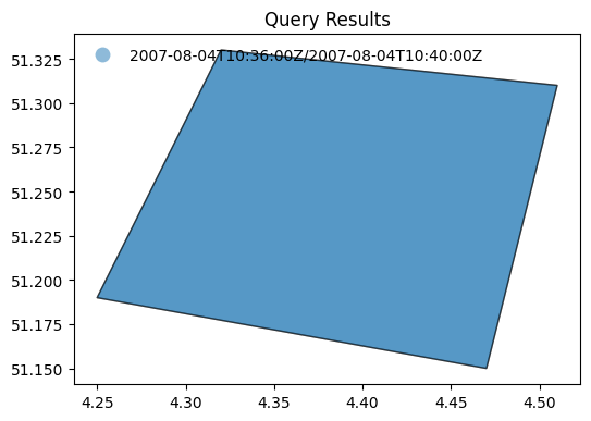
display_map(results)
Search by temporal extent#
Example: 3.5
Search granules by date range (
datetime).
results = w.collection_items(
'datasets',
limit=50,
parentIdentifier=COLLECTION_ID1,
datetime='2019-01-01T00:00:00Z/2019-12-02T00:00:00Z'
)
curl -X GET -G https://eocat.esa.int/eo-catalogue/collections/datasets/items \
--data-urlencode "limit=50" \
--data-urlencode "parentIdentifier=PROBA.CHRIS.1A" \
--data-urlencode "datetime=2019-01-01T00:00:00Z/2019-12-02T00:00:00Z"
print(f"{results['numberMatched']} items found.")
414 items found.
display_date_distribution(results)
Example: 3.6
Search granules by open-ended date range (datetime).
results = w.collection_items(
'datasets',
limit=50,
parentIdentifier=COLLECTION_ID1,
datetime='2021-12-01T00:00:00Z/'
)
curl -X GET -G https://eocat.esa.int/eo-catalogue/collections/datasets/items \
--data-urlencode "limit=50" \
--data-urlencode "parentIdentifier=PROBA.CHRIS.1A" \
--data-urlencode "datetime=2021-12-01T00:00:00Z/"
print(f"{results['numberMatched']} items found.")
510 items found.
display_date_distribution(results)
Search by identifier#
The geo:uid combined with the collection identifier eo:parentIdentifier (already prefilled in the OSDD template extracted from the collection search response) allows retrieving granule metadata for a specific granule. Use an identifier extracted from the previous search response.
'PR1_OPER_CHR_MO2_1P_20211210T065700_N22-100_E111-030_0001'
Example: 3.7
Search granules by identifier (
uid).
results = w.collection_items(
collection_id = 'datasets',
uid = granule_id,
parentIdentifier = COLLECTION_ID1
)
curl -X GET -G https://eocat.esa.int/eo-catalogue/collections/datasets/items \
--data-urlencode "uid=PR1_OPER_CHR_MO2_1P_20211210T065700_N22-100_E111-030_0001" \
--data-urlencode "parentIdentifier=PROBA.CHRIS.1A"
results
{'features': [{'bbox': [110.95, 22.02, 111.11, 22.18],
'geometry': {'coordinates': [[[111.09, 22.02],
[111.11, 22.16],
[110.97, 22.18],
[110.95, 22.04],
[111.09, 22.02]]],
'type': 'Polygon'},
'links': [{'rel': 'self',
'href': 'https://eocat.esa.int/eo-catalogue/collections/PROBA.CHRIS.1A/items/PR1_OPER_CHR_MO2_1P_20211210T065700_N22-100_E111-030_0001',
'type': 'application/geo+json'},
{'rel': 'collection',
'href': 'https://eocat.esa.int/eo-catalogue/collections/PROBA.CHRIS.1A?httpAccept=application/json',
'type': 'application/json',
'title': 'the collection document'},
{'rel': 'enclosure',
'href': 'https://tpm-ds.eo.esa.int/oads/data/PROBA1-CHRIS/PR1_OPER_CHR_MO2_1P_20211210T065700_N22-100_E111-030_0001.SIP.ZIP',
'type': 'application/x-binary',
'title': 'Download'},
{'rel': 'icon',
'href': 'http://tpm-ds.eo.esa.int/oads/meta/PROBA1-CHRIS/browse/PR1_OPER_CHR_MO2_1P_20211210T065700_N22-100_E111-030_0001.SIP.ZIP_BID.PNG',
'type': 'image/png',
'title': 'QUICKLOOK'},
{'rel': 'icon',
'href': 'http://tpm-ds.eo.esa.int/oads/meta/PROBA1-CHRIS/thumbnail/PR1_OPER_CHR_MO2_1P_20211210T065700_N22-100_E111-030_0001.SIP.ZIP_TIMG.jpg',
'type': 'image/jpeg',
'title': 'THUMBNAIL'},
{'rel': 'up',
'href': 'https://eocat.esa.int/eo-catalogue/collections/PROBA.CHRIS.1A',
'type': 'application/geo+json',
'title': 'OGC 17-069r3 metadata'},
{'rel': 'alternate',
'href': 'https://eocat.esa.int/eo-catalogue/collections/PROBA.CHRIS.1A/items/PR1_OPER_CHR_MO2_1P_20211210T065700_N22-100_E111-030_0001?httpAccept=application/atom%2Bxml',
'type': 'application/atom+xml',
'title': 'Atom format'},
{'rel': 'alternate',
'href': 'https://eocat.esa.int/eo-catalogue/collections/PROBA.CHRIS.1A/items/PR1_OPER_CHR_MO2_1P_20211210T065700_N22-100_E111-030_0001?httpAccept=application/gml%2Bxml&recordSchema=om',
'type': 'application/gml+xml;profile="http://www.opengis.net/spec/EOMPOM/1.1"',
'title': 'OGC 10-157r4 metadata'},
{'rel': 'alternate',
'href': 'https://eocat.esa.int/eo-catalogue/collections/PROBA.CHRIS.1A/items/PR1_OPER_CHR_MO2_1P_20211210T065700_N22-100_E111-030_0001?httpAccept=application/gml%2Bxml&recordSchema=om10',
'type': 'application/gml+xml;profile="http://www.opengis.net/spec/EOMPOM/1.0"',
'title': 'OGC 10-157r3 metadata'},
{'rel': 'alternate',
'href': 'https://eocat.esa.int/eo-catalogue/collections/PROBA.CHRIS.1A/items/PR1_OPER_CHR_MO2_1P_20211210T065700_N22-100_E111-030_0001?mode=owc',
'type': 'application/geo+json;profile="http://www.opengis.net/spec/eo-geojson/1.0"',
'title': 'OGC 17-003r2 metadata'},
{'rel': 'alternate',
'href': 'https://eocat.esa.int/eo-catalogue/collections/PROBA.CHRIS.1A/items/PR1_OPER_CHR_MO2_1P_20211210T065700_N22-100_E111-030_0001?httpAccept=application/geo%2Bjson;profile=https://stacspec.org',
'type': 'application/geo+json;profile="https://stacspec.org"',
'title': 'STAC metadata'},
{'rel': 'alternate',
'href': 'https://eocat.esa.int/eo-catalogue/collections/PROBA.CHRIS.1A/items/PR1_OPER_CHR_MO2_1P_20211210T065700_N22-100_E111-030_0001?httpAccept=application/vnd.iso.19139%2Bxml',
'type': 'application/vnd.iso.19139+xml',
'title': 'ISO 19139 metadata'},
{'rel': 'alternate',
'href': 'https://eocat.esa.int/eo-catalogue/collections/PROBA.CHRIS.1A/items/PR1_OPER_CHR_MO2_1P_20211210T065700_N22-100_E111-030_0001?httpAccept=application/ld%2Bjson',
'type': 'application/ld+json',
'title': 'JSON-LD metadata'},
{'rel': 'alternate',
'href': 'https://eocat.esa.int/eo-catalogue/collections/PROBA.CHRIS.1A/items/PR1_OPER_CHR_MO2_1P_20211210T065700_N22-100_E111-030_0001?httpAccept=application/ld%2Bjson;profile=https://schema.org',
'type': 'application/ld+json;profile="https://schema.org"',
'title': 'JSON-LD (schema.org) metadata'},
{'rel': 'alternate',
'href': 'https://eocat.esa.int/eo-catalogue/collections/PROBA.CHRIS.1A/items/PR1_OPER_CHR_MO2_1P_20211210T065700_N22-100_E111-030_0001?httpAccept=application/ld%2Bjson;profile=http://data.europa.eu/930/',
'type': 'application/ld+json;profile="http://data.europa.eu/930/"',
'title': 'JSON-LD (GeoDCAT-AP) metadata'},
{'rel': 'alternate',
'href': 'https://eocat.esa.int/eo-catalogue/collections/PROBA.CHRIS.1A/items/PR1_OPER_CHR_MO2_1P_20211210T065700_N22-100_E111-030_0001?httpAccept=application/rdf%2Bxml',
'type': 'application/rdf+xml',
'title': 'RDF/XML metadata'},
{'rel': 'alternate',
'href': 'https://eocat.esa.int/eo-catalogue/collections/PROBA.CHRIS.1A/items/PR1_OPER_CHR_MO2_1P_20211210T065700_N22-100_E111-030_0001?httpAccept=application/rdf%2Bxml;profile=https://schema.org',
'type': 'application/rdf+xml;profile="https://schema.org"',
'title': 'RDF/XML (schema.org) metadata'},
{'rel': 'alternate',
'href': 'https://eocat.esa.int/eo-catalogue/collections/PROBA.CHRIS.1A/items/PR1_OPER_CHR_MO2_1P_20211210T065700_N22-100_E111-030_0001?httpAccept=application/rdf%2Bxml;profile=http://data.europa.eu/930/',
'type': 'application/rdf+xml;profile="http://data.europa.eu/930/"',
'title': 'RDF/XML (GeoDCAT-AP) metadata'},
{'rel': 'alternate',
'href': 'https://eocat.esa.int/eo-catalogue/collections/PROBA.CHRIS.1A/items/PR1_OPER_CHR_MO2_1P_20211210T065700_N22-100_E111-030_0001?httpAccept=text/turtle',
'type': 'text/turtle',
'title': 'Turtle metadata'},
{'rel': 'alternate',
'href': 'https://eocat.esa.int/eo-catalogue/collections/PROBA.CHRIS.1A/items/PR1_OPER_CHR_MO2_1P_20211210T065700_N22-100_E111-030_0001?httpAccept=text/turtle;profile=https://schema.org',
'type': 'text/turtle;profile="https://schema.org"',
'title': 'Turtle (schema.org) metadata'},
{'rel': 'alternate',
'href': 'https://eocat.esa.int/eo-catalogue/collections/PROBA.CHRIS.1A/items/PR1_OPER_CHR_MO2_1P_20211210T065700_N22-100_E111-030_0001?httpAccept=text/turtle;profile=http://data.europa.eu/930/',
'type': 'text/turtle;profile="http://data.europa.eu/930/"',
'title': 'Turtle (GeoDCAT-AP) metadata'},
{'rel': 'alternate',
'href': 'https://eocat.esa.int/eo-catalogue/collections/PROBA.CHRIS.1A/items/PR1_OPER_CHR_MO2_1P_20211210T065700_N22-100_E111-030_0001?httpAccept=text/html',
'type': 'text/html',
'title': 'HTML'}],
'id': 'PR1_OPER_CHR_MO2_1P_20211210T065700_N22-100_E111-030_0001',
'collection': 'PROBA.CHRIS.1A',
'type': 'Feature',
'properties': {'date': '2021-12-10T06:57:00Z/2021-12-10T07:01:00Z',
'kind': 'http://purl.org/dc/dcmitype/Dataset',
'productInformation': {'referenceSystemIdentifier': 'epsg:4326',
'size': 36383714,
'productType': 'CHR_MO2_1P',
'availabilityTime': '2021-12-10T07:01:00Z'},
'title': 'PR1_OPER_CHR_MO2_1P_20211210T065700_N22-100_E111-030_0001',
'updated': '2023-08-25T14:56:32Z',
'acquisitionInformation': [{'acquisitionParameters': {'operationalMode': 'MODE-2',
'acquisitionType': 'NOMINAL',
'beginningDateTime': '2021-12-10T06:57:00Z',
'wrsLongitudeGrid': 'E111',
'wrsLatitudeGrid': 'N22',
'acquisitionAngles': {'illuminationAzimuthAngle': 221.0610428208729,
'illuminationElevationAngle': 57.726},
'endingDateTime': '2021-12-10T07:01:00Z',
'orbitNumber': 0},
'instrument': {'instrumentShortName': 'CHRIS', 'sensorType': 'OPTICAL'},
'platform': {'platformShortName': 'PROBA',
'platformSerialIdentifier': '1'}}],
'status': 'ARCHIVED'}}],
'numberReturned': 1,
'links': [{'rel': 'self',
'href': 'https://eocat.esa.int/eo-catalogue/collections/datasets/items?uid=PR1_OPER_CHR_MO2_1P_20211210T065700_N22-100_E111-030_0001&parentIdentifier=PROBA.CHRIS.1A',
'type': 'application/geo+json'},
{'rel': 'search',
'href': 'https://eocat.esa.int/eo-catalogue/collections/series/items/PROBA.CHRIS.1A/api',
'type': 'application/opensearchdescription+xml',
'title': 'OpenSearch Description Document'},
{'rel': 'last',
'href': 'https://eocat.esa.int/eo-catalogue/collections/datasets/items?uid=PR1_OPER_CHR_MO2_1P_20211210T065700_N22-100_E111-030_0001&parentIdentifier=PROBA.CHRIS.1A&startRecord=1',
'type': 'application/geo+json',
'title': 'last results'},
{'rel': 'alternate',
'href': 'https://eocat.esa.int/eo-catalogue/collections/datasets/items?uid=PR1_OPER_CHR_MO2_1P_20211210T065700_N22-100_E111-030_0001&parentIdentifier=PROBA.CHRIS.1A&httpAccept=application/atom%2Bxml',
'type': 'application/atom+xml'},
{'rel': 'alternate',
'href': 'https://eocat.esa.int/eo-catalogue/collections/datasets/items?uid=PR1_OPER_CHR_MO2_1P_20211210T065700_N22-100_E111-030_0001&parentIdentifier=PROBA.CHRIS.1A&mode=owc',
'type': 'application/geo+json;profile="http://www.opengis.net/spec/os-geojson/1.0"'},
{'rel': 'alternate',
'href': 'https://eocat.esa.int/eo-catalogue/collections/datasets/items?uid=PR1_OPER_CHR_MO2_1P_20211210T065700_N22-100_E111-030_0001&parentIdentifier=PROBA.CHRIS.1A&httpAccept=application/geo%2Bjson;profile=https://stacspec.org',
'type': 'application/geo+json;profile="https://stacspec.org"'},
{'rel': 'first',
'href': 'https://eocat.esa.int/eo-catalogue/collections/datasets/items?uid=PR1_OPER_CHR_MO2_1P_20211210T065700_N22-100_E111-030_0001&parentIdentifier=PROBA.CHRIS.1A&startRecord=1',
'type': 'application/geo+json',
'title': 'first results'}],
'id': 'https://eocat.esa.int/eo-catalogue/collections/datasets/items',
'type': 'FeatureCollection',
'numberMatched': 1}
Alternatively, the feature can be accessed directly as shown below. The httpAccept query parameter can be added to request a different representation.
Example: 3.8
Access granule by identifier.
results = w.collection_item(
collection_id = 'datasets',
identifier = granule_id
)
curl -X GET -G https://eocat.esa.int/eo-catalogue/collections/datasets/items/PR1_OPER_CHR_MO2_1P_20211210T065700_N22-100_E111-030_0001
# results['properties']['title']
# results['properties']
results
{'bbox': [110.95, 22.02, 111.11, 22.18],
'geometry': {'coordinates': [[[111.09, 22.02],
[111.11, 22.16],
[110.97, 22.18],
[110.95, 22.04],
[111.09, 22.02]]],
'type': 'Polygon'},
'links': [{'rel': 'self',
'href': 'https://eocat.esa.int/eo-catalogue/collections/PROBA.CHRIS.1A/items/PR1_OPER_CHR_MO2_1P_20211210T065700_N22-100_E111-030_0001',
'type': 'application/geo+json'},
{'rel': 'collection',
'href': 'https://eocat.esa.int/eo-catalogue/collections/PROBA.CHRIS.1A?httpAccept=application/json',
'type': 'application/json',
'title': 'the collection document'},
{'rel': 'enclosure',
'href': 'https://tpm-ds.eo.esa.int/oads/data/PROBA1-CHRIS/PR1_OPER_CHR_MO2_1P_20211210T065700_N22-100_E111-030_0001.SIP.ZIP',
'type': 'application/x-binary',
'title': 'Download'},
{'rel': 'icon',
'href': 'http://tpm-ds.eo.esa.int/oads/meta/PROBA1-CHRIS/browse/PR1_OPER_CHR_MO2_1P_20211210T065700_N22-100_E111-030_0001.SIP.ZIP_BID.PNG',
'type': 'image/png',
'title': 'QUICKLOOK'},
{'rel': 'icon',
'href': 'http://tpm-ds.eo.esa.int/oads/meta/PROBA1-CHRIS/thumbnail/PR1_OPER_CHR_MO2_1P_20211210T065700_N22-100_E111-030_0001.SIP.ZIP_TIMG.jpg',
'type': 'image/jpeg',
'title': 'THUMBNAIL'},
{'rel': 'up',
'href': 'https://eocat.esa.int/eo-catalogue/collections/PROBA.CHRIS.1A',
'type': 'application/geo+json',
'title': 'OGC 17-069r3 metadata'},
{'rel': 'alternate',
'href': 'https://eocat.esa.int/eo-catalogue/collections/PROBA.CHRIS.1A/items/PR1_OPER_CHR_MO2_1P_20211210T065700_N22-100_E111-030_0001?httpAccept=application/atom%2Bxml',
'type': 'application/atom+xml',
'title': 'Atom format'},
{'rel': 'alternate',
'href': 'https://eocat.esa.int/eo-catalogue/collections/PROBA.CHRIS.1A/items/PR1_OPER_CHR_MO2_1P_20211210T065700_N22-100_E111-030_0001?httpAccept=application/gml%2Bxml&recordSchema=om',
'type': 'application/gml+xml;profile="http://www.opengis.net/spec/EOMPOM/1.1"',
'title': 'OGC 10-157r4 metadata'},
{'rel': 'alternate',
'href': 'https://eocat.esa.int/eo-catalogue/collections/PROBA.CHRIS.1A/items/PR1_OPER_CHR_MO2_1P_20211210T065700_N22-100_E111-030_0001?httpAccept=application/gml%2Bxml&recordSchema=om10',
'type': 'application/gml+xml;profile="http://www.opengis.net/spec/EOMPOM/1.0"',
'title': 'OGC 10-157r3 metadata'},
{'rel': 'alternate',
'href': 'https://eocat.esa.int/eo-catalogue/collections/PROBA.CHRIS.1A/items/PR1_OPER_CHR_MO2_1P_20211210T065700_N22-100_E111-030_0001?mode=owc',
'type': 'application/geo+json;profile="http://www.opengis.net/spec/eo-geojson/1.0"',
'title': 'OGC 17-003r2 metadata'},
{'rel': 'alternate',
'href': 'https://eocat.esa.int/eo-catalogue/collections/PROBA.CHRIS.1A/items/PR1_OPER_CHR_MO2_1P_20211210T065700_N22-100_E111-030_0001?httpAccept=application/geo%2Bjson;profile=https://stacspec.org',
'type': 'application/geo+json;profile="https://stacspec.org"',
'title': 'STAC metadata'},
{'rel': 'alternate',
'href': 'https://eocat.esa.int/eo-catalogue/collections/PROBA.CHRIS.1A/items/PR1_OPER_CHR_MO2_1P_20211210T065700_N22-100_E111-030_0001?httpAccept=application/vnd.iso.19139%2Bxml',
'type': 'application/vnd.iso.19139+xml',
'title': 'ISO 19139 metadata'},
{'rel': 'alternate',
'href': 'https://eocat.esa.int/eo-catalogue/collections/PROBA.CHRIS.1A/items/PR1_OPER_CHR_MO2_1P_20211210T065700_N22-100_E111-030_0001?httpAccept=application/ld%2Bjson',
'type': 'application/ld+json',
'title': 'JSON-LD metadata'},
{'rel': 'alternate',
'href': 'https://eocat.esa.int/eo-catalogue/collections/PROBA.CHRIS.1A/items/PR1_OPER_CHR_MO2_1P_20211210T065700_N22-100_E111-030_0001?httpAccept=application/ld%2Bjson;profile=https://schema.org',
'type': 'application/ld+json;profile="https://schema.org"',
'title': 'JSON-LD (schema.org) metadata'},
{'rel': 'alternate',
'href': 'https://eocat.esa.int/eo-catalogue/collections/PROBA.CHRIS.1A/items/PR1_OPER_CHR_MO2_1P_20211210T065700_N22-100_E111-030_0001?httpAccept=application/ld%2Bjson;profile=http://data.europa.eu/930/',
'type': 'application/ld+json;profile="http://data.europa.eu/930/"',
'title': 'JSON-LD (GeoDCAT-AP) metadata'},
{'rel': 'alternate',
'href': 'https://eocat.esa.int/eo-catalogue/collections/PROBA.CHRIS.1A/items/PR1_OPER_CHR_MO2_1P_20211210T065700_N22-100_E111-030_0001?httpAccept=application/rdf%2Bxml',
'type': 'application/rdf+xml',
'title': 'RDF/XML metadata'},
{'rel': 'alternate',
'href': 'https://eocat.esa.int/eo-catalogue/collections/PROBA.CHRIS.1A/items/PR1_OPER_CHR_MO2_1P_20211210T065700_N22-100_E111-030_0001?httpAccept=application/rdf%2Bxml;profile=https://schema.org',
'type': 'application/rdf+xml;profile="https://schema.org"',
'title': 'RDF/XML (schema.org) metadata'},
{'rel': 'alternate',
'href': 'https://eocat.esa.int/eo-catalogue/collections/PROBA.CHRIS.1A/items/PR1_OPER_CHR_MO2_1P_20211210T065700_N22-100_E111-030_0001?httpAccept=application/rdf%2Bxml;profile=http://data.europa.eu/930/',
'type': 'application/rdf+xml;profile="http://data.europa.eu/930/"',
'title': 'RDF/XML (GeoDCAT-AP) metadata'},
{'rel': 'alternate',
'href': 'https://eocat.esa.int/eo-catalogue/collections/PROBA.CHRIS.1A/items/PR1_OPER_CHR_MO2_1P_20211210T065700_N22-100_E111-030_0001?httpAccept=text/turtle',
'type': 'text/turtle',
'title': 'Turtle metadata'},
{'rel': 'alternate',
'href': 'https://eocat.esa.int/eo-catalogue/collections/PROBA.CHRIS.1A/items/PR1_OPER_CHR_MO2_1P_20211210T065700_N22-100_E111-030_0001?httpAccept=text/turtle;profile=https://schema.org',
'type': 'text/turtle;profile="https://schema.org"',
'title': 'Turtle (schema.org) metadata'},
{'rel': 'alternate',
'href': 'https://eocat.esa.int/eo-catalogue/collections/PROBA.CHRIS.1A/items/PR1_OPER_CHR_MO2_1P_20211210T065700_N22-100_E111-030_0001?httpAccept=text/turtle;profile=http://data.europa.eu/930/',
'type': 'text/turtle;profile="http://data.europa.eu/930/"',
'title': 'Turtle (GeoDCAT-AP) metadata'},
{'rel': 'alternate',
'href': 'https://eocat.esa.int/eo-catalogue/collections/PROBA.CHRIS.1A/items/PR1_OPER_CHR_MO2_1P_20211210T065700_N22-100_E111-030_0001?httpAccept=text/html',
'type': 'text/html',
'title': 'HTML'}],
'id': 'PR1_OPER_CHR_MO2_1P_20211210T065700_N22-100_E111-030_0001',
'collection': 'PROBA.CHRIS.1A',
'type': 'Feature',
'properties': {'date': '2021-12-10T06:57:00Z/2021-12-10T07:01:00Z',
'kind': 'http://purl.org/dc/dcmitype/Dataset',
'productInformation': {'referenceSystemIdentifier': 'epsg:4326',
'size': 36383714,
'productType': 'CHR_MO2_1P',
'availabilityTime': '2021-12-10T07:01:00Z'},
'title': 'PR1_OPER_CHR_MO2_1P_20211210T065700_N22-100_E111-030_0001',
'updated': '2023-08-25T14:56:32Z',
'acquisitionInformation': [{'acquisitionParameters': {'operationalMode': 'MODE-2',
'acquisitionType': 'NOMINAL',
'beginningDateTime': '2021-12-10T06:57:00Z',
'wrsLongitudeGrid': 'E111',
'wrsLatitudeGrid': 'N22',
'acquisitionAngles': {'illuminationAzimuthAngle': 221.0610428208729,
'illuminationElevationAngle': 57.726},
'endingDateTime': '2021-12-10T07:01:00Z',
'orbitNumber': 0},
'instrument': {'instrumentShortName': 'CHRIS', 'sensorType': 'OPTICAL'},
'platform': {'platformShortName': 'PROBA',
'platformSerialIdentifier': '1'}}],
'status': 'ARCHIVED'}}
Search by acquisition parameters#
Example: 3.9
Search granules by illumination angles
illuminationElevationAngle,illuminationAzimuthAngle.
The example shows how a set of values can be provided using square brackets: [value-1,value-2].
The illuminationElevationAngle and illuminationAzimuthAngle search parameters allow filtering results by illumination angles. An interval specifying minimum and maximum allowed values is to be provided, e.g. [48,50]. Only providing the minimum or maximum value can be done by using an open interval, e.g. [48 or 50].
Other acquisition parameters can be advertised as searchable in the collection OSDD, depending on the sensor type e.g.:
orbitNumber
orbitDirection
frame
track etc.
results = w.collection_items(
limit = 3,
collection_id = 'datasets',
parentIdentifier = COLLECTION_ID3_CLOUDS,
illuminationElevationAngle = '[30,40]'
)
curl -X GET -G https://eocat.esa.int/eo-catalogue/collections/datasets/items \
--data-urlencode "limit=3" \
--data-urlencode "parentIdentifier=IKONOS.ESA.archive" \
--data-urlencode "illuminationElevationAngle=[30,40]"
print(f"{results['numberMatched']} items found.")
33 items found.
df = pd.json_normalize(results['features'][0]['properties']['acquisitionInformation'])
df.transpose()
| 0 | |
|---|---|
| acquisitionParameters.operationalMode | IM |
| acquisitionParameters.acquisitionType | NOMINAL |
| acquisitionParameters.beginningDateTime | 2006-10-11T10:30:00Z |
| acquisitionParameters.acquisitionAngles.illuminationAzimuthAngle | 171.2605 |
| acquisitionParameters.acquisitionAngles.alongTrackIncidenceAngle | 315.2859 |
| acquisitionParameters.acquisitionAngles.illuminationElevationAngle | 37.74352 |
| acquisitionParameters.acquisitionAngles.acrossTrackIncidenceAngle | 65.79101 |
| acquisitionParameters.endingDateTime | 2006-10-11T10:30:00Z |
| acquisitionParameters.orbitDirection | DESCENDING |
| acquisitionParameters.orbitNumber | 0 |
| instrument.instrumentShortName | OSA |
| instrument.sensorType | OPTICAL |
| platform.platformShortName | IKONOS |
| platform.platformSerialIdentifier | 2 |
Example: 3.10
Search granules by
orbitDirection.
results = w.collection_items(
limit = 3,
collection_id = 'datasets',
parentIdentifier = COLLECTION_ID2,
orbitDirection = 'DESCENDING'
)
curl -X GET -G https://eocat.esa.int/eo-catalogue/collections/datasets/items \
--data-urlencode "limit=3" \
--data-urlencode "parentIdentifier=SPOT-6.and.7.ESA.archive" \
--data-urlencode "orbitDirection=DESCENDING"
print(f"{results['numberMatched']} items found.")
806 items found.
df = pd.json_normalize(results['features'][0]['properties']['acquisitionInformation'])
df.transpose()
| 0 | |
|---|---|
| acquisitionParameters.operationalMode | P_S |
| acquisitionParameters.acquisitionType | NOMINAL |
| acquisitionParameters.beginningDateTime | 2015-04-26T11:13:00Z |
| acquisitionParameters.wrsLongitudeGrid | W008 |
| acquisitionParameters.wrsLatitudeGrid | N52 |
| acquisitionParameters.acquisitionAngles.illuminationAzimuthAngle | 151.309361 |
| acquisitionParameters.acquisitionAngles.alongTrackIncidenceAngle | 2.56659 |
| acquisitionParameters.acquisitionAngles.illuminationElevationAngle | 47.511078 |
| acquisitionParameters.acquisitionAngles.acrossTrackIncidenceAngle | 4.350939 |
| acquisitionParameters.endingDateTime | 2015-04-26T11:13:31Z |
| acquisitionParameters.orbitDirection | DESCENDING |
| acquisitionParameters.orbitNumber | 0 |
| instrument.instrumentShortName | NAOMI |
| instrument.sensorType | OPTICAL |
| platform.platformShortName | SPOT |
| platform.platformSerialIdentifier | 7 |
Example: 3.11
Search granules by
orbitNumber.
The example shows how a set of values can be provided using curly brackets: {value-1,value-2,…,value-n}
results = w.collection_items(
limit = 3,
collection_id = 'datasets',
parentIdentifier = COLLECTION_ID2_CLOUDS,
orbitNumber = '{1237, 1248}' # 1237 or 1248
)
curl -X GET -G https://eocat.esa.int/eo-catalogue/collections/datasets/items \
--data-urlencode "limit=3" \
--data-urlencode "parentIdentifier=LANDSAT.ETM.GTC" \
--data-urlencode "orbitNumber={1237, 1248}"
print(f"{results['numberMatched']} items found.")
14 items found.
df = pd.json_normalize(results['features'][0]['properties']['acquisitionInformation'])
df.transpose()
| 0 | |
|---|---|
| acquisitionParameters.operationalMode | IM |
| acquisitionParameters.acquisitionType | NOMINAL |
| acquisitionParameters.beginningDateTime | 1999-07-09T13:16:51Z |
| acquisitionParameters.wrsLongitudeGrid | 227 |
| acquisitionParameters.wrsLatitudeGrid | 2 |
| acquisitionParameters.acquisitionAngles.illuminationAzimuthAngle | -153.035 |
| acquisitionParameters.acquisitionAngles.illuminationZenithAngle | 58.6547 |
| acquisitionParameters.acquisitionAngles.illuminationElevationAngle | 31.3453 |
| acquisitionParameters.endingDateTime | 1999-07-09T13:17:20Z |
| acquisitionParameters.orbitDirection | DESCENDING |
| acquisitionParameters.orbitNumber | 1237 |
| instrument.instrumentShortName | ETM |
| instrument.sensorType | OPTICAL |
| platform.platformShortName | Landsat |
| platform.platformSerialIdentifier | 7 |
Advanced topics#
Sorting results#
Sorting of search results is available for collection, services and granule searches. The supported search criteria can be found in the corresponding OpenSearch OSDD document. The sortKeys query parameter is defined in the SRU specification [RD07].
Example: 4.1
Collection search results can be sorted according to various criteria with
sortKeys[RD07], in descending or ascending order which can be discovered in the OSDD. The example sorts collections in descending chronological order according to the {eo:modificationDate} value.
results = w.collection_items(
'series',
limit=10,
# sortKeys='title,dc,1',
sortKeys='modificationDate,eo,0',
organisationName = 'ESA/ESRIN'
)
curl -X GET -G https://eocat.esa.int/eo-catalogue/collections/series/items \
--data-urlencode "limit=10" \
--data-urlencode "sortKeys=modificationDate,eo,0" \
--data-urlencode "organisationName=ESA/ESRIN"
print(f"{results['numberMatched']} items found.")
187 items found.
gdf = gpd.GeoDataFrame.from_features(results)
gdf[['updated','title']]
| updated | title | |
|---|---|---|
| 0 | 2024-01-11T00:00:00.000Z | MOS-1/1B ESA System Corrected VTIR Products [V... |
| 1 | 2024-01-11T00:00:00.000Z | MOS-1/1B ESA System Corrected Map-oriented Pro... |
| 2 | 2023-06-19T00:00:00.000Z | KOMPSAT-1 Coverage of 50 European Cities |
| 3 | 2023-05-12T00:00:00.000Z | GOSAT-2 TANSO FTS-2 and CAI-2 ESA archive |
| 4 | 2023-05-12T00:00:00.000Z | GOSAT TANSO FTS and CAI ESA archive |
| 5 | 2023-03-29T00:00:00.000Z | FSSCat products |
| 6 | 2023-02-17T00:00:00.000Z | Aeolus Level 2C assisted wind fields resulting... |
| 7 | 2023-02-17T00:00:00.000Z | Envisat AATSR L1B Brightness Temperature/Radia... |
| 8 | 2023-02-16T00:00:00.000Z | Biomass Level 2A |
| 9 | 2023-02-16T00:00:00.000Z | Biomass Level 1C |
Example: 4.2
Granule search results can be sorted according to various criteria with
sortKeys[RD07], in descending or ascending order which can be discovered in the OSDD. The example sorts granules in ascending chronological order according to the {time:start} value.
results = w.collection_items(
'datasets',
limit=10,
parentIdentifier=COLLECTION_ID1,
sortKeys='start,time,1'
)
curl -X GET -G https://eocat.esa.int/eo-catalogue/collections/datasets/items \
--data-urlencode "limit=10" \
--data-urlencode "parentIdentifier=PROBA.CHRIS.1A" \
--data-urlencode "sortKeys=start,time,1"
print(f"{results['numberMatched']} items found.")
8268 items found.
gdf = gpd.GeoDataFrame.from_features(results)
gdf[['date','title']]
| date | title | |
|---|---|---|
| 0 | 2002-05-14T10:09:00Z/2002-05-14T10:13:00Z | PR1_OPER_CHR_MO2_1P_20020514T100900_N45-018_E0... |
| 1 | 2002-05-15T18:29:00Z/2002-05-15T18:33:00Z | PR1_OPER_CHR_MO5_1P_20020515T182900_N38-005_W1... |
| 2 | 2002-05-29T18:33:00Z/2002-05-29T18:37:00Z | PR1_OPER_CHR_MO3_1P_20020529T183300_N38-005_W1... |
| 3 | 2002-06-01T15:59:00Z/2002-06-01T16:03:00Z | PR1_OPER_CHR_MO4_1P_20020601T155900_N45-029_W0... |
| 4 | 2002-06-02T17:47:00Z/2002-06-02T17:51:00Z | PR1_OPER_CHR_MO3_1P_20020602T174700_N55-049_W0... |
| 5 | 2002-06-04T18:17:00Z/2002-06-04T18:21:00Z | PR1_OPER_CHR_MO4_1P_20020604T181700_N50-055_W1... |
| 6 | 2002-06-12T10:25:00Z/2002-06-12T10:29:00Z | PR1_OPER_CHR_MO3_1P_20020612T102500_N48-008_E0... |
| 7 | 2002-06-13T18:45:00Z/2002-06-13T18:49:00Z | PR1_OPER_CHR_MO2_1P_20020613T184500_N43-018_W1... |
| 8 | 2002-06-14T17:29:00Z/2002-06-14T17:33:00Z | PR1_OPER_CHR_MO3_1P_20020614T172900_N19-033_W0... |
| 9 | 2002-06-18T08:40:00Z/2002-06-18T08:44:00Z | PR1_OPER_CHR_MO1_1P_20020618T084000_N30-058_E0... |
Faceted search#
Faceted search results are available for collection, service and granule searches in both GeoJSON and Atom response formats. The GeoJSON encoding is defined in [RD35] at https://docs.ogc.org/per/19-020r1.html#_facetedresults and consistent with the OASIS SRU encoding available for Atom response format defined in [RD07].
The server can supply faceted results for a query: i.e. an analysis of how the search results are distributed over various categories (or “facets”). For example, the analysis may reveal how the results are distributed by organization. The client might then refine the query to one particular organization among those listed.
By default, the search response contains faceted search results under the element facetedResults. In the current implementation, the faceted search information groups the results by a number of predefined facets which may include platform, instrument and organisation etc. The client can also specify which facets it would like to receive as part of the request with the facetLimit search parameter.
The search response does not include the list of all values for the facet. The list is truncated and provides the values with the largest count. Future versions of the software may allow paging through all values, which would require support for the sru:facetStart search parameter.
The faceted Results are consistent with the OASIS searchRetrieve facetedResults XML schema available at http://docs.oasis-open.org/search-ws/searchRetrieve/v1.0/os/schemas/facetedResults.xsd defined in [RD07] and the GeoJSON encoding defined in [RD35].
The facetLimit query parameter is defined in the SRU specification [RD07].
Additional response formats#
Different representations are available for search results (container), and individual items representing a Collection, Service or Granule. They are declared in the OpenAPI definition document (/api). Content negotiation can be used via the Accept header parameter or httpAccept query parameter.
Available formats are listed in the following subsections.
All the search criteria described previously can be combined with any of the available representations.
The OpenAPI definition describing the OGC API Features interface is available at https://eocat.esa.int/eo-catalogue/api.
Search results#
The various media types available for search results are listed in the OpenAPI definition. For each of the available media types, an example is provided in the current section.
ref = apidoc['paths']['/collections/datasets/items']['get']['responses']['200']['content']
df = pd.json_normalize(ref, max_level = 0)
sorted(ref.keys())
['application/atom+xml',
'application/geo+json',
'application/geo+json;profile="http://www.opengis.net/spec/ogcapi-features-1/1.0"',
'application/geo+json;profile="http://www.opengis.net/spec/os-geojson/1.0"',
'application/geo+json;profile="https://stacspec.org"',
'application/ld+json',
'application/ld+json;profile="http://data.europa.eu/930/"',
'application/ld+json;profile="http://www.opengis.net/spec/os-geojson/1.0"',
'application/ld+json;profile="https://schema.org"',
'application/rdf+xml',
'application/rdf+xml;profile="http://data.europa.eu/930/"',
'application/rdf+xml;profile="http://www.opengis.net/spec/os-geojson/1.0"',
'application/rdf+xml;profile="https://schema.org"',
'text/html',
'text/turtle',
'text/turtle;profile="http://data.europa.eu/930/"',
'text/turtle;profile="http://www.opengis.net/spec/os-geojson/1.0"',
'text/turtle;profile="https://schema.org"']
| Example | Media type |
|---|---|
| Example 5.1 | application/atom+xml |
| Example 5.2 | application/geo+json |
| Example 5.3 | application/geo+json;profile="http://www.opengis.net/spec/ogcapi-features-1/1.0" |
| Example 5.4 | application/geo+json;profile="http://www.opengis.net/spec/os-geojson/1.0" |
| Example 5.5 | application/geo+json;profile="https://stacspec.org" |
| Example 5.6 | application/ld+json |
| Example 5.7 | application/ld+json;profile="http://data.europa.eu/930/" |
| Example 5.8 | application/ld+json;profile="http://www.opengis.net/spec/os-geojson/1.0" |
| Example 5.9 | application/ld+json;profile="https://schema.org" |
| Example 5.10 | application/rdf+xml |
| Example 5.11 | application/rdf+xml;profile="http://data.europa.eu/930/" |
| Example 5.12 | application/rdf+xml;profile="http://www.opengis.net/spec/os-geojson/1.0" |
| Example 5.13 | application/rdf+xml;profile="https://schema.org" |
| Example 5.14 | text/html |
| Example 5.15 | text/turtle |
| Example 5.16 | text/turtle;profile="http://data.europa.eu/930/" |
| Example 5.17 | text/turtle;profile="http://www.opengis.net/spec/os-geojson/1.0" |
| Example 5.18 | text/turtle;profile="https://schema.org" |
Example: 5.1
Represent search response in
application/atom+xmlmedia format (httpAccept).
curl -X GET -G https://eocat.esa.int/eo-catalogue/collections/series/items \
--data-urlencode "limit=0" \
--data-urlencode "httpAccept=application/atom+xml"
<?xml version="1.0" ?><feed xmlns="http://www.w3.org/2005/Atom" xmlns:dc="http://purl.org/dc/elements/1.1/" xmlns:eo="http://a9.com/-/opensearch/extensions/eo/1.0/" xmlns:geo="http://a9.com/-/opensearch/extensions/geo/1.0/" xmlns:georss="http://www.georss.org/georss" xmlns:os="http://a9.com/-/spec/opensearch/1.1/" xmlns:owc="http://www.opengis.net/owc/1.0" xmlns:referrer="http://a9.com/-/opensearch/extensions/referrer/1.0/" xmlns:semantic="http://a9.com/-/opensearch/extensions/semantic/1.0/" xmlns:sru="http://a9.com/-/opensearch/extensions/sru/2.0/" xmlns:time="http://a9.com/-/opensearch/extensions/time/1.0/">
<author>
<name>ESA Catalog</name>
<email>eohelp@eo.esa.int</email>
</author>
<generator>ESA Catalog</generator>
<id>https://eocat.esa.int/eo-catalogue/collections/series/items</id>
<rights>Copyright 2016-2023, European Space Agency</rights>
<title>ESA Catalog - Search Response</title>
<updated>2024-01-29T13:52:56Z</updated>
<link href="https://eocat.esa.int/eo-catalogue/api?httpAccept=application/opensearchdescription%2Bxml" rel="search" type="application/opensearchdescription+xml"/>
<link href="https://eocat.esa.int/eo-catalogue/collections/series/items?limit=0&httpAccept=application/geo%2Bjson;profile="http://www.opengis.net/spec/ogcapi-features-1/1.0"" rel="alternate" type="application/geo+json;profile="http://www.opengis.net/spec/ogcapi-features-1/1.0""/>
<link href="https://eocat.esa.int/eo-catalogue/collections/series/items?limit=0&httpAccept=application/geo%2Bjson;profile="http://www.opengis.net/spec/os-geojson/1.0"" rel="alternate" type="application/geo+json;profile="http://www.opengis.net/spec/os-geojson/1.0""/>
<link href="https://eocat.esa.int/eo-catalogue/collections/series/items?limit=0&httpAccept=application/geo%2Bjson;profile="https://stacspec.org"" rel="alternate" type="application/geo+json;profile="https://stacspec.org""/>
<link href="https://eocat.esa.int/eo-catalogue/collections/series/items?limit=0&httpAccept=application/atom%2Bxml" hreflang="en" rel="self" type="application/atom+xml"/>
<os:totalResults>187</os:totalResults>
<os:startIndex>1</os:startIndex>
<os:itemsPerPage>0</os:itemsPerPage>
<os:Query dc:type="collection" os:count="0" os:startIndex="1" role="request"/>
</feed>
Example: 5.2
Represent search response in
application/geo+jsonmedia format (httpAccept).
curl -X GET -G https://eocat.esa.int/eo-catalogue/collections/series/items \
--data-urlencode "limit=0" \
--data-urlencode "httpAccept=application/geo+json"
{
"features": [],
"numberReturned": 0,
"links": [
{
"rel": "self",
"href": "https://eocat.esa.int/eo-catalogue/collections/series/items?limit=0&httpAccept=application/geo%2Bjson",
"type": "application/geo+json"
},
{
"rel": "search",
"href": "https://eocat.esa.int/eo-catalogue/api?httpAccept=application/opensearchdescription%2Bxml",
"type": "application/opensearchdescription+xml",
"title": "OpenSearch Description Document"
},
{
"rel": "alternate",
"href": "https://eocat.esa.int/eo-catalogue/collections/series/items?limit=0&httpAccept=application/atom%2Bxml",
"type": "application/atom+xml"
},
{
"rel": "alternate",
"href": "https://eocat.esa.int/eo-catalogue/collections/series/items?limit=0&mode=owc",
"type": "application/geo+json;profile=\"http://www.opengis.net/spec/os-geojson/1.0\""
},
{
"rel": "alternate",
"href": "https://eocat.esa.int/eo-catalogue/collections/series/items?limit=0&httpAccept=application/geo%2Bjson;profile=https://stacspec.org",
"type": "application/geo+json;profile=\"https://stacspec.org\""
}
],
"id": "https://eocat.esa.int/eo-catalogue/collections/series/items",
"type": "FeatureCollection",
"numberMatched": 187
}
Example: 5.3
Represent search response in
application/geo+json;profile="http://www.opengis.net/spec/ogcapi-features-1/1.0"media format (httpAccept).
curl -X GET -G https://eocat.esa.int/eo-catalogue/collections/series/items \
--data-urlencode "limit=0" \
--data-urlencode "httpAccept=application/geo+json;profile="http://www.opengis.net/spec/ogcapi-features-1/1.0""
{
"features": [],
"numberReturned": 0,
"links": [
{
"rel": "self",
"href": "https://eocat.esa.int/eo-catalogue/collections/series/items?limit=0&httpAccept=application/geo%2Bjson%3Bprofile%3D%22http%3A//www.opengis.net/spec/ogcapi-features-1/1.0%22",
"type": "application/geo+json"
},
{
"rel": "search",
"href": "https://eocat.esa.int/eo-catalogue/api?httpAccept=application/opensearchdescription%2Bxml",
"type": "application/opensearchdescription+xml",
"title": "OpenSearch Description Document"
},
{
"rel": "alternate",
"href": "https://eocat.esa.int/eo-catalogue/collections/series/items?limit=0&httpAccept=application/atom%2Bxml",
"type": "application/atom+xml"
},
{
"rel": "alternate",
"href": "https://eocat.esa.int/eo-catalogue/collections/series/items?limit=0&mode=owc",
"type": "application/geo+json;profile=\"http://www.opengis.net/spec/os-geojson/1.0\""
},
{
"rel": "alternate",
"href": "https://eocat.esa.int/eo-catalogue/collections/series/items?limit=0&httpAccept=application/geo%2Bjson;profile=https://stacspec.org",
"type": "application/geo+json;profile=\"https://stacspec.org\""
}
],
"id": "https://eocat.esa.int/eo-catalogue/collections/series/items",
"type": "FeatureCollection",
"numberMatched": 187
}
Example: 5.4
Represent search response in
application/geo+json;profile="http://www.opengis.net/spec/os-geojson/1.0"media format (httpAccept).
curl -X GET -G https://eocat.esa.int/eo-catalogue/collections/series/items \
--data-urlencode "limit=0" \
--data-urlencode "httpAccept=application/geo+json;profile="http://www.opengis.net/spec/os-geojson/1.0""
{
"facetedResults": {
"datasource": [
{
"displayLabel": "ESA Catalog",
"baseURL": "https://eocat.esa.int/eo-catalogue",
"description": "ESA Catalog",
"facets": [
{
"displayLabel": "Platform",
"terms": [
{
"actualTerm": "Envisat",
"count": 34
},
{
"actualTerm": "ERS-2",
"count": 20
},
{
"actualTerm": "ERS-1",
"count": 16
},
{
"actualTerm": "Swarm",
"count": 11
},
{
"actualTerm": "SMOS",
"count": 9
},
{
"actualTerm": "ALOS-1",
"count": 8
},
{
"actualTerm": "GOCE",
"count": 7
},
{
"actualTerm": "Biomass",
"count": 5
},
{
"actualTerm": "GEOSAT-2",
"count": 5
},
{
"actualTerm": "Aeolus",
"count": 4
}
],
"index": "eo:platform",
"relation": "="
},
{
"displayLabel": "Instrument",
"terms": [
{
"actualTerm": "STR",
"count": 18
},
{
"actualTerm": "ASAR",
"count": 15
},
{
"actualTerm": "ACC",
"count": 11
},
{
"actualTerm": "ASM",
"count": 11
},
{
"actualTerm": "EFI",
"count": 11
},
{
"actualTerm": "GPSR",
"count": 11
},
{
"actualTerm": "LRR",
"count": 11
},
{
"actualTerm": "VFM",
"count": 11
},
{
"actualTerm": "MIRAS",
"count": 9
},
{
"actualTerm": "EGG",
"count": 7
}
],
"index": "eo:instrument",
"relation": "="
},
{
"displayLabel": "OrganisationName",
"terms": [
{
"actualTerm": "ESA/ESRIN",
"count": 187
}
],
"index": "eo:organisationName",
"relation": "="
},
{
"displayLabel": "ProcessingLevel",
"terms": [
{
"actualTerm": "level 2",
"count": 66
},
{
"actualTerm": "level 1b",
"count": 58
},
{
"actualTerm": "multiple",
"count": 47
},
{
"actualTerm": "level 1",
"count": 46
},
{
"actualTerm": "level 3",
"count": 29
},
{
"actualTerm": "level 1a",
"count": 19
},
{
"actualTerm": "level 1c",
"count": 14
},
{
"actualTerm": "level 0",
"count": 9
},
{
"actualTerm": "level 2a",
"count": 7
},
{
"actualTerm": "level 3a",
"count": 5
}
],
"index": "eo:processingLevel",
"relation": "="
},
{
"displayLabel": "ClassifiedAs",
"terms": [
{
"actualTerm": "https://earth.esa.int/concepts/concept_scheme/earth-topics",
"count": 187
},
{
"actualTerm": "https://earth.esa.int/concepts/concept_scheme/instruments",
"count": 187
},
{
"actualTerm": "https://earth.esa.int/concepts/concept_scheme/platforms",
"count": 187
},
{
"actualTerm": "https://earth.esa.int/concept/66ab957a-0434-5953-8b33-be95150a9ecb",
"count": 61
},
{
"actualTerm": "https://earth.esa.int/concept/3bf4cc22-5dad-5652-8575-8347564c4a0c",
"count": 60
},
{
"actualTerm": "https://earth.esa.int/concept/8dc47b68-6cad-59ce-836f-7328372de417",
"count": 60
},
{
"actualTerm": "https://earth.esa.int/concept/e4d01e03-0ef5-5b4c-b40f-2b5f49667f53",
"count": 59
},
{
"actualTerm": "https://earth.esa.int/concept/e3666b36-a100-5e2c-b0c0-a24ed76f195e",
"count": 46
},
{
"actualTerm": "https://earth.esa.int/concept/8f86e1ce-97c3-534d-b370-2692352992fe",
"count": 40
},
{
"actualTerm": "https://earth.esa.int/concept/0d2133c5-b0bb-5ce2-b000-243ade6a65b8",
"count": 37
}
],
"index": "semantic:classifiedAs",
"relation": "="
},
{
"displayLabel": "UseLimitation",
"terms": [
{
"actualTerm": "EO Sign In Authentication",
"count": 69
},
{
"actualTerm": "Fast Registration with immediate access",
"count": 31
},
{
"actualTerm": "Project Proposal (Restrained)",
"count": 26
},
{
"actualTerm": "Fast Registration with Approval",
"count": 23
},
{
"actualTerm": "Open Access",
"count": 12
},
{
"actualTerm": "External Data",
"count": 10
},
{
"actualTerm": "Fast Registration with approval",
"count": 7
},
{
"actualTerm": "Data Service Request",
"count": 4
},
{
"actualTerm": "EO Sign In Authentication (Open)",
"count": 3
},
{
"actualTerm": "Project Proposal",
"count": 1
}
],
"index": "eo:useLimitation",
"relation": "="
}
]
}
]
},
"features": [],
"totalResults": 187,
"startIndex": 1,
"itemsPerPage": 0,
"id": "https://eocat.esa.int/eo-catalogue/collections/series/items",
"type": "FeatureCollection",
"queries": {
"request": [
{
"dc:type": "collection",
"os:count": "0",
"os:startIndex": "1"
}
]
},
"properties": {
"creator": "ESA Catalog",
"rights": "Copyright 2016-2023, European Space Agency",
"links": {
"search": [
{
"href": "https://eocat.esa.int/eo-catalogue/api?httpAccept=application/opensearchdescription%2Bxml",
"type": "application/opensearchdescription+xml",
"title": "OpenSearch Description Document"
}
],
"profiles": [
{
"href": "http://www.opengis.net/spec/owc-geojson/1.0/req/core"
},
{
"href": "http://www.opengis.net/spec/os-geojson/1.0/req/core"
}
],
"alternates": [
{
"href": "https://eocat.esa.int/eo-catalogue/collections/series/items?limit=0&httpAccept=application/atom%2Bxml",
"type": "application/atom+xml"
},
{
"href": "https://eocat.esa.int/eo-catalogue/collections/series/items?limit=0",
"type": "application/geo+json;profile=\"http://www.opengis.net/spec/ogcapi-features-1/1.0\""
},
{
"href": "https://eocat.esa.int/eo-catalogue/collections/series/items?limit=0&httpAccept=application/geo%2Bjson;profile=https://stacspec.org",
"type": "application/geo+json;profile=\"https://stacspec.org\""
}
]
},
"title": "ESA Catalog - Search Response",
"lang": "en",
"updated": "2024-01-29T13:52:56Z",
"authors": [
{
"name": "ESA Catalog",
"type": "Agent",
"email": "eohelp@eo.esa.int"
}
]
}
}
Example: 5.5
Represent search response in
application/geo+json;profile="https://stacspec.org"media format (httpAccept).
curl -X GET -G https://eocat.esa.int/eo-catalogue/collections/series/items \
--data-urlencode "limit=0" \
--data-urlencode "httpAccept=application/geo+json;profile="https://stacspec.org""
{
"collections": [],
"numberReturned": 0,
"links": [
{
"rel": "self",
"href": "https://eocat.esa.int/eo-catalogue/collections/series/items?limit=0&httpAccept=application/geo%2Bjson%3Bprofile%3D%22https%3A//stacspec.org%22",
"type": "application/geo+json"
},
{
"rel": "search",
"href": "https://eocat.esa.int/eo-catalogue/api?httpAccept=application/opensearchdescription%2Bxml",
"type": "application/opensearchdescription+xml",
"title": "OpenSearch Description Document"
},
{
"rel": "alternate",
"href": "https://eocat.esa.int/eo-catalogue/collections/series/items?limit=0&httpAccept=application/atom%2Bxml",
"type": "application/atom+xml"
},
{
"rel": "alternate",
"href": "https://eocat.esa.int/eo-catalogue/collections/series/items?limit=0",
"type": "application/geo+json;profile=\"http://www.opengis.net/spec/ogcapi-features-1/1.0\""
},
{
"rel": "alternate",
"href": "https://eocat.esa.int/eo-catalogue/collections/series/items?limit=0&mode=owc",
"type": "application/geo+json;profile=\"http://www.opengis.net/spec/os-geojson/1.0\""
}
],
"numberMatched": 187
}
Example: 5.6
Represent search response in
application/ld+jsonmedia format (httpAccept).
curl -X GET -G https://eocat.esa.int/eo-catalogue/collections/series/items \
--data-urlencode "limit=0" \
--data-urlencode "httpAccept=application/ld+json"
{
"dct:date": "2024-01-29T13:52:56Z",
"@type": [
"ldp:Resource",
"ldp:Page"
],
"os:startIndex": 1,
"os:Query": {
"dc:type": "collection",
"os:count": "0",
"os:startIndex": "1"
},
"dct:creator": [
{
"foaf:name": "ESA Catalog",
"@type": "foaf:Agent",
"foaf:mbox": "eohelp@eo.esa.int"
}
],
"@id": "https://eocat.esa.int/eo-catalogue/collections/series/items?limit=0",
"os:totalResults": 187,
"os:itemsPerPage": 0,
"@context": {
"void": "http://rdfs.org/ns/void#",
"adms": "http://www.w3.org/ns/adms#",
"os": "http://a9.com/-/spec/opensearch/1.1/",
"gsp": "http://www.opengis.net/ont/geosparql#",
"owl": "http://www.w3.org/2002/07/owl#",
"xsd": "http://www.w3.org/2001/XMLSchema#",
"skos": "http://www.w3.org/2004/02/skos/core#",
"rdfs": "http://www.w3.org/2000/01/rdf-schema#",
"eo": "http://a9.com/-/opensearch/extensions/eo/1.0/",
"vcard": "http://www.w3.org/2006/vcard/ns#",
"dct": "http://purl.org/dc/terms/",
"ldp": "http://www.w3.org/ns/ldp#",
"iana": "http://www.iana.org/assignments/relation/",
"owc": "http://www.opengis.net/ont/owc/1.0/",
"dcat": "http://www.w3.org/ns/dcat#",
"locn": "http://www.w3.org/ns/locn#",
"prov": "http://www.w3.org/ns/prov#",
"foaf": "http://xmlns.com/foaf/0.1/",
"dc": "http://purl.org/dc/elements/1.1/"
}
}
Example: 5.7
Represent search response in
application/ld+json;profile="http://data.europa.eu/930/"media format (httpAccept).
curl -X GET -G https://eocat.esa.int/eo-catalogue/collections/series/items \
--data-urlencode "limit=0" \
--data-urlencode "httpAccept=application/ld+json;profile="http://data.europa.eu/930/""
{
"dct:date": "2024-01-29T13:52:56Z",
"@type": [
"ldp:Resource",
"ldp:Page"
],
"os:startIndex": 1,
"os:Query": {
"dc:type": "collection",
"os:count": "0",
"os:startIndex": "1"
},
"dct:creator": [
{
"foaf:name": "ESA Catalog",
"@type": "foaf:Agent",
"foaf:mbox": "eohelp@eo.esa.int"
}
],
"@id": "https://eocat.esa.int/eo-catalogue/collections/series/items?limit=0",
"os:totalResults": 187,
"os:itemsPerPage": 0,
"@context": {
"void": "http://rdfs.org/ns/void#",
"adms": "http://www.w3.org/ns/adms#",
"os": "http://a9.com/-/spec/opensearch/1.1/",
"gsp": "http://www.opengis.net/ont/geosparql#",
"owl": "http://www.w3.org/2002/07/owl#",
"xsd": "http://www.w3.org/2001/XMLSchema#",
"skos": "http://www.w3.org/2004/02/skos/core#",
"rdfs": "http://www.w3.org/2000/01/rdf-schema#",
"eo": "http://a9.com/-/opensearch/extensions/eo/1.0/",
"vcard": "http://www.w3.org/2006/vcard/ns#",
"dct": "http://purl.org/dc/terms/",
"ldp": "http://www.w3.org/ns/ldp#",
"iana": "http://www.iana.org/assignments/relation/",
"owc": "http://www.opengis.net/ont/owc/1.0/",
"dcat": "http://www.w3.org/ns/dcat#",
"locn": "http://www.w3.org/ns/locn#",
"prov": "http://www.w3.org/ns/prov#",
"foaf": "http://xmlns.com/foaf/0.1/",
"dc": "http://purl.org/dc/elements/1.1/"
}
}
Example: 5.8
Represent search response in
application/ld+json;profile="http://www.opengis.net/spec/os-geojson/1.0"media format (httpAccept).
curl -X GET -G https://eocat.esa.int/eo-catalogue/collections/series/items \
--data-urlencode "limit=0" \
--data-urlencode "httpAccept=application/ld+json;profile="http://www.opengis.net/spec/os-geojson/1.0""
{
"dct:modified": "2024-01-29T13:52:56Z",
"dct:rights": "Copyright 2016-2023, European Space Agency",
"@type": "gj:FeatureCollection",
"owc:links": {
"iana:profiles": [
{
"@id": "http://www.opengis.net/spec/owc-geojson/1.0/req/core"
},
{
"@id": "http://www.opengis.net/spec/os-geojson/1.0/req/core"
}
],
"iana:alternate": [
{
"atom:type": "application/atom+xml",
"@id": "https://eocat.esa.int/eo-catalogue/collections/series/items?limit=0&httpAccept=application/atom%2Bxml"
},
{
"atom:type": "application/geo+json;profile=\"http://www.opengis.net/spec/ogcapi-features-1/1.0\"",
"@id": "https://eocat.esa.int/eo-catalogue/collections/series/items?limit=0"
},
{
"atom:type": "application/geo+json;profile=\"https://stacspec.org\"",
"@id": "https://eocat.esa.int/eo-catalogue/collections/series/items?limit=0&httpAccept=application/geo%2Bjson;profile=https://stacspec.org"
}
]
},
"os:itemsPerPage": {
"@value": 0,
"@type": "xsd:nonNegativeInteger"
},
"@context": {
"gj": "https://purl.org/geojson/vocab#",
"void": "http://rdfs.org/ns/void#",
"adms": "http://www.w3.org/ns/adms#",
"os": "http://a9.com/-/spec/opensearch/1.1/",
"gsp": "http://www.opengis.net/ont/geosparql#",
"owl": "http://www.w3.org/2002/07/owl#",
"eop": "http://www.opengis.net/ont/eo-geojson/1.0/",
"xsd": "http://www.w3.org/2001/XMLSchema#",
"skos": "http://www.w3.org/2004/02/skos/core#",
"eo": "http://a9.com/-/opensearch/extensions/eo/1.0/",
"vcard": "http://www.w3.org/2006/vcard/ns#",
"dct": "http://purl.org/dc/terms/",
"sru": "http://a9.com/-/opensearch/extensions/sru/2.0/",
"iana": "http://www.iana.org/assignments/relation/",
"owc": "http://www.opengis.net/ont/owc/1.0/",
"atom": "http://www.w3.org/2005/Atom/",
"dcat": "http://www.w3.org/ns/dcat#",
"locn": "http://www.w3.org/ns/locn#",
"prov": "http://www.w3.org/ns/prov#",
"foaf": "http://xmlns.com/foaf/0.1/",
"dc": "http://purl.org/dc/elements/1.1/"
},
"dct:language": {
"@id": "http://id.loc.gov/vocabulary/iso639-1/en"
},
"os:queries": {
"os:request": {
"dc:type": "collection",
"os:count": "0",
"os:startIndex": "1"
}
},
"os:startIndex": {
"@value": 1,
"@type": "xsd:nonNegativeInteger"
},
"dct:creator": [
{
"foaf:name": "ESA Catalog",
"@type": "foaf:Agent",
"foaf:mbox": "eohelp@eo.esa.int"
}
],
"@id": "https://eocat.esa.int/eo-catalogue/collections/series/items?limit=0",
"os:totalResults": {
"@value": 187,
"@type": "xsd:nonNegativeInteger"
},
"dct:title": "ESA Catalog - Search Response"
}
Example: 5.9
Represent search response in
application/ld+json;profile="https://schema.org"media format (httpAccept).
curl -X GET -G https://eocat.esa.int/eo-catalogue/collections/series/items \
--data-urlencode "limit=0" \
--data-urlencode "httpAccept=application/ld+json;profile="https://schema.org""
{
"@type": [
"Collection",
"ListItem"
],
"collectionSize": 187,
"description": "ESA Catalog - Search Response",
"@id": "https://eocat.esa.int/eo-catalogue/collections/series/items",
"@context": {
"@vocab": "https://schema.org/"
}
}
Example: 5.10
Represent search response in
application/rdf+xmlmedia format (httpAccept).
curl -X GET -G https://eocat.esa.int/eo-catalogue/collections/series/items \
--data-urlencode "limit=0" \
--data-urlencode "httpAccept=application/rdf+xml"
<?xml version="1.0" ?><rdf:RDF xmlns:rdf="http://www.w3.org/1999/02/22-rdf-syntax-ns#" xmlns:eo="http://a9.com/-/opensearch/extensions/eo/1.0/" xmlns:sru="http://a9.com/-/opensearch/extensions/sru/2.0/" xmlns:ldp="http://www.w3.org/ns/ldp#" xmlns:geo="http://a9.com/-/opensearch/extensions/geo/1.0/" xmlns:iana="http://www.iana.org/assignments/relation/" xmlns:locn="http://www.w3.org/ns/locn#" xmlns:rdfs="http://www.w3.org/2000/01/rdf-schema#" xmlns:os="http://a9.com/-/spec/opensearch/1.1/" xmlns:void="http://rdfs.org/ns/void#" xmlns:time="http://a9.com/-/opensearch/extensions/time/1.0/" xmlns:dct="http://purl.org/dc/terms/" xmlns:dc="http://purl.org/dc/elements/1.1/" xmlns:adms="http://www.w3.org/ns/adms#" xmlns:owl="http://www.w3.org/2002/07/owl#" xmlns:prov="http://www.w3.org/ns/prov#" xmlns:vcard="http://www.w3.org/2006/vcard/ns#" xmlns:skos="http://www.w3.org/2004/02/skos/core#" xmlns:gsp="http://www.opengis.net/ont/geosparql#" xmlns:owc="http://www.opengis.net/ont/owc/1.0/" xmlns:dcat="http://www.w3.org/ns/dcat#" xmlns:atom="http://www.w3.org/2005/Atom/" xmlns:foaf="http://xmlns.com/foaf/0.1/" xmlns:xsd="http://www.w3.org/2001/XMLSchema#">
<ldp:Page rdf:about="https://eocat.esa.int/eo-catalogue/collections/series/items?limit=0">
<dct:date>2024-01-29T13:52:57Z</dct:date>
<dct:creator>
<foaf:Agent>
<foaf:name>ESA Catalog</foaf:name>
<foaf:mbox>eohelp@eo.esa.int</foaf:mbox>
</foaf:Agent>
</dct:creator>
<os:totalResults rdf:datatype="http://www.w3.org/2001/XMLSchema#integer">187</os:totalResults>
<os:startIndex rdf:datatype="http://www.w3.org/2001/XMLSchema#integer">1</os:startIndex>
<os:itemsPerPage rdf:datatype="http://www.w3.org/2001/XMLSchema#integer">0</os:itemsPerPage>
<os:Query rdf:parseType="Resource">
<dc:type>collection</dc:type>
<os:startIndex>1</os:startIndex>
<os:count>0</os:count>
</os:Query>
<rdf:type rdf:resource="http://www.w3.org/ns/ldp#Resource"/>
</ldp:Page>
</rdf:RDF>
Example: 5.11
Represent search response in
application/rdf+xml;profile="http://data.europa.eu/930/"media format (httpAccept).
curl -X GET -G https://eocat.esa.int/eo-catalogue/collections/series/items \
--data-urlencode "limit=0" \
--data-urlencode "httpAccept=application/rdf+xml;profile="http://data.europa.eu/930/""
<?xml version="1.0" ?><rdf:RDF xmlns:rdf="http://www.w3.org/1999/02/22-rdf-syntax-ns#" xmlns:eo="http://a9.com/-/opensearch/extensions/eo/1.0/" xmlns:sru="http://a9.com/-/opensearch/extensions/sru/2.0/" xmlns:ldp="http://www.w3.org/ns/ldp#" xmlns:geo="http://a9.com/-/opensearch/extensions/geo/1.0/" xmlns:iana="http://www.iana.org/assignments/relation/" xmlns:locn="http://www.w3.org/ns/locn#" xmlns:rdfs="http://www.w3.org/2000/01/rdf-schema#" xmlns:os="http://a9.com/-/spec/opensearch/1.1/" xmlns:void="http://rdfs.org/ns/void#" xmlns:time="http://a9.com/-/opensearch/extensions/time/1.0/" xmlns:dct="http://purl.org/dc/terms/" xmlns:dc="http://purl.org/dc/elements/1.1/" xmlns:adms="http://www.w3.org/ns/adms#" xmlns:owl="http://www.w3.org/2002/07/owl#" xmlns:prov="http://www.w3.org/ns/prov#" xmlns:vcard="http://www.w3.org/2006/vcard/ns#" xmlns:skos="http://www.w3.org/2004/02/skos/core#" xmlns:gsp="http://www.opengis.net/ont/geosparql#" xmlns:owc="http://www.opengis.net/ont/owc/1.0/" xmlns:dcat="http://www.w3.org/ns/dcat#" xmlns:atom="http://www.w3.org/2005/Atom/" xmlns:foaf="http://xmlns.com/foaf/0.1/" xmlns:xsd="http://www.w3.org/2001/XMLSchema#">
<ldp:Page rdf:about="https://eocat.esa.int/eo-catalogue/collections/series/items?limit=0">
<dct:date>2024-01-29T13:52:57Z</dct:date>
<dct:creator>
<foaf:Agent>
<foaf:name>ESA Catalog</foaf:name>
<foaf:mbox>eohelp@eo.esa.int</foaf:mbox>
</foaf:Agent>
</dct:creator>
<os:totalResults rdf:datatype="http://www.w3.org/2001/XMLSchema#integer">187</os:totalResults>
<os:startIndex rdf:datatype="http://www.w3.org/2001/XMLSchema#integer">1</os:startIndex>
<os:itemsPerPage rdf:datatype="http://www.w3.org/2001/XMLSchema#integer">0</os:itemsPerPage>
<os:Query rdf:parseType="Resource">
<dc:type>collection</dc:type>
<os:startIndex>1</os:startIndex>
<os:count>0</os:count>
</os:Query>
<rdf:type rdf:resource="http://www.w3.org/ns/ldp#Resource"/>
</ldp:Page>
</rdf:RDF>
Example: 5.12
Represent search response in
application/rdf+xml;profile="http://www.opengis.net/spec/os-geojson/1.0"media format (httpAccept).
curl -X GET -G https://eocat.esa.int/eo-catalogue/collections/series/items \
--data-urlencode "limit=0" \
--data-urlencode "httpAccept=application/rdf+xml;profile="http://www.opengis.net/spec/os-geojson/1.0""
<?xml version="1.0" ?><rdf:RDF xmlns:geo="http://a9.com/-/opensearch/extensions/geo/1.0/" xmlns:locn="http://www.w3.org/ns/locn#" xmlns:dct="http://purl.org/dc/terms/" xmlns:dc="http://purl.org/dc/elements/1.1/" xmlns:adms="http://www.w3.org/ns/adms#" xmlns:prov="http://www.w3.org/ns/prov#" xmlns:skos="http://www.w3.org/2004/02/skos/core#" xmlns:eop="http://www.opengis.net/ont/eo-geojson/1.0/" xmlns:owc="http://www.opengis.net/ont/owc/1.0/" xmlns:xsd="http://www.w3.org/2001/XMLSchema#" xmlns:rdf="http://www.w3.org/1999/02/22-rdf-syntax-ns#" xmlns:eo="http://a9.com/-/opensearch/extensions/eo/1.0/" xmlns:sru="http://a9.com/-/opensearch/extensions/sru/2.0/" xmlns:iana="http://www.iana.org/assignments/relation/" xmlns:rdfs="http://www.w3.org/2000/01/rdf-schema#" xmlns:gj="https://purl.org/geojson/vocab#" xmlns:os="http://a9.com/-/spec/opensearch/1.1/" xmlns:void="http://rdfs.org/ns/void#" xmlns:time="http://a9.com/-/opensearch/extensions/time/1.0/" xmlns:owl="http://www.w3.org/2002/07/owl#" xmlns:vcard="http://www.w3.org/2006/vcard/ns#" xmlns:gsp="http://www.opengis.net/ont/geosparql#" xmlns:dcat="http://www.w3.org/ns/dcat#" xmlns:atom="http://www.w3.org/2005/Atom/" xmlns:foaf="http://xmlns.com/foaf/0.1/">
<gj:FeatureCollection rdf:about="https://eocat.esa.int/eo-catalogue/collections/series/items?limit=0">
<os:itemsPerPage rdf:datatype="http://www.w3.org/2001/XMLSchema#nonNegativeInteger">0</os:itemsPerPage>
<dct:modified>2024-01-29T13:52:57Z</dct:modified>
<dct:language rdf:resource="http://id.loc.gov/vocabulary/iso639-1/en"/>
<atom:type>application/geo+json;profile="http://www.opengis.net/spec/ogcapi-features-1/1.0"</atom:type>
<os:totalResults rdf:datatype="http://www.w3.org/2001/XMLSchema#nonNegativeInteger">187</os:totalResults>
<dct:title>ESA Catalog - Search Response</dct:title>
<os:startIndex rdf:datatype="http://www.w3.org/2001/XMLSchema#nonNegativeInteger">1</os:startIndex>
<owc:links rdf:parseType="Resource">
<iana:profiles rdf:resource="http://www.opengis.net/spec/os-geojson/1.0/req/core"/>
<iana:profiles rdf:resource="http://www.opengis.net/spec/owc-geojson/1.0/req/core"/>
<iana:alternate>
<rdf:Description rdf:about="https://eocat.esa.int/eo-catalogue/collections/series/items?limit=0&httpAccept=application/geo%2Bjson;profile=https://stacspec.org">
<atom:type>application/geo+json;profile="https://stacspec.org"</atom:type>
</rdf:Description>
</iana:alternate>
<iana:alternate rdf:resource="https://eocat.esa.int/eo-catalogue/collections/series/items?limit=0"/>
<iana:alternate>
<rdf:Description rdf:about="https://eocat.esa.int/eo-catalogue/collections/series/items?limit=0&httpAccept=application/atom%2Bxml">
<atom:type>application/atom+xml</atom:type>
</rdf:Description>
</iana:alternate>
</owc:links>
<dct:rights>Copyright 2016-2023, European Space Agency</dct:rights>
<os:queries rdf:parseType="Resource">
<os:request rdf:parseType="Resource">
<dc:type>collection</dc:type>
<os:startIndex>1</os:startIndex>
<os:count>0</os:count>
</os:request>
</os:queries>
<dct:creator>
<foaf:Agent>
<foaf:name>ESA Catalog</foaf:name>
<foaf:mbox>eohelp@eo.esa.int</foaf:mbox>
</foaf:Agent>
</dct:creator>
</gj:FeatureCollection>
</rdf:RDF>
Example: 5.13
Represent search response in
application/rdf+xml;profile="https://schema.org"media format (httpAccept).
curl -X GET -G https://eocat.esa.int/eo-catalogue/collections/series/items \
--data-urlencode "limit=0" \
--data-urlencode "httpAccept=application/rdf+xml;profile="https://schema.org""
<?xml version="1.0" ?><rdf:RDF xmlns:rdf="http://www.w3.org/1999/02/22-rdf-syntax-ns#" xmlns:schema="https://schema.org/" xmlns:wikidata="http://www.wikidata.org/entity/" xmlns:rdfa="http://www.w3.org/ns/rdfa#" xmlns:snomed="http://purl.bioontology.org/ontology/SNOMEDCT/" xmlns:yago="http://yago-knowledge.org/resource/" xmlns:dbpedia="http://dbpedia.org/resource/" xmlns:rdfs="http://www.w3.org/2000/01/rdf-schema#" xmlns:void="http://rdfs.org/ns/void#" xmlns:dcterms="http://purl.org/dc/terms/" xmlns:dc="http://purl.org/dc/elements/1.1/" xmlns:owl="http://www.w3.org/2002/07/owl#" xmlns:dctype="http://purl.org/dc/dcmitype/" xmlns:eli="http://data.europa.eu/eli/ontology#" xmlns:skos="http://www.w3.org/2004/02/skos/core#" xmlns:bibo="http://purl.org/ontology/bibo/" xmlns:dcat="http://www.w3.org/ns/dcat#" xmlns:foaf="http://xmlns.com/foaf/0.1/" xmlns:xsd="http://www.w3.org/2001/XMLSchema#">
<schema:ListItem rdf:about="https://eocat.esa.int/eo-catalogue/collections/series/items">
<schema:description>ESA Catalog - Search Response</schema:description>
<schema:collectionSize rdf:datatype="http://www.w3.org/2001/XMLSchema#integer">187</schema:collectionSize>
<rdf:type rdf:resource="https://schema.org/Collection"/>
</schema:ListItem>
</rdf:RDF>
Example: 5.14
Represent search response in
text/htmlmedia format (httpAccept).
curl -X GET -G https://eocat.esa.int/eo-catalogue/collections/series/items \
--data-urlencode "limit=0" \
--data-urlencode "httpAccept=text/html"
<html>
<head>
<title>ESA Catalog - Search Response</title>
<meta name="viewport" content="width=device-width, initial-scale=1.0">
<meta content="text/html; charset=UTF-8" http-equiv="content-type"/>
<link rel="stylesheet" type="text/css" href="https://eocat.esa.int/eo-catalogue/css/eocat.css"/>
</head>
<body>
<table width="100%">
<tr>
<td>
<table class="bannerTable">
<tr>
<td>
<a href="" target="_blank"></a>
</td>
<td></td>
<td class="bannerTable-td-right"></td>
</tr>
</table>
</td>
</tr>
</table>
<div class="container"><div class="title"><h1>Search Response <small><a href='https://eocat.esa.int/eo-catalogue/collections/series/items?limit=0'>View Full Response</a></small></h1></div><div class="table"><div class="row"><div class="label-cell label-align"><label class="label">Number of results:</label></div><div class="cell"><ul><li><div>187</div></li></ul></div></div><div class="row"><div class="label-cell label-align"><label class="label">Start index:</label></div><div class="cell"><ul><li><div>1</div></li></ul></div></div></div></div>
</body>
</html>
Example: 5.15
Represent search response in
text/turtlemedia format (httpAccept).
curl -X GET -G https://eocat.esa.int/eo-catalogue/collections/series/items \
--data-urlencode "limit=0" \
--data-urlencode "httpAccept=text/turtle"
@prefix void: <http://rdfs.org/ns/void#> .
@prefix os: <http://a9.com/-/spec/opensearch/1.1/> .
@prefix adms: <http://www.w3.org/ns/adms#> .
@prefix owl: <http://www.w3.org/2002/07/owl#> .
@prefix gsp: <http://www.opengis.net/ont/geosparql#> .
@prefix xsd: <http://www.w3.org/2001/XMLSchema#> .
@prefix skos: <http://www.w3.org/2004/02/skos/core#> .
@prefix eo: <http://a9.com/-/opensearch/extensions/eo/1.0/> .
@prefix rdfs: <http://www.w3.org/2000/01/rdf-schema#> .
@prefix vcard: <http://www.w3.org/2006/vcard/ns#> .
@prefix geo: <http://a9.com/-/opensearch/extensions/geo/1.0/> .
@prefix dct: <http://purl.org/dc/terms/> .
@prefix sru: <http://a9.com/-/opensearch/extensions/sru/2.0/> .
@prefix ldp: <http://www.w3.org/ns/ldp#> .
@prefix owc: <http://www.opengis.net/ont/owc/1.0/> .
@prefix iana: <http://www.iana.org/assignments/relation/> .
@prefix time: <http://a9.com/-/opensearch/extensions/time/1.0/> .
@prefix locn: <http://www.w3.org/ns/locn#> .
@prefix atom: <http://www.w3.org/2005/Atom/> .
@prefix dcat: <http://www.w3.org/ns/dcat#> .
@prefix prov: <http://www.w3.org/ns/prov#> .
@prefix foaf: <http://xmlns.com/foaf/0.1/> .
@prefix dc: <http://purl.org/dc/elements/1.1/> .
<https://eocat.esa.int/eo-catalogue/collections/series/items?limit=0>
a ldp:Page , ldp:Resource ;
os:Query [ os:count "0" ;
os:startIndex "1" ;
dc:type "collection"
] ;
os:itemsPerPage 0 ;
os:startIndex 1 ;
os:totalResults 187 ;
dct:creator [ a foaf:Agent ;
foaf:mbox "eohelp@eo.esa.int" ;
foaf:name "ESA Catalog"
] ;
dct:date "2024-01-29T13:52:58Z" .
Example: 5.16
Represent search response in
text/turtle;profile="http://data.europa.eu/930/"media format (httpAccept).
curl -X GET -G https://eocat.esa.int/eo-catalogue/collections/series/items \
--data-urlencode "limit=0" \
--data-urlencode "httpAccept=text/turtle;profile="http://data.europa.eu/930/""
@prefix void: <http://rdfs.org/ns/void#> .
@prefix os: <http://a9.com/-/spec/opensearch/1.1/> .
@prefix adms: <http://www.w3.org/ns/adms#> .
@prefix owl: <http://www.w3.org/2002/07/owl#> .
@prefix gsp: <http://www.opengis.net/ont/geosparql#> .
@prefix xsd: <http://www.w3.org/2001/XMLSchema#> .
@prefix skos: <http://www.w3.org/2004/02/skos/core#> .
@prefix eo: <http://a9.com/-/opensearch/extensions/eo/1.0/> .
@prefix rdfs: <http://www.w3.org/2000/01/rdf-schema#> .
@prefix vcard: <http://www.w3.org/2006/vcard/ns#> .
@prefix geo: <http://a9.com/-/opensearch/extensions/geo/1.0/> .
@prefix dct: <http://purl.org/dc/terms/> .
@prefix sru: <http://a9.com/-/opensearch/extensions/sru/2.0/> .
@prefix ldp: <http://www.w3.org/ns/ldp#> .
@prefix owc: <http://www.opengis.net/ont/owc/1.0/> .
@prefix iana: <http://www.iana.org/assignments/relation/> .
@prefix time: <http://a9.com/-/opensearch/extensions/time/1.0/> .
@prefix locn: <http://www.w3.org/ns/locn#> .
@prefix atom: <http://www.w3.org/2005/Atom/> .
@prefix dcat: <http://www.w3.org/ns/dcat#> .
@prefix prov: <http://www.w3.org/ns/prov#> .
@prefix foaf: <http://xmlns.com/foaf/0.1/> .
@prefix dc: <http://purl.org/dc/elements/1.1/> .
<https://eocat.esa.int/eo-catalogue/collections/series/items?limit=0>
a ldp:Page , ldp:Resource ;
os:Query [ os:count "0" ;
os:startIndex "1" ;
dc:type "collection"
] ;
os:itemsPerPage 0 ;
os:startIndex 1 ;
os:totalResults 187 ;
dct:creator [ a foaf:Agent ;
foaf:mbox "eohelp@eo.esa.int" ;
foaf:name "ESA Catalog"
] ;
dct:date "2024-01-29T13:52:58Z" .
Example: 5.17
Represent search response in
text/turtle;profile="http://www.opengis.net/spec/os-geojson/1.0"media format (httpAccept).
curl -X GET -G https://eocat.esa.int/eo-catalogue/collections/series/items \
--data-urlencode "limit=0" \
--data-urlencode "httpAccept=text/turtle;profile="http://www.opengis.net/spec/os-geojson/1.0""
@prefix void: <http://rdfs.org/ns/void#> .
@prefix gj: <https://purl.org/geojson/vocab#> .
@prefix os: <http://a9.com/-/spec/opensearch/1.1/> .
@prefix adms: <http://www.w3.org/ns/adms#> .
@prefix owl: <http://www.w3.org/2002/07/owl#> .
@prefix gsp: <http://www.opengis.net/ont/geosparql#> .
@prefix eop: <http://www.opengis.net/ont/eo-geojson/1.0/> .
@prefix xsd: <http://www.w3.org/2001/XMLSchema#> .
@prefix skos: <http://www.w3.org/2004/02/skos/core#> .
@prefix eo: <http://a9.com/-/opensearch/extensions/eo/1.0/> .
@prefix rdfs: <http://www.w3.org/2000/01/rdf-schema#> .
@prefix vcard: <http://www.w3.org/2006/vcard/ns#> .
@prefix geo: <http://a9.com/-/opensearch/extensions/geo/1.0/> .
@prefix dct: <http://purl.org/dc/terms/> .
@prefix sru: <http://a9.com/-/opensearch/extensions/sru/2.0/> .
@prefix owc: <http://www.opengis.net/ont/owc/1.0/> .
@prefix iana: <http://www.iana.org/assignments/relation/> .
@prefix time: <http://a9.com/-/opensearch/extensions/time/1.0/> .
@prefix atom: <http://www.w3.org/2005/Atom/> .
@prefix locn: <http://www.w3.org/ns/locn#> .
@prefix dcat: <http://www.w3.org/ns/dcat#> .
@prefix prov: <http://www.w3.org/ns/prov#> .
@prefix foaf: <http://xmlns.com/foaf/0.1/> .
@prefix dc: <http://purl.org/dc/elements/1.1/> .
<https://eocat.esa.int/eo-catalogue/collections/series/items?limit=0>
a gj:FeatureCollection ;
os:itemsPerPage "0"^^xsd:nonNegativeInteger ;
os:queries [ os:request [ os:count "0" ;
os:startIndex "1" ;
dc:type "collection"
] ] ;
os:startIndex "1"^^xsd:nonNegativeInteger ;
os:totalResults "187"^^xsd:nonNegativeInteger ;
dct:creator [ a foaf:Agent ;
foaf:mbox "eohelp@eo.esa.int" ;
foaf:name "ESA Catalog"
] ;
dct:language <http://id.loc.gov/vocabulary/iso639-1/en> ;
dct:modified "2024-01-29T13:52:58Z" ;
dct:rights "Copyright 2016-2023, European Space Agency" ;
dct:title "ESA Catalog - Search Response" ;
owc:links [ iana:alternate <https://eocat.esa.int/eo-catalogue/collections/series/items?limit=0&httpAccept=application/geo%2Bjson;profile=https://stacspec.org> , <https://eocat.esa.int/eo-catalogue/collections/series/items?limit=0> , <https://eocat.esa.int/eo-catalogue/collections/series/items?limit=0&httpAccept=application/atom%2Bxml> ;
iana:profiles <http://www.opengis.net/spec/os-geojson/1.0/req/core> , <http://www.opengis.net/spec/owc-geojson/1.0/req/core>
] ;
atom:type "application/geo+json;profile=\"http://www.opengis.net/spec/ogcapi-features-1/1.0\"" .
<https://eocat.esa.int/eo-catalogue/collections/series/items?limit=0&httpAccept=application/geo%2Bjson;profile=https://stacspec.org>
atom:type "application/geo+json;profile=\"https://stacspec.org\"" .
<https://eocat.esa.int/eo-catalogue/collections/series/items?limit=0&httpAccept=application/atom%2Bxml>
atom:type "application/atom+xml" .
Example: 5.18
Represent search response in
text/turtle;profile="https://schema.org"media format (httpAccept).
curl -X GET -G https://eocat.esa.int/eo-catalogue/collections/series/items \
--data-urlencode "limit=0" \
--data-urlencode "httpAccept=text/turtle;profile="https://schema.org""
@prefix schema: <https://schema.org/> .
@prefix void: <http://rdfs.org/ns/void#> .
@prefix eli: <http://data.europa.eu/eli/ontology#> .
@prefix owl: <http://www.w3.org/2002/07/owl#> .
@prefix snomed: <http://purl.bioontology.org/ontology/SNOMEDCT/> .
@prefix xsd: <http://www.w3.org/2001/XMLSchema#> .
@prefix yago: <http://yago-knowledge.org/resource/> .
@prefix skos: <http://www.w3.org/2004/02/skos/core#> .
@prefix rdfs: <http://www.w3.org/2000/01/rdf-schema#> .
@prefix dbpedia: <http://dbpedia.org/resource/> .
@prefix dct: <http://purl.org/dc/terms/> .
@prefix rdf: <http://www.w3.org/1999/02/22-rdf-syntax-ns#> .
@prefix dctype: <http://purl.org/dc/dcmitype/> .
@prefix rdfa: <http://www.w3.org/ns/rdfa#> .
@prefix dcterms: <http://purl.org/dc/terms/> .
@prefix bibo: <http://purl.org/ontology/bibo/> .
@prefix dcat: <http://www.w3.org/ns/dcat#> .
@prefix wikidata: <http://www.wikidata.org/entity/> .
@prefix foaf: <http://xmlns.com/foaf/0.1/> .
@prefix dc: <http://purl.org/dc/elements/1.1/> .
<https://kbs.spacebel.be/collections/series/items>
a schema:ListItem , schema:Collection ;
schema:collectionSize 187 ;
schema:description "ESA Catalog - Search Response" .
Item (Collection)#
The various media types available for representing a collection are listed in the OpenAPI definition. For each of the available media types, an example is provided in the current section.
ref = apidoc['paths']['/collections/series/items/{seriesId}']['get']['responses']['200']['content']
df = pd.json_normalize(ref, max_level = 0)
sorted(ref.keys())
['application/atom+xml',
'application/dif10+xml',
'application/geo+json',
'application/geo+json;profile="http://www.opengis.net/spec/eoc-geojson/1.0"',
'application/geo+json;profile="http://www.opengis.net/spec/ogcapi-features-1/1.0"',
'application/json',
'application/ld+json',
'application/ld+json;profile="http://data.europa.eu/930/"',
'application/ld+json;profile="https://schema.org"',
'application/rdf+xml',
'application/rdf+xml;profile="http://data.europa.eu/930/"',
'application/rdf+xml;profile="https://schema.org"',
'application/vnd.iso.19115-3+xml',
'application/vnd.iso.19139+xml',
'application/vnd.iso.19139-2+xml',
'application/xml',
'text/html',
'text/turtle',
'text/turtle;profile="http://data.europa.eu/930/"',
'text/turtle;profile="https://schema.org"']
| Example | Media type |
|---|---|
| Example 6.1 | application/atom+xml |
| Example 6.2 | application/dif10+xml |
| Example 6.3 | application/geo+json |
| Example 6.4 | application/geo+json;profile="http://www.opengis.net/spec/eoc-geojson/1.0" |
| Example 6.5 | application/geo+json;profile="http://www.opengis.net/spec/ogcapi-features-1/1.0" |
| Example 6.6 | application/json |
| Example 6.7 | application/ld+json |
| Example 6.8 | application/ld+json;profile="http://data.europa.eu/930/" |
| Example 6.9 | application/ld+json;profile="https://schema.org" |
| Example 6.10 | application/rdf+xml |
| Example 6.11 | application/rdf+xml;profile="http://data.europa.eu/930/" |
| Example 6.12 | application/rdf+xml;profile="https://schema.org" |
| Example 6.13 | application/vnd.iso.19115-3+xml |
| Example 6.14 | application/vnd.iso.19139+xml |
| Example 6.15 | application/vnd.iso.19139-2+xml |
| Example 6.16 | application/xml |
| Example 6.17 | text/html |
| Example 6.18 | text/turtle |
| Example 6.19 | text/turtle;profile="http://data.europa.eu/930/" |
| Example 6.20 | text/turtle;profile="https://schema.org" |
series_id
'PROBA.HRC.1A'
Example: 6.1
Represent series in
application/atom+xmlmedia format (httpAccept).
curl -X GET -G https://eocat.esa.int/eo-catalogue/collections/series/items/PROBA.HRC.1A \
--data-urlencode "httpAccept=application/atom+xml"
<?xml version="1.0" ?><feed xmlns="http://www.w3.org/2005/Atom" xmlns:dc="http://purl.org/dc/elements/1.1/" xmlns:eo="http://a9.com/-/opensearch/extensions/eo/1.0/" xmlns:geo="http://a9.com/-/opensearch/extensions/geo/1.0/" xmlns:georss="http://www.georss.org/georss" xmlns:os="http://a9.com/-/spec/opensearch/1.1/" xmlns:owc="http://www.opengis.net/owc/1.0" xmlns:referrer="http://a9.com/-/opensearch/extensions/referrer/1.0/" xmlns:semantic="http://a9.com/-/opensearch/extensions/semantic/1.0/" xmlns:sru="http://a9.com/-/opensearch/extensions/sru/2.0/" xmlns:time="http://a9.com/-/opensearch/extensions/time/1.0/">
<author>
<name>ESA Catalog</name>
<email>eohelp@eo.esa.int</email>
</author>
<generator>ESA Catalog</generator>
<id>https://eocat.esa.int/eo-catalogue/collections/series/items/PROBA.HRC.1A</id>
<rights>Copyright 2016-2023, European Space Agency</rights>
<title>ESA Catalog - Search Response</title>
<updated>2024-01-29T13:52:58Z</updated>
<link href="https://eocat.esa.int/eo-catalogue/api?httpAccept=application/opensearchdescription%2Bxml" rel="search" type="application/opensearchdescription+xml"/>
<link href="https://eocat.esa.int/eo-catalogue/collections/series/items/PROBA.HRC.1A?httpAccept=application/geo%2Bjson;profile="http://www.opengis.net/spec/ogcapi-features-1/1.0"" rel="alternate" type="application/geo+json;profile="http://www.opengis.net/spec/ogcapi-features-1/1.0""/>
<link href="https://eocat.esa.int/eo-catalogue/collections/series/items/PROBA.HRC.1A?httpAccept=application/geo%2Bjson;profile="http://www.opengis.net/spec/os-geojson/1.0"" rel="alternate" type="application/geo+json;profile="http://www.opengis.net/spec/os-geojson/1.0""/>
<link href="https://eocat.esa.int/eo-catalogue/collections/series/items/PROBA.HRC.1A?httpAccept=application/geo%2Bjson;profile="https://stacspec.org"" rel="alternate" type="application/geo+json;profile="https://stacspec.org""/>
<link href="https://eocat.esa.int/eo-catalogue/collections/series/items/PROBA.HRC.1A?httpAccept=application/atom%2Bxml" hreflang="en" rel="self" type="application/atom+xml"/>
<os:totalResults>1</os:totalResults>
<os:startIndex>1</os:startIndex>
<os:itemsPerPage>10</os:itemsPerPage>
<os:Query dc:type="collection" eo:parentIdentifier="dataset" geo:uid="PROBA.HRC.1A" os:count="10" os:startIndex="1" role="request"/>
<sru:facetedResults>
<sru:datasource>
<sru:facets>
<sru:facet>
<sru:index>eo:platform</sru:index>
<sru:terms>
<sru:term>
<sru:actualTerm>PROBA-1</sru:actualTerm>
<sru:count>1</sru:count>
</sru:term>
</sru:terms>
</sru:facet>
<sru:facet>
<sru:index>eo:instrument</sru:index>
<sru:terms>
<sru:term>
<sru:actualTerm>HRC</sru:actualTerm>
<sru:count>1</sru:count>
</sru:term>
</sru:terms>
</sru:facet>
<sru:facet>
<sru:index>eo:organisationName</sru:index>
<sru:terms>
<sru:term>
<sru:actualTerm>ESA/ESRIN</sru:actualTerm>
<sru:count>1</sru:count>
</sru:term>
</sru:terms>
</sru:facet>
<sru:facet>
<sru:index>eo:processingLevel</sru:index>
<sru:terms>
<sru:term>
<sru:actualTerm>level 1A</sru:actualTerm>
<sru:count>1</sru:count>
</sru:term>
</sru:terms>
</sru:facet>
<sru:facet>
<sru:index>semantic:classifiedAs</sru:index>
<sru:terms>
<sru:term>
<sru:actualTerm>https://earth.esa.int/concept/2027d98a-082f-509c-ab9b-86b46b20553c</sru:actualTerm>
<sru:count>1</sru:count>
</sru:term>
<sru:term>
<sru:actualTerm>https://earth.esa.int/concept/3bf4cc22-5dad-5652-8575-8347564c4a0c</sru:actualTerm>
<sru:count>1</sru:count>
</sru:term>
<sru:term>
<sru:actualTerm>https://earth.esa.int/concept/764a170a-e361-5ea8-838e-e56994de69b7</sru:actualTerm>
<sru:count>1</sru:count>
</sru:term>
<sru:term>
<sru:actualTerm>https://earth.esa.int/concept/80694ace-7a2a-50b0-9c22-4a4b45c985a1</sru:actualTerm>
<sru:count>1</sru:count>
</sru:term>
<sru:term>
<sru:actualTerm>https://earth.esa.int/concept/8dc47b68-6cad-59ce-836f-7328372de417</sru:actualTerm>
<sru:count>1</sru:count>
</sru:term>
<sru:term>
<sru:actualTerm>https://earth.esa.int/concept/b3979ff2-d27d-5f22-9e06-a18c5759d9a5</sru:actualTerm>
<sru:count>1</sru:count>
</sru:term>
<sru:term>
<sru:actualTerm>https://earth.esa.int/concept/c4d9537e-36c9-5366-96eb-a69483dd50e4</sru:actualTerm>
<sru:count>1</sru:count>
</sru:term>
<sru:term>
<sru:actualTerm>https://earth.esa.int/concepts/concept_scheme/earth-topics</sru:actualTerm>
<sru:count>1</sru:count>
</sru:term>
<sru:term>
<sru:actualTerm>https://earth.esa.int/concepts/concept_scheme/instruments</sru:actualTerm>
<sru:count>1</sru:count>
</sru:term>
<sru:term>
<sru:actualTerm>https://earth.esa.int/concepts/concept_scheme/platforms</sru:actualTerm>
<sru:count>1</sru:count>
</sru:term>
</sru:terms>
</sru:facet>
<sru:facet>
<sru:index>eo:useLimitation</sru:index>
<sru:terms>
<sru:term>
<sru:actualTerm>EO Sign In Authentication</sru:actualTerm>
<sru:count>1</sru:count>
</sru:term>
</sru:terms>
</sru:facet>
</sru:facets>
</sru:datasource>
</sru:facetedResults>
<entry>
<category label="Forestry" term="https://earth.esa.int/concept/80694ace-7a2a-50b0-9c22-4a4b45c985a1"/>
<category label="Vegetation" term="https://earth.esa.int/concept/3bf4cc22-5dad-5652-8575-8347564c4a0c"/>
<category label="Surface Water" term="https://earth.esa.int/concept/c4d9537e-36c9-5366-96eb-a69483dd50e4"/>
<category label="Oceans" term="https://earth.esa.int/concept/8dc47b68-6cad-59ce-836f-7328372de417"/>
<category label="EARTH SCIENCE > BIOSPHERE > ECOSYSTEMS > TERRESTRIAL ECOSYSTEMS > FORESTS" term="https://gcmd.earthdata.nasa.gov/kms/concept/46e4aaa4-349c-4049-a910-035391360010"/>
<category label="EARTH SCIENCE > BIOSPHERE > VEGETATION" term="https://gcmd.earthdata.nasa.gov/kms/concept/c7b5c02c-724d-4a19-b824-98180f3900c9"/>
<category label="EARTH SCIENCE > TERRESTRIAL HYDROSPHERE > SURFACE WATER" term="https://gcmd.earthdata.nasa.gov/kms/concept/5debb283-51e4-435e-b2a2-e8e2a977220d"/>
<category label="EARTH SCIENCE > OCEANS" term="https://gcmd.earthdata.nasa.gov/kms/concept/91697b7d-8f2b-4954-850e-61d5f61c867d"/>
<category label="VIS (0.40 - 0.75 µm)" term="http://www.opengis.net/eop/2.1/wavelengthInformation"/>
<category label="Sun-synchronous" term="http://www.opengis.net/eop/2.1/orbitType"/>
<category label="High Resolution - HR (5 - 20 m)" term="http://www.opengis.net/eop/2.1/resolution"/>
<category label="HRC_HRC_1P" term="http://www.opengis.net/eop/2.1/productType"/>
<category label="615 km" term="https://earth.esa.int/eop-ext/orbitHeight"/>
<category label="4 km" term="https://earth.esa.int/eop-ext/swathWidth"/>
<category label="Cameras" term="https://earth.esa.int/concept/764a170a-e361-5ea8-838e-e56994de69b7"/>
<category label="PROBA-1" term="https://earth.esa.int/concept/b3979ff2-d27d-5f22-9e06-a18c5759d9a5"/>
<category label="HRC" term="https://earth.esa.int/concept/2027d98a-082f-509c-ab9b-86b46b20553c"/>
<category label="World" term="World"/>
<category label="High Resolution Camera" term="High Resolution Camera"/>
<category label="ESA/ESRIN" term="ESA/ESRIN"/>
<id>https://eocat.esa.int/eo-catalogue/collections/series/items/PROBA.HRC.1A?httpAccept=application/atom%2Bxml</id>
<link href="https://eocat.esa.int/eo-catalogue/collections/series/items/PROBA.HRC.1A?httpAccept=application/atom%2Bxml" rel="alternate" title="Atom format" type="application/atom+xml"/>
<link href="https://eocat.esa.int/eo-catalogue/collections/series/items/PROBA.HRC.1A" rel="alternate" title="OGC 17-069r3 metadata" type="application/geo+json;profile="http://www.opengis.net/spec/ogcapi-features-1/1.0""/>
<link href="https://eocat.esa.int/eo-catalogue/collections/series/items/PROBA.HRC.1A?httpAccept=application/vnd.iso.19139%2Bxml" rel="alternate" title="ISO 19139 metadata" type="application/vnd.iso.19139+xml"/>
<link href="https://eocat.esa.int/eo-catalogue/collections/series/items/PROBA.HRC.1A?httpAccept=application/vnd.iso.19139-2%2Bxml" rel="alternate" title="ISO 19139-2 metadata" type="application/vnd.iso.19139-2+xml"/>
<link href="https://eocat.esa.int/eo-catalogue/collections/series/items/PROBA.HRC.1A?httpAccept=application/vnd.iso.19115-3%2Bxml" rel="alternate" title="ISO 19115-3 metadata" type="application/vnd.iso.19115-3+xml"/>
<link href="https://eocat.esa.int/eo-catalogue/collections/series/items/PROBA.HRC.1A?httpAccept=application/dif10%2Bxml" rel="alternate" title="DIF-10 metadata" type="application/dif10+xml"/>
<link href="https://eocat.esa.int/eo-catalogue/collections/series/items/PROBA.HRC.1A?httpAccept=application/xml" rel="alternate" title="Dublin Core metadata" type="application/xml"/>
<link href="https://eocat.esa.int/eo-catalogue/collections/series/items/PROBA.HRC.1A?mode=owc" rel="alternate" title="OGC 17-084r1 metadata" type="application/geo+json;profile="http://www.opengis.net/spec/eoc-geojson/1.0""/>
<link href="https://eocat.esa.int/eo-catalogue/collections/series/items/PROBA.HRC.1A?httpAccept=application/json" rel="alternate" title="STAC metadata" type="application/json"/>
<link href="https://eocat.esa.int/eo-catalogue/collections/series/items/PROBA.HRC.1A?httpAccept=application/ld%2Bjson" rel="alternate" title="JSON-LD metadata" type="application/ld+json"/>
<link href="https://eocat.esa.int/eo-catalogue/collections/series/items/PROBA.HRC.1A?httpAccept=application/ld%2Bjson;profile=https://schema.org" rel="alternate" title="JSON-LD (schema.org) metadata" type="application/ld+json;profile="https://schema.org""/>
<link href="https://eocat.esa.int/eo-catalogue/collections/series/items/PROBA.HRC.1A?httpAccept=application/ld%2Bjson;profile=http://data.europa.eu/930/" rel="alternate" title="JSON-LD (GeoDCAT-AP) metadata" type="application/ld+json;profile="http://data.europa.eu/930/""/>
<link href="https://eocat.esa.int/eo-catalogue/collections/series/items/PROBA.HRC.1A?httpAccept=application/rdf%2Bxml" rel="alternate" title="RDF/XML metadata" type="application/rdf+xml"/>
<link href="https://eocat.esa.int/eo-catalogue/collections/series/items/PROBA.HRC.1A?httpAccept=application/rdf%2Bxml;profile=https://schema.org" rel="alternate" title="RDF/XML (schema.org) metadata" type="application/rdf+xml;profile="https://schema.org""/>
<link href="https://eocat.esa.int/eo-catalogue/collections/series/items/PROBA.HRC.1A?httpAccept=application/rdf%2Bxml;profile=http://data.europa.eu/930/" rel="alternate" title="RDF/XML (GeoDCAT-AP) metadata" type="application/rdf+xml;profile="http://data.europa.eu/930/""/>
<link href="https://eocat.esa.int/eo-catalogue/collections/series/items/PROBA.HRC.1A?httpAccept=text/turtle" rel="alternate" title="Turtle metadata" type="text/turtle"/>
<link href="https://eocat.esa.int/eo-catalogue/collections/series/items/PROBA.HRC.1A?httpAccept=text/turtle;profile=https://schema.org" rel="alternate" title="Turtle (schema.org) metadata" type="text/turtle;profile="https://schema.org""/>
<link href="https://eocat.esa.int/eo-catalogue/collections/series/items/PROBA.HRC.1A?httpAccept=text/turtle;profile=http://data.europa.eu/930/" rel="alternate" title="Turtle (GeoDCAT-AP) metadata" type="text/turtle;profile="http://data.europa.eu/930/""/>
<link href="https://eocat.esa.int/eo-catalogue/collections/series/items/PROBA.HRC.1A?httpAccept=text/html" rel="alternate" title="HTML" type="text/html"/>
<link href="https://eocat.esa.int/eo-catalogue/collections/series/items/PROBA.HRC.1A/api" rel="search" type="application/opensearchdescription+xml"/>
<link href="https://earth.esa.int/eogateway/documents/20142/37627/Note%20on%20CHRIS%20Acquisition%20Procedure%20and%20Image%20Geometry" rel="describedby" title="Note on CHRIS Acquisition Procedure and Image Geometry - Technical Note" type="application/pdf"/>
<link href="https://esatellus.service-now.com/csp?id=esa_simple_request&sys_id=f27b38f9dbdffe40e3cedb11ce961958" rel="describedby" title="Get Help? - ESA Earth Observation User Services Portal" type="text/html"/>
<rights type="html">EO Sign In Authentication Open Data EO Sign In Authentication (Open) 1. Go to the _$$Dissemination Service$$ https://tpm-ds.eo.esa.int/oads/access/collection/PROBA1-HRC 2. Find the product you want via a map 3. Register or log in to EO Sign In 4. Download In the Optical Online _$$Dissemination Service$$ https://tpm-ds.eo.esa.int/smcat/PROBA1-HRC/ and catalogue the data is collection based and allows data browse and download through the treeview as well as via geographical search using a static map. PROBA-1 products can also be discovered through _$$ESA's EO Catalogue (EO CAT)$$ https://eocat.esa.int/sec/#data-services-area/search?osParameters={%22EOCAT-PROBA.HRC.1A%22:%22%22,%22commonCriteria%22:%22bbox=-180,-56,180,75%22}, which allows users to discover and download products among the available datasets from ESA and Third Party Missions and instruments, using various criteria (spatial, temporal, specific). For further information about the EO Sign In Service you can visit _$$TellUs$$ https://esatellus.service-now.com/csp?id=esa_faq&kb_category=3e0b38dedb212700ee849785ca96194e. ESA internal users can use their ESAAD account. Should you need support to access the data, please contact _$$EOHelp$$ https://esatellus.service-now.com/csp?id=esa_simple_request&sys_id=f27b38f9dbdffe40e3cedb11ce961958 Available to residents of the following countries:</rights>
<link href="https://eocat.esa.int/eo-catalogue/images/esa.png" rel="icon" type="image/png"/>
<content type="html">The HRC Level 1A product is an image images with a pixel resolution of 8m. The data are grey scale images, an image contains 1026 x 1026 pixels and covers an area of 25 km2. HRC data is supplied in BMP format. All Proba-1 passes are systematically acquired according to the current acquisition plan, HRC data are processed every day to Level 1A and made available to ESA users.</content>
<title>Proba HRC</title>
<updated>2019-05-22T00:00:00.000Z</updated>
<dc:identifier>PROBA.HRC.1A</dc:identifier>
<dc:date>2002-10-10T00:00:00.000Z/</dc:date>
<georss:polygon>-56.0 -180.0 -56.0 180.0 75.0 180.0 75.0 -180.0 -56.0 -180.0</georss:polygon>
<georss:box>-56.0 -180.0 75.0 180.0</georss:box>
</entry>
</feed>
Example: 6.2
Represent series in
application/dif10+xmlmedia format (httpAccept).
curl -X GET -G https://eocat.esa.int/eo-catalogue/collections/series/items/PROBA.HRC.1A \
--data-urlencode "httpAccept=application/dif10+xml"
<?xml version="1.0" ?><DIF xmlns="http://gcmd.gsfc.nasa.gov/Aboutus/xml/dif/" xmlns:xsi="http://www.w3.org/2001/XMLSchema-instance" xsi:schemaLocation="http://gcmd.gsfc.nasa.gov/Aboutus/xml/dif/ https://gcmd.gsfc.nasa.gov/Aboutus/xml/dif/dif_v10.2.xsd">
<Entry_ID>
<Short_Name>PROBA.HRC.1A</Short_Name>
<Version>NA</Version>
</Entry_ID>
<Entry_Title>Proba HRC</Entry_Title>
<Science_Keywords>
<Category>EARTH SCIENCE</Category>
<Topic>BIOSPHERE</Topic>
<Term>ECOSYSTEMS</Term>
<Variable_Level_1>TERRESTRIAL ECOSYSTEMS</Variable_Level_1>
<Variable_Level_2>FORESTS</Variable_Level_2>
</Science_Keywords>
<Science_Keywords>
<Category>EARTH SCIENCE</Category>
<Topic>BIOSPHERE</Topic>
<Term>VEGETATION</Term>
</Science_Keywords>
<Science_Keywords>
<Category>EARTH SCIENCE</Category>
<Topic>TERRESTRIAL HYDROSPHERE</Topic>
<Term>SURFACE WATER</Term>
</Science_Keywords>
<ISO_Topic_Category>IMAGERY/BASE MAPS/EARTH COVER</ISO_Topic_Category>
<Ancillary_Keyword>World</Ancillary_Keyword>
<Ancillary_Keyword>HRC</Ancillary_Keyword>
<Ancillary_Keyword>High Resolution Camera</Ancillary_Keyword>
<Platform>
<Type>Earth Observation Satellites</Type>
<Short_Name>PROBA-1</Short_Name>
<Long_Name>Project for On-Board Autonomy, PROBA-1</Long_Name>
<Instrument>
<Short_Name>HRC</Short_Name>
<Long_Name>High Resolution Camera</Long_Name>
</Instrument>
</Platform>
<Temporal_Coverage>
<Range_DateTime>
<Beginning_Date_Time>2002-10-10</Beginning_Date_Time>
</Range_DateTime>
</Temporal_Coverage>
<Dataset_Progress>IN WORK</Dataset_Progress>
<Spatial_Coverage>
<Granule_Spatial_Representation>NO_SPATIAL</Granule_Spatial_Representation>
<Geometry>
<Coordinate_System>CARTESIAN</Coordinate_System>
<Bounding_Rectangle>
<Southernmost_Latitude>-56.0</Southernmost_Latitude>
<Northernmost_Latitude>75.0</Northernmost_Latitude>
<Westernmost_Longitude>-180.0</Westernmost_Longitude>
<Easternmost_Longitude>180.0</Easternmost_Longitude>
</Bounding_Rectangle>
</Geometry>
</Spatial_Coverage>
<Project>
<Short_Name>FedEO</Short_Name>
<Long_Name>FedEO: Federated EO Gateway</Long_Name>
</Project>
<Use_Constraints>
<License_URL>
<URL>https://earth.esa.int/eogateway/documents/20142/1560778/ESA-Third-Party-Missions-Terms-and-Conditions.pdf</URL>
<Title>Other Constraints</Title>
<Description>Utilisation of this data is subject to ESA's Earth Observation Terms and Conditions</Description>
</License_URL>
</Use_Constraints>
<Organization>
<Organization_Type>DISTRIBUTOR</Organization_Type>
<Organization_Name>
<Short_Name>ESA/ESRIN</Short_Name>
<Long_Name>ESRIN Earth Observation, European Space Agency</Long_Name>
</Organization_Name>
<Organization_URL>http://www.esa.int</Organization_URL>
<Personnel>
<Role>DATA CENTER CONTACT</Role>
<Contact_Group>
<Name>ESRIN Earth Observation Help Desk</Name>
<Address>
<Street_Address>Largo Galileo Galilei 1</Street_Address>
<City>Frascati (Roma)</City>
<Postal_Code>00044</Postal_Code>
<Country>Italy</Country>
</Address>
<Email>eohelp@esa.int</Email>
</Contact_Group>
</Personnel>
</Organization>
<Organization>
<Organization_Type>ORIGINATOR</Organization_Type>
<Organization_Name>
<Short_Name>ESA/ESRIN</Short_Name>
<Long_Name>ESRIN Earth Observation, European Space Agency</Long_Name>
</Organization_Name>
<Organization_URL>http://www.esa.int</Organization_URL>
<Personnel>
<Role>DATA CENTER CONTACT</Role>
<Contact_Group>
<Name>Earth Observation helpdesk</Name>
<Address>
<Street_Address>Largo Galileo Galilei 1</Street_Address>
<City>Frascati (Roma)</City>
<Postal_Code>00044</Postal_Code>
<Country>Italy</Country>
</Address>
<Email>eohelp@esa.int</Email>
</Contact_Group>
</Personnel>
</Organization>
<Summary>
<Abstract>The HRC Level 1A product is an image images with a pixel resolution of 8m. The data are grey scale images, an image contains 1026 x 1026 pixels and covers an area of 25 km2. HRC data is supplied in BMP format. All Proba-1 passes are systematically acquired according to the current acquisition plan, HRC data are processed every day to Level 1A and made available to ESA users.</Abstract>
</Summary>
<Related_URL>
<URL_Content_Type>
<Type>GET DATA</Type>
</URL_Content_Type>
<URL>https://fedeo-client.ceos.org?uid=PROBA.HRC.1A</URL>
<Description>DescribedBy</Description>
<Mime_Type>text/html</Mime_Type>
</Related_URL>
<Related_URL>
<URL_Content_Type>
<Type>GET DATA</Type>
</URL_Content_Type>
<URL>https://eocat.esa.int/eo-catalogue/collections/series/items/PROBA.HRC.1A?httpAccept=application/vnd.iso.19139-2%2Bxml</URL>
<Description>DescribedBy</Description>
<Mime_Type>application/x-vnd.iso.19139-2+xml</Mime_Type>
</Related_URL>
<Related_URL>
<URL_Content_Type>
<Type>GET CAPABILITIES</Type>
<Subtype>OpenSearch</Subtype>
</URL_Content_Type>
<URL>https://eocat.esa.int/eo-catalogue/collections/series/items/PROBA.HRC.1A/api</URL>
<Description>tag_key: opensearch.granule.osdd</Description>
<Mime_Type>application/opensearchdescription+xml</Mime_Type>
</Related_URL>
<Metadata_Name>CEOS IDN DIF</Metadata_Name>
<Metadata_Version>VERSION 10.2</Metadata_Version>
<Metadata_Dates>
<Metadata_Creation>unknown</Metadata_Creation>
<Metadata_Last_Revision>2023-06-13T13:23:41</Metadata_Last_Revision>
<Data_Creation>2019-05-22</Data_Creation>
<Data_Last_Revision>unknown</Data_Last_Revision>
</Metadata_Dates>
<Product_Level_Id>1A</Product_Level_Id>
<Extended_Metadata>
<Metadata>
<Group>org.ceos.fedeo</Group>
<Name>ESA Thesaurus</Name>
<Value>Forestry</Value>
<Value>Vegetation</Value>
<Value>Surface Water</Value>
<Value>Oceans</Value>
</Metadata>
</Extended_Metadata>
</DIF>
Example: 6.3
Represent series in
application/geo+jsonmedia format (httpAccept).
curl -X GET -G https://eocat.esa.int/eo-catalogue/collections/series/items/PROBA.HRC.1A \
--data-urlencode "httpAccept=application/geo+json"
{
"geometry": {
"coordinates": [
[
[
-180,
-56
],
[
180,
-56
],
[
180,
75
],
[
-180,
75
],
[
-180,
-56
]
]
],
"type": "Polygon"
},
"links": [
{
"rel": "self",
"href": "https://eocat.esa.int/eo-catalogue/collections/series/items/PROBA.HRC.1A",
"type": "application/geo+json"
},
{
"rel": "collection",
"href": "https://eocat.esa.int/eo-catalogue/collections/series",
"type": "application/json",
"title": "the collection document"
},
{
"rel": "search",
"href": "https://eocat.esa.int/eo-catalogue/collections/series/items/PROBA.HRC.1A/api",
"type": "application/opensearchdescription+xml",
"title": "OpenSearch Description Document"
},
{
"rel": "describedby",
"href": "https://earth.esa.int/eogateway/documents/20142/37627/Note%20on%20CHRIS%20Acquisition%20Procedure%20and%20Image%20Geometry",
"type": "application/pdf",
"title": "Note on CHRIS Acquisition Procedure and Image Geometry - Technical Note"
},
{
"rel": "describedby",
"href": "https://esatellus.service-now.com/csp?id=esa_simple_request&sys_id=f27b38f9dbdffe40e3cedb11ce961958",
"type": "text/html",
"title": "Get Help? - ESA Earth Observation User Services Portal"
},
{
"rel": "alternate",
"href": "https://eocat.esa.int/eo-catalogue/collections/series/items/PROBA.HRC.1A?httpAccept=application/atom%2Bxml",
"type": "application/atom+xml",
"title": "Atom format"
},
{
"rel": "alternate",
"href": "https://eocat.esa.int/eo-catalogue/collections/series/items/PROBA.HRC.1A?httpAccept=application/vnd.iso.19139%2Bxml",
"type": "application/vnd.iso.19139+xml",
"title": "ISO 19139 metadata"
},
{
"rel": "alternate",
"href": "https://eocat.esa.int/eo-catalogue/collections/series/items/PROBA.HRC.1A?httpAccept=application/vnd.iso.19139-2%2Bxml",
"type": "application/vnd.iso.19139-2+xml",
"title": "ISO 19139-2 metadata"
},
{
"rel": "alternate",
"href": "https://eocat.esa.int/eo-catalogue/collections/series/items/PROBA.HRC.1A?httpAccept=application/vnd.iso.19115-3%2Bxml",
"type": "application/vnd.iso.19115-3+xml",
"title": "ISO 19115-3 metadata"
},
{
"rel": "alternate",
"href": "https://eocat.esa.int/eo-catalogue/collections/series/items/PROBA.HRC.1A?httpAccept=application/dif10%2Bxml",
"type": "application/dif10+xml",
"title": "DIF-10 metadata"
},
{
"rel": "alternate",
"href": "https://eocat.esa.int/eo-catalogue/collections/series/items/PROBA.HRC.1A?httpAccept=application/xml",
"type": "application/xml",
"title": "Dublin Core metadata"
},
{
"rel": "alternate",
"href": "https://eocat.esa.int/eo-catalogue/collections/series/items/PROBA.HRC.1A?mode=owc",
"type": "application/geo+json;profile=\"http://www.opengis.net/spec/eoc-geojson/1.0\"",
"title": "OGC 17-084r1 metadata"
},
{
"rel": "alternate",
"href": "https://eocat.esa.int/eo-catalogue/collections/series/items/PROBA.HRC.1A?httpAccept=application/json",
"type": "application/json",
"title": "STAC metadata"
},
{
"rel": "alternate",
"href": "https://eocat.esa.int/eo-catalogue/collections/series/items/PROBA.HRC.1A?httpAccept=application/ld%2Bjson",
"type": "application/ld+json",
"title": "JSON-LD metadata"
},
{
"rel": "alternate",
"href": "https://eocat.esa.int/eo-catalogue/collections/series/items/PROBA.HRC.1A?httpAccept=application/ld%2Bjson;profile=https://schema.org",
"type": "application/ld+json;profile=\"https://schema.org\"",
"title": "JSON-LD (schema.org) metadata"
},
{
"rel": "alternate",
"href": "https://eocat.esa.int/eo-catalogue/collections/series/items/PROBA.HRC.1A?httpAccept=application/ld%2Bjson;profile=http://data.europa.eu/930/",
"type": "application/ld+json;profile=\"http://data.europa.eu/930/\"",
"title": "JSON-LD (GeoDCAT-AP) metadata"
},
{
"rel": "alternate",
"href": "https://eocat.esa.int/eo-catalogue/collections/series/items/PROBA.HRC.1A?httpAccept=application/rdf%2Bxml",
"type": "application/rdf+xml",
"title": "RDF/XML metadata"
},
{
"rel": "alternate",
"href": "https://eocat.esa.int/eo-catalogue/collections/series/items/PROBA.HRC.1A?httpAccept=application/rdf%2Bxml;profile=https://schema.org",
"type": "application/rdf+xml;profile=\"https://schema.org\"",
"title": "RDF/XML (schema.org) metadata"
},
{
"rel": "alternate",
"href": "https://eocat.esa.int/eo-catalogue/collections/series/items/PROBA.HRC.1A?httpAccept=application/rdf%2Bxml;profile=http://data.europa.eu/930/",
"type": "application/rdf+xml;profile=\"http://data.europa.eu/930/\"",
"title": "RDF/XML (GeoDCAT-AP) metadata"
},
{
"rel": "alternate",
"href": "https://eocat.esa.int/eo-catalogue/collections/series/items/PROBA.HRC.1A?httpAccept=text/turtle",
"type": "text/turtle",
"title": "Turtle metadata"
},
{
"rel": "alternate",
"href": "https://eocat.esa.int/eo-catalogue/collections/series/items/PROBA.HRC.1A?httpAccept=text/turtle;profile=https://schema.org",
"type": "text/turtle;profile=\"https://schema.org\"",
"title": "Turtle (schema.org) metadata"
},
{
"rel": "alternate",
"href": "https://eocat.esa.int/eo-catalogue/collections/series/items/PROBA.HRC.1A?httpAccept=text/turtle;profile=http://data.europa.eu/930/",
"type": "text/turtle;profile=\"http://data.europa.eu/930/\"",
"title": "Turtle (GeoDCAT-AP) metadata"
},
{
"rel": "alternate",
"href": "https://eocat.esa.int/eo-catalogue/collections/series/items/PROBA.HRC.1A?httpAccept=text/html",
"type": "text/html",
"title": "HTML"
}
],
"id": "PROBA.HRC.1A",
"collection": "series",
"type": "Feature",
"properties": {
"date": "2002-10-10T00:00:00.000Z/",
"contactPoint": [
{
"hasAddress": {
"postal-code": "00044",
"street-address": "Largo Galileo Galilei 1",
"locality": "Frascati (Roma)",
"country-name": "Italy"
},
"phone": "tel:+3906941801",
"name": "ESA/ESRIN",
"type": "Organization",
"uri": "http://www.esa.int",
"email": "eohelp@esa.int"
}
],
"kind": "http://purl.org/dc/dcmitype/Collection",
"created": "2019-05-22T00:00:00.000Z",
"subject": [
{
"term": "http://inspire.ec.europa.eu/metadata-codelist/TopicCategory/imageryBaseMapsEarthCover",
"label": "Imagery Base Maps Earth Cover"
}
],
"abstract": {
"text/plain": "The HRC Level 1A product is an image images with a pixel resolution of 8m. The data are grey scale images, an image contains 1026 x 1026 pixels and covers an area of 25 km2. HRC data is supplied in BMP format. All Proba-1 passes are systematically acquired according to the current acquisition plan, HRC data are processed every day to Level 1A and made available to ESA users."
},
"title": "Proba HRC",
"license": [
{
"label": "Utilisation of this data is subject to ESA's Earth Observation Terms and Conditions https://earth.esa.int/eogateway/documents/20142/1560778/ESA-Third-Party-Missions-Terms-and-Conditions.pdf",
"type": "LicenseDocument"
}
],
"categories": [
{
"scheme": "https://earth.esa.int/concepts/concept_scheme/earth-topics",
"term": "https://earth.esa.int/concept/80694ace-7a2a-50b0-9c22-4a4b45c985a1",
"label": "Forestry"
},
{
"scheme": "https://earth.esa.int/concepts/concept_scheme/earth-topics",
"term": "https://earth.esa.int/concept/3bf4cc22-5dad-5652-8575-8347564c4a0c",
"label": "Vegetation"
},
{
"scheme": "https://earth.esa.int/concepts/concept_scheme/earth-topics",
"term": "https://earth.esa.int/concept/c4d9537e-36c9-5366-96eb-a69483dd50e4",
"label": "Surface Water"
},
{
"scheme": "https://earth.esa.int/concepts/concept_scheme/earth-topics",
"term": "https://earth.esa.int/concept/8dc47b68-6cad-59ce-836f-7328372de417",
"label": "Oceans"
},
{
"scheme": "https://gcmd.earthdata.nasa.gov/kms/concepts/concept_scheme/sciencekeywords",
"term": "https://gcmd.earthdata.nasa.gov/kms/concept/46e4aaa4-349c-4049-a910-035391360010",
"label": "EARTH SCIENCE > BIOSPHERE > ECOSYSTEMS > TERRESTRIAL ECOSYSTEMS > FORESTS"
},
{
"scheme": "https://gcmd.earthdata.nasa.gov/kms/concepts/concept_scheme/sciencekeywords",
"term": "https://gcmd.earthdata.nasa.gov/kms/concept/c7b5c02c-724d-4a19-b824-98180f3900c9",
"label": "EARTH SCIENCE > BIOSPHERE > VEGETATION"
},
{
"scheme": "https://gcmd.earthdata.nasa.gov/kms/concepts/concept_scheme/sciencekeywords",
"term": "https://gcmd.earthdata.nasa.gov/kms/concept/5debb283-51e4-435e-b2a2-e8e2a977220d",
"label": "EARTH SCIENCE > TERRESTRIAL HYDROSPHERE > SURFACE WATER"
},
{
"scheme": "https://gcmd.earthdata.nasa.gov/kms/concepts/concept_scheme/sciencekeywords",
"term": "https://gcmd.earthdata.nasa.gov/kms/concept/91697b7d-8f2b-4954-850e-61d5f61c867d",
"label": "EARTH SCIENCE > OCEANS"
},
{
"scheme": "http://www.opengis.net/eop/2.1/",
"term": "http://www.opengis.net/eop/2.1/wavelengthInformation",
"label": "VIS (0.40 - 0.75 \u00b5m)"
},
{
"scheme": "http://www.opengis.net/eop/2.1/",
"term": "http://www.opengis.net/eop/2.1/orbitType",
"label": "Sun-synchronous"
},
{
"scheme": "http://www.opengis.net/eop/2.1/",
"term": "http://www.opengis.net/eop/2.1/resolution",
"label": "High Resolution - HR (5 - 20 m)"
},
{
"scheme": "http://www.opengis.net/eop/2.1/",
"term": "http://www.opengis.net/eop/2.1/productType",
"label": "HRC_HRC_1P"
},
{
"scheme": "https://earth.esa.int/eop-ext/",
"term": "https://earth.esa.int/eop-ext/orbitHeight",
"label": "615 km"
},
{
"scheme": "https://earth.esa.int/eop-ext/",
"term": "https://earth.esa.int/eop-ext/swathWidth",
"label": "4 km"
},
{
"scheme": "https://earth.esa.int/concepts/concept_scheme/instruments",
"term": "https://earth.esa.int/concept/764a170a-e361-5ea8-838e-e56994de69b7",
"label": "Cameras"
},
{
"scheme": "https://earth.esa.int/concepts/concept_scheme/platforms",
"term": "https://earth.esa.int/concept/b3979ff2-d27d-5f22-9e06-a18c5759d9a5",
"label": "PROBA-1"
},
{
"scheme": "https://earth.esa.int/concepts/concept_scheme/instruments",
"term": "https://earth.esa.int/concept/2027d98a-082f-509c-ab9b-86b46b20553c",
"label": "HRC"
}
],
"accessRights": [
{
"label": "EO Sign In Authentication",
"type": "RightsStatement"
},
{
"label": "Open Data",
"type": "RightsStatement"
},
{
"label": "EO Sign In Authentication (Open) 1. Go to the _$$Dissemination Service$$ https://tpm-ds.eo.esa.int/oads/access/collection/PROBA1-HRC 2. Find the product you want via a map 3. Register or log in to EO Sign In 4. Download",
"type": "RightsStatement"
},
{
"label": "In the Optical Online _$$Dissemination Service$$ https://tpm-ds.eo.esa.int/smcat/PROBA1-HRC/ and catalogue the data is collection based and allows data browse and download through the treeview as well as via geographical search using a static map. PROBA-1 products can also be discovered through _$$ESA's EO Catalogue (EO CAT)$$ https://eocat.esa.int/sec/#data-services-area/search?osParameters={%22EOCAT-PROBA.HRC.1A%22:%22%22,%22commonCriteria%22:%22bbox=-180,-56,180,75%22}, which allows users to discover and download products among the available datasets from ESA and Third Party Missions and instruments, using various criteria (spatial, temporal, specific). For further information about the EO Sign In Service you can visit _$$TellUs$$ https://esatellus.service-now.com/csp?id=esa_faq&kb_category=3e0b38dedb212700ee849785ca96194e. ESA internal users can use their ESAAD account. Should you need support to access the data, please contact _$$EOHelp$$ https://esatellus.service-now.com/csp?id=esa_simple_request&sys_id=f27b38f9dbdffe40e3cedb11ce961958",
"type": "RightsStatement"
},
{
"label": "Available to residents of the following countries:",
"type": "RightsStatement"
}
],
"isPrimaryTopicOf": {
"created": "2019-05-22T00:00:00.00Z",
"conformsTo": {
"versionInfo": "2005/Cor.1:2006",
"type": "Standard",
"title": "ISO19115"
},
"type": "CatalogRecord",
"lang": "en",
"updated": "2023-06-13T13:23:41Z"
},
"keyword": [
"World",
"High Resolution Camera"
],
"updated": "2019-05-22T00:00:00.000Z",
"qualifiedAttribution": [
{
"agent": [
{
"hasAddress": {
"postal-code": "00044",
"street-address": "Largo Galileo Galilei 1",
"locality": "Frascati (Roma)",
"country-name": "Italy"
},
"phone": "tel:+3906941801",
"name": "ESA/ESRIN",
"type": "Organization",
"uri": "http://www.esa.int",
"email": "eohelp@esa.int"
}
],
"role": "originator",
"type": "Attribution"
}
],
"acquisitionInformation": [
{
"instrument": {
"instrumentShortName": "HRC",
"id": "https://earth.esa.int/concept/2027d98a-082f-509c-ab9b-86b46b20553c"
},
"platform": {
"platformShortName": "PROBA-1",
"id": "https://earth.esa.int/concept/b3979ff2-d27d-5f22-9e06-a18c5759d9a5"
}
}
]
}
}
Example: 6.4
Represent series in
application/geo+json;profile="http://www.opengis.net/spec/eoc-geojson/1.0"media format (httpAccept).
curl -X GET -G https://eocat.esa.int/eo-catalogue/collections/series/items/PROBA.HRC.1A \
--data-urlencode "httpAccept=application/geo+json;profile="http://www.opengis.net/spec/eoc-geojson/1.0""
{
"geometry": {
"coordinates": [
[
[
-180,
-56
],
[
180,
-56
],
[
180,
75
],
[
-180,
75
],
[
-180,
-56
]
]
],
"type": "Polygon"
},
"id": "https://eocat.esa.int/eo-catalogue/collections/series/items/PROBA.HRC.1A?mode=owc",
"type": "Feature",
"properties": {
"date": "2002-10-10T00:00:00.000Z/",
"identifier": "PROBA.HRC.1A",
"contactPoint": [
{
"hasAddress": {
"postal-code": "00044",
"street-address": "Largo Galileo Galilei 1",
"locality": "Frascati (Roma)",
"country-name": "Italy"
},
"phone": "tel:+3906941801",
"name": "ESA/ESRIN",
"type": "Organization",
"uri": "http://www.esa.int",
"email": "eohelp@esa.int"
}
],
"kind": "http://purl.org/dc/dcmitype/Collection",
"created": "2019-05-22T00:00:00.000Z",
"subject": [
{
"term": "http://inspire.ec.europa.eu/metadata-codelist/TopicCategory/imageryBaseMapsEarthCover",
"label": "Imagery Base Maps Earth Cover"
}
],
"abstract": {
"text/plain": "The HRC Level 1A product is an image images with a pixel resolution of 8m. The data are grey scale images, an image contains 1026 x 1026 pixels and covers an area of 25 km2. HRC data is supplied in BMP format. All Proba-1 passes are systematically acquired according to the current acquisition plan, HRC data are processed every day to Level 1A and made available to ESA users."
},
"title": "Proba HRC",
"license": [
{
"label": "Utilisation of this data is subject to ESA's Earth Observation Terms and Conditions https://earth.esa.int/eogateway/documents/20142/1560778/ESA-Third-Party-Missions-Terms-and-Conditions.pdf",
"type": "LicenseDocument"
}
],
"links": {
"search": [
{
"href": "https://eocat.esa.int/eo-catalogue/collections/series/items/PROBA.HRC.1A/api",
"type": "application/opensearchdescription+xml",
"title": "OpenSearch Description Document"
}
],
"describedby": [
{
"href": "https://earth.esa.int/eogateway/documents/20142/37627/Note%20on%20CHRIS%20Acquisition%20Procedure%20and%20Image%20Geometry",
"title": "Note on CHRIS Acquisition Procedure and Image Geometry - Technical Note",
"type": "application/pdf"
},
{
"href": "https://esatellus.service-now.com/csp?id=esa_simple_request&sys_id=f27b38f9dbdffe40e3cedb11ce961958",
"title": "Get Help? - ESA Earth Observation User Services Portal",
"type": "text/html"
}
],
"alternates": [
{
"href": "https://eocat.esa.int/eo-catalogue/collections/series/items/PROBA.HRC.1A?httpAccept=application/atom%2Bxml",
"type": "application/atom+xml",
"title": "Atom format"
},
{
"href": "https://eocat.esa.int/eo-catalogue/collections/series/items/PROBA.HRC.1A",
"type": "application/geo+json;profile=\"http://www.opengis.net/spec/ogcapi-features-1/1.0\"",
"title": "OGC 17-069r3 metadata"
},
{
"href": "https://eocat.esa.int/eo-catalogue/collections/series/items/PROBA.HRC.1A?httpAccept=application/vnd.iso.19139%2Bxml",
"type": "application/vnd.iso.19139+xml",
"title": "ISO 19139 metadata"
},
{
"href": "https://eocat.esa.int/eo-catalogue/collections/series/items/PROBA.HRC.1A?httpAccept=application/vnd.iso.19139-2%2Bxml",
"type": "application/vnd.iso.19139-2+xml",
"title": "ISO 19139-2 metadata"
},
{
"href": "https://eocat.esa.int/eo-catalogue/collections/series/items/PROBA.HRC.1A?httpAccept=application/vnd.iso.19115-3%2Bxml",
"type": "application/vnd.iso.19115-3+xml",
"title": "ISO 19115-3 metadata"
},
{
"href": "https://eocat.esa.int/eo-catalogue/collections/series/items/PROBA.HRC.1A?httpAccept=application/dif10%2Bxml",
"type": "application/dif10+xml",
"title": "DIF-10 metadata"
},
{
"href": "https://eocat.esa.int/eo-catalogue/collections/series/items/PROBA.HRC.1A?httpAccept=application/xml",
"type": "application/xml",
"title": "Dublin Core metadata"
},
{
"href": "https://eocat.esa.int/eo-catalogue/collections/series/items/PROBA.HRC.1A?httpAccept=application/json",
"type": "application/json",
"title": "STAC metadata"
},
{
"href": "https://eocat.esa.int/eo-catalogue/collections/series/items/PROBA.HRC.1A?httpAccept=application/ld%2Bjson",
"type": "application/ld+json",
"title": "JSON-LD metadata"
},
{
"href": "https://eocat.esa.int/eo-catalogue/collections/series/items/PROBA.HRC.1A?httpAccept=application/ld%2Bjson;profile=https://schema.org",
"type": "application/ld+json;profile=\"https://schema.org\"",
"title": "JSON-LD (schema.org) metadata"
},
{
"href": "https://eocat.esa.int/eo-catalogue/collections/series/items/PROBA.HRC.1A?httpAccept=application/ld%2Bjson;profile=http://data.europa.eu/930/",
"type": "application/ld+json;profile=\"http://data.europa.eu/930/\"",
"title": "JSON-LD (GeoDCAT-AP) metadata"
},
{
"href": "https://eocat.esa.int/eo-catalogue/collections/series/items/PROBA.HRC.1A?httpAccept=application/rdf%2Bxml",
"type": "application/rdf+xml",
"title": "RDF/XML metadata"
},
{
"href": "https://eocat.esa.int/eo-catalogue/collections/series/items/PROBA.HRC.1A?httpAccept=application/rdf%2Bxml;profile=https://schema.org",
"type": "application/rdf+xml;profile=\"https://schema.org\"",
"title": "RDF/XML (schema.org) metadata"
},
{
"href": "https://eocat.esa.int/eo-catalogue/collections/series/items/PROBA.HRC.1A?httpAccept=application/rdf%2Bxml;profile=http://data.europa.eu/930/",
"type": "application/rdf+xml;profile=\"http://data.europa.eu/930/\"",
"title": "RDF/XML (GeoDCAT-AP) metadata"
},
{
"href": "https://eocat.esa.int/eo-catalogue/collections/series/items/PROBA.HRC.1A?httpAccept=text/turtle",
"type": "text/turtle",
"title": "Turtle metadata"
},
{
"href": "https://eocat.esa.int/eo-catalogue/collections/series/items/PROBA.HRC.1A?httpAccept=text/turtle;profile=https://schema.org",
"type": "text/turtle;profile=\"https://schema.org\"",
"title": "Turtle (schema.org) metadata"
},
{
"href": "https://eocat.esa.int/eo-catalogue/collections/series/items/PROBA.HRC.1A?httpAccept=text/turtle;profile=http://data.europa.eu/930/",
"type": "text/turtle;profile=\"http://data.europa.eu/930/\"",
"title": "Turtle (GeoDCAT-AP) metadata"
},
{
"href": "https://eocat.esa.int/eo-catalogue/collections/series/items/PROBA.HRC.1A?httpAccept=text/html",
"type": "text/html",
"title": "HTML"
}
]
},
"categories": [
{
"scheme": "https://earth.esa.int/concepts/concept_scheme/earth-topics",
"term": "https://earth.esa.int/concept/80694ace-7a2a-50b0-9c22-4a4b45c985a1",
"label": "Forestry"
},
{
"scheme": "https://earth.esa.int/concepts/concept_scheme/earth-topics",
"term": "https://earth.esa.int/concept/3bf4cc22-5dad-5652-8575-8347564c4a0c",
"label": "Vegetation"
},
{
"scheme": "https://earth.esa.int/concepts/concept_scheme/earth-topics",
"term": "https://earth.esa.int/concept/c4d9537e-36c9-5366-96eb-a69483dd50e4",
"label": "Surface Water"
},
{
"scheme": "https://earth.esa.int/concepts/concept_scheme/earth-topics",
"term": "https://earth.esa.int/concept/8dc47b68-6cad-59ce-836f-7328372de417",
"label": "Oceans"
},
{
"scheme": "https://gcmd.earthdata.nasa.gov/kms/concepts/concept_scheme/sciencekeywords",
"term": "https://gcmd.earthdata.nasa.gov/kms/concept/46e4aaa4-349c-4049-a910-035391360010",
"label": "EARTH SCIENCE > BIOSPHERE > ECOSYSTEMS > TERRESTRIAL ECOSYSTEMS > FORESTS"
},
{
"scheme": "https://gcmd.earthdata.nasa.gov/kms/concepts/concept_scheme/sciencekeywords",
"term": "https://gcmd.earthdata.nasa.gov/kms/concept/c7b5c02c-724d-4a19-b824-98180f3900c9",
"label": "EARTH SCIENCE > BIOSPHERE > VEGETATION"
},
{
"scheme": "https://gcmd.earthdata.nasa.gov/kms/concepts/concept_scheme/sciencekeywords",
"term": "https://gcmd.earthdata.nasa.gov/kms/concept/5debb283-51e4-435e-b2a2-e8e2a977220d",
"label": "EARTH SCIENCE > TERRESTRIAL HYDROSPHERE > SURFACE WATER"
},
{
"scheme": "https://gcmd.earthdata.nasa.gov/kms/concepts/concept_scheme/sciencekeywords",
"term": "https://gcmd.earthdata.nasa.gov/kms/concept/91697b7d-8f2b-4954-850e-61d5f61c867d",
"label": "EARTH SCIENCE > OCEANS"
},
{
"scheme": "http://www.opengis.net/eop/2.1/",
"term": "http://www.opengis.net/eop/2.1/wavelengthInformation",
"label": "VIS (0.40 - 0.75 \u00b5m)"
},
{
"scheme": "http://www.opengis.net/eop/2.1/",
"term": "http://www.opengis.net/eop/2.1/orbitType",
"label": "Sun-synchronous"
},
{
"scheme": "http://www.opengis.net/eop/2.1/",
"term": "http://www.opengis.net/eop/2.1/resolution",
"label": "High Resolution - HR (5 - 20 m)"
},
{
"scheme": "http://www.opengis.net/eop/2.1/",
"term": "http://www.opengis.net/eop/2.1/productType",
"label": "HRC_HRC_1P"
},
{
"scheme": "https://earth.esa.int/eop-ext/",
"term": "https://earth.esa.int/eop-ext/orbitHeight",
"label": "615 km"
},
{
"scheme": "https://earth.esa.int/eop-ext/",
"term": "https://earth.esa.int/eop-ext/swathWidth",
"label": "4 km"
},
{
"scheme": "https://earth.esa.int/concepts/concept_scheme/instruments",
"term": "https://earth.esa.int/concept/764a170a-e361-5ea8-838e-e56994de69b7",
"label": "Cameras"
},
{
"scheme": "https://earth.esa.int/concepts/concept_scheme/platforms",
"term": "https://earth.esa.int/concept/b3979ff2-d27d-5f22-9e06-a18c5759d9a5",
"label": "PROBA-1"
},
{
"scheme": "https://earth.esa.int/concepts/concept_scheme/instruments",
"term": "https://earth.esa.int/concept/2027d98a-082f-509c-ab9b-86b46b20553c",
"label": "HRC"
}
],
"accessRights": [
{
"label": "EO Sign In Authentication",
"type": "RightsStatement"
},
{
"label": "Open Data",
"type": "RightsStatement"
},
{
"label": "EO Sign In Authentication (Open) 1. Go to the _$$Dissemination Service$$ https://tpm-ds.eo.esa.int/oads/access/collection/PROBA1-HRC 2. Find the product you want via a map 3. Register or log in to EO Sign In 4. Download",
"type": "RightsStatement"
},
{
"label": "In the Optical Online _$$Dissemination Service$$ https://tpm-ds.eo.esa.int/smcat/PROBA1-HRC/ and catalogue the data is collection based and allows data browse and download through the treeview as well as via geographical search using a static map. PROBA-1 products can also be discovered through _$$ESA's EO Catalogue (EO CAT)$$ https://eocat.esa.int/sec/#data-services-area/search?osParameters={%22EOCAT-PROBA.HRC.1A%22:%22%22,%22commonCriteria%22:%22bbox=-180,-56,180,75%22}, which allows users to discover and download products among the available datasets from ESA and Third Party Missions and instruments, using various criteria (spatial, temporal, specific). For further information about the EO Sign In Service you can visit _$$TellUs$$ https://esatellus.service-now.com/csp?id=esa_faq&kb_category=3e0b38dedb212700ee849785ca96194e. ESA internal users can use their ESAAD account. Should you need support to access the data, please contact _$$EOHelp$$ https://esatellus.service-now.com/csp?id=esa_simple_request&sys_id=f27b38f9dbdffe40e3cedb11ce961958",
"type": "RightsStatement"
},
{
"label": "Available to residents of the following countries:",
"type": "RightsStatement"
}
],
"isPrimaryTopicOf": {
"created": "2019-05-22T00:00:00.00Z",
"conformsTo": {
"versionInfo": "2005/Cor.1:2006",
"type": "Standard",
"title": "ISO19115"
},
"type": "CatalogRecord",
"lang": "en",
"updated": "2023-06-13T13:23:41Z"
},
"keyword": [
"World",
"High Resolution Camera"
],
"updated": "2019-05-22T00:00:00.000Z",
"qualifiedAttribution": [
{
"agent": [
{
"hasAddress": {
"postal-code": "00044",
"street-address": "Largo Galileo Galilei 1",
"locality": "Frascati (Roma)",
"country-name": "Italy"
},
"phone": "tel:+3906941801",
"name": "ESA/ESRIN",
"type": "Organization",
"uri": "http://www.esa.int",
"email": "eohelp@esa.int"
}
],
"role": "originator",
"type": "Attribution"
}
],
"acquisitionInformation": [
{
"instrument": {
"instrumentShortName": "HRC",
"id": "https://earth.esa.int/concept/2027d98a-082f-509c-ab9b-86b46b20553c"
},
"platform": {
"platformShortName": "PROBA-1",
"id": "https://earth.esa.int/concept/b3979ff2-d27d-5f22-9e06-a18c5759d9a5"
}
}
]
}
}
Example: 6.5
Represent series in
application/geo+json;profile="http://www.opengis.net/spec/ogcapi-features-1/1.0"media format (httpAccept).
curl -X GET -G https://eocat.esa.int/eo-catalogue/collections/series/items/PROBA.HRC.1A \
--data-urlencode "httpAccept=application/geo+json;profile="http://www.opengis.net/spec/ogcapi-features-1/1.0""
{
"geometry": {
"coordinates": [
[
[
-180,
-56
],
[
180,
-56
],
[
180,
75
],
[
-180,
75
],
[
-180,
-56
]
]
],
"type": "Polygon"
},
"links": [
{
"rel": "self",
"href": "https://eocat.esa.int/eo-catalogue/collections/series/items/PROBA.HRC.1A",
"type": "application/geo+json"
},
{
"rel": "collection",
"href": "https://eocat.esa.int/eo-catalogue/collections/series",
"type": "application/json",
"title": "the collection document"
},
{
"rel": "search",
"href": "https://eocat.esa.int/eo-catalogue/collections/series/items/PROBA.HRC.1A/api",
"type": "application/opensearchdescription+xml",
"title": "OpenSearch Description Document"
},
{
"rel": "describedby",
"href": "https://earth.esa.int/eogateway/documents/20142/37627/Note%20on%20CHRIS%20Acquisition%20Procedure%20and%20Image%20Geometry",
"type": "application/pdf",
"title": "Note on CHRIS Acquisition Procedure and Image Geometry - Technical Note"
},
{
"rel": "describedby",
"href": "https://esatellus.service-now.com/csp?id=esa_simple_request&sys_id=f27b38f9dbdffe40e3cedb11ce961958",
"type": "text/html",
"title": "Get Help? - ESA Earth Observation User Services Portal"
},
{
"rel": "alternate",
"href": "https://eocat.esa.int/eo-catalogue/collections/series/items/PROBA.HRC.1A?httpAccept=application/atom%2Bxml",
"type": "application/atom+xml",
"title": "Atom format"
},
{
"rel": "alternate",
"href": "https://eocat.esa.int/eo-catalogue/collections/series/items/PROBA.HRC.1A?httpAccept=application/vnd.iso.19139%2Bxml",
"type": "application/vnd.iso.19139+xml",
"title": "ISO 19139 metadata"
},
{
"rel": "alternate",
"href": "https://eocat.esa.int/eo-catalogue/collections/series/items/PROBA.HRC.1A?httpAccept=application/vnd.iso.19139-2%2Bxml",
"type": "application/vnd.iso.19139-2+xml",
"title": "ISO 19139-2 metadata"
},
{
"rel": "alternate",
"href": "https://eocat.esa.int/eo-catalogue/collections/series/items/PROBA.HRC.1A?httpAccept=application/vnd.iso.19115-3%2Bxml",
"type": "application/vnd.iso.19115-3+xml",
"title": "ISO 19115-3 metadata"
},
{
"rel": "alternate",
"href": "https://eocat.esa.int/eo-catalogue/collections/series/items/PROBA.HRC.1A?httpAccept=application/dif10%2Bxml",
"type": "application/dif10+xml",
"title": "DIF-10 metadata"
},
{
"rel": "alternate",
"href": "https://eocat.esa.int/eo-catalogue/collections/series/items/PROBA.HRC.1A?httpAccept=application/xml",
"type": "application/xml",
"title": "Dublin Core metadata"
},
{
"rel": "alternate",
"href": "https://eocat.esa.int/eo-catalogue/collections/series/items/PROBA.HRC.1A?mode=owc",
"type": "application/geo+json;profile=\"http://www.opengis.net/spec/eoc-geojson/1.0\"",
"title": "OGC 17-084r1 metadata"
},
{
"rel": "alternate",
"href": "https://eocat.esa.int/eo-catalogue/collections/series/items/PROBA.HRC.1A?httpAccept=application/json",
"type": "application/json",
"title": "STAC metadata"
},
{
"rel": "alternate",
"href": "https://eocat.esa.int/eo-catalogue/collections/series/items/PROBA.HRC.1A?httpAccept=application/ld%2Bjson",
"type": "application/ld+json",
"title": "JSON-LD metadata"
},
{
"rel": "alternate",
"href": "https://eocat.esa.int/eo-catalogue/collections/series/items/PROBA.HRC.1A?httpAccept=application/ld%2Bjson;profile=https://schema.org",
"type": "application/ld+json;profile=\"https://schema.org\"",
"title": "JSON-LD (schema.org) metadata"
},
{
"rel": "alternate",
"href": "https://eocat.esa.int/eo-catalogue/collections/series/items/PROBA.HRC.1A?httpAccept=application/ld%2Bjson;profile=http://data.europa.eu/930/",
"type": "application/ld+json;profile=\"http://data.europa.eu/930/\"",
"title": "JSON-LD (GeoDCAT-AP) metadata"
},
{
"rel": "alternate",
"href": "https://eocat.esa.int/eo-catalogue/collections/series/items/PROBA.HRC.1A?httpAccept=application/rdf%2Bxml",
"type": "application/rdf+xml",
"title": "RDF/XML metadata"
},
{
"rel": "alternate",
"href": "https://eocat.esa.int/eo-catalogue/collections/series/items/PROBA.HRC.1A?httpAccept=application/rdf%2Bxml;profile=https://schema.org",
"type": "application/rdf+xml;profile=\"https://schema.org\"",
"title": "RDF/XML (schema.org) metadata"
},
{
"rel": "alternate",
"href": "https://eocat.esa.int/eo-catalogue/collections/series/items/PROBA.HRC.1A?httpAccept=application/rdf%2Bxml;profile=http://data.europa.eu/930/",
"type": "application/rdf+xml;profile=\"http://data.europa.eu/930/\"",
"title": "RDF/XML (GeoDCAT-AP) metadata"
},
{
"rel": "alternate",
"href": "https://eocat.esa.int/eo-catalogue/collections/series/items/PROBA.HRC.1A?httpAccept=text/turtle",
"type": "text/turtle",
"title": "Turtle metadata"
},
{
"rel": "alternate",
"href": "https://eocat.esa.int/eo-catalogue/collections/series/items/PROBA.HRC.1A?httpAccept=text/turtle;profile=https://schema.org",
"type": "text/turtle;profile=\"https://schema.org\"",
"title": "Turtle (schema.org) metadata"
},
{
"rel": "alternate",
"href": "https://eocat.esa.int/eo-catalogue/collections/series/items/PROBA.HRC.1A?httpAccept=text/turtle;profile=http://data.europa.eu/930/",
"type": "text/turtle;profile=\"http://data.europa.eu/930/\"",
"title": "Turtle (GeoDCAT-AP) metadata"
},
{
"rel": "alternate",
"href": "https://eocat.esa.int/eo-catalogue/collections/series/items/PROBA.HRC.1A?httpAccept=text/html",
"type": "text/html",
"title": "HTML"
}
],
"id": "PROBA.HRC.1A",
"collection": "series",
"type": "Feature",
"properties": {
"date": "2002-10-10T00:00:00.000Z/",
"contactPoint": [
{
"hasAddress": {
"postal-code": "00044",
"street-address": "Largo Galileo Galilei 1",
"locality": "Frascati (Roma)",
"country-name": "Italy"
},
"phone": "tel:+3906941801",
"name": "ESA/ESRIN",
"type": "Organization",
"uri": "http://www.esa.int",
"email": "eohelp@esa.int"
}
],
"kind": "http://purl.org/dc/dcmitype/Collection",
"created": "2019-05-22T00:00:00.000Z",
"subject": [
{
"term": "http://inspire.ec.europa.eu/metadata-codelist/TopicCategory/imageryBaseMapsEarthCover",
"label": "Imagery Base Maps Earth Cover"
}
],
"abstract": {
"text/plain": "The HRC Level 1A product is an image images with a pixel resolution of 8m. The data are grey scale images, an image contains 1026 x 1026 pixels and covers an area of 25 km2. HRC data is supplied in BMP format. All Proba-1 passes are systematically acquired according to the current acquisition plan, HRC data are processed every day to Level 1A and made available to ESA users."
},
"title": "Proba HRC",
"license": [
{
"label": "Utilisation of this data is subject to ESA's Earth Observation Terms and Conditions https://earth.esa.int/eogateway/documents/20142/1560778/ESA-Third-Party-Missions-Terms-and-Conditions.pdf",
"type": "LicenseDocument"
}
],
"categories": [
{
"scheme": "https://earth.esa.int/concepts/concept_scheme/earth-topics",
"term": "https://earth.esa.int/concept/80694ace-7a2a-50b0-9c22-4a4b45c985a1",
"label": "Forestry"
},
{
"scheme": "https://earth.esa.int/concepts/concept_scheme/earth-topics",
"term": "https://earth.esa.int/concept/3bf4cc22-5dad-5652-8575-8347564c4a0c",
"label": "Vegetation"
},
{
"scheme": "https://earth.esa.int/concepts/concept_scheme/earth-topics",
"term": "https://earth.esa.int/concept/c4d9537e-36c9-5366-96eb-a69483dd50e4",
"label": "Surface Water"
},
{
"scheme": "https://earth.esa.int/concepts/concept_scheme/earth-topics",
"term": "https://earth.esa.int/concept/8dc47b68-6cad-59ce-836f-7328372de417",
"label": "Oceans"
},
{
"scheme": "https://gcmd.earthdata.nasa.gov/kms/concepts/concept_scheme/sciencekeywords",
"term": "https://gcmd.earthdata.nasa.gov/kms/concept/46e4aaa4-349c-4049-a910-035391360010",
"label": "EARTH SCIENCE > BIOSPHERE > ECOSYSTEMS > TERRESTRIAL ECOSYSTEMS > FORESTS"
},
{
"scheme": "https://gcmd.earthdata.nasa.gov/kms/concepts/concept_scheme/sciencekeywords",
"term": "https://gcmd.earthdata.nasa.gov/kms/concept/c7b5c02c-724d-4a19-b824-98180f3900c9",
"label": "EARTH SCIENCE > BIOSPHERE > VEGETATION"
},
{
"scheme": "https://gcmd.earthdata.nasa.gov/kms/concepts/concept_scheme/sciencekeywords",
"term": "https://gcmd.earthdata.nasa.gov/kms/concept/5debb283-51e4-435e-b2a2-e8e2a977220d",
"label": "EARTH SCIENCE > TERRESTRIAL HYDROSPHERE > SURFACE WATER"
},
{
"scheme": "https://gcmd.earthdata.nasa.gov/kms/concepts/concept_scheme/sciencekeywords",
"term": "https://gcmd.earthdata.nasa.gov/kms/concept/91697b7d-8f2b-4954-850e-61d5f61c867d",
"label": "EARTH SCIENCE > OCEANS"
},
{
"scheme": "http://www.opengis.net/eop/2.1/",
"term": "http://www.opengis.net/eop/2.1/wavelengthInformation",
"label": "VIS (0.40 - 0.75 \u00b5m)"
},
{
"scheme": "http://www.opengis.net/eop/2.1/",
"term": "http://www.opengis.net/eop/2.1/orbitType",
"label": "Sun-synchronous"
},
{
"scheme": "http://www.opengis.net/eop/2.1/",
"term": "http://www.opengis.net/eop/2.1/resolution",
"label": "High Resolution - HR (5 - 20 m)"
},
{
"scheme": "http://www.opengis.net/eop/2.1/",
"term": "http://www.opengis.net/eop/2.1/productType",
"label": "HRC_HRC_1P"
},
{
"scheme": "https://earth.esa.int/eop-ext/",
"term": "https://earth.esa.int/eop-ext/orbitHeight",
"label": "615 km"
},
{
"scheme": "https://earth.esa.int/eop-ext/",
"term": "https://earth.esa.int/eop-ext/swathWidth",
"label": "4 km"
},
{
"scheme": "https://earth.esa.int/concepts/concept_scheme/instruments",
"term": "https://earth.esa.int/concept/764a170a-e361-5ea8-838e-e56994de69b7",
"label": "Cameras"
},
{
"scheme": "https://earth.esa.int/concepts/concept_scheme/platforms",
"term": "https://earth.esa.int/concept/b3979ff2-d27d-5f22-9e06-a18c5759d9a5",
"label": "PROBA-1"
},
{
"scheme": "https://earth.esa.int/concepts/concept_scheme/instruments",
"term": "https://earth.esa.int/concept/2027d98a-082f-509c-ab9b-86b46b20553c",
"label": "HRC"
}
],
"accessRights": [
{
"label": "EO Sign In Authentication",
"type": "RightsStatement"
},
{
"label": "Open Data",
"type": "RightsStatement"
},
{
"label": "EO Sign In Authentication (Open) 1. Go to the _$$Dissemination Service$$ https://tpm-ds.eo.esa.int/oads/access/collection/PROBA1-HRC 2. Find the product you want via a map 3. Register or log in to EO Sign In 4. Download",
"type": "RightsStatement"
},
{
"label": "In the Optical Online _$$Dissemination Service$$ https://tpm-ds.eo.esa.int/smcat/PROBA1-HRC/ and catalogue the data is collection based and allows data browse and download through the treeview as well as via geographical search using a static map. PROBA-1 products can also be discovered through _$$ESA's EO Catalogue (EO CAT)$$ https://eocat.esa.int/sec/#data-services-area/search?osParameters={%22EOCAT-PROBA.HRC.1A%22:%22%22,%22commonCriteria%22:%22bbox=-180,-56,180,75%22}, which allows users to discover and download products among the available datasets from ESA and Third Party Missions and instruments, using various criteria (spatial, temporal, specific). For further information about the EO Sign In Service you can visit _$$TellUs$$ https://esatellus.service-now.com/csp?id=esa_faq&kb_category=3e0b38dedb212700ee849785ca96194e. ESA internal users can use their ESAAD account. Should you need support to access the data, please contact _$$EOHelp$$ https://esatellus.service-now.com/csp?id=esa_simple_request&sys_id=f27b38f9dbdffe40e3cedb11ce961958",
"type": "RightsStatement"
},
{
"label": "Available to residents of the following countries:",
"type": "RightsStatement"
}
],
"isPrimaryTopicOf": {
"created": "2019-05-22T00:00:00.00Z",
"conformsTo": {
"versionInfo": "2005/Cor.1:2006",
"type": "Standard",
"title": "ISO19115"
},
"type": "CatalogRecord",
"lang": "en",
"updated": "2023-06-13T13:23:41Z"
},
"keyword": [
"World",
"High Resolution Camera"
],
"updated": "2019-05-22T00:00:00.000Z",
"qualifiedAttribution": [
{
"agent": [
{
"hasAddress": {
"postal-code": "00044",
"street-address": "Largo Galileo Galilei 1",
"locality": "Frascati (Roma)",
"country-name": "Italy"
},
"phone": "tel:+3906941801",
"name": "ESA/ESRIN",
"type": "Organization",
"uri": "http://www.esa.int",
"email": "eohelp@esa.int"
}
],
"role": "originator",
"type": "Attribution"
}
],
"acquisitionInformation": [
{
"instrument": {
"instrumentShortName": "HRC",
"id": "https://earth.esa.int/concept/2027d98a-082f-509c-ab9b-86b46b20553c"
},
"platform": {
"platformShortName": "PROBA-1",
"id": "https://earth.esa.int/concept/b3979ff2-d27d-5f22-9e06-a18c5759d9a5"
}
}
]
}
}
Example: 6.6
Represent series in
application/jsonmedia format (httpAccept).
curl -X GET -G https://eocat.esa.int/eo-catalogue/collections/series/items/PROBA.HRC.1A \
--data-urlencode "httpAccept=application/json"
{
"extent": {
"spatial": {
"bbox": [
[
-180,
-56,
180,
75
]
]
},
"temporal": {
"interval": [
[
"2002-10-10T00:00:00.000Z",
null
]
]
}
},
"stac_version": "1.0.0",
"license": "various",
"assets": {
"search": {
"roles": [
"search"
],
"href": "https://fedeo-client.ceos.org?url=https%3A%2F%2Feocat.esa.int/eo-catalogue%2Fapi%3FhttpAccept%3Dapplication%2Fopensearchdescription%2Bxml+uid=PROBA.HRC.1A",
"type": "text/html",
"title": "Search client"
},
"metadata_ogc_17_069r3": {
"roles": [
"metadata"
],
"href": "https://eocat.esa.int/eo-catalogue/collections/series/items/PROBA.HRC.1A",
"type": "application/geo+json;profile=\"http://www.opengis.net/spec/ogcapi-features-1/1.0\"",
"title": "OGC 17-069r3 metadata"
},
"metadata_iso_19139": {
"roles": [
"metadata"
],
"href": "https://eocat.esa.int/eo-catalogue/collections/series/items/PROBA.HRC.1A?httpAccept=application/vnd.iso.19139%2Bxml",
"title": "ISO 19139 metadata",
"type": "application/vnd.iso.19139+xml"
},
"metadata_iso_19139_2": {
"roles": [
"metadata"
],
"href": "https://eocat.esa.int/eo-catalogue/collections/series/items/PROBA.HRC.1A?httpAccept=application/vnd.iso.19139-2%2Bxml",
"title": "ISO 19139-2 metadata",
"type": "application/vnd.iso.19139-2+xml"
},
"metadata_dif_10": {
"roles": [
"metadata"
],
"href": "https://eocat.esa.int/eo-catalogue/collections/series/items/PROBA.HRC.1A?httpAccept=application/dif10%2Bxml",
"title": "DIF-10 metadata",
"type": "application/dif10+xml"
},
"metadata_iso_19115_3": {
"roles": [
"metadata"
],
"href": "https://eocat.esa.int/eo-catalogue/collections/series/items/PROBA.HRC.1A?httpAccept=application/vnd.iso.19115-3%2Bxml",
"title": "ISO 19115-3 metadata",
"type": "application/vnd.iso.19115-3+xml"
},
"metadata_ogc_17_084r1": {
"roles": [
"metadata"
],
"href": "https://eocat.esa.int/eo-catalogue/collections/series/items/PROBA.HRC.1A?mode=owc",
"title": "OGC 17-084r1 metadata",
"type": "application/geo+json;profile=\"http://www.opengis.net/spec/eoc-geojson/1.0\""
},
"metadata_html": {
"roles": [
"metadata"
],
"href": "https://eocat.esa.int/eo-catalogue/collections/series/items/PROBA.HRC.1A?httpAccept=text/html",
"title": "HTML",
"type": "text/html"
}
},
"keywords": [
"World",
"High Resolution Camera",
"Forestry",
"Vegetation",
"Surface Water",
"Oceans",
"EARTH SCIENCE > BIOSPHERE > ECOSYSTEMS > TERRESTRIAL ECOSYSTEMS > FORESTS",
"EARTH SCIENCE > BIOSPHERE > VEGETATION",
"EARTH SCIENCE > TERRESTRIAL HYDROSPHERE > SURFACE WATER",
"EARTH SCIENCE > OCEANS",
"VIS (0.40 - 0.75 \u00b5m)",
"Sun-synchronous",
"High Resolution - HR (5 - 20 m)",
"HRC_HRC_1P",
"615 km",
"4 km",
"Cameras",
"PROBA-1",
"HRC"
],
"description": "The HRC Level 1A product is an image images with a pixel resolution of 8m. The data are grey scale images, an image contains 1026 x 1026 pixels and covers an area of 25 km2. HRC data is supplied in BMP format. All Proba-1 passes are systematically acquired according to the current acquisition plan, HRC data are processed every day to Level 1A and made available to ESA users.",
"links": [
{
"rel": "self",
"href": "https://eocat.esa.int/eo-catalogue/collections/series/items/PROBA.HRC.1A?httpAccept=application/json",
"type": "application/json"
},
{
"rel": "parent",
"href": "https://eocat.esa.int/eo-catalogue/collections/series",
"title": "EO Series",
"type": "application/json"
},
{
"rel": "collection",
"href": "https://eocat.esa.int/eo-catalogue/collections/series",
"title": "EO Series",
"type": "application/json"
},
{
"rel": "search",
"href": "https://eocat.esa.int/eo-catalogue/collections/series/items/PROBA.HRC.1A/api",
"type": "application/opensearchdescription+xml",
"title": "OpenSearch Description Document"
},
{
"rel": "describedby",
"href": "https://earth.esa.int/eogateway/documents/20142/37627/Note%20on%20CHRIS%20Acquisition%20Procedure%20and%20Image%20Geometry",
"type": "application/pdf",
"title": "Note on CHRIS Acquisition Procedure and Image Geometry - Technical Note"
},
{
"rel": "describedby",
"href": "https://esatellus.service-now.com/csp?id=esa_simple_request&sys_id=f27b38f9dbdffe40e3cedb11ce961958",
"type": "text/html",
"title": "Get Help? - ESA Earth Observation User Services Portal"
},
{
"rel": "alternate",
"href": "https://eocat.esa.int/eo-catalogue/collections/series/items/PROBA.HRC.1A?httpAccept=application/atom%2Bxml",
"type": "application/atom+xml",
"title": "Atom format"
},
{
"rel": "alternate",
"href": "https://eocat.esa.int/eo-catalogue/collections/series/items/PROBA.HRC.1A",
"type": "application/geo+json;profile=\"http://www.opengis.net/spec/ogcapi-features-1/1.0\"",
"title": "OGC 17-069r3 metadata"
},
{
"rel": "alternate",
"href": "https://eocat.esa.int/eo-catalogue/collections/series/items/PROBA.HRC.1A?httpAccept=application/vnd.iso.19139%2Bxml",
"type": "application/vnd.iso.19139+xml",
"title": "ISO 19139 metadata"
},
{
"rel": "alternate",
"href": "https://eocat.esa.int/eo-catalogue/collections/series/items/PROBA.HRC.1A?httpAccept=application/vnd.iso.19139-2%2Bxml",
"type": "application/vnd.iso.19139-2+xml",
"title": "ISO 19139-2 metadata"
},
{
"rel": "alternate",
"href": "https://eocat.esa.int/eo-catalogue/collections/series/items/PROBA.HRC.1A?httpAccept=application/vnd.iso.19115-3%2Bxml",
"type": "application/vnd.iso.19115-3+xml",
"title": "ISO 19115-3 metadata"
},
{
"rel": "alternate",
"href": "https://eocat.esa.int/eo-catalogue/collections/series/items/PROBA.HRC.1A?httpAccept=application/dif10%2Bxml",
"type": "application/dif10+xml",
"title": "DIF-10 metadata"
},
{
"rel": "alternate",
"href": "https://eocat.esa.int/eo-catalogue/collections/series/items/PROBA.HRC.1A?httpAccept=application/xml",
"type": "application/xml",
"title": "Dublin Core metadata"
},
{
"rel": "alternate",
"href": "https://eocat.esa.int/eo-catalogue/collections/series/items/PROBA.HRC.1A?mode=owc",
"type": "application/geo+json;profile=\"http://www.opengis.net/spec/eoc-geojson/1.0\"",
"title": "OGC 17-084r1 metadata"
},
{
"rel": "alternate",
"href": "https://eocat.esa.int/eo-catalogue/collections/series/items/PROBA.HRC.1A?httpAccept=application/ld%2Bjson",
"type": "application/ld+json",
"title": "JSON-LD metadata"
},
{
"rel": "alternate",
"href": "https://eocat.esa.int/eo-catalogue/collections/series/items/PROBA.HRC.1A?httpAccept=application/ld%2Bjson;profile=https://schema.org",
"type": "application/ld+json;profile=\"https://schema.org\"",
"title": "JSON-LD (schema.org) metadata"
},
{
"rel": "alternate",
"href": "https://eocat.esa.int/eo-catalogue/collections/series/items/PROBA.HRC.1A?httpAccept=application/ld%2Bjson;profile=http://data.europa.eu/930/",
"type": "application/ld+json;profile=\"http://data.europa.eu/930/\"",
"title": "JSON-LD (GeoDCAT-AP) metadata"
},
{
"rel": "alternate",
"href": "https://eocat.esa.int/eo-catalogue/collections/series/items/PROBA.HRC.1A?httpAccept=application/rdf%2Bxml",
"type": "application/rdf+xml",
"title": "RDF/XML metadata"
},
{
"rel": "alternate",
"href": "https://eocat.esa.int/eo-catalogue/collections/series/items/PROBA.HRC.1A?httpAccept=application/rdf%2Bxml;profile=https://schema.org",
"type": "application/rdf+xml;profile=\"https://schema.org\"",
"title": "RDF/XML (schema.org) metadata"
},
{
"rel": "alternate",
"href": "https://eocat.esa.int/eo-catalogue/collections/series/items/PROBA.HRC.1A?httpAccept=application/rdf%2Bxml;profile=http://data.europa.eu/930/",
"type": "application/rdf+xml;profile=\"http://data.europa.eu/930/\"",
"title": "RDF/XML (GeoDCAT-AP) metadata"
},
{
"rel": "alternate",
"href": "https://eocat.esa.int/eo-catalogue/collections/series/items/PROBA.HRC.1A?httpAccept=text/turtle",
"type": "text/turtle",
"title": "Turtle metadata"
},
{
"rel": "alternate",
"href": "https://eocat.esa.int/eo-catalogue/collections/series/items/PROBA.HRC.1A?httpAccept=text/turtle;profile=https://schema.org",
"type": "text/turtle;profile=\"https://schema.org\"",
"title": "Turtle (schema.org) metadata"
},
{
"rel": "alternate",
"href": "https://eocat.esa.int/eo-catalogue/collections/series/items/PROBA.HRC.1A?httpAccept=text/turtle;profile=http://data.europa.eu/930/",
"type": "text/turtle;profile=\"http://data.europa.eu/930/\"",
"title": "Turtle (GeoDCAT-AP) metadata"
},
{
"rel": "alternate",
"href": "https://eocat.esa.int/eo-catalogue/collections/series/items/PROBA.HRC.1A?httpAccept=text/html",
"type": "text/html",
"title": "HTML"
}
],
"id": "PROBA.HRC.1A",
"type": "Collection",
"title": "Proba HRC",
"providers": [
{
"roles": [
"producer"
],
"name": "ESA/ESRIN",
"url": "http://www.esa.int"
},
{
"roles": [
"host"
],
"name": "ESA Catalog",
"url": "https://eocat.esa.int/eo-catalogue/readme.html"
}
],
"summaries": {
"instruments": [
"HRC"
],
"platform": [
"PROBA-1"
]
}
}
Example: 6.7
Represent series in
application/ld+jsonmedia format (httpAccept).
curl -X GET -G https://eocat.esa.int/eo-catalogue/collections/series/items/PROBA.HRC.1A \
--data-urlencode "httpAccept=application/ld+json"
{
"dct:modified": "2019-05-22T00:00:00.000Z",
"dcat:keyword": [
"World",
"High Resolution Camera"
],
"dct:spatial": {
"@type": "dct:Location",
"locn:geometry": [
{
"@value": "{\"type\":\"Polygon\",\"coordinates\":[[[-180,-56],[180,-56],[180,75],[-180,75],[-180,-56]]] }",
"@type": "gsp:geoJSONLiteral"
},
{
"@value": "POLYGON((-180.0 -56.0,180.0 -56.0,180.0 75.0,-180.0 75.0,-180.0 -56.0))",
"@type": "gsp:wktLiteral"
},
{
"@value": "<gml:Envelope srsName=\"http://www.opengis.net/def/crs/OGC/1.3/CRS84\"><gml:lowerCorner>-180.0 -56.0</gml:lowerCorner><gml:upperCorner>180.0 75.0</gml:upperCorner></gml:Envelope>",
"@type": "gsp:gmlLiteral"
}
]
},
"prov:wasGeneratedBy": [
{
"prov:used": [
{
"@type": "prov:Entity",
"@id": "https://earth.esa.int/concept/2027d98a-082f-509c-ab9b-86b46b20553c",
"dct:title": "HRC"
},
{
"@type": "prov:Entity",
"@id": "https://earth.esa.int/concept/b3979ff2-d27d-5f22-9e06-a18c5759d9a5",
"dct:title": "PROBA-1"
}
],
"@type": "prov:Activity",
"prov:startedAtTime": "2002-10-10T00:00:00.000Z"
}
],
"dct:accessRights": [
{
"rdfs:label": "EO Sign In Authentication",
"@type": "dct:RightsStatement"
},
{
"rdfs:label": "Open Data",
"@type": "dct:RightsStatement"
},
{
"rdfs:label": "EO Sign In Authentication (Open) 1. Go to the _$$Dissemination Service$$ https://tpm-ds.eo.esa.int/oads/access/collection/PROBA1-HRC 2. Find the product you want via a map 3. Register or log in to EO Sign In 4. Download",
"@type": "dct:RightsStatement"
},
{
"rdfs:label": "In the Optical Online _$$Dissemination Service$$ https://tpm-ds.eo.esa.int/smcat/PROBA1-HRC/ and catalogue the data is collection based and allows data browse and download through the treeview as well as via geographical search using a static map. PROBA-1 products can also be discovered through _$$ESA's EO Catalogue (EO CAT)$$ https://eocat.esa.int/sec/#data-services-area/search?osParameters={%22EOCAT-PROBA.HRC.1A%22:%22%22,%22commonCriteria%22:%22bbox=-180,-56,180,75%22}, which allows users to discover and download products among the available datasets from ESA and Third Party Missions and instruments, using various criteria (spatial, temporal, specific). For further information about the EO Sign In Service you can visit _$$TellUs$$ https://esatellus.service-now.com/csp?id=esa_faq&kb_category=3e0b38dedb212700ee849785ca96194e. ESA internal users can use their ESAAD account. Should you need support to access the data, please contact _$$EOHelp$$ https://esatellus.service-now.com/csp?id=esa_simple_request&sys_id=f27b38f9dbdffe40e3cedb11ce961958",
"@type": "dct:RightsStatement"
},
{
"rdfs:label": "Available to residents of the following countries:",
"@type": "dct:RightsStatement"
}
],
"foaf:isPrimaryTopicOf": {
"dct:modified": "2023-06-13T13:23:41Z",
"@type": "dcat:CatalogRecord",
"dct:identifier": "https://eocat.esa.int/eo-catalogue/collections/series/items/PROBA.HRC.1A",
"dct:source": {
"@type": "dcat:CatalogRecord",
"@id": "https://eocat.esa.int/eo-catalogue/collections/series/items/PROBA.HRC.1A?httpAccept=application/vnd.iso.19139-2%2Bxml",
"dct:conformsTo": {
"@type": "dct:Standard",
"dct:title": "ISO19139-2"
}
},
"dct:conformsTo": "https://joinup.ec.europa.eu/release/geodcat-ap/20"
},
"@type": "dcat:Dataset",
"dct:type": "http://inspire.ec.europa.eu/metadata-codelist/ResourceType/series",
"dct:identifier": "PROBA.HRC.1A",
"dct:subject": [
{
"@id": "http://inspire.ec.europa.eu/metadata-codelist/TopicCategory/imageryBaseMapsEarthCover"
}
],
"prov:qualifiedAttribution": {
"@type": "prov:Attribution",
"prov:agent": {
"vcard:hasTelephone": {
"@id": "tel:+3906941801"
},
"vcard:hasEmail": {
"@id": "eohelp@esa.int"
},
"@type": "vcard:Organization",
"vcard:hasAddress": {
"vcard:country-name": "Italy",
"@type": "vcard:Address",
"vcard:street-address": "Largo Galileo Galilei 1",
"vcard:postal-code": "00044",
"vcard:locality": "Frascati (Roma)"
},
"vcard:hasName": {
"@value": "ESA/ESRIN",
"@language": "en"
},
"vcard:hasURL": {
"@id": "http://www.esa.int"
}
},
"dcat:hadRole": {
"@id": "http://inspire.ec.europa.eu/metadata-codelist/ResponsiblePartyRole/originator"
}
},
"foaf:page": [
{
"@type": "foaf:Document",
"dct:description": {
"@value": "Technical Note",
"@language": "en"
},
"@id": "https://earth.esa.int/eogateway/documents/20142/37627/Note%20on%20CHRIS%20Acquisition%20Procedure%20and%20Image%20Geometry",
"dct:title": {
"@value": "Note on CHRIS Acquisition Procedure and Image Geometry",
"@language": "en"
}
},
{
"@type": "foaf:Document",
"dct:description": {
"@value": "ESA Earth Observation User Services Portal",
"@language": "en"
},
"@id": "https://esatellus.service-now.com/csp?id=esa_simple_request&sys_id=f27b38f9dbdffe40e3cedb11ce961958",
"dct:title": {
"@value": "Get Help?",
"@language": "en"
}
}
],
"@context": {
"void": "http://rdfs.org/ns/void#",
"adms": "http://www.w3.org/ns/adms#",
"gsp": "http://www.opengis.net/ont/geosparql#",
"owl": "http://www.w3.org/2002/07/owl#",
"xsd": "http://www.w3.org/2001/XMLSchema#",
"skos": "http://www.w3.org/2004/02/skos/core#",
"rdfs": "http://www.w3.org/2000/01/rdf-schema#",
"vcard": "http://www.w3.org/2006/vcard/ns#",
"dct": "http://purl.org/dc/terms/",
"iana": "http://www.iana.org/assignments/relation/",
"owc": "http://www.opengis.net/ont/owc/1.0/",
"dcat": "http://www.w3.org/ns/dcat#",
"locn": "http://www.w3.org/ns/locn#",
"prov": "http://www.w3.org/ns/prov#",
"foaf": "http://xmlns.com/foaf/0.1/"
},
"dct:language": {
"@id": "http://publications.europa.eu/resource/authority/language/EN"
},
"dct:license": [
{
"rdfs:label": "Utilisation of this data is subject to ESA's Earth Observation Terms and Conditions https://earth.esa.int/eogateway/documents/20142/1560778/ESA-Third-Party-Missions-Terms-and-Conditions.pdf",
"@type": "dct:LicenseDocument"
}
],
"dcat:contactPoint": {
"vcard:hasTelephone": {
"@id": "tel:+3906941801"
},
"vcard:hasEmail": {
"@id": "eohelp@esa.int"
},
"@type": "vcard:Organization",
"vcard:hasAddress": {
"vcard:country-name": "Italy",
"@type": "vcard:Address",
"vcard:street-address": "Largo Galileo Galilei 1",
"vcard:postal-code": "00044",
"vcard:locality": "Frascati (Roma)"
},
"vcard:hasName": {
"@value": "ESA/ESRIN",
"@language": "en"
},
"vcard:hasURL": {
"@id": "http://www.esa.int"
}
},
"dcat:endpointDescription": "https://eocat.esa.int/eo-catalogue/collections/series/items/PROBA.HRC.1A/api",
"dcat:qualifiedRelation": [
{
"dct:relation": "https://eocat.esa.int/eo-catalogue/collections/series/items/PROBA.HRC.1A?httpAccept=application/atom%2Bxml",
"dct:format": {
"rdfs:label": "application/atom+xml",
"@type": "dct:MediaType"
},
"@type": "dcat:Relationship",
"dct:title": "Atom format",
"dcat:hadRole": "http://www.iana.org/assignments/relation/alternate"
},
{
"dct:relation": "https://eocat.esa.int/eo-catalogue/collections/series/items/PROBA.HRC.1A",
"dct:format": {
"rdfs:label": "application/geo+json;profile=\"http://www.opengis.net/spec/ogcapi-features-1/1.0\"",
"@type": "dct:MediaType"
},
"@type": "dcat:Relationship",
"dct:title": "OGC 17-069r3 metadata",
"dcat:hadRole": "http://www.iana.org/assignments/relation/alternate"
},
{
"dct:relation": "https://eocat.esa.int/eo-catalogue/collections/series/items/PROBA.HRC.1A?httpAccept=application/vnd.iso.19139%2Bxml",
"dct:format": {
"rdfs:label": "application/vnd.iso.19139+xml",
"@type": "dct:MediaType"
},
"@type": "dcat:Relationship",
"dct:title": "ISO 19139 metadata",
"dcat:hadRole": "http://www.iana.org/assignments/relation/alternate"
},
{
"dct:relation": "https://eocat.esa.int/eo-catalogue/collections/series/items/PROBA.HRC.1A?httpAccept=application/vnd.iso.19139-2%2Bxml",
"dct:format": {
"rdfs:label": "application/vnd.iso.19139-2+xml",
"@type": "dct:MediaType"
},
"@type": "dcat:Relationship",
"dct:title": "ISO 19139-2 metadata",
"dcat:hadRole": "http://www.iana.org/assignments/relation/alternate"
},
{
"dct:relation": "https://eocat.esa.int/eo-catalogue/collections/series/items/PROBA.HRC.1A?httpAccept=application/vnd.iso.19115-3%2Bxml",
"dct:format": {
"rdfs:label": "application/vnd.iso.19115-3+xml",
"@type": "dct:MediaType"
},
"@type": "dcat:Relationship",
"dct:title": "ISO 19115-3 metadata",
"dcat:hadRole": "http://www.iana.org/assignments/relation/alternate"
},
{
"dct:relation": "https://eocat.esa.int/eo-catalogue/collections/series/items/PROBA.HRC.1A?httpAccept=application/dif10%2Bxml",
"dct:format": {
"rdfs:label": "application/dif10+xml",
"@type": "dct:MediaType"
},
"@type": "dcat:Relationship",
"dct:title": "DIF-10 metadata",
"dcat:hadRole": "http://www.iana.org/assignments/relation/alternate"
},
{
"dct:relation": "https://eocat.esa.int/eo-catalogue/collections/series/items/PROBA.HRC.1A?httpAccept=application/xml",
"dct:format": {
"rdfs:label": "application/xml",
"@type": "dct:MediaType"
},
"@type": "dcat:Relationship",
"dct:title": "Dublin Core metadata",
"dcat:hadRole": "http://www.iana.org/assignments/relation/alternate"
},
{
"dct:relation": "https://eocat.esa.int/eo-catalogue/collections/series/items/PROBA.HRC.1A?mode=owc",
"dct:format": {
"rdfs:label": "application/geo+json;profile=\"http://www.opengis.net/spec/eoc-geojson/1.0\"",
"@type": "dct:MediaType"
},
"@type": "dcat:Relationship",
"dct:title": "OGC 17-084r1 metadata",
"dcat:hadRole": "http://www.iana.org/assignments/relation/alternate"
},
{
"dct:relation": "https://eocat.esa.int/eo-catalogue/collections/series/items/PROBA.HRC.1A?httpAccept=application/json",
"dct:format": {
"rdfs:label": "application/json",
"@type": "dct:MediaType"
},
"@type": "dcat:Relationship",
"dct:title": "STAC metadata",
"dcat:hadRole": "http://www.iana.org/assignments/relation/alternate"
},
{
"dct:relation": "https://eocat.esa.int/eo-catalogue/collections/series/items/PROBA.HRC.1A?httpAccept=application/ld%2Bjson;profile=https://schema.org",
"dct:format": {
"rdfs:label": "application/ld+json;profile=\"https://schema.org\"",
"@type": "dct:MediaType"
},
"@type": "dcat:Relationship",
"dct:title": "JSON-LD (schema.org) metadata",
"dcat:hadRole": "http://www.iana.org/assignments/relation/alternate"
},
{
"dct:relation": "https://eocat.esa.int/eo-catalogue/collections/series/items/PROBA.HRC.1A?httpAccept=application/ld%2Bjson;profile=http://data.europa.eu/930/",
"dct:format": {
"rdfs:label": "application/ld+json;profile=\"http://data.europa.eu/930/\"",
"@type": "dct:MediaType"
},
"@type": "dcat:Relationship",
"dct:title": "JSON-LD (GeoDCAT-AP) metadata",
"dcat:hadRole": "http://www.iana.org/assignments/relation/alternate"
},
{
"dct:relation": "https://eocat.esa.int/eo-catalogue/collections/series/items/PROBA.HRC.1A?httpAccept=application/rdf%2Bxml",
"dct:format": {
"rdfs:label": "application/rdf+xml",
"@type": "dct:MediaType"
},
"@type": "dcat:Relationship",
"dct:title": "RDF/XML metadata",
"dcat:hadRole": "http://www.iana.org/assignments/relation/alternate"
},
{
"dct:relation": "https://eocat.esa.int/eo-catalogue/collections/series/items/PROBA.HRC.1A?httpAccept=application/rdf%2Bxml;profile=https://schema.org",
"dct:format": {
"rdfs:label": "application/rdf+xml;profile=\"https://schema.org\"",
"@type": "dct:MediaType"
},
"@type": "dcat:Relationship",
"dct:title": "RDF/XML (schema.org) metadata",
"dcat:hadRole": "http://www.iana.org/assignments/relation/alternate"
},
{
"dct:relation": "https://eocat.esa.int/eo-catalogue/collections/series/items/PROBA.HRC.1A?httpAccept=application/rdf%2Bxml;profile=http://data.europa.eu/930/",
"dct:format": {
"rdfs:label": "application/rdf+xml;profile=\"http://data.europa.eu/930/\"",
"@type": "dct:MediaType"
},
"@type": "dcat:Relationship",
"dct:title": "RDF/XML (GeoDCAT-AP) metadata",
"dcat:hadRole": "http://www.iana.org/assignments/relation/alternate"
},
{
"dct:relation": "https://eocat.esa.int/eo-catalogue/collections/series/items/PROBA.HRC.1A?httpAccept=text/turtle",
"dct:format": {
"rdfs:label": "text/turtle",
"@type": "dct:MediaType"
},
"@type": "dcat:Relationship",
"dct:title": "Turtle metadata",
"dcat:hadRole": "http://www.iana.org/assignments/relation/alternate"
},
{
"dct:relation": "https://eocat.esa.int/eo-catalogue/collections/series/items/PROBA.HRC.1A?httpAccept=text/turtle;profile=https://schema.org",
"dct:format": {
"rdfs:label": "text/turtle;profile=\"https://schema.org\"",
"@type": "dct:MediaType"
},
"@type": "dcat:Relationship",
"dct:title": "Turtle (schema.org) metadata",
"dcat:hadRole": "http://www.iana.org/assignments/relation/alternate"
},
{
"dct:relation": "https://eocat.esa.int/eo-catalogue/collections/series/items/PROBA.HRC.1A?httpAccept=text/turtle;profile=http://data.europa.eu/930/",
"dct:format": {
"rdfs:label": "text/turtle;profile=\"http://data.europa.eu/930/\"",
"@type": "dct:MediaType"
},
"@type": "dcat:Relationship",
"dct:title": "Turtle (GeoDCAT-AP) metadata",
"dcat:hadRole": "http://www.iana.org/assignments/relation/alternate"
},
{
"dct:relation": "https://eocat.esa.int/eo-catalogue/collections/series/items/PROBA.HRC.1A?httpAccept=text/html",
"dct:format": {
"rdfs:label": "text/html",
"@type": "dct:MediaType"
},
"@type": "dcat:Relationship",
"dct:title": "HTML",
"dcat:hadRole": "http://www.iana.org/assignments/relation/alternate"
}
],
"dct:description": "The HRC Level 1A product is an image images with a pixel resolution of 8m. The data are grey scale images, an image contains 1026 x 1026 pixels and covers an area of 25 km2. HRC data is supplied in BMP format. All Proba-1 passes are systematically acquired according to the current acquisition plan, HRC data are processed every day to Level 1A and made available to ESA users.",
"dcat:theme": [
{
"skos:prefLabel": "Forestry",
"@type": "skos:Concept",
"@id": "https://earth.esa.int/concept/80694ace-7a2a-50b0-9c22-4a4b45c985a1",
"skos:inScheme": "https://earth.esa.int/concepts/concept_scheme/earth-topics"
},
{
"skos:prefLabel": "Vegetation",
"@type": "skos:Concept",
"@id": "https://earth.esa.int/concept/3bf4cc22-5dad-5652-8575-8347564c4a0c",
"skos:inScheme": "https://earth.esa.int/concepts/concept_scheme/earth-topics"
},
{
"skos:prefLabel": "Surface Water",
"@type": "skos:Concept",
"@id": "https://earth.esa.int/concept/c4d9537e-36c9-5366-96eb-a69483dd50e4",
"skos:inScheme": "https://earth.esa.int/concepts/concept_scheme/earth-topics"
},
{
"skos:prefLabel": "Oceans",
"@type": "skos:Concept",
"@id": "https://earth.esa.int/concept/8dc47b68-6cad-59ce-836f-7328372de417",
"skos:inScheme": "https://earth.esa.int/concepts/concept_scheme/earth-topics"
},
{
"skos:prefLabel": "EARTH SCIENCE > BIOSPHERE > ECOSYSTEMS > TERRESTRIAL ECOSYSTEMS > FORESTS",
"@type": "skos:Concept",
"@id": "https://gcmd.earthdata.nasa.gov/kms/concept/46e4aaa4-349c-4049-a910-035391360010",
"skos:inScheme": "https://gcmd.earthdata.nasa.gov/kms/concepts/concept_scheme/sciencekeywords"
},
{
"skos:prefLabel": "EARTH SCIENCE > BIOSPHERE > VEGETATION",
"@type": "skos:Concept",
"@id": "https://gcmd.earthdata.nasa.gov/kms/concept/c7b5c02c-724d-4a19-b824-98180f3900c9",
"skos:inScheme": "https://gcmd.earthdata.nasa.gov/kms/concepts/concept_scheme/sciencekeywords"
},
{
"skos:prefLabel": "EARTH SCIENCE > TERRESTRIAL HYDROSPHERE > SURFACE WATER",
"@type": "skos:Concept",
"@id": "https://gcmd.earthdata.nasa.gov/kms/concept/5debb283-51e4-435e-b2a2-e8e2a977220d",
"skos:inScheme": "https://gcmd.earthdata.nasa.gov/kms/concepts/concept_scheme/sciencekeywords"
},
{
"skos:prefLabel": "EARTH SCIENCE > OCEANS",
"@type": "skos:Concept",
"@id": "https://gcmd.earthdata.nasa.gov/kms/concept/91697b7d-8f2b-4954-850e-61d5f61c867d",
"skos:inScheme": "https://gcmd.earthdata.nasa.gov/kms/concepts/concept_scheme/sciencekeywords"
},
{
"skos:prefLabel": "Cameras",
"@type": "skos:Concept",
"@id": "https://earth.esa.int/concept/764a170a-e361-5ea8-838e-e56994de69b7",
"skos:inScheme": "https://earth.esa.int/concepts/concept_scheme/instruments"
},
{
"skos:prefLabel": "PROBA-1",
"@type": "skos:Concept",
"@id": "https://earth.esa.int/concept/b3979ff2-d27d-5f22-9e06-a18c5759d9a5",
"skos:inScheme": "https://earth.esa.int/concepts/concept_scheme/platforms"
},
{
"skos:prefLabel": "HRC",
"@type": "skos:Concept",
"@id": "https://earth.esa.int/concept/2027d98a-082f-509c-ab9b-86b46b20553c",
"skos:inScheme": "https://earth.esa.int/concepts/concept_scheme/instruments"
}
],
"@id": "https://eocat.esa.int/eo-catalogue/collections/series/items/PROBA.HRC.1A",
"dct:title": "Proba HRC",
"dct:temporal": {
"@type": "dct:PeriodOfTime",
"dcat:startDate": {
"@value": "2002-10-10T00:00:00.000Z",
"@type": "xsd:date"
}
}
}
Example: 6.8
Represent series in
application/ld+json;profile="http://data.europa.eu/930/"media format (httpAccept).
curl -X GET -G https://eocat.esa.int/eo-catalogue/collections/series/items/PROBA.HRC.1A \
--data-urlencode "httpAccept=application/ld+json;profile="http://data.europa.eu/930/""
{
"dct:modified": "2019-05-22T00:00:00.000Z",
"dcat:keyword": [
"World",
"High Resolution Camera"
],
"dct:spatial": {
"@type": "dct:Location",
"locn:geometry": [
{
"@value": "{\"type\":\"Polygon\",\"coordinates\":[[[-180,-56],[180,-56],[180,75],[-180,75],[-180,-56]]] }",
"@type": "gsp:geoJSONLiteral"
},
{
"@value": "POLYGON((-180.0 -56.0,180.0 -56.0,180.0 75.0,-180.0 75.0,-180.0 -56.0))",
"@type": "gsp:wktLiteral"
},
{
"@value": "<gml:Envelope srsName=\"http://www.opengis.net/def/crs/OGC/1.3/CRS84\"><gml:lowerCorner>-180.0 -56.0</gml:lowerCorner><gml:upperCorner>180.0 75.0</gml:upperCorner></gml:Envelope>",
"@type": "gsp:gmlLiteral"
}
]
},
"prov:wasGeneratedBy": [
{
"prov:used": [
{
"@type": "prov:Entity",
"@id": "https://earth.esa.int/concept/2027d98a-082f-509c-ab9b-86b46b20553c",
"dct:title": "HRC"
},
{
"@type": "prov:Entity",
"@id": "https://earth.esa.int/concept/b3979ff2-d27d-5f22-9e06-a18c5759d9a5",
"dct:title": "PROBA-1"
}
],
"@type": "prov:Activity",
"prov:startedAtTime": "2002-10-10T00:00:00.000Z"
}
],
"dct:accessRights": [
{
"rdfs:label": "EO Sign In Authentication",
"@type": "dct:RightsStatement"
},
{
"rdfs:label": "Open Data",
"@type": "dct:RightsStatement"
},
{
"rdfs:label": "EO Sign In Authentication (Open) 1. Go to the _$$Dissemination Service$$ https://tpm-ds.eo.esa.int/oads/access/collection/PROBA1-HRC 2. Find the product you want via a map 3. Register or log in to EO Sign In 4. Download",
"@type": "dct:RightsStatement"
},
{
"rdfs:label": "In the Optical Online _$$Dissemination Service$$ https://tpm-ds.eo.esa.int/smcat/PROBA1-HRC/ and catalogue the data is collection based and allows data browse and download through the treeview as well as via geographical search using a static map. PROBA-1 products can also be discovered through _$$ESA's EO Catalogue (EO CAT)$$ https://eocat.esa.int/sec/#data-services-area/search?osParameters={%22EOCAT-PROBA.HRC.1A%22:%22%22,%22commonCriteria%22:%22bbox=-180,-56,180,75%22}, which allows users to discover and download products among the available datasets from ESA and Third Party Missions and instruments, using various criteria (spatial, temporal, specific). For further information about the EO Sign In Service you can visit _$$TellUs$$ https://esatellus.service-now.com/csp?id=esa_faq&kb_category=3e0b38dedb212700ee849785ca96194e. ESA internal users can use their ESAAD account. Should you need support to access the data, please contact _$$EOHelp$$ https://esatellus.service-now.com/csp?id=esa_simple_request&sys_id=f27b38f9dbdffe40e3cedb11ce961958",
"@type": "dct:RightsStatement"
},
{
"rdfs:label": "Available to residents of the following countries:",
"@type": "dct:RightsStatement"
}
],
"foaf:isPrimaryTopicOf": {
"dct:modified": "2023-06-13T13:23:41Z",
"@type": "dcat:CatalogRecord",
"dct:identifier": "https://eocat.esa.int/eo-catalogue/collections/series/items/PROBA.HRC.1A",
"dct:source": {
"@type": "dcat:CatalogRecord",
"@id": "https://eocat.esa.int/eo-catalogue/collections/series/items/PROBA.HRC.1A?httpAccept=application/vnd.iso.19139-2%2Bxml",
"dct:conformsTo": {
"@type": "dct:Standard",
"dct:title": "ISO19139-2"
}
},
"dct:conformsTo": "https://joinup.ec.europa.eu/release/geodcat-ap/20"
},
"@type": "dcat:Dataset",
"dct:type": "http://inspire.ec.europa.eu/metadata-codelist/ResourceType/series",
"dct:identifier": "PROBA.HRC.1A",
"dct:subject": [
{
"@id": "http://inspire.ec.europa.eu/metadata-codelist/TopicCategory/imageryBaseMapsEarthCover"
}
],
"prov:qualifiedAttribution": {
"@type": "prov:Attribution",
"prov:agent": {
"vcard:hasTelephone": {
"@id": "tel:+3906941801"
},
"vcard:hasEmail": {
"@id": "eohelp@esa.int"
},
"@type": "vcard:Organization",
"vcard:hasAddress": {
"vcard:country-name": "Italy",
"@type": "vcard:Address",
"vcard:street-address": "Largo Galileo Galilei 1",
"vcard:postal-code": "00044",
"vcard:locality": "Frascati (Roma)"
},
"vcard:hasName": {
"@value": "ESA/ESRIN",
"@language": "en"
},
"vcard:hasURL": {
"@id": "http://www.esa.int"
}
},
"dcat:hadRole": {
"@id": "http://inspire.ec.europa.eu/metadata-codelist/ResponsiblePartyRole/originator"
}
},
"foaf:page": [
{
"@type": "foaf:Document",
"dct:description": {
"@value": "Technical Note",
"@language": "en"
},
"@id": "https://earth.esa.int/eogateway/documents/20142/37627/Note%20on%20CHRIS%20Acquisition%20Procedure%20and%20Image%20Geometry",
"dct:title": {
"@value": "Note on CHRIS Acquisition Procedure and Image Geometry",
"@language": "en"
}
},
{
"@type": "foaf:Document",
"dct:description": {
"@value": "ESA Earth Observation User Services Portal",
"@language": "en"
},
"@id": "https://esatellus.service-now.com/csp?id=esa_simple_request&sys_id=f27b38f9dbdffe40e3cedb11ce961958",
"dct:title": {
"@value": "Get Help?",
"@language": "en"
}
}
],
"@context": {
"void": "http://rdfs.org/ns/void#",
"adms": "http://www.w3.org/ns/adms#",
"gsp": "http://www.opengis.net/ont/geosparql#",
"owl": "http://www.w3.org/2002/07/owl#",
"xsd": "http://www.w3.org/2001/XMLSchema#",
"skos": "http://www.w3.org/2004/02/skos/core#",
"rdfs": "http://www.w3.org/2000/01/rdf-schema#",
"vcard": "http://www.w3.org/2006/vcard/ns#",
"dct": "http://purl.org/dc/terms/",
"iana": "http://www.iana.org/assignments/relation/",
"owc": "http://www.opengis.net/ont/owc/1.0/",
"dcat": "http://www.w3.org/ns/dcat#",
"locn": "http://www.w3.org/ns/locn#",
"prov": "http://www.w3.org/ns/prov#",
"foaf": "http://xmlns.com/foaf/0.1/"
},
"dct:language": {
"@id": "http://publications.europa.eu/resource/authority/language/EN"
},
"dct:license": [
{
"rdfs:label": "Utilisation of this data is subject to ESA's Earth Observation Terms and Conditions https://earth.esa.int/eogateway/documents/20142/1560778/ESA-Third-Party-Missions-Terms-and-Conditions.pdf",
"@type": "dct:LicenseDocument"
}
],
"dcat:contactPoint": {
"vcard:hasTelephone": {
"@id": "tel:+3906941801"
},
"vcard:hasEmail": {
"@id": "eohelp@esa.int"
},
"@type": "vcard:Organization",
"vcard:hasAddress": {
"vcard:country-name": "Italy",
"@type": "vcard:Address",
"vcard:street-address": "Largo Galileo Galilei 1",
"vcard:postal-code": "00044",
"vcard:locality": "Frascati (Roma)"
},
"vcard:hasName": {
"@value": "ESA/ESRIN",
"@language": "en"
},
"vcard:hasURL": {
"@id": "http://www.esa.int"
}
},
"dcat:endpointDescription": "https://eocat.esa.int/eo-catalogue/collections/series/items/PROBA.HRC.1A/api",
"dcat:qualifiedRelation": [
{
"dct:relation": "https://eocat.esa.int/eo-catalogue/collections/series/items/PROBA.HRC.1A?httpAccept=application/atom%2Bxml",
"dct:format": {
"rdfs:label": "application/atom+xml",
"@type": "dct:MediaType"
},
"@type": "dcat:Relationship",
"dct:title": "Atom format",
"dcat:hadRole": "http://www.iana.org/assignments/relation/alternate"
},
{
"dct:relation": "https://eocat.esa.int/eo-catalogue/collections/series/items/PROBA.HRC.1A",
"dct:format": {
"rdfs:label": "application/geo+json;profile=\"http://www.opengis.net/spec/ogcapi-features-1/1.0\"",
"@type": "dct:MediaType"
},
"@type": "dcat:Relationship",
"dct:title": "OGC 17-069r3 metadata",
"dcat:hadRole": "http://www.iana.org/assignments/relation/alternate"
},
{
"dct:relation": "https://eocat.esa.int/eo-catalogue/collections/series/items/PROBA.HRC.1A?httpAccept=application/vnd.iso.19139%2Bxml",
"dct:format": {
"rdfs:label": "application/vnd.iso.19139+xml",
"@type": "dct:MediaType"
},
"@type": "dcat:Relationship",
"dct:title": "ISO 19139 metadata",
"dcat:hadRole": "http://www.iana.org/assignments/relation/alternate"
},
{
"dct:relation": "https://eocat.esa.int/eo-catalogue/collections/series/items/PROBA.HRC.1A?httpAccept=application/vnd.iso.19139-2%2Bxml",
"dct:format": {
"rdfs:label": "application/vnd.iso.19139-2+xml",
"@type": "dct:MediaType"
},
"@type": "dcat:Relationship",
"dct:title": "ISO 19139-2 metadata",
"dcat:hadRole": "http://www.iana.org/assignments/relation/alternate"
},
{
"dct:relation": "https://eocat.esa.int/eo-catalogue/collections/series/items/PROBA.HRC.1A?httpAccept=application/vnd.iso.19115-3%2Bxml",
"dct:format": {
"rdfs:label": "application/vnd.iso.19115-3+xml",
"@type": "dct:MediaType"
},
"@type": "dcat:Relationship",
"dct:title": "ISO 19115-3 metadata",
"dcat:hadRole": "http://www.iana.org/assignments/relation/alternate"
},
{
"dct:relation": "https://eocat.esa.int/eo-catalogue/collections/series/items/PROBA.HRC.1A?httpAccept=application/dif10%2Bxml",
"dct:format": {
"rdfs:label": "application/dif10+xml",
"@type": "dct:MediaType"
},
"@type": "dcat:Relationship",
"dct:title": "DIF-10 metadata",
"dcat:hadRole": "http://www.iana.org/assignments/relation/alternate"
},
{
"dct:relation": "https://eocat.esa.int/eo-catalogue/collections/series/items/PROBA.HRC.1A?httpAccept=application/xml",
"dct:format": {
"rdfs:label": "application/xml",
"@type": "dct:MediaType"
},
"@type": "dcat:Relationship",
"dct:title": "Dublin Core metadata",
"dcat:hadRole": "http://www.iana.org/assignments/relation/alternate"
},
{
"dct:relation": "https://eocat.esa.int/eo-catalogue/collections/series/items/PROBA.HRC.1A?mode=owc",
"dct:format": {
"rdfs:label": "application/geo+json;profile=\"http://www.opengis.net/spec/eoc-geojson/1.0\"",
"@type": "dct:MediaType"
},
"@type": "dcat:Relationship",
"dct:title": "OGC 17-084r1 metadata",
"dcat:hadRole": "http://www.iana.org/assignments/relation/alternate"
},
{
"dct:relation": "https://eocat.esa.int/eo-catalogue/collections/series/items/PROBA.HRC.1A?httpAccept=application/json",
"dct:format": {
"rdfs:label": "application/json",
"@type": "dct:MediaType"
},
"@type": "dcat:Relationship",
"dct:title": "STAC metadata",
"dcat:hadRole": "http://www.iana.org/assignments/relation/alternate"
},
{
"dct:relation": "https://eocat.esa.int/eo-catalogue/collections/series/items/PROBA.HRC.1A?httpAccept=application/ld%2Bjson",
"dct:format": {
"rdfs:label": "application/ld+json",
"@type": "dct:MediaType"
},
"@type": "dcat:Relationship",
"dct:title": "JSON-LD metadata",
"dcat:hadRole": "http://www.iana.org/assignments/relation/alternate"
},
{
"dct:relation": "https://eocat.esa.int/eo-catalogue/collections/series/items/PROBA.HRC.1A?httpAccept=application/ld%2Bjson;profile=https://schema.org",
"dct:format": {
"rdfs:label": "application/ld+json;profile=\"https://schema.org\"",
"@type": "dct:MediaType"
},
"@type": "dcat:Relationship",
"dct:title": "JSON-LD (schema.org) metadata",
"dcat:hadRole": "http://www.iana.org/assignments/relation/alternate"
},
{
"dct:relation": "https://eocat.esa.int/eo-catalogue/collections/series/items/PROBA.HRC.1A?httpAccept=application/rdf%2Bxml",
"dct:format": {
"rdfs:label": "application/rdf+xml",
"@type": "dct:MediaType"
},
"@type": "dcat:Relationship",
"dct:title": "RDF/XML metadata",
"dcat:hadRole": "http://www.iana.org/assignments/relation/alternate"
},
{
"dct:relation": "https://eocat.esa.int/eo-catalogue/collections/series/items/PROBA.HRC.1A?httpAccept=application/rdf%2Bxml;profile=https://schema.org",
"dct:format": {
"rdfs:label": "application/rdf+xml;profile=\"https://schema.org\"",
"@type": "dct:MediaType"
},
"@type": "dcat:Relationship",
"dct:title": "RDF/XML (schema.org) metadata",
"dcat:hadRole": "http://www.iana.org/assignments/relation/alternate"
},
{
"dct:relation": "https://eocat.esa.int/eo-catalogue/collections/series/items/PROBA.HRC.1A?httpAccept=application/rdf%2Bxml;profile=http://data.europa.eu/930/",
"dct:format": {
"rdfs:label": "application/rdf+xml;profile=\"http://data.europa.eu/930/\"",
"@type": "dct:MediaType"
},
"@type": "dcat:Relationship",
"dct:title": "RDF/XML (GeoDCAT-AP) metadata",
"dcat:hadRole": "http://www.iana.org/assignments/relation/alternate"
},
{
"dct:relation": "https://eocat.esa.int/eo-catalogue/collections/series/items/PROBA.HRC.1A?httpAccept=text/turtle",
"dct:format": {
"rdfs:label": "text/turtle",
"@type": "dct:MediaType"
},
"@type": "dcat:Relationship",
"dct:title": "Turtle metadata",
"dcat:hadRole": "http://www.iana.org/assignments/relation/alternate"
},
{
"dct:relation": "https://eocat.esa.int/eo-catalogue/collections/series/items/PROBA.HRC.1A?httpAccept=text/turtle;profile=https://schema.org",
"dct:format": {
"rdfs:label": "text/turtle;profile=\"https://schema.org\"",
"@type": "dct:MediaType"
},
"@type": "dcat:Relationship",
"dct:title": "Turtle (schema.org) metadata",
"dcat:hadRole": "http://www.iana.org/assignments/relation/alternate"
},
{
"dct:relation": "https://eocat.esa.int/eo-catalogue/collections/series/items/PROBA.HRC.1A?httpAccept=text/turtle;profile=http://data.europa.eu/930/",
"dct:format": {
"rdfs:label": "text/turtle;profile=\"http://data.europa.eu/930/\"",
"@type": "dct:MediaType"
},
"@type": "dcat:Relationship",
"dct:title": "Turtle (GeoDCAT-AP) metadata",
"dcat:hadRole": "http://www.iana.org/assignments/relation/alternate"
},
{
"dct:relation": "https://eocat.esa.int/eo-catalogue/collections/series/items/PROBA.HRC.1A?httpAccept=text/html",
"dct:format": {
"rdfs:label": "text/html",
"@type": "dct:MediaType"
},
"@type": "dcat:Relationship",
"dct:title": "HTML",
"dcat:hadRole": "http://www.iana.org/assignments/relation/alternate"
}
],
"dct:description": "The HRC Level 1A product is an image images with a pixel resolution of 8m. The data are grey scale images, an image contains 1026 x 1026 pixels and covers an area of 25 km2. HRC data is supplied in BMP format. All Proba-1 passes are systematically acquired according to the current acquisition plan, HRC data are processed every day to Level 1A and made available to ESA users.",
"dcat:theme": [
{
"skos:prefLabel": "Forestry",
"@type": "skos:Concept",
"@id": "https://earth.esa.int/concept/80694ace-7a2a-50b0-9c22-4a4b45c985a1",
"skos:inScheme": "https://earth.esa.int/concepts/concept_scheme/earth-topics"
},
{
"skos:prefLabel": "Vegetation",
"@type": "skos:Concept",
"@id": "https://earth.esa.int/concept/3bf4cc22-5dad-5652-8575-8347564c4a0c",
"skos:inScheme": "https://earth.esa.int/concepts/concept_scheme/earth-topics"
},
{
"skos:prefLabel": "Surface Water",
"@type": "skos:Concept",
"@id": "https://earth.esa.int/concept/c4d9537e-36c9-5366-96eb-a69483dd50e4",
"skos:inScheme": "https://earth.esa.int/concepts/concept_scheme/earth-topics"
},
{
"skos:prefLabel": "Oceans",
"@type": "skos:Concept",
"@id": "https://earth.esa.int/concept/8dc47b68-6cad-59ce-836f-7328372de417",
"skos:inScheme": "https://earth.esa.int/concepts/concept_scheme/earth-topics"
},
{
"skos:prefLabel": "EARTH SCIENCE > BIOSPHERE > ECOSYSTEMS > TERRESTRIAL ECOSYSTEMS > FORESTS",
"@type": "skos:Concept",
"@id": "https://gcmd.earthdata.nasa.gov/kms/concept/46e4aaa4-349c-4049-a910-035391360010",
"skos:inScheme": "https://gcmd.earthdata.nasa.gov/kms/concepts/concept_scheme/sciencekeywords"
},
{
"skos:prefLabel": "EARTH SCIENCE > BIOSPHERE > VEGETATION",
"@type": "skos:Concept",
"@id": "https://gcmd.earthdata.nasa.gov/kms/concept/c7b5c02c-724d-4a19-b824-98180f3900c9",
"skos:inScheme": "https://gcmd.earthdata.nasa.gov/kms/concepts/concept_scheme/sciencekeywords"
},
{
"skos:prefLabel": "EARTH SCIENCE > TERRESTRIAL HYDROSPHERE > SURFACE WATER",
"@type": "skos:Concept",
"@id": "https://gcmd.earthdata.nasa.gov/kms/concept/5debb283-51e4-435e-b2a2-e8e2a977220d",
"skos:inScheme": "https://gcmd.earthdata.nasa.gov/kms/concepts/concept_scheme/sciencekeywords"
},
{
"skos:prefLabel": "EARTH SCIENCE > OCEANS",
"@type": "skos:Concept",
"@id": "https://gcmd.earthdata.nasa.gov/kms/concept/91697b7d-8f2b-4954-850e-61d5f61c867d",
"skos:inScheme": "https://gcmd.earthdata.nasa.gov/kms/concepts/concept_scheme/sciencekeywords"
},
{
"skos:prefLabel": "Cameras",
"@type": "skos:Concept",
"@id": "https://earth.esa.int/concept/764a170a-e361-5ea8-838e-e56994de69b7",
"skos:inScheme": "https://earth.esa.int/concepts/concept_scheme/instruments"
},
{
"skos:prefLabel": "PROBA-1",
"@type": "skos:Concept",
"@id": "https://earth.esa.int/concept/b3979ff2-d27d-5f22-9e06-a18c5759d9a5",
"skos:inScheme": "https://earth.esa.int/concepts/concept_scheme/platforms"
},
{
"skos:prefLabel": "HRC",
"@type": "skos:Concept",
"@id": "https://earth.esa.int/concept/2027d98a-082f-509c-ab9b-86b46b20553c",
"skos:inScheme": "https://earth.esa.int/concepts/concept_scheme/instruments"
}
],
"@id": "https://eocat.esa.int/eo-catalogue/collections/series/items/PROBA.HRC.1A",
"dct:title": "Proba HRC",
"dct:temporal": {
"@type": "dct:PeriodOfTime",
"dcat:startDate": {
"@value": "2002-10-10T00:00:00.000Z",
"@type": "xsd:date"
}
}
}
Example: 6.9
Represent series in
application/ld+json;profile="https://schema.org"media format (httpAccept).
curl -X GET -G https://eocat.esa.int/eo-catalogue/collections/series/items/PROBA.HRC.1A \
--data-urlencode "httpAccept=application/ld+json;profile="https://schema.org""
{
"identifier": [
"PROBA.HRC.1A"
],
"creator": [
{
"address": {
"addressCountry": "Italy",
"streetAddress": "Largo Galileo Galilei 1",
"@type": "PostalAddress",
"postalCode": "00044",
"addressLocality": "Frascati (Roma)"
},
"@type": "Organization",
"name": "ESA/ESRIN",
"telephone": "tel:+3906941801",
"url": "http://www.esa.int",
"email": "eohelp@esa.int",
"sameAs": [
"https://gcmd.earthdata.nasa.gov/kms/concept/c56b4a86-82f8-4f15-98ba-c5f7abe8ee5a",
"https://yago-knowledge.org/resource/European_Space_Agency",
"https://dbpedia.org/resource/European_Space_Agency",
"https://ror.org/03wd9za21"
]
}
],
"additionalProperty": [
{
"@type": "PropertyValue",
"propertyID": "http://www.opengis.net/eop/2.1/wavelengthInformation",
"value": "VIS (0.40 - 0.75 \u00b5m)"
},
{
"@type": "PropertyValue",
"propertyID": "http://www.opengis.net/eop/2.1/orbitType",
"value": "Sun-synchronous"
},
{
"@type": "PropertyValue",
"propertyID": "http://www.opengis.net/eop/2.1/resolution",
"value": "High Resolution - HR (5 - 20 m)"
},
{
"@type": "PropertyValue",
"propertyID": "http://www.opengis.net/eop/2.1/productType",
"value": "HRC_HRC_1P"
},
{
"@type": "PropertyValue",
"propertyID": "https://earth.esa.int/eop-ext/orbitHeight",
"value": "615 km"
},
{
"@type": "PropertyValue",
"propertyID": "https://earth.esa.int/eop-ext/swathWidth",
"value": "4 km"
}
],
"keywords": [
{
"@type": "DefinedTerm",
"name": "Forestry",
"@id": "https://earth.esa.int/concept/80694ace-7a2a-50b0-9c22-4a4b45c985a1",
"inDefinedTermSet": "https://earth.esa.int/concepts/concept_scheme/earth-topics"
},
{
"@type": "DefinedTerm",
"name": "Vegetation",
"@id": "https://earth.esa.int/concept/3bf4cc22-5dad-5652-8575-8347564c4a0c",
"inDefinedTermSet": "https://earth.esa.int/concepts/concept_scheme/earth-topics"
},
{
"@type": "DefinedTerm",
"name": "Oceans",
"@id": "https://earth.esa.int/concept/8dc47b68-6cad-59ce-836f-7328372de417",
"inDefinedTermSet": "https://earth.esa.int/concepts/concept_scheme/earth-topics"
},
{
"@type": "DefinedTerm",
"name": "Surface Water",
"@id": "https://earth.esa.int/concept/c4d9537e-36c9-5366-96eb-a69483dd50e4",
"inDefinedTermSet": "https://earth.esa.int/concepts/concept_scheme/earth-topics"
},
{
"@type": "DefinedTerm",
"name": "Cameras",
"@id": "https://earth.esa.int/concept/764a170a-e361-5ea8-838e-e56994de69b7",
"inDefinedTermSet": "https://earth.esa.int/concepts/concept_scheme/instruments"
},
{
"@type": "DefinedTerm",
"name": "HRC",
"@id": "https://earth.esa.int/concept/2027d98a-082f-509c-ab9b-86b46b20553c",
"inDefinedTermSet": "https://earth.esa.int/concepts/concept_scheme/instruments"
},
{
"@type": "DefinedTerm",
"name": "PROBA-1",
"@id": "https://earth.esa.int/concept/b3979ff2-d27d-5f22-9e06-a18c5759d9a5",
"inDefinedTermSet": "https://earth.esa.int/concepts/concept_scheme/platforms"
},
{
"@type": "DefinedTerm",
"name": "EARTH SCIENCE > BIOSPHERE > ECOSYSTEMS > TERRESTRIAL ECOSYSTEMS > FORESTS",
"@id": "https://gcmd.earthdata.nasa.gov/kms/concept/46e4aaa4-349c-4049-a910-035391360010",
"inDefinedTermSet": "https://gcmd.earthdata.nasa.gov/kms/concepts/concept_scheme/sciencekeywords"
},
{
"@type": "DefinedTerm",
"name": "EARTH SCIENCE > BIOSPHERE > VEGETATION",
"@id": "https://gcmd.earthdata.nasa.gov/kms/concept/c7b5c02c-724d-4a19-b824-98180f3900c9",
"inDefinedTermSet": "https://gcmd.earthdata.nasa.gov/kms/concepts/concept_scheme/sciencekeywords"
},
{
"@type": "DefinedTerm",
"name": "EARTH SCIENCE > TERRESTRIAL HYDROSPHERE > SURFACE WATER",
"@id": "https://gcmd.earthdata.nasa.gov/kms/concept/5debb283-51e4-435e-b2a2-e8e2a977220d",
"inDefinedTermSet": "https://gcmd.earthdata.nasa.gov/kms/concepts/concept_scheme/sciencekeywords"
},
{
"@type": "DefinedTerm",
"name": "EARTH SCIENCE > OCEANS",
"@id": "https://gcmd.earthdata.nasa.gov/kms/concept/91697b7d-8f2b-4954-850e-61d5f61c867d",
"inDefinedTermSet": "https://gcmd.earthdata.nasa.gov/kms/concepts/concept_scheme/sciencekeywords"
},
{
"@type": "DefinedTerm",
"name": "PROBA-1",
"@id": "https://gcmd.earthdata.nasa.gov/kms/concept/fe4a4604-029e-4cdc-93f0-6d8799dd25e5"
},
{
"@type": "DefinedTerm",
"@id": "http://dbpedia.org/resource/PROBA",
"inDefinedTermSet": "http://dbpedia.org/resource/Satellite"
},
{
"@type": "DefinedTerm",
"@id": "http://www.wikidata.org/entity/Q1479854",
"inDefinedTermSet": "http://www.wikidata.org/entity/Q854845"
},
{
"@type": "DefinedTerm",
"@id": "http://yago-knowledge.org/resource/PROBA",
"inDefinedTermSet": "http://yago-knowledge.org/resource/Earth_observation_satellite"
},
{
"@type": "DefinedTerm",
"name": "HRC",
"@id": "https://gcmd.earthdata.nasa.gov/kms/concept/4a0a0d09-63c9-4c2e-ab46-25727248df27"
},
{
"@type": "DefinedTerm",
"@id": "https://gcmd.earthdata.nasa.gov/kms/concept/5debb283-51e4-435e-b2a2-e8e2a977220d",
"inDefinedTermSet": "https://gcmd.earthdata.nasa.gov/kms/concepts/concept_scheme/sciencekeywords"
},
{
"@type": "DefinedTerm",
"@id": "https://gcmd.earthdata.nasa.gov/kms/concept/91697b7d-8f2b-4954-850e-61d5f61c867d",
"inDefinedTermSet": "https://gcmd.earthdata.nasa.gov/kms/concepts/concept_scheme/sciencekeywords"
},
{
"@type": "DefinedTerm",
"@id": "https://gcmd.earthdata.nasa.gov/kms/concept/c7b5c02c-724d-4a19-b824-98180f3900c9",
"inDefinedTermSet": "https://gcmd.earthdata.nasa.gov/kms/concepts/concept_scheme/sciencekeywords"
},
{
"@type": "DefinedTerm",
"@id": "https://www.eionet.europa.eu/gemet/en/concept/8922",
"inDefinedTermSet": "http://www.eionet.europa.eu/gemet"
},
{
"@type": "DefinedTerm",
"@id": "https://www.eionet.europa.eu/gemet/en/concept/8229",
"inDefinedTermSet": "http://www.eionet.europa.eu/gemet"
},
{
"@type": "DefinedTerm",
"@id": "https://gcmd.earthdata.nasa.gov/kms/concept/46e4aaa4-349c-4049-a910-035391360010",
"inDefinedTermSet": "https://gcmd.earthdata.nasa.gov/kms/concepts/concept_scheme/sciencekeywords"
},
{
"@type": "DefinedTerm",
"@id": "https://www.eionet.europa.eu/gemet/en/concept/5789",
"inDefinedTermSet": "http://www.eionet.europa.eu/gemet"
},
{
"@type": "DefinedTerm",
"@id": "https://gcmd.earthdata.nasa.gov/kms/concept/d322ae9d-bde0-448f-948d-777aef096eb6"
},
{
"@type": "DefinedTerm",
"@id": "https://www.eionet.europa.eu/gemet/en/concept/3439",
"inDefinedTermSet": "http://www.eionet.europa.eu/gemet"
},
"World",
"High Resolution Camera"
],
"@type": "Dataset",
"description": "The HRC Level 1A product is an image images with a pixel resolution of 8m. The data are grey scale images, an image contains 1026 x 1026 pixels and covers an area of 25 km2. HRC data is supplied in BMP format. All Proba-1 passes are systematically acquired according to the current acquisition plan, HRC data are processed every day to Level 1A and made available to ESA users.",
"alternateName": "PROBA.HRC.1A",
"dateModified": "2019-05-22T00:00:00.000Z",
"subjectOf": [
{
"dateCreated": "2019-05-22T00:00:00.00Z",
"@type": "ListItem",
"inLanguage": {
"@type": "Language",
"name": "en",
"@id": "http://id.loc.gov/vocabulary/iso639-1/en"
},
"encodingFormat": "application/vnd.iso.19139+xml",
"dateModified": "2023-06-13T13:23:41Z"
},
{
"contentUrl": "https://eocat.esa.int/eo-catalogue/collections/series/items/PROBA.HRC.1A?httpAccept=application/atom%2Bxml",
"additionalType": "http://www.iana.org/assignments/relation/alternate",
"@type": "MediaObject",
"name": "Atom format",
"encodingFormat": "application/atom+xml"
},
{
"contentUrl": "https://eocat.esa.int/eo-catalogue/collections/series/items/PROBA.HRC.1A",
"additionalType": "http://www.iana.org/assignments/relation/alternate",
"@type": "MediaObject",
"name": "OGC 17-069r3 metadata",
"encodingFormat": "application/geo+json;profile=\"http://www.opengis.net/spec/ogcapi-features-1/1.0\""
},
{
"contentUrl": "https://eocat.esa.int/eo-catalogue/collections/series/items/PROBA.HRC.1A?httpAccept=application/vnd.iso.19139%2Bxml",
"additionalType": "http://www.iana.org/assignments/relation/alternate",
"@type": "MediaObject",
"name": "ISO 19139 metadata",
"encodingFormat": "application/vnd.iso.19139+xml"
},
{
"contentUrl": "https://eocat.esa.int/eo-catalogue/collections/series/items/PROBA.HRC.1A?httpAccept=application/vnd.iso.19139-2%2Bxml",
"additionalType": "http://www.iana.org/assignments/relation/alternate",
"@type": "MediaObject",
"name": "ISO 19139-2 metadata",
"encodingFormat": "application/vnd.iso.19139-2+xml"
},
{
"contentUrl": "https://eocat.esa.int/eo-catalogue/collections/series/items/PROBA.HRC.1A?httpAccept=application/vnd.iso.19115-3%2Bxml",
"additionalType": "http://www.iana.org/assignments/relation/alternate",
"@type": "MediaObject",
"name": "ISO 19115-3 metadata",
"encodingFormat": "application/vnd.iso.19115-3+xml"
},
{
"contentUrl": "https://eocat.esa.int/eo-catalogue/collections/series/items/PROBA.HRC.1A?httpAccept=application/dif10%2Bxml",
"additionalType": "http://www.iana.org/assignments/relation/alternate",
"@type": "MediaObject",
"name": "DIF-10 metadata",
"encodingFormat": "application/dif10+xml"
},
{
"contentUrl": "https://eocat.esa.int/eo-catalogue/collections/series/items/PROBA.HRC.1A?httpAccept=application/xml",
"additionalType": "http://www.iana.org/assignments/relation/alternate",
"@type": "MediaObject",
"name": "Dublin Core metadata",
"encodingFormat": "application/xml"
},
{
"contentUrl": "https://eocat.esa.int/eo-catalogue/collections/series/items/PROBA.HRC.1A?httpAccept=application/json",
"additionalType": "http://www.iana.org/assignments/relation/alternate",
"@type": "MediaObject",
"name": "STAC metadata",
"encodingFormat": "application/json"
},
{
"contentUrl": "https://eocat.esa.int/eo-catalogue/collections/series/items/PROBA.HRC.1A?httpAccept=application/ld%2Bjson",
"additionalType": "http://www.iana.org/assignments/relation/alternate",
"@type": "MediaObject",
"name": "JSON-LD metadata",
"encodingFormat": "application/ld+json"
},
{
"contentUrl": "https://eocat.esa.int/eo-catalogue/collections/series/items/PROBA.HRC.1A?httpAccept=application/ld%2Bjson;profile=https://schema.org",
"additionalType": "http://www.iana.org/assignments/relation/alternate",
"@type": "MediaObject",
"name": "JSON-LD (schema.org) metadata",
"encodingFormat": "application/ld+json;profile=\"https://schema.org\""
},
{
"contentUrl": "https://eocat.esa.int/eo-catalogue/collections/series/items/PROBA.HRC.1A?httpAccept=application/ld%2Bjson;profile=http://data.europa.eu/930/",
"additionalType": "http://www.iana.org/assignments/relation/alternate",
"@type": "MediaObject",
"name": "JSON-LD (GeoDCAT-AP) metadata",
"encodingFormat": "application/ld+json;profile=\"http://data.europa.eu/930/\""
},
{
"contentUrl": "https://eocat.esa.int/eo-catalogue/collections/series/items/PROBA.HRC.1A?httpAccept=application/rdf%2Bxml",
"additionalType": "http://www.iana.org/assignments/relation/alternate",
"@type": "MediaObject",
"name": "RDF/XML metadata",
"encodingFormat": "application/rdf+xml"
},
{
"contentUrl": "https://eocat.esa.int/eo-catalogue/collections/series/items/PROBA.HRC.1A?httpAccept=application/rdf%2Bxml;profile=https://schema.org",
"additionalType": "http://www.iana.org/assignments/relation/alternate",
"@type": "MediaObject",
"name": "RDF/XML (schema.org) metadata",
"encodingFormat": "application/rdf+xml;profile=\"https://schema.org\""
},
{
"contentUrl": "https://eocat.esa.int/eo-catalogue/collections/series/items/PROBA.HRC.1A?httpAccept=application/rdf%2Bxml;profile=http://data.europa.eu/930/",
"additionalType": "http://www.iana.org/assignments/relation/alternate",
"@type": "MediaObject",
"name": "RDF/XML (GeoDCAT-AP) metadata",
"encodingFormat": "application/rdf+xml;profile=\"http://data.europa.eu/930/\""
},
{
"contentUrl": "https://eocat.esa.int/eo-catalogue/collections/series/items/PROBA.HRC.1A?httpAccept=text/turtle",
"additionalType": "http://www.iana.org/assignments/relation/alternate",
"@type": "MediaObject",
"name": "Turtle metadata",
"encodingFormat": "text/turtle"
},
{
"contentUrl": "https://eocat.esa.int/eo-catalogue/collections/series/items/PROBA.HRC.1A?httpAccept=text/turtle;profile=https://schema.org",
"additionalType": "http://www.iana.org/assignments/relation/alternate",
"@type": "MediaObject",
"name": "Turtle (schema.org) metadata",
"encodingFormat": "text/turtle;profile=\"https://schema.org\""
},
{
"contentUrl": "https://eocat.esa.int/eo-catalogue/collections/series/items/PROBA.HRC.1A?httpAccept=text/turtle;profile=http://data.europa.eu/930/",
"additionalType": "http://www.iana.org/assignments/relation/alternate",
"@type": "MediaObject",
"name": "Turtle (GeoDCAT-AP) metadata",
"encodingFormat": "text/turtle;profile=\"http://data.europa.eu/930/\""
},
{
"contentUrl": "https://eocat.esa.int/eo-catalogue/collections/series/items/PROBA.HRC.1A?httpAccept=text/html",
"additionalType": "http://www.iana.org/assignments/relation/alternate",
"@type": "MediaObject",
"name": "HTML",
"encodingFormat": "text/html"
},
{
"contentUrl": "https://eocat.esa.int/eo-catalogue/collections/series/items/PROBA.HRC.1A?mode=owc",
"additionalType": "http://www.iana.org/assignments/relation/alternate",
"@type": "MediaObject",
"name": "OGC 17-084r1 metadata",
"encodingFormat": "application/geo+json;profile=\"http://www.opengis.net/spec/eoc-geojson/1.0\""
},
{
"contentUrl": "https://earth.esa.int/eogateway/documents/20142/37627/Note%20on%20CHRIS%20Acquisition%20Procedure%20and%20Image%20Geometry",
"additionalType": "http://www.iana.org/assignments/relation/describedby",
"@type": "MediaObject",
"name": "Note on CHRIS Acquisition Procedure and Image Geometry - Technical Note",
"encodingFormat": "application/pdf"
},
{
"contentUrl": "https://esatellus.service-now.com/csp?id=esa_simple_request&sys_id=f27b38f9dbdffe40e3cedb11ce961958",
"additionalType": "http://www.iana.org/assignments/relation/describedby",
"@type": "MediaObject",
"name": "Get Help? - ESA Earth Observation User Services Portal",
"encodingFormat": "text/html"
}
],
"spatialCoverage": {
"geo": {
"polygon": "-56.0 -180.0 -56.0 180.0 75.0 180.0 75.0 -180.0 -56.0 -180.0",
"@type": "GeoShape"
},
"@type": "Place"
},
"@context": {
"@vocab": "https://schema.org/"
},
"conditionsOfAccess": [
"EO Sign In Authentication",
"Open Data",
"EO Sign In Authentication (Open) 1. Go to the _$$Dissemination Service$$ https://tpm-ds.eo.esa.int/oads/access/collection/PROBA1-HRC 2. Find the product you want via a map 3. Register or log in to EO Sign In 4. Download",
"In the Optical Online _$$Dissemination Service$$ https://tpm-ds.eo.esa.int/smcat/PROBA1-HRC/ and catalogue the data is collection based and allows data browse and download through the treeview as well as via geographical search using a static map. PROBA-1 products can also be discovered through _$$ESA's EO Catalogue (EO CAT)$$ https://eocat.esa.int/sec/#data-services-area/search?osParameters={%22EOCAT-PROBA.HRC.1A%22:%22%22,%22commonCriteria%22:%22bbox=-180,-56,180,75%22}, which allows users to discover and download products among the available datasets from ESA and Third Party Missions and instruments, using various criteria (spatial, temporal, specific). For further information about the EO Sign In Service you can visit _$$TellUs$$ https://esatellus.service-now.com/csp?id=esa_faq&kb_category=3e0b38dedb212700ee849785ca96194e. ESA internal users can use their ESAAD account. Should you need support to access the data, please contact _$$EOHelp$$ https://esatellus.service-now.com/csp?id=esa_simple_request&sys_id=f27b38f9dbdffe40e3cedb11ce961958",
"Available to residents of the following countries:"
],
"license": [
{
"@type": "CreativeWork",
"description": "Utilisation of this data is subject to ESA's Earth Observation Terms and Conditions",
"url": "https://earth.esa.int/eogateway/documents/20142/1560778/ESA-Third-Party-Missions-Terms-and-Conditions.pdf"
}
],
"additionalType": [
"http://purl.org/dc/dcmitype/Collection"
],
"dateCreated": "2019-05-22T00:00:00.000Z",
"temporalCoverage": "2002-10-10T00:00:00.000Z/",
"provider": [
{
"address": {
"addressCountry": "Italy",
"streetAddress": "Largo Galileo Galilei 1",
"@type": "PostalAddress",
"postalCode": "00044",
"addressLocality": "Frascati (Roma)"
},
"@type": "Organization",
"name": "ESA/ESRIN",
"telephone": "tel:+3906941801",
"url": "http://www.esa.int",
"email": "eohelp@esa.int",
"sameAs": [
"https://gcmd.earthdata.nasa.gov/kms/concept/c56b4a86-82f8-4f15-98ba-c5f7abe8ee5a",
"https://yago-knowledge.org/resource/European_Space_Agency",
"https://dbpedia.org/resource/European_Space_Agency",
"https://ror.org/03wd9za21"
]
}
],
"includedInDataCatalog": {
"@type": "DataCatalog",
"name": "ESA Catalog"
},
"potentialAction": [
{
"@type": "CreateAction",
"instrument": [
{
"name": "Cameras",
"@id": "https://earth.esa.int/concept/764a170a-e361-5ea8-838e-e56994de69b7",
"inDefinedTermSet": "https://earth.esa.int/concepts/concept_scheme/instruments",
"sameAs": [
"https://gcmd.earthdata.nasa.gov/kms/concept/d322ae9d-bde0-448f-948d-777aef096eb6"
]
},
{
"name": "HRC",
"@id": "https://earth.esa.int/concept/2027d98a-082f-509c-ab9b-86b46b20553c",
"inDefinedTermSet": "https://earth.esa.int/concepts/concept_scheme/instruments",
"sameAs": [
"https://gcmd.earthdata.nasa.gov/kms/concept/4a0a0d09-63c9-4c2e-ab46-25727248df27"
]
},
{
"@type": [
"DefinedTerm",
"http://dbpedia.org/resource/Satellite",
"http://www.wikidata.org/entity/Q854845",
"http://yago-knowledge.org/resource/Earth_observation_satellite"
],
"name": "PROBA-1",
"@id": "https://earth.esa.int/concept/b3979ff2-d27d-5f22-9e06-a18c5759d9a5",
"inDefinedTermSet": "https://earth.esa.int/concepts/concept_scheme/platforms",
"url": [
"https://earth.esa.int/web/guest/missions/esa-operational-eo-missions/proba",
"https://directory.eoportal.org/web/eoportal/satellite-missions/p/proba-1"
],
"sameAs": [
"https://gcmd.earthdata.nasa.gov/kms/concept/fe4a4604-029e-4cdc-93f0-6d8799dd25e5",
"http://dbpedia.org/resource/PROBA",
"http://www.wikidata.org/entity/Q1479854",
"http://yago-knowledge.org/resource/PROBA"
]
}
]
},
{
"@type": "SearchAction",
"target": "https://eocat.esa.int/eo-catalogue/collections/series/items/PROBA.HRC.1A/api"
}
],
"name": "Proba HRC",
"measurementTechnique": [
"Cameras"
],
"@id": "https://eocat.esa.int/eo-catalogue/collections/series/items/PROBA.HRC.1A"
}
Example: 6.10
Represent series in
application/rdf+xmlmedia format (httpAccept).
curl -X GET -G https://eocat.esa.int/eo-catalogue/collections/series/items/PROBA.HRC.1A \
--data-urlencode "httpAccept=application/rdf+xml"
<?xml version="1.0" ?><rdf:RDF xmlns:rdf="http://www.w3.org/1999/02/22-rdf-syntax-ns#" xmlns:eo="http://a9.com/-/opensearch/extensions/eo/1.0/" xmlns:sru="http://a9.com/-/opensearch/extensions/sru/2.0/" xmlns:ldp="http://www.w3.org/ns/ldp#" xmlns:geo="http://a9.com/-/opensearch/extensions/geo/1.0/" xmlns:iana="http://www.iana.org/assignments/relation/" xmlns:locn="http://www.w3.org/ns/locn#" xmlns:rdfs="http://www.w3.org/2000/01/rdf-schema#" xmlns:os="http://a9.com/-/spec/opensearch/1.1/" xmlns:void="http://rdfs.org/ns/void#" xmlns:time="http://a9.com/-/opensearch/extensions/time/1.0/" xmlns:dct="http://purl.org/dc/terms/" xmlns:dc="http://purl.org/dc/elements/1.1/" xmlns:adms="http://www.w3.org/ns/adms#" xmlns:owl="http://www.w3.org/2002/07/owl#" xmlns:prov="http://www.w3.org/ns/prov#" xmlns:vcard="http://www.w3.org/2006/vcard/ns#" xmlns:skos="http://www.w3.org/2004/02/skos/core#" xmlns:gsp="http://www.opengis.net/ont/geosparql#" xmlns:owc="http://www.opengis.net/ont/owc/1.0/" xmlns:dcat="http://www.w3.org/ns/dcat#" xmlns:atom="http://www.w3.org/2005/Atom/" xmlns:foaf="http://xmlns.com/foaf/0.1/" xmlns:xsd="http://www.w3.org/2001/XMLSchema#">
<dcat:Dataset rdf:about="https://eocat.esa.int/eo-catalogue/collections/series/items/PROBA.HRC.1A">
<dcat:theme>
<skos:Concept rdf:about="https://gcmd.earthdata.nasa.gov/kms/concept/46e4aaa4-349c-4049-a910-035391360010">
<skos:prefLabel>EARTH SCIENCE > BIOSPHERE > ECOSYSTEMS > TERRESTRIAL ECOSYSTEMS > FORESTS</skos:prefLabel>
<skos:inScheme>https://gcmd.earthdata.nasa.gov/kms/concepts/concept_scheme/sciencekeywords</skos:inScheme>
</skos:Concept>
</dcat:theme>
<dcat:keyword>World</dcat:keyword>
<dcat:qualifiedRelation>
<dcat:Relationship>
<dcat:hadRole>http://www.iana.org/assignments/relation/alternate</dcat:hadRole>
<dct:title>Atom format</dct:title>
<dct:relation>https://eocat.esa.int/eo-catalogue/collections/series/items/PROBA.HRC.1A?httpAccept=application/atom%2Bxml</dct:relation>
<dct:format>
<dct:MediaType>
<rdfs:label>application/atom+xml</rdfs:label>
</dct:MediaType>
</dct:format>
</dcat:Relationship>
</dcat:qualifiedRelation>
<dct:title>Proba HRC</dct:title>
<foaf:page>
<foaf:Document rdf:about="https://esatellus.service-now.com/csp?id=esa_simple_request&sys_id=f27b38f9dbdffe40e3cedb11ce961958">
<dct:title xml:lang="en">Get Help?</dct:title>
<dct:description xml:lang="en">ESA Earth Observation User Services Portal</dct:description>
</foaf:Document>
</foaf:page>
<dct:language rdf:resource="http://publications.europa.eu/resource/authority/language/EN"/>
<dcat:theme>
<skos:Concept rdf:about="https://gcmd.earthdata.nasa.gov/kms/concept/5debb283-51e4-435e-b2a2-e8e2a977220d">
<skos:prefLabel>EARTH SCIENCE > TERRESTRIAL HYDROSPHERE > SURFACE WATER</skos:prefLabel>
<skos:inScheme>https://gcmd.earthdata.nasa.gov/kms/concepts/concept_scheme/sciencekeywords</skos:inScheme>
</skos:Concept>
</dcat:theme>
<dcat:qualifiedRelation>
<dcat:Relationship>
<dcat:hadRole>http://www.iana.org/assignments/relation/alternate</dcat:hadRole>
<dct:title>OGC 17-069r3 metadata</dct:title>
<dct:relation>https://eocat.esa.int/eo-catalogue/collections/series/items/PROBA.HRC.1A</dct:relation>
<dct:format>
<dct:MediaType>
<rdfs:label>application/geo+json;profile="http://www.opengis.net/spec/ogcapi-features-1/1.0"</rdfs:label>
</dct:MediaType>
</dct:format>
</dcat:Relationship>
</dcat:qualifiedRelation>
<dcat:theme>
<skos:Concept rdf:about="https://earth.esa.int/concept/764a170a-e361-5ea8-838e-e56994de69b7">
<skos:prefLabel>Cameras</skos:prefLabel>
<skos:inScheme>https://earth.esa.int/concepts/concept_scheme/instruments</skos:inScheme>
</skos:Concept>
</dcat:theme>
<dct:subject rdf:resource="http://inspire.ec.europa.eu/metadata-codelist/TopicCategory/imageryBaseMapsEarthCover"/>
<dcat:qualifiedRelation>
<dcat:Relationship>
<dcat:hadRole>http://www.iana.org/assignments/relation/alternate</dcat:hadRole>
<dct:title>JSON-LD metadata</dct:title>
<dct:relation>https://eocat.esa.int/eo-catalogue/collections/series/items/PROBA.HRC.1A?httpAccept=application/ld%2Bjson</dct:relation>
<dct:format>
<dct:MediaType>
<rdfs:label>application/ld+json</rdfs:label>
</dct:MediaType>
</dct:format>
</dcat:Relationship>
</dcat:qualifiedRelation>
<dcat:qualifiedRelation>
<dcat:Relationship>
<dcat:hadRole>http://www.iana.org/assignments/relation/alternate</dcat:hadRole>
<dct:title>RDF/XML (schema.org) metadata</dct:title>
<dct:relation>https://eocat.esa.int/eo-catalogue/collections/series/items/PROBA.HRC.1A?httpAccept=application/rdf%2Bxml;profile=https://schema.org</dct:relation>
<dct:format>
<dct:MediaType>
<rdfs:label>application/rdf+xml;profile="https://schema.org"</rdfs:label>
</dct:MediaType>
</dct:format>
</dcat:Relationship>
</dcat:qualifiedRelation>
<dcat:qualifiedRelation>
<dcat:Relationship>
<dcat:hadRole>http://www.iana.org/assignments/relation/alternate</dcat:hadRole>
<dct:title>Turtle metadata</dct:title>
<dct:relation>https://eocat.esa.int/eo-catalogue/collections/series/items/PROBA.HRC.1A?httpAccept=text/turtle</dct:relation>
<dct:format>
<dct:MediaType>
<rdfs:label>text/turtle</rdfs:label>
</dct:MediaType>
</dct:format>
</dcat:Relationship>
</dcat:qualifiedRelation>
<dct:temporal>
<dct:PeriodOfTime>
<dcat:startDate rdf:datatype="http://www.w3.org/2001/XMLSchema#date">2002-10-10T00:00:00.000Z</dcat:startDate>
</dct:PeriodOfTime>
</dct:temporal>
<dct:accessRights>
<dct:RightsStatement>
<rdfs:label>In the Optical Online _$$Dissemination Service$$ https://tpm-ds.eo.esa.int/smcat/PROBA1-HRC/ and catalogue the data is collection based and allows data browse and download through the treeview as well as via geographical search using a static map. PROBA-1 products can also be discovered through _$$ESA's EO Catalogue (EO CAT)$$ https://eocat.esa.int/sec/#data-services-area/search?osParameters={%22EOCAT-PROBA.HRC.1A%22:%22%22,%22commonCriteria%22:%22bbox=-180,-56,180,75%22}, which allows users to discover and download products among the available datasets from ESA and Third Party Missions and instruments, using various criteria (spatial, temporal, specific). For further information about the EO Sign In Service you can visit _$$TellUs$$ https://esatellus.service-now.com/csp?id=esa_faq&kb_category=3e0b38dedb212700ee849785ca96194e. ESA internal users can use their ESAAD account. Should you need support to access the data, please contact _$$EOHelp$$ https://esatellus.service-now.com/csp?id=esa_simple_request&sys_id=f27b38f9dbdffe40e3cedb11ce961958</rdfs:label>
</dct:RightsStatement>
</dct:accessRights>
<dcat:qualifiedRelation>
<dcat:Relationship>
<dcat:hadRole>http://www.iana.org/assignments/relation/alternate</dcat:hadRole>
<dct:title>Dublin Core metadata</dct:title>
<dct:relation>https://eocat.esa.int/eo-catalogue/collections/series/items/PROBA.HRC.1A?httpAccept=application/xml</dct:relation>
<dct:format>
<dct:MediaType>
<rdfs:label>application/xml</rdfs:label>
</dct:MediaType>
</dct:format>
</dcat:Relationship>
</dcat:qualifiedRelation>
<dcat:qualifiedRelation>
<dcat:Relationship>
<dcat:hadRole>http://www.iana.org/assignments/relation/alternate</dcat:hadRole>
<dct:title>JSON-LD (GeoDCAT-AP) metadata</dct:title>
<dct:relation>https://eocat.esa.int/eo-catalogue/collections/series/items/PROBA.HRC.1A?httpAccept=application/ld%2Bjson;profile=http://data.europa.eu/930/</dct:relation>
<dct:format>
<dct:MediaType>
<rdfs:label>application/ld+json;profile="http://data.europa.eu/930/"</rdfs:label>
</dct:MediaType>
</dct:format>
</dcat:Relationship>
</dcat:qualifiedRelation>
<dcat:theme>
<skos:Concept rdf:about="https://gcmd.earthdata.nasa.gov/kms/concept/c7b5c02c-724d-4a19-b824-98180f3900c9">
<skos:prefLabel>EARTH SCIENCE > BIOSPHERE > VEGETATION</skos:prefLabel>
<skos:inScheme>https://gcmd.earthdata.nasa.gov/kms/concepts/concept_scheme/sciencekeywords</skos:inScheme>
</skos:Concept>
</dcat:theme>
<dcat:qualifiedRelation>
<dcat:Relationship>
<dcat:hadRole>http://www.iana.org/assignments/relation/alternate</dcat:hadRole>
<dct:title>HTML</dct:title>
<dct:relation>https://eocat.esa.int/eo-catalogue/collections/series/items/PROBA.HRC.1A?httpAccept=text/html</dct:relation>
<dct:format>
<dct:MediaType>
<rdfs:label>text/html</rdfs:label>
</dct:MediaType>
</dct:format>
</dcat:Relationship>
</dcat:qualifiedRelation>
<dcat:qualifiedRelation>
<dcat:Relationship>
<dcat:hadRole>http://www.iana.org/assignments/relation/alternate</dcat:hadRole>
<dct:title>RDF/XML (GeoDCAT-AP) metadata</dct:title>
<dct:relation>https://eocat.esa.int/eo-catalogue/collections/series/items/PROBA.HRC.1A?httpAccept=application/rdf%2Bxml;profile=http://data.europa.eu/930/</dct:relation>
<dct:format>
<dct:MediaType>
<rdfs:label>application/rdf+xml;profile="http://data.europa.eu/930/"</rdfs:label>
</dct:MediaType>
</dct:format>
</dcat:Relationship>
</dcat:qualifiedRelation>
<dct:description>The HRC Level 1A product is an image images with a pixel resolution of 8m. The data are grey scale images, an image contains 1026 x 1026 pixels and covers an area of 25 km2. HRC data is supplied in BMP format. All Proba-1 passes are systematically acquired according to the current acquisition plan, HRC data are processed every day to Level 1A and made available to ESA users.</dct:description>
<dcat:keyword>High Resolution Camera</dcat:keyword>
<dcat:theme>
<prov:Entity rdf:about="https://earth.esa.int/concept/2027d98a-082f-509c-ab9b-86b46b20553c">
<skos:prefLabel>HRC</skos:prefLabel>
<skos:inScheme>https://earth.esa.int/concepts/concept_scheme/instruments</skos:inScheme>
<dct:title>HRC</dct:title>
<rdf:type rdf:resource="http://www.w3.org/2004/02/skos/core#Concept"/>
</prov:Entity>
</dcat:theme>
<dcat:theme>
<skos:Concept rdf:about="https://earth.esa.int/concept/8dc47b68-6cad-59ce-836f-7328372de417">
<skos:prefLabel>Oceans</skos:prefLabel>
<skos:inScheme>https://earth.esa.int/concepts/concept_scheme/earth-topics</skos:inScheme>
</skos:Concept>
</dcat:theme>
<dcat:qualifiedRelation>
<dcat:Relationship>
<dcat:hadRole>http://www.iana.org/assignments/relation/alternate</dcat:hadRole>
<dct:title>OGC 17-084r1 metadata</dct:title>
<dct:relation>https://eocat.esa.int/eo-catalogue/collections/series/items/PROBA.HRC.1A?mode=owc</dct:relation>
<dct:format>
<dct:MediaType>
<rdfs:label>application/geo+json;profile="http://www.opengis.net/spec/eoc-geojson/1.0"</rdfs:label>
</dct:MediaType>
</dct:format>
</dcat:Relationship>
</dcat:qualifiedRelation>
<dcat:qualifiedRelation>
<dcat:Relationship>
<dcat:hadRole>http://www.iana.org/assignments/relation/alternate</dcat:hadRole>
<dct:title>Turtle (GeoDCAT-AP) metadata</dct:title>
<dct:relation>https://eocat.esa.int/eo-catalogue/collections/series/items/PROBA.HRC.1A?httpAccept=text/turtle;profile=http://data.europa.eu/930/</dct:relation>
<dct:format>
<dct:MediaType>
<rdfs:label>text/turtle;profile="http://data.europa.eu/930/"</rdfs:label>
</dct:MediaType>
</dct:format>
</dcat:Relationship>
</dcat:qualifiedRelation>
<dct:accessRights>
<dct:RightsStatement>
<rdfs:label>EO Sign In Authentication (Open) 1. Go to the _$$Dissemination Service$$ https://tpm-ds.eo.esa.int/oads/access/collection/PROBA1-HRC 2. Find the product you want via a map 3. Register or log in to EO Sign In 4. Download</rdfs:label>
</dct:RightsStatement>
</dct:accessRights>
<prov:wasGeneratedBy>
<prov:Activity>
<prov:used>
<prov:Entity rdf:about="https://earth.esa.int/concept/b3979ff2-d27d-5f22-9e06-a18c5759d9a5">
<skos:prefLabel>PROBA-1</skos:prefLabel>
<skos:inScheme>https://earth.esa.int/concepts/concept_scheme/platforms</skos:inScheme>
<dct:title>PROBA-1</dct:title>
<rdf:type rdf:resource="http://www.w3.org/2004/02/skos/core#Concept"/>
</prov:Entity>
</prov:used>
<prov:used rdf:resource="https://earth.esa.int/concept/2027d98a-082f-509c-ab9b-86b46b20553c"/>
<prov:startedAtTime>2002-10-10T00:00:00.000Z</prov:startedAtTime>
</prov:Activity>
</prov:wasGeneratedBy>
<dcat:theme>
<skos:Concept rdf:about="https://earth.esa.int/concept/c4d9537e-36c9-5366-96eb-a69483dd50e4">
<skos:prefLabel>Surface Water</skos:prefLabel>
<skos:inScheme>https://earth.esa.int/concepts/concept_scheme/earth-topics</skos:inScheme>
</skos:Concept>
</dcat:theme>
<dct:type>http://inspire.ec.europa.eu/metadata-codelist/ResourceType/series</dct:type>
<dcat:theme>
<skos:Concept rdf:about="https://earth.esa.int/concept/3bf4cc22-5dad-5652-8575-8347564c4a0c">
<skos:prefLabel>Vegetation</skos:prefLabel>
<skos:inScheme>https://earth.esa.int/concepts/concept_scheme/earth-topics</skos:inScheme>
</skos:Concept>
</dcat:theme>
<dcat:qualifiedRelation>
<dcat:Relationship>
<dcat:hadRole>http://www.iana.org/assignments/relation/alternate</dcat:hadRole>
<dct:title>ISO 19115-3 metadata</dct:title>
<dct:relation>https://eocat.esa.int/eo-catalogue/collections/series/items/PROBA.HRC.1A?httpAccept=application/vnd.iso.19115-3%2Bxml</dct:relation>
<dct:format>
<dct:MediaType>
<rdfs:label>application/vnd.iso.19115-3+xml</rdfs:label>
</dct:MediaType>
</dct:format>
</dcat:Relationship>
</dcat:qualifiedRelation>
<dct:identifier>PROBA.HRC.1A</dct:identifier>
<dcat:endpointDescription>https://eocat.esa.int/eo-catalogue/collections/series/items/PROBA.HRC.1A/api</dcat:endpointDescription>
<dcat:qualifiedRelation>
<dcat:Relationship>
<dcat:hadRole>http://www.iana.org/assignments/relation/alternate</dcat:hadRole>
<dct:title>Turtle (schema.org) metadata</dct:title>
<dct:relation>https://eocat.esa.int/eo-catalogue/collections/series/items/PROBA.HRC.1A?httpAccept=text/turtle;profile=https://schema.org</dct:relation>
<dct:format>
<dct:MediaType>
<rdfs:label>text/turtle;profile="https://schema.org"</rdfs:label>
</dct:MediaType>
</dct:format>
</dcat:Relationship>
</dcat:qualifiedRelation>
<dcat:theme rdf:resource="https://earth.esa.int/concept/b3979ff2-d27d-5f22-9e06-a18c5759d9a5"/>
<prov:qualifiedAttribution>
<prov:Attribution>
<prov:agent>
<vcard:Organization>
<vcard:hasURL rdf:resource="http://www.esa.int"/>
<vcard:hasTelephone rdf:resource="tel:+3906941801"/>
<vcard:hasName xml:lang="en">ESA/ESRIN</vcard:hasName>
<vcard:hasAddress>
<vcard:Address>
<vcard:street-address>Largo Galileo Galilei 1</vcard:street-address>
<vcard:postal-code>00044</vcard:postal-code>
<vcard:locality>Frascati (Roma)</vcard:locality>
<vcard:country-name>Italy</vcard:country-name>
</vcard:Address>
</vcard:hasAddress>
</vcard:Organization>
</prov:agent>
<dcat:hadRole rdf:resource="http://inspire.ec.europa.eu/metadata-codelist/ResponsiblePartyRole/originator"/>
</prov:Attribution>
</prov:qualifiedAttribution>
<dcat:qualifiedRelation>
<dcat:Relationship>
<dcat:hadRole>http://www.iana.org/assignments/relation/alternate</dcat:hadRole>
<dct:title>ISO 19139-2 metadata</dct:title>
<dct:relation>https://eocat.esa.int/eo-catalogue/collections/series/items/PROBA.HRC.1A?httpAccept=application/vnd.iso.19139-2%2Bxml</dct:relation>
<dct:format>
<dct:MediaType>
<rdfs:label>application/vnd.iso.19139-2+xml</rdfs:label>
</dct:MediaType>
</dct:format>
</dcat:Relationship>
</dcat:qualifiedRelation>
<dct:modified>2019-05-22T00:00:00.000Z</dct:modified>
<dcat:qualifiedRelation>
<dcat:Relationship>
<dcat:hadRole>http://www.iana.org/assignments/relation/alternate</dcat:hadRole>
<dct:title>STAC metadata</dct:title>
<dct:relation>https://eocat.esa.int/eo-catalogue/collections/series/items/PROBA.HRC.1A?httpAccept=application/json</dct:relation>
<dct:format>
<dct:MediaType>
<rdfs:label>application/json</rdfs:label>
</dct:MediaType>
</dct:format>
</dcat:Relationship>
</dcat:qualifiedRelation>
<foaf:page>
<foaf:Document rdf:about="https://earth.esa.int/eogateway/documents/20142/37627/Note%20on%20CHRIS%20Acquisition%20Procedure%20and%20Image%20Geometry">
<dct:title xml:lang="en">Note on CHRIS Acquisition Procedure and Image Geometry</dct:title>
<dct:description xml:lang="en">Technical Note</dct:description>
</foaf:Document>
</foaf:page>
<dcat:qualifiedRelation>
<dcat:Relationship>
<dcat:hadRole>http://www.iana.org/assignments/relation/alternate</dcat:hadRole>
<dct:title>DIF-10 metadata</dct:title>
<dct:relation>https://eocat.esa.int/eo-catalogue/collections/series/items/PROBA.HRC.1A?httpAccept=application/dif10%2Bxml</dct:relation>
<dct:format>
<dct:MediaType>
<rdfs:label>application/dif10+xml</rdfs:label>
</dct:MediaType>
</dct:format>
</dcat:Relationship>
</dcat:qualifiedRelation>
<dcat:theme>
<skos:Concept rdf:about="https://gcmd.earthdata.nasa.gov/kms/concept/91697b7d-8f2b-4954-850e-61d5f61c867d">
<skos:prefLabel>EARTH SCIENCE > OCEANS</skos:prefLabel>
<skos:inScheme>https://gcmd.earthdata.nasa.gov/kms/concepts/concept_scheme/sciencekeywords</skos:inScheme>
</skos:Concept>
</dcat:theme>
<dcat:qualifiedRelation>
<dcat:Relationship>
<dcat:hadRole>http://www.iana.org/assignments/relation/alternate</dcat:hadRole>
<dct:title>JSON-LD (schema.org) metadata</dct:title>
<dct:relation>https://eocat.esa.int/eo-catalogue/collections/series/items/PROBA.HRC.1A?httpAccept=application/ld%2Bjson;profile=https://schema.org</dct:relation>
<dct:format>
<dct:MediaType>
<rdfs:label>application/ld+json;profile="https://schema.org"</rdfs:label>
</dct:MediaType>
</dct:format>
</dcat:Relationship>
</dcat:qualifiedRelation>
<dct:license>
<dct:LicenseDocument>
<rdfs:label>Utilisation of this data is subject to ESA's Earth Observation Terms and Conditions https://earth.esa.int/eogateway/documents/20142/1560778/ESA-Third-Party-Missions-Terms-and-Conditions.pdf</rdfs:label>
</dct:LicenseDocument>
</dct:license>
<dct:accessRights>
<dct:RightsStatement>
<rdfs:label>Available to residents of the following countries:</rdfs:label>
</dct:RightsStatement>
</dct:accessRights>
<foaf:isPrimaryTopicOf>
<dcat:CatalogRecord>
<dct:source>
<dcat:CatalogRecord rdf:about="https://eocat.esa.int/eo-catalogue/collections/series/items/PROBA.HRC.1A?httpAccept=application/vnd.iso.19139-2%2Bxml">
<dct:conformsTo>
<dct:Standard>
<dct:title>ISO19139-2</dct:title>
</dct:Standard>
</dct:conformsTo>
</dcat:CatalogRecord>
</dct:source>
<dct:modified>2023-06-13T13:23:41Z</dct:modified>
<dct:identifier>https://eocat.esa.int/eo-catalogue/collections/series/items/PROBA.HRC.1A</dct:identifier>
<dct:conformsTo>https://joinup.ec.europa.eu/release/geodcat-ap/20</dct:conformsTo>
</dcat:CatalogRecord>
</foaf:isPrimaryTopicOf>
<dct:accessRights>
<dct:RightsStatement>
<rdfs:label>EO Sign In Authentication</rdfs:label>
</dct:RightsStatement>
</dct:accessRights>
<dcat:qualifiedRelation>
<dcat:Relationship>
<dcat:hadRole>http://www.iana.org/assignments/relation/alternate</dcat:hadRole>
<dct:title>ISO 19139 metadata</dct:title>
<dct:relation>https://eocat.esa.int/eo-catalogue/collections/series/items/PROBA.HRC.1A?httpAccept=application/vnd.iso.19139%2Bxml</dct:relation>
<dct:format>
<dct:MediaType>
<rdfs:label>application/vnd.iso.19139+xml</rdfs:label>
</dct:MediaType>
</dct:format>
</dcat:Relationship>
</dcat:qualifiedRelation>
<dcat:contactPoint>
<vcard:Organization>
<vcard:hasURL rdf:resource="http://www.esa.int"/>
<vcard:hasTelephone rdf:resource="tel:+3906941801"/>
<vcard:hasName xml:lang="en">ESA/ESRIN</vcard:hasName>
<vcard:hasAddress>
<vcard:Address>
<vcard:street-address>Largo Galileo Galilei 1</vcard:street-address>
<vcard:postal-code>00044</vcard:postal-code>
<vcard:locality>Frascati (Roma)</vcard:locality>
<vcard:country-name>Italy</vcard:country-name>
</vcard:Address>
</vcard:hasAddress>
</vcard:Organization>
</dcat:contactPoint>
<dcat:theme>
<skos:Concept rdf:about="https://earth.esa.int/concept/80694ace-7a2a-50b0-9c22-4a4b45c985a1">
<skos:prefLabel>Forestry</skos:prefLabel>
<skos:inScheme>https://earth.esa.int/concepts/concept_scheme/earth-topics</skos:inScheme>
</skos:Concept>
</dcat:theme>
<dct:spatial>
<dct:Location>
<locn:geometry rdf:datatype="http://www.opengis.net/ont/geosparql#gmlLiteral"><gml:Envelope srsName="http://www.opengis.net/def/crs/OGC/1.3/CRS84"><gml:lowerCorner>-180.0 -56.0</gml:lowerCorner><gml:upperCorner>180.0 75.0</gml:upperCorner></gml:Envelope></locn:geometry>
<locn:geometry rdf:datatype="http://www.opengis.net/ont/geosparql#wktLiteral">POLYGON((-180.0 -56.0,180.0 -56.0,180.0 75.0,-180.0 75.0,-180.0 -56.0))</locn:geometry>
<locn:geometry rdf:datatype="http://www.opengis.net/ont/geosparql#geoJSONLiteral">{"type":"Polygon","coordinates":[[[-180,-56],[180,-56],[180,75],[-180,75],[-180,-56]]] }</locn:geometry>
</dct:Location>
</dct:spatial>
<dct:accessRights>
<dct:RightsStatement>
<rdfs:label>Open Data</rdfs:label>
</dct:RightsStatement>
</dct:accessRights>
</dcat:Dataset>
</rdf:RDF>
Example: 6.11
Represent series in
application/rdf+xml;profile="http://data.europa.eu/930/"media format (httpAccept).
curl -X GET -G https://eocat.esa.int/eo-catalogue/collections/series/items/PROBA.HRC.1A \
--data-urlencode "httpAccept=application/rdf+xml;profile="http://data.europa.eu/930/""
<?xml version="1.0" ?><rdf:RDF xmlns:rdf="http://www.w3.org/1999/02/22-rdf-syntax-ns#" xmlns:eo="http://a9.com/-/opensearch/extensions/eo/1.0/" xmlns:sru="http://a9.com/-/opensearch/extensions/sru/2.0/" xmlns:ldp="http://www.w3.org/ns/ldp#" xmlns:geo="http://a9.com/-/opensearch/extensions/geo/1.0/" xmlns:iana="http://www.iana.org/assignments/relation/" xmlns:locn="http://www.w3.org/ns/locn#" xmlns:rdfs="http://www.w3.org/2000/01/rdf-schema#" xmlns:os="http://a9.com/-/spec/opensearch/1.1/" xmlns:void="http://rdfs.org/ns/void#" xmlns:time="http://a9.com/-/opensearch/extensions/time/1.0/" xmlns:dct="http://purl.org/dc/terms/" xmlns:dc="http://purl.org/dc/elements/1.1/" xmlns:adms="http://www.w3.org/ns/adms#" xmlns:owl="http://www.w3.org/2002/07/owl#" xmlns:prov="http://www.w3.org/ns/prov#" xmlns:vcard="http://www.w3.org/2006/vcard/ns#" xmlns:skos="http://www.w3.org/2004/02/skos/core#" xmlns:gsp="http://www.opengis.net/ont/geosparql#" xmlns:owc="http://www.opengis.net/ont/owc/1.0/" xmlns:dcat="http://www.w3.org/ns/dcat#" xmlns:atom="http://www.w3.org/2005/Atom/" xmlns:foaf="http://xmlns.com/foaf/0.1/" xmlns:xsd="http://www.w3.org/2001/XMLSchema#">
<dcat:Dataset rdf:about="https://eocat.esa.int/eo-catalogue/collections/series/items/PROBA.HRC.1A">
<dcat:theme>
<skos:Concept rdf:about="https://gcmd.earthdata.nasa.gov/kms/concept/46e4aaa4-349c-4049-a910-035391360010">
<skos:prefLabel>EARTH SCIENCE > BIOSPHERE > ECOSYSTEMS > TERRESTRIAL ECOSYSTEMS > FORESTS</skos:prefLabel>
<skos:inScheme>https://gcmd.earthdata.nasa.gov/kms/concepts/concept_scheme/sciencekeywords</skos:inScheme>
</skos:Concept>
</dcat:theme>
<dcat:contactPoint>
<vcard:Organization>
<vcard:hasURL rdf:resource="http://www.esa.int"/>
<vcard:hasTelephone rdf:resource="tel:+3906941801"/>
<vcard:hasName xml:lang="en">ESA/ESRIN</vcard:hasName>
<vcard:hasAddress>
<vcard:Address>
<vcard:street-address>Largo Galileo Galilei 1</vcard:street-address>
<vcard:postal-code>00044</vcard:postal-code>
<vcard:locality>Frascati (Roma)</vcard:locality>
<vcard:country-name>Italy</vcard:country-name>
</vcard:Address>
</vcard:hasAddress>
</vcard:Organization>
</dcat:contactPoint>
<dcat:qualifiedRelation>
<dcat:Relationship>
<dcat:hadRole>http://www.iana.org/assignments/relation/alternate</dcat:hadRole>
<dct:title>HTML</dct:title>
<dct:relation>https://eocat.esa.int/eo-catalogue/collections/series/items/PROBA.HRC.1A?httpAccept=text/html</dct:relation>
<dct:format>
<dct:MediaType>
<rdfs:label>text/html</rdfs:label>
</dct:MediaType>
</dct:format>
</dcat:Relationship>
</dcat:qualifiedRelation>
<dcat:keyword>World</dcat:keyword>
<dct:accessRights>
<dct:RightsStatement>
<rdfs:label>Available to residents of the following countries:</rdfs:label>
</dct:RightsStatement>
</dct:accessRights>
<prov:qualifiedAttribution>
<prov:Attribution>
<prov:agent>
<vcard:Organization>
<vcard:hasURL rdf:resource="http://www.esa.int"/>
<vcard:hasTelephone rdf:resource="tel:+3906941801"/>
<vcard:hasName xml:lang="en">ESA/ESRIN</vcard:hasName>
<vcard:hasAddress>
<vcard:Address>
<vcard:street-address>Largo Galileo Galilei 1</vcard:street-address>
<vcard:postal-code>00044</vcard:postal-code>
<vcard:locality>Frascati (Roma)</vcard:locality>
<vcard:country-name>Italy</vcard:country-name>
</vcard:Address>
</vcard:hasAddress>
</vcard:Organization>
</prov:agent>
<dcat:hadRole rdf:resource="http://inspire.ec.europa.eu/metadata-codelist/ResponsiblePartyRole/originator"/>
</prov:Attribution>
</prov:qualifiedAttribution>
<dct:title>Proba HRC</dct:title>
<dcat:qualifiedRelation>
<dcat:Relationship>
<dcat:hadRole>http://www.iana.org/assignments/relation/alternate</dcat:hadRole>
<dct:title>JSON-LD metadata</dct:title>
<dct:relation>https://eocat.esa.int/eo-catalogue/collections/series/items/PROBA.HRC.1A?httpAccept=application/ld%2Bjson</dct:relation>
<dct:format>
<dct:MediaType>
<rdfs:label>application/ld+json</rdfs:label>
</dct:MediaType>
</dct:format>
</dcat:Relationship>
</dcat:qualifiedRelation>
<dcat:qualifiedRelation>
<dcat:Relationship>
<dcat:hadRole>http://www.iana.org/assignments/relation/alternate</dcat:hadRole>
<dct:title>ISO 19139 metadata</dct:title>
<dct:relation>https://eocat.esa.int/eo-catalogue/collections/series/items/PROBA.HRC.1A?httpAccept=application/vnd.iso.19139%2Bxml</dct:relation>
<dct:format>
<dct:MediaType>
<rdfs:label>application/vnd.iso.19139+xml</rdfs:label>
</dct:MediaType>
</dct:format>
</dcat:Relationship>
</dcat:qualifiedRelation>
<foaf:page>
<foaf:Document rdf:about="https://esatellus.service-now.com/csp?id=esa_simple_request&sys_id=f27b38f9dbdffe40e3cedb11ce961958">
<dct:title xml:lang="en">Get Help?</dct:title>
<dct:description xml:lang="en">ESA Earth Observation User Services Portal</dct:description>
</foaf:Document>
</foaf:page>
<dct:language rdf:resource="http://publications.europa.eu/resource/authority/language/EN"/>
<dcat:theme>
<skos:Concept rdf:about="https://gcmd.earthdata.nasa.gov/kms/concept/5debb283-51e4-435e-b2a2-e8e2a977220d">
<skos:prefLabel>EARTH SCIENCE > TERRESTRIAL HYDROSPHERE > SURFACE WATER</skos:prefLabel>
<skos:inScheme>https://gcmd.earthdata.nasa.gov/kms/concepts/concept_scheme/sciencekeywords</skos:inScheme>
</skos:Concept>
</dcat:theme>
<dcat:theme>
<skos:Concept rdf:about="https://earth.esa.int/concept/764a170a-e361-5ea8-838e-e56994de69b7">
<skos:prefLabel>Cameras</skos:prefLabel>
<skos:inScheme>https://earth.esa.int/concepts/concept_scheme/instruments</skos:inScheme>
</skos:Concept>
</dcat:theme>
<dct:accessRights>
<dct:RightsStatement>
<rdfs:label>In the Optical Online _$$Dissemination Service$$ https://tpm-ds.eo.esa.int/smcat/PROBA1-HRC/ and catalogue the data is collection based and allows data browse and download through the treeview as well as via geographical search using a static map. PROBA-1 products can also be discovered through _$$ESA's EO Catalogue (EO CAT)$$ https://eocat.esa.int/sec/#data-services-area/search?osParameters={%22EOCAT-PROBA.HRC.1A%22:%22%22,%22commonCriteria%22:%22bbox=-180,-56,180,75%22}, which allows users to discover and download products among the available datasets from ESA and Third Party Missions and instruments, using various criteria (spatial, temporal, specific). For further information about the EO Sign In Service you can visit _$$TellUs$$ https://esatellus.service-now.com/csp?id=esa_faq&kb_category=3e0b38dedb212700ee849785ca96194e. ESA internal users can use their ESAAD account. Should you need support to access the data, please contact _$$EOHelp$$ https://esatellus.service-now.com/csp?id=esa_simple_request&sys_id=f27b38f9dbdffe40e3cedb11ce961958</rdfs:label>
</dct:RightsStatement>
</dct:accessRights>
<dct:subject rdf:resource="http://inspire.ec.europa.eu/metadata-codelist/TopicCategory/imageryBaseMapsEarthCover"/>
<dct:accessRights>
<dct:RightsStatement>
<rdfs:label>EO Sign In Authentication (Open) 1. Go to the _$$Dissemination Service$$ https://tpm-ds.eo.esa.int/oads/access/collection/PROBA1-HRC 2. Find the product you want via a map 3. Register or log in to EO Sign In 4. Download</rdfs:label>
</dct:RightsStatement>
</dct:accessRights>
<dcat:theme>
<skos:Concept rdf:about="https://gcmd.earthdata.nasa.gov/kms/concept/c7b5c02c-724d-4a19-b824-98180f3900c9">
<skos:prefLabel>EARTH SCIENCE > BIOSPHERE > VEGETATION</skos:prefLabel>
<skos:inScheme>https://gcmd.earthdata.nasa.gov/kms/concepts/concept_scheme/sciencekeywords</skos:inScheme>
</skos:Concept>
</dcat:theme>
<dct:description>The HRC Level 1A product is an image images with a pixel resolution of 8m. The data are grey scale images, an image contains 1026 x 1026 pixels and covers an area of 25 km2. HRC data is supplied in BMP format. All Proba-1 passes are systematically acquired according to the current acquisition plan, HRC data are processed every day to Level 1A and made available to ESA users.</dct:description>
<dcat:keyword>High Resolution Camera</dcat:keyword>
<dcat:theme>
<prov:Entity rdf:about="https://earth.esa.int/concept/2027d98a-082f-509c-ab9b-86b46b20553c">
<skos:prefLabel>HRC</skos:prefLabel>
<skos:inScheme>https://earth.esa.int/concepts/concept_scheme/instruments</skos:inScheme>
<dct:title>HRC</dct:title>
<rdf:type rdf:resource="http://www.w3.org/2004/02/skos/core#Concept"/>
</prov:Entity>
</dcat:theme>
<dcat:qualifiedRelation>
<dcat:Relationship>
<dcat:hadRole>http://www.iana.org/assignments/relation/alternate</dcat:hadRole>
<dct:title>JSON-LD (GeoDCAT-AP) metadata</dct:title>
<dct:relation>https://eocat.esa.int/eo-catalogue/collections/series/items/PROBA.HRC.1A?httpAccept=application/ld%2Bjson;profile=http://data.europa.eu/930/</dct:relation>
<dct:format>
<dct:MediaType>
<rdfs:label>application/ld+json;profile="http://data.europa.eu/930/"</rdfs:label>
</dct:MediaType>
</dct:format>
</dcat:Relationship>
</dcat:qualifiedRelation>
<dcat:theme>
<skos:Concept rdf:about="https://earth.esa.int/concept/8dc47b68-6cad-59ce-836f-7328372de417">
<skos:prefLabel>Oceans</skos:prefLabel>
<skos:inScheme>https://earth.esa.int/concepts/concept_scheme/earth-topics</skos:inScheme>
</skos:Concept>
</dcat:theme>
<dcat:qualifiedRelation>
<dcat:Relationship>
<dcat:hadRole>http://www.iana.org/assignments/relation/alternate</dcat:hadRole>
<dct:title>Turtle (GeoDCAT-AP) metadata</dct:title>
<dct:relation>https://eocat.esa.int/eo-catalogue/collections/series/items/PROBA.HRC.1A?httpAccept=text/turtle;profile=http://data.europa.eu/930/</dct:relation>
<dct:format>
<dct:MediaType>
<rdfs:label>text/turtle;profile="http://data.europa.eu/930/"</rdfs:label>
</dct:MediaType>
</dct:format>
</dcat:Relationship>
</dcat:qualifiedRelation>
<dcat:qualifiedRelation>
<dcat:Relationship>
<dcat:hadRole>http://www.iana.org/assignments/relation/alternate</dcat:hadRole>
<dct:title>Dublin Core metadata</dct:title>
<dct:relation>https://eocat.esa.int/eo-catalogue/collections/series/items/PROBA.HRC.1A?httpAccept=application/xml</dct:relation>
<dct:format>
<dct:MediaType>
<rdfs:label>application/xml</rdfs:label>
</dct:MediaType>
</dct:format>
</dcat:Relationship>
</dcat:qualifiedRelation>
<dcat:qualifiedRelation>
<dcat:Relationship>
<dcat:hadRole>http://www.iana.org/assignments/relation/alternate</dcat:hadRole>
<dct:title>ISO 19115-3 metadata</dct:title>
<dct:relation>https://eocat.esa.int/eo-catalogue/collections/series/items/PROBA.HRC.1A?httpAccept=application/vnd.iso.19115-3%2Bxml</dct:relation>
<dct:format>
<dct:MediaType>
<rdfs:label>application/vnd.iso.19115-3+xml</rdfs:label>
</dct:MediaType>
</dct:format>
</dcat:Relationship>
</dcat:qualifiedRelation>
<dct:accessRights>
<dct:RightsStatement>
<rdfs:label>Open Data</rdfs:label>
</dct:RightsStatement>
</dct:accessRights>
<dcat:theme>
<skos:Concept rdf:about="https://earth.esa.int/concept/c4d9537e-36c9-5366-96eb-a69483dd50e4">
<skos:prefLabel>Surface Water</skos:prefLabel>
<skos:inScheme>https://earth.esa.int/concepts/concept_scheme/earth-topics</skos:inScheme>
</skos:Concept>
</dcat:theme>
<dct:type>http://inspire.ec.europa.eu/metadata-codelist/ResourceType/series</dct:type>
<dcat:theme>
<skos:Concept rdf:about="https://earth.esa.int/concept/3bf4cc22-5dad-5652-8575-8347564c4a0c">
<skos:prefLabel>Vegetation</skos:prefLabel>
<skos:inScheme>https://earth.esa.int/concepts/concept_scheme/earth-topics</skos:inScheme>
</skos:Concept>
</dcat:theme>
<dct:identifier>PROBA.HRC.1A</dct:identifier>
<foaf:isPrimaryTopicOf>
<dcat:CatalogRecord>
<dct:source>
<dcat:CatalogRecord rdf:about="https://eocat.esa.int/eo-catalogue/collections/series/items/PROBA.HRC.1A?httpAccept=application/vnd.iso.19139-2%2Bxml">
<dct:conformsTo>
<dct:Standard>
<dct:title>ISO19139-2</dct:title>
</dct:Standard>
</dct:conformsTo>
</dcat:CatalogRecord>
</dct:source>
<dct:modified>2023-06-13T13:23:41Z</dct:modified>
<dct:identifier>https://eocat.esa.int/eo-catalogue/collections/series/items/PROBA.HRC.1A</dct:identifier>
<dct:conformsTo>https://joinup.ec.europa.eu/release/geodcat-ap/20</dct:conformsTo>
</dcat:CatalogRecord>
</foaf:isPrimaryTopicOf>
<dcat:endpointDescription>https://eocat.esa.int/eo-catalogue/collections/series/items/PROBA.HRC.1A/api</dcat:endpointDescription>
<dcat:qualifiedRelation>
<dcat:Relationship>
<dcat:hadRole>http://www.iana.org/assignments/relation/alternate</dcat:hadRole>
<dct:title>OGC 17-069r3 metadata</dct:title>
<dct:relation>https://eocat.esa.int/eo-catalogue/collections/series/items/PROBA.HRC.1A</dct:relation>
<dct:format>
<dct:MediaType>
<rdfs:label>application/geo+json;profile="http://www.opengis.net/spec/ogcapi-features-1/1.0"</rdfs:label>
</dct:MediaType>
</dct:format>
</dcat:Relationship>
</dcat:qualifiedRelation>
<dcat:theme>
<prov:Entity rdf:about="https://earth.esa.int/concept/b3979ff2-d27d-5f22-9e06-a18c5759d9a5">
<skos:prefLabel>PROBA-1</skos:prefLabel>
<skos:inScheme>https://earth.esa.int/concepts/concept_scheme/platforms</skos:inScheme>
<dct:title>PROBA-1</dct:title>
<rdf:type rdf:resource="http://www.w3.org/2004/02/skos/core#Concept"/>
</prov:Entity>
</dcat:theme>
<dcat:qualifiedRelation>
<dcat:Relationship>
<dcat:hadRole>http://www.iana.org/assignments/relation/alternate</dcat:hadRole>
<dct:title>Turtle (schema.org) metadata</dct:title>
<dct:relation>https://eocat.esa.int/eo-catalogue/collections/series/items/PROBA.HRC.1A?httpAccept=text/turtle;profile=https://schema.org</dct:relation>
<dct:format>
<dct:MediaType>
<rdfs:label>text/turtle;profile="https://schema.org"</rdfs:label>
</dct:MediaType>
</dct:format>
</dcat:Relationship>
</dcat:qualifiedRelation>
<dcat:qualifiedRelation>
<dcat:Relationship>
<dcat:hadRole>http://www.iana.org/assignments/relation/alternate</dcat:hadRole>
<dct:title>DIF-10 metadata</dct:title>
<dct:relation>https://eocat.esa.int/eo-catalogue/collections/series/items/PROBA.HRC.1A?httpAccept=application/dif10%2Bxml</dct:relation>
<dct:format>
<dct:MediaType>
<rdfs:label>application/dif10+xml</rdfs:label>
</dct:MediaType>
</dct:format>
</dcat:Relationship>
</dcat:qualifiedRelation>
<dcat:qualifiedRelation>
<dcat:Relationship>
<dcat:hadRole>http://www.iana.org/assignments/relation/alternate</dcat:hadRole>
<dct:title>ISO 19139-2 metadata</dct:title>
<dct:relation>https://eocat.esa.int/eo-catalogue/collections/series/items/PROBA.HRC.1A?httpAccept=application/vnd.iso.19139-2%2Bxml</dct:relation>
<dct:format>
<dct:MediaType>
<rdfs:label>application/vnd.iso.19139-2+xml</rdfs:label>
</dct:MediaType>
</dct:format>
</dcat:Relationship>
</dcat:qualifiedRelation>
<dcat:qualifiedRelation>
<dcat:Relationship>
<dcat:hadRole>http://www.iana.org/assignments/relation/alternate</dcat:hadRole>
<dct:title>RDF/XML metadata</dct:title>
<dct:relation>https://eocat.esa.int/eo-catalogue/collections/series/items/PROBA.HRC.1A?httpAccept=application/rdf%2Bxml</dct:relation>
<dct:format>
<dct:MediaType>
<rdfs:label>application/rdf+xml</rdfs:label>
</dct:MediaType>
</dct:format>
</dcat:Relationship>
</dcat:qualifiedRelation>
<dct:modified>2019-05-22T00:00:00.000Z</dct:modified>
<dct:license>
<dct:LicenseDocument>
<rdfs:label>Utilisation of this data is subject to ESA's Earth Observation Terms and Conditions https://earth.esa.int/eogateway/documents/20142/1560778/ESA-Third-Party-Missions-Terms-and-Conditions.pdf</rdfs:label>
</dct:LicenseDocument>
</dct:license>
<prov:wasGeneratedBy>
<prov:Activity>
<prov:used rdf:resource="https://earth.esa.int/concept/b3979ff2-d27d-5f22-9e06-a18c5759d9a5"/>
<prov:used rdf:resource="https://earth.esa.int/concept/2027d98a-082f-509c-ab9b-86b46b20553c"/>
<prov:startedAtTime>2002-10-10T00:00:00.000Z</prov:startedAtTime>
</prov:Activity>
</prov:wasGeneratedBy>
<foaf:page>
<foaf:Document rdf:about="https://earth.esa.int/eogateway/documents/20142/37627/Note%20on%20CHRIS%20Acquisition%20Procedure%20and%20Image%20Geometry">
<dct:title xml:lang="en">Note on CHRIS Acquisition Procedure and Image Geometry</dct:title>
<dct:description xml:lang="en">Technical Note</dct:description>
</foaf:Document>
</foaf:page>
<dct:accessRights>
<dct:RightsStatement>
<rdfs:label>EO Sign In Authentication</rdfs:label>
</dct:RightsStatement>
</dct:accessRights>
<dcat:qualifiedRelation>
<dcat:Relationship>
<dcat:hadRole>http://www.iana.org/assignments/relation/alternate</dcat:hadRole>
<dct:title>OGC 17-084r1 metadata</dct:title>
<dct:relation>https://eocat.esa.int/eo-catalogue/collections/series/items/PROBA.HRC.1A?mode=owc</dct:relation>
<dct:format>
<dct:MediaType>
<rdfs:label>application/geo+json;profile="http://www.opengis.net/spec/eoc-geojson/1.0"</rdfs:label>
</dct:MediaType>
</dct:format>
</dcat:Relationship>
</dcat:qualifiedRelation>
<dct:temporal>
<dct:PeriodOfTime>
<dcat:startDate rdf:datatype="http://www.w3.org/2001/XMLSchema#date">2002-10-10T00:00:00.000Z</dcat:startDate>
</dct:PeriodOfTime>
</dct:temporal>
<dcat:qualifiedRelation>
<dcat:Relationship>
<dcat:hadRole>http://www.iana.org/assignments/relation/alternate</dcat:hadRole>
<dct:title>Turtle metadata</dct:title>
<dct:relation>https://eocat.esa.int/eo-catalogue/collections/series/items/PROBA.HRC.1A?httpAccept=text/turtle</dct:relation>
<dct:format>
<dct:MediaType>
<rdfs:label>text/turtle</rdfs:label>
</dct:MediaType>
</dct:format>
</dcat:Relationship>
</dcat:qualifiedRelation>
<dcat:theme>
<skos:Concept rdf:about="https://gcmd.earthdata.nasa.gov/kms/concept/91697b7d-8f2b-4954-850e-61d5f61c867d">
<skos:prefLabel>EARTH SCIENCE > OCEANS</skos:prefLabel>
<skos:inScheme>https://gcmd.earthdata.nasa.gov/kms/concepts/concept_scheme/sciencekeywords</skos:inScheme>
</skos:Concept>
</dcat:theme>
<dct:spatial>
<dct:Location>
<locn:geometry rdf:datatype="http://www.opengis.net/ont/geosparql#gmlLiteral"><gml:Envelope srsName="http://www.opengis.net/def/crs/OGC/1.3/CRS84"><gml:lowerCorner>-180.0 -56.0</gml:lowerCorner><gml:upperCorner>180.0 75.0</gml:upperCorner></gml:Envelope></locn:geometry>
<locn:geometry rdf:datatype="http://www.opengis.net/ont/geosparql#wktLiteral">POLYGON((-180.0 -56.0,180.0 -56.0,180.0 75.0,-180.0 75.0,-180.0 -56.0))</locn:geometry>
<locn:geometry rdf:datatype="http://www.opengis.net/ont/geosparql#geoJSONLiteral">{"type":"Polygon","coordinates":[[[-180,-56],[180,-56],[180,75],[-180,75],[-180,-56]]] }</locn:geometry>
</dct:Location>
</dct:spatial>
<dcat:qualifiedRelation>
<dcat:Relationship>
<dcat:hadRole>http://www.iana.org/assignments/relation/alternate</dcat:hadRole>
<dct:title>Atom format</dct:title>
<dct:relation>https://eocat.esa.int/eo-catalogue/collections/series/items/PROBA.HRC.1A?httpAccept=application/atom%2Bxml</dct:relation>
<dct:format>
<dct:MediaType>
<rdfs:label>application/atom+xml</rdfs:label>
</dct:MediaType>
</dct:format>
</dcat:Relationship>
</dcat:qualifiedRelation>
<dcat:qualifiedRelation>
<dcat:Relationship>
<dcat:hadRole>http://www.iana.org/assignments/relation/alternate</dcat:hadRole>
<dct:title>STAC metadata</dct:title>
<dct:relation>https://eocat.esa.int/eo-catalogue/collections/series/items/PROBA.HRC.1A?httpAccept=application/json</dct:relation>
<dct:format>
<dct:MediaType>
<rdfs:label>application/json</rdfs:label>
</dct:MediaType>
</dct:format>
</dcat:Relationship>
</dcat:qualifiedRelation>
<dcat:qualifiedRelation>
<dcat:Relationship>
<dcat:hadRole>http://www.iana.org/assignments/relation/alternate</dcat:hadRole>
<dct:title>RDF/XML (schema.org) metadata</dct:title>
<dct:relation>https://eocat.esa.int/eo-catalogue/collections/series/items/PROBA.HRC.1A?httpAccept=application/rdf%2Bxml;profile=https://schema.org</dct:relation>
<dct:format>
<dct:MediaType>
<rdfs:label>application/rdf+xml;profile="https://schema.org"</rdfs:label>
</dct:MediaType>
</dct:format>
</dcat:Relationship>
</dcat:qualifiedRelation>
<dcat:theme>
<skos:Concept rdf:about="https://earth.esa.int/concept/80694ace-7a2a-50b0-9c22-4a4b45c985a1">
<skos:prefLabel>Forestry</skos:prefLabel>
<skos:inScheme>https://earth.esa.int/concepts/concept_scheme/earth-topics</skos:inScheme>
</skos:Concept>
</dcat:theme>
<dcat:qualifiedRelation>
<dcat:Relationship>
<dcat:hadRole>http://www.iana.org/assignments/relation/alternate</dcat:hadRole>
<dct:title>JSON-LD (schema.org) metadata</dct:title>
<dct:relation>https://eocat.esa.int/eo-catalogue/collections/series/items/PROBA.HRC.1A?httpAccept=application/ld%2Bjson;profile=https://schema.org</dct:relation>
<dct:format>
<dct:MediaType>
<rdfs:label>application/ld+json;profile="https://schema.org"</rdfs:label>
</dct:MediaType>
</dct:format>
</dcat:Relationship>
</dcat:qualifiedRelation>
</dcat:Dataset>
</rdf:RDF>
Example: 6.12
Represent series in
application/rdf+xml;profile="https://schema.org"media format (httpAccept).
curl -X GET -G https://eocat.esa.int/eo-catalogue/collections/series/items/PROBA.HRC.1A \
--data-urlencode "httpAccept=application/rdf+xml;profile="https://schema.org""
<?xml version="1.0" ?><rdf:RDF xmlns:rdf="http://www.w3.org/1999/02/22-rdf-syntax-ns#" xmlns:schema="https://schema.org/" xmlns:wikidata="http://www.wikidata.org/entity/" xmlns:rdfa="http://www.w3.org/ns/rdfa#" xmlns:snomed="http://purl.bioontology.org/ontology/SNOMEDCT/" xmlns:yago="http://yago-knowledge.org/resource/" xmlns:dbpedia="http://dbpedia.org/resource/" xmlns:rdfs="http://www.w3.org/2000/01/rdf-schema#" xmlns:void="http://rdfs.org/ns/void#" xmlns:dcterms="http://purl.org/dc/terms/" xmlns:dc="http://purl.org/dc/elements/1.1/" xmlns:owl="http://www.w3.org/2002/07/owl#" xmlns:dctype="http://purl.org/dc/dcmitype/" xmlns:eli="http://data.europa.eu/eli/ontology#" xmlns:skos="http://www.w3.org/2004/02/skos/core#" xmlns:bibo="http://purl.org/ontology/bibo/" xmlns:dcat="http://www.w3.org/ns/dcat#" xmlns:foaf="http://xmlns.com/foaf/0.1/" xmlns:xsd="http://www.w3.org/2001/XMLSchema#">
<schema:Dataset rdf:about="https://eocat.esa.int/eo-catalogue/collections/series/items/PROBA.HRC.1A">
<schema:keywords>
<schema:DefinedTerm rdf:about="http://www.wikidata.org/entity/Q1479854">
<schema:inDefinedTermSet rdf:resource="http://www.wikidata.org/entity/Q854845"/>
</schema:DefinedTerm>
</schema:keywords>
<schema:conditionsOfAccess>EO Sign In Authentication</schema:conditionsOfAccess>
<schema:subjectOf>
<schema:MediaObject>
<schema:name>ISO 19139 metadata</schema:name>
<schema:encodingFormat>application/vnd.iso.19139+xml</schema:encodingFormat>
<schema:contentUrl rdf:resource="https://eocat.esa.int/eo-catalogue/collections/series/items/PROBA.HRC.1A?httpAccept=application/vnd.iso.19139%2Bxml"/>
<schema:additionalType rdf:resource="http://www.iana.org/assignments/relation/alternate"/>
</schema:MediaObject>
</schema:subjectOf>
<schema:keywords>
<schema:DefinedTerm rdf:about="https://gcmd.earthdata.nasa.gov/kms/concept/4a0a0d09-63c9-4c2e-ab46-25727248df27">
<schema:name>HRC</schema:name>
</schema:DefinedTerm>
</schema:keywords>
<schema:subjectOf>
<schema:MediaObject>
<schema:name>RDF/XML (GeoDCAT-AP) metadata</schema:name>
<schema:encodingFormat>application/rdf+xml;profile="http://data.europa.eu/930/"</schema:encodingFormat>
<schema:contentUrl rdf:resource="https://eocat.esa.int/eo-catalogue/collections/series/items/PROBA.HRC.1A?httpAccept=application/rdf%2Bxml;profile=http://data.europa.eu/930/"/>
<schema:additionalType rdf:resource="http://www.iana.org/assignments/relation/alternate"/>
</schema:MediaObject>
</schema:subjectOf>
<schema:subjectOf>
<schema:MediaObject>
<schema:name>Atom format</schema:name>
<schema:encodingFormat>application/atom+xml</schema:encodingFormat>
<schema:contentUrl rdf:resource="https://eocat.esa.int/eo-catalogue/collections/series/items/PROBA.HRC.1A?httpAccept=application/atom%2Bxml"/>
<schema:additionalType rdf:resource="http://www.iana.org/assignments/relation/alternate"/>
</schema:MediaObject>
</schema:subjectOf>
<schema:dateModified rdf:datatype="https://schema.org/Date">2019-05-22T00:00:00.000Z</schema:dateModified>
<schema:subjectOf>
<schema:MediaObject>
<schema:name>JSON-LD (schema.org) metadata</schema:name>
<schema:encodingFormat>application/ld+json;profile="https://schema.org"</schema:encodingFormat>
<schema:contentUrl rdf:resource="https://eocat.esa.int/eo-catalogue/collections/series/items/PROBA.HRC.1A?httpAccept=application/ld%2Bjson;profile=https://schema.org"/>
<schema:additionalType rdf:resource="http://www.iana.org/assignments/relation/alternate"/>
</schema:MediaObject>
</schema:subjectOf>
<schema:provider>
<schema:Organization>
<schema:sameAs rdf:resource="https://ror.org/03wd9za21"/>
<schema:sameAs rdf:resource="https://yago-knowledge.org/resource/European_Space_Agency"/>
<schema:name>ESA/ESRIN</schema:name>
<schema:sameAs rdf:resource="https://gcmd.earthdata.nasa.gov/kms/concept/c56b4a86-82f8-4f15-98ba-c5f7abe8ee5a"/>
<schema:telephone>tel:+3906941801</schema:telephone>
<schema:sameAs rdf:resource="https://dbpedia.org/resource/European_Space_Agency"/>
<schema:address>
<schema:PostalAddress>
<schema:streetAddress>Largo Galileo Galilei 1</schema:streetAddress>
<schema:postalCode>00044</schema:postalCode>
<schema:addressLocality>Frascati (Roma)</schema:addressLocality>
<schema:addressCountry>Italy</schema:addressCountry>
</schema:PostalAddress>
</schema:address>
<schema:url rdf:resource="http://www.esa.int"/>
<schema:email>eohelp@esa.int</schema:email>
</schema:Organization>
</schema:provider>
<schema:keywords>
<schema:DefinedTerm rdf:about="https://earth.esa.int/concept/2027d98a-082f-509c-ab9b-86b46b20553c">
<schema:sameAs rdf:resource="https://gcmd.earthdata.nasa.gov/kms/concept/4a0a0d09-63c9-4c2e-ab46-25727248df27"/>
<schema:name>HRC</schema:name>
<schema:inDefinedTermSet rdf:resource="https://earth.esa.int/concepts/concept_scheme/instruments"/>
</schema:DefinedTerm>
</schema:keywords>
<schema:subjectOf>
<schema:MediaObject>
<schema:name>JSON-LD (GeoDCAT-AP) metadata</schema:name>
<schema:encodingFormat>application/ld+json;profile="http://data.europa.eu/930/"</schema:encodingFormat>
<schema:contentUrl rdf:resource="https://eocat.esa.int/eo-catalogue/collections/series/items/PROBA.HRC.1A?httpAccept=application/ld%2Bjson;profile=http://data.europa.eu/930/"/>
<schema:additionalType rdf:resource="http://www.iana.org/assignments/relation/alternate"/>
</schema:MediaObject>
</schema:subjectOf>
<schema:subjectOf>
<schema:MediaObject>
<schema:name>JSON-LD metadata</schema:name>
<schema:encodingFormat>application/ld+json</schema:encodingFormat>
<schema:contentUrl rdf:resource="https://eocat.esa.int/eo-catalogue/collections/series/items/PROBA.HRC.1A?httpAccept=application/ld%2Bjson"/>
<schema:additionalType rdf:resource="http://www.iana.org/assignments/relation/alternate"/>
</schema:MediaObject>
</schema:subjectOf>
<schema:keywords>
<schema:DefinedTerm rdf:about="https://gcmd.earthdata.nasa.gov/kms/concept/91697b7d-8f2b-4954-850e-61d5f61c867d">
<schema:name>EARTH SCIENCE > OCEANS</schema:name>
<schema:inDefinedTermSet rdf:resource="https://gcmd.earthdata.nasa.gov/kms/concepts/concept_scheme/sciencekeywords"/>
</schema:DefinedTerm>
</schema:keywords>
<schema:conditionsOfAccess>Open Data</schema:conditionsOfAccess>
<schema:keywords>
<schema:DefinedTerm rdf:about="https://earth.esa.int/concept/c4d9537e-36c9-5366-96eb-a69483dd50e4">
<schema:name>Surface Water</schema:name>
<schema:inDefinedTermSet rdf:resource="https://earth.esa.int/concepts/concept_scheme/earth-topics"/>
</schema:DefinedTerm>
</schema:keywords>
<schema:keywords>
<schema:DefinedTerm rdf:about="http://dbpedia.org/resource/PROBA">
<schema:inDefinedTermSet rdf:resource="http://dbpedia.org/resource/Satellite"/>
</schema:DefinedTerm>
</schema:keywords>
<schema:measurementTechnique>Cameras</schema:measurementTechnique>
<schema:subjectOf>
<schema:MediaObject>
<schema:name>STAC metadata</schema:name>
<schema:encodingFormat>application/json</schema:encodingFormat>
<schema:contentUrl rdf:resource="https://eocat.esa.int/eo-catalogue/collections/series/items/PROBA.HRC.1A?httpAccept=application/json"/>
<schema:additionalType rdf:resource="http://www.iana.org/assignments/relation/alternate"/>
</schema:MediaObject>
</schema:subjectOf>
<schema:keywords>
<schema:DefinedTerm rdf:about="https://www.eionet.europa.eu/gemet/en/concept/5789">
<schema:inDefinedTermSet rdf:resource="http://www.eionet.europa.eu/gemet"/>
</schema:DefinedTerm>
</schema:keywords>
<schema:alternateName>PROBA.HRC.1A</schema:alternateName>
<schema:keywords>
<schema:DefinedTerm rdf:about="https://earth.esa.int/concept/8dc47b68-6cad-59ce-836f-7328372de417">
<schema:name>Oceans</schema:name>
<schema:inDefinedTermSet rdf:resource="https://earth.esa.int/concepts/concept_scheme/earth-topics"/>
</schema:DefinedTerm>
</schema:keywords>
<schema:spatialCoverage>
<schema:Place>
<schema:geo>
<schema:GeoShape>
<schema:polygon>-56.0 -180.0 -56.0 180.0 75.0 180.0 75.0 -180.0 -56.0 -180.0</schema:polygon>
</schema:GeoShape>
</schema:geo>
</schema:Place>
</schema:spatialCoverage>
<schema:potentialAction>
<schema:CreateAction>
<schema:instrument>
<schema:DefinedTerm rdf:about="https://earth.esa.int/concept/b3979ff2-d27d-5f22-9e06-a18c5759d9a5">
<schema:inDefinedTermSet rdf:resource="https://earth.esa.int/concepts/concept_scheme/platforms"/>
<schema:url rdf:resource="https://directory.eoportal.org/web/eoportal/satellite-missions/p/proba-1"/>
<rdf:type rdf:resource="http://dbpedia.org/resource/Satellite"/>
<schema:sameAs>
<schema:DefinedTerm rdf:about="https://gcmd.earthdata.nasa.gov/kms/concept/fe4a4604-029e-4cdc-93f0-6d8799dd25e5">
<schema:name>PROBA-1</schema:name>
</schema:DefinedTerm>
</schema:sameAs>
<schema:sameAs>
<schema:DefinedTerm rdf:about="http://yago-knowledge.org/resource/PROBA">
<schema:inDefinedTermSet rdf:resource="http://yago-knowledge.org/resource/Earth_observation_satellite"/>
</schema:DefinedTerm>
</schema:sameAs>
<rdf:type rdf:resource="http://www.wikidata.org/entity/Q854845"/>
<schema:url rdf:resource="https://earth.esa.int/web/guest/missions/esa-operational-eo-missions/proba"/>
<schema:name>PROBA-1</schema:name>
<schema:sameAs rdf:resource="http://dbpedia.org/resource/PROBA"/>
<rdf:type rdf:resource="http://yago-knowledge.org/resource/Earth_observation_satellite"/>
<schema:sameAs rdf:resource="http://www.wikidata.org/entity/Q1479854"/>
</schema:DefinedTerm>
</schema:instrument>
<schema:instrument rdf:resource="https://earth.esa.int/concept/2027d98a-082f-509c-ab9b-86b46b20553c"/>
<schema:instrument>
<schema:DefinedTerm rdf:about="https://earth.esa.int/concept/764a170a-e361-5ea8-838e-e56994de69b7">
<schema:sameAs>
<schema:DefinedTerm rdf:about="https://gcmd.earthdata.nasa.gov/kms/concept/d322ae9d-bde0-448f-948d-777aef096eb6"/>
</schema:sameAs>
<schema:name>Cameras</schema:name>
<schema:inDefinedTermSet rdf:resource="https://earth.esa.int/concepts/concept_scheme/instruments"/>
</schema:DefinedTerm>
</schema:instrument>
</schema:CreateAction>
</schema:potentialAction>
<schema:subjectOf>
<schema:MediaObject>
<schema:name>Turtle (schema.org) metadata</schema:name>
<schema:encodingFormat>text/turtle;profile="https://schema.org"</schema:encodingFormat>
<schema:contentUrl rdf:resource="https://eocat.esa.int/eo-catalogue/collections/series/items/PROBA.HRC.1A?httpAccept=text/turtle;profile=https://schema.org"/>
<schema:additionalType rdf:resource="http://www.iana.org/assignments/relation/alternate"/>
</schema:MediaObject>
</schema:subjectOf>
<schema:keywords>High Resolution Camera</schema:keywords>
<schema:description>The HRC Level 1A product is an image images with a pixel resolution of 8m. The data are grey scale images, an image contains 1026 x 1026 pixels and covers an area of 25 km2. HRC data is supplied in BMP format. All Proba-1 passes are systematically acquired according to the current acquisition plan, HRC data are processed every day to Level 1A and made available to ESA users.</schema:description>
<schema:subjectOf>
<schema:ListItem>
<schema:inLanguage>
<schema:Language rdf:about="http://id.loc.gov/vocabulary/iso639-1/en">
<schema:name>en</schema:name>
</schema:Language>
</schema:inLanguage>
<schema:encodingFormat>application/vnd.iso.19139+xml</schema:encodingFormat>
<schema:dateModified rdf:datatype="https://schema.org/Date">2023-06-13T13:23:41Z</schema:dateModified>
<schema:dateCreated rdf:datatype="https://schema.org/Date">2019-05-22T00:00:00.00Z</schema:dateCreated>
</schema:ListItem>
</schema:subjectOf>
<schema:dateCreated rdf:datatype="https://schema.org/Date">2019-05-22T00:00:00.000Z</schema:dateCreated>
<schema:subjectOf>
<schema:MediaObject>
<schema:name>Turtle (GeoDCAT-AP) metadata</schema:name>
<schema:encodingFormat>text/turtle;profile="http://data.europa.eu/930/"</schema:encodingFormat>
<schema:contentUrl rdf:resource="https://eocat.esa.int/eo-catalogue/collections/series/items/PROBA.HRC.1A?httpAccept=text/turtle;profile=http://data.europa.eu/930/"/>
<schema:additionalType rdf:resource="http://www.iana.org/assignments/relation/alternate"/>
</schema:MediaObject>
</schema:subjectOf>
<schema:includedInDataCatalog>
<schema:DataCatalog>
<schema:name>ESA Catalog</schema:name>
</schema:DataCatalog>
</schema:includedInDataCatalog>
<schema:subjectOf>
<schema:MediaObject>
<schema:name>Get Help? - ESA Earth Observation User Services Portal</schema:name>
<schema:encodingFormat>text/html</schema:encodingFormat>
<schema:contentUrl rdf:resource="https://esatellus.service-now.com/csp?id=esa_simple_request&sys_id=f27b38f9dbdffe40e3cedb11ce961958"/>
<schema:additionalType rdf:resource="http://www.iana.org/assignments/relation/describedby"/>
</schema:MediaObject>
</schema:subjectOf>
<schema:subjectOf>
<schema:MediaObject>
<schema:name>Dublin Core metadata</schema:name>
<schema:encodingFormat>application/xml</schema:encodingFormat>
<schema:contentUrl rdf:resource="https://eocat.esa.int/eo-catalogue/collections/series/items/PROBA.HRC.1A?httpAccept=application/xml"/>
<schema:additionalType rdf:resource="http://www.iana.org/assignments/relation/alternate"/>
</schema:MediaObject>
</schema:subjectOf>
<schema:subjectOf>
<schema:MediaObject>
<schema:name>Turtle metadata</schema:name>
<schema:encodingFormat>text/turtle</schema:encodingFormat>
<schema:contentUrl rdf:resource="https://eocat.esa.int/eo-catalogue/collections/series/items/PROBA.HRC.1A?httpAccept=text/turtle"/>
<schema:additionalType rdf:resource="http://www.iana.org/assignments/relation/alternate"/>
</schema:MediaObject>
</schema:subjectOf>
<schema:additionalProperty>
<schema:PropertyValue>
<schema:value>High Resolution - HR (5 - 20 m)</schema:value>
<schema:propertyID>http://www.opengis.net/eop/2.1/resolution</schema:propertyID>
</schema:PropertyValue>
</schema:additionalProperty>
<schema:keywords>
<schema:DefinedTerm rdf:about="https://earth.esa.int/concept/3bf4cc22-5dad-5652-8575-8347564c4a0c">
<schema:name>Vegetation</schema:name>
<schema:inDefinedTermSet rdf:resource="https://earth.esa.int/concepts/concept_scheme/earth-topics"/>
</schema:DefinedTerm>
</schema:keywords>
<schema:keywords>
<schema:DefinedTerm rdf:about="https://gcmd.earthdata.nasa.gov/kms/concept/5debb283-51e4-435e-b2a2-e8e2a977220d">
<schema:name>EARTH SCIENCE > TERRESTRIAL HYDROSPHERE > SURFACE WATER</schema:name>
<schema:inDefinedTermSet rdf:resource="https://gcmd.earthdata.nasa.gov/kms/concepts/concept_scheme/sciencekeywords"/>
</schema:DefinedTerm>
</schema:keywords>
<schema:keywords rdf:resource="https://gcmd.earthdata.nasa.gov/kms/concept/fe4a4604-029e-4cdc-93f0-6d8799dd25e5"/>
<schema:keywords>World</schema:keywords>
<schema:keywords>
<schema:DefinedTerm rdf:about="https://earth.esa.int/concept/80694ace-7a2a-50b0-9c22-4a4b45c985a1">
<schema:name>Forestry</schema:name>
<schema:inDefinedTermSet rdf:resource="https://earth.esa.int/concepts/concept_scheme/earth-topics"/>
</schema:DefinedTerm>
</schema:keywords>
<schema:additionalType rdf:resource="http://purl.org/dc/dcmitype/Collection"/>
<schema:subjectOf>
<schema:MediaObject>
<schema:name>Note on CHRIS Acquisition Procedure and Image Geometry - Technical Note</schema:name>
<schema:encodingFormat>application/pdf</schema:encodingFormat>
<schema:contentUrl rdf:resource="https://earth.esa.int/eogateway/documents/20142/37627/Note%20on%20CHRIS%20Acquisition%20Procedure%20and%20Image%20Geometry"/>
<schema:additionalType rdf:resource="http://www.iana.org/assignments/relation/describedby"/>
</schema:MediaObject>
</schema:subjectOf>
<schema:identifier>PROBA.HRC.1A</schema:identifier>
<schema:keywords rdf:resource="https://earth.esa.int/concept/764a170a-e361-5ea8-838e-e56994de69b7"/>
<schema:license>
<schema:CreativeWork>
<schema:url rdf:resource="https://earth.esa.int/eogateway/documents/20142/1560778/ESA-Third-Party-Missions-Terms-and-Conditions.pdf"/>
<schema:description>Utilisation of this data is subject to ESA's Earth Observation Terms and Conditions</schema:description>
</schema:CreativeWork>
</schema:license>
<schema:keywords>
<schema:DefinedTerm rdf:about="https://www.eionet.europa.eu/gemet/en/concept/8922">
<schema:inDefinedTermSet rdf:resource="http://www.eionet.europa.eu/gemet"/>
</schema:DefinedTerm>
</schema:keywords>
<schema:conditionsOfAccess>Available to residents of the following countries:</schema:conditionsOfAccess>
<schema:conditionsOfAccess>In the Optical Online _$$Dissemination Service$$ https://tpm-ds.eo.esa.int/smcat/PROBA1-HRC/ and catalogue the data is collection based and allows data browse and download through the treeview as well as via geographical search using a static map. PROBA-1 products can also be discovered through _$$ESA's EO Catalogue (EO CAT)$$ https://eocat.esa.int/sec/#data-services-area/search?osParameters={%22EOCAT-PROBA.HRC.1A%22:%22%22,%22commonCriteria%22:%22bbox=-180,-56,180,75%22}, which allows users to discover and download products among the available datasets from ESA and Third Party Missions and instruments, using various criteria (spatial, temporal, specific). For further information about the EO Sign In Service you can visit _$$TellUs$$ https://esatellus.service-now.com/csp?id=esa_faq&kb_category=3e0b38dedb212700ee849785ca96194e. ESA internal users can use their ESAAD account. Should you need support to access the data, please contact _$$EOHelp$$ https://esatellus.service-now.com/csp?id=esa_simple_request&sys_id=f27b38f9dbdffe40e3cedb11ce961958</schema:conditionsOfAccess>
<schema:subjectOf>
<schema:MediaObject>
<schema:name>DIF-10 metadata</schema:name>
<schema:encodingFormat>application/dif10+xml</schema:encodingFormat>
<schema:contentUrl rdf:resource="https://eocat.esa.int/eo-catalogue/collections/series/items/PROBA.HRC.1A?httpAccept=application/dif10%2Bxml"/>
<schema:additionalType rdf:resource="http://www.iana.org/assignments/relation/alternate"/>
</schema:MediaObject>
</schema:subjectOf>
<schema:potentialAction>
<schema:SearchAction>
<schema:target>https://eocat.esa.int/eo-catalogue/collections/series/items/PROBA.HRC.1A/api</schema:target>
</schema:SearchAction>
</schema:potentialAction>
<schema:subjectOf>
<schema:MediaObject>
<schema:name>HTML</schema:name>
<schema:encodingFormat>text/html</schema:encodingFormat>
<schema:contentUrl rdf:resource="https://eocat.esa.int/eo-catalogue/collections/series/items/PROBA.HRC.1A?httpAccept=text/html"/>
<schema:additionalType rdf:resource="http://www.iana.org/assignments/relation/alternate"/>
</schema:MediaObject>
</schema:subjectOf>
<schema:additionalProperty>
<schema:PropertyValue>
<schema:value>615 km</schema:value>
<schema:propertyID>https://earth.esa.int/eop-ext/orbitHeight</schema:propertyID>
</schema:PropertyValue>
</schema:additionalProperty>
<schema:conditionsOfAccess>EO Sign In Authentication (Open) 1. Go to the _$$Dissemination Service$$ https://tpm-ds.eo.esa.int/oads/access/collection/PROBA1-HRC 2. Find the product you want via a map 3. Register or log in to EO Sign In 4. Download</schema:conditionsOfAccess>
<schema:subjectOf>
<schema:MediaObject>
<schema:name>RDF/XML (schema.org) metadata</schema:name>
<schema:encodingFormat>application/rdf+xml;profile="https://schema.org"</schema:encodingFormat>
<schema:contentUrl rdf:resource="https://eocat.esa.int/eo-catalogue/collections/series/items/PROBA.HRC.1A?httpAccept=application/rdf%2Bxml;profile=https://schema.org"/>
<schema:additionalType rdf:resource="http://www.iana.org/assignments/relation/alternate"/>
</schema:MediaObject>
</schema:subjectOf>
<schema:keywords>
<schema:DefinedTerm rdf:about="https://www.eionet.europa.eu/gemet/en/concept/3439">
<schema:inDefinedTermSet rdf:resource="http://www.eionet.europa.eu/gemet"/>
</schema:DefinedTerm>
</schema:keywords>
<schema:subjectOf>
<schema:MediaObject>
<schema:name>OGC 17-069r3 metadata</schema:name>
<schema:encodingFormat>application/geo+json;profile="http://www.opengis.net/spec/ogcapi-features-1/1.0"</schema:encodingFormat>
<schema:contentUrl rdf:resource="https://eocat.esa.int/eo-catalogue/collections/series/items/PROBA.HRC.1A"/>
<schema:additionalType rdf:resource="http://www.iana.org/assignments/relation/alternate"/>
</schema:MediaObject>
</schema:subjectOf>
<schema:creator>
<schema:Organization>
<schema:sameAs rdf:resource="https://ror.org/03wd9za21"/>
<schema:name>ESA/ESRIN</schema:name>
<schema:address>
<schema:PostalAddress>
<schema:streetAddress>Largo Galileo Galilei 1</schema:streetAddress>
<schema:postalCode>00044</schema:postalCode>
<schema:addressLocality>Frascati (Roma)</schema:addressLocality>
<schema:addressCountry>Italy</schema:addressCountry>
</schema:PostalAddress>
</schema:address>
<schema:url rdf:resource="http://www.esa.int"/>
<schema:telephone>tel:+3906941801</schema:telephone>
<schema:sameAs rdf:resource="https://yago-knowledge.org/resource/European_Space_Agency"/>
<schema:sameAs rdf:resource="https://gcmd.earthdata.nasa.gov/kms/concept/c56b4a86-82f8-4f15-98ba-c5f7abe8ee5a"/>
<schema:email>eohelp@esa.int</schema:email>
<schema:sameAs rdf:resource="https://dbpedia.org/resource/European_Space_Agency"/>
</schema:Organization>
</schema:creator>
<schema:additionalProperty>
<schema:PropertyValue>
<schema:value>Sun-synchronous</schema:value>
<schema:propertyID>http://www.opengis.net/eop/2.1/orbitType</schema:propertyID>
</schema:PropertyValue>
</schema:additionalProperty>
<schema:keywords>
<schema:DefinedTerm rdf:about="https://gcmd.earthdata.nasa.gov/kms/concept/c7b5c02c-724d-4a19-b824-98180f3900c9">
<schema:name>EARTH SCIENCE > BIOSPHERE > VEGETATION</schema:name>
<schema:inDefinedTermSet rdf:resource="https://gcmd.earthdata.nasa.gov/kms/concepts/concept_scheme/sciencekeywords"/>
</schema:DefinedTerm>
</schema:keywords>
<schema:additionalProperty>
<schema:PropertyValue>
<schema:value>HRC_HRC_1P</schema:value>
<schema:propertyID>http://www.opengis.net/eop/2.1/productType</schema:propertyID>
</schema:PropertyValue>
</schema:additionalProperty>
<schema:keywords rdf:resource="https://gcmd.earthdata.nasa.gov/kms/concept/d322ae9d-bde0-448f-948d-777aef096eb6"/>
<schema:subjectOf>
<schema:MediaObject>
<schema:name>ISO 19115-3 metadata</schema:name>
<schema:encodingFormat>application/vnd.iso.19115-3+xml</schema:encodingFormat>
<schema:contentUrl rdf:resource="https://eocat.esa.int/eo-catalogue/collections/series/items/PROBA.HRC.1A?httpAccept=application/vnd.iso.19115-3%2Bxml"/>
<schema:additionalType rdf:resource="http://www.iana.org/assignments/relation/alternate"/>
</schema:MediaObject>
</schema:subjectOf>
<schema:additionalProperty>
<schema:PropertyValue>
<schema:value>VIS (0.40 - 0.75 µm)</schema:value>
<schema:propertyID>http://www.opengis.net/eop/2.1/wavelengthInformation</schema:propertyID>
</schema:PropertyValue>
</schema:additionalProperty>
<schema:name>Proba HRC</schema:name>
<schema:additionalProperty>
<schema:PropertyValue>
<schema:value>4 km</schema:value>
<schema:propertyID>https://earth.esa.int/eop-ext/swathWidth</schema:propertyID>
</schema:PropertyValue>
</schema:additionalProperty>
<schema:keywords>
<schema:DefinedTerm rdf:about="https://gcmd.earthdata.nasa.gov/kms/concept/46e4aaa4-349c-4049-a910-035391360010">
<schema:name>EARTH SCIENCE > BIOSPHERE > ECOSYSTEMS > TERRESTRIAL ECOSYSTEMS > FORESTS</schema:name>
<schema:inDefinedTermSet rdf:resource="https://gcmd.earthdata.nasa.gov/kms/concepts/concept_scheme/sciencekeywords"/>
</schema:DefinedTerm>
</schema:keywords>
<schema:keywords rdf:resource="https://earth.esa.int/concept/b3979ff2-d27d-5f22-9e06-a18c5759d9a5"/>
<schema:keywords rdf:resource="http://yago-knowledge.org/resource/PROBA"/>
<schema:keywords>
<schema:DefinedTerm rdf:about="https://www.eionet.europa.eu/gemet/en/concept/8229">
<schema:inDefinedTermSet rdf:resource="http://www.eionet.europa.eu/gemet"/>
</schema:DefinedTerm>
</schema:keywords>
<schema:temporalCoverage>2002-10-10T00:00:00.000Z/</schema:temporalCoverage>
<schema:subjectOf>
<schema:MediaObject>
<schema:name>ISO 19139-2 metadata</schema:name>
<schema:encodingFormat>application/vnd.iso.19139-2+xml</schema:encodingFormat>
<schema:contentUrl rdf:resource="https://eocat.esa.int/eo-catalogue/collections/series/items/PROBA.HRC.1A?httpAccept=application/vnd.iso.19139-2%2Bxml"/>
<schema:additionalType rdf:resource="http://www.iana.org/assignments/relation/alternate"/>
</schema:MediaObject>
</schema:subjectOf>
<schema:subjectOf>
<schema:MediaObject>
<schema:name>RDF/XML metadata</schema:name>
<schema:encodingFormat>application/rdf+xml</schema:encodingFormat>
<schema:contentUrl rdf:resource="https://eocat.esa.int/eo-catalogue/collections/series/items/PROBA.HRC.1A?httpAccept=application/rdf%2Bxml"/>
<schema:additionalType rdf:resource="http://www.iana.org/assignments/relation/alternate"/>
</schema:MediaObject>
</schema:subjectOf>
<schema:subjectOf>
<schema:MediaObject>
<schema:name>OGC 17-084r1 metadata</schema:name>
<schema:encodingFormat>application/geo+json;profile="http://www.opengis.net/spec/eoc-geojson/1.0"</schema:encodingFormat>
<schema:contentUrl rdf:resource="https://eocat.esa.int/eo-catalogue/collections/series/items/PROBA.HRC.1A?mode=owc"/>
<schema:additionalType rdf:resource="http://www.iana.org/assignments/relation/alternate"/>
</schema:MediaObject>
</schema:subjectOf>
</schema:Dataset>
</rdf:RDF>
Example: 6.13
Represent series in
application/vnd.iso.19115-3+xmlmedia format (httpAccept).
curl -X GET -G https://eocat.esa.int/eo-catalogue/collections/series/items/PROBA.HRC.1A \
--data-urlencode "httpAccept=application/vnd.iso.19115-3+xml"
<?xml version="1.0" ?><mdb:MD_Metadata xmlns:mdb="http://standards.iso.org/iso/19115/-3/mdb/1.0" xmlns:cat="http://standards.iso.org/iso/19115/-3/cat/1.0" xmlns:cit="http://standards.iso.org/iso/19115/-3/cit/1.0" xmlns:gco="http://standards.iso.org/iso/19115/-3/gco/1.0" xmlns:gcx="http://standards.iso.org/iso/19115/-3/gcx/1.0" xmlns:gex="http://standards.iso.org/iso/19115/-3/gex/1.0" xmlns:gml="http://www.opengis.net/gml" xmlns:lan="http://standards.iso.org/iso/19115/-3/lan/1.0" xmlns:mac="http://standards.iso.org/iso/19115/-3/mac/1.0" xmlns:mas="http://standards.iso.org/iso/19115/-3/mas/1.0" xmlns:mcc="http://standards.iso.org/iso/19115/-3/mcc/1.0" xmlns:mco="http://standards.iso.org/iso/19115/-3/mco/1.0" xmlns:mda="http://standards.iso.org/iso/19115/-3/mda/1.0" xmlns:mdq="http://standards.iso.org/iso/19157/-2/mdq/1.0" xmlns:mds="http://standards.iso.org/iso/19115/-3/mds/1.0" xmlns:mdt="http://standards.iso.org/iso/19115/-3/mdt/1.0" xmlns:mex="http://standards.iso.org/iso/19115/-3/mex/1.0" xmlns:mmi="http://standards.iso.org/iso/19115/-3/mmi/1.0" xmlns:mpc="http://standards.iso.org/iso/19115/-3/mpc/1.0" xmlns:mrc="http://standards.iso.org/iso/19115/-3/mrc/1.0" xmlns:mrd="http://standards.iso.org/iso/19115/-3/mrd/1.0" xmlns:mri="http://standards.iso.org/iso/19115/-3/mri/1.0" xmlns:mrl="http://standards.iso.org/iso/19115/-3/mrl/1.0" xmlns:mrs="http://standards.iso.org/iso/19115/-3/mrs/1.0" xmlns:msr="http://standards.iso.org/iso/19115/-3/msr/1.0" xmlns:srv="http://standards.iso.org/iso/19115/-3/srv/2.0" xmlns:xlink="http://www.w3.org/1999/xlink" xmlns:xsi="http://www.w3.org/2001/XMLSchema-instance">
<mdb:metadataIdentifier>
<mcc:MD_Identifier>
<mcc:code>
<gco:CharacterString>PROBA.HRC.1A</gco:CharacterString>
</mcc:code>
</mcc:MD_Identifier>
</mdb:metadataIdentifier>
<mdb:defaultLocale>
<lan:PT_Locale>
<lan:language>
<lan:LanguageCode codeList="codeListLocation#LanguageCode" codeListValue="eng">eng</lan:LanguageCode>
</lan:language>
<lan:characterEncoding gco:nilReason="unknown"/>
</lan:PT_Locale>
</mdb:defaultLocale>
<mdb:metadataScope>
<mdb:MD_MetadataScope>
<mdb:resourceScope>
<mcc:MD_ScopeCode codeList="codeListLocation#MD_ScopeCode" codeListValue="series">series</mcc:MD_ScopeCode>
</mdb:resourceScope>
</mdb:MD_MetadataScope>
</mdb:metadataScope>
<mdb:contact>
<cit:CI_Responsibility>
<cit:role>
<cit:CI_RoleCode codeList="codeListLocation#CI_RoleCode" codeListValue="pointOfContact">pointOfContact</cit:CI_RoleCode>
</cit:role>
<cit:party>
<cit:CI_Organisation>
<cit:name>
<gco:CharacterString>ESA/ESRIN</gco:CharacterString>
</cit:name>
<cit:contactInfo>
<cit:CI_Contact>
<cit:phone>
<cit:CI_Telephone>
<cit:number>
<gco:CharacterString>+3906941801</gco:CharacterString>
</cit:number>
<cit:numberType>
<cit:CI_TelephoneTypeCode codeList="codeListLocation#CI_TelephoneTypeCode" codeListValue="voice">voice</cit:CI_TelephoneTypeCode>
</cit:numberType>
</cit:CI_Telephone>
</cit:phone>
<cit:phone>
<cit:CI_Telephone>
<cit:number>
<gco:CharacterString>+390694180280</gco:CharacterString>
</cit:number>
<cit:numberType>
<cit:CI_TelephoneTypeCode codeList="codeListLocation#CI_TelephoneTypeCode" codeListValue="facsimile">facsimile</cit:CI_TelephoneTypeCode>
</cit:numberType>
</cit:CI_Telephone>
</cit:phone>
<cit:address>
<cit:CI_Address>
<cit:deliveryPoint>
<gco:CharacterString>Largo Galileo Galilei 1</gco:CharacterString>
</cit:deliveryPoint>
<cit:city>
<gco:CharacterString>Frascati (Roma)</gco:CharacterString>
</cit:city>
<cit:postalCode>
<gco:CharacterString>00044</gco:CharacterString>
</cit:postalCode>
<cit:country>
<gco:CharacterString>Italy</gco:CharacterString>
</cit:country>
<cit:electronicMailAddress>
<gco:CharacterString>eohelp@esa.int</gco:CharacterString>
</cit:electronicMailAddress>
</cit:CI_Address>
</cit:address>
<cit:onlineResource>
<cit:CI_OnlineResource>
<cit:linkage>
<gco:CharacterString>http://www.esa.int</gco:CharacterString>
</cit:linkage>
</cit:CI_OnlineResource>
</cit:onlineResource>
</cit:CI_Contact>
</cit:contactInfo>
<cit:individual>
<cit:CI_Individual>
<cit:positionName>
<gco:CharacterString>ESRIN Earth Observation Help Desk</gco:CharacterString>
</cit:positionName>
</cit:CI_Individual>
</cit:individual>
</cit:CI_Organisation>
</cit:party>
</cit:CI_Responsibility>
</mdb:contact>
<mdb:dateInfo>
<cit:CI_Date>
<cit:date>
<gco:DateTime>2023-06-13T13:23:41</gco:DateTime>
</cit:date>
<cit:dateType>
<cit:CI_DateTypeCode codeList="codeListLocation#CI_DateTypeCode" codeListValue="creation">creation</cit:CI_DateTypeCode>
</cit:dateType>
</cit:CI_Date>
</mdb:dateInfo>
<mdb:metadataStandard>
<cit:CI_Citation>
<cit:title>
<gco:CharacterString>ISO19115</gco:CharacterString>
</cit:title>
<cit:edition>
<gco:CharacterString>2005/Cor.1:2006</gco:CharacterString>
</cit:edition>
</cit:CI_Citation>
</mdb:metadataStandard>
<mdb:identificationInfo>
<mri:MD_DataIdentification>
<mri:citation>
<cit:CI_Citation>
<cit:title>
<gco:CharacterString>Proba HRC</gco:CharacterString>
</cit:title>
<cit:alternateTitle>
<gco:CharacterString/>
</cit:alternateTitle>
<cit:date>
<cit:CI_Date>
<cit:date>
<gco:DateTime>2019-05-22T00:00:00</gco:DateTime>
</cit:date>
<cit:dateType>
<cit:CI_DateTypeCode codeList="codeListLocation#CI_DateTypeCode" codeListValue="creation">creation</cit:CI_DateTypeCode>
</cit:dateType>
</cit:CI_Date>
</cit:date>
<cit:identifier/>
</cit:CI_Citation>
</mri:citation>
<mri:abstract>
<gco:CharacterString>The HRC Level 1A product is an image images with a pixel resolution of 8m. The data are grey scale images, an image contains 1026 x 1026 pixels and covers an area of 25 km2. HRC data is supplied in BMP format. All Proba-1 passes are systematically acquired according to the current acquisition plan, HRC data are processed every day to Level 1A and made available to ESA users.</gco:CharacterString>
</mri:abstract>
<mri:pointOfContact>
<cit:CI_Responsibility>
<cit:role>
<cit:CI_RoleCode codeList="codeListLocation#CI_RoleCode" codeListValue="originator">originator</cit:CI_RoleCode>
</cit:role>
<cit:party>
<cit:CI_Organisation>
<cit:name>
<gco:CharacterString>ESA/ESRIN</gco:CharacterString>
</cit:name>
<cit:contactInfo>
<cit:CI_Contact>
<cit:phone>
<cit:CI_Telephone>
<cit:number>
<gco:CharacterString>+3906941801</gco:CharacterString>
</cit:number>
<cit:numberType>
<cit:CI_TelephoneTypeCode codeList="codeListLocation#CI_TelephoneTypeCode" codeListValue="voice">voice</cit:CI_TelephoneTypeCode>
</cit:numberType>
</cit:CI_Telephone>
</cit:phone>
<cit:phone>
<cit:CI_Telephone>
<cit:number>
<gco:CharacterString>+390694180280</gco:CharacterString>
</cit:number>
<cit:numberType>
<cit:CI_TelephoneTypeCode codeList="codeListLocation#CI_TelephoneTypeCode" codeListValue="facsimile">facsimile</cit:CI_TelephoneTypeCode>
</cit:numberType>
</cit:CI_Telephone>
</cit:phone>
<cit:address>
<cit:CI_Address>
<cit:deliveryPoint>
<gco:CharacterString>Largo Galileo Galilei 1</gco:CharacterString>
</cit:deliveryPoint>
<cit:city>
<gco:CharacterString>Frascati (Roma)</gco:CharacterString>
</cit:city>
<cit:postalCode>
<gco:CharacterString>00044</gco:CharacterString>
</cit:postalCode>
<cit:country>
<gco:CharacterString>Italy</gco:CharacterString>
</cit:country>
<cit:electronicMailAddress>
<gco:CharacterString>eohelp@esa.int</gco:CharacterString>
</cit:electronicMailAddress>
</cit:CI_Address>
</cit:address>
<cit:onlineResource>
<cit:CI_OnlineResource>
<cit:linkage>
<gco:CharacterString>http://www.esa.int</gco:CharacterString>
</cit:linkage>
</cit:CI_OnlineResource>
</cit:onlineResource>
</cit:CI_Contact>
</cit:contactInfo>
<cit:individual>
<cit:CI_Individual>
<cit:positionName>
<gco:CharacterString>Earth Observation helpdesk</gco:CharacterString>
</cit:positionName>
</cit:CI_Individual>
</cit:individual>
</cit:CI_Organisation>
</cit:party>
</cit:CI_Responsibility>
</mri:pointOfContact>
<mri:topicCategory>
<mri:MD_TopicCategoryCode>imageryBaseMapsEarthCover</mri:MD_TopicCategoryCode>
</mri:topicCategory>
<mri:extent>
<gex:EX_Extent>
<gex:temporalElement>
<gex:EX_TemporalExtent>
<gex:extent>
<gml:TimePeriod gml:id="timeperiod1">
<gml:beginPosition>2002-10-10</gml:beginPosition>
<gml:endPosition/>
</gml:TimePeriod>
</gex:extent>
</gex:EX_TemporalExtent>
</gex:temporalElement>
</gex:EX_Extent>
</mri:extent>
<mri:extent>
<gex:EX_Extent>
<gex:geographicElement>
<gex:EX_GeographicBoundingBox>
<gex:westBoundLongitude>
<gco:Decimal>-180.0</gco:Decimal>
</gex:westBoundLongitude>
<gex:eastBoundLongitude>
<gco:Decimal>180.0</gco:Decimal>
</gex:eastBoundLongitude>
<gex:southBoundLatitude>
<gco:Decimal>-56.0</gco:Decimal>
</gex:southBoundLatitude>
<gex:northBoundLatitude>
<gco:Decimal>75.0</gco:Decimal>
</gex:northBoundLatitude>
</gex:EX_GeographicBoundingBox>
</gex:geographicElement>
</gex:EX_Extent>
</mri:extent>
<mri:descriptiveKeywords>
<mri:MD_Keywords>
<mri:keyword>
<gcx:Anchor xlink:href="https://earth.esa.int/concept/80694ace-7a2a-50b0-9c22-4a4b45c985a1">Forestry</gcx:Anchor>
</mri:keyword>
<mri:keyword>
<gcx:Anchor xlink:href="https://earth.esa.int/concept/3bf4cc22-5dad-5652-8575-8347564c4a0c">Vegetation</gcx:Anchor>
</mri:keyword>
<mri:keyword>
<gcx:Anchor xlink:href="https://earth.esa.int/concept/c4d9537e-36c9-5366-96eb-a69483dd50e4">Surface Water</gcx:Anchor>
</mri:keyword>
<mri:keyword>
<gcx:Anchor xlink:href="https://earth.esa.int/concept/8dc47b68-6cad-59ce-836f-7328372de417">Oceans</gcx:Anchor>
</mri:keyword>
<mri:thesaurusName>
<cit:CI_Citation>
<cit:title>
<gcx:Anchor>ESA Thesaurus</gcx:Anchor>
</cit:title>
<cit:date>
<cit:CI_Date>
<cit:date>
<gco:DateTime>2022-07-11T00:00:00</gco:DateTime>
</cit:date>
<cit:dateType>
<cit:CI_DateTypeCode codeList="codeListLocation#CI_DateTypeCode" codeListValue="publication">publication</cit:CI_DateTypeCode>
</cit:dateType>
</cit:CI_Date>
</cit:date>
</cit:CI_Citation>
</mri:thesaurusName>
</mri:MD_Keywords>
</mri:descriptiveKeywords>
<mri:descriptiveKeywords>
<mri:MD_Keywords>
<mri:keyword>
<gcx:Anchor xlink:href="https://gcmd.earthdata.nasa.gov/kms/concept/46e4aaa4-349c-4049-a910-035391360010">EARTH SCIENCE > BIOSPHERE > ECOSYSTEMS > TERRESTRIAL ECOSYSTEMS > FORESTS</gcx:Anchor>
</mri:keyword>
<mri:keyword>
<gcx:Anchor xlink:href="https://gcmd.earthdata.nasa.gov/kms/concept/c7b5c02c-724d-4a19-b824-98180f3900c9">EARTH SCIENCE > BIOSPHERE > VEGETATION</gcx:Anchor>
</mri:keyword>
<mri:keyword>
<gcx:Anchor xlink:href="https://gcmd.earthdata.nasa.gov/kms/concept/5debb283-51e4-435e-b2a2-e8e2a977220d">EARTH SCIENCE > TERRESTRIAL HYDROSPHERE > SURFACE WATER</gcx:Anchor>
</mri:keyword>
<mri:keyword>
<gcx:Anchor xlink:href="https://gcmd.earthdata.nasa.gov/kms/concept/91697b7d-8f2b-4954-850e-61d5f61c867d">EARTH SCIENCE > OCEANS</gcx:Anchor>
</mri:keyword>
<mri:type>
<mri:MD_KeywordTypeCode codeList="theme" codeListValue="http://www.isotc211.org/2005/resources/codeList.xml#MD_KeywordTypeCode"/>
</mri:type>
<mri:thesaurusName>
<cit:CI_Citation>
<cit:title>
<gcx:Anchor>Global Change Master Directory (GCMD). 2023 Earth Science Keywords. Version 15.9</gcx:Anchor>
</cit:title>
<cit:date>
<cit:CI_Date>
<cit:date>
<gco:DateTime>2023-04-14T00:00:00</gco:DateTime>
</cit:date>
<cit:dateType>
<cit:CI_DateTypeCode codeList="codeListLocation#CI_DateTypeCode" codeListValue="publication">publication</cit:CI_DateTypeCode>
</cit:dateType>
</cit:CI_Date>
</cit:date>
</cit:CI_Citation>
</mri:thesaurusName>
</mri:MD_Keywords>
</mri:descriptiveKeywords>
<mri:descriptiveKeywords>
<mri:MD_Keywords>
<mri:keyword>
<gcx:Anchor xlink:href="http://www.opengis.net/eop/2.1/wavelengthInformation">VIS (0.40 - 0.75 µm)</gcx:Anchor>
</mri:keyword>
<mri:type>
<mri:MD_KeywordTypeCode codeList="https://earth.esa.int/2017/resources/codeList.xml#MD_KeywordTypeCode" codeListValue="wavelengthInformation"/>
</mri:type>
<mri:thesaurusName>
<cit:CI_Citation>
<cit:title>
<gcx:Anchor>Observations and Measurements Version 1.1</gcx:Anchor>
</cit:title>
<cit:date>
<cit:CI_Date>
<cit:date>
<gco:DateTime>2016-06-09T00:00:00</gco:DateTime>
</cit:date>
<cit:dateType>
<cit:CI_DateTypeCode codeList="codeListLocation#CI_DateTypeCode" codeListValue="publication">publication</cit:CI_DateTypeCode>
</cit:dateType>
</cit:CI_Date>
</cit:date>
</cit:CI_Citation>
</mri:thesaurusName>
</mri:MD_Keywords>
</mri:descriptiveKeywords>
<mri:descriptiveKeywords>
<mri:MD_Keywords>
<mri:keyword>
<gcx:Anchor xlink:href="http://www.opengis.net/eop/2.1/orbitType">Sun-synchronous</gcx:Anchor>
</mri:keyword>
<mri:type>
<mri:MD_KeywordTypeCode codeList="https://earth.esa.int/2017/resources/codeList.xml#MD_KeywordTypeCode" codeListValue="orbitType"/>
</mri:type>
<mri:thesaurusName>
<cit:CI_Citation>
<cit:title>
<gcx:Anchor>Observations and Measurements Version 1.1</gcx:Anchor>
</cit:title>
<cit:date>
<cit:CI_Date>
<cit:date>
<gco:DateTime>2016-06-09T00:00:00</gco:DateTime>
</cit:date>
<cit:dateType>
<cit:CI_DateTypeCode codeList="codeListLocation#CI_DateTypeCode" codeListValue="publication">publication</cit:CI_DateTypeCode>
</cit:dateType>
</cit:CI_Date>
</cit:date>
</cit:CI_Citation>
</mri:thesaurusName>
</mri:MD_Keywords>
</mri:descriptiveKeywords>
<mri:descriptiveKeywords>
<mri:MD_Keywords>
<mri:keyword>
<gcx:Anchor xlink:href="http://www.opengis.net/eop/2.1/resolution">High Resolution - HR (5 - 20 m)</gcx:Anchor>
</mri:keyword>
<mri:type>
<mri:MD_KeywordTypeCode codeList="https://earth.esa.int/2017/resources/codeList.xml#MD_KeywordTypeCode" codeListValue="resolution"/>
</mri:type>
<mri:thesaurusName>
<cit:CI_Citation>
<cit:title>
<gcx:Anchor>Observations and Measurements Version 1.1</gcx:Anchor>
</cit:title>
<cit:date>
<cit:CI_Date>
<cit:date>
<gco:DateTime>2016-06-09T00:00:00</gco:DateTime>
</cit:date>
<cit:dateType>
<cit:CI_DateTypeCode codeList="codeListLocation#CI_DateTypeCode" codeListValue="publication">publication</cit:CI_DateTypeCode>
</cit:dateType>
</cit:CI_Date>
</cit:date>
</cit:CI_Citation>
</mri:thesaurusName>
</mri:MD_Keywords>
</mri:descriptiveKeywords>
<mri:descriptiveKeywords>
<mri:MD_Keywords>
<mri:keyword>
<gcx:Anchor xlink:href="http://www.opengis.net/eop/2.1/productType">HRC_HRC_1P</gcx:Anchor>
</mri:keyword>
<mri:type>
<mri:MD_KeywordTypeCode codeList="https://earth.esa.int/2017/resources/codeList.xml#MD_KeywordTypeCode" codeListValue="productType"/>
</mri:type>
<mri:thesaurusName>
<cit:CI_Citation>
<cit:title>
<gcx:Anchor>Observations and Measurements Version 1.1</gcx:Anchor>
</cit:title>
<cit:date>
<cit:CI_Date>
<cit:date>
<gco:DateTime>2016-06-09T00:00:00</gco:DateTime>
</cit:date>
<cit:dateType>
<cit:CI_DateTypeCode codeList="codeListLocation#CI_DateTypeCode" codeListValue="publication">publication</cit:CI_DateTypeCode>
</cit:dateType>
</cit:CI_Date>
</cit:date>
</cit:CI_Citation>
</mri:thesaurusName>
</mri:MD_Keywords>
</mri:descriptiveKeywords>
<mri:descriptiveKeywords>
<mri:MD_Keywords>
<mri:keyword>
<gcx:Anchor xlink:href="https://earth.esa.int/eop-ext/orbitHeight">615 km</gcx:Anchor>
</mri:keyword>
<mri:type>
<mri:MD_KeywordTypeCode codeList="https://earth.esa.int/2017/resources/codeList.xml#MD_KeywordTypeCode" codeListValue="orbitHeight"/>
</mri:type>
<mri:thesaurusName>
<cit:CI_Citation>
<cit:title>
<gcx:Anchor>Observations and Measurements Extension</gcx:Anchor>
</cit:title>
<cit:date>
<cit:CI_Date>
<cit:date>
<gco:DateTime>2017-01-01T00:00:00</gco:DateTime>
</cit:date>
<cit:dateType>
<cit:CI_DateTypeCode codeList="codeListLocation#CI_DateTypeCode" codeListValue="publication">publication</cit:CI_DateTypeCode>
</cit:dateType>
</cit:CI_Date>
</cit:date>
</cit:CI_Citation>
</mri:thesaurusName>
</mri:MD_Keywords>
</mri:descriptiveKeywords>
<mri:descriptiveKeywords>
<mri:MD_Keywords>
<mri:keyword>
<gcx:Anchor xlink:href="https://earth.esa.int/eop-ext/swathWidth">4 km</gcx:Anchor>
</mri:keyword>
<mri:type>
<mri:MD_KeywordTypeCode codeList="https://earth.esa.int/2017/resources/codeList.xml#MD_KeywordTypeCode" codeListValue="swathWidth"/>
</mri:type>
<mri:thesaurusName>
<cit:CI_Citation>
<cit:title>
<gcx:Anchor>Observations and Measurements Extension</gcx:Anchor>
</cit:title>
<cit:date>
<cit:CI_Date>
<cit:date>
<gco:DateTime>2017-01-01T00:00:00</gco:DateTime>
</cit:date>
<cit:dateType>
<cit:CI_DateTypeCode codeList="codeListLocation#CI_DateTypeCode" codeListValue="publication">publication</cit:CI_DateTypeCode>
</cit:dateType>
</cit:CI_Date>
</cit:date>
</cit:CI_Citation>
</mri:thesaurusName>
</mri:MD_Keywords>
</mri:descriptiveKeywords>
<mri:descriptiveKeywords>
<mri:MD_Keywords>
<mri:keyword>
<gcx:Anchor xlink:href="https://earth.esa.int/concept/764a170a-e361-5ea8-838e-e56994de69b7">Cameras</gcx:Anchor>
</mri:keyword>
<mri:type>
<mri:MD_KeywordTypeCode codeList="http://www.isotc211.org/2005/resources/codeList.xml#MD_KeywordTypeCode" codeListValue="theme"/>
</mri:type>
<mri:thesaurusName>
<cit:CI_Citation>
<cit:title>
<gcx:Anchor>ESA Thesaurus</gcx:Anchor>
</cit:title>
<cit:date>
<cit:CI_Date>
<cit:date>
<gco:DateTime>2023-03-03T00:00:00</gco:DateTime>
</cit:date>
<cit:dateType>
<cit:CI_DateTypeCode codeList="codeListLocation#CI_DateTypeCode" codeListValue="publication">publication</cit:CI_DateTypeCode>
</cit:dateType>
</cit:CI_Date>
</cit:date>
</cit:CI_Citation>
</mri:thesaurusName>
</mri:MD_Keywords>
</mri:descriptiveKeywords>
<mri:descriptiveKeywords>
<mri:MD_Keywords>
<mri:keyword>
<gco:CharacterString>World</gco:CharacterString>
</mri:keyword>
<mri:type>
<mri:MD_KeywordTypeCode codeList="http://standards.iso.org/ittf/PubliclyAvailableStandards/ISO_19139_Schemas/resources/codelist/gmxCodelists.xml#MD_KeywordTypeCode" codeListValue="place">place</mri:MD_KeywordTypeCode>
</mri:type>
</mri:MD_Keywords>
</mri:descriptiveKeywords>
<mri:descriptiveKeywords>
<mri:MD_Keywords>
<mri:keyword>
<gco:CharacterString>HRC</gco:CharacterString>
</mri:keyword>
<mri:keyword>
<gco:CharacterString>High Resolution Camera</gco:CharacterString>
</mri:keyword>
</mri:MD_Keywords>
</mri:descriptiveKeywords>
<mri:resourceConstraints>
<mco:MD_LegalConstraints>
<mco:useLimitation>
<gco:CharacterString>EO Sign In Authentication</gco:CharacterString>
</mco:useLimitation>
<mco:useLimitation>
<gco:CharacterString>Open Data</gco:CharacterString>
</mco:useLimitation>
<mco:useLimitation>
<gco:CharacterString>EO Sign In Authentication (Open) 1. Go to the _$$Dissemination Service$$ https://tpm-ds.eo.esa.int/oads/access/collection/PROBA1-HRC 2. Find the product you want via a map 3. Register or log in to EO Sign In 4. Download</gco:CharacterString>
</mco:useLimitation>
<mco:useLimitation>
<gco:CharacterString>In the Optical Online _$$Dissemination Service$$ https://tpm-ds.eo.esa.int/smcat/PROBA1-HRC/ and catalogue the data is collection based and allows data browse and download through the treeview as well as via geographical search using a static map. PROBA-1 products can also be discovered through _$$ESA's EO Catalogue (EO CAT)$$ https://eocat.esa.int/sec/#data-services-area/search?osParameters={%22EOCAT-PROBA.HRC.1A%22:%22%22,%22commonCriteria%22:%22bbox=-180,-56,180,75%22}, which allows users to discover and download products among the available datasets from ESA and Third Party Missions and instruments, using various criteria (spatial, temporal, specific). For further information about the EO Sign In Service you can visit _$$TellUs$$ https://esatellus.service-now.com/csp?id=esa_faq&kb_category=3e0b38dedb212700ee849785ca96194e. ESA internal users can use their ESAAD account. Should you need support to access the data, please contact _$$EOHelp$$ https://esatellus.service-now.com/csp?id=esa_simple_request&sys_id=f27b38f9dbdffe40e3cedb11ce961958</gco:CharacterString>
</mco:useLimitation>
<mco:useLimitation>
<gco:CharacterString>Available to residents of the following countries:</gco:CharacterString>
</mco:useLimitation>
<mco:accessConstraints>
<mco:MD_RestrictionCode codeList="http://standards.iso.org/iso/19139/resources/gmxCodelists.xml#MD_RestrictionCode" codeListValue="otherRestrictions"/>
</mco:accessConstraints>
<mco:otherConstraints>
<gcx:Anchor xlink:href="https://earth.esa.int/eogateway/documents/20142/1560778/ESA-Third-Party-Missions-Terms-and-Conditions.pdf">Utilisation of this data is subject to ESA's Earth Observation Terms and Conditions</gcx:Anchor>
</mco:otherConstraints>
</mco:MD_LegalConstraints>
</mri:resourceConstraints>
<mri:defaultLocale>
<lan:PT_Locale>
<lan:language>
<lan:LanguageCode codeList="codeListLocation#LanguageCode" codeListValue="eng">eng</lan:LanguageCode>
</lan:language>
<lan:characterEncoding gco:nilReason="unknown"/>
</lan:PT_Locale>
</mri:defaultLocale>
</mri:MD_DataIdentification>
</mdb:identificationInfo>
<mdb:contentInfo>
<mrc:MD_CoverageDescription>
<mrc:attributeDescription>
<gco:RecordType/>
</mrc:attributeDescription>
</mrc:MD_CoverageDescription>
</mdb:contentInfo>
<mdb:distributionInfo>
<mrd:MD_Distribution>
<mrd:transferOptions>
<mrd:MD_DigitalTransferOptions>
<mrd:onLine>
<cit:CI_OnlineResource>
<cit:linkage>
<gco:CharacterString>https://earth.esa.int/eogateway/documents/20142/37627/Note%20on%20CHRIS%20Acquisition%20Procedure%20and%20Image%20Geometry</gco:CharacterString>
</cit:linkage>
<cit:protocol>
<gco:CharacterString>Download</gco:CharacterString>
</cit:protocol>
<cit:applicationProfile>
<gco:CharacterString>PDF</gco:CharacterString>
</cit:applicationProfile>
<cit:name>
<gco:CharacterString>Note on CHRIS Acquisition Procedure and Image Geometry</gco:CharacterString>
</cit:name>
<cit:description>
<gco:CharacterString>Technical Note</gco:CharacterString>
</cit:description>
<cit:function>
<cit:CI_OnLineFunctionCode codeList="http://standards.iso.org/ittf/PubliclyAvailableStandards/ISO_19139_Schemas/resources/codelist/ML_gmxCodelists.xml#CI_OnLineFunctionCode" codeListValue="information"/>
</cit:function>
</cit:CI_OnlineResource>
</mrd:onLine>
<mrd:onLine>
<cit:CI_OnlineResource>
<cit:linkage>
<gco:CharacterString>https://esatellus.service-now.com/csp?id=esa_simple_request&sys_id=f27b38f9dbdffe40e3cedb11ce961958</gco:CharacterString>
</cit:linkage>
<cit:protocol>
<gco:CharacterString>Visit Page</gco:CharacterString>
</cit:protocol>
<cit:applicationProfile>
<gco:CharacterString>HTML</gco:CharacterString>
</cit:applicationProfile>
<cit:name>
<gco:CharacterString>Get Help?</gco:CharacterString>
</cit:name>
<cit:description>
<gco:CharacterString>ESA Earth Observation User Services Portal</gco:CharacterString>
</cit:description>
<cit:function>
<cit:CI_OnLineFunctionCode codeList="http://standards.iso.org/ittf/PubliclyAvailableStandards/ISO_19139_Schemas/resources/codelist/ML_gmxCodelists.xml#CI_OnLineFunctionCode" codeListValue="information"/>
</cit:function>
</cit:CI_OnlineResource>
</mrd:onLine>
</mrd:MD_DigitalTransferOptions>
</mrd:transferOptions>
</mrd:MD_Distribution>
</mdb:distributionInfo>
<mdb:acquisitionInformation>
<mac:MI_AcquisitionInformation>
<mac:operation>
<mac:MI_Operation>
<mac:citation/>
<mac:status>
<mcc:MD_ProgressCode codeList="http://standards.iso.org/ittf/PubliclyAvailableStandards/ISO_19139_Schemas/resources/Codelist/gmxCodelists.xml#MD_ProgressCode" codeListValue="onGoing"/>
</mac:status>
<mac:parentOperation/>
</mac:MI_Operation>
</mac:operation>
<mac:platform>
<mac:MI_Platform>
<mac:citation>
<cit:CI_Citation>
<cit:title>
<gcx:Anchor>PROBA-1</gcx:Anchor>
</cit:title>
<cit:alternateTitle>
<gcx:Anchor xlink:href="https://gcmd.earthdata.nasa.gov/kms/concept/fe4a4604-029e-4cdc-93f0-6d8799dd25e5">PROBA-1</gcx:Anchor>
</cit:alternateTitle>
<cit:date>
<cit:CI_Date>
<cit:date>
<gco:DateTime>2001-10-22T00:00:00</gco:DateTime>
</cit:date>
<cit:dateType>
<cit:CI_DateTypeCode codeList="codeListLocation#CI_DateTypeCode" codeListValue="creation">creation</cit:CI_DateTypeCode>
</cit:dateType>
</cit:CI_Date>
</cit:date>
</cit:CI_Citation>
</mac:citation>
<mac:identifier>
<mcc:MD_Identifier>
<mcc:code>
<gcx:Anchor xlink:href="https://earth.esa.int/concept/b3979ff2-d27d-5f22-9e06-a18c5759d9a5">PROBA-1</gcx:Anchor>
</mcc:code>
</mcc:MD_Identifier>
</mac:identifier>
<mac:description>
<gco:CharacterString>Project for On-Board Autonomy, PROBA-1</gco:CharacterString>
</mac:description>
<mac:sponsor>
<cit:CI_Responsibility>
<cit:role xmlns:gcoold="http://www.isotc211.org/2005/gco" gcoold:nilReason="missing"/>
<cit:party>
<cit:CI_Organisation>
<cit:name>
<gco:CharacterString>REDU</gco:CharacterString>
</cit:name>
</cit:CI_Organisation>
</cit:party>
</cit:CI_Responsibility>
</mac:sponsor>
<mac:instrument>
<mac:MI_Instrument>
<mac:citation>
<cit:CI_Citation>
<cit:title>
<gcx:Anchor>HRC</gcx:Anchor>
</cit:title>
<cit:alternateTitle>
<gcx:Anchor xlink:href="https://gcmd.earthdata.nasa.gov/kms/concept/4a0a0d09-63c9-4c2e-ab46-25727248df27">HRC</gcx:Anchor>
</cit:alternateTitle>
<cit:date>
<cit:CI_Date>
<cit:date>
<gco:DateTime>2001-10-22T00:00:00</gco:DateTime>
</cit:date>
<cit:dateType>
<cit:CI_DateTypeCode codeList="codeListLocation#CI_DateTypeCode" codeListValue="creation">creation</cit:CI_DateTypeCode>
</cit:dateType>
</cit:CI_Date>
</cit:date>
<cit:identifier>
<mcc:MD_Identifier>
<mcc:code>
<gcx:Anchor xlink:href="https://earth.esa.int/concept/2027d98a-082f-509c-ab9b-86b46b20553c">HRC</gcx:Anchor>
</mcc:code>
</mcc:MD_Identifier>
</cit:identifier>
</cit:CI_Citation>
</mac:citation>
<mac:type>
<mac:MI_SensorTypeCode/>
</mac:type>
<mac:description>
<gco:CharacterString>High Resolution Camera</gco:CharacterString>
</mac:description>
</mac:MI_Instrument>
</mac:instrument>
</mac:MI_Platform>
</mac:platform>
</mac:MI_AcquisitionInformation>
</mdb:acquisitionInformation>
</mdb:MD_Metadata>
Example: 6.14
Represent series in
application/vnd.iso.19139+xmlmedia format (httpAccept).
curl -X GET -G https://eocat.esa.int/eo-catalogue/collections/series/items/PROBA.HRC.1A \
--data-urlencode "httpAccept=application/vnd.iso.19139+xml"
<?xml version="1.0" ?><gmd:MD_Metadata xmlns:gmd="http://www.isotc211.org/2005/gmd" xmlns:gco="http://www.isotc211.org/2005/gco" xmlns:gmi="http://www.isotc211.org/2005/gmi" xmlns:gml="http://www.opengis.net/gml/3.2" xmlns:gmx="http://www.isotc211.org/2005/gmx" xmlns:srv="http://www.isotc211.org/2005/srv" xmlns:xlink="http://www.w3.org/1999/xlink" xmlns:xsi="http://www.w3.org/2001/XMLSchema-instance" xsi:schemaLocation="http://www.isotc211.org/2005/gmd http://www.isotc211.org/2005/gmd/gmd.xsd">
<gmd:fileIdentifier> <gco:CharacterString>PROBA.HRC.1A</gco:CharacterString> </gmd:fileIdentifier>
<gmd:language> <gmd:LanguageCode codeList="http://standards.iso.org/ittf/PubliclyAvailableStandards/ISO_19139_Schemas/resources/codelist/gmxCodelists.xml#LanguageCode" codeListValue="eng">eng</gmd:LanguageCode> </gmd:language>
<gmd:hierarchyLevel> <gmd:MD_ScopeCode codeList="http://standards.iso.org/ittf/PubliclyAvailableStandards/ISO_19139_Schemas/resources/codelist/gmxCodelists.xml#MD_ScopeCode" codeListValue="series">series</gmd:MD_ScopeCode> </gmd:hierarchyLevel>
<gmd:contact> <gmd:CI_ResponsibleParty> <gmd:organisationName> <gco:CharacterString>ESA/ESRIN</gco:CharacterString> </gmd:organisationName> <gmd:positionName> <gco:CharacterString>ESRIN Earth Observation Help Desk</gco:CharacterString> </gmd:positionName> <gmd:contactInfo> <gmd:CI_Contact> <gmd:phone> <gmd:CI_Telephone> <gmd:voice> <gco:CharacterString>+3906941801</gco:CharacterString> </gmd:voice> <gmd:facsimile> <gco:CharacterString>+390694180280</gco:CharacterString> </gmd:facsimile> </gmd:CI_Telephone> </gmd:phone> <gmd:address> <gmd:CI_Address> <gmd:deliveryPoint> <gco:CharacterString>Largo Galileo Galilei 1</gco:CharacterString> </gmd:deliveryPoint> <gmd:city> <gco:CharacterString>Frascati (Roma)</gco:CharacterString> </gmd:city> <gmd:postalCode> <gco:CharacterString>00044</gco:CharacterString> </gmd:postalCode> <gmd:country> <gco:CharacterString>Italy</gco:CharacterString> </gmd:country> <gmd:electronicMailAddress> <gco:CharacterString>eohelp@esa.int</gco:CharacterString> </gmd:electronicMailAddress> </gmd:CI_Address> </gmd:address> <gmd:onlineResource> <gmd:CI_OnlineResource> <gmd:linkage> <gmd:URL>http://www.esa.int</gmd:URL> </gmd:linkage> </gmd:CI_OnlineResource> </gmd:onlineResource> </gmd:CI_Contact> </gmd:contactInfo> <role xmlns="http://www.isotc211.org/2005/gmd"> <gmd:CI_RoleCode codeList="http://standards.iso.org/ittf/PubliclyAvailableStandards/ISO_19139_Schemas/resources/codelist/gmxCodelists.xml#CI_RoleCode" codeListValue="pointOfContact">pointOfContact</gmd:CI_RoleCode> </role> </gmd:CI_ResponsibleParty> </gmd:contact>
<gmd:dateStamp> <gco:DateTime>2023-06-13T13:23:41</gco:DateTime> </gmd:dateStamp>
<gmd:metadataStandardName>
<gco:CharacterString>ISO19115</gco:CharacterString>
</gmd:metadataStandardName>
<gmd:metadataStandardVersion> <gco:CharacterString>2005/Cor.1:2006</gco:CharacterString> </gmd:metadataStandardVersion>
<gmd:identificationInfo>
<gmd:MD_DataIdentification>
<gmd:citation> <gmd:CI_Citation> <gmd:title> <gco:CharacterString>Proba HRC</gco:CharacterString> </gmd:title> <gmd:alternateTitle> <gco:CharacterString/> </gmd:alternateTitle> <gmd:date> <gmd:CI_Date> <gmd:date> <gco:Date>2019-05-22</gco:Date> </gmd:date> <gmd:dateType> <gmd:CI_DateTypeCode codeList="http://www.isotc211.org/2005/resources/Codelist/gmxCodelists.xml#CI_DateTypeCode" codeListValue="creation"/> </gmd:dateType> </gmd:CI_Date> </gmd:date> <gmd:identifier/> </gmd:CI_Citation> </gmd:citation>
<gmd:abstract> <gco:CharacterString>The HRC Level 1A product is an image images with a pixel resolution of 8m. The data are grey scale images, an image contains 1026 x 1026 pixels and covers an area of 25 km2. HRC data is supplied in BMP format. All Proba-1 passes are systematically acquired according to the current acquisition plan, HRC data are processed every day to Level 1A and made available to ESA users.</gco:CharacterString> </gmd:abstract>
<gmd:pointOfContact> <gmd:CI_ResponsibleParty> <gmd:organisationName> <gco:CharacterString>ESA/ESRIN</gco:CharacterString> </gmd:organisationName> <gmd:positionName> <gco:CharacterString>Earth Observation helpdesk</gco:CharacterString> </gmd:positionName> <gmd:contactInfo> <gmd:CI_Contact> <gmd:phone> <gmd:CI_Telephone> <gmd:voice> <gco:CharacterString>+3906941801</gco:CharacterString> </gmd:voice> <gmd:facsimile> <gco:CharacterString>+390694180280</gco:CharacterString> </gmd:facsimile> </gmd:CI_Telephone> </gmd:phone> <gmd:address> <gmd:CI_Address> <gmd:deliveryPoint> <gco:CharacterString>Largo Galileo Galilei 1</gco:CharacterString> </gmd:deliveryPoint> <gmd:city> <gco:CharacterString>Frascati (Roma)</gco:CharacterString> </gmd:city> <gmd:postalCode> <gco:CharacterString>00044</gco:CharacterString> </gmd:postalCode> <gmd:country> <gco:CharacterString>Italy</gco:CharacterString> </gmd:country> <gmd:electronicMailAddress> <gco:CharacterString>eohelp@esa.int</gco:CharacterString> </gmd:electronicMailAddress> </gmd:CI_Address> </gmd:address> <gmd:onlineResource> <gmd:CI_OnlineResource> <gmd:linkage> <gmd:URL>http://www.esa.int</gmd:URL> </gmd:linkage> </gmd:CI_OnlineResource> </gmd:onlineResource> </gmd:CI_Contact> </gmd:contactInfo> <gmd:role> <gmd:CI_RoleCode codeList="http://standards.iso.org/ittf/PubliclyAvailableStandards/ISO_19139_Schemas/resources/codelist/gmxCodelists.xml#CI_RoleCode" codeListValue="originator">originator</gmd:CI_RoleCode> </gmd:role> </gmd:CI_ResponsibleParty> </gmd:pointOfContact>
<gmd:descriptiveKeywords>
<gmd:MD_Keywords>
<gmd:keyword>
<gco:CharacterString>Forestry</gco:CharacterString>
</gmd:keyword>
<gmd:keyword>
<gco:CharacterString>Vegetation</gco:CharacterString>
</gmd:keyword>
<gmd:keyword>
<gco:CharacterString>Surface Water</gco:CharacterString>
</gmd:keyword>
<gmd:keyword>
<gco:CharacterString>Oceans</gco:CharacterString>
</gmd:keyword>
<gmd:thesaurusName>
<gmd:CI_Citation>
<gmd:title>
<gco:CharacterString>ESA Thesaurus</gco:CharacterString>
</gmd:title>
<gmd:date> <gmd:CI_Date> <gmd:date> <gco:Date>2022-07-11</gco:Date> </gmd:date> <gmd:dateType> <gmd:CI_DateTypeCode codeList="http://standards.iso.org/ittf/PubliclyAvailableStandards/ISO_19139_Schemas/resources/codelist/ML_gmxCodelists.xml#CI_DateTypeCode" codeListValue="publication">publication</gmd:CI_DateTypeCode> </gmd:dateType> </gmd:CI_Date> </gmd:date>
</gmd:CI_Citation>
</gmd:thesaurusName>
</gmd:MD_Keywords>
</gmd:descriptiveKeywords>
<gmd:descriptiveKeywords>
<gmd:MD_Keywords>
<gmd:keyword>
<gco:CharacterString>EARTH SCIENCE > BIOSPHERE > ECOSYSTEMS > TERRESTRIAL ECOSYSTEMS > FORESTS</gco:CharacterString>
</gmd:keyword>
<gmd:keyword>
<gco:CharacterString>EARTH SCIENCE > BIOSPHERE > VEGETATION</gco:CharacterString>
</gmd:keyword>
<gmd:keyword>
<gco:CharacterString>EARTH SCIENCE > TERRESTRIAL HYDROSPHERE > SURFACE WATER</gco:CharacterString>
</gmd:keyword>
<gmd:keyword>
<gco:CharacterString>EARTH SCIENCE > OCEANS</gco:CharacterString>
</gmd:keyword>
<gmd:type> <gmd:MD_KeywordTypeCode codeList="theme" codeListValue="http://www.isotc211.org/2005/resources/codeList.xml#MD_KeywordTypeCode"/> </gmd:type>
<gmd:thesaurusName>
<gmd:CI_Citation>
<gmd:title>
<gco:CharacterString>Global Change Master Directory (GCMD). 2023 Earth Science Keywords. Version 15.9</gco:CharacterString>
</gmd:title>
<gmd:date> <gmd:CI_Date> <gmd:date> <gco:Date>2023-04-14</gco:Date> </gmd:date> <gmd:dateType> <gmd:CI_DateTypeCode codeList="http://standards.iso.org/ittf/PubliclyAvailableStandards/ISO_19139_Schemas/resources/codelist/ML_gmxCodelists.xml#CI_DateTypeCode" codeListValue="publication">publication</gmd:CI_DateTypeCode> </gmd:dateType> </gmd:CI_Date> </gmd:date>
</gmd:CI_Citation>
</gmd:thesaurusName>
</gmd:MD_Keywords>
</gmd:descriptiveKeywords>
<gmd:descriptiveKeywords>
<gmd:MD_Keywords>
<gmd:keyword>
<gco:CharacterString>VIS (0.40 - 0.75 µm)</gco:CharacterString>
</gmd:keyword>
<gmd:type> <gmd:MD_KeywordTypeCode codeList="https://earth.esa.int/2017/resources/codeList.xml#MD_KeywordTypeCode" codeListValue="wavelengthInformation"/> </gmd:type>
<gmd:thesaurusName>
<gmd:CI_Citation>
<gmd:title>
<gco:CharacterString>Observations and Measurements Version 1.1</gco:CharacterString>
</gmd:title>
<gmd:date> <gmd:CI_Date> <gmd:date> <gco:Date>2016-06-09</gco:Date> </gmd:date> <gmd:dateType> <gmd:CI_DateTypeCode codeList="http://standards.iso.org/ittf/PubliclyAvailableStandards/ISO_19139_Schemas/resources/codelist/ML_gmxCodelists.xml#CI_DateTypeCode" codeListValue="publication">publication</gmd:CI_DateTypeCode> </gmd:dateType> </gmd:CI_Date> </gmd:date>
</gmd:CI_Citation>
</gmd:thesaurusName>
</gmd:MD_Keywords>
</gmd:descriptiveKeywords>
<gmd:descriptiveKeywords>
<gmd:MD_Keywords>
<gmd:keyword>
<gco:CharacterString>Sun-synchronous</gco:CharacterString>
</gmd:keyword>
<gmd:type> <gmd:MD_KeywordTypeCode codeList="https://earth.esa.int/2017/resources/codeList.xml#MD_KeywordTypeCode" codeListValue="orbitType"/> </gmd:type>
<gmd:thesaurusName>
<gmd:CI_Citation>
<gmd:title>
<gco:CharacterString>Observations and Measurements Version 1.1</gco:CharacterString>
</gmd:title>
<gmd:date> <gmd:CI_Date> <gmd:date> <gco:Date>2016-06-09</gco:Date> </gmd:date> <gmd:dateType> <gmd:CI_DateTypeCode codeList="http://standards.iso.org/ittf/PubliclyAvailableStandards/ISO_19139_Schemas/resources/codelist/ML_gmxCodelists.xml#CI_DateTypeCode" codeListValue="publication">publication</gmd:CI_DateTypeCode> </gmd:dateType> </gmd:CI_Date> </gmd:date>
</gmd:CI_Citation>
</gmd:thesaurusName>
</gmd:MD_Keywords>
</gmd:descriptiveKeywords>
<gmd:descriptiveKeywords>
<gmd:MD_Keywords>
<gmd:keyword>
<gco:CharacterString>High Resolution - HR (5 - 20 m)</gco:CharacterString>
</gmd:keyword>
<gmd:type> <gmd:MD_KeywordTypeCode codeList="https://earth.esa.int/2017/resources/codeList.xml#MD_KeywordTypeCode" codeListValue="resolution"/> </gmd:type>
<gmd:thesaurusName>
<gmd:CI_Citation>
<gmd:title>
<gco:CharacterString>Observations and Measurements Version 1.1</gco:CharacterString>
</gmd:title>
<gmd:date> <gmd:CI_Date> <gmd:date> <gco:Date>2016-06-09</gco:Date> </gmd:date> <gmd:dateType> <gmd:CI_DateTypeCode codeList="http://standards.iso.org/ittf/PubliclyAvailableStandards/ISO_19139_Schemas/resources/codelist/ML_gmxCodelists.xml#CI_DateTypeCode" codeListValue="publication">publication</gmd:CI_DateTypeCode> </gmd:dateType> </gmd:CI_Date> </gmd:date>
</gmd:CI_Citation>
</gmd:thesaurusName>
</gmd:MD_Keywords>
</gmd:descriptiveKeywords>
<gmd:descriptiveKeywords>
<gmd:MD_Keywords>
<gmd:keyword>
<gco:CharacterString>HRC_HRC_1P</gco:CharacterString>
</gmd:keyword>
<gmd:type> <gmd:MD_KeywordTypeCode codeList="https://earth.esa.int/2017/resources/codeList.xml#MD_KeywordTypeCode" codeListValue="productType"/> </gmd:type>
<gmd:thesaurusName>
<gmd:CI_Citation>
<gmd:title>
<gco:CharacterString>Observations and Measurements Version 1.1</gco:CharacterString>
</gmd:title>
<gmd:date> <gmd:CI_Date> <gmd:date> <gco:Date>2016-06-09</gco:Date> </gmd:date> <gmd:dateType> <gmd:CI_DateTypeCode codeList="http://standards.iso.org/ittf/PubliclyAvailableStandards/ISO_19139_Schemas/resources/codelist/ML_gmxCodelists.xml#CI_DateTypeCode" codeListValue="publication">publication</gmd:CI_DateTypeCode> </gmd:dateType> </gmd:CI_Date> </gmd:date>
</gmd:CI_Citation>
</gmd:thesaurusName>
</gmd:MD_Keywords>
</gmd:descriptiveKeywords>
<gmd:descriptiveKeywords>
<gmd:MD_Keywords>
<gmd:keyword>
<gco:CharacterString>615 km</gco:CharacterString>
</gmd:keyword>
<gmd:type> <gmd:MD_KeywordTypeCode codeList="https://earth.esa.int/2017/resources/codeList.xml#MD_KeywordTypeCode" codeListValue="orbitHeight"/> </gmd:type>
<gmd:thesaurusName>
<gmd:CI_Citation>
<gmd:title>
<gco:CharacterString>Observations and Measurements Extension</gco:CharacterString>
</gmd:title>
<gmd:date> <gmd:CI_Date> <gmd:date> <gco:Date>2017</gco:Date> </gmd:date> <gmd:dateType> <gmd:CI_DateTypeCode codeList="http://standards.iso.org/ittf/PubliclyAvailableStandards/ISO_19139_Schemas/resources/codelist/ML_gmxCodelists.xml#CI_DateTypeCode" codeListValue="publication">publication</gmd:CI_DateTypeCode> </gmd:dateType> </gmd:CI_Date> </gmd:date>
</gmd:CI_Citation>
</gmd:thesaurusName>
</gmd:MD_Keywords>
</gmd:descriptiveKeywords>
<gmd:descriptiveKeywords>
<gmd:MD_Keywords>
<gmd:keyword>
<gco:CharacterString>4 km</gco:CharacterString>
</gmd:keyword>
<gmd:type> <gmd:MD_KeywordTypeCode codeList="https://earth.esa.int/2017/resources/codeList.xml#MD_KeywordTypeCode" codeListValue="swathWidth"/> </gmd:type>
<gmd:thesaurusName>
<gmd:CI_Citation>
<gmd:title>
<gco:CharacterString>Observations and Measurements Extension</gco:CharacterString>
</gmd:title>
<gmd:date> <gmd:CI_Date> <gmd:date> <gco:Date>2017</gco:Date> </gmd:date> <gmd:dateType> <gmd:CI_DateTypeCode codeList="http://standards.iso.org/ittf/PubliclyAvailableStandards/ISO_19139_Schemas/resources/codelist/ML_gmxCodelists.xml#CI_DateTypeCode" codeListValue="publication">publication</gmd:CI_DateTypeCode> </gmd:dateType> </gmd:CI_Date> </gmd:date>
</gmd:CI_Citation>
</gmd:thesaurusName>
</gmd:MD_Keywords>
</gmd:descriptiveKeywords>
<gmd:descriptiveKeywords>
<gmd:MD_Keywords>
<gmd:keyword>
<gco:CharacterString>Cameras</gco:CharacterString>
</gmd:keyword>
<gmd:type> <gmd:MD_KeywordTypeCode codeList="http://www.isotc211.org/2005/resources/codeList.xml#MD_KeywordTypeCode" codeListValue="theme"/> </gmd:type>
<gmd:thesaurusName>
<gmd:CI_Citation>
<gmd:title>
<gco:CharacterString>ESA Thesaurus</gco:CharacterString>
</gmd:title>
<gmd:date> <gmd:CI_Date> <gmd:date> <gco:Date>2023-03-03</gco:Date> </gmd:date> <gmd:dateType> <gmd:CI_DateTypeCode codeList="http://standards.iso.org/ittf/PubliclyAvailableStandards/ISO_19139_Schemas/resources/codelist/ML_gmxCodelists.xml#CI_DateTypeCode" codeListValue="publication">publication</gmd:CI_DateTypeCode> </gmd:dateType> </gmd:CI_Date> </gmd:date>
</gmd:CI_Citation>
</gmd:thesaurusName>
</gmd:MD_Keywords>
</gmd:descriptiveKeywords>
<gmd:descriptiveKeywords>
<gmd:MD_Keywords>
<gmd:keyword> <gco:CharacterString>World</gco:CharacterString> </gmd:keyword>
<gmd:type> <gmd:MD_KeywordTypeCode codeList="http://standards.iso.org/ittf/PubliclyAvailableStandards/ISO_19139_Schemas/resources/codelist/gmxCodelists.xml#MD_KeywordTypeCode" codeListValue="place">place</gmd:MD_KeywordTypeCode> </gmd:type>
</gmd:MD_Keywords>
</gmd:descriptiveKeywords>
<gmd:descriptiveKeywords>
<gmd:MD_Keywords>
<gmd:keyword> <gco:CharacterString>HRC</gco:CharacterString> </gmd:keyword>
<gmd:keyword> <gco:CharacterString>High Resolution Camera</gco:CharacterString> </gmd:keyword>
</gmd:MD_Keywords>
</gmd:descriptiveKeywords>
<gmd:resourceConstraints>
<gmd:MD_LegalConstraints>
<gmd:useLimitation> <gco:CharacterString>EO Sign In Authentication</gco:CharacterString> </gmd:useLimitation>
<gmd:useLimitation> <gco:CharacterString>Open Data</gco:CharacterString> </gmd:useLimitation>
<gmd:useLimitation> <gco:CharacterString>EO Sign In Authentication (Open) 1. Go to the _$$Dissemination Service$$ https://tpm-ds.eo.esa.int/oads/access/collection/PROBA1-HRC 2. Find the product you want via a map 3. Register or log in to EO Sign In 4. Download</gco:CharacterString> </gmd:useLimitation>
<gmd:useLimitation> <gco:CharacterString>In the Optical Online _$$Dissemination Service$$ https://tpm-ds.eo.esa.int/smcat/PROBA1-HRC/ and catalogue the data is collection based and allows data browse and download through the treeview as well as via geographical search using a static map. PROBA-1 products can also be discovered through _$$ESA's EO Catalogue (EO CAT)$$ https://eocat.esa.int/sec/#data-services-area/search?osParameters={%22EOCAT-PROBA.HRC.1A%22:%22%22,%22commonCriteria%22:%22bbox=-180,-56,180,75%22}, which allows users to discover and download products among the available datasets from ESA and Third Party Missions and instruments, using various criteria (spatial, temporal, specific). For further information about the EO Sign In Service you can visit _$$TellUs$$ https://esatellus.service-now.com/csp?id=esa_faq&kb_category=3e0b38dedb212700ee849785ca96194e. ESA internal users can use their ESAAD account. Should you need support to access the data, please contact _$$EOHelp$$ https://esatellus.service-now.com/csp?id=esa_simple_request&sys_id=f27b38f9dbdffe40e3cedb11ce961958</gco:CharacterString> </gmd:useLimitation>
<gmd:useLimitation> <gco:CharacterString>Available to residents of the following countries:</gco:CharacterString> </gmd:useLimitation>
<gmd:accessConstraints> <gmd:MD_RestrictionCode codeList="http://standards.iso.org/iso/19139/resources/gmxCodelists.xml#MD_RestrictionCode" codeListValue="otherRestrictions"/> </gmd:accessConstraints>
<gmd:otherConstraints>
<gco:CharacterString>Utilisation of this data is subject to ESA's Earth Observation Terms and Conditions</gco:CharacterString>
</gmd:otherConstraints>
</gmd:MD_LegalConstraints>
</gmd:resourceConstraints>
<gmd:language> <gmd:LanguageCode codeList="http://standards.iso.org/ittf/PubliclyAvailableStandards/ISO_19139_Schemas/resources/codelist/gmxCodelists.xml#LanguageCode" codeListValue="eng">eng</gmd:LanguageCode> </gmd:language>
<gmd:topicCategory> <gmd:MD_TopicCategoryCode>imageryBaseMapsEarthCover</gmd:MD_TopicCategoryCode> </gmd:topicCategory>
<gmd:extent>
<gmd:EX_Extent>
<gmd:temporalElement> <gmd:EX_TemporalExtent> <gmd:extent> <gml:TimePeriod gml:id="timeperiod1"> <gml:beginPosition>2002-10-10</gml:beginPosition> <gml:endPosition/> </gml:TimePeriod> </gmd:extent> </gmd:EX_TemporalExtent> </gmd:temporalElement>
</gmd:EX_Extent>
</gmd:extent>
<gmd:extent>
<gmd:EX_Extent>
<gmd:geographicElement> <gmd:EX_GeographicBoundingBox> <gmd:westBoundLongitude> <gco:Decimal>-180.0</gco:Decimal> </gmd:westBoundLongitude> <gmd:eastBoundLongitude> <gco:Decimal>180.0</gco:Decimal> </gmd:eastBoundLongitude> <gmd:southBoundLatitude> <gco:Decimal>-56.0</gco:Decimal> </gmd:southBoundLatitude> <gmd:northBoundLatitude> <gco:Decimal>75.0</gco:Decimal> </gmd:northBoundLatitude> </gmd:EX_GeographicBoundingBox> </gmd:geographicElement>
</gmd:EX_Extent>
</gmd:extent>
</gmd:MD_DataIdentification>
</gmd:identificationInfo>
<gmd:distributionInfo> <gmd:MD_Distribution> <gmd:transferOptions> <gmd:MD_DigitalTransferOptions> <gmd:onLine> <gmd:CI_OnlineResource> <gmd:linkage> <gmd:URL>https://earth.esa.int/eogateway/documents/20142/37627/Note%20on%20CHRIS%20Acquisition%20Procedure%20and%20Image%20Geometry</gmd:URL> </gmd:linkage> <gmd:protocol> <gco:CharacterString>Download</gco:CharacterString> </gmd:protocol> <gmd:applicationProfile> <gco:CharacterString>PDF</gco:CharacterString> </gmd:applicationProfile> <gmd:name> <gco:CharacterString>Note on CHRIS Acquisition Procedure and Image Geometry</gco:CharacterString> </gmd:name> <gmd:description> <gco:CharacterString>Technical Note</gco:CharacterString> </gmd:description> <gmd:function> <gmd:CI_OnLineFunctionCode codeList="http://standards.iso.org/ittf/PubliclyAvailableStandards/ISO_19139_Schemas/resources/codelist/ML_gmxCodelists.xml#CI_OnLineFunctionCode" codeListValue="information"/> </gmd:function> </gmd:CI_OnlineResource> </gmd:onLine> <gmd:onLine> <gmd:CI_OnlineResource> <gmd:linkage> <gmd:URL>https://esatellus.service-now.com/csp?id=esa_simple_request&sys_id=f27b38f9dbdffe40e3cedb11ce961958</gmd:URL> </gmd:linkage> <gmd:protocol> <gco:CharacterString>Visit Page</gco:CharacterString> </gmd:protocol> <gmd:applicationProfile> <gco:CharacterString>HTML</gco:CharacterString> </gmd:applicationProfile> <gmd:name> <gco:CharacterString>Get Help?</gco:CharacterString> </gmd:name> <gmd:description> <gco:CharacterString>ESA Earth Observation User Services Portal</gco:CharacterString> </gmd:description> <gmd:function> <gmd:CI_OnLineFunctionCode codeList="http://standards.iso.org/ittf/PubliclyAvailableStandards/ISO_19139_Schemas/resources/codelist/ML_gmxCodelists.xml#CI_OnLineFunctionCode" codeListValue="information"/> </gmd:function> </gmd:CI_OnlineResource> </gmd:onLine> </gmd:MD_DigitalTransferOptions> </gmd:transferOptions> </gmd:MD_Distribution> </gmd:distributionInfo>
</gmd:MD_Metadata>
Example: 6.15
Represent series in
application/vnd.iso.19139-2+xmlmedia format (httpAccept).
curl -X GET -G https://eocat.esa.int/eo-catalogue/collections/series/items/PROBA.HRC.1A \
--data-urlencode "httpAccept=application/vnd.iso.19139-2+xml"
<?xml version="1.0" ?><gmi:MI_Metadata xmlns:gmi="http://www.isotc211.org/2005/gmi" xmlns:gco="http://www.isotc211.org/2005/gco" xmlns:gmx="http://www.isotc211.org/2005/gmx" xmlns:xlink="http://www.w3.org/1999/xlink"> <gmd:fileIdentifier xmlns:gmd="http://www.isotc211.org/2005/gmd"> <gco:CharacterString>PROBA.HRC.1A</gco:CharacterString> </gmd:fileIdentifier> <gmd:language xmlns:gmd="http://www.isotc211.org/2005/gmd"> <gmd:LanguageCode codeList="http://standards.iso.org/ittf/PubliclyAvailableStandards/ISO_19139_Schemas/resources/codelist/gmxCodelists.xml#LanguageCode" codeListValue="eng">eng</gmd:LanguageCode> </gmd:language> <gmd:hierarchyLevel xmlns:gmd="http://www.isotc211.org/2005/gmd"> <gmd:MD_ScopeCode codeList="http://standards.iso.org/ittf/PubliclyAvailableStandards/ISO_19139_Schemas/resources/codelist/gmxCodelists.xml#MD_ScopeCode" codeListValue="series">series</gmd:MD_ScopeCode> </gmd:hierarchyLevel> <gmd:contact xmlns:gmd="http://www.isotc211.org/2005/gmd"> <gmd:CI_ResponsibleParty> <gmd:organisationName> <gco:CharacterString>ESA/ESRIN</gco:CharacterString> </gmd:organisationName> <gmd:positionName> <gco:CharacterString>ESRIN Earth Observation Help Desk</gco:CharacterString> </gmd:positionName> <gmd:contactInfo> <gmd:CI_Contact> <gmd:phone> <gmd:CI_Telephone> <gmd:voice> <gco:CharacterString>+3906941801</gco:CharacterString> </gmd:voice> <gmd:facsimile> <gco:CharacterString>+390694180280</gco:CharacterString> </gmd:facsimile> </gmd:CI_Telephone> </gmd:phone> <gmd:address> <gmd:CI_Address> <gmd:deliveryPoint> <gco:CharacterString>Largo Galileo Galilei 1</gco:CharacterString> </gmd:deliveryPoint> <gmd:city> <gco:CharacterString>Frascati (Roma)</gco:CharacterString> </gmd:city> <gmd:postalCode> <gco:CharacterString>00044</gco:CharacterString> </gmd:postalCode> <gmd:country> <gco:CharacterString>Italy</gco:CharacterString> </gmd:country> <gmd:electronicMailAddress> <gco:CharacterString>eohelp@esa.int</gco:CharacterString> </gmd:electronicMailAddress> </gmd:CI_Address> </gmd:address> <gmd:onlineResource> <gmd:CI_OnlineResource> <gmd:linkage> <gmd:URL>http://www.esa.int</gmd:URL> </gmd:linkage> </gmd:CI_OnlineResource> </gmd:onlineResource> </gmd:CI_Contact> </gmd:contactInfo> <role xmlns="http://www.isotc211.org/2005/gmd"> <gmd:CI_RoleCode codeList="http://standards.iso.org/ittf/PubliclyAvailableStandards/ISO_19139_Schemas/resources/codelist/gmxCodelists.xml#CI_RoleCode" codeListValue="pointOfContact">pointOfContact</gmd:CI_RoleCode> </role> </gmd:CI_ResponsibleParty> </gmd:contact> <gmd:dateStamp xmlns:gmd="http://www.isotc211.org/2005/gmd"> <gco:DateTime>2023-06-13T13:23:41</gco:DateTime> </gmd:dateStamp> <gmd:metadataStandardName xmlns:gmd="http://www.isotc211.org/2005/gmd"> <gco:CharacterString>ISO19115</gco:CharacterString> </gmd:metadataStandardName> <gmd:metadataStandardVersion xmlns:gmd="http://www.isotc211.org/2005/gmd"> <gco:CharacterString>2005/Cor.1:2006</gco:CharacterString> </gmd:metadataStandardVersion> <gmd:identificationInfo xmlns:gmd="http://www.isotc211.org/2005/gmd"> <gmd:MD_DataIdentification> <gmd:citation> <gmd:CI_Citation> <gmd:title> <gco:CharacterString>Proba HRC</gco:CharacterString> </gmd:title> <gmd:alternateTitle> <gco:CharacterString/> </gmd:alternateTitle> <gmd:date> <gmd:CI_Date> <gmd:date> <gco:Date>2019-05-22</gco:Date> </gmd:date> <gmd:dateType> <gmd:CI_DateTypeCode codeList="http://www.isotc211.org/2005/resources/Codelist/gmxCodelists.xml#CI_DateTypeCode" codeListValue="creation"/> </gmd:dateType> </gmd:CI_Date> </gmd:date> <gmd:identifier/> </gmd:CI_Citation> </gmd:citation> <gmd:abstract> <gco:CharacterString>The HRC Level 1A product is an image images with a pixel resolution of 8m. The data are grey scale images, an image contains 1026 x 1026 pixels and covers an area of 25 km2. HRC data is supplied in BMP format. All Proba-1 passes are systematically acquired according to the current acquisition plan, HRC data are processed every day to Level 1A and made available to ESA users.</gco:CharacterString> </gmd:abstract> <gmd:pointOfContact> <gmd:CI_ResponsibleParty> <gmd:organisationName> <gco:CharacterString>ESA/ESRIN</gco:CharacterString> </gmd:organisationName> <gmd:positionName> <gco:CharacterString>Earth Observation helpdesk</gco:CharacterString> </gmd:positionName> <gmd:contactInfo> <gmd:CI_Contact> <gmd:phone> <gmd:CI_Telephone> <gmd:voice> <gco:CharacterString>+3906941801</gco:CharacterString> </gmd:voice> <gmd:facsimile> <gco:CharacterString>+390694180280</gco:CharacterString> </gmd:facsimile> </gmd:CI_Telephone> </gmd:phone> <gmd:address> <gmd:CI_Address> <gmd:deliveryPoint> <gco:CharacterString>Largo Galileo Galilei 1</gco:CharacterString> </gmd:deliveryPoint> <gmd:city> <gco:CharacterString>Frascati (Roma)</gco:CharacterString> </gmd:city> <gmd:postalCode> <gco:CharacterString>00044</gco:CharacterString> </gmd:postalCode> <gmd:country> <gco:CharacterString>Italy</gco:CharacterString> </gmd:country> <gmd:electronicMailAddress> <gco:CharacterString>eohelp@esa.int</gco:CharacterString> </gmd:electronicMailAddress> </gmd:CI_Address> </gmd:address> <gmd:onlineResource> <gmd:CI_OnlineResource> <gmd:linkage> <gmd:URL>http://www.esa.int</gmd:URL> </gmd:linkage> </gmd:CI_OnlineResource> </gmd:onlineResource> </gmd:CI_Contact> </gmd:contactInfo> <gmd:role> <gmd:CI_RoleCode codeList="http://standards.iso.org/ittf/PubliclyAvailableStandards/ISO_19139_Schemas/resources/codelist/gmxCodelists.xml#CI_RoleCode" codeListValue="originator">originator</gmd:CI_RoleCode> </gmd:role> </gmd:CI_ResponsibleParty> </gmd:pointOfContact> <gmd:descriptiveKeywords> <gmd:MD_Keywords> <gmd:keyword> <gmx:Anchor xlink:href="https://earth.esa.int/concept/80694ace-7a2a-50b0-9c22-4a4b45c985a1">Forestry</gmx:Anchor> </gmd:keyword> <gmd:keyword> <gmx:Anchor xlink:href="https://earth.esa.int/concept/3bf4cc22-5dad-5652-8575-8347564c4a0c">Vegetation</gmx:Anchor> </gmd:keyword> <gmd:keyword> <gmx:Anchor xlink:href="https://earth.esa.int/concept/c4d9537e-36c9-5366-96eb-a69483dd50e4">Surface Water</gmx:Anchor> </gmd:keyword> <gmd:keyword> <gmx:Anchor xlink:href="https://earth.esa.int/concept/8dc47b68-6cad-59ce-836f-7328372de417">Oceans</gmx:Anchor> </gmd:keyword> <gmd:thesaurusName> <gmd:CI_Citation> <gmd:title> <gmx:Anchor xlink:href="https://earth.esa.int/concepts/concept_scheme/earth-topics">ESA Thesaurus</gmx:Anchor> </gmd:title> <gmd:date> <gmd:CI_Date> <gmd:date> <gco:Date>2022-07-11</gco:Date> </gmd:date> <gmd:dateType> <gmd:CI_DateTypeCode codeList="http://standards.iso.org/ittf/PubliclyAvailableStandards/ISO_19139_Schemas/resources/codelist/ML_gmxCodelists.xml#CI_DateTypeCode" codeListValue="publication">publication</gmd:CI_DateTypeCode> </gmd:dateType> </gmd:CI_Date> </gmd:date> </gmd:CI_Citation> </gmd:thesaurusName> </gmd:MD_Keywords> </gmd:descriptiveKeywords> <gmd:descriptiveKeywords> <gmd:MD_Keywords> <gmd:keyword> <gmx:Anchor xlink:href="https://gcmd.earthdata.nasa.gov/kms/concept/46e4aaa4-349c-4049-a910-035391360010">EARTH SCIENCE > BIOSPHERE > ECOSYSTEMS > TERRESTRIAL ECOSYSTEMS > FORESTS</gmx:Anchor> </gmd:keyword> <gmd:keyword> <gmx:Anchor xlink:href="https://gcmd.earthdata.nasa.gov/kms/concept/c7b5c02c-724d-4a19-b824-98180f3900c9">EARTH SCIENCE > BIOSPHERE > VEGETATION</gmx:Anchor> </gmd:keyword> <gmd:keyword> <gmx:Anchor xlink:href="https://gcmd.earthdata.nasa.gov/kms/concept/5debb283-51e4-435e-b2a2-e8e2a977220d">EARTH SCIENCE > TERRESTRIAL HYDROSPHERE > SURFACE WATER</gmx:Anchor> </gmd:keyword> <gmd:keyword> <gmx:Anchor xlink:href="https://gcmd.earthdata.nasa.gov/kms/concept/91697b7d-8f2b-4954-850e-61d5f61c867d">EARTH SCIENCE > OCEANS</gmx:Anchor> </gmd:keyword> <gmd:type> <gmd:MD_KeywordTypeCode codeList="theme" codeListValue="http://www.isotc211.org/2005/resources/codeList.xml#MD_KeywordTypeCode"/> </gmd:type> <gmd:thesaurusName> <gmd:CI_Citation> <gmd:title> <gmx:Anchor xlink:href="https://gcmd.earthdata.nasa.gov/kms/concepts/concept_scheme/sciencekeywords">Global Change Master Directory (GCMD). 2023 Earth Science Keywords. Version 15.9</gmx:Anchor> </gmd:title> <gmd:date> <gmd:CI_Date> <gmd:date> <gco:Date>2023-04-14</gco:Date> </gmd:date> <gmd:dateType> <gmd:CI_DateTypeCode codeList="http://standards.iso.org/ittf/PubliclyAvailableStandards/ISO_19139_Schemas/resources/codelist/ML_gmxCodelists.xml#CI_DateTypeCode" codeListValue="publication">publication</gmd:CI_DateTypeCode> </gmd:dateType> </gmd:CI_Date> </gmd:date> </gmd:CI_Citation> </gmd:thesaurusName> </gmd:MD_Keywords> </gmd:descriptiveKeywords> <gmd:descriptiveKeywords> <gmd:MD_Keywords> <gmd:keyword> <gmx:Anchor xlink:href="http://www.opengis.net/eop/2.1/wavelengthInformation">VIS (0.40 - 0.75 µm)</gmx:Anchor> </gmd:keyword> <gmd:type> <gmd:MD_KeywordTypeCode codeList="https://earth.esa.int/2017/resources/codeList.xml#MD_KeywordTypeCode" codeListValue="wavelengthInformation"/> </gmd:type> <gmd:thesaurusName> <gmd:CI_Citation> <gmd:title> <gmx:Anchor xlink:href="http://www.opengis.net/eop/2.1/">Observations and Measurements Version 1.1</gmx:Anchor> </gmd:title> <gmd:date> <gmd:CI_Date> <gmd:date> <gco:Date>2016-06-09</gco:Date> </gmd:date> <gmd:dateType> <gmd:CI_DateTypeCode codeList="http://standards.iso.org/ittf/PubliclyAvailableStandards/ISO_19139_Schemas/resources/codelist/ML_gmxCodelists.xml#CI_DateTypeCode" codeListValue="publication">publication</gmd:CI_DateTypeCode> </gmd:dateType> </gmd:CI_Date> </gmd:date> </gmd:CI_Citation> </gmd:thesaurusName> </gmd:MD_Keywords> </gmd:descriptiveKeywords> <gmd:descriptiveKeywords> <gmd:MD_Keywords> <gmd:keyword> <gmx:Anchor xlink:href="http://www.opengis.net/eop/2.1/orbitType">Sun-synchronous</gmx:Anchor> </gmd:keyword> <gmd:type> <gmd:MD_KeywordTypeCode codeList="https://earth.esa.int/2017/resources/codeList.xml#MD_KeywordTypeCode" codeListValue="orbitType"/> </gmd:type> <gmd:thesaurusName> <gmd:CI_Citation> <gmd:title> <gmx:Anchor xlink:href="http://www.opengis.net/eop/2.1/">Observations and Measurements Version 1.1</gmx:Anchor> </gmd:title> <gmd:date> <gmd:CI_Date> <gmd:date> <gco:Date>2016-06-09</gco:Date> </gmd:date> <gmd:dateType> <gmd:CI_DateTypeCode codeList="http://standards.iso.org/ittf/PubliclyAvailableStandards/ISO_19139_Schemas/resources/codelist/ML_gmxCodelists.xml#CI_DateTypeCode" codeListValue="publication">publication</gmd:CI_DateTypeCode> </gmd:dateType> </gmd:CI_Date> </gmd:date> </gmd:CI_Citation> </gmd:thesaurusName> </gmd:MD_Keywords> </gmd:descriptiveKeywords> <gmd:descriptiveKeywords> <gmd:MD_Keywords> <gmd:keyword> <gmx:Anchor xlink:href="http://www.opengis.net/eop/2.1/resolution">High Resolution - HR (5 - 20 m)</gmx:Anchor> </gmd:keyword> <gmd:type> <gmd:MD_KeywordTypeCode codeList="https://earth.esa.int/2017/resources/codeList.xml#MD_KeywordTypeCode" codeListValue="resolution"/> </gmd:type> <gmd:thesaurusName> <gmd:CI_Citation> <gmd:title> <gmx:Anchor xlink:href="http://www.opengis.net/eop/2.1/">Observations and Measurements Version 1.1</gmx:Anchor> </gmd:title> <gmd:date> <gmd:CI_Date> <gmd:date> <gco:Date>2016-06-09</gco:Date> </gmd:date> <gmd:dateType> <gmd:CI_DateTypeCode codeList="http://standards.iso.org/ittf/PubliclyAvailableStandards/ISO_19139_Schemas/resources/codelist/ML_gmxCodelists.xml#CI_DateTypeCode" codeListValue="publication">publication</gmd:CI_DateTypeCode> </gmd:dateType> </gmd:CI_Date> </gmd:date> </gmd:CI_Citation> </gmd:thesaurusName> </gmd:MD_Keywords> </gmd:descriptiveKeywords> <gmd:descriptiveKeywords> <gmd:MD_Keywords> <gmd:keyword> <gmx:Anchor xlink:href="http://www.opengis.net/eop/2.1/productType">HRC_HRC_1P</gmx:Anchor> </gmd:keyword> <gmd:type> <gmd:MD_KeywordTypeCode codeList="https://earth.esa.int/2017/resources/codeList.xml#MD_KeywordTypeCode" codeListValue="productType"/> </gmd:type> <gmd:thesaurusName> <gmd:CI_Citation> <gmd:title> <gmx:Anchor xlink:href="http://www.opengis.net/eop/2.1/">Observations and Measurements Version 1.1</gmx:Anchor> </gmd:title> <gmd:date> <gmd:CI_Date> <gmd:date> <gco:Date>2016-06-09</gco:Date> </gmd:date> <gmd:dateType> <gmd:CI_DateTypeCode codeList="http://standards.iso.org/ittf/PubliclyAvailableStandards/ISO_19139_Schemas/resources/codelist/ML_gmxCodelists.xml#CI_DateTypeCode" codeListValue="publication">publication</gmd:CI_DateTypeCode> </gmd:dateType> </gmd:CI_Date> </gmd:date> </gmd:CI_Citation> </gmd:thesaurusName> </gmd:MD_Keywords> </gmd:descriptiveKeywords> <gmd:descriptiveKeywords> <gmd:MD_Keywords> <gmd:keyword> <gmx:Anchor xlink:href="https://earth.esa.int/eop-ext/orbitHeight">615 km</gmx:Anchor> </gmd:keyword> <gmd:type> <gmd:MD_KeywordTypeCode codeList="https://earth.esa.int/2017/resources/codeList.xml#MD_KeywordTypeCode" codeListValue="orbitHeight"/> </gmd:type> <gmd:thesaurusName> <gmd:CI_Citation> <gmd:title> <gmx:Anchor xlink:href="https://earth.esa.int/eop-ext/">Observations and Measurements Extension</gmx:Anchor> </gmd:title> <gmd:date> <gmd:CI_Date> <gmd:date> <gco:Date>2017</gco:Date> </gmd:date> <gmd:dateType> <gmd:CI_DateTypeCode codeList="http://standards.iso.org/ittf/PubliclyAvailableStandards/ISO_19139_Schemas/resources/codelist/ML_gmxCodelists.xml#CI_DateTypeCode" codeListValue="publication">publication</gmd:CI_DateTypeCode> </gmd:dateType> </gmd:CI_Date> </gmd:date> </gmd:CI_Citation> </gmd:thesaurusName> </gmd:MD_Keywords> </gmd:descriptiveKeywords> <gmd:descriptiveKeywords> <gmd:MD_Keywords> <gmd:keyword> <gmx:Anchor xlink:href="https://earth.esa.int/eop-ext/swathWidth">4 km</gmx:Anchor> </gmd:keyword> <gmd:type> <gmd:MD_KeywordTypeCode codeList="https://earth.esa.int/2017/resources/codeList.xml#MD_KeywordTypeCode" codeListValue="swathWidth"/> </gmd:type> <gmd:thesaurusName> <gmd:CI_Citation> <gmd:title> <gmx:Anchor xlink:href="https://earth.esa.int/eop-ext/">Observations and Measurements Extension</gmx:Anchor> </gmd:title> <gmd:date> <gmd:CI_Date> <gmd:date> <gco:Date>2017</gco:Date> </gmd:date> <gmd:dateType> <gmd:CI_DateTypeCode codeList="http://standards.iso.org/ittf/PubliclyAvailableStandards/ISO_19139_Schemas/resources/codelist/ML_gmxCodelists.xml#CI_DateTypeCode" codeListValue="publication">publication</gmd:CI_DateTypeCode> </gmd:dateType> </gmd:CI_Date> </gmd:date> </gmd:CI_Citation> </gmd:thesaurusName> </gmd:MD_Keywords> </gmd:descriptiveKeywords> <gmd:descriptiveKeywords> <gmd:MD_Keywords> <gmd:keyword> <gmx:Anchor xlink:href="https://earth.esa.int/concept/764a170a-e361-5ea8-838e-e56994de69b7">Cameras</gmx:Anchor> </gmd:keyword> <gmd:type> <gmd:MD_KeywordTypeCode codeList="http://www.isotc211.org/2005/resources/codeList.xml#MD_KeywordTypeCode" codeListValue="theme"/> </gmd:type> <gmd:thesaurusName> <gmd:CI_Citation> <gmd:title> <gmx:Anchor xlink:href="https://earth.esa.int/concepts/concept_scheme/instruments">ESA Thesaurus</gmx:Anchor> </gmd:title> <gmd:date> <gmd:CI_Date> <gmd:date> <gco:Date>2023-03-03</gco:Date> </gmd:date> <gmd:dateType> <gmd:CI_DateTypeCode codeList="http://standards.iso.org/ittf/PubliclyAvailableStandards/ISO_19139_Schemas/resources/codelist/ML_gmxCodelists.xml#CI_DateTypeCode" codeListValue="publication">publication</gmd:CI_DateTypeCode> </gmd:dateType> </gmd:CI_Date> </gmd:date> </gmd:CI_Citation> </gmd:thesaurusName> </gmd:MD_Keywords> </gmd:descriptiveKeywords> <gmd:descriptiveKeywords> <gmd:MD_Keywords> <gmd:keyword> <gco:CharacterString>World</gco:CharacterString> </gmd:keyword> <gmd:type> <gmd:MD_KeywordTypeCode codeList="http://standards.iso.org/ittf/PubliclyAvailableStandards/ISO_19139_Schemas/resources/codelist/gmxCodelists.xml#MD_KeywordTypeCode" codeListValue="place">place</gmd:MD_KeywordTypeCode> </gmd:type> </gmd:MD_Keywords> </gmd:descriptiveKeywords> <gmd:descriptiveKeywords> <gmd:MD_Keywords> <gmd:keyword> <gco:CharacterString>HRC</gco:CharacterString> </gmd:keyword> <gmd:keyword> <gco:CharacterString>High Resolution Camera</gco:CharacterString> </gmd:keyword> </gmd:MD_Keywords> </gmd:descriptiveKeywords> <gmd:resourceConstraints> <gmd:MD_LegalConstraints> <gmd:useLimitation> <gco:CharacterString>EO Sign In Authentication</gco:CharacterString> </gmd:useLimitation> <gmd:useLimitation> <gco:CharacterString>Open Data</gco:CharacterString> </gmd:useLimitation> <gmd:useLimitation> <gco:CharacterString>EO Sign In Authentication (Open) 1. Go to the _$$Dissemination Service$$ https://tpm-ds.eo.esa.int/oads/access/collection/PROBA1-HRC 2. Find the product you want via a map 3. Register or log in to EO Sign In 4. Download</gco:CharacterString> </gmd:useLimitation> <gmd:useLimitation> <gco:CharacterString>In the Optical Online _$$Dissemination Service$$ https://tpm-ds.eo.esa.int/smcat/PROBA1-HRC/ and catalogue the data is collection based and allows data browse and download through the treeview as well as via geographical search using a static map. PROBA-1 products can also be discovered through _$$ESA's EO Catalogue (EO CAT)$$ https://eocat.esa.int/sec/#data-services-area/search?osParameters={%22EOCAT-PROBA.HRC.1A%22:%22%22,%22commonCriteria%22:%22bbox=-180,-56,180,75%22}, which allows users to discover and download products among the available datasets from ESA and Third Party Missions and instruments, using various criteria (spatial, temporal, specific). For further information about the EO Sign In Service you can visit _$$TellUs$$ https://esatellus.service-now.com/csp?id=esa_faq&kb_category=3e0b38dedb212700ee849785ca96194e. ESA internal users can use their ESAAD account. Should you need support to access the data, please contact _$$EOHelp$$ https://esatellus.service-now.com/csp?id=esa_simple_request&sys_id=f27b38f9dbdffe40e3cedb11ce961958</gco:CharacterString> </gmd:useLimitation> <gmd:useLimitation> <gco:CharacterString>Available to residents of the following countries:</gco:CharacterString> </gmd:useLimitation> <gmd:accessConstraints> <gmd:MD_RestrictionCode codeList="http://standards.iso.org/iso/19139/resources/gmxCodelists.xml#MD_RestrictionCode" codeListValue="otherRestrictions"/> </gmd:accessConstraints> <gmd:otherConstraints> <gmx:Anchor xlink:href="https://earth.esa.int/eogateway/documents/20142/1560778/ESA-Third-Party-Missions-Terms-and-Conditions.pdf">Utilisation of this data is subject to ESA's Earth Observation Terms and Conditions</gmx:Anchor> </gmd:otherConstraints> </gmd:MD_LegalConstraints> </gmd:resourceConstraints> <gmd:language> <gmd:LanguageCode codeList="http://standards.iso.org/ittf/PubliclyAvailableStandards/ISO_19139_Schemas/resources/codelist/gmxCodelists.xml#LanguageCode" codeListValue="eng">eng</gmd:LanguageCode> </gmd:language> <gmd:topicCategory> <gmd:MD_TopicCategoryCode>imageryBaseMapsEarthCover</gmd:MD_TopicCategoryCode> </gmd:topicCategory> <gmd:extent> <gmd:EX_Extent> <gmd:temporalElement> <gmd:EX_TemporalExtent> <gmd:extent> <gml:TimePeriod xmlns:gml="http://www.opengis.net/gml/3.2" gml:id="timeperiod1"> <gml:beginPosition>2002-10-10</gml:beginPosition> <gml:endPosition/> </gml:TimePeriod> </gmd:extent> </gmd:EX_TemporalExtent> </gmd:temporalElement> </gmd:EX_Extent> </gmd:extent> <gmd:extent> <gmd:EX_Extent> <gmd:geographicElement> <gmd:EX_GeographicBoundingBox> <gmd:westBoundLongitude> <gco:Decimal>-180.0</gco:Decimal> </gmd:westBoundLongitude> <gmd:eastBoundLongitude> <gco:Decimal>180.0</gco:Decimal> </gmd:eastBoundLongitude> <gmd:southBoundLatitude> <gco:Decimal>-56.0</gco:Decimal> </gmd:southBoundLatitude> <gmd:northBoundLatitude> <gco:Decimal>75.0</gco:Decimal> </gmd:northBoundLatitude> </gmd:EX_GeographicBoundingBox> </gmd:geographicElement> </gmd:EX_Extent> </gmd:extent> </gmd:MD_DataIdentification> </gmd:identificationInfo> <gmd:contentInfo xmlns:gmd="http://www.isotc211.org/2005/gmd"> <gmi:MI_ImageDescription> <gmd:attributeDescription/> <gmd:contentType/> <gmd:processingLevelCode> <gmd:RS_Identifier> <gmd:code> <gco:CharacterString>level 1A</gco:CharacterString> </gmd:code> <gmd:codeSpace/> </gmd:RS_Identifier> </gmd:processingLevelCode> </gmi:MI_ImageDescription> </gmd:contentInfo> <gmd:distributionInfo xmlns:gmd="http://www.isotc211.org/2005/gmd"> <gmd:MD_Distribution> <gmd:transferOptions> <gmd:MD_DigitalTransferOptions> <gmd:onLine> <gmd:CI_OnlineResource> <gmd:linkage> <gmd:URL>https://earth.esa.int/eogateway/documents/20142/37627/Note%20on%20CHRIS%20Acquisition%20Procedure%20and%20Image%20Geometry</gmd:URL> </gmd:linkage> <gmd:protocol> <gco:CharacterString>Download</gco:CharacterString> </gmd:protocol> <gmd:applicationProfile> <gco:CharacterString>PDF</gco:CharacterString> </gmd:applicationProfile> <gmd:name> <gco:CharacterString>Note on CHRIS Acquisition Procedure and Image Geometry</gco:CharacterString> </gmd:name> <gmd:description> <gco:CharacterString>Technical Note</gco:CharacterString> </gmd:description> <gmd:function> <gmd:CI_OnLineFunctionCode codeList="http://standards.iso.org/ittf/PubliclyAvailableStandards/ISO_19139_Schemas/resources/codelist/ML_gmxCodelists.xml#CI_OnLineFunctionCode" codeListValue="information"/> </gmd:function> </gmd:CI_OnlineResource> </gmd:onLine> <gmd:onLine> <gmd:CI_OnlineResource> <gmd:linkage> <gmd:URL>https://esatellus.service-now.com/csp?id=esa_simple_request&sys_id=f27b38f9dbdffe40e3cedb11ce961958</gmd:URL> </gmd:linkage> <gmd:protocol> <gco:CharacterString>Visit Page</gco:CharacterString> </gmd:protocol> <gmd:applicationProfile> <gco:CharacterString>HTML</gco:CharacterString> </gmd:applicationProfile> <gmd:name> <gco:CharacterString>Get Help?</gco:CharacterString> </gmd:name> <gmd:description> <gco:CharacterString>ESA Earth Observation User Services Portal</gco:CharacterString> </gmd:description> <gmd:function> <gmd:CI_OnLineFunctionCode codeList="http://standards.iso.org/ittf/PubliclyAvailableStandards/ISO_19139_Schemas/resources/codelist/ML_gmxCodelists.xml#CI_OnLineFunctionCode" codeListValue="information"/> </gmd:function> </gmd:CI_OnlineResource> </gmd:onLine> </gmd:MD_DigitalTransferOptions> </gmd:transferOptions> </gmd:MD_Distribution> </gmd:distributionInfo> <gmi:acquisitionInformation> <gmi:MI_AcquisitionInformation> <gmi:operation> <gmi:MI_Operation> <gmi:citation/> <gmi:status> <gmd:MD_ProgressCode xmlns:gmd="http://www.isotc211.org/2005/gmd" codeList="http://standards.iso.org/ittf/PubliclyAvailableStandards/ISO_19139_Schemas/resources/Codelist/gmxCodelists.xml#MD_ProgressCode" codeListValue="onGoing"/> </gmi:status> <gmi:parentOperation/> </gmi:MI_Operation> </gmi:operation> <gmi:platform> <gmi:MI_Platform> <gmi:citation> <gmd:CI_Citation xmlns:gmd="http://www.isotc211.org/2005/gmd"> <gmd:title> <gmx:Anchor xlink:href="https://earth.esa.int/concept/b3979ff2-d27d-5f22-9e06-a18c5759d9a5">PROBA-1</gmx:Anchor> </gmd:title> <gmd:alternateTitle> <gmx:Anchor xlink:href="https://gcmd.earthdata.nasa.gov/kms/concept/fe4a4604-029e-4cdc-93f0-6d8799dd25e5">PROBA-1</gmx:Anchor> </gmd:alternateTitle> <gmd:date> <gmd:CI_Date> <gmd:date> <gco:Date>2001-10-22</gco:Date> </gmd:date> <gmd:dateType> <gmd:CI_DateTypeCode codeList="http://www.isotc211.org/2005/resources/Codelist/gmxCodelists.xml#CI_DateTypeCode" codeListValue="creation"/> </gmd:dateType> </gmd:CI_Date> </gmd:date> </gmd:CI_Citation> </gmi:citation> <gmi:identifier> <gmd:MD_Identifier xmlns:gmd="http://www.isotc211.org/2005/gmd"> <gmd:code> <gmx:Anchor xlink:href="https://earth.esa.int/concept/b3979ff2-d27d-5f22-9e06-a18c5759d9a5">PROBA-1</gmx:Anchor> </gmd:code> </gmd:MD_Identifier> </gmi:identifier> <gmi:description> <gco:CharacterString>Project for On-Board Autonomy, PROBA-1</gco:CharacterString> </gmi:description> <gmi:sponsor> <gmd:CI_ResponsibleParty xmlns:gmd="http://www.isotc211.org/2005/gmd"> <gmd:organisationName> <gco:CharacterString>REDU</gco:CharacterString> </gmd:organisationName> <gmd:role/> </gmd:CI_ResponsibleParty> </gmi:sponsor> <gmi:instrument> <gmi:MI_Instrument> <gmi:citation> <gmd:CI_Citation xmlns:gmd="http://www.isotc211.org/2005/gmd"> <gmd:title> <gmx:Anchor xlink:href="https://earth.esa.int/concept/2027d98a-082f-509c-ab9b-86b46b20553c">HRC</gmx:Anchor> </gmd:title> <gmd:alternateTitle> <gmx:Anchor xlink:href="https://gcmd.earthdata.nasa.gov/kms/concept/4a0a0d09-63c9-4c2e-ab46-25727248df27">HRC</gmx:Anchor> </gmd:alternateTitle> <gmd:date> <gmd:CI_Date> <gmd:date> <gco:Date>2001-10-22</gco:Date> </gmd:date> <gmd:dateType> <gmd:CI_DateTypeCode codeList="http://www.isotc211.org/2005/resources/Codelist/gmxCodelists.xml#CI_DateTypeCode" codeListValue="creation"/> </gmd:dateType> </gmd:CI_Date> </gmd:date> <gmd:identifier> <gmd:MD_Identifier> <gmd:code> <gmx:Anchor xlink:href="https://earth.esa.int/concept/2027d98a-082f-509c-ab9b-86b46b20553c">HRC</gmx:Anchor> </gmd:code> </gmd:MD_Identifier> </gmd:identifier> </gmd:CI_Citation> </gmi:citation> <gmi:type> <gmi:MI_SensorTypeCode/> </gmi:type> <gmi:description> <gco:CharacterString>High Resolution Camera</gco:CharacterString> </gmi:description> </gmi:MI_Instrument> </gmi:instrument> </gmi:MI_Platform> </gmi:platform> </gmi:MI_AcquisitionInformation> </gmi:acquisitionInformation>
</gmi:MI_Metadata>
Example: 6.16
Represent series in
application/xmlmedia format (httpAccept).
curl -X GET -G https://eocat.esa.int/eo-catalogue/collections/series/items/PROBA.HRC.1A \
--data-urlencode "httpAccept=application/xml"
<?xml version="1.0" ?><srw_dc:dc xmlns:srw_dc="info:srw/schema/1/dc-schema" xmlns:dc="http://purl.org/dc/elements/1.1/" xmlns:xsi="http://www.w3.org/2001/XMLSchema-instance" xsi:schemaLocation="info:srw/schema/1/dc-schema http://www.loc.gov/standards/sru/recordSchemas/dc-schema.xsd">
<dc:title>Proba HRC</dc:title>
<dc:creator>ESA/ESRIN</dc:creator>
<dc:subject>Forestry</dc:subject>
<dc:subject>Vegetation</dc:subject>
<dc:subject>Surface Water</dc:subject>
<dc:subject>Oceans</dc:subject>
<dc:subject>EARTH SCIENCE > BIOSPHERE > ECOSYSTEMS > TERRESTRIAL ECOSYSTEMS > FORESTS</dc:subject>
<dc:subject>EARTH SCIENCE > BIOSPHERE > VEGETATION</dc:subject>
<dc:subject>EARTH SCIENCE > TERRESTRIAL HYDROSPHERE > SURFACE WATER</dc:subject>
<dc:subject>EARTH SCIENCE > OCEANS</dc:subject>
<dc:subject>VIS (0.40 - 0.75 µm)</dc:subject>
<dc:subject>Sun-synchronous</dc:subject>
<dc:subject>High Resolution - HR (5 - 20 m)</dc:subject>
<dc:subject>HRC_HRC_1P</dc:subject>
<dc:subject>615 km</dc:subject>
<dc:subject>4 km</dc:subject>
<dc:subject>Cameras</dc:subject>
<dc:subject>PROBA-1</dc:subject>
<dc:subject>HRC</dc:subject>
<dc:subject>World</dc:subject>
<dc:subject>High Resolution Camera</dc:subject>
<dc:description>The HRC Level 1A product is an image images with a pixel resolution of 8m. The data are grey scale images, an image contains 1026 x 1026 pixels and covers an area of 25 km2. HRC data is supplied in BMP format. All Proba-1 passes are systematically acquired according to the current acquisition plan, HRC data are processed every day to Level 1A and made available to ESA users.</dc:description>
<dc:date>2019-05-22T00:00:00.00Z</dc:date>
<dc:type>series</dc:type>
<dc:identifier>PROBA.HRC.1A</dc:identifier>
<dc:language>eng</dc:language>
<dc:coverage>-56.0 -180.0 75.0 -180.0 75.0 180.0 -56.0 180.0 -56.0 -180.0</dc:coverage>
<dc:rights>EO Sign In Authentication</dc:rights>
</srw_dc:dc>
Example: 6.17
Represent series in
text/htmlmedia format (httpAccept).
curl -X GET -G https://eocat.esa.int/eo-catalogue/collections/series/items/PROBA.HRC.1A \
--data-urlencode "httpAccept=text/html"
<html>
<head>
<title>ESA Catalog - PROBA.HRC.1A</title>
<meta name="viewport" content="width=device-width, initial-scale=1.0">
<meta content="text/html; charset=UTF-8" http-equiv="content-type"/>
<link rel="stylesheet" type="text/css" href="https://eocat.esa.int/eo-catalogue/css/eocat.css"/>
<script type="application/ld+json">
{
"identifier": ["PROBA.HRC.1A"],
"creator": [{
"address": {
"addressCountry": "Italy",
"streetAddress": "Largo Galileo Galilei 1",
"@type": "PostalAddress",
"postalCode": "00044",
"addressLocality": "Frascati (Roma)"
},
"@type": "Organization",
"name": "ESA/ESRIN",
"telephone": "tel:+3906941801",
"url": "http://www.esa.int",
"email": "eohelp@esa.int",
"sameAs": [
"https://gcmd.earthdata.nasa.gov/kms/concept/c56b4a86-82f8-4f15-98ba-c5f7abe8ee5a",
"https://yago-knowledge.org/resource/European_Space_Agency",
"https://dbpedia.org/resource/European_Space_Agency",
"https://ror.org/03wd9za21"
]
}],
"additionalProperty": [
{
"@type": "PropertyValue",
"propertyID": "http://www.opengis.net/eop/2.1/wavelengthInformation",
"value": "VIS (0.40 - 0.75 µm)"
},
{
"@type": "PropertyValue",
"propertyID": "http://www.opengis.net/eop/2.1/orbitType",
"value": "Sun-synchronous"
},
{
"@type": "PropertyValue",
"propertyID": "http://www.opengis.net/eop/2.1/resolution",
"value": "High Resolution - HR (5 - 20 m)"
},
{
"@type": "PropertyValue",
"propertyID": "http://www.opengis.net/eop/2.1/productType",
"value": "HRC_HRC_1P"
},
{
"@type": "PropertyValue",
"propertyID": "https://earth.esa.int/eop-ext/orbitHeight",
"value": "615 km"
},
{
"@type": "PropertyValue",
"propertyID": "https://earth.esa.int/eop-ext/swathWidth",
"value": "4 km"
}
],
"keywords": [
{
"@type": "DefinedTerm",
"name": "Forestry",
"@id": "https://earth.esa.int/concept/80694ace-7a2a-50b0-9c22-4a4b45c985a1",
"inDefinedTermSet": "https://earth.esa.int/concepts/concept_scheme/earth-topics"
},
{
"@type": "DefinedTerm",
"name": "Vegetation",
"@id": "https://earth.esa.int/concept/3bf4cc22-5dad-5652-8575-8347564c4a0c",
"inDefinedTermSet": "https://earth.esa.int/concepts/concept_scheme/earth-topics"
},
{
"@type": "DefinedTerm",
"name": "Oceans",
"@id": "https://earth.esa.int/concept/8dc47b68-6cad-59ce-836f-7328372de417",
"inDefinedTermSet": "https://earth.esa.int/concepts/concept_scheme/earth-topics"
},
{
"@type": "DefinedTerm",
"name": "Surface Water",
"@id": "https://earth.esa.int/concept/c4d9537e-36c9-5366-96eb-a69483dd50e4",
"inDefinedTermSet": "https://earth.esa.int/concepts/concept_scheme/earth-topics"
},
{
"@type": "DefinedTerm",
"name": "Cameras",
"@id": "https://earth.esa.int/concept/764a170a-e361-5ea8-838e-e56994de69b7",
"inDefinedTermSet": "https://earth.esa.int/concepts/concept_scheme/instruments"
},
{
"@type": "DefinedTerm",
"name": "HRC",
"@id": "https://earth.esa.int/concept/2027d98a-082f-509c-ab9b-86b46b20553c",
"inDefinedTermSet": "https://earth.esa.int/concepts/concept_scheme/instruments"
},
{
"@type": "DefinedTerm",
"name": "PROBA-1",
"@id": "https://earth.esa.int/concept/b3979ff2-d27d-5f22-9e06-a18c5759d9a5",
"inDefinedTermSet": "https://earth.esa.int/concepts/concept_scheme/platforms"
},
{
"@type": "DefinedTerm",
"name": "EARTH SCIENCE > BIOSPHERE > ECOSYSTEMS > TERRESTRIAL ECOSYSTEMS > FORESTS",
"@id": "https://gcmd.earthdata.nasa.gov/kms/concept/46e4aaa4-349c-4049-a910-035391360010",
"inDefinedTermSet": "https://gcmd.earthdata.nasa.gov/kms/concepts/concept_scheme/sciencekeywords"
},
{
"@type": "DefinedTerm",
"name": "EARTH SCIENCE > BIOSPHERE > VEGETATION",
"@id": "https://gcmd.earthdata.nasa.gov/kms/concept/c7b5c02c-724d-4a19-b824-98180f3900c9",
"inDefinedTermSet": "https://gcmd.earthdata.nasa.gov/kms/concepts/concept_scheme/sciencekeywords"
},
{
"@type": "DefinedTerm",
"name": "EARTH SCIENCE > TERRESTRIAL HYDROSPHERE > SURFACE WATER",
"@id": "https://gcmd.earthdata.nasa.gov/kms/concept/5debb283-51e4-435e-b2a2-e8e2a977220d",
"inDefinedTermSet": "https://gcmd.earthdata.nasa.gov/kms/concepts/concept_scheme/sciencekeywords"
},
{
"@type": "DefinedTerm",
"name": "EARTH SCIENCE > OCEANS",
"@id": "https://gcmd.earthdata.nasa.gov/kms/concept/91697b7d-8f2b-4954-850e-61d5f61c867d",
"inDefinedTermSet": "https://gcmd.earthdata.nasa.gov/kms/concepts/concept_scheme/sciencekeywords"
},
{
"@type": "DefinedTerm",
"name": "PROBA-1",
"@id": "https://gcmd.earthdata.nasa.gov/kms/concept/fe4a4604-029e-4cdc-93f0-6d8799dd25e5"
},
{
"@type": "DefinedTerm",
"@id": "http://dbpedia.org/resource/PROBA",
"inDefinedTermSet": "http://dbpedia.org/resource/Satellite"
},
{
"@type": "DefinedTerm",
"@id": "http://www.wikidata.org/entity/Q1479854",
"inDefinedTermSet": "http://www.wikidata.org/entity/Q854845"
},
{
"@type": "DefinedTerm",
"@id": "http://yago-knowledge.org/resource/PROBA",
"inDefinedTermSet": "http://yago-knowledge.org/resource/Earth_observation_satellite"
},
{
"@type": "DefinedTerm",
"name": "HRC",
"@id": "https://gcmd.earthdata.nasa.gov/kms/concept/4a0a0d09-63c9-4c2e-ab46-25727248df27"
},
{
"@type": "DefinedTerm",
"@id": "https://gcmd.earthdata.nasa.gov/kms/concept/5debb283-51e4-435e-b2a2-e8e2a977220d",
"inDefinedTermSet": "https://gcmd.earthdata.nasa.gov/kms/concepts/concept_scheme/sciencekeywords"
},
{
"@type": "DefinedTerm",
"@id": "https://gcmd.earthdata.nasa.gov/kms/concept/91697b7d-8f2b-4954-850e-61d5f61c867d",
"inDefinedTermSet": "https://gcmd.earthdata.nasa.gov/kms/concepts/concept_scheme/sciencekeywords"
},
{
"@type": "DefinedTerm",
"@id": "https://gcmd.earthdata.nasa.gov/kms/concept/c7b5c02c-724d-4a19-b824-98180f3900c9",
"inDefinedTermSet": "https://gcmd.earthdata.nasa.gov/kms/concepts/concept_scheme/sciencekeywords"
},
{
"@type": "DefinedTerm",
"@id": "https://www.eionet.europa.eu/gemet/en/concept/8922",
"inDefinedTermSet": "http://www.eionet.europa.eu/gemet"
},
{
"@type": "DefinedTerm",
"@id": "https://www.eionet.europa.eu/gemet/en/concept/8229",
"inDefinedTermSet": "http://www.eionet.europa.eu/gemet"
},
{
"@type": "DefinedTerm",
"@id": "https://gcmd.earthdata.nasa.gov/kms/concept/46e4aaa4-349c-4049-a910-035391360010",
"inDefinedTermSet": "https://gcmd.earthdata.nasa.gov/kms/concepts/concept_scheme/sciencekeywords"
},
{
"@type": "DefinedTerm",
"@id": "https://www.eionet.europa.eu/gemet/en/concept/5789",
"inDefinedTermSet": "http://www.eionet.europa.eu/gemet"
},
{
"@type": "DefinedTerm",
"@id": "https://gcmd.earthdata.nasa.gov/kms/concept/d322ae9d-bde0-448f-948d-777aef096eb6"
},
{
"@type": "DefinedTerm",
"@id": "https://www.eionet.europa.eu/gemet/en/concept/3439",
"inDefinedTermSet": "http://www.eionet.europa.eu/gemet"
},
"World",
"High Resolution Camera"
],
"@type": "Dataset",
"description": "The HRC Level 1A product is an image images with a pixel resolution of 8m. The data are grey scale images, an image contains 1026 x 1026 pixels and covers an area of 25 km2. HRC data is supplied in BMP format. All Proba-1 passes are systematically acquired according to the current acquisition plan, HRC data are processed every day to Level 1A and made available to ESA users.",
"alternateName": "PROBA.HRC.1A",
"dateModified": "2019-05-22T00:00:00.000Z",
"subjectOf": [
{
"dateCreated": "2019-05-22T00:00:00.00Z",
"@type": "ListItem",
"inLanguage": {
"@type": "Language",
"name": "en",
"@id": "http://id.loc.gov/vocabulary/iso639-1/en"
},
"encodingFormat": "application/vnd.iso.19139+xml",
"dateModified": "2023-06-13T13:23:41Z"
},
{
"contentUrl": "https://eocat.esa.int/eo-catalogue/collections/series/items/PROBA.HRC.1A?httpAccept=application/atom%2Bxml",
"additionalType": "http://www.iana.org/assignments/relation/alternate",
"@type": "MediaObject",
"name": "Atom format",
"encodingFormat": "application/atom+xml"
},
{
"contentUrl": "https://eocat.esa.int/eo-catalogue/collections/series/items/PROBA.HRC.1A",
"additionalType": "http://www.iana.org/assignments/relation/alternate",
"@type": "MediaObject",
"name": "OGC 17-069r3 metadata",
"encodingFormat": "application/geo+json;profile=\"http://www.opengis.net/spec/ogcapi-features-1/1.0\""
},
{
"contentUrl": "https://eocat.esa.int/eo-catalogue/collections/series/items/PROBA.HRC.1A?httpAccept=application/vnd.iso.19139%2Bxml",
"additionalType": "http://www.iana.org/assignments/relation/alternate",
"@type": "MediaObject",
"name": "ISO 19139 metadata",
"encodingFormat": "application/vnd.iso.19139+xml"
},
{
"contentUrl": "https://eocat.esa.int/eo-catalogue/collections/series/items/PROBA.HRC.1A?httpAccept=application/vnd.iso.19139-2%2Bxml",
"additionalType": "http://www.iana.org/assignments/relation/alternate",
"@type": "MediaObject",
"name": "ISO 19139-2 metadata",
"encodingFormat": "application/vnd.iso.19139-2+xml"
},
{
"contentUrl": "https://eocat.esa.int/eo-catalogue/collections/series/items/PROBA.HRC.1A?httpAccept=application/vnd.iso.19115-3%2Bxml",
"additionalType": "http://www.iana.org/assignments/relation/alternate",
"@type": "MediaObject",
"name": "ISO 19115-3 metadata",
"encodingFormat": "application/vnd.iso.19115-3+xml"
},
{
"contentUrl": "https://eocat.esa.int/eo-catalogue/collections/series/items/PROBA.HRC.1A?httpAccept=application/dif10%2Bxml",
"additionalType": "http://www.iana.org/assignments/relation/alternate",
"@type": "MediaObject",
"name": "DIF-10 metadata",
"encodingFormat": "application/dif10+xml"
},
{
"contentUrl": "https://eocat.esa.int/eo-catalogue/collections/series/items/PROBA.HRC.1A?httpAccept=application/xml",
"additionalType": "http://www.iana.org/assignments/relation/alternate",
"@type": "MediaObject",
"name": "Dublin Core metadata",
"encodingFormat": "application/xml"
},
{
"contentUrl": "https://eocat.esa.int/eo-catalogue/collections/series/items/PROBA.HRC.1A?httpAccept=application/json",
"additionalType": "http://www.iana.org/assignments/relation/alternate",
"@type": "MediaObject",
"name": "STAC metadata",
"encodingFormat": "application/json"
},
{
"contentUrl": "https://eocat.esa.int/eo-catalogue/collections/series/items/PROBA.HRC.1A?httpAccept=application/ld%2Bjson",
"additionalType": "http://www.iana.org/assignments/relation/alternate",
"@type": "MediaObject",
"name": "JSON-LD metadata",
"encodingFormat": "application/ld+json"
},
{
"contentUrl": "https://eocat.esa.int/eo-catalogue/collections/series/items/PROBA.HRC.1A?httpAccept=application/ld%2Bjson;profile=https://schema.org",
"additionalType": "http://www.iana.org/assignments/relation/alternate",
"@type": "MediaObject",
"name": "JSON-LD (schema.org) metadata",
"encodingFormat": "application/ld+json;profile=\"https://schema.org\""
},
{
"contentUrl": "https://eocat.esa.int/eo-catalogue/collections/series/items/PROBA.HRC.1A?httpAccept=application/ld%2Bjson;profile=http://data.europa.eu/930/",
"additionalType": "http://www.iana.org/assignments/relation/alternate",
"@type": "MediaObject",
"name": "JSON-LD (GeoDCAT-AP) metadata",
"encodingFormat": "application/ld+json;profile=\"http://data.europa.eu/930/\""
},
{
"contentUrl": "https://eocat.esa.int/eo-catalogue/collections/series/items/PROBA.HRC.1A?httpAccept=application/rdf%2Bxml",
"additionalType": "http://www.iana.org/assignments/relation/alternate",
"@type": "MediaObject",
"name": "RDF/XML metadata",
"encodingFormat": "application/rdf+xml"
},
{
"contentUrl": "https://eocat.esa.int/eo-catalogue/collections/series/items/PROBA.HRC.1A?httpAccept=application/rdf%2Bxml;profile=https://schema.org",
"additionalType": "http://www.iana.org/assignments/relation/alternate",
"@type": "MediaObject",
"name": "RDF/XML (schema.org) metadata",
"encodingFormat": "application/rdf+xml;profile=\"https://schema.org\""
},
{
"contentUrl": "https://eocat.esa.int/eo-catalogue/collections/series/items/PROBA.HRC.1A?httpAccept=application/rdf%2Bxml;profile=http://data.europa.eu/930/",
"additionalType": "http://www.iana.org/assignments/relation/alternate",
"@type": "MediaObject",
"name": "RDF/XML (GeoDCAT-AP) metadata",
"encodingFormat": "application/rdf+xml;profile=\"http://data.europa.eu/930/\""
},
{
"contentUrl": "https://eocat.esa.int/eo-catalogue/collections/series/items/PROBA.HRC.1A?httpAccept=text/turtle",
"additionalType": "http://www.iana.org/assignments/relation/alternate",
"@type": "MediaObject",
"name": "Turtle metadata",
"encodingFormat": "text/turtle"
},
{
"contentUrl": "https://eocat.esa.int/eo-catalogue/collections/series/items/PROBA.HRC.1A?httpAccept=text/turtle;profile=https://schema.org",
"additionalType": "http://www.iana.org/assignments/relation/alternate",
"@type": "MediaObject",
"name": "Turtle (schema.org) metadata",
"encodingFormat": "text/turtle;profile=\"https://schema.org\""
},
{
"contentUrl": "https://eocat.esa.int/eo-catalogue/collections/series/items/PROBA.HRC.1A?httpAccept=text/turtle;profile=http://data.europa.eu/930/",
"additionalType": "http://www.iana.org/assignments/relation/alternate",
"@type": "MediaObject",
"name": "Turtle (GeoDCAT-AP) metadata",
"encodingFormat": "text/turtle;profile=\"http://data.europa.eu/930/\""
},
{
"contentUrl": "https://eocat.esa.int/eo-catalogue/collections/series/items/PROBA.HRC.1A?httpAccept=text/html",
"additionalType": "http://www.iana.org/assignments/relation/alternate",
"@type": "MediaObject",
"name": "HTML",
"encodingFormat": "text/html"
},
{
"contentUrl": "https://eocat.esa.int/eo-catalogue/collections/series/items/PROBA.HRC.1A?mode=owc",
"additionalType": "http://www.iana.org/assignments/relation/alternate",
"@type": "MediaObject",
"name": "OGC 17-084r1 metadata",
"encodingFormat": "application/geo+json;profile=\"http://www.opengis.net/spec/eoc-geojson/1.0\""
},
{
"contentUrl": "https://earth.esa.int/eogateway/documents/20142/37627/Note%20on%20CHRIS%20Acquisition%20Procedure%20and%20Image%20Geometry",
"additionalType": "http://www.iana.org/assignments/relation/describedby",
"@type": "MediaObject",
"name": "Note on CHRIS Acquisition Procedure and Image Geometry - Technical Note",
"encodingFormat": "application/pdf"
},
{
"contentUrl": "https://esatellus.service-now.com/csp?id=esa_simple_request&sys_id=f27b38f9dbdffe40e3cedb11ce961958",
"additionalType": "http://www.iana.org/assignments/relation/describedby",
"@type": "MediaObject",
"name": "Get Help? - ESA Earth Observation User Services Portal",
"encodingFormat": "text/html"
}
],
"spatialCoverage": {
"geo": {
"polygon": "-56.0 -180.0 -56.0 180.0 75.0 180.0 75.0 -180.0 -56.0 -180.0",
"@type": "GeoShape"
},
"@type": "Place"
},
"@context": {"@vocab": "https://schema.org/"},
"conditionsOfAccess": [
"EO Sign In Authentication",
"Open Data",
"EO Sign In Authentication (Open) 1. Go to the _$$Dissemination Service$$ https://tpm-ds.eo.esa.int/oads/access/collection/PROBA1-HRC 2. Find the product you want via a map 3. Register or log in to EO Sign In 4. Download",
"In the Optical Online _$$Dissemination Service$$ https://tpm-ds.eo.esa.int/smcat/PROBA1-HRC/ and catalogue the data is collection based and allows data browse and download through the treeview as well as via geographical search using a static map. PROBA-1 products can also be discovered through _$$ESA's EO Catalogue (EO CAT)$$ https://eocat.esa.int/sec/#data-services-area/search?osParameters={%22EOCAT-PROBA.HRC.1A%22:%22%22,%22commonCriteria%22:%22bbox=-180,-56,180,75%22}, which allows users to discover and download products among the available datasets from ESA and Third Party Missions and instruments, using various criteria (spatial, temporal, specific). For further information about the EO Sign In Service you can visit _$$TellUs$$ https://esatellus.service-now.com/csp?id=esa_faq&kb_category=3e0b38dedb212700ee849785ca96194e. ESA internal users can use their ESAAD account. Should you need support to access the data, please contact _$$EOHelp$$ https://esatellus.service-now.com/csp?id=esa_simple_request&sys_id=f27b38f9dbdffe40e3cedb11ce961958",
"Available to residents of the following countries:"
],
"license": [{
"@type": "CreativeWork",
"description": "Utilisation of this data is subject to ESA's Earth Observation Terms and Conditions",
"url": "https://earth.esa.int/eogateway/documents/20142/1560778/ESA-Third-Party-Missions-Terms-and-Conditions.pdf"
}],
"additionalType": ["http://purl.org/dc/dcmitype/Collection"],
"dateCreated": "2019-05-22T00:00:00.000Z",
"temporalCoverage": "2002-10-10T00:00:00.000Z/",
"provider": [{
"address": {
"addressCountry": "Italy",
"streetAddress": "Largo Galileo Galilei 1",
"@type": "PostalAddress",
"postalCode": "00044",
"addressLocality": "Frascati (Roma)"
},
"@type": "Organization",
"name": "ESA/ESRIN",
"telephone": "tel:+3906941801",
"url": "http://www.esa.int",
"email": "eohelp@esa.int",
"sameAs": [
"https://gcmd.earthdata.nasa.gov/kms/concept/c56b4a86-82f8-4f15-98ba-c5f7abe8ee5a",
"https://yago-knowledge.org/resource/European_Space_Agency",
"https://dbpedia.org/resource/European_Space_Agency",
"https://ror.org/03wd9za21"
]
}],
"includedInDataCatalog": {
"@type": "DataCatalog",
"name": "ESA Catalog"
},
"potentialAction": [
{
"@type": "CreateAction",
"instrument": [
{
"name": "Cameras",
"@id": "https://earth.esa.int/concept/764a170a-e361-5ea8-838e-e56994de69b7",
"inDefinedTermSet": "https://earth.esa.int/concepts/concept_scheme/instruments",
"sameAs": ["https://gcmd.earthdata.nasa.gov/kms/concept/d322ae9d-bde0-448f-948d-777aef096eb6"]
},
{
"name": "HRC",
"@id": "https://earth.esa.int/concept/2027d98a-082f-509c-ab9b-86b46b20553c",
"inDefinedTermSet": "https://earth.esa.int/concepts/concept_scheme/instruments",
"sameAs": ["https://gcmd.earthdata.nasa.gov/kms/concept/4a0a0d09-63c9-4c2e-ab46-25727248df27"]
},
{
"@type": [
"DefinedTerm",
"http://dbpedia.org/resource/Satellite",
"http://www.wikidata.org/entity/Q854845",
"http://yago-knowledge.org/resource/Earth_observation_satellite"
],
"name": "PROBA-1",
"@id": "https://earth.esa.int/concept/b3979ff2-d27d-5f22-9e06-a18c5759d9a5",
"inDefinedTermSet": "https://earth.esa.int/concepts/concept_scheme/platforms",
"url": [
"https://earth.esa.int/web/guest/missions/esa-operational-eo-missions/proba",
"https://directory.eoportal.org/web/eoportal/satellite-missions/p/proba-1"
],
"sameAs": [
"https://gcmd.earthdata.nasa.gov/kms/concept/fe4a4604-029e-4cdc-93f0-6d8799dd25e5",
"http://dbpedia.org/resource/PROBA",
"http://www.wikidata.org/entity/Q1479854",
"http://yago-knowledge.org/resource/PROBA"
]
}
]
},
{
"@type": "SearchAction",
"target": "https://eocat.esa.int/eo-catalogue/collections/series/items/PROBA.HRC.1A/api"
}
],
"name": "Proba HRC",
"measurementTechnique": ["Cameras"],
"@id": "https://eocat.esa.int/eo-catalogue/collections/series/items/PROBA.HRC.1A"
}
</script>
</head>
<body>
<table width="100%">
<tr>
<td>
<table class="bannerTable">
<tr>
<td>
<a href="" target="_blank"></a>
</td>
<td></td>
<td class="bannerTable-td-right"></td>
</tr>
</table>
</td>
</tr>
</table>
<div class="container"><div class="title"><h1>Metadata Summary <small><a href='https://eocat.esa.int/eo-catalogue/collections/series/items/PROBA.HRC.1A?mode=owc'>View Full Metadata</a></small></h1></div><div class="table"><div class="row"><div class="label-cell label-align"><label class="label">Identifier:</label></div><div class="cell"><ul><li><div>PROBA.HRC.1A</div></li></ul></div></div><div class="row"><div class="label-cell label-align"><label class="label">Title:</label></div><div class="cell"><ul><li><div>Proba HRC</div></li></ul></div></div><div class="row"><div class="label-cell label-align"><label class="label">Last Update:</label></div><div class="cell"><ul><li><div>2023-06-13 13:23:41</div></li></ul></div></div><div class="row"><div class="label-cell label-align"><label class="label">Abstract:</label></div><div class="cell"><ul><li><div>The HRC Level 1A product is an image images with a pixel resolution of 8m. The data are grey scale images, an image contains 1026 x 1026 pixels and covers an area of 25 km2. HRC data is supplied in BMP format. All Proba-1 passes are systematically acquired according to the current acquisition plan, HRC data are processed every day to Level 1A and made available to ESA users.</div></li></ul></div></div><div class="row"><div class="label-cell label-align"><label class="label">Type:</label></div><div class="cell"><ul><li><div>Collection</div></li></ul></div></div><div class="row"><div class="label-cell label-align"><label class="label">Originator:</label></div><div class="cell"><ul><li><div>ESA/ESRIN<br/>Largo Galileo Galilei 1<br/>00044 Frascati (Roma)<br/>Italy<br/>tel:+3906941801<br/>eohelp@esa.int<br/><a href="http://www.esa.int" target="_blank">http://www.esa.int</a></div></li></ul></div></div><div class="row"><div class="label-cell label-align"><label class="label">Point of contact:</label></div><div class="cell"><ul><li><div>ESA/ESRIN<br/>Largo Galileo Galilei 1<br/>00044 Frascati (Roma)<br/>Italy<br/>tel:+3906941801<br/>eohelp@esa.int<br/><a href="http://www.esa.int" target="_blank">http://www.esa.int</a></div></li></ul></div></div><div class="row"><div class="label-cell label-align"><label class="label">Spatial Coverage:</label></div><div class="cell"><ul><li><div>-56.0 -180.0 -56.0 180.0 75.0 180.0 75.0 -180.0 -56.0 -180.0</div></li></ul></div></div><div class="row"><div class="label-cell label-align"><label class="label">Temporal Extent:</label></div><div class="cell"><ul><li><div>2002-10-10 00:00:00 / </div></li></ul></div></div><div class="row"><div class="label-cell label-align"><label class="label">Mission:</label></div><div class="cell"><ul><li class="keyword">PROBA-1</li></ul></div></div><div class="row"><div class="label-cell label-align"><label class="label">Instrument:</label></div><div class="cell"><ul><li class="keyword">Cameras</li><li class="keyword">HRC</li></ul></div></div><div class="row"><div class="label-cell label-align"><label class="label">Keywords:</label></div><div class="cell"><ul><li class="keyword">Forestry</li><li class="keyword">Vegetation</li><li class="keyword">Surface Water</li><li class="keyword">Oceans</li><li class="keyword">World</li><li class="keyword">High Resolution Camera</li></ul></div></div><div class="row"><div class="label-cell label-align"><label class="label">Resources:</label></div><div class="cell"><ul><li>Search<ol><li><a href='https://eocat.esa.int/eo-catalogue/collections/series/items/PROBA.HRC.1A/api' target="_blank">OpenSearch Description Document</a></li></ol></li><li>Alternates<ol><li><a href='https://eocat.esa.int/eo-catalogue/collections/series/items/PROBA.HRC.1A?httpAccept=application/atom%2Bxml' target="_blank">Atom format</a></li><li><a href='https://eocat.esa.int/eo-catalogue/collections/series/items/PROBA.HRC.1A' target="_blank">OGC 17-069r3 metadata</a></li><li><a href='https://eocat.esa.int/eo-catalogue/collections/series/items/PROBA.HRC.1A?httpAccept=application/vnd.iso.19139%2Bxml' target="_blank">ISO 19139 metadata</a></li><li><a href='https://eocat.esa.int/eo-catalogue/collections/series/items/PROBA.HRC.1A?httpAccept=application/vnd.iso.19139-2%2Bxml' target="_blank">ISO 19139-2 metadata</a></li><li><a href='https://eocat.esa.int/eo-catalogue/collections/series/items/PROBA.HRC.1A?httpAccept=application/vnd.iso.19115-3%2Bxml' target="_blank">ISO 19115-3 metadata</a></li><li><a href='https://eocat.esa.int/eo-catalogue/collections/series/items/PROBA.HRC.1A?httpAccept=application/dif10%2Bxml' target="_blank">DIF-10 metadata</a></li><li><a href='https://eocat.esa.int/eo-catalogue/collections/series/items/PROBA.HRC.1A?httpAccept=application/xml' target="_blank">Dublin Core metadata</a></li><li><a href='https://eocat.esa.int/eo-catalogue/collections/series/items/PROBA.HRC.1A?httpAccept=application/json' target="_blank">STAC metadata</a></li><li><a href='https://eocat.esa.int/eo-catalogue/collections/series/items/PROBA.HRC.1A?httpAccept=application/ld%2Bjson' target="_blank">JSON-LD metadata</a></li><li><a href='https://eocat.esa.int/eo-catalogue/collections/series/items/PROBA.HRC.1A?httpAccept=application/ld%2Bjson;profile=https://schema.org' target="_blank">JSON-LD (schema.org) metadata</a></li><li><a href='https://eocat.esa.int/eo-catalogue/collections/series/items/PROBA.HRC.1A?httpAccept=application/ld%2Bjson;profile=http://data.europa.eu/930/' target="_blank">JSON-LD (GeoDCAT-AP) metadata</a></li><li><a href='https://eocat.esa.int/eo-catalogue/collections/series/items/PROBA.HRC.1A?httpAccept=application/rdf%2Bxml' target="_blank">RDF/XML metadata</a></li><li><a href='https://eocat.esa.int/eo-catalogue/collections/series/items/PROBA.HRC.1A?httpAccept=application/rdf%2Bxml;profile=https://schema.org' target="_blank">RDF/XML (schema.org) metadata</a></li><li><a href='https://eocat.esa.int/eo-catalogue/collections/series/items/PROBA.HRC.1A?httpAccept=application/rdf%2Bxml;profile=http://data.europa.eu/930/' target="_blank">RDF/XML (GeoDCAT-AP) metadata</a></li><li><a href='https://eocat.esa.int/eo-catalogue/collections/series/items/PROBA.HRC.1A?httpAccept=text/turtle' target="_blank">Turtle metadata</a></li><li><a href='https://eocat.esa.int/eo-catalogue/collections/series/items/PROBA.HRC.1A?httpAccept=text/turtle;profile=https://schema.org' target="_blank">Turtle (schema.org) metadata</a></li><li><a href='https://eocat.esa.int/eo-catalogue/collections/series/items/PROBA.HRC.1A?httpAccept=text/turtle;profile=http://data.europa.eu/930/' target="_blank">Turtle (GeoDCAT-AP) metadata</a></li><li><a href='https://eocat.esa.int/eo-catalogue/collections/series/items/PROBA.HRC.1A?httpAccept=text/html' target="_blank">HTML</a></li><li><a href='https://eocat.esa.int/eo-catalogue/collections/series/items/PROBA.HRC.1A?mode=owc' target="_blank">OGC 17-084r1 metadata</a></li></ol></li><li>Described by<ol><li><a href='https://earth.esa.int/eogateway/documents/20142/37627/Note%20on%20CHRIS%20Acquisition%20Procedure%20and%20Image%20Geometry' target="_blank">Note on CHRIS Acquisition Procedure and Image Geometry - Technical Note</a></li><li><a href='https://esatellus.service-now.com/csp?id=esa_simple_request&sys_id=f27b38f9dbdffe40e3cedb11ce961958' target="_blank">Get Help? - ESA Earth Observation User Services Portal</a></li></ol></li></ul></div></div></div></div>
</body>
</html>
Example: 6.18
Represent series in
text/turtlemedia format (httpAccept).
curl -X GET -G https://eocat.esa.int/eo-catalogue/collections/series/items/PROBA.HRC.1A \
--data-urlencode "httpAccept=text/turtle"
@prefix void: <http://rdfs.org/ns/void#> .
@prefix os: <http://a9.com/-/spec/opensearch/1.1/> .
@prefix adms: <http://www.w3.org/ns/adms#> .
@prefix owl: <http://www.w3.org/2002/07/owl#> .
@prefix gsp: <http://www.opengis.net/ont/geosparql#> .
@prefix xsd: <http://www.w3.org/2001/XMLSchema#> .
@prefix skos: <http://www.w3.org/2004/02/skos/core#> .
@prefix eo: <http://a9.com/-/opensearch/extensions/eo/1.0/> .
@prefix rdfs: <http://www.w3.org/2000/01/rdf-schema#> .
@prefix vcard: <http://www.w3.org/2006/vcard/ns#> .
@prefix geo: <http://a9.com/-/opensearch/extensions/geo/1.0/> .
@prefix dct: <http://purl.org/dc/terms/> .
@prefix sru: <http://a9.com/-/opensearch/extensions/sru/2.0/> .
@prefix ldp: <http://www.w3.org/ns/ldp#> .
@prefix owc: <http://www.opengis.net/ont/owc/1.0/> .
@prefix iana: <http://www.iana.org/assignments/relation/> .
@prefix time: <http://a9.com/-/opensearch/extensions/time/1.0/> .
@prefix locn: <http://www.w3.org/ns/locn#> .
@prefix atom: <http://www.w3.org/2005/Atom/> .
@prefix dcat: <http://www.w3.org/ns/dcat#> .
@prefix prov: <http://www.w3.org/ns/prov#> .
@prefix foaf: <http://xmlns.com/foaf/0.1/> .
@prefix dc: <http://purl.org/dc/elements/1.1/> .
<https://gcmd.earthdata.nasa.gov/kms/concept/91697b7d-8f2b-4954-850e-61d5f61c867d>
a skos:Concept ;
skos:inScheme "https://gcmd.earthdata.nasa.gov/kms/concepts/concept_scheme/sciencekeywords" ;
skos:prefLabel "EARTH SCIENCE > OCEANS" .
<https://earth.esa.int/eogateway/documents/20142/37627/Note%20on%20CHRIS%20Acquisition%20Procedure%20and%20Image%20Geometry>
a foaf:Document ;
dct:description "Technical Note"@en ;
dct:title "Note on CHRIS Acquisition Procedure and Image Geometry"@en .
<https://gcmd.earthdata.nasa.gov/kms/concept/5debb283-51e4-435e-b2a2-e8e2a977220d>
a skos:Concept ;
skos:inScheme "https://gcmd.earthdata.nasa.gov/kms/concepts/concept_scheme/sciencekeywords" ;
skos:prefLabel "EARTH SCIENCE > TERRESTRIAL HYDROSPHERE > SURFACE WATER" .
<https://earth.esa.int/concept/c4d9537e-36c9-5366-96eb-a69483dd50e4>
a skos:Concept ;
skos:inScheme "https://earth.esa.int/concepts/concept_scheme/earth-topics" ;
skos:prefLabel "Surface Water" .
<https://earth.esa.int/concept/80694ace-7a2a-50b0-9c22-4a4b45c985a1>
a skos:Concept ;
skos:inScheme "https://earth.esa.int/concepts/concept_scheme/earth-topics" ;
skos:prefLabel "Forestry" .
<https://earth.esa.int/concept/3bf4cc22-5dad-5652-8575-8347564c4a0c>
a skos:Concept ;
skos:inScheme "https://earth.esa.int/concepts/concept_scheme/earth-topics" ;
skos:prefLabel "Vegetation" .
<https://earth.esa.int/concept/2027d98a-082f-509c-ab9b-86b46b20553c>
a prov:Entity , skos:Concept ;
dct:title "HRC" ;
skos:inScheme "https://earth.esa.int/concepts/concept_scheme/instruments" ;
skos:prefLabel "HRC" .
<https://earth.esa.int/concept/764a170a-e361-5ea8-838e-e56994de69b7>
a skos:Concept ;
skos:inScheme "https://earth.esa.int/concepts/concept_scheme/instruments" ;
skos:prefLabel "Cameras" .
<https://earth.esa.int/concept/b3979ff2-d27d-5f22-9e06-a18c5759d9a5>
a prov:Entity , skos:Concept ;
dct:title "PROBA-1" ;
skos:inScheme "https://earth.esa.int/concepts/concept_scheme/platforms" ;
skos:prefLabel "PROBA-1" .
<https://gcmd.earthdata.nasa.gov/kms/concept/46e4aaa4-349c-4049-a910-035391360010>
a skos:Concept ;
skos:inScheme "https://gcmd.earthdata.nasa.gov/kms/concepts/concept_scheme/sciencekeywords" ;
skos:prefLabel "EARTH SCIENCE > BIOSPHERE > ECOSYSTEMS > TERRESTRIAL ECOSYSTEMS > FORESTS" .
<https://eocat.esa.int/eo-catalogue/collections/series/items/PROBA.HRC.1A?httpAccept=application/vnd.iso.19139-2%2Bxml>
a dcat:CatalogRecord ;
dct:conformsTo [ a dct:Standard ;
dct:title "ISO19139-2"
] .
<https://esatellus.service-now.com/csp?id=esa_simple_request&sys_id=f27b38f9dbdffe40e3cedb11ce961958>
a foaf:Document ;
dct:description "ESA Earth Observation User Services Portal"@en ;
dct:title "Get Help?"@en .
<https://gcmd.earthdata.nasa.gov/kms/concept/c7b5c02c-724d-4a19-b824-98180f3900c9>
a skos:Concept ;
skos:inScheme "https://gcmd.earthdata.nasa.gov/kms/concepts/concept_scheme/sciencekeywords" ;
skos:prefLabel "EARTH SCIENCE > BIOSPHERE > VEGETATION" .
<https://eocat.esa.int/eo-catalogue/collections/series/items/PROBA.HRC.1A>
a dcat:Dataset ;
dct:accessRights [ a dct:RightsStatement ;
rdfs:label "Available to residents of the following countries:"
] ;
dct:accessRights [ a dct:RightsStatement ;
rdfs:label "EO Sign In Authentication"
] ;
dct:accessRights [ a dct:RightsStatement ;
rdfs:label "In the Optical Online _$$Dissemination Service$$ https://tpm-ds.eo.esa.int/smcat/PROBA1-HRC/ and catalogue the data is collection based and allows data browse and download through the treeview as well as via geographical search using a static map. PROBA-1 products can also be discovered through _$$ESA's EO Catalogue (EO CAT)$$ https://eocat.esa.int/sec/#data-services-area/search?osParameters={%22EOCAT-PROBA.HRC.1A%22:%22%22,%22commonCriteria%22:%22bbox=-180,-56,180,75%22}, which allows users to discover and download products among the available datasets from ESA and Third Party Missions and instruments, using various criteria (spatial, temporal, specific). For further information about the EO Sign In Service you can visit _$$TellUs$$ https://esatellus.service-now.com/csp?id=esa_faq&kb_category=3e0b38dedb212700ee849785ca96194e. ESA internal users can use their ESAAD account. Should you need support to access the data, please contact _$$EOHelp$$ https://esatellus.service-now.com/csp?id=esa_simple_request&sys_id=f27b38f9dbdffe40e3cedb11ce961958"
] ;
dct:accessRights [ a dct:RightsStatement ;
rdfs:label "EO Sign In Authentication (Open) 1. Go to the _$$Dissemination Service$$ https://tpm-ds.eo.esa.int/oads/access/collection/PROBA1-HRC 2. Find the product you want via a map 3. Register or log in to EO Sign In 4. Download"
] ;
dct:accessRights [ a dct:RightsStatement ;
rdfs:label "Open Data"
] ;
dct:description "The HRC Level 1A product is an image images with a pixel resolution of 8m. The data are grey scale images, an image contains 1026 x 1026 pixels and covers an area of 25 km2. HRC data is supplied in BMP format. All Proba-1 passes are systematically acquired according to the current acquisition plan, HRC data are processed every day to Level 1A and made available to ESA users." ;
dct:identifier "PROBA.HRC.1A" ;
dct:language <http://publications.europa.eu/resource/authority/language/EN> ;
dct:license [ a dct:LicenseDocument ;
rdfs:label "Utilisation of this data is subject to ESA's Earth Observation Terms and Conditions https://earth.esa.int/eogateway/documents/20142/1560778/ESA-Third-Party-Missions-Terms-and-Conditions.pdf"
] ;
dct:modified "2019-05-22T00:00:00.000Z" ;
dct:spatial [ a dct:Location ;
locn:geometry "<gml:Envelope srsName=\"http://www.opengis.net/def/crs/OGC/1.3/CRS84\"><gml:lowerCorner>-180.0 -56.0</gml:lowerCorner><gml:upperCorner>180.0 75.0</gml:upperCorner></gml:Envelope>"^^gsp:gmlLiteral , "POLYGON((-180.0 -56.0,180.0 -56.0,180.0 75.0,-180.0 75.0,-180.0 -56.0))"^^gsp:wktLiteral , "{\"type\":\"Polygon\",\"coordinates\":[[[-180,-56],[180,-56],[180,75],[-180,75],[-180,-56]]] }"^^gsp:geoJSONLiteral
] ;
dct:subject <http://inspire.ec.europa.eu/metadata-codelist/TopicCategory/imageryBaseMapsEarthCover> ;
dct:temporal [ a dct:PeriodOfTime ;
dcat:startDate "2002-10-10T00:00:00.000Z"^^xsd:date
] ;
dct:title "Proba HRC" ;
dct:type "http://inspire.ec.europa.eu/metadata-codelist/ResourceType/series" ;
dcat:contactPoint [ a vcard:Organization ;
vcard:hasAddress [ a vcard:Address ;
vcard:country-name "Italy" ;
vcard:locality "Frascati (Roma)" ;
vcard:postal-code "00044" ;
vcard:street-address "Largo Galileo Galilei 1"
] ;
vcard:hasName "ESA/ESRIN"@en ;
vcard:hasTelephone <tel:+3906941801> ;
vcard:hasURL <http://www.esa.int>
] ;
dcat:endpointDescription "https://eocat.esa.int/eo-catalogue/collections/series/items/PROBA.HRC.1A/api" ;
dcat:keyword "World" , "High Resolution Camera" ;
dcat:qualifiedRelation [ a dcat:Relationship ;
dct:format [ a dct:MediaType ;
rdfs:label "application/rdf+xml;profile=\"http://data.europa.eu/930/\""
] ;
dct:relation "https://eocat.esa.int/eo-catalogue/collections/series/items/PROBA.HRC.1A?httpAccept=application/rdf%2Bxml;profile=http://data.europa.eu/930/" ;
dct:title "RDF/XML (GeoDCAT-AP) metadata" ;
dcat:hadRole "http://www.iana.org/assignments/relation/alternate"
] ;
dcat:qualifiedRelation [ a dcat:Relationship ;
dct:format [ a dct:MediaType ;
rdfs:label "application/geo+json;profile=\"http://www.opengis.net/spec/ogcapi-features-1/1.0\""
] ;
dct:relation "https://eocat.esa.int/eo-catalogue/collections/series/items/PROBA.HRC.1A" ;
dct:title "OGC 17-069r3 metadata" ;
dcat:hadRole "http://www.iana.org/assignments/relation/alternate"
] ;
dcat:qualifiedRelation [ a dcat:Relationship ;
dct:format [ a dct:MediaType ;
rdfs:label "application/rdf+xml"
] ;
dct:relation "https://eocat.esa.int/eo-catalogue/collections/series/items/PROBA.HRC.1A?httpAccept=application/rdf%2Bxml" ;
dct:title "RDF/XML metadata" ;
dcat:hadRole "http://www.iana.org/assignments/relation/alternate"
] ;
dcat:qualifiedRelation [ a dcat:Relationship ;
dct:format [ a dct:MediaType ;
rdfs:label "text/turtle;profile=\"https://schema.org\""
] ;
dct:relation "https://eocat.esa.int/eo-catalogue/collections/series/items/PROBA.HRC.1A?httpAccept=text/turtle;profile=https://schema.org" ;
dct:title "Turtle (schema.org) metadata" ;
dcat:hadRole "http://www.iana.org/assignments/relation/alternate"
] ;
dcat:qualifiedRelation [ a dcat:Relationship ;
dct:format [ a dct:MediaType ;
rdfs:label "text/html"
] ;
dct:relation "https://eocat.esa.int/eo-catalogue/collections/series/items/PROBA.HRC.1A?httpAccept=text/html" ;
dct:title "HTML" ;
dcat:hadRole "http://www.iana.org/assignments/relation/alternate"
] ;
dcat:qualifiedRelation [ a dcat:Relationship ;
dct:format [ a dct:MediaType ;
rdfs:label "application/ld+json;profile=\"https://schema.org\""
] ;
dct:relation "https://eocat.esa.int/eo-catalogue/collections/series/items/PROBA.HRC.1A?httpAccept=application/ld%2Bjson;profile=https://schema.org" ;
dct:title "JSON-LD (schema.org) metadata" ;
dcat:hadRole "http://www.iana.org/assignments/relation/alternate"
] ;
dcat:qualifiedRelation [ a dcat:Relationship ;
dct:format [ a dct:MediaType ;
rdfs:label "application/rdf+xml;profile=\"https://schema.org\""
] ;
dct:relation "https://eocat.esa.int/eo-catalogue/collections/series/items/PROBA.HRC.1A?httpAccept=application/rdf%2Bxml;profile=https://schema.org" ;
dct:title "RDF/XML (schema.org) metadata" ;
dcat:hadRole "http://www.iana.org/assignments/relation/alternate"
] ;
dcat:qualifiedRelation [ a dcat:Relationship ;
dct:format [ a dct:MediaType ;
rdfs:label "application/ld+json"
] ;
dct:relation "https://eocat.esa.int/eo-catalogue/collections/series/items/PROBA.HRC.1A?httpAccept=application/ld%2Bjson" ;
dct:title "JSON-LD metadata" ;
dcat:hadRole "http://www.iana.org/assignments/relation/alternate"
] ;
dcat:qualifiedRelation [ a dcat:Relationship ;
dct:format [ a dct:MediaType ;
rdfs:label "application/geo+json;profile=\"http://www.opengis.net/spec/eoc-geojson/1.0\""
] ;
dct:relation "https://eocat.esa.int/eo-catalogue/collections/series/items/PROBA.HRC.1A?mode=owc" ;
dct:title "OGC 17-084r1 metadata" ;
dcat:hadRole "http://www.iana.org/assignments/relation/alternate"
] ;
dcat:qualifiedRelation [ a dcat:Relationship ;
dct:format [ a dct:MediaType ;
rdfs:label "application/vnd.iso.19139+xml"
] ;
dct:relation "https://eocat.esa.int/eo-catalogue/collections/series/items/PROBA.HRC.1A?httpAccept=application/vnd.iso.19139%2Bxml" ;
dct:title "ISO 19139 metadata" ;
dcat:hadRole "http://www.iana.org/assignments/relation/alternate"
] ;
dcat:qualifiedRelation [ a dcat:Relationship ;
dct:format [ a dct:MediaType ;
rdfs:label "application/atom+xml"
] ;
dct:relation "https://eocat.esa.int/eo-catalogue/collections/series/items/PROBA.HRC.1A?httpAccept=application/atom%2Bxml" ;
dct:title "Atom format" ;
dcat:hadRole "http://www.iana.org/assignments/relation/alternate"
] ;
dcat:qualifiedRelation [ a dcat:Relationship ;
dct:format [ a dct:MediaType ;
rdfs:label "text/turtle;profile=\"http://data.europa.eu/930/\""
] ;
dct:relation "https://eocat.esa.int/eo-catalogue/collections/series/items/PROBA.HRC.1A?httpAccept=text/turtle;profile=http://data.europa.eu/930/" ;
dct:title "Turtle (GeoDCAT-AP) metadata" ;
dcat:hadRole "http://www.iana.org/assignments/relation/alternate"
] ;
dcat:qualifiedRelation [ a dcat:Relationship ;
dct:format [ a dct:MediaType ;
rdfs:label "application/ld+json;profile=\"http://data.europa.eu/930/\""
] ;
dct:relation "https://eocat.esa.int/eo-catalogue/collections/series/items/PROBA.HRC.1A?httpAccept=application/ld%2Bjson;profile=http://data.europa.eu/930/" ;
dct:title "JSON-LD (GeoDCAT-AP) metadata" ;
dcat:hadRole "http://www.iana.org/assignments/relation/alternate"
] ;
dcat:qualifiedRelation [ a dcat:Relationship ;
dct:format [ a dct:MediaType ;
rdfs:label "application/xml"
] ;
dct:relation "https://eocat.esa.int/eo-catalogue/collections/series/items/PROBA.HRC.1A?httpAccept=application/xml" ;
dct:title "Dublin Core metadata" ;
dcat:hadRole "http://www.iana.org/assignments/relation/alternate"
] ;
dcat:qualifiedRelation [ a dcat:Relationship ;
dct:format [ a dct:MediaType ;
rdfs:label "application/vnd.iso.19115-3+xml"
] ;
dct:relation "https://eocat.esa.int/eo-catalogue/collections/series/items/PROBA.HRC.1A?httpAccept=application/vnd.iso.19115-3%2Bxml" ;
dct:title "ISO 19115-3 metadata" ;
dcat:hadRole "http://www.iana.org/assignments/relation/alternate"
] ;
dcat:qualifiedRelation [ a dcat:Relationship ;
dct:format [ a dct:MediaType ;
rdfs:label "application/dif10+xml"
] ;
dct:relation "https://eocat.esa.int/eo-catalogue/collections/series/items/PROBA.HRC.1A?httpAccept=application/dif10%2Bxml" ;
dct:title "DIF-10 metadata" ;
dcat:hadRole "http://www.iana.org/assignments/relation/alternate"
] ;
dcat:qualifiedRelation [ a dcat:Relationship ;
dct:format [ a dct:MediaType ;
rdfs:label "application/json"
] ;
dct:relation "https://eocat.esa.int/eo-catalogue/collections/series/items/PROBA.HRC.1A?httpAccept=application/json" ;
dct:title "STAC metadata" ;
dcat:hadRole "http://www.iana.org/assignments/relation/alternate"
] ;
dcat:qualifiedRelation [ a dcat:Relationship ;
dct:format [ a dct:MediaType ;
rdfs:label "application/vnd.iso.19139-2+xml"
] ;
dct:relation "https://eocat.esa.int/eo-catalogue/collections/series/items/PROBA.HRC.1A?httpAccept=application/vnd.iso.19139-2%2Bxml" ;
dct:title "ISO 19139-2 metadata" ;
dcat:hadRole "http://www.iana.org/assignments/relation/alternate"
] ;
dcat:theme <https://gcmd.earthdata.nasa.gov/kms/concept/46e4aaa4-349c-4049-a910-035391360010> , <https://gcmd.earthdata.nasa.gov/kms/concept/5debb283-51e4-435e-b2a2-e8e2a977220d> , <https://earth.esa.int/concept/764a170a-e361-5ea8-838e-e56994de69b7> , <https://gcmd.earthdata.nasa.gov/kms/concept/c7b5c02c-724d-4a19-b824-98180f3900c9> , <https://earth.esa.int/concept/2027d98a-082f-509c-ab9b-86b46b20553c> , <https://earth.esa.int/concept/8dc47b68-6cad-59ce-836f-7328372de417> , <https://earth.esa.int/concept/c4d9537e-36c9-5366-96eb-a69483dd50e4> , <https://earth.esa.int/concept/3bf4cc22-5dad-5652-8575-8347564c4a0c> , <https://earth.esa.int/concept/b3979ff2-d27d-5f22-9e06-a18c5759d9a5> , <https://gcmd.earthdata.nasa.gov/kms/concept/91697b7d-8f2b-4954-850e-61d5f61c867d> , <https://earth.esa.int/concept/80694ace-7a2a-50b0-9c22-4a4b45c985a1> ;
prov:qualifiedAttribution [ a prov:Attribution ;
dcat:hadRole <http://inspire.ec.europa.eu/metadata-codelist/ResponsiblePartyRole/originator> ;
prov:agent [ a vcard:Organization ;
vcard:hasAddress [ a vcard:Address ;
vcard:country-name "Italy" ;
vcard:locality "Frascati (Roma)" ;
vcard:postal-code "00044" ;
vcard:street-address "Largo Galileo Galilei 1"
] ;
vcard:hasName "ESA/ESRIN"@en ;
vcard:hasTelephone <tel:+3906941801> ;
vcard:hasURL <http://www.esa.int>
]
] ;
prov:wasGeneratedBy [ a prov:Activity ;
prov:startedAtTime "2002-10-10T00:00:00.000Z" ;
prov:used <https://earth.esa.int/concept/b3979ff2-d27d-5f22-9e06-a18c5759d9a5> , <https://earth.esa.int/concept/2027d98a-082f-509c-ab9b-86b46b20553c>
] ;
foaf:isPrimaryTopicOf [ a dcat:CatalogRecord ;
dct:conformsTo "https://joinup.ec.europa.eu/release/geodcat-ap/20" ;
dct:identifier "https://eocat.esa.int/eo-catalogue/collections/series/items/PROBA.HRC.1A" ;
dct:modified "2023-06-13T13:23:41Z" ;
dct:source <https://eocat.esa.int/eo-catalogue/collections/series/items/PROBA.HRC.1A?httpAccept=application/vnd.iso.19139-2%2Bxml>
] ;
foaf:page <https://esatellus.service-now.com/csp?id=esa_simple_request&sys_id=f27b38f9dbdffe40e3cedb11ce961958> , <https://earth.esa.int/eogateway/documents/20142/37627/Note%20on%20CHRIS%20Acquisition%20Procedure%20and%20Image%20Geometry> .
<https://earth.esa.int/concept/8dc47b68-6cad-59ce-836f-7328372de417>
a skos:Concept ;
skos:inScheme "https://earth.esa.int/concepts/concept_scheme/earth-topics" ;
skos:prefLabel "Oceans" .
Example: 6.19
Represent series in
text/turtle;profile="http://data.europa.eu/930/"media format (httpAccept).
curl -X GET -G https://eocat.esa.int/eo-catalogue/collections/series/items/PROBA.HRC.1A \
--data-urlencode "httpAccept=text/turtle;profile="http://data.europa.eu/930/""
@prefix void: <http://rdfs.org/ns/void#> .
@prefix os: <http://a9.com/-/spec/opensearch/1.1/> .
@prefix adms: <http://www.w3.org/ns/adms#> .
@prefix owl: <http://www.w3.org/2002/07/owl#> .
@prefix gsp: <http://www.opengis.net/ont/geosparql#> .
@prefix xsd: <http://www.w3.org/2001/XMLSchema#> .
@prefix skos: <http://www.w3.org/2004/02/skos/core#> .
@prefix eo: <http://a9.com/-/opensearch/extensions/eo/1.0/> .
@prefix rdfs: <http://www.w3.org/2000/01/rdf-schema#> .
@prefix vcard: <http://www.w3.org/2006/vcard/ns#> .
@prefix geo: <http://a9.com/-/opensearch/extensions/geo/1.0/> .
@prefix dct: <http://purl.org/dc/terms/> .
@prefix sru: <http://a9.com/-/opensearch/extensions/sru/2.0/> .
@prefix ldp: <http://www.w3.org/ns/ldp#> .
@prefix owc: <http://www.opengis.net/ont/owc/1.0/> .
@prefix iana: <http://www.iana.org/assignments/relation/> .
@prefix time: <http://a9.com/-/opensearch/extensions/time/1.0/> .
@prefix locn: <http://www.w3.org/ns/locn#> .
@prefix atom: <http://www.w3.org/2005/Atom/> .
@prefix dcat: <http://www.w3.org/ns/dcat#> .
@prefix prov: <http://www.w3.org/ns/prov#> .
@prefix foaf: <http://xmlns.com/foaf/0.1/> .
@prefix dc: <http://purl.org/dc/elements/1.1/> .
<https://gcmd.earthdata.nasa.gov/kms/concept/91697b7d-8f2b-4954-850e-61d5f61c867d>
a skos:Concept ;
skos:inScheme "https://gcmd.earthdata.nasa.gov/kms/concepts/concept_scheme/sciencekeywords" ;
skos:prefLabel "EARTH SCIENCE > OCEANS" .
<https://earth.esa.int/eogateway/documents/20142/37627/Note%20on%20CHRIS%20Acquisition%20Procedure%20and%20Image%20Geometry>
a foaf:Document ;
dct:description "Technical Note"@en ;
dct:title "Note on CHRIS Acquisition Procedure and Image Geometry"@en .
<https://gcmd.earthdata.nasa.gov/kms/concept/5debb283-51e4-435e-b2a2-e8e2a977220d>
a skos:Concept ;
skos:inScheme "https://gcmd.earthdata.nasa.gov/kms/concepts/concept_scheme/sciencekeywords" ;
skos:prefLabel "EARTH SCIENCE > TERRESTRIAL HYDROSPHERE > SURFACE WATER" .
<https://earth.esa.int/concept/c4d9537e-36c9-5366-96eb-a69483dd50e4>
a skos:Concept ;
skos:inScheme "https://earth.esa.int/concepts/concept_scheme/earth-topics" ;
skos:prefLabel "Surface Water" .
<https://earth.esa.int/concept/80694ace-7a2a-50b0-9c22-4a4b45c985a1>
a skos:Concept ;
skos:inScheme "https://earth.esa.int/concepts/concept_scheme/earth-topics" ;
skos:prefLabel "Forestry" .
<https://earth.esa.int/concept/3bf4cc22-5dad-5652-8575-8347564c4a0c>
a skos:Concept ;
skos:inScheme "https://earth.esa.int/concepts/concept_scheme/earth-topics" ;
skos:prefLabel "Vegetation" .
<https://earth.esa.int/concept/2027d98a-082f-509c-ab9b-86b46b20553c>
a prov:Entity , skos:Concept ;
dct:title "HRC" ;
skos:inScheme "https://earth.esa.int/concepts/concept_scheme/instruments" ;
skos:prefLabel "HRC" .
<https://earth.esa.int/concept/764a170a-e361-5ea8-838e-e56994de69b7>
a skos:Concept ;
skos:inScheme "https://earth.esa.int/concepts/concept_scheme/instruments" ;
skos:prefLabel "Cameras" .
<https://earth.esa.int/concept/b3979ff2-d27d-5f22-9e06-a18c5759d9a5>
a prov:Entity , skos:Concept ;
dct:title "PROBA-1" ;
skos:inScheme "https://earth.esa.int/concepts/concept_scheme/platforms" ;
skos:prefLabel "PROBA-1" .
<https://gcmd.earthdata.nasa.gov/kms/concept/46e4aaa4-349c-4049-a910-035391360010>
a skos:Concept ;
skos:inScheme "https://gcmd.earthdata.nasa.gov/kms/concepts/concept_scheme/sciencekeywords" ;
skos:prefLabel "EARTH SCIENCE > BIOSPHERE > ECOSYSTEMS > TERRESTRIAL ECOSYSTEMS > FORESTS" .
<https://eocat.esa.int/eo-catalogue/collections/series/items/PROBA.HRC.1A?httpAccept=application/vnd.iso.19139-2%2Bxml>
a dcat:CatalogRecord ;
dct:conformsTo [ a dct:Standard ;
dct:title "ISO19139-2"
] .
<https://esatellus.service-now.com/csp?id=esa_simple_request&sys_id=f27b38f9dbdffe40e3cedb11ce961958>
a foaf:Document ;
dct:description "ESA Earth Observation User Services Portal"@en ;
dct:title "Get Help?"@en .
<https://gcmd.earthdata.nasa.gov/kms/concept/c7b5c02c-724d-4a19-b824-98180f3900c9>
a skos:Concept ;
skos:inScheme "https://gcmd.earthdata.nasa.gov/kms/concepts/concept_scheme/sciencekeywords" ;
skos:prefLabel "EARTH SCIENCE > BIOSPHERE > VEGETATION" .
<https://eocat.esa.int/eo-catalogue/collections/series/items/PROBA.HRC.1A>
a dcat:Dataset ;
dct:accessRights [ a dct:RightsStatement ;
rdfs:label "Available to residents of the following countries:"
] ;
dct:accessRights [ a dct:RightsStatement ;
rdfs:label "EO Sign In Authentication (Open) 1. Go to the _$$Dissemination Service$$ https://tpm-ds.eo.esa.int/oads/access/collection/PROBA1-HRC 2. Find the product you want via a map 3. Register or log in to EO Sign In 4. Download"
] ;
dct:accessRights [ a dct:RightsStatement ;
rdfs:label "EO Sign In Authentication"
] ;
dct:accessRights [ a dct:RightsStatement ;
rdfs:label "Open Data"
] ;
dct:accessRights [ a dct:RightsStatement ;
rdfs:label "In the Optical Online _$$Dissemination Service$$ https://tpm-ds.eo.esa.int/smcat/PROBA1-HRC/ and catalogue the data is collection based and allows data browse and download through the treeview as well as via geographical search using a static map. PROBA-1 products can also be discovered through _$$ESA's EO Catalogue (EO CAT)$$ https://eocat.esa.int/sec/#data-services-area/search?osParameters={%22EOCAT-PROBA.HRC.1A%22:%22%22,%22commonCriteria%22:%22bbox=-180,-56,180,75%22}, which allows users to discover and download products among the available datasets from ESA and Third Party Missions and instruments, using various criteria (spatial, temporal, specific). For further information about the EO Sign In Service you can visit _$$TellUs$$ https://esatellus.service-now.com/csp?id=esa_faq&kb_category=3e0b38dedb212700ee849785ca96194e. ESA internal users can use their ESAAD account. Should you need support to access the data, please contact _$$EOHelp$$ https://esatellus.service-now.com/csp?id=esa_simple_request&sys_id=f27b38f9dbdffe40e3cedb11ce961958"
] ;
dct:description "The HRC Level 1A product is an image images with a pixel resolution of 8m. The data are grey scale images, an image contains 1026 x 1026 pixels and covers an area of 25 km2. HRC data is supplied in BMP format. All Proba-1 passes are systematically acquired according to the current acquisition plan, HRC data are processed every day to Level 1A and made available to ESA users." ;
dct:identifier "PROBA.HRC.1A" ;
dct:language <http://publications.europa.eu/resource/authority/language/EN> ;
dct:license [ a dct:LicenseDocument ;
rdfs:label "Utilisation of this data is subject to ESA's Earth Observation Terms and Conditions https://earth.esa.int/eogateway/documents/20142/1560778/ESA-Third-Party-Missions-Terms-and-Conditions.pdf"
] ;
dct:modified "2019-05-22T00:00:00.000Z" ;
dct:spatial [ a dct:Location ;
locn:geometry "<gml:Envelope srsName=\"http://www.opengis.net/def/crs/OGC/1.3/CRS84\"><gml:lowerCorner>-180.0 -56.0</gml:lowerCorner><gml:upperCorner>180.0 75.0</gml:upperCorner></gml:Envelope>"^^gsp:gmlLiteral , "POLYGON((-180.0 -56.0,180.0 -56.0,180.0 75.0,-180.0 75.0,-180.0 -56.0))"^^gsp:wktLiteral , "{\"type\":\"Polygon\",\"coordinates\":[[[-180,-56],[180,-56],[180,75],[-180,75],[-180,-56]]] }"^^gsp:geoJSONLiteral
] ;
dct:subject <http://inspire.ec.europa.eu/metadata-codelist/TopicCategory/imageryBaseMapsEarthCover> ;
dct:temporal [ a dct:PeriodOfTime ;
dcat:startDate "2002-10-10T00:00:00.000Z"^^xsd:date
] ;
dct:title "Proba HRC" ;
dct:type "http://inspire.ec.europa.eu/metadata-codelist/ResourceType/series" ;
dcat:contactPoint [ a vcard:Organization ;
vcard:hasAddress [ a vcard:Address ;
vcard:country-name "Italy" ;
vcard:locality "Frascati (Roma)" ;
vcard:postal-code "00044" ;
vcard:street-address "Largo Galileo Galilei 1"
] ;
vcard:hasName "ESA/ESRIN"@en ;
vcard:hasTelephone <tel:+3906941801> ;
vcard:hasURL <http://www.esa.int>
] ;
dcat:endpointDescription "https://eocat.esa.int/eo-catalogue/collections/series/items/PROBA.HRC.1A/api" ;
dcat:keyword "World" , "High Resolution Camera" ;
dcat:qualifiedRelation [ a dcat:Relationship ;
dct:format [ a dct:MediaType ;
rdfs:label "application/vnd.iso.19115-3+xml"
] ;
dct:relation "https://eocat.esa.int/eo-catalogue/collections/series/items/PROBA.HRC.1A?httpAccept=application/vnd.iso.19115-3%2Bxml" ;
dct:title "ISO 19115-3 metadata" ;
dcat:hadRole "http://www.iana.org/assignments/relation/alternate"
] ;
dcat:qualifiedRelation [ a dcat:Relationship ;
dct:format [ a dct:MediaType ;
rdfs:label "application/ld+json;profile=\"http://data.europa.eu/930/\""
] ;
dct:relation "https://eocat.esa.int/eo-catalogue/collections/series/items/PROBA.HRC.1A?httpAccept=application/ld%2Bjson;profile=http://data.europa.eu/930/" ;
dct:title "JSON-LD (GeoDCAT-AP) metadata" ;
dcat:hadRole "http://www.iana.org/assignments/relation/alternate"
] ;
dcat:qualifiedRelation [ a dcat:Relationship ;
dct:format [ a dct:MediaType ;
rdfs:label "application/atom+xml"
] ;
dct:relation "https://eocat.esa.int/eo-catalogue/collections/series/items/PROBA.HRC.1A?httpAccept=application/atom%2Bxml" ;
dct:title "Atom format" ;
dcat:hadRole "http://www.iana.org/assignments/relation/alternate"
] ;
dcat:qualifiedRelation [ a dcat:Relationship ;
dct:format [ a dct:MediaType ;
rdfs:label "application/vnd.iso.19139-2+xml"
] ;
dct:relation "https://eocat.esa.int/eo-catalogue/collections/series/items/PROBA.HRC.1A?httpAccept=application/vnd.iso.19139-2%2Bxml" ;
dct:title "ISO 19139-2 metadata" ;
dcat:hadRole "http://www.iana.org/assignments/relation/alternate"
] ;
dcat:qualifiedRelation [ a dcat:Relationship ;
dct:format [ a dct:MediaType ;
rdfs:label "application/dif10+xml"
] ;
dct:relation "https://eocat.esa.int/eo-catalogue/collections/series/items/PROBA.HRC.1A?httpAccept=application/dif10%2Bxml" ;
dct:title "DIF-10 metadata" ;
dcat:hadRole "http://www.iana.org/assignments/relation/alternate"
] ;
dcat:qualifiedRelation [ a dcat:Relationship ;
dct:format [ a dct:MediaType ;
rdfs:label "application/ld+json;profile=\"https://schema.org\""
] ;
dct:relation "https://eocat.esa.int/eo-catalogue/collections/series/items/PROBA.HRC.1A?httpAccept=application/ld%2Bjson;profile=https://schema.org" ;
dct:title "JSON-LD (schema.org) metadata" ;
dcat:hadRole "http://www.iana.org/assignments/relation/alternate"
] ;
dcat:qualifiedRelation [ a dcat:Relationship ;
dct:format [ a dct:MediaType ;
rdfs:label "application/rdf+xml;profile=\"https://schema.org\""
] ;
dct:relation "https://eocat.esa.int/eo-catalogue/collections/series/items/PROBA.HRC.1A?httpAccept=application/rdf%2Bxml;profile=https://schema.org" ;
dct:title "RDF/XML (schema.org) metadata" ;
dcat:hadRole "http://www.iana.org/assignments/relation/alternate"
] ;
dcat:qualifiedRelation [ a dcat:Relationship ;
dct:format [ a dct:MediaType ;
rdfs:label "application/geo+json;profile=\"http://www.opengis.net/spec/eoc-geojson/1.0\""
] ;
dct:relation "https://eocat.esa.int/eo-catalogue/collections/series/items/PROBA.HRC.1A?mode=owc" ;
dct:title "OGC 17-084r1 metadata" ;
dcat:hadRole "http://www.iana.org/assignments/relation/alternate"
] ;
dcat:qualifiedRelation [ a dcat:Relationship ;
dct:format [ a dct:MediaType ;
rdfs:label "text/turtle"
] ;
dct:relation "https://eocat.esa.int/eo-catalogue/collections/series/items/PROBA.HRC.1A?httpAccept=text/turtle" ;
dct:title "Turtle metadata" ;
dcat:hadRole "http://www.iana.org/assignments/relation/alternate"
] ;
dcat:qualifiedRelation [ a dcat:Relationship ;
dct:format [ a dct:MediaType ;
rdfs:label "text/html"
] ;
dct:relation "https://eocat.esa.int/eo-catalogue/collections/series/items/PROBA.HRC.1A?httpAccept=text/html" ;
dct:title "HTML" ;
dcat:hadRole "http://www.iana.org/assignments/relation/alternate"
] ;
dcat:qualifiedRelation [ a dcat:Relationship ;
dct:format [ a dct:MediaType ;
rdfs:label "application/geo+json;profile=\"http://www.opengis.net/spec/ogcapi-features-1/1.0\""
] ;
dct:relation "https://eocat.esa.int/eo-catalogue/collections/series/items/PROBA.HRC.1A" ;
dct:title "OGC 17-069r3 metadata" ;
dcat:hadRole "http://www.iana.org/assignments/relation/alternate"
] ;
dcat:qualifiedRelation [ a dcat:Relationship ;
dct:format [ a dct:MediaType ;
rdfs:label "application/ld+json"
] ;
dct:relation "https://eocat.esa.int/eo-catalogue/collections/series/items/PROBA.HRC.1A?httpAccept=application/ld%2Bjson" ;
dct:title "JSON-LD metadata" ;
dcat:hadRole "http://www.iana.org/assignments/relation/alternate"
] ;
dcat:qualifiedRelation [ a dcat:Relationship ;
dct:format [ a dct:MediaType ;
rdfs:label "text/turtle;profile=\"https://schema.org\""
] ;
dct:relation "https://eocat.esa.int/eo-catalogue/collections/series/items/PROBA.HRC.1A?httpAccept=text/turtle;profile=https://schema.org" ;
dct:title "Turtle (schema.org) metadata" ;
dcat:hadRole "http://www.iana.org/assignments/relation/alternate"
] ;
dcat:qualifiedRelation [ a dcat:Relationship ;
dct:format [ a dct:MediaType ;
rdfs:label "application/json"
] ;
dct:relation "https://eocat.esa.int/eo-catalogue/collections/series/items/PROBA.HRC.1A?httpAccept=application/json" ;
dct:title "STAC metadata" ;
dcat:hadRole "http://www.iana.org/assignments/relation/alternate"
] ;
dcat:qualifiedRelation [ a dcat:Relationship ;
dct:format [ a dct:MediaType ;
rdfs:label "application/vnd.iso.19139+xml"
] ;
dct:relation "https://eocat.esa.int/eo-catalogue/collections/series/items/PROBA.HRC.1A?httpAccept=application/vnd.iso.19139%2Bxml" ;
dct:title "ISO 19139 metadata" ;
dcat:hadRole "http://www.iana.org/assignments/relation/alternate"
] ;
dcat:qualifiedRelation [ a dcat:Relationship ;
dct:format [ a dct:MediaType ;
rdfs:label "application/rdf+xml"
] ;
dct:relation "https://eocat.esa.int/eo-catalogue/collections/series/items/PROBA.HRC.1A?httpAccept=application/rdf%2Bxml" ;
dct:title "RDF/XML metadata" ;
dcat:hadRole "http://www.iana.org/assignments/relation/alternate"
] ;
dcat:qualifiedRelation [ a dcat:Relationship ;
dct:format [ a dct:MediaType ;
rdfs:label "application/xml"
] ;
dct:relation "https://eocat.esa.int/eo-catalogue/collections/series/items/PROBA.HRC.1A?httpAccept=application/xml" ;
dct:title "Dublin Core metadata" ;
dcat:hadRole "http://www.iana.org/assignments/relation/alternate"
] ;
dcat:qualifiedRelation [ a dcat:Relationship ;
dct:format [ a dct:MediaType ;
rdfs:label "application/rdf+xml;profile=\"http://data.europa.eu/930/\""
] ;
dct:relation "https://eocat.esa.int/eo-catalogue/collections/series/items/PROBA.HRC.1A?httpAccept=application/rdf%2Bxml;profile=http://data.europa.eu/930/" ;
dct:title "RDF/XML (GeoDCAT-AP) metadata" ;
dcat:hadRole "http://www.iana.org/assignments/relation/alternate"
] ;
dcat:theme <https://gcmd.earthdata.nasa.gov/kms/concept/46e4aaa4-349c-4049-a910-035391360010> , <https://gcmd.earthdata.nasa.gov/kms/concept/5debb283-51e4-435e-b2a2-e8e2a977220d> , <https://earth.esa.int/concept/764a170a-e361-5ea8-838e-e56994de69b7> , <https://gcmd.earthdata.nasa.gov/kms/concept/c7b5c02c-724d-4a19-b824-98180f3900c9> , <https://earth.esa.int/concept/2027d98a-082f-509c-ab9b-86b46b20553c> , <https://earth.esa.int/concept/8dc47b68-6cad-59ce-836f-7328372de417> , <https://earth.esa.int/concept/c4d9537e-36c9-5366-96eb-a69483dd50e4> , <https://earth.esa.int/concept/3bf4cc22-5dad-5652-8575-8347564c4a0c> , <https://earth.esa.int/concept/b3979ff2-d27d-5f22-9e06-a18c5759d9a5> , <https://gcmd.earthdata.nasa.gov/kms/concept/91697b7d-8f2b-4954-850e-61d5f61c867d> , <https://earth.esa.int/concept/80694ace-7a2a-50b0-9c22-4a4b45c985a1> ;
prov:qualifiedAttribution [ a prov:Attribution ;
dcat:hadRole <http://inspire.ec.europa.eu/metadata-codelist/ResponsiblePartyRole/originator> ;
prov:agent [ a vcard:Organization ;
vcard:hasAddress [ a vcard:Address ;
vcard:country-name "Italy" ;
vcard:locality "Frascati (Roma)" ;
vcard:postal-code "00044" ;
vcard:street-address "Largo Galileo Galilei 1"
] ;
vcard:hasName "ESA/ESRIN"@en ;
vcard:hasTelephone <tel:+3906941801> ;
vcard:hasURL <http://www.esa.int>
]
] ;
prov:wasGeneratedBy [ a prov:Activity ;
prov:startedAtTime "2002-10-10T00:00:00.000Z" ;
prov:used <https://earth.esa.int/concept/b3979ff2-d27d-5f22-9e06-a18c5759d9a5> , <https://earth.esa.int/concept/2027d98a-082f-509c-ab9b-86b46b20553c>
] ;
foaf:isPrimaryTopicOf [ a dcat:CatalogRecord ;
dct:conformsTo "https://joinup.ec.europa.eu/release/geodcat-ap/20" ;
dct:identifier "https://eocat.esa.int/eo-catalogue/collections/series/items/PROBA.HRC.1A" ;
dct:modified "2023-06-13T13:23:41Z" ;
dct:source <https://eocat.esa.int/eo-catalogue/collections/series/items/PROBA.HRC.1A?httpAccept=application/vnd.iso.19139-2%2Bxml>
] ;
foaf:page <https://esatellus.service-now.com/csp?id=esa_simple_request&sys_id=f27b38f9dbdffe40e3cedb11ce961958> , <https://earth.esa.int/eogateway/documents/20142/37627/Note%20on%20CHRIS%20Acquisition%20Procedure%20and%20Image%20Geometry> .
<https://earth.esa.int/concept/8dc47b68-6cad-59ce-836f-7328372de417>
a skos:Concept ;
skos:inScheme "https://earth.esa.int/concepts/concept_scheme/earth-topics" ;
skos:prefLabel "Oceans" .
Example: 6.20
Represent series in
text/turtle;profile="https://schema.org"media format (httpAccept).
curl -X GET -G https://eocat.esa.int/eo-catalogue/collections/series/items/PROBA.HRC.1A \
--data-urlencode "httpAccept=text/turtle;profile="https://schema.org""
@prefix schema: <https://schema.org/> .
@prefix void: <http://rdfs.org/ns/void#> .
@prefix eli: <http://data.europa.eu/eli/ontology#> .
@prefix owl: <http://www.w3.org/2002/07/owl#> .
@prefix snomed: <http://purl.bioontology.org/ontology/SNOMEDCT/> .
@prefix xsd: <http://www.w3.org/2001/XMLSchema#> .
@prefix yago: <http://yago-knowledge.org/resource/> .
@prefix skos: <http://www.w3.org/2004/02/skos/core#> .
@prefix rdfs: <http://www.w3.org/2000/01/rdf-schema#> .
@prefix dbpedia: <http://dbpedia.org/resource/> .
@prefix dct: <http://purl.org/dc/terms/> .
@prefix rdf: <http://www.w3.org/1999/02/22-rdf-syntax-ns#> .
@prefix dctype: <http://purl.org/dc/dcmitype/> .
@prefix rdfa: <http://www.w3.org/ns/rdfa#> .
@prefix dcterms: <http://purl.org/dc/terms/> .
@prefix bibo: <http://purl.org/ontology/bibo/> .
@prefix dcat: <http://www.w3.org/ns/dcat#> .
@prefix wikidata: <http://www.wikidata.org/entity/> .
@prefix foaf: <http://xmlns.com/foaf/0.1/> .
@prefix dc: <http://purl.org/dc/elements/1.1/> .
<https://gcmd.earthdata.nasa.gov/kms/concept/91697b7d-8f2b-4954-850e-61d5f61c867d>
a schema:DefinedTerm ;
schema:inDefinedTermSet <https://gcmd.earthdata.nasa.gov/kms/concepts/concept_scheme/sciencekeywords> ;
schema:name "EARTH SCIENCE > OCEANS" .
<https://gcmd.earthdata.nasa.gov/kms/concept/d322ae9d-bde0-448f-948d-777aef096eb6>
a schema:DefinedTerm .
<https://gcmd.earthdata.nasa.gov/kms/concept/5debb283-51e4-435e-b2a2-e8e2a977220d>
a schema:DefinedTerm ;
schema:inDefinedTermSet <https://gcmd.earthdata.nasa.gov/kms/concepts/concept_scheme/sciencekeywords> ;
schema:name "EARTH SCIENCE > TERRESTRIAL HYDROSPHERE > SURFACE WATER" .
<https://www.eionet.europa.eu/gemet/en/concept/8922>
a schema:DefinedTerm ;
schema:inDefinedTermSet <http://www.eionet.europa.eu/gemet> .
<https://www.eionet.europa.eu/gemet/en/concept/8229>
a schema:DefinedTerm ;
schema:inDefinedTermSet <http://www.eionet.europa.eu/gemet> .
<https://gcmd.earthdata.nasa.gov/kms/concept/4a0a0d09-63c9-4c2e-ab46-25727248df27>
a schema:DefinedTerm ;
schema:name "HRC" .
<https://earth.esa.int/concept/c4d9537e-36c9-5366-96eb-a69483dd50e4>
a schema:DefinedTerm ;
schema:inDefinedTermSet <https://earth.esa.int/concepts/concept_scheme/earth-topics> ;
schema:name "Surface Water" .
<https://earth.esa.int/concept/80694ace-7a2a-50b0-9c22-4a4b45c985a1>
a schema:DefinedTerm ;
schema:inDefinedTermSet <https://earth.esa.int/concepts/concept_scheme/earth-topics> ;
schema:name "Forestry" .
<https://earth.esa.int/concept/3bf4cc22-5dad-5652-8575-8347564c4a0c>
a schema:DefinedTerm ;
schema:inDefinedTermSet <https://earth.esa.int/concepts/concept_scheme/earth-topics> ;
schema:name "Vegetation" .
<https://www.eionet.europa.eu/gemet/en/concept/5789>
a schema:DefinedTerm ;
schema:inDefinedTermSet <http://www.eionet.europa.eu/gemet> .
<https://earth.esa.int/concept/2027d98a-082f-509c-ab9b-86b46b20553c>
a schema:DefinedTerm ;
schema:inDefinedTermSet <https://earth.esa.int/concepts/concept_scheme/instruments> ;
schema:name "HRC" ;
schema:sameAs <https://gcmd.earthdata.nasa.gov/kms/concept/4a0a0d09-63c9-4c2e-ab46-25727248df27> .
<https://earth.esa.int/concept/764a170a-e361-5ea8-838e-e56994de69b7>
a schema:DefinedTerm ;
schema:inDefinedTermSet <https://earth.esa.int/concepts/concept_scheme/instruments> ;
schema:name "Cameras" ;
schema:sameAs <https://gcmd.earthdata.nasa.gov/kms/concept/d322ae9d-bde0-448f-948d-777aef096eb6> .
dbpedia:PROBA a schema:DefinedTerm ;
schema:inDefinedTermSet dbpedia:Satellite .
wikidata:Q1479854 a schema:DefinedTerm ;
schema:inDefinedTermSet wikidata:Q854845 .
<https://earth.esa.int/concept/b3979ff2-d27d-5f22-9e06-a18c5759d9a5>
a schema:DefinedTerm , dbpedia:Satellite , wikidata:Q854845 , yago:Earth_observation_satellite ;
schema:inDefinedTermSet <https://earth.esa.int/concepts/concept_scheme/platforms> ;
schema:name "PROBA-1" ;
schema:sameAs <https://gcmd.earthdata.nasa.gov/kms/concept/fe4a4604-029e-4cdc-93f0-6d8799dd25e5> , yago:PROBA , dbpedia:PROBA , wikidata:Q1479854 ;
schema:url <https://directory.eoportal.org/web/eoportal/satellite-missions/p/proba-1> , <https://earth.esa.int/web/guest/missions/esa-operational-eo-missions/proba> .
<https://gcmd.earthdata.nasa.gov/kms/concept/fe4a4604-029e-4cdc-93f0-6d8799dd25e5>
a schema:DefinedTerm ;
schema:name "PROBA-1" .
<https://gcmd.earthdata.nasa.gov/kms/concept/46e4aaa4-349c-4049-a910-035391360010>
a schema:DefinedTerm ;
schema:inDefinedTermSet <https://gcmd.earthdata.nasa.gov/kms/concepts/concept_scheme/sciencekeywords> ;
schema:name "EARTH SCIENCE > BIOSPHERE > ECOSYSTEMS > TERRESTRIAL ECOSYSTEMS > FORESTS" .
yago:PROBA a schema:DefinedTerm ;
schema:inDefinedTermSet yago:Earth_observation_satellite .
<https://gcmd.earthdata.nasa.gov/kms/concept/c7b5c02c-724d-4a19-b824-98180f3900c9>
a schema:DefinedTerm ;
schema:inDefinedTermSet <https://gcmd.earthdata.nasa.gov/kms/concepts/concept_scheme/sciencekeywords> ;
schema:name "EARTH SCIENCE > BIOSPHERE > VEGETATION" .
<https://eocat.esa.int/eo-catalogue/collections/series/items/PROBA.HRC.1A>
a schema:Dataset ;
schema:additionalProperty [ a schema:PropertyValue ;
schema:propertyID "https://earth.esa.int/eop-ext/swathWidth" ;
schema:value "4 km"
] ;
schema:additionalProperty [ a schema:PropertyValue ;
schema:propertyID "http://www.opengis.net/eop/2.1/wavelengthInformation" ;
schema:value "VIS (0.40 - 0.75 µm)"
] ;
schema:additionalProperty [ a schema:PropertyValue ;
schema:propertyID "http://www.opengis.net/eop/2.1/orbitType" ;
schema:value "Sun-synchronous"
] ;
schema:additionalProperty [ a schema:PropertyValue ;
schema:propertyID "https://earth.esa.int/eop-ext/orbitHeight" ;
schema:value "615 km"
] ;
schema:additionalProperty [ a schema:PropertyValue ;
schema:propertyID "http://www.opengis.net/eop/2.1/resolution" ;
schema:value "High Resolution - HR (5 - 20 m)"
] ;
schema:additionalProperty [ a schema:PropertyValue ;
schema:propertyID "http://www.opengis.net/eop/2.1/productType" ;
schema:value "HRC_HRC_1P"
] ;
schema:additionalType dctype:Collection ;
schema:alternateName "PROBA.HRC.1A" ;
schema:conditionsOfAccess "EO Sign In Authentication" , "Open Data" , "Available to residents of the following countries:" , "In the Optical Online _$$Dissemination Service$$ https://tpm-ds.eo.esa.int/smcat/PROBA1-HRC/ and catalogue the data is collection based and allows data browse and download through the treeview as well as via geographical search using a static map. PROBA-1 products can also be discovered through _$$ESA's EO Catalogue (EO CAT)$$ https://eocat.esa.int/sec/#data-services-area/search?osParameters={%22EOCAT-PROBA.HRC.1A%22:%22%22,%22commonCriteria%22:%22bbox=-180,-56,180,75%22}, which allows users to discover and download products among the available datasets from ESA and Third Party Missions and instruments, using various criteria (spatial, temporal, specific). For further information about the EO Sign In Service you can visit _$$TellUs$$ https://esatellus.service-now.com/csp?id=esa_faq&kb_category=3e0b38dedb212700ee849785ca96194e. ESA internal users can use their ESAAD account. Should you need support to access the data, please contact _$$EOHelp$$ https://esatellus.service-now.com/csp?id=esa_simple_request&sys_id=f27b38f9dbdffe40e3cedb11ce961958" , "EO Sign In Authentication (Open) 1. Go to the _$$Dissemination Service$$ https://tpm-ds.eo.esa.int/oads/access/collection/PROBA1-HRC 2. Find the product you want via a map 3. Register or log in to EO Sign In 4. Download" ;
schema:creator [ a schema:Organization ;
schema:address [ a schema:PostalAddress ;
schema:addressCountry "Italy" ;
schema:addressLocality "Frascati (Roma)" ;
schema:postalCode "00044" ;
schema:streetAddress "Largo Galileo Galilei 1"
] ;
schema:email "eohelp@esa.int" ;
schema:name "ESA/ESRIN" ;
schema:sameAs <https://dbpedia.org/resource/European_Space_Agency> , <https://ror.org/03wd9za21> , <https://gcmd.earthdata.nasa.gov/kms/concept/c56b4a86-82f8-4f15-98ba-c5f7abe8ee5a> , <https://yago-knowledge.org/resource/European_Space_Agency> ;
schema:telephone "tel:+3906941801" ;
schema:url <http://www.esa.int>
] ;
schema:dateCreated "2019-05-22T00:00:00.000Z"^^schema:Date ;
schema:dateModified "2019-05-22T00:00:00.000Z"^^schema:Date ;
schema:description "The HRC Level 1A product is an image images with a pixel resolution of 8m. The data are grey scale images, an image contains 1026 x 1026 pixels and covers an area of 25 km2. HRC data is supplied in BMP format. All Proba-1 passes are systematically acquired according to the current acquisition plan, HRC data are processed every day to Level 1A and made available to ESA users." ;
schema:identifier "PROBA.HRC.1A" ;
schema:includedInDataCatalog [ a schema:DataCatalog ;
schema:name "ESA Catalog"
] ;
schema:keywords "High Resolution Camera" , "World" ;
schema:keywords wikidata:Q1479854 , <https://gcmd.earthdata.nasa.gov/kms/concept/4a0a0d09-63c9-4c2e-ab46-25727248df27> , <https://earth.esa.int/concept/2027d98a-082f-509c-ab9b-86b46b20553c> , <https://gcmd.earthdata.nasa.gov/kms/concept/91697b7d-8f2b-4954-850e-61d5f61c867d> , <https://earth.esa.int/concept/c4d9537e-36c9-5366-96eb-a69483dd50e4> , dbpedia:PROBA , <https://www.eionet.europa.eu/gemet/en/concept/5789> , <https://earth.esa.int/concept/8dc47b68-6cad-59ce-836f-7328372de417> , <https://earth.esa.int/concept/3bf4cc22-5dad-5652-8575-8347564c4a0c> , <https://gcmd.earthdata.nasa.gov/kms/concept/5debb283-51e4-435e-b2a2-e8e2a977220d> , <https://gcmd.earthdata.nasa.gov/kms/concept/fe4a4604-029e-4cdc-93f0-6d8799dd25e5> , <https://earth.esa.int/concept/80694ace-7a2a-50b0-9c22-4a4b45c985a1> , <https://earth.esa.int/concept/764a170a-e361-5ea8-838e-e56994de69b7> , <https://www.eionet.europa.eu/gemet/en/concept/8922> , <https://www.eionet.europa.eu/gemet/en/concept/3439> , <https://gcmd.earthdata.nasa.gov/kms/concept/c7b5c02c-724d-4a19-b824-98180f3900c9> , <https://gcmd.earthdata.nasa.gov/kms/concept/d322ae9d-bde0-448f-948d-777aef096eb6> , <https://gcmd.earthdata.nasa.gov/kms/concept/46e4aaa4-349c-4049-a910-035391360010> , <https://earth.esa.int/concept/b3979ff2-d27d-5f22-9e06-a18c5759d9a5> , yago:PROBA , <https://www.eionet.europa.eu/gemet/en/concept/8229> ;
schema:license [ a schema:CreativeWork ;
schema:description "Utilisation of this data is subject to ESA's Earth Observation Terms and Conditions" ;
schema:url <https://earth.esa.int/eogateway/documents/20142/1560778/ESA-Third-Party-Missions-Terms-and-Conditions.pdf>
] ;
schema:measurementTechnique "Cameras" ;
schema:name "Proba HRC" ;
schema:potentialAction [ a schema:SearchAction ;
schema:target "https://eocat.esa.int/eo-catalogue/collections/series/items/PROBA.HRC.1A/api"
] ;
schema:potentialAction [ a schema:CreateAction ;
schema:instrument <https://earth.esa.int/concept/b3979ff2-d27d-5f22-9e06-a18c5759d9a5> , <https://earth.esa.int/concept/2027d98a-082f-509c-ab9b-86b46b20553c> , <https://earth.esa.int/concept/764a170a-e361-5ea8-838e-e56994de69b7>
] ;
schema:provider [ a schema:Organization ;
schema:address [ a schema:PostalAddress ;
schema:addressCountry "Italy" ;
schema:addressLocality "Frascati (Roma)" ;
schema:postalCode "00044" ;
schema:streetAddress "Largo Galileo Galilei 1"
] ;
schema:email "eohelp@esa.int" ;
schema:name "ESA/ESRIN" ;
schema:sameAs <https://yago-knowledge.org/resource/European_Space_Agency> , <https://ror.org/03wd9za21> , <https://dbpedia.org/resource/European_Space_Agency> , <https://gcmd.earthdata.nasa.gov/kms/concept/c56b4a86-82f8-4f15-98ba-c5f7abe8ee5a> ;
schema:telephone "tel:+3906941801" ;
schema:url <http://www.esa.int>
] ;
schema:spatialCoverage [ a schema:Place ;
schema:geo [ a schema:GeoShape ;
schema:polygon "-56.0 -180.0 -56.0 180.0 75.0 180.0 75.0 -180.0 -56.0 -180.0"
]
] ;
schema:subjectOf [ a schema:MediaObject ;
schema:additionalType <http://www.iana.org/assignments/relation/alternate> ;
schema:contentUrl <https://eocat.esa.int/eo-catalogue/collections/series/items/PROBA.HRC.1A?httpAccept=text/html> ;
schema:encodingFormat "text/html" ;
schema:name "HTML"
] ;
schema:subjectOf [ a schema:MediaObject ;
schema:additionalType <http://www.iana.org/assignments/relation/alternate> ;
schema:contentUrl <https://eocat.esa.int/eo-catalogue/collections/series/items/PROBA.HRC.1A?httpAccept=application/rdf%2Bxml;profile=http://data.europa.eu/930/> ;
schema:encodingFormat "application/rdf+xml;profile=\"http://data.europa.eu/930/\"" ;
schema:name "RDF/XML (GeoDCAT-AP) metadata"
] ;
schema:subjectOf [ a schema:MediaObject ;
schema:additionalType <http://www.iana.org/assignments/relation/alternate> ;
schema:contentUrl <https://eocat.esa.int/eo-catalogue/collections/series/items/PROBA.HRC.1A?httpAccept=application/atom%2Bxml> ;
schema:encodingFormat "application/atom+xml" ;
schema:name "Atom format"
] ;
schema:subjectOf [ a schema:MediaObject ;
schema:additionalType <http://www.iana.org/assignments/relation/alternate> ;
schema:contentUrl <https://eocat.esa.int/eo-catalogue/collections/series/items/PROBA.HRC.1A?httpAccept=text/turtle;profile=https://schema.org> ;
schema:encodingFormat "text/turtle;profile=\"https://schema.org\"" ;
schema:name "Turtle (schema.org) metadata"
] ;
schema:subjectOf [ a schema:MediaObject ;
schema:additionalType <http://www.iana.org/assignments/relation/alternate> ;
schema:contentUrl <https://eocat.esa.int/eo-catalogue/collections/series/items/PROBA.HRC.1A?httpAccept=application/vnd.iso.19139%2Bxml> ;
schema:encodingFormat "application/vnd.iso.19139+xml" ;
schema:name "ISO 19139 metadata"
] ;
schema:subjectOf [ a schema:MediaObject ;
schema:additionalType <http://www.iana.org/assignments/relation/alternate> ;
schema:contentUrl <https://eocat.esa.int/eo-catalogue/collections/series/items/PROBA.HRC.1A?httpAccept=text/turtle;profile=http://data.europa.eu/930/> ;
schema:encodingFormat "text/turtle;profile=\"http://data.europa.eu/930/\"" ;
schema:name "Turtle (GeoDCAT-AP) metadata"
] ;
schema:subjectOf [ a schema:MediaObject ;
schema:additionalType <http://www.iana.org/assignments/relation/alternate> ;
schema:contentUrl <https://eocat.esa.int/eo-catalogue/collections/series/items/PROBA.HRC.1A?mode=owc> ;
schema:encodingFormat "application/geo+json;profile=\"http://www.opengis.net/spec/eoc-geojson/1.0\"" ;
schema:name "OGC 17-084r1 metadata"
] ;
schema:subjectOf [ a schema:MediaObject ;
schema:additionalType <http://www.iana.org/assignments/relation/alternate> ;
schema:contentUrl <https://eocat.esa.int/eo-catalogue/collections/series/items/PROBA.HRC.1A?httpAccept=application/vnd.iso.19139-2%2Bxml> ;
schema:encodingFormat "application/vnd.iso.19139-2+xml" ;
schema:name "ISO 19139-2 metadata"
] ;
schema:subjectOf [ a schema:MediaObject ;
schema:additionalType <http://www.iana.org/assignments/relation/alternate> ;
schema:contentUrl <https://eocat.esa.int/eo-catalogue/collections/series/items/PROBA.HRC.1A?httpAccept=application/json> ;
schema:encodingFormat "application/json" ;
schema:name "STAC metadata"
] ;
schema:subjectOf [ a schema:MediaObject ;
schema:additionalType <http://www.iana.org/assignments/relation/describedby> ;
schema:contentUrl <https://earth.esa.int/eogateway/documents/20142/37627/Note%20on%20CHRIS%20Acquisition%20Procedure%20and%20Image%20Geometry> ;
schema:encodingFormat "application/pdf" ;
schema:name "Note on CHRIS Acquisition Procedure and Image Geometry - Technical Note"
] ;
schema:subjectOf [ a schema:MediaObject ;
schema:additionalType <http://www.iana.org/assignments/relation/alternate> ;
schema:contentUrl <https://eocat.esa.int/eo-catalogue/collections/series/items/PROBA.HRC.1A> ;
schema:encodingFormat "application/geo+json;profile=\"http://www.opengis.net/spec/ogcapi-features-1/1.0\"" ;
schema:name "OGC 17-069r3 metadata"
] ;
schema:subjectOf [ a schema:MediaObject ;
schema:additionalType <http://www.iana.org/assignments/relation/describedby> ;
schema:contentUrl <https://esatellus.service-now.com/csp?id=esa_simple_request&sys_id=f27b38f9dbdffe40e3cedb11ce961958> ;
schema:encodingFormat "text/html" ;
schema:name "Get Help? - ESA Earth Observation User Services Portal"
] ;
schema:subjectOf [ a schema:MediaObject ;
schema:additionalType <http://www.iana.org/assignments/relation/alternate> ;
schema:contentUrl <https://eocat.esa.int/eo-catalogue/collections/series/items/PROBA.HRC.1A?httpAccept=application/rdf%2Bxml> ;
schema:encodingFormat "application/rdf+xml" ;
schema:name "RDF/XML metadata"
] ;
schema:subjectOf [ a schema:MediaObject ;
schema:additionalType <http://www.iana.org/assignments/relation/alternate> ;
schema:contentUrl <https://eocat.esa.int/eo-catalogue/collections/series/items/PROBA.HRC.1A?httpAccept=application/xml> ;
schema:encodingFormat "application/xml" ;
schema:name "Dublin Core metadata"
] ;
schema:subjectOf [ a schema:ListItem ;
schema:dateCreated "2019-05-22T00:00:00.00Z"^^schema:Date ;
schema:dateModified "2023-06-13T13:23:41Z"^^schema:Date ;
schema:encodingFormat "application/vnd.iso.19139+xml" ;
schema:inLanguage <http://id.loc.gov/vocabulary/iso639-1/en>
] ;
schema:subjectOf [ a schema:MediaObject ;
schema:additionalType <http://www.iana.org/assignments/relation/alternate> ;
schema:contentUrl <https://eocat.esa.int/eo-catalogue/collections/series/items/PROBA.HRC.1A?httpAccept=application/dif10%2Bxml> ;
schema:encodingFormat "application/dif10+xml" ;
schema:name "DIF-10 metadata"
] ;
schema:subjectOf [ a schema:MediaObject ;
schema:additionalType <http://www.iana.org/assignments/relation/alternate> ;
schema:contentUrl <https://eocat.esa.int/eo-catalogue/collections/series/items/PROBA.HRC.1A?httpAccept=application/ld%2Bjson;profile=http://data.europa.eu/930/> ;
schema:encodingFormat "application/ld+json;profile=\"http://data.europa.eu/930/\"" ;
schema:name "JSON-LD (GeoDCAT-AP) metadata"
] ;
schema:subjectOf [ a schema:MediaObject ;
schema:additionalType <http://www.iana.org/assignments/relation/alternate> ;
schema:contentUrl <https://eocat.esa.int/eo-catalogue/collections/series/items/PROBA.HRC.1A?httpAccept=text/turtle> ;
schema:encodingFormat "text/turtle" ;
schema:name "Turtle metadata"
] ;
schema:subjectOf [ a schema:MediaObject ;
schema:additionalType <http://www.iana.org/assignments/relation/alternate> ;
schema:contentUrl <https://eocat.esa.int/eo-catalogue/collections/series/items/PROBA.HRC.1A?httpAccept=application/rdf%2Bxml;profile=https://schema.org> ;
schema:encodingFormat "application/rdf+xml;profile=\"https://schema.org\"" ;
schema:name "RDF/XML (schema.org) metadata"
] ;
schema:subjectOf [ a schema:MediaObject ;
schema:additionalType <http://www.iana.org/assignments/relation/alternate> ;
schema:contentUrl <https://eocat.esa.int/eo-catalogue/collections/series/items/PROBA.HRC.1A?httpAccept=application/ld%2Bjson;profile=https://schema.org> ;
schema:encodingFormat "application/ld+json;profile=\"https://schema.org\"" ;
schema:name "JSON-LD (schema.org) metadata"
] ;
schema:subjectOf [ a schema:MediaObject ;
schema:additionalType <http://www.iana.org/assignments/relation/alternate> ;
schema:contentUrl <https://eocat.esa.int/eo-catalogue/collections/series/items/PROBA.HRC.1A?httpAccept=application/ld%2Bjson> ;
schema:encodingFormat "application/ld+json" ;
schema:name "JSON-LD metadata"
] ;
schema:subjectOf [ a schema:MediaObject ;
schema:additionalType <http://www.iana.org/assignments/relation/alternate> ;
schema:contentUrl <https://eocat.esa.int/eo-catalogue/collections/series/items/PROBA.HRC.1A?httpAccept=application/vnd.iso.19115-3%2Bxml> ;
schema:encodingFormat "application/vnd.iso.19115-3+xml" ;
schema:name "ISO 19115-3 metadata"
] ;
schema:temporalCoverage "2002-10-10T00:00:00.000Z/" .
<https://www.eionet.europa.eu/gemet/en/concept/3439>
a schema:DefinedTerm ;
schema:inDefinedTermSet <http://www.eionet.europa.eu/gemet> .
<https://earth.esa.int/concept/8dc47b68-6cad-59ce-836f-7328372de417>
a schema:DefinedTerm ;
schema:inDefinedTermSet <https://earth.esa.int/concepts/concept_scheme/earth-topics> ;
schema:name "Oceans" .
<http://id.loc.gov/vocabulary/iso639-1/en>
a schema:Language ;
schema:name "en" .
Item (Service)#
The various media types available for representing a service (or application) are listed in the OpenAPI definition. For each of the available media types, an example is provided in the current section.
ref = apidoc['paths']['/collections/services/items/{serviceId}']['get']['responses']['200']['content']
df = pd.json_normalize(ref, max_level = 0)
sorted(ref.keys())
['application/atom+xml',
'application/geo+json',
'application/geo+json;profile="http://www.opengis.net/spec/eopad-geojson/1.0"',
'application/geo+json;profile="http://www.opengis.net/spec/ogcapi-features-1/1.0"',
'application/ld+json',
'application/ld+json;profile="http://data.europa.eu/930/"',
'application/ld+json;profile="https://schema.org"',
'application/rdf+xml',
'application/rdf+xml;profile="http://data.europa.eu/930/"',
'application/rdf+xml;profile="https://schema.org"',
'application/vnd.iso.19139+xml',
'text/html',
'text/turtle',
'text/turtle;profile="http://data.europa.eu/930/"',
'text/turtle;profile="https://schema.org"']
| Example | Media type |
|---|---|
| Example 7.1 | application/atom+xml |
| Example 7.2 | application/geo+json |
| Example 7.3 | application/geo+json;profile="http://www.opengis.net/spec/eopad-geojson/1.0" |
| Example 7.4 | application/geo+json;profile="http://www.opengis.net/spec/ogcapi-features-1/1.0" |
| Example 7.5 | application/ld+json |
| Example 7.6 | application/ld+json;profile="http://data.europa.eu/930/" |
| Example 7.7 | application/ld+json;profile="https://schema.org" |
| Example 7.8 | application/rdf+xml |
| Example 7.9 | application/rdf+xml;profile="http://data.europa.eu/930/" |
| Example 7.10 | application/rdf+xml;profile="https://schema.org" |
| Example 7.11 | application/vnd.iso.19139+xml |
| Example 7.12 | text/html |
| Example 7.13 | text/turtle |
| Example 7.14 | text/turtle;profile="http://data.europa.eu/930/" |
| Example 7.15 | text/turtle;profile="https://schema.org" |
service_id = 'rasdaman'
Example: 7.1
Represent service in
application/atom+xmlmedia format (httpAccept).
curl -X GET -G https://eocat.esa.int/eo-catalogue/collections/services/items/rasdaman \
--data-urlencode "httpAccept=application/atom+xml"
<?xml version="1.0" ?><feed xmlns="http://www.w3.org/2005/Atom" xmlns:dc="http://purl.org/dc/elements/1.1/" xmlns:eo="http://a9.com/-/opensearch/extensions/eo/1.0/" xmlns:geo="http://a9.com/-/opensearch/extensions/geo/1.0/" xmlns:georss="http://www.georss.org/georss" xmlns:os="http://a9.com/-/spec/opensearch/1.1/" xmlns:owc="http://www.opengis.net/owc/1.0" xmlns:referrer="http://a9.com/-/opensearch/extensions/referrer/1.0/" xmlns:semantic="http://a9.com/-/opensearch/extensions/semantic/1.0/" xmlns:sru="http://a9.com/-/opensearch/extensions/sru/2.0/" xmlns:time="http://a9.com/-/opensearch/extensions/time/1.0/">
<author>
<name>ESA Catalog</name>
<email>eohelp@eo.esa.int</email>
</author>
<generator>ESA Catalog</generator>
<id>https://eocat.esa.int/eo-catalogue/collections/services/items/rasdaman</id>
<rights>Copyright 2016-2023, European Space Agency</rights>
<title>ESA Catalog - Search Response</title>
<updated>2024-01-29T13:53:01Z</updated>
<link href="https://eocat.esa.int/eo-catalogue/api?httpAccept=application/opensearchdescription%2Bxml" rel="search" type="application/opensearchdescription+xml"/>
<link href="https://eocat.esa.int/eo-catalogue/collections/services/items/rasdaman?httpAccept=application/geo%2Bjson;profile="http://www.opengis.net/spec/ogcapi-features-1/1.0"" rel="alternate" type="application/geo+json;profile="http://www.opengis.net/spec/ogcapi-features-1/1.0""/>
<link href="https://eocat.esa.int/eo-catalogue/collections/services/items/rasdaman?httpAccept=application/geo%2Bjson;profile="http://www.opengis.net/spec/os-geojson/1.0"" rel="alternate" type="application/geo+json;profile="http://www.opengis.net/spec/os-geojson/1.0""/>
<link href="https://eocat.esa.int/eo-catalogue/collections/services/items/rasdaman?httpAccept=application/geo%2Bjson;profile="https://stacspec.org"" rel="alternate" type="application/geo+json;profile="https://stacspec.org""/>
<link href="https://eocat.esa.int/eo-catalogue/collections/services/items/rasdaman?httpAccept=application/atom%2Bxml" hreflang="en" rel="self" type="application/atom+xml"/>
<os:totalResults>1</os:totalResults>
<os:startIndex>1</os:startIndex>
<os:itemsPerPage>10</os:itemsPerPage>
<os:Query dc:type="service" eo:parentIdentifier="dataset" geo:uid="rasdaman" os:count="10" os:startIndex="1" role="request"/>
<sru:facetedResults>
<sru:datasource>
<sru:facets>
<sru:facet>
<sru:index>eo:organisationName</sru:index>
<sru:terms>
<sru:term>
<sru:actualTerm>rasdaman GmbH</sru:actualTerm>
<sru:count>1</sru:count>
</sru:term>
</sru:terms>
</sru:facet>
</sru:facets>
</sru:datasource>
</sru:facetedResults>
<entry>
<category label="EARTH SCIENCE SERVICES > DATA MANAGEMENT/DATA HANDLING > DATA ACCESS/RETRIEVAL" term="https://gcmd.earthdata.nasa.gov/kms/concept/86cbb2d3-6783-4d9b-9dc1-b0aea78f98ea"/>
<category label="OGC Web Coverage Service 2.0" term="http://www.opengis.net/def/serviceType/ogc/wcs/2.0"/>
<category label="Coverage access service" term="https://inspire.ec.europa.eu/metadata-codelist/SpatialDataServiceCategory/infoCoverageAccessService"/>
<category label="Big Data" term="Big Data"/>
<category label="arrays" term="arrays"/>
<category label="raster data" term="raster data"/>
<category label="OGC" term="OGC"/>
<category label="WMS" term="WMS"/>
<category label="WCS" term="WCS"/>
<category label="WCS-T" term="WCS-T"/>
<category label="WCPS" term="WCPS"/>
<category label="fast" term="fast"/>
<category label="scalable" term="scalable"/>
<category label="flexible" term="flexible"/>
<category label="open standards" term="open standards"/>
<category label="free" term="free"/>
<category label="cost-efficient" term="cost-efficient"/>
<category label="sensor" term="sensor"/>
<category label="image" term="image"/>
<category label="simulation" term="simulation"/>
<category label="statistics data" term="statistics data"/>
<category label="rasdaman GmbH" term="rasdaman GmbH"/>
<id>https://eocat.esa.int/eo-catalogue/collections/services/items/rasdaman?httpAccept=application/atom%2Bxml</id>
<link href="https://eocat.esa.int/eo-catalogue/collections/services/items/rasdaman?httpAccept=application/atom%2Bxml" rel="alternate" title="Atom format" type="application/atom+xml"/>
<link href="https://eocat.esa.int/eo-catalogue/collections/services/items/rasdaman" rel="alternate" title="OGC 17-069r3 metadata" type="application/geo+json;profile="http://www.opengis.net/spec/ogcapi-features-1/1.0""/>
<link href="https://eocat.esa.int/eo-catalogue/collections/services/items/rasdaman?httpAccept=application/vnd.iso.19139%2Bxml" rel="alternate" title="ISO 19139 metadata" type="application/vnd.iso.19139+xml"/>
<link href="https://eocat.esa.int/eo-catalogue/collections/services/items/rasdaman?mode=owc" rel="alternate" title="OGC 19-020r1 metadata" type="application/geo+json;profile="http://www.opengis.net/spec/eopad-geojson/1.0""/>
<link href="https://eocat.esa.int/eo-catalogue/collections/services/items/rasdaman?httpAccept=application/ld%2Bjson" rel="alternate" title="JSON-LD metadata" type="application/ld+json"/>
<link href="https://eocat.esa.int/eo-catalogue/collections/services/items/rasdaman?httpAccept=application/ld%2Bjson;profile=https://schema.org" rel="alternate" title="JSON-LD (schema.org) metadata" type="application/ld+json;profile="https://schema.org""/>
<link href="https://eocat.esa.int/eo-catalogue/collections/services/items/rasdaman?httpAccept=application/ld%2Bjson;profile=http://data.europa.eu/930/" rel="alternate" title="JSON-LD (GeoDCAT-AP) metadata" type="application/ld+json;profile="http://data.europa.eu/930/""/>
<link href="https://eocat.esa.int/eo-catalogue/collections/services/items/rasdaman?httpAccept=application/rdf%2Bxml" rel="alternate" title="RDF/XML metadata" type="application/rdf+xml"/>
<link href="https://eocat.esa.int/eo-catalogue/collections/services/items/rasdaman?httpAccept=application/rdf%2Bxml;profile=https://schema.org" rel="alternate" title="RDF/XML (schema.org) metadata" type="application/rdf+xml;profile="https://schema.org""/>
<link href="https://eocat.esa.int/eo-catalogue/collections/services/items/rasdaman?httpAccept=application/rdf%2Bxml;profile=http://data.europa.eu/930/" rel="alternate" title="RDF/XML (GeoDCAT-AP) metadata" type="application/rdf+xml;profile="http://data.europa.eu/930/""/>
<link href="https://eocat.esa.int/eo-catalogue/collections/services/items/rasdaman?httpAccept=text/turtle" rel="alternate" title="Turtle metadata" type="text/turtle"/>
<link href="https://eocat.esa.int/eo-catalogue/collections/services/items/rasdaman?httpAccept=text/turtle;profile=https://schema.org" rel="alternate" title="Turtle (schema.org) metadata" type="text/turtle;profile="https://schema.org""/>
<link href="https://eocat.esa.int/eo-catalogue/collections/services/items/rasdaman?httpAccept=text/turtle;profile=http://data.europa.eu/930/" rel="alternate" title="Turtle (GeoDCAT-AP) metadata" type="text/turtle;profile="http://data.europa.eu/930/""/>
<link href="https://eocat.esa.int/eo-catalogue/collections/services/items/rasdaman?httpAccept=text/html" rel="alternate" title="HTML" type="text/html"/>
<link href="http://www.rasdaman.org/" rel="describedby" title="Welcome to rasdaman — the world's most flexible and scalable Array / Datacube Engine" type="text/html"/>
<content type="html">Rasdaman (raster data manager) is an open source array database system, which provides flexible, fast, scalable geo services for multi-dimensional spatio-temporal sensor, image, simulation, and statistics data of unlimited volume. ... data with all geo data in the PostgreSQL database, support for the raster-relevant OGC standards, Reference Implementation for WCS Core and WCPS.</content>
<title>rasdaman - raster data manager</title>
<updated>2021-10-20T16:12:55.511Z</updated>
<dc:identifier>rasdaman</dc:identifier>
</entry>
</feed>
Example: 7.2
Represent service in
application/geo+jsonmedia format (httpAccept).
curl -X GET -G https://eocat.esa.int/eo-catalogue/collections/services/items/rasdaman \
--data-urlencode "httpAccept=application/geo+json"
{
"geometry": null,
"links": [
{
"rel": "self",
"href": "https://eocat.esa.int/eo-catalogue/collections/services/items/rasdaman",
"type": "application/geo+json"
},
{
"rel": "collection",
"href": "https://eocat.esa.int/eo-catalogue/collections/services",
"type": "application/json",
"title": "the collection document"
},
{
"rel": "profile",
"href": "http://www.opengis.net/spec/owc-geojson/1.0/req/core"
},
{
"rel": "profile",
"href": "http://www.opengis.net/spec/eopad-geojson/1.0/req/core"
},
{
"rel": "describedby",
"href": "http://www.rasdaman.org/",
"type": "text/html",
"title": "Welcome to rasdaman \u2014 the world's most flexible and scalable Array / Datacube Engine"
},
{
"rel": "alternate",
"href": "https://eocat.esa.int/eo-catalogue/collections/services/items/rasdaman?httpAccept=application/atom%2Bxml",
"type": "application/atom+xml",
"title": "Atom format"
},
{
"rel": "alternate",
"href": "https://eocat.esa.int/eo-catalogue/collections/services/items/rasdaman?httpAccept=application/vnd.iso.19139%2Bxml",
"type": "application/vnd.iso.19139+xml",
"title": "ISO 19139 metadata"
},
{
"rel": "alternate",
"href": "https://eocat.esa.int/eo-catalogue/collections/services/items/rasdaman?mode=owc",
"type": "application/geo+json;profile=\"http://www.opengis.net/spec/eopad-geojson/1.0\"",
"title": "OGC 19-020r1 metadata"
},
{
"rel": "alternate",
"href": "https://eocat.esa.int/eo-catalogue/collections/services/items/rasdaman?httpAccept=application/ld%2Bjson",
"type": "application/ld+json",
"title": "JSON-LD metadata"
},
{
"rel": "alternate",
"href": "https://eocat.esa.int/eo-catalogue/collections/services/items/rasdaman?httpAccept=application/ld%2Bjson;profile=https://schema.org",
"type": "application/ld+json;profile=\"https://schema.org\"",
"title": "JSON-LD (schema.org) metadata"
},
{
"rel": "alternate",
"href": "https://eocat.esa.int/eo-catalogue/collections/services/items/rasdaman?httpAccept=application/ld%2Bjson;profile=http://data.europa.eu/930/",
"type": "application/ld+json;profile=\"http://data.europa.eu/930/\"",
"title": "JSON-LD (GeoDCAT-AP) metadata"
},
{
"rel": "alternate",
"href": "https://eocat.esa.int/eo-catalogue/collections/services/items/rasdaman?httpAccept=application/rdf%2Bxml",
"type": "application/rdf+xml",
"title": "RDF/XML metadata"
},
{
"rel": "alternate",
"href": "https://eocat.esa.int/eo-catalogue/collections/services/items/rasdaman?httpAccept=application/rdf%2Bxml;profile=https://schema.org",
"type": "application/rdf+xml;profile=\"https://schema.org\"",
"title": "RDF/XML (schema.org) metadata"
},
{
"rel": "alternate",
"href": "https://eocat.esa.int/eo-catalogue/collections/services/items/rasdaman?httpAccept=application/rdf%2Bxml;profile=http://data.europa.eu/930/",
"type": "application/rdf+xml;profile=\"http://data.europa.eu/930/\"",
"title": "RDF/XML (GeoDCAT-AP) metadata"
},
{
"rel": "alternate",
"href": "https://eocat.esa.int/eo-catalogue/collections/services/items/rasdaman?httpAccept=text/turtle",
"type": "text/turtle",
"title": "Turtle metadata"
},
{
"rel": "alternate",
"href": "https://eocat.esa.int/eo-catalogue/collections/services/items/rasdaman?httpAccept=text/turtle;profile=https://schema.org",
"type": "text/turtle;profile=\"https://schema.org\"",
"title": "Turtle (schema.org) metadata"
},
{
"rel": "alternate",
"href": "https://eocat.esa.int/eo-catalogue/collections/services/items/rasdaman?httpAccept=text/turtle;profile=http://data.europa.eu/930/",
"type": "text/turtle;profile=\"http://data.europa.eu/930/\"",
"title": "Turtle (GeoDCAT-AP) metadata"
},
{
"rel": "alternate",
"href": "https://eocat.esa.int/eo-catalogue/collections/services/items/rasdaman?httpAccept=text/html",
"type": "text/html",
"title": "HTML"
}
],
"id": "rasdaman",
"collection": "services",
"type": "Feature",
"properties": {
"contactPoint": [
{
"name": "rasdaman GmbH",
"type": "Organization",
"uri": "http://rasdaman.org"
}
],
"kind": "http://purl.org/dc/dcmitype/Service",
"abstract": "Rasdaman (raster data manager) is an open source array database system, which provides flexible, fast, scalable geo services for multi-dimensional spatio-temporal sensor, image, simulation, and statistics data of unlimited volume. ... data with all geo data in the PostgreSQL database, support for the raster-relevant OGC standards, Reference Implementation for WCS Core and WCPS.",
"versionInfo": "9.5",
"title": "rasdaman - raster data manager",
"bibliographicCitation": "Peter Baumann, email: p.baumann@jacobs-university.de, & website: rasdaman.org. (2018, January 31). rasdaman - raster data manager (Version 9.5.0). Zenodo. http://doi.org/10.5281/zenodo.1163021",
"isPrimaryTopicOf": {
"contactPoint": [
{
"name": "Committee on Earth Observation Satellites",
"type": "Organization",
"uri": "https://ceos.org"
}
],
"created": "2021-10-20T16:12:55.511Z",
"type": "CatalogRecord",
"lang": "en",
"updated": "2021-10-20T16:12:55.511Z"
},
"categories": [
{
"scheme": "https://gcmd.earthdata.nasa.gov/kms/concepts/concept_scheme/sciencekeywords",
"term": "https://gcmd.earthdata.nasa.gov/kms/concept/86cbb2d3-6783-4d9b-9dc1-b0aea78f98ea",
"label": "EARTH SCIENCE SERVICES > DATA MANAGEMENT/DATA HANDLING > DATA ACCESS/RETRIEVAL"
},
{
"scheme": "https://inspire.ec.europa.eu/metadata-codelist/ProtocolValue",
"term": "http://www.opengis.net/def/serviceType/ogc/wcs/2.0",
"label": "OGC Web Coverage Service 2.0"
},
{
"scheme": "http://inspire.ec.europa.eu/metadata-codelist/SpatialDataServiceCategory",
"term": "https://inspire.ec.europa.eu/metadata-codelist/SpatialDataServiceCategory/infoCoverageAccessService",
"label": "Coverage access service"
}
],
"lang": "en",
"keyword": [
"Big Data",
"arrays",
"raster data",
"OGC",
"WMS",
"WCS",
"WCS-T",
"WCPS",
"fast",
"scalable",
"flexible",
"open standards",
"free",
"cost-efficient",
"sensor",
"image",
"simulation",
"statistics data"
],
"updated": "2018-01-31T00:00:55.511Z",
"doi": "10.5281/zenodo.1040170"
}
}
Example: 7.3
Represent service in
application/geo+json;profile="http://www.opengis.net/spec/eopad-geojson/1.0"media format (httpAccept).
curl -X GET -G https://eocat.esa.int/eo-catalogue/collections/services/items/rasdaman \
--data-urlencode "httpAccept=application/geo+json;profile="http://www.opengis.net/spec/eopad-geojson/1.0""
{
"geometry": null,
"id": "https://eocat.esa.int/eo-catalogue/collections/services/items/rasdaman?mode=owc",
"type": "Feature",
"properties": {
"identifier": "rasdaman",
"contactPoint": [
{
"name": "rasdaman GmbH",
"type": "Organization",
"uri": "http://rasdaman.org"
}
],
"kind": "http://purl.org/dc/dcmitype/Service",
"abstract": "Rasdaman (raster data manager) is an open source array database system, which provides flexible, fast, scalable geo services for multi-dimensional spatio-temporal sensor, image, simulation, and statistics data of unlimited volume. ... data with all geo data in the PostgreSQL database, support for the raster-relevant OGC standards, Reference Implementation for WCS Core and WCPS.",
"versionInfo": "9.5",
"title": "rasdaman - raster data manager",
"links": {
"profiles": [
{
"href": "http://www.opengis.net/spec/owc-geojson/1.0/req/core"
},
{
"href": "http://www.opengis.net/spec/eopad-geojson/1.0/req/core"
}
],
"describedby": [
{
"href": "http://www.rasdaman.org/",
"title": "Welcome to rasdaman \u2014 the world's most flexible and scalable Array / Datacube Engine",
"type": "text/html"
}
],
"alternates": [
{
"href": "https://eocat.esa.int/eo-catalogue/collections/services/items/rasdaman?httpAccept=application/atom%2Bxml",
"type": "application/atom+xml",
"title": "Atom format"
},
{
"href": "https://eocat.esa.int/eo-catalogue/collections/services/items/rasdaman",
"type": "application/geo+json;profile=\"http://www.opengis.net/spec/ogcapi-features-1/1.0\"",
"title": "OGC 17-069r3 metadata"
},
{
"href": "https://eocat.esa.int/eo-catalogue/collections/services/items/rasdaman?httpAccept=application/vnd.iso.19139%2Bxml",
"type": "application/vnd.iso.19139+xml",
"title": "ISO 19139 metadata"
},
{
"href": "https://eocat.esa.int/eo-catalogue/collections/services/items/rasdaman?httpAccept=application/ld%2Bjson",
"type": "application/ld+json",
"title": "JSON-LD metadata"
},
{
"href": "https://eocat.esa.int/eo-catalogue/collections/services/items/rasdaman?httpAccept=application/ld%2Bjson;profile=https://schema.org",
"type": "application/ld+json;profile=\"https://schema.org\"",
"title": "JSON-LD (schema.org) metadata"
},
{
"href": "https://eocat.esa.int/eo-catalogue/collections/services/items/rasdaman?httpAccept=application/ld%2Bjson;profile=http://data.europa.eu/930/",
"type": "application/ld+json;profile=\"http://data.europa.eu/930/\"",
"title": "JSON-LD (GeoDCAT-AP) metadata"
},
{
"href": "https://eocat.esa.int/eo-catalogue/collections/services/items/rasdaman?httpAccept=application/rdf%2Bxml",
"type": "application/rdf+xml",
"title": "RDF/XML metadata"
},
{
"href": "https://eocat.esa.int/eo-catalogue/collections/services/items/rasdaman?httpAccept=application/rdf%2Bxml;profile=https://schema.org",
"type": "application/rdf+xml;profile=\"https://schema.org\"",
"title": "RDF/XML (schema.org) metadata"
},
{
"href": "https://eocat.esa.int/eo-catalogue/collections/services/items/rasdaman?httpAccept=application/rdf%2Bxml;profile=http://data.europa.eu/930/",
"type": "application/rdf+xml;profile=\"http://data.europa.eu/930/\"",
"title": "RDF/XML (GeoDCAT-AP) metadata"
},
{
"href": "https://eocat.esa.int/eo-catalogue/collections/services/items/rasdaman?httpAccept=text/turtle",
"type": "text/turtle",
"title": "Turtle metadata"
},
{
"href": "https://eocat.esa.int/eo-catalogue/collections/services/items/rasdaman?httpAccept=text/turtle;profile=https://schema.org",
"type": "text/turtle;profile=\"https://schema.org\"",
"title": "Turtle (schema.org) metadata"
},
{
"href": "https://eocat.esa.int/eo-catalogue/collections/services/items/rasdaman?httpAccept=text/turtle;profile=http://data.europa.eu/930/",
"type": "text/turtle;profile=\"http://data.europa.eu/930/\"",
"title": "Turtle (GeoDCAT-AP) metadata"
},
{
"href": "https://eocat.esa.int/eo-catalogue/collections/services/items/rasdaman?httpAccept=text/html",
"type": "text/html",
"title": "HTML"
}
]
},
"bibliographicCitation": "Peter Baumann, email: p.baumann@jacobs-university.de, & website: rasdaman.org. (2018, January 31). rasdaman - raster data manager (Version 9.5.0). Zenodo. http://doi.org/10.5281/zenodo.1163021",
"isPrimaryTopicOf": {
"contactPoint": [
{
"name": "Committee on Earth Observation Satellites",
"type": "Organization",
"uri": "https://ceos.org"
}
],
"created": "2021-10-20T16:12:55.511Z",
"type": "CatalogRecord",
"lang": "en",
"updated": "2021-10-20T16:12:55.511Z"
},
"categories": [
{
"scheme": "https://gcmd.earthdata.nasa.gov/kms/concepts/concept_scheme/sciencekeywords",
"term": "https://gcmd.earthdata.nasa.gov/kms/concept/86cbb2d3-6783-4d9b-9dc1-b0aea78f98ea",
"label": "EARTH SCIENCE SERVICES > DATA MANAGEMENT/DATA HANDLING > DATA ACCESS/RETRIEVAL"
},
{
"scheme": "https://inspire.ec.europa.eu/metadata-codelist/ProtocolValue",
"term": "http://www.opengis.net/def/serviceType/ogc/wcs/2.0",
"label": "OGC Web Coverage Service 2.0"
},
{
"scheme": "http://inspire.ec.europa.eu/metadata-codelist/SpatialDataServiceCategory",
"term": "https://inspire.ec.europa.eu/metadata-codelist/SpatialDataServiceCategory/infoCoverageAccessService",
"label": "Coverage access service"
}
],
"lang": "en",
"keyword": [
"Big Data",
"arrays",
"raster data",
"OGC",
"WMS",
"WCS",
"WCS-T",
"WCPS",
"fast",
"scalable",
"flexible",
"open standards",
"free",
"cost-efficient",
"sensor",
"image",
"simulation",
"statistics data"
],
"updated": "2018-01-31T00:00:55.511Z",
"doi": "10.5281/zenodo.1040170"
}
}
Example: 7.4
Represent service in
application/geo+json;profile="http://www.opengis.net/spec/ogcapi-features-1/1.0"media format (httpAccept).
curl -X GET -G https://eocat.esa.int/eo-catalogue/collections/services/items/rasdaman \
--data-urlencode "httpAccept=application/geo+json;profile="http://www.opengis.net/spec/ogcapi-features-1/1.0""
{
"geometry": null,
"links": [
{
"rel": "self",
"href": "https://eocat.esa.int/eo-catalogue/collections/services/items/rasdaman",
"type": "application/geo+json"
},
{
"rel": "collection",
"href": "https://eocat.esa.int/eo-catalogue/collections/services",
"type": "application/json",
"title": "the collection document"
},
{
"rel": "profile",
"href": "http://www.opengis.net/spec/owc-geojson/1.0/req/core"
},
{
"rel": "profile",
"href": "http://www.opengis.net/spec/eopad-geojson/1.0/req/core"
},
{
"rel": "describedby",
"href": "http://www.rasdaman.org/",
"type": "text/html",
"title": "Welcome to rasdaman \u2014 the world's most flexible and scalable Array / Datacube Engine"
},
{
"rel": "alternate",
"href": "https://eocat.esa.int/eo-catalogue/collections/services/items/rasdaman?httpAccept=application/atom%2Bxml",
"type": "application/atom+xml",
"title": "Atom format"
},
{
"rel": "alternate",
"href": "https://eocat.esa.int/eo-catalogue/collections/services/items/rasdaman?httpAccept=application/vnd.iso.19139%2Bxml",
"type": "application/vnd.iso.19139+xml",
"title": "ISO 19139 metadata"
},
{
"rel": "alternate",
"href": "https://eocat.esa.int/eo-catalogue/collections/services/items/rasdaman?mode=owc",
"type": "application/geo+json;profile=\"http://www.opengis.net/spec/eopad-geojson/1.0\"",
"title": "OGC 19-020r1 metadata"
},
{
"rel": "alternate",
"href": "https://eocat.esa.int/eo-catalogue/collections/services/items/rasdaman?httpAccept=application/ld%2Bjson",
"type": "application/ld+json",
"title": "JSON-LD metadata"
},
{
"rel": "alternate",
"href": "https://eocat.esa.int/eo-catalogue/collections/services/items/rasdaman?httpAccept=application/ld%2Bjson;profile=https://schema.org",
"type": "application/ld+json;profile=\"https://schema.org\"",
"title": "JSON-LD (schema.org) metadata"
},
{
"rel": "alternate",
"href": "https://eocat.esa.int/eo-catalogue/collections/services/items/rasdaman?httpAccept=application/ld%2Bjson;profile=http://data.europa.eu/930/",
"type": "application/ld+json;profile=\"http://data.europa.eu/930/\"",
"title": "JSON-LD (GeoDCAT-AP) metadata"
},
{
"rel": "alternate",
"href": "https://eocat.esa.int/eo-catalogue/collections/services/items/rasdaman?httpAccept=application/rdf%2Bxml",
"type": "application/rdf+xml",
"title": "RDF/XML metadata"
},
{
"rel": "alternate",
"href": "https://eocat.esa.int/eo-catalogue/collections/services/items/rasdaman?httpAccept=application/rdf%2Bxml;profile=https://schema.org",
"type": "application/rdf+xml;profile=\"https://schema.org\"",
"title": "RDF/XML (schema.org) metadata"
},
{
"rel": "alternate",
"href": "https://eocat.esa.int/eo-catalogue/collections/services/items/rasdaman?httpAccept=application/rdf%2Bxml;profile=http://data.europa.eu/930/",
"type": "application/rdf+xml;profile=\"http://data.europa.eu/930/\"",
"title": "RDF/XML (GeoDCAT-AP) metadata"
},
{
"rel": "alternate",
"href": "https://eocat.esa.int/eo-catalogue/collections/services/items/rasdaman?httpAccept=text/turtle",
"type": "text/turtle",
"title": "Turtle metadata"
},
{
"rel": "alternate",
"href": "https://eocat.esa.int/eo-catalogue/collections/services/items/rasdaman?httpAccept=text/turtle;profile=https://schema.org",
"type": "text/turtle;profile=\"https://schema.org\"",
"title": "Turtle (schema.org) metadata"
},
{
"rel": "alternate",
"href": "https://eocat.esa.int/eo-catalogue/collections/services/items/rasdaman?httpAccept=text/turtle;profile=http://data.europa.eu/930/",
"type": "text/turtle;profile=\"http://data.europa.eu/930/\"",
"title": "Turtle (GeoDCAT-AP) metadata"
},
{
"rel": "alternate",
"href": "https://eocat.esa.int/eo-catalogue/collections/services/items/rasdaman?httpAccept=text/html",
"type": "text/html",
"title": "HTML"
}
],
"id": "rasdaman",
"collection": "services",
"type": "Feature",
"properties": {
"contactPoint": [
{
"name": "rasdaman GmbH",
"type": "Organization",
"uri": "http://rasdaman.org"
}
],
"kind": "http://purl.org/dc/dcmitype/Service",
"abstract": "Rasdaman (raster data manager) is an open source array database system, which provides flexible, fast, scalable geo services for multi-dimensional spatio-temporal sensor, image, simulation, and statistics data of unlimited volume. ... data with all geo data in the PostgreSQL database, support for the raster-relevant OGC standards, Reference Implementation for WCS Core and WCPS.",
"versionInfo": "9.5",
"title": "rasdaman - raster data manager",
"bibliographicCitation": "Peter Baumann, email: p.baumann@jacobs-university.de, & website: rasdaman.org. (2018, January 31). rasdaman - raster data manager (Version 9.5.0). Zenodo. http://doi.org/10.5281/zenodo.1163021",
"isPrimaryTopicOf": {
"contactPoint": [
{
"name": "Committee on Earth Observation Satellites",
"type": "Organization",
"uri": "https://ceos.org"
}
],
"created": "2021-10-20T16:12:55.511Z",
"type": "CatalogRecord",
"lang": "en",
"updated": "2021-10-20T16:12:55.511Z"
},
"categories": [
{
"scheme": "https://gcmd.earthdata.nasa.gov/kms/concepts/concept_scheme/sciencekeywords",
"term": "https://gcmd.earthdata.nasa.gov/kms/concept/86cbb2d3-6783-4d9b-9dc1-b0aea78f98ea",
"label": "EARTH SCIENCE SERVICES > DATA MANAGEMENT/DATA HANDLING > DATA ACCESS/RETRIEVAL"
},
{
"scheme": "https://inspire.ec.europa.eu/metadata-codelist/ProtocolValue",
"term": "http://www.opengis.net/def/serviceType/ogc/wcs/2.0",
"label": "OGC Web Coverage Service 2.0"
},
{
"scheme": "http://inspire.ec.europa.eu/metadata-codelist/SpatialDataServiceCategory",
"term": "https://inspire.ec.europa.eu/metadata-codelist/SpatialDataServiceCategory/infoCoverageAccessService",
"label": "Coverage access service"
}
],
"lang": "en",
"keyword": [
"Big Data",
"arrays",
"raster data",
"OGC",
"WMS",
"WCS",
"WCS-T",
"WCPS",
"fast",
"scalable",
"flexible",
"open standards",
"free",
"cost-efficient",
"sensor",
"image",
"simulation",
"statistics data"
],
"updated": "2018-01-31T00:00:55.511Z",
"doi": "10.5281/zenodo.1040170"
}
}
Example: 7.5
Represent service in
application/ld+jsonmedia format (httpAccept).
curl -X GET -G https://eocat.esa.int/eo-catalogue/collections/services/items/rasdaman \
--data-urlencode "httpAccept=application/ld+json"
{
"dct:modified": "2018-01-31T00:00:55.511Z",
"dcat:keyword": [
"Big Data",
"arrays",
"raster data",
"OGC",
"WMS",
"WCS",
"WCS-T",
"WCPS",
"fast",
"scalable",
"flexible",
"open standards",
"free",
"cost-efficient",
"sensor",
"image",
"simulation",
"statistics data"
],
"foaf:isPrimaryTopicOf": {
"dct:modified": "2021-10-20T16:12:55.511Z",
"@type": "dcat:CatalogRecord",
"dct:identifier": "https://eocat.esa.int/eo-catalogue/collections/services/items/rasdaman",
"dct:source": {
"@type": "dcat:CatalogRecord",
"@id": "https://eocat.esa.int/eo-catalogue/collections/services/items/rasdaman?httpAccept=application/vnd.iso.19139-2%2Bxml",
"dct:conformsTo": {
"@type": "dct:Standard",
"dct:title": "ISO19139"
}
},
"dct:conformsTo": "https://joinup.ec.europa.eu/release/geodcat-ap/20"
},
"@type": "dcat:DataService",
"dct:type": "http://inspire.ec.europa.eu/metadata-codelist/ResourceType/service",
"dct:identifier": "rasdaman",
"adms:identifier": {
"@type": "adms:Identifier",
"dct:creator": "https://doi.org/",
"skos:notation": "https://doi.org/10.5281/zenodo.1040170"
},
"foaf:page": [
{
"@type": "foaf:Document",
"@id": "http://www.rasdaman.org/",
"dct:title": {
"@value": "Welcome to rasdaman \u2014 the world's most flexible and scalable Array / Datacube Engine",
"@language": "en"
}
}
],
"@context": {
"void": "http://rdfs.org/ns/void#",
"adms": "http://www.w3.org/ns/adms#",
"gsp": "http://www.opengis.net/ont/geosparql#",
"owl": "http://www.w3.org/2002/07/owl#",
"xsd": "http://www.w3.org/2001/XMLSchema#",
"skos": "http://www.w3.org/2004/02/skos/core#",
"rdfs": "http://www.w3.org/2000/01/rdf-schema#",
"vcard": "http://www.w3.org/2006/vcard/ns#",
"dct": "http://purl.org/dc/terms/",
"iana": "http://www.iana.org/assignments/relation/",
"owc": "http://www.opengis.net/ont/owc/1.0/",
"dcat": "http://www.w3.org/ns/dcat#",
"locn": "http://www.w3.org/ns/locn#",
"prov": "http://www.w3.org/ns/prov#",
"foaf": "http://xmlns.com/foaf/0.1/"
},
"dct:language": {
"@id": "http://publications.europa.eu/resource/authority/language/EN"
},
"dct:bibliographicCitation": "Peter Baumann, email: p.baumann@jacobs-university.de, & website: rasdaman.org. (2018, January 31). rasdaman - raster data manager (Version 9.5.0). Zenodo. http://doi.org/10.5281/zenodo.1163021",
"dcat:contactPoint": {
"@type": "vcard:Organization",
"vcard:hasName": {
"@value": "rasdaman GmbH",
"@language": "en"
},
"vcard:hasURL": {
"@id": "http://rasdaman.org"
}
},
"dcat:qualifiedRelation": [
{
"dct:relation": "https://eocat.esa.int/eo-catalogue/collections/services/items/rasdaman?httpAccept=application/atom%2Bxml",
"dct:format": {
"rdfs:label": "application/atom+xml",
"@type": "dct:MediaType"
},
"@type": "dcat:Relationship",
"dct:title": "Atom format",
"dcat:hadRole": "http://www.iana.org/assignments/relation/alternate"
},
{
"dct:relation": "https://eocat.esa.int/eo-catalogue/collections/services/items/rasdaman",
"dct:format": {
"rdfs:label": "application/geo+json;profile=\"http://www.opengis.net/spec/ogcapi-features-1/1.0\"",
"@type": "dct:MediaType"
},
"@type": "dcat:Relationship",
"dct:title": "OGC 17-069r3 metadata",
"dcat:hadRole": "http://www.iana.org/assignments/relation/alternate"
},
{
"dct:relation": "https://eocat.esa.int/eo-catalogue/collections/services/items/rasdaman?httpAccept=application/vnd.iso.19139%2Bxml",
"dct:format": {
"rdfs:label": "application/vnd.iso.19139+xml",
"@type": "dct:MediaType"
},
"@type": "dcat:Relationship",
"dct:title": "ISO 19139 metadata",
"dcat:hadRole": "http://www.iana.org/assignments/relation/alternate"
},
{
"dct:relation": "https://eocat.esa.int/eo-catalogue/collections/services/items/rasdaman?mode=owc",
"dct:format": {
"rdfs:label": "application/geo+json;profile=\"http://www.opengis.net/spec/eopad-geojson/1.0\"",
"@type": "dct:MediaType"
},
"@type": "dcat:Relationship",
"dct:title": "OGC 19-020r1 metadata",
"dcat:hadRole": "http://www.iana.org/assignments/relation/alternate"
},
{
"dct:relation": "https://eocat.esa.int/eo-catalogue/collections/services/items/rasdaman?httpAccept=application/ld%2Bjson;profile=https://schema.org",
"dct:format": {
"rdfs:label": "application/ld+json;profile=\"https://schema.org\"",
"@type": "dct:MediaType"
},
"@type": "dcat:Relationship",
"dct:title": "JSON-LD (schema.org) metadata",
"dcat:hadRole": "http://www.iana.org/assignments/relation/alternate"
},
{
"dct:relation": "https://eocat.esa.int/eo-catalogue/collections/services/items/rasdaman?httpAccept=application/ld%2Bjson;profile=http://data.europa.eu/930/",
"dct:format": {
"rdfs:label": "application/ld+json;profile=\"http://data.europa.eu/930/\"",
"@type": "dct:MediaType"
},
"@type": "dcat:Relationship",
"dct:title": "JSON-LD (GeoDCAT-AP) metadata",
"dcat:hadRole": "http://www.iana.org/assignments/relation/alternate"
},
{
"dct:relation": "https://eocat.esa.int/eo-catalogue/collections/services/items/rasdaman?httpAccept=application/rdf%2Bxml",
"dct:format": {
"rdfs:label": "application/rdf+xml",
"@type": "dct:MediaType"
},
"@type": "dcat:Relationship",
"dct:title": "RDF/XML metadata",
"dcat:hadRole": "http://www.iana.org/assignments/relation/alternate"
},
{
"dct:relation": "https://eocat.esa.int/eo-catalogue/collections/services/items/rasdaman?httpAccept=application/rdf%2Bxml;profile=https://schema.org",
"dct:format": {
"rdfs:label": "application/rdf+xml;profile=\"https://schema.org\"",
"@type": "dct:MediaType"
},
"@type": "dcat:Relationship",
"dct:title": "RDF/XML (schema.org) metadata",
"dcat:hadRole": "http://www.iana.org/assignments/relation/alternate"
},
{
"dct:relation": "https://eocat.esa.int/eo-catalogue/collections/services/items/rasdaman?httpAccept=application/rdf%2Bxml;profile=http://data.europa.eu/930/",
"dct:format": {
"rdfs:label": "application/rdf+xml;profile=\"http://data.europa.eu/930/\"",
"@type": "dct:MediaType"
},
"@type": "dcat:Relationship",
"dct:title": "RDF/XML (GeoDCAT-AP) metadata",
"dcat:hadRole": "http://www.iana.org/assignments/relation/alternate"
},
{
"dct:relation": "https://eocat.esa.int/eo-catalogue/collections/services/items/rasdaman?httpAccept=text/turtle",
"dct:format": {
"rdfs:label": "text/turtle",
"@type": "dct:MediaType"
},
"@type": "dcat:Relationship",
"dct:title": "Turtle metadata",
"dcat:hadRole": "http://www.iana.org/assignments/relation/alternate"
},
{
"dct:relation": "https://eocat.esa.int/eo-catalogue/collections/services/items/rasdaman?httpAccept=text/turtle;profile=https://schema.org",
"dct:format": {
"rdfs:label": "text/turtle;profile=\"https://schema.org\"",
"@type": "dct:MediaType"
},
"@type": "dcat:Relationship",
"dct:title": "Turtle (schema.org) metadata",
"dcat:hadRole": "http://www.iana.org/assignments/relation/alternate"
},
{
"dct:relation": "https://eocat.esa.int/eo-catalogue/collections/services/items/rasdaman?httpAccept=text/turtle;profile=http://data.europa.eu/930/",
"dct:format": {
"rdfs:label": "text/turtle;profile=\"http://data.europa.eu/930/\"",
"@type": "dct:MediaType"
},
"@type": "dcat:Relationship",
"dct:title": "Turtle (GeoDCAT-AP) metadata",
"dcat:hadRole": "http://www.iana.org/assignments/relation/alternate"
},
{
"dct:relation": "https://eocat.esa.int/eo-catalogue/collections/services/items/rasdaman?httpAccept=text/html",
"dct:format": {
"rdfs:label": "text/html",
"@type": "dct:MediaType"
},
"@type": "dcat:Relationship",
"dct:title": "HTML",
"dcat:hadRole": "http://www.iana.org/assignments/relation/alternate"
}
],
"dct:description": "Rasdaman (raster data manager) is an open source array database system, which provides flexible, fast, scalable geo services for multi-dimensional spatio-temporal sensor, image, simulation, and statistics data of unlimited volume. ... data with all geo data in the PostgreSQL database, support for the raster-relevant OGC standards, Reference Implementation for WCS Core and WCPS.",
"dcat:theme": [
{
"skos:prefLabel": "EARTH SCIENCE SERVICES > DATA MANAGEMENT/DATA HANDLING > DATA ACCESS/RETRIEVAL",
"@type": "skos:Concept",
"@id": "https://gcmd.earthdata.nasa.gov/kms/concept/86cbb2d3-6783-4d9b-9dc1-b0aea78f98ea",
"skos:inScheme": "https://gcmd.earthdata.nasa.gov/kms/concepts/concept_scheme/sciencekeywords"
},
{
"skos:prefLabel": "OGC Web Coverage Service 2.0",
"@type": "skos:Concept",
"@id": "http://www.opengis.net/def/serviceType/ogc/wcs/2.0",
"skos:inScheme": "https://inspire.ec.europa.eu/metadata-codelist/ProtocolValue"
},
{
"skos:prefLabel": "Coverage access service",
"@type": "skos:Concept",
"@id": "https://inspire.ec.europa.eu/metadata-codelist/SpatialDataServiceCategory/infoCoverageAccessService",
"skos:inScheme": "http://inspire.ec.europa.eu/metadata-codelist/SpatialDataServiceCategory"
}
],
"@id": "https://eocat.esa.int/eo-catalogue/collections/services/items/rasdaman",
"dct:title": "rasdaman - raster data manager",
"owl:versionInfo": "9.5"
}
Example: 7.6
Represent service in
application/ld+json;profile="http://data.europa.eu/930/"media format (httpAccept).
curl -X GET -G https://eocat.esa.int/eo-catalogue/collections/services/items/rasdaman \
--data-urlencode "httpAccept=application/ld+json;profile="http://data.europa.eu/930/""
{
"dct:modified": "2018-01-31T00:00:55.511Z",
"dcat:keyword": [
"Big Data",
"arrays",
"raster data",
"OGC",
"WMS",
"WCS",
"WCS-T",
"WCPS",
"fast",
"scalable",
"flexible",
"open standards",
"free",
"cost-efficient",
"sensor",
"image",
"simulation",
"statistics data"
],
"foaf:isPrimaryTopicOf": {
"dct:modified": "2021-10-20T16:12:55.511Z",
"@type": "dcat:CatalogRecord",
"dct:identifier": "https://eocat.esa.int/eo-catalogue/collections/services/items/rasdaman",
"dct:source": {
"@type": "dcat:CatalogRecord",
"@id": "https://eocat.esa.int/eo-catalogue/collections/services/items/rasdaman?httpAccept=application/vnd.iso.19139-2%2Bxml",
"dct:conformsTo": {
"@type": "dct:Standard",
"dct:title": "ISO19139"
}
},
"dct:conformsTo": "https://joinup.ec.europa.eu/release/geodcat-ap/20"
},
"@type": "dcat:DataService",
"dct:type": "http://inspire.ec.europa.eu/metadata-codelist/ResourceType/service",
"dct:identifier": "rasdaman",
"adms:identifier": {
"@type": "adms:Identifier",
"dct:creator": "https://doi.org/",
"skos:notation": "https://doi.org/10.5281/zenodo.1040170"
},
"foaf:page": [
{
"@type": "foaf:Document",
"@id": "http://www.rasdaman.org/",
"dct:title": {
"@value": "Welcome to rasdaman \u2014 the world's most flexible and scalable Array / Datacube Engine",
"@language": "en"
}
}
],
"@context": {
"void": "http://rdfs.org/ns/void#",
"adms": "http://www.w3.org/ns/adms#",
"gsp": "http://www.opengis.net/ont/geosparql#",
"owl": "http://www.w3.org/2002/07/owl#",
"xsd": "http://www.w3.org/2001/XMLSchema#",
"skos": "http://www.w3.org/2004/02/skos/core#",
"rdfs": "http://www.w3.org/2000/01/rdf-schema#",
"vcard": "http://www.w3.org/2006/vcard/ns#",
"dct": "http://purl.org/dc/terms/",
"iana": "http://www.iana.org/assignments/relation/",
"owc": "http://www.opengis.net/ont/owc/1.0/",
"dcat": "http://www.w3.org/ns/dcat#",
"locn": "http://www.w3.org/ns/locn#",
"prov": "http://www.w3.org/ns/prov#",
"foaf": "http://xmlns.com/foaf/0.1/"
},
"dct:language": {
"@id": "http://publications.europa.eu/resource/authority/language/EN"
},
"dct:bibliographicCitation": "Peter Baumann, email: p.baumann@jacobs-university.de, & website: rasdaman.org. (2018, January 31). rasdaman - raster data manager (Version 9.5.0). Zenodo. http://doi.org/10.5281/zenodo.1163021",
"dcat:contactPoint": {
"@type": "vcard:Organization",
"vcard:hasName": {
"@value": "rasdaman GmbH",
"@language": "en"
},
"vcard:hasURL": {
"@id": "http://rasdaman.org"
}
},
"dcat:qualifiedRelation": [
{
"dct:relation": "https://eocat.esa.int/eo-catalogue/collections/services/items/rasdaman?httpAccept=application/atom%2Bxml",
"dct:format": {
"rdfs:label": "application/atom+xml",
"@type": "dct:MediaType"
},
"@type": "dcat:Relationship",
"dct:title": "Atom format",
"dcat:hadRole": "http://www.iana.org/assignments/relation/alternate"
},
{
"dct:relation": "https://eocat.esa.int/eo-catalogue/collections/services/items/rasdaman",
"dct:format": {
"rdfs:label": "application/geo+json;profile=\"http://www.opengis.net/spec/ogcapi-features-1/1.0\"",
"@type": "dct:MediaType"
},
"@type": "dcat:Relationship",
"dct:title": "OGC 17-069r3 metadata",
"dcat:hadRole": "http://www.iana.org/assignments/relation/alternate"
},
{
"dct:relation": "https://eocat.esa.int/eo-catalogue/collections/services/items/rasdaman?httpAccept=application/vnd.iso.19139%2Bxml",
"dct:format": {
"rdfs:label": "application/vnd.iso.19139+xml",
"@type": "dct:MediaType"
},
"@type": "dcat:Relationship",
"dct:title": "ISO 19139 metadata",
"dcat:hadRole": "http://www.iana.org/assignments/relation/alternate"
},
{
"dct:relation": "https://eocat.esa.int/eo-catalogue/collections/services/items/rasdaman?mode=owc",
"dct:format": {
"rdfs:label": "application/geo+json;profile=\"http://www.opengis.net/spec/eopad-geojson/1.0\"",
"@type": "dct:MediaType"
},
"@type": "dcat:Relationship",
"dct:title": "OGC 19-020r1 metadata",
"dcat:hadRole": "http://www.iana.org/assignments/relation/alternate"
},
{
"dct:relation": "https://eocat.esa.int/eo-catalogue/collections/services/items/rasdaman?httpAccept=application/ld%2Bjson",
"dct:format": {
"rdfs:label": "application/ld+json",
"@type": "dct:MediaType"
},
"@type": "dcat:Relationship",
"dct:title": "JSON-LD metadata",
"dcat:hadRole": "http://www.iana.org/assignments/relation/alternate"
},
{
"dct:relation": "https://eocat.esa.int/eo-catalogue/collections/services/items/rasdaman?httpAccept=application/ld%2Bjson;profile=https://schema.org",
"dct:format": {
"rdfs:label": "application/ld+json;profile=\"https://schema.org\"",
"@type": "dct:MediaType"
},
"@type": "dcat:Relationship",
"dct:title": "JSON-LD (schema.org) metadata",
"dcat:hadRole": "http://www.iana.org/assignments/relation/alternate"
},
{
"dct:relation": "https://eocat.esa.int/eo-catalogue/collections/services/items/rasdaman?httpAccept=application/rdf%2Bxml",
"dct:format": {
"rdfs:label": "application/rdf+xml",
"@type": "dct:MediaType"
},
"@type": "dcat:Relationship",
"dct:title": "RDF/XML metadata",
"dcat:hadRole": "http://www.iana.org/assignments/relation/alternate"
},
{
"dct:relation": "https://eocat.esa.int/eo-catalogue/collections/services/items/rasdaman?httpAccept=application/rdf%2Bxml;profile=https://schema.org",
"dct:format": {
"rdfs:label": "application/rdf+xml;profile=\"https://schema.org\"",
"@type": "dct:MediaType"
},
"@type": "dcat:Relationship",
"dct:title": "RDF/XML (schema.org) metadata",
"dcat:hadRole": "http://www.iana.org/assignments/relation/alternate"
},
{
"dct:relation": "https://eocat.esa.int/eo-catalogue/collections/services/items/rasdaman?httpAccept=application/rdf%2Bxml;profile=http://data.europa.eu/930/",
"dct:format": {
"rdfs:label": "application/rdf+xml;profile=\"http://data.europa.eu/930/\"",
"@type": "dct:MediaType"
},
"@type": "dcat:Relationship",
"dct:title": "RDF/XML (GeoDCAT-AP) metadata",
"dcat:hadRole": "http://www.iana.org/assignments/relation/alternate"
},
{
"dct:relation": "https://eocat.esa.int/eo-catalogue/collections/services/items/rasdaman?httpAccept=text/turtle",
"dct:format": {
"rdfs:label": "text/turtle",
"@type": "dct:MediaType"
},
"@type": "dcat:Relationship",
"dct:title": "Turtle metadata",
"dcat:hadRole": "http://www.iana.org/assignments/relation/alternate"
},
{
"dct:relation": "https://eocat.esa.int/eo-catalogue/collections/services/items/rasdaman?httpAccept=text/turtle;profile=https://schema.org",
"dct:format": {
"rdfs:label": "text/turtle;profile=\"https://schema.org\"",
"@type": "dct:MediaType"
},
"@type": "dcat:Relationship",
"dct:title": "Turtle (schema.org) metadata",
"dcat:hadRole": "http://www.iana.org/assignments/relation/alternate"
},
{
"dct:relation": "https://eocat.esa.int/eo-catalogue/collections/services/items/rasdaman?httpAccept=text/turtle;profile=http://data.europa.eu/930/",
"dct:format": {
"rdfs:label": "text/turtle;profile=\"http://data.europa.eu/930/\"",
"@type": "dct:MediaType"
},
"@type": "dcat:Relationship",
"dct:title": "Turtle (GeoDCAT-AP) metadata",
"dcat:hadRole": "http://www.iana.org/assignments/relation/alternate"
},
{
"dct:relation": "https://eocat.esa.int/eo-catalogue/collections/services/items/rasdaman?httpAccept=text/html",
"dct:format": {
"rdfs:label": "text/html",
"@type": "dct:MediaType"
},
"@type": "dcat:Relationship",
"dct:title": "HTML",
"dcat:hadRole": "http://www.iana.org/assignments/relation/alternate"
}
],
"dct:description": "Rasdaman (raster data manager) is an open source array database system, which provides flexible, fast, scalable geo services for multi-dimensional spatio-temporal sensor, image, simulation, and statistics data of unlimited volume. ... data with all geo data in the PostgreSQL database, support for the raster-relevant OGC standards, Reference Implementation for WCS Core and WCPS.",
"dcat:theme": [
{
"skos:prefLabel": "EARTH SCIENCE SERVICES > DATA MANAGEMENT/DATA HANDLING > DATA ACCESS/RETRIEVAL",
"@type": "skos:Concept",
"@id": "https://gcmd.earthdata.nasa.gov/kms/concept/86cbb2d3-6783-4d9b-9dc1-b0aea78f98ea",
"skos:inScheme": "https://gcmd.earthdata.nasa.gov/kms/concepts/concept_scheme/sciencekeywords"
},
{
"skos:prefLabel": "OGC Web Coverage Service 2.0",
"@type": "skos:Concept",
"@id": "http://www.opengis.net/def/serviceType/ogc/wcs/2.0",
"skos:inScheme": "https://inspire.ec.europa.eu/metadata-codelist/ProtocolValue"
},
{
"skos:prefLabel": "Coverage access service",
"@type": "skos:Concept",
"@id": "https://inspire.ec.europa.eu/metadata-codelist/SpatialDataServiceCategory/infoCoverageAccessService",
"skos:inScheme": "http://inspire.ec.europa.eu/metadata-codelist/SpatialDataServiceCategory"
}
],
"@id": "https://eocat.esa.int/eo-catalogue/collections/services/items/rasdaman",
"dct:title": "rasdaman - raster data manager",
"owl:versionInfo": "9.5"
}
Example: 7.7
Represent service in
application/ld+json;profile="https://schema.org"media format (httpAccept).
curl -X GET -G https://eocat.esa.int/eo-catalogue/collections/services/items/rasdaman \
--data-urlencode "httpAccept=application/ld+json;profile="https://schema.org""
{
"identifier": [
"rasdaman",
{
"@type": "PropertyValue",
"@id": "https://doi.org/10.5281/zenodo.1040170",
"propertyID": "https://registry.identifiers.org/registry/doi",
"value": "doi:10.5281/zenodo.1040170",
"url": "https://doi.org/10.5281/zenodo.1040170"
}
],
"keywords": [
{
"@type": "DefinedTerm",
"name": "EARTH SCIENCE SERVICES > DATA MANAGEMENT/DATA HANDLING > DATA ACCESS/RETRIEVAL",
"@id": "https://gcmd.earthdata.nasa.gov/kms/concept/86cbb2d3-6783-4d9b-9dc1-b0aea78f98ea",
"inDefinedTermSet": "https://gcmd.earthdata.nasa.gov/kms/concepts/concept_scheme/sciencekeywords"
},
{
"@type": "DefinedTerm",
"name": "OGC Web Coverage Service 2.0",
"@id": "http://www.opengis.net/def/serviceType/ogc/wcs/2.0",
"inDefinedTermSet": "https://inspire.ec.europa.eu/metadata-codelist/ProtocolValue"
},
{
"@type": "DefinedTerm",
"name": "Coverage access service",
"@id": "https://inspire.ec.europa.eu/metadata-codelist/SpatialDataServiceCategory/infoCoverageAccessService",
"inDefinedTermSet": "http://inspire.ec.europa.eu/metadata-codelist/SpatialDataServiceCategory"
},
"Big Data",
"arrays",
"raster data",
"OGC",
"WMS",
"WCS",
"WCS-T",
"WCPS",
"fast",
"scalable",
"flexible",
"open standards",
"free",
"cost-efficient",
"sensor",
"image",
"simulation",
"statistics data"
],
"citation": "Peter Baumann, email: p.baumann@jacobs-university.de, & website: rasdaman.org. (2018, January 31). rasdaman - raster data manager (Version 9.5.0). Zenodo. http://doi.org/10.5281/zenodo.1163021",
"@type": "CreativeWork",
"description": "Rasdaman (raster data manager) is an open source array database system, which provides flexible, fast, scalable geo services for multi-dimensional spatio-temporal sensor, image, simulation, and statistics data of unlimited volume. ... data with all geo data in the PostgreSQL database, support for the raster-relevant OGC standards, Reference Implementation for WCS Core and WCPS.",
"alternateName": "rasdaman",
"dateModified": "2018-01-31T00:00:55.511Z",
"subjectOf": [
{
"dateCreated": "2021-10-20T16:12:55.511Z",
"@type": "ListItem",
"inLanguage": {
"@type": "Language",
"name": "en",
"@id": "http://id.loc.gov/vocabulary/iso639-1/en"
},
"encodingFormat": "application/vnd.iso.19139+xml",
"dateModified": "2021-10-20T16:12:55.511Z"
},
{
"contentUrl": "https://eocat.esa.int/eo-catalogue/collections/services/items/rasdaman?httpAccept=application/atom%2Bxml",
"additionalType": "http://www.iana.org/assignments/relation/alternate",
"@type": "MediaObject",
"name": "Atom format",
"encodingFormat": "application/atom+xml"
},
{
"contentUrl": "https://eocat.esa.int/eo-catalogue/collections/services/items/rasdaman",
"additionalType": "http://www.iana.org/assignments/relation/alternate",
"@type": "MediaObject",
"name": "OGC 17-069r3 metadata",
"encodingFormat": "application/geo+json;profile=\"http://www.opengis.net/spec/ogcapi-features-1/1.0\""
},
{
"contentUrl": "https://eocat.esa.int/eo-catalogue/collections/services/items/rasdaman?httpAccept=application/vnd.iso.19139%2Bxml",
"additionalType": "http://www.iana.org/assignments/relation/alternate",
"@type": "MediaObject",
"name": "ISO 19139 metadata",
"encodingFormat": "application/vnd.iso.19139+xml"
},
{
"contentUrl": "https://eocat.esa.int/eo-catalogue/collections/services/items/rasdaman?httpAccept=application/ld%2Bjson",
"additionalType": "http://www.iana.org/assignments/relation/alternate",
"@type": "MediaObject",
"name": "JSON-LD metadata",
"encodingFormat": "application/ld+json"
},
{
"contentUrl": "https://eocat.esa.int/eo-catalogue/collections/services/items/rasdaman?httpAccept=application/ld%2Bjson;profile=https://schema.org",
"additionalType": "http://www.iana.org/assignments/relation/alternate",
"@type": "MediaObject",
"name": "JSON-LD (schema.org) metadata",
"encodingFormat": "application/ld+json;profile=\"https://schema.org\""
},
{
"contentUrl": "https://eocat.esa.int/eo-catalogue/collections/services/items/rasdaman?httpAccept=application/ld%2Bjson;profile=http://data.europa.eu/930/",
"additionalType": "http://www.iana.org/assignments/relation/alternate",
"@type": "MediaObject",
"name": "JSON-LD (GeoDCAT-AP) metadata",
"encodingFormat": "application/ld+json;profile=\"http://data.europa.eu/930/\""
},
{
"contentUrl": "https://eocat.esa.int/eo-catalogue/collections/services/items/rasdaman?httpAccept=application/rdf%2Bxml",
"additionalType": "http://www.iana.org/assignments/relation/alternate",
"@type": "MediaObject",
"name": "RDF/XML metadata",
"encodingFormat": "application/rdf+xml"
},
{
"contentUrl": "https://eocat.esa.int/eo-catalogue/collections/services/items/rasdaman?httpAccept=application/rdf%2Bxml;profile=https://schema.org",
"additionalType": "http://www.iana.org/assignments/relation/alternate",
"@type": "MediaObject",
"name": "RDF/XML (schema.org) metadata",
"encodingFormat": "application/rdf+xml;profile=\"https://schema.org\""
},
{
"contentUrl": "https://eocat.esa.int/eo-catalogue/collections/services/items/rasdaman?httpAccept=application/rdf%2Bxml;profile=http://data.europa.eu/930/",
"additionalType": "http://www.iana.org/assignments/relation/alternate",
"@type": "MediaObject",
"name": "RDF/XML (GeoDCAT-AP) metadata",
"encodingFormat": "application/rdf+xml;profile=\"http://data.europa.eu/930/\""
},
{
"contentUrl": "https://eocat.esa.int/eo-catalogue/collections/services/items/rasdaman?httpAccept=text/turtle",
"additionalType": "http://www.iana.org/assignments/relation/alternate",
"@type": "MediaObject",
"name": "Turtle metadata",
"encodingFormat": "text/turtle"
},
{
"contentUrl": "https://eocat.esa.int/eo-catalogue/collections/services/items/rasdaman?httpAccept=text/turtle;profile=https://schema.org",
"additionalType": "http://www.iana.org/assignments/relation/alternate",
"@type": "MediaObject",
"name": "Turtle (schema.org) metadata",
"encodingFormat": "text/turtle;profile=\"https://schema.org\""
},
{
"contentUrl": "https://eocat.esa.int/eo-catalogue/collections/services/items/rasdaman?httpAccept=text/turtle;profile=http://data.europa.eu/930/",
"additionalType": "http://www.iana.org/assignments/relation/alternate",
"@type": "MediaObject",
"name": "Turtle (GeoDCAT-AP) metadata",
"encodingFormat": "text/turtle;profile=\"http://data.europa.eu/930/\""
},
{
"contentUrl": "https://eocat.esa.int/eo-catalogue/collections/services/items/rasdaman?httpAccept=text/html",
"additionalType": "http://www.iana.org/assignments/relation/alternate",
"@type": "MediaObject",
"name": "HTML",
"encodingFormat": "text/html"
},
{
"contentUrl": "https://eocat.esa.int/eo-catalogue/collections/services/items/rasdaman?mode=owc",
"additionalType": "http://www.iana.org/assignments/relation/alternate",
"@type": "MediaObject",
"name": "OGC 19-020r1 metadata",
"encodingFormat": "application/geo+json;profile=\"http://www.opengis.net/spec/eopad-geojson/1.0\""
},
{
"contentUrl": "http://www.rasdaman.org/",
"additionalType": "http://www.iana.org/assignments/relation/describedby",
"@type": "MediaObject",
"name": "Welcome to rasdaman \u2014 the world's most flexible and scalable Array / Datacube Engine",
"encodingFormat": "text/html"
}
],
"spatialCoverage": {
"geo": {
"@type": "GeoShape"
},
"@type": "Place"
},
"@context": {
"@vocab": "https://schema.org/"
},
"additionalType": [
"http://purl.org/dc/dcmitype/Service"
],
"temporalCoverage": "",
"provider": [
{
"@type": "Organization",
"name": "rasdaman GmbH",
"url": "http://rasdaman.org"
}
],
"name": "rasdaman - raster data manager",
"@id": "https://eocat.esa.int/eo-catalogue/collections/services/items/rasdaman"
}
Example: 7.8
Represent service in
application/rdf+xmlmedia format (httpAccept).
curl -X GET -G https://eocat.esa.int/eo-catalogue/collections/services/items/rasdaman \
--data-urlencode "httpAccept=application/rdf+xml"
<?xml version="1.0" ?><rdf:RDF xmlns:rdf="http://www.w3.org/1999/02/22-rdf-syntax-ns#" xmlns:eo="http://a9.com/-/opensearch/extensions/eo/1.0/" xmlns:sru="http://a9.com/-/opensearch/extensions/sru/2.0/" xmlns:ldp="http://www.w3.org/ns/ldp#" xmlns:geo="http://a9.com/-/opensearch/extensions/geo/1.0/" xmlns:iana="http://www.iana.org/assignments/relation/" xmlns:locn="http://www.w3.org/ns/locn#" xmlns:rdfs="http://www.w3.org/2000/01/rdf-schema#" xmlns:os="http://a9.com/-/spec/opensearch/1.1/" xmlns:void="http://rdfs.org/ns/void#" xmlns:time="http://a9.com/-/opensearch/extensions/time/1.0/" xmlns:dct="http://purl.org/dc/terms/" xmlns:dc="http://purl.org/dc/elements/1.1/" xmlns:adms="http://www.w3.org/ns/adms#" xmlns:owl="http://www.w3.org/2002/07/owl#" xmlns:prov="http://www.w3.org/ns/prov#" xmlns:vcard="http://www.w3.org/2006/vcard/ns#" xmlns:skos="http://www.w3.org/2004/02/skos/core#" xmlns:gsp="http://www.opengis.net/ont/geosparql#" xmlns:owc="http://www.opengis.net/ont/owc/1.0/" xmlns:dcat="http://www.w3.org/ns/dcat#" xmlns:atom="http://www.w3.org/2005/Atom/" xmlns:foaf="http://xmlns.com/foaf/0.1/" xmlns:xsd="http://www.w3.org/2001/XMLSchema#">
<dcat:DataService rdf:about="https://eocat.esa.int/eo-catalogue/collections/services/items/rasdaman">
<foaf:isPrimaryTopicOf>
<dcat:CatalogRecord>
<dct:source>
<dcat:CatalogRecord rdf:about="https://eocat.esa.int/eo-catalogue/collections/services/items/rasdaman?httpAccept=application/vnd.iso.19139-2%2Bxml">
<dct:conformsTo>
<dct:Standard>
<dct:title>ISO19139</dct:title>
</dct:Standard>
</dct:conformsTo>
</dcat:CatalogRecord>
</dct:source>
<dct:modified>2021-10-20T16:12:55.511Z</dct:modified>
<dct:identifier>https://eocat.esa.int/eo-catalogue/collections/services/items/rasdaman</dct:identifier>
<dct:conformsTo>https://joinup.ec.europa.eu/release/geodcat-ap/20</dct:conformsTo>
</dcat:CatalogRecord>
</foaf:isPrimaryTopicOf>
<dcat:theme>
<skos:Concept rdf:about="https://inspire.ec.europa.eu/metadata-codelist/SpatialDataServiceCategory/infoCoverageAccessService">
<skos:prefLabel>Coverage access service</skos:prefLabel>
<skos:inScheme>http://inspire.ec.europa.eu/metadata-codelist/SpatialDataServiceCategory</skos:inScheme>
</skos:Concept>
</dcat:theme>
<dcat:qualifiedRelation>
<dcat:Relationship>
<dcat:hadRole>http://www.iana.org/assignments/relation/alternate</dcat:hadRole>
<dct:title>Atom format</dct:title>
<dct:relation>https://eocat.esa.int/eo-catalogue/collections/services/items/rasdaman?httpAccept=application/atom%2Bxml</dct:relation>
<dct:format>
<dct:MediaType>
<rdfs:label>application/atom+xml</rdfs:label>
</dct:MediaType>
</dct:format>
</dcat:Relationship>
</dcat:qualifiedRelation>
<dcat:keyword>scalable</dcat:keyword>
<dcat:keyword>open standards</dcat:keyword>
<dcat:keyword>arrays</dcat:keyword>
<dcat:keyword>sensor</dcat:keyword>
<dct:bibliographicCitation>Peter Baumann, email: p.baumann@jacobs-university.de, & website: rasdaman.org. (2018, January 31). rasdaman - raster data manager (Version 9.5.0). Zenodo. http://doi.org/10.5281/zenodo.1163021</dct:bibliographicCitation>
<dcat:qualifiedRelation>
<dcat:Relationship>
<dcat:hadRole>http://www.iana.org/assignments/relation/alternate</dcat:hadRole>
<dct:title>Turtle (GeoDCAT-AP) metadata</dct:title>
<dct:relation>https://eocat.esa.int/eo-catalogue/collections/services/items/rasdaman?httpAccept=text/turtle;profile=http://data.europa.eu/930/</dct:relation>
<dct:format>
<dct:MediaType>
<rdfs:label>text/turtle;profile="http://data.europa.eu/930/"</rdfs:label>
</dct:MediaType>
</dct:format>
</dcat:Relationship>
</dcat:qualifiedRelation>
<dcat:qualifiedRelation>
<dcat:Relationship>
<dcat:hadRole>http://www.iana.org/assignments/relation/alternate</dcat:hadRole>
<dct:title>JSON-LD (GeoDCAT-AP) metadata</dct:title>
<dct:relation>https://eocat.esa.int/eo-catalogue/collections/services/items/rasdaman?httpAccept=application/ld%2Bjson;profile=http://data.europa.eu/930/</dct:relation>
<dct:format>
<dct:MediaType>
<rdfs:label>application/ld+json;profile="http://data.europa.eu/930/"</rdfs:label>
</dct:MediaType>
</dct:format>
</dcat:Relationship>
</dcat:qualifiedRelation>
<dct:title>rasdaman - raster data manager</dct:title>
<dct:identifier>rasdaman</dct:identifier>
<dcat:qualifiedRelation>
<dcat:Relationship>
<dcat:hadRole>http://www.iana.org/assignments/relation/alternate</dcat:hadRole>
<dct:title>RDF/XML (GeoDCAT-AP) metadata</dct:title>
<dct:relation>https://eocat.esa.int/eo-catalogue/collections/services/items/rasdaman?httpAccept=application/rdf%2Bxml;profile=http://data.europa.eu/930/</dct:relation>
<dct:format>
<dct:MediaType>
<rdfs:label>application/rdf+xml;profile="http://data.europa.eu/930/"</rdfs:label>
</dct:MediaType>
</dct:format>
</dcat:Relationship>
</dcat:qualifiedRelation>
<dcat:theme>
<skos:Concept rdf:about="http://www.opengis.net/def/serviceType/ogc/wcs/2.0">
<skos:prefLabel>OGC Web Coverage Service 2.0</skos:prefLabel>
<skos:inScheme>https://inspire.ec.europa.eu/metadata-codelist/ProtocolValue</skos:inScheme>
</skos:Concept>
</dcat:theme>
<dcat:qualifiedRelation>
<dcat:Relationship>
<dcat:hadRole>http://www.iana.org/assignments/relation/alternate</dcat:hadRole>
<dct:title>JSON-LD metadata</dct:title>
<dct:relation>https://eocat.esa.int/eo-catalogue/collections/services/items/rasdaman?httpAccept=application/ld%2Bjson</dct:relation>
<dct:format>
<dct:MediaType>
<rdfs:label>application/ld+json</rdfs:label>
</dct:MediaType>
</dct:format>
</dcat:Relationship>
</dcat:qualifiedRelation>
<dcat:keyword>Big Data</dcat:keyword>
<dcat:keyword>OGC</dcat:keyword>
<dcat:keyword>cost-efficient</dcat:keyword>
<dcat:keyword>WCS</dcat:keyword>
<dcat:qualifiedRelation>
<dcat:Relationship>
<dcat:hadRole>http://www.iana.org/assignments/relation/alternate</dcat:hadRole>
<dct:title>OGC 19-020r1 metadata</dct:title>
<dct:relation>https://eocat.esa.int/eo-catalogue/collections/services/items/rasdaman?mode=owc</dct:relation>
<dct:format>
<dct:MediaType>
<rdfs:label>application/geo+json;profile="http://www.opengis.net/spec/eopad-geojson/1.0"</rdfs:label>
</dct:MediaType>
</dct:format>
</dcat:Relationship>
</dcat:qualifiedRelation>
<dcat:keyword>raster data</dcat:keyword>
<dcat:keyword>WCPS</dcat:keyword>
<dcat:keyword>image</dcat:keyword>
<dcat:qualifiedRelation>
<dcat:Relationship>
<dcat:hadRole>http://www.iana.org/assignments/relation/alternate</dcat:hadRole>
<dct:title>Turtle (schema.org) metadata</dct:title>
<dct:relation>https://eocat.esa.int/eo-catalogue/collections/services/items/rasdaman?httpAccept=text/turtle;profile=https://schema.org</dct:relation>
<dct:format>
<dct:MediaType>
<rdfs:label>text/turtle;profile="https://schema.org"</rdfs:label>
</dct:MediaType>
</dct:format>
</dcat:Relationship>
</dcat:qualifiedRelation>
<dcat:qualifiedRelation>
<dcat:Relationship>
<dcat:hadRole>http://www.iana.org/assignments/relation/alternate</dcat:hadRole>
<dct:title>OGC 17-069r3 metadata</dct:title>
<dct:relation>https://eocat.esa.int/eo-catalogue/collections/services/items/rasdaman</dct:relation>
<dct:format>
<dct:MediaType>
<rdfs:label>application/geo+json;profile="http://www.opengis.net/spec/ogcapi-features-1/1.0"</rdfs:label>
</dct:MediaType>
</dct:format>
</dcat:Relationship>
</dcat:qualifiedRelation>
<dcat:keyword>simulation</dcat:keyword>
<dcat:keyword>free</dcat:keyword>
<dcat:qualifiedRelation>
<dcat:Relationship>
<dcat:hadRole>http://www.iana.org/assignments/relation/alternate</dcat:hadRole>
<dct:title>HTML</dct:title>
<dct:relation>https://eocat.esa.int/eo-catalogue/collections/services/items/rasdaman?httpAccept=text/html</dct:relation>
<dct:format>
<dct:MediaType>
<rdfs:label>text/html</rdfs:label>
</dct:MediaType>
</dct:format>
</dcat:Relationship>
</dcat:qualifiedRelation>
<dcat:qualifiedRelation>
<dcat:Relationship>
<dcat:hadRole>http://www.iana.org/assignments/relation/alternate</dcat:hadRole>
<dct:title>ISO 19139 metadata</dct:title>
<dct:relation>https://eocat.esa.int/eo-catalogue/collections/services/items/rasdaman?httpAccept=application/vnd.iso.19139%2Bxml</dct:relation>
<dct:format>
<dct:MediaType>
<rdfs:label>application/vnd.iso.19139+xml</rdfs:label>
</dct:MediaType>
</dct:format>
</dcat:Relationship>
</dcat:qualifiedRelation>
<dcat:qualifiedRelation>
<dcat:Relationship>
<dcat:hadRole>http://www.iana.org/assignments/relation/alternate</dcat:hadRole>
<dct:title>RDF/XML (schema.org) metadata</dct:title>
<dct:relation>https://eocat.esa.int/eo-catalogue/collections/services/items/rasdaman?httpAccept=application/rdf%2Bxml;profile=https://schema.org</dct:relation>
<dct:format>
<dct:MediaType>
<rdfs:label>application/rdf+xml;profile="https://schema.org"</rdfs:label>
</dct:MediaType>
</dct:format>
</dcat:Relationship>
</dcat:qualifiedRelation>
<dcat:contactPoint>
<vcard:Organization>
<vcard:hasURL rdf:resource="http://rasdaman.org"/>
<vcard:hasName xml:lang="en">rasdaman GmbH</vcard:hasName>
</vcard:Organization>
</dcat:contactPoint>
<dct:description>Rasdaman (raster data manager) is an open source array database system, which provides flexible, fast, scalable geo services for multi-dimensional spatio-temporal sensor, image, simulation, and statistics data of unlimited volume. ... data with all geo data in the PostgreSQL database, support for the raster-relevant OGC standards, Reference Implementation for WCS Core and WCPS.</dct:description>
<adms:identifier>
<adms:Identifier>
<skos:notation>https://doi.org/10.5281/zenodo.1040170</skos:notation>
<dct:creator>https://doi.org/</dct:creator>
</adms:Identifier>
</adms:identifier>
<dcat:theme>
<skos:Concept rdf:about="https://gcmd.earthdata.nasa.gov/kms/concept/86cbb2d3-6783-4d9b-9dc1-b0aea78f98ea">
<skos:prefLabel>EARTH SCIENCE SERVICES > DATA MANAGEMENT/DATA HANDLING > DATA ACCESS/RETRIEVAL</skos:prefLabel>
<skos:inScheme>https://gcmd.earthdata.nasa.gov/kms/concepts/concept_scheme/sciencekeywords</skos:inScheme>
</skos:Concept>
</dcat:theme>
<dct:modified>2018-01-31T00:00:55.511Z</dct:modified>
<dcat:keyword>WMS</dcat:keyword>
<dct:type>http://inspire.ec.europa.eu/metadata-codelist/ResourceType/service</dct:type>
<dcat:keyword>statistics data</dcat:keyword>
<owl:versionInfo>9.5</owl:versionInfo>
<dcat:keyword>fast</dcat:keyword>
<dcat:keyword>flexible</dcat:keyword>
<dct:language rdf:resource="http://publications.europa.eu/resource/authority/language/EN"/>
<foaf:page>
<foaf:Document rdf:about="http://www.rasdaman.org/">
<dct:title xml:lang="en">Welcome to rasdaman — the world's most flexible and scalable Array / Datacube Engine</dct:title>
</foaf:Document>
</foaf:page>
<dcat:qualifiedRelation>
<dcat:Relationship>
<dcat:hadRole>http://www.iana.org/assignments/relation/alternate</dcat:hadRole>
<dct:title>Turtle metadata</dct:title>
<dct:relation>https://eocat.esa.int/eo-catalogue/collections/services/items/rasdaman?httpAccept=text/turtle</dct:relation>
<dct:format>
<dct:MediaType>
<rdfs:label>text/turtle</rdfs:label>
</dct:MediaType>
</dct:format>
</dcat:Relationship>
</dcat:qualifiedRelation>
<dcat:qualifiedRelation>
<dcat:Relationship>
<dcat:hadRole>http://www.iana.org/assignments/relation/alternate</dcat:hadRole>
<dct:title>JSON-LD (schema.org) metadata</dct:title>
<dct:relation>https://eocat.esa.int/eo-catalogue/collections/services/items/rasdaman?httpAccept=application/ld%2Bjson;profile=https://schema.org</dct:relation>
<dct:format>
<dct:MediaType>
<rdfs:label>application/ld+json;profile="https://schema.org"</rdfs:label>
</dct:MediaType>
</dct:format>
</dcat:Relationship>
</dcat:qualifiedRelation>
<dcat:keyword>WCS-T</dcat:keyword>
</dcat:DataService>
</rdf:RDF>
Example: 7.9
Represent service in
application/rdf+xml;profile="http://data.europa.eu/930/"media format (httpAccept).
curl -X GET -G https://eocat.esa.int/eo-catalogue/collections/services/items/rasdaman \
--data-urlencode "httpAccept=application/rdf+xml;profile="http://data.europa.eu/930/""
<?xml version="1.0" ?><rdf:RDF xmlns:rdf="http://www.w3.org/1999/02/22-rdf-syntax-ns#" xmlns:eo="http://a9.com/-/opensearch/extensions/eo/1.0/" xmlns:sru="http://a9.com/-/opensearch/extensions/sru/2.0/" xmlns:ldp="http://www.w3.org/ns/ldp#" xmlns:geo="http://a9.com/-/opensearch/extensions/geo/1.0/" xmlns:iana="http://www.iana.org/assignments/relation/" xmlns:locn="http://www.w3.org/ns/locn#" xmlns:rdfs="http://www.w3.org/2000/01/rdf-schema#" xmlns:os="http://a9.com/-/spec/opensearch/1.1/" xmlns:void="http://rdfs.org/ns/void#" xmlns:time="http://a9.com/-/opensearch/extensions/time/1.0/" xmlns:dct="http://purl.org/dc/terms/" xmlns:dc="http://purl.org/dc/elements/1.1/" xmlns:adms="http://www.w3.org/ns/adms#" xmlns:owl="http://www.w3.org/2002/07/owl#" xmlns:prov="http://www.w3.org/ns/prov#" xmlns:vcard="http://www.w3.org/2006/vcard/ns#" xmlns:skos="http://www.w3.org/2004/02/skos/core#" xmlns:gsp="http://www.opengis.net/ont/geosparql#" xmlns:owc="http://www.opengis.net/ont/owc/1.0/" xmlns:dcat="http://www.w3.org/ns/dcat#" xmlns:atom="http://www.w3.org/2005/Atom/" xmlns:foaf="http://xmlns.com/foaf/0.1/" xmlns:xsd="http://www.w3.org/2001/XMLSchema#">
<dcat:DataService rdf:about="https://eocat.esa.int/eo-catalogue/collections/services/items/rasdaman">
<dcat:qualifiedRelation>
<dcat:Relationship>
<dcat:hadRole>http://www.iana.org/assignments/relation/alternate</dcat:hadRole>
<dct:title>Turtle (schema.org) metadata</dct:title>
<dct:relation>https://eocat.esa.int/eo-catalogue/collections/services/items/rasdaman?httpAccept=text/turtle;profile=https://schema.org</dct:relation>
<dct:format>
<dct:MediaType>
<rdfs:label>text/turtle;profile="https://schema.org"</rdfs:label>
</dct:MediaType>
</dct:format>
</dcat:Relationship>
</dcat:qualifiedRelation>
<dcat:theme>
<skos:Concept rdf:about="https://inspire.ec.europa.eu/metadata-codelist/SpatialDataServiceCategory/infoCoverageAccessService">
<skos:prefLabel>Coverage access service</skos:prefLabel>
<skos:inScheme>http://inspire.ec.europa.eu/metadata-codelist/SpatialDataServiceCategory</skos:inScheme>
</skos:Concept>
</dcat:theme>
<dcat:keyword>scalable</dcat:keyword>
<dcat:keyword>open standards</dcat:keyword>
<dcat:qualifiedRelation>
<dcat:Relationship>
<dcat:hadRole>http://www.iana.org/assignments/relation/alternate</dcat:hadRole>
<dct:title>HTML</dct:title>
<dct:relation>https://eocat.esa.int/eo-catalogue/collections/services/items/rasdaman?httpAccept=text/html</dct:relation>
<dct:format>
<dct:MediaType>
<rdfs:label>text/html</rdfs:label>
</dct:MediaType>
</dct:format>
</dcat:Relationship>
</dcat:qualifiedRelation>
<dcat:keyword>arrays</dcat:keyword>
<dcat:keyword>sensor</dcat:keyword>
<dct:bibliographicCitation>Peter Baumann, email: p.baumann@jacobs-university.de, & website: rasdaman.org. (2018, January 31). rasdaman - raster data manager (Version 9.5.0). Zenodo. http://doi.org/10.5281/zenodo.1163021</dct:bibliographicCitation>
<dcat:qualifiedRelation>
<dcat:Relationship>
<dcat:hadRole>http://www.iana.org/assignments/relation/alternate</dcat:hadRole>
<dct:title>Turtle metadata</dct:title>
<dct:relation>https://eocat.esa.int/eo-catalogue/collections/services/items/rasdaman?httpAccept=text/turtle</dct:relation>
<dct:format>
<dct:MediaType>
<rdfs:label>text/turtle</rdfs:label>
</dct:MediaType>
</dct:format>
</dcat:Relationship>
</dcat:qualifiedRelation>
<dct:title>rasdaman - raster data manager</dct:title>
<dct:identifier>rasdaman</dct:identifier>
<dcat:theme>
<skos:Concept rdf:about="http://www.opengis.net/def/serviceType/ogc/wcs/2.0">
<skos:prefLabel>OGC Web Coverage Service 2.0</skos:prefLabel>
<skos:inScheme>https://inspire.ec.europa.eu/metadata-codelist/ProtocolValue</skos:inScheme>
</skos:Concept>
</dcat:theme>
<dcat:qualifiedRelation>
<dcat:Relationship>
<dcat:hadRole>http://www.iana.org/assignments/relation/alternate</dcat:hadRole>
<dct:title>RDF/XML (schema.org) metadata</dct:title>
<dct:relation>https://eocat.esa.int/eo-catalogue/collections/services/items/rasdaman?httpAccept=application/rdf%2Bxml;profile=https://schema.org</dct:relation>
<dct:format>
<dct:MediaType>
<rdfs:label>application/rdf+xml;profile="https://schema.org"</rdfs:label>
</dct:MediaType>
</dct:format>
</dcat:Relationship>
</dcat:qualifiedRelation>
<dcat:qualifiedRelation>
<dcat:Relationship>
<dcat:hadRole>http://www.iana.org/assignments/relation/alternate</dcat:hadRole>
<dct:title>ISO 19139 metadata</dct:title>
<dct:relation>https://eocat.esa.int/eo-catalogue/collections/services/items/rasdaman?httpAccept=application/vnd.iso.19139%2Bxml</dct:relation>
<dct:format>
<dct:MediaType>
<rdfs:label>application/vnd.iso.19139+xml</rdfs:label>
</dct:MediaType>
</dct:format>
</dcat:Relationship>
</dcat:qualifiedRelation>
<dcat:qualifiedRelation>
<dcat:Relationship>
<dcat:hadRole>http://www.iana.org/assignments/relation/alternate</dcat:hadRole>
<dct:title>JSON-LD (GeoDCAT-AP) metadata</dct:title>
<dct:relation>https://eocat.esa.int/eo-catalogue/collections/services/items/rasdaman?httpAccept=application/ld%2Bjson;profile=http://data.europa.eu/930/</dct:relation>
<dct:format>
<dct:MediaType>
<rdfs:label>application/ld+json;profile="http://data.europa.eu/930/"</rdfs:label>
</dct:MediaType>
</dct:format>
</dcat:Relationship>
</dcat:qualifiedRelation>
<dcat:qualifiedRelation>
<dcat:Relationship>
<dcat:hadRole>http://www.iana.org/assignments/relation/alternate</dcat:hadRole>
<dct:title>JSON-LD metadata</dct:title>
<dct:relation>https://eocat.esa.int/eo-catalogue/collections/services/items/rasdaman?httpAccept=application/ld%2Bjson</dct:relation>
<dct:format>
<dct:MediaType>
<rdfs:label>application/ld+json</rdfs:label>
</dct:MediaType>
</dct:format>
</dcat:Relationship>
</dcat:qualifiedRelation>
<dcat:keyword>Big Data</dcat:keyword>
<dcat:keyword>OGC</dcat:keyword>
<dcat:keyword>cost-efficient</dcat:keyword>
<dcat:keyword>WCS</dcat:keyword>
<dcat:keyword>raster data</dcat:keyword>
<dcat:keyword>WCPS</dcat:keyword>
<dcat:keyword>image</dcat:keyword>
<dcat:qualifiedRelation>
<dcat:Relationship>
<dcat:hadRole>http://www.iana.org/assignments/relation/alternate</dcat:hadRole>
<dct:title>JSON-LD (schema.org) metadata</dct:title>
<dct:relation>https://eocat.esa.int/eo-catalogue/collections/services/items/rasdaman?httpAccept=application/ld%2Bjson;profile=https://schema.org</dct:relation>
<dct:format>
<dct:MediaType>
<rdfs:label>application/ld+json;profile="https://schema.org"</rdfs:label>
</dct:MediaType>
</dct:format>
</dcat:Relationship>
</dcat:qualifiedRelation>
<dcat:keyword>simulation</dcat:keyword>
<dcat:keyword>free</dcat:keyword>
<adms:identifier>
<adms:Identifier>
<skos:notation>https://doi.org/10.5281/zenodo.1040170</skos:notation>
<dct:creator>https://doi.org/</dct:creator>
</adms:Identifier>
</adms:identifier>
<dcat:qualifiedRelation>
<dcat:Relationship>
<dcat:hadRole>http://www.iana.org/assignments/relation/alternate</dcat:hadRole>
<dct:title>Turtle (GeoDCAT-AP) metadata</dct:title>
<dct:relation>https://eocat.esa.int/eo-catalogue/collections/services/items/rasdaman?httpAccept=text/turtle;profile=http://data.europa.eu/930/</dct:relation>
<dct:format>
<dct:MediaType>
<rdfs:label>text/turtle;profile="http://data.europa.eu/930/"</rdfs:label>
</dct:MediaType>
</dct:format>
</dcat:Relationship>
</dcat:qualifiedRelation>
<dcat:qualifiedRelation>
<dcat:Relationship>
<dcat:hadRole>http://www.iana.org/assignments/relation/alternate</dcat:hadRole>
<dct:title>RDF/XML metadata</dct:title>
<dct:relation>https://eocat.esa.int/eo-catalogue/collections/services/items/rasdaman?httpAccept=application/rdf%2Bxml</dct:relation>
<dct:format>
<dct:MediaType>
<rdfs:label>application/rdf+xml</rdfs:label>
</dct:MediaType>
</dct:format>
</dcat:Relationship>
</dcat:qualifiedRelation>
<dct:description>Rasdaman (raster data manager) is an open source array database system, which provides flexible, fast, scalable geo services for multi-dimensional spatio-temporal sensor, image, simulation, and statistics data of unlimited volume. ... data with all geo data in the PostgreSQL database, support for the raster-relevant OGC standards, Reference Implementation for WCS Core and WCPS.</dct:description>
<dcat:theme>
<skos:Concept rdf:about="https://gcmd.earthdata.nasa.gov/kms/concept/86cbb2d3-6783-4d9b-9dc1-b0aea78f98ea">
<skos:prefLabel>EARTH SCIENCE SERVICES > DATA MANAGEMENT/DATA HANDLING > DATA ACCESS/RETRIEVAL</skos:prefLabel>
<skos:inScheme>https://gcmd.earthdata.nasa.gov/kms/concepts/concept_scheme/sciencekeywords</skos:inScheme>
</skos:Concept>
</dcat:theme>
<dct:modified>2018-01-31T00:00:55.511Z</dct:modified>
<dcat:keyword>WMS</dcat:keyword>
<dct:type>http://inspire.ec.europa.eu/metadata-codelist/ResourceType/service</dct:type>
<foaf:isPrimaryTopicOf>
<dcat:CatalogRecord>
<dct:source>
<dcat:CatalogRecord rdf:about="https://eocat.esa.int/eo-catalogue/collections/services/items/rasdaman?httpAccept=application/vnd.iso.19139-2%2Bxml">
<dct:conformsTo>
<dct:Standard>
<dct:title>ISO19139</dct:title>
</dct:Standard>
</dct:conformsTo>
</dcat:CatalogRecord>
</dct:source>
<dct:modified>2021-10-20T16:12:55.511Z</dct:modified>
<dct:identifier>https://eocat.esa.int/eo-catalogue/collections/services/items/rasdaman</dct:identifier>
<dct:conformsTo>https://joinup.ec.europa.eu/release/geodcat-ap/20</dct:conformsTo>
</dcat:CatalogRecord>
</foaf:isPrimaryTopicOf>
<dcat:contactPoint>
<vcard:Organization>
<vcard:hasURL rdf:resource="http://rasdaman.org"/>
<vcard:hasName xml:lang="en">rasdaman GmbH</vcard:hasName>
</vcard:Organization>
</dcat:contactPoint>
<dcat:keyword>statistics data</dcat:keyword>
<owl:versionInfo>9.5</owl:versionInfo>
<dcat:keyword>fast</dcat:keyword>
<dcat:qualifiedRelation>
<dcat:Relationship>
<dcat:hadRole>http://www.iana.org/assignments/relation/alternate</dcat:hadRole>
<dct:title>Atom format</dct:title>
<dct:relation>https://eocat.esa.int/eo-catalogue/collections/services/items/rasdaman?httpAccept=application/atom%2Bxml</dct:relation>
<dct:format>
<dct:MediaType>
<rdfs:label>application/atom+xml</rdfs:label>
</dct:MediaType>
</dct:format>
</dcat:Relationship>
</dcat:qualifiedRelation>
<dcat:keyword>flexible</dcat:keyword>
<dct:language rdf:resource="http://publications.europa.eu/resource/authority/language/EN"/>
<foaf:page>
<foaf:Document rdf:about="http://www.rasdaman.org/">
<dct:title xml:lang="en">Welcome to rasdaman — the world's most flexible and scalable Array / Datacube Engine</dct:title>
</foaf:Document>
</foaf:page>
<dcat:qualifiedRelation>
<dcat:Relationship>
<dcat:hadRole>http://www.iana.org/assignments/relation/alternate</dcat:hadRole>
<dct:title>OGC 17-069r3 metadata</dct:title>
<dct:relation>https://eocat.esa.int/eo-catalogue/collections/services/items/rasdaman</dct:relation>
<dct:format>
<dct:MediaType>
<rdfs:label>application/geo+json;profile="http://www.opengis.net/spec/ogcapi-features-1/1.0"</rdfs:label>
</dct:MediaType>
</dct:format>
</dcat:Relationship>
</dcat:qualifiedRelation>
<dcat:keyword>WCS-T</dcat:keyword>
<dcat:qualifiedRelation>
<dcat:Relationship>
<dcat:hadRole>http://www.iana.org/assignments/relation/alternate</dcat:hadRole>
<dct:title>OGC 19-020r1 metadata</dct:title>
<dct:relation>https://eocat.esa.int/eo-catalogue/collections/services/items/rasdaman?mode=owc</dct:relation>
<dct:format>
<dct:MediaType>
<rdfs:label>application/geo+json;profile="http://www.opengis.net/spec/eopad-geojson/1.0"</rdfs:label>
</dct:MediaType>
</dct:format>
</dcat:Relationship>
</dcat:qualifiedRelation>
</dcat:DataService>
</rdf:RDF>
Example: 7.10
Represent service in
application/rdf+xml;profile="https://schema.org"media format (httpAccept).
curl -X GET -G https://eocat.esa.int/eo-catalogue/collections/services/items/rasdaman \
--data-urlencode "httpAccept=application/rdf+xml;profile="https://schema.org""
<?xml version="1.0" ?><rdf:RDF xmlns:rdf="http://www.w3.org/1999/02/22-rdf-syntax-ns#" xmlns:schema="https://schema.org/" xmlns:wikidata="http://www.wikidata.org/entity/" xmlns:rdfa="http://www.w3.org/ns/rdfa#" xmlns:snomed="http://purl.bioontology.org/ontology/SNOMEDCT/" xmlns:yago="http://yago-knowledge.org/resource/" xmlns:dbpedia="http://dbpedia.org/resource/" xmlns:rdfs="http://www.w3.org/2000/01/rdf-schema#" xmlns:void="http://rdfs.org/ns/void#" xmlns:dcterms="http://purl.org/dc/terms/" xmlns:dc="http://purl.org/dc/elements/1.1/" xmlns:owl="http://www.w3.org/2002/07/owl#" xmlns:dctype="http://purl.org/dc/dcmitype/" xmlns:eli="http://data.europa.eu/eli/ontology#" xmlns:skos="http://www.w3.org/2004/02/skos/core#" xmlns:bibo="http://purl.org/ontology/bibo/" xmlns:dcat="http://www.w3.org/ns/dcat#" xmlns:foaf="http://xmlns.com/foaf/0.1/" xmlns:xsd="http://www.w3.org/2001/XMLSchema#">
<schema:PropertyValue rdf:about="https://doi.org/10.5281/zenodo.1040170">
<schema:value>doi:10.5281/zenodo.1040170</schema:value>
<schema:url rdf:resource="https://doi.org/10.5281/zenodo.1040170"/>
<schema:propertyID>https://registry.identifiers.org/registry/doi</schema:propertyID>
</schema:PropertyValue>
<schema:CreativeWork rdf:about="https://eocat.esa.int/eo-catalogue/collections/services/items/rasdaman">
<schema:keywords>open standards</schema:keywords>
<schema:keywords>WCS-T</schema:keywords>
<schema:subjectOf>
<schema:MediaObject>
<schema:name>RDF/XML (schema.org) metadata</schema:name>
<schema:encodingFormat>application/rdf+xml;profile="https://schema.org"</schema:encodingFormat>
<schema:contentUrl rdf:resource="https://eocat.esa.int/eo-catalogue/collections/services/items/rasdaman?httpAccept=application/rdf%2Bxml;profile=https://schema.org"/>
<schema:additionalType rdf:resource="http://www.iana.org/assignments/relation/alternate"/>
</schema:MediaObject>
</schema:subjectOf>
<schema:keywords>cost-efficient</schema:keywords>
<schema:keywords>statistics data</schema:keywords>
<schema:keywords>scalable</schema:keywords>
<schema:keywords>OGC</schema:keywords>
<schema:spatialCoverage>
<schema:Place>
<schema:geo>
<schema:GeoShape/>
</schema:geo>
</schema:Place>
</schema:spatialCoverage>
<schema:description>Rasdaman (raster data manager) is an open source array database system, which provides flexible, fast, scalable geo services for multi-dimensional spatio-temporal sensor, image, simulation, and statistics data of unlimited volume. ... data with all geo data in the PostgreSQL database, support for the raster-relevant OGC standards, Reference Implementation for WCS Core and WCPS.</schema:description>
<schema:subjectOf>
<schema:MediaObject>
<schema:name>Turtle (GeoDCAT-AP) metadata</schema:name>
<schema:encodingFormat>text/turtle;profile="http://data.europa.eu/930/"</schema:encodingFormat>
<schema:contentUrl rdf:resource="https://eocat.esa.int/eo-catalogue/collections/services/items/rasdaman?httpAccept=text/turtle;profile=http://data.europa.eu/930/"/>
<schema:additionalType rdf:resource="http://www.iana.org/assignments/relation/alternate"/>
</schema:MediaObject>
</schema:subjectOf>
<schema:keywords>
<schema:DefinedTerm rdf:about="https://inspire.ec.europa.eu/metadata-codelist/SpatialDataServiceCategory/infoCoverageAccessService">
<schema:name>Coverage access service</schema:name>
<schema:inDefinedTermSet rdf:resource="http://inspire.ec.europa.eu/metadata-codelist/SpatialDataServiceCategory"/>
</schema:DefinedTerm>
</schema:keywords>
<schema:identifier rdf:resource="https://doi.org/10.5281/zenodo.1040170"/>
<schema:subjectOf>
<schema:MediaObject>
<schema:name>JSON-LD metadata</schema:name>
<schema:encodingFormat>application/ld+json</schema:encodingFormat>
<schema:contentUrl rdf:resource="https://eocat.esa.int/eo-catalogue/collections/services/items/rasdaman?httpAccept=application/ld%2Bjson"/>
<schema:additionalType rdf:resource="http://www.iana.org/assignments/relation/alternate"/>
</schema:MediaObject>
</schema:subjectOf>
<schema:keywords>free</schema:keywords>
<schema:alternateName>rasdaman</schema:alternateName>
<schema:subjectOf>
<schema:MediaObject>
<schema:name>ISO 19139 metadata</schema:name>
<schema:encodingFormat>application/vnd.iso.19139+xml</schema:encodingFormat>
<schema:contentUrl rdf:resource="https://eocat.esa.int/eo-catalogue/collections/services/items/rasdaman?httpAccept=application/vnd.iso.19139%2Bxml"/>
<schema:additionalType rdf:resource="http://www.iana.org/assignments/relation/alternate"/>
</schema:MediaObject>
</schema:subjectOf>
<schema:subjectOf>
<schema:MediaObject>
<schema:name>RDF/XML (GeoDCAT-AP) metadata</schema:name>
<schema:encodingFormat>application/rdf+xml;profile="http://data.europa.eu/930/"</schema:encodingFormat>
<schema:contentUrl rdf:resource="https://eocat.esa.int/eo-catalogue/collections/services/items/rasdaman?httpAccept=application/rdf%2Bxml;profile=http://data.europa.eu/930/"/>
<schema:additionalType rdf:resource="http://www.iana.org/assignments/relation/alternate"/>
</schema:MediaObject>
</schema:subjectOf>
<schema:subjectOf>
<schema:MediaObject>
<schema:name>OGC 19-020r1 metadata</schema:name>
<schema:encodingFormat>application/geo+json;profile="http://www.opengis.net/spec/eopad-geojson/1.0"</schema:encodingFormat>
<schema:contentUrl rdf:resource="https://eocat.esa.int/eo-catalogue/collections/services/items/rasdaman?mode=owc"/>
<schema:additionalType rdf:resource="http://www.iana.org/assignments/relation/alternate"/>
</schema:MediaObject>
</schema:subjectOf>
<schema:keywords>image</schema:keywords>
<schema:keywords>WMS</schema:keywords>
<schema:keywords>
<schema:DefinedTerm rdf:about="https://gcmd.earthdata.nasa.gov/kms/concept/86cbb2d3-6783-4d9b-9dc1-b0aea78f98ea">
<schema:name>EARTH SCIENCE SERVICES > DATA MANAGEMENT/DATA HANDLING > DATA ACCESS/RETRIEVAL</schema:name>
<schema:inDefinedTermSet rdf:resource="https://gcmd.earthdata.nasa.gov/kms/concepts/concept_scheme/sciencekeywords"/>
</schema:DefinedTerm>
</schema:keywords>
<schema:subjectOf>
<schema:MediaObject>
<schema:name>Welcome to rasdaman — the world's most flexible and scalable Array / Datacube Engine</schema:name>
<schema:encodingFormat>text/html</schema:encodingFormat>
<schema:contentUrl rdf:resource="http://www.rasdaman.org/"/>
<schema:additionalType rdf:resource="http://www.iana.org/assignments/relation/describedby"/>
</schema:MediaObject>
</schema:subjectOf>
<schema:keywords>simulation</schema:keywords>
<schema:keywords>arrays</schema:keywords>
<schema:keywords>sensor</schema:keywords>
<schema:provider>
<schema:Organization>
<schema:url rdf:resource="http://rasdaman.org"/>
<schema:name>rasdaman GmbH</schema:name>
</schema:Organization>
</schema:provider>
<schema:subjectOf>
<schema:MediaObject>
<schema:name>JSON-LD (schema.org) metadata</schema:name>
<schema:encodingFormat>application/ld+json;profile="https://schema.org"</schema:encodingFormat>
<schema:contentUrl rdf:resource="https://eocat.esa.int/eo-catalogue/collections/services/items/rasdaman?httpAccept=application/ld%2Bjson;profile=https://schema.org"/>
<schema:additionalType rdf:resource="http://www.iana.org/assignments/relation/alternate"/>
</schema:MediaObject>
</schema:subjectOf>
<schema:subjectOf>
<schema:MediaObject>
<schema:name>Turtle metadata</schema:name>
<schema:encodingFormat>text/turtle</schema:encodingFormat>
<schema:contentUrl rdf:resource="https://eocat.esa.int/eo-catalogue/collections/services/items/rasdaman?httpAccept=text/turtle"/>
<schema:additionalType rdf:resource="http://www.iana.org/assignments/relation/alternate"/>
</schema:MediaObject>
</schema:subjectOf>
<schema:additionalType rdf:resource="http://purl.org/dc/dcmitype/Service"/>
<schema:keywords>fast</schema:keywords>
<schema:subjectOf>
<schema:ListItem>
<schema:inLanguage>
<schema:Language rdf:about="http://id.loc.gov/vocabulary/iso639-1/en">
<schema:name>en</schema:name>
</schema:Language>
</schema:inLanguage>
<schema:encodingFormat>application/vnd.iso.19139+xml</schema:encodingFormat>
<schema:dateModified rdf:datatype="https://schema.org/Date">2021-10-20T16:12:55.511Z</schema:dateModified>
<schema:dateCreated rdf:datatype="https://schema.org/Date">2021-10-20T16:12:55.511Z</schema:dateCreated>
</schema:ListItem>
</schema:subjectOf>
<schema:subjectOf>
<schema:MediaObject>
<schema:name>HTML</schema:name>
<schema:encodingFormat>text/html</schema:encodingFormat>
<schema:contentUrl rdf:resource="https://eocat.esa.int/eo-catalogue/collections/services/items/rasdaman?httpAccept=text/html"/>
<schema:additionalType rdf:resource="http://www.iana.org/assignments/relation/alternate"/>
</schema:MediaObject>
</schema:subjectOf>
<schema:keywords>WCS</schema:keywords>
<schema:keywords>raster data</schema:keywords>
<schema:keywords>Big Data</schema:keywords>
<schema:keywords>WCPS</schema:keywords>
<schema:keywords>
<schema:DefinedTerm rdf:about="http://www.opengis.net/def/serviceType/ogc/wcs/2.0">
<schema:name>OGC Web Coverage Service 2.0</schema:name>
<schema:inDefinedTermSet rdf:resource="https://inspire.ec.europa.eu/metadata-codelist/ProtocolValue"/>
</schema:DefinedTerm>
</schema:keywords>
<schema:keywords>flexible</schema:keywords>
<schema:temporalCoverage/>
<schema:subjectOf>
<schema:MediaObject>
<schema:name>Atom format</schema:name>
<schema:encodingFormat>application/atom+xml</schema:encodingFormat>
<schema:contentUrl rdf:resource="https://eocat.esa.int/eo-catalogue/collections/services/items/rasdaman?httpAccept=application/atom%2Bxml"/>
<schema:additionalType rdf:resource="http://www.iana.org/assignments/relation/alternate"/>
</schema:MediaObject>
</schema:subjectOf>
<schema:name>rasdaman - raster data manager</schema:name>
<schema:dateModified rdf:datatype="https://schema.org/Date">2018-01-31T00:00:55.511Z</schema:dateModified>
<schema:subjectOf>
<schema:MediaObject>
<schema:name>OGC 17-069r3 metadata</schema:name>
<schema:encodingFormat>application/geo+json;profile="http://www.opengis.net/spec/ogcapi-features-1/1.0"</schema:encodingFormat>
<schema:contentUrl rdf:resource="https://eocat.esa.int/eo-catalogue/collections/services/items/rasdaman"/>
<schema:additionalType rdf:resource="http://www.iana.org/assignments/relation/alternate"/>
</schema:MediaObject>
</schema:subjectOf>
<schema:citation>Peter Baumann, email: p.baumann@jacobs-university.de, & website: rasdaman.org. (2018, January 31). rasdaman - raster data manager (Version 9.5.0). Zenodo. http://doi.org/10.5281/zenodo.1163021</schema:citation>
<schema:subjectOf>
<schema:MediaObject>
<schema:name>Turtle (schema.org) metadata</schema:name>
<schema:encodingFormat>text/turtle;profile="https://schema.org"</schema:encodingFormat>
<schema:contentUrl rdf:resource="https://eocat.esa.int/eo-catalogue/collections/services/items/rasdaman?httpAccept=text/turtle;profile=https://schema.org"/>
<schema:additionalType rdf:resource="http://www.iana.org/assignments/relation/alternate"/>
</schema:MediaObject>
</schema:subjectOf>
<schema:subjectOf>
<schema:MediaObject>
<schema:name>JSON-LD (GeoDCAT-AP) metadata</schema:name>
<schema:encodingFormat>application/ld+json;profile="http://data.europa.eu/930/"</schema:encodingFormat>
<schema:contentUrl rdf:resource="https://eocat.esa.int/eo-catalogue/collections/services/items/rasdaman?httpAccept=application/ld%2Bjson;profile=http://data.europa.eu/930/"/>
<schema:additionalType rdf:resource="http://www.iana.org/assignments/relation/alternate"/>
</schema:MediaObject>
</schema:subjectOf>
<schema:subjectOf>
<schema:MediaObject>
<schema:name>RDF/XML metadata</schema:name>
<schema:encodingFormat>application/rdf+xml</schema:encodingFormat>
<schema:contentUrl rdf:resource="https://eocat.esa.int/eo-catalogue/collections/services/items/rasdaman?httpAccept=application/rdf%2Bxml"/>
<schema:additionalType rdf:resource="http://www.iana.org/assignments/relation/alternate"/>
</schema:MediaObject>
</schema:subjectOf>
<schema:identifier>rasdaman</schema:identifier>
</schema:CreativeWork>
</rdf:RDF>
Example: 7.11
Represent service in
application/vnd.iso.19139+xmlmedia format (httpAccept).
curl -X GET -G https://eocat.esa.int/eo-catalogue/collections/services/items/rasdaman \
--data-urlencode "httpAccept=application/vnd.iso.19139+xml"
<?xml version="1.0" ?><gmd:MD_Metadata xmlns:gmd="http://www.isotc211.org/2005/gmd" xmlns:gco="http://www.isotc211.org/2005/gco" xmlns:gmi="http://www.isotc211.org/2005/gmi" xmlns:gml="http://www.opengis.net/gml/3.2" xmlns:gmx="http://www.isotc211.org/2005/gmx" xmlns:srv="http://www.isotc211.org/2005/srv" xmlns:xlink="http://www.w3.org/1999/xlink" xmlns:xsi="http://www.w3.org/2001/XMLSchema-instance">
<gmd:fileIdentifier>
<gco:CharacterString>rasdaman</gco:CharacterString>
</gmd:fileIdentifier>
<gmd:language>
<gmd:LanguageCode codeList="http://standards.iso.org/ittf/PubliclyAvailableStandards/ISO_19139_Schemas/resources/codelist/ML_gmxCodelists.xml#LanguageCode" codeListValue="eng">eng</gmd:LanguageCode>
</gmd:language>
<gmd:hierarchyLevel>
<gmd:MD_ScopeCode codeList="http://standards.iso.org/ittf/PubliclyAvailableStandards/ISO_19139_Schemas/resources/codelist/ML_gmxCodelists.xml#MD_ScopeCode" codeListValue="service">service</gmd:MD_ScopeCode>
</gmd:hierarchyLevel>
<gmd:contact>
<gmd:CI_ResponsibleParty>
<gmd:organisationName>
<gco:CharacterString>rasdaman GmbH</gco:CharacterString>
</gmd:organisationName>
<gmd:contactInfo>
<gmd:CI_Contact>
<gmd:onlineResource>
<gmd:CI_OnlineResource>
<gmd:linkage>
<gmd:URL>http://rasdaman.org</gmd:URL>
</gmd:linkage>
</gmd:CI_OnlineResource>
</gmd:onlineResource>
</gmd:CI_Contact>
</gmd:contactInfo>
<gmd:role>
<gmd:CI_RoleCode codeList="http://standards.iso.org/ittf/PubliclyAvailableStandards/ISO_19139_Schemas/resources/codelist/ML_gmxCodelists.xml#CI_RoleCode" codeListValue="pointOfContact">pointOfContact</gmd:CI_RoleCode>
</gmd:role>
</gmd:CI_ResponsibleParty>
</gmd:contact>
<gmd:dateStamp/>
<gmd:metadataStandardName>
<gco:CharacterString>ISO19115</gco:CharacterString>
</gmd:metadataStandardName>
<gmd:metadataStandardVersion>
<gco:CharacterString>2005/Cor.1:2006</gco:CharacterString>
</gmd:metadataStandardVersion>
<gmd:identificationInfo>
<srv:SV_ServiceIdentification>
<gmd:citation>
<gmd:CI_Citation>
<gmd:title>
<gco:CharacterString>rasdaman - raster data manager</gco:CharacterString>
</gmd:title>
<gmd:date>
<gmd:CI_Date>
<gmd:date>
<gco:DateTime>2021-10-20T16:12:55.511Z</gco:DateTime>
</gmd:date>
<gmd:dateType>
<gmd:CI_DateTypeCode codeList="http://www.isotc211.org/2005/resources/codeList.xml#CI_DateTypeCode" codeListValue="creation"/>
</gmd:dateType>
</gmd:CI_Date>
</gmd:date>
<gmd:identifier>
<gmd:RS_Identifier>
<gmd:code>
<gco:CharacterString>rasdaman</gco:CharacterString>
</gmd:code>
</gmd:RS_Identifier>
</gmd:identifier>
</gmd:CI_Citation>
</gmd:citation>
<gmd:abstract>
<gco:CharacterString>Rasdaman (raster data manager) is an open source array database system, which provides flexible, fast, scalable geo services for multi-dimensional spatio-temporal sensor, image, simulation, and statistics data of unlimited volume. ... data with all geo data in the PostgreSQL database, support for the raster-relevant OGC standards, Reference Implementation for WCS Core and WCPS.</gco:CharacterString>
</gmd:abstract>
<gmd:pointOfContact/>
<gmd:descriptiveKeywords>
<gmd:MD_Keywords>
<gmd:keyword>
<gco:CharacterString>EARTH SCIENCE SERVICES > DATA MANAGEMENT/DATA HANDLING > DATA ACCESS/RETRIEVAL</gco:CharacterString>
</gmd:keyword>
<gmd:type>
<gmd:MD_KeywordTypeCode codeList="http://www.isotc211.org/2005/resources/codeList.xml#MD_KeywordTypeCode" codeListValue="theme"/>
</gmd:type>
<gmd:thesaurusName>
<gmd:CI_Citation>
<gmd:title>
<gco:CharacterString>Global Change Master Directory (GCMD), GCMD Keywords, Version 10.7</gco:CharacterString>
</gmd:title>
<gmd:date>
<gmd:CI_Date>
<gmd:date>
<gco:Date>2021-08-06</gco:Date>
</gmd:date>
<gmd:dateType>
<gmd:CI_DateTypeCode codeList="http://standards.iso.org/ittf/PubliclyAvailableStandards/ISO_19139_Schemas/resources/codelist/ML_gmxCodelists.xml#CI_DateTypeCode" codeListValue="publication">publication</gmd:CI_DateTypeCode>
</gmd:dateType>
</gmd:CI_Date>
</gmd:date>
</gmd:CI_Citation>
</gmd:thesaurusName>
</gmd:MD_Keywords>
</gmd:descriptiveKeywords>
<gmd:descriptiveKeywords>
<gmd:MD_Keywords>
<gmd:keyword>
<gco:CharacterString>Big Data</gco:CharacterString>
</gmd:keyword>
<gmd:keyword>
<gco:CharacterString>arrays</gco:CharacterString>
</gmd:keyword>
<gmd:keyword>
<gco:CharacterString>raster data</gco:CharacterString>
</gmd:keyword>
<gmd:keyword>
<gco:CharacterString>OGC</gco:CharacterString>
</gmd:keyword>
<gmd:keyword>
<gco:CharacterString>WMS</gco:CharacterString>
</gmd:keyword>
<gmd:keyword>
<gco:CharacterString>WCS</gco:CharacterString>
</gmd:keyword>
<gmd:keyword>
<gco:CharacterString>WCS-T</gco:CharacterString>
</gmd:keyword>
<gmd:keyword>
<gco:CharacterString>WCPS</gco:CharacterString>
</gmd:keyword>
<gmd:keyword>
<gco:CharacterString>fast</gco:CharacterString>
</gmd:keyword>
<gmd:keyword>
<gco:CharacterString>scalable</gco:CharacterString>
</gmd:keyword>
<gmd:keyword>
<gco:CharacterString>flexible</gco:CharacterString>
</gmd:keyword>
<gmd:keyword>
<gco:CharacterString>open standards</gco:CharacterString>
</gmd:keyword>
<gmd:keyword>
<gco:CharacterString>free</gco:CharacterString>
</gmd:keyword>
<gmd:keyword>
<gco:CharacterString>cost-efficient</gco:CharacterString>
</gmd:keyword>
<gmd:keyword>
<gco:CharacterString>sensor</gco:CharacterString>
</gmd:keyword>
<gmd:keyword>
<gco:CharacterString>image</gco:CharacterString>
</gmd:keyword>
<gmd:keyword>
<gco:CharacterString>simulation</gco:CharacterString>
</gmd:keyword>
<gmd:keyword>
<gco:CharacterString>statistics data</gco:CharacterString>
</gmd:keyword>
</gmd:MD_Keywords>
</gmd:descriptiveKeywords>
<srv:serviceType/>
<srv:couplingType gco:nilReason="missing"/>
<srv:containsOperations gco:nilReason="missing"/>
</srv:SV_ServiceIdentification>
</gmd:identificationInfo>
<gmd:distributionInfo>
<gmd:MD_Distribution>
<gmd:transferOptions>
<gmd:MD_DigitalTransferOptions>
<gmd:onLine>
<gmd:CI_OnlineResource>
<gmd:linkage>
<gmd:URL>http://www.rasdaman.org/</gmd:URL>
</gmd:linkage>
<gmd:name>
<gco:CharacterString>Welcome to rasdaman — the world's most flexible and scalable Array / Datacube Engine</gco:CharacterString>
</gmd:name>
<gmd:function>
<gmd:CI_OnLineFunctionCode codeList="http://standards.iso.org/ittf/PubliclyAvailableStandards/ISO_19139_Schemas/resources/codelist/ML_gmxCodelists.xml#CI_OnLineFunctionCode" codeListValue="information"/>
</gmd:function>
</gmd:CI_OnlineResource>
</gmd:onLine>
</gmd:MD_DigitalTransferOptions>
</gmd:transferOptions>
</gmd:MD_Distribution>
</gmd:distributionInfo>
</gmd:MD_Metadata>
Example: 7.12
Represent service in
text/htmlmedia format (httpAccept).
curl -X GET -G https://eocat.esa.int/eo-catalogue/collections/services/items/rasdaman \
--data-urlencode "httpAccept=text/html"
<html>
<head>
<title>ESA Catalog - rasdaman</title>
<meta name="viewport" content="width=device-width, initial-scale=1.0">
<meta content="text/html; charset=UTF-8" http-equiv="content-type"/>
<link rel="stylesheet" type="text/css" href="https://eocat.esa.int/eo-catalogue/css/eocat.css"/>
<script type="application/ld+json">
{
"identifier": [
"rasdaman",
{
"@type": "PropertyValue",
"@id": "https://doi.org/10.5281/zenodo.1040170",
"propertyID": "https://registry.identifiers.org/registry/doi",
"value": "doi:10.5281/zenodo.1040170",
"url": "https://doi.org/10.5281/zenodo.1040170"
}
],
"keywords": [
{
"@type": "DefinedTerm",
"name": "EARTH SCIENCE SERVICES > DATA MANAGEMENT/DATA HANDLING > DATA ACCESS/RETRIEVAL",
"@id": "https://gcmd.earthdata.nasa.gov/kms/concept/86cbb2d3-6783-4d9b-9dc1-b0aea78f98ea",
"inDefinedTermSet": "https://gcmd.earthdata.nasa.gov/kms/concepts/concept_scheme/sciencekeywords"
},
{
"@type": "DefinedTerm",
"name": "OGC Web Coverage Service 2.0",
"@id": "http://www.opengis.net/def/serviceType/ogc/wcs/2.0",
"inDefinedTermSet": "https://inspire.ec.europa.eu/metadata-codelist/ProtocolValue"
},
{
"@type": "DefinedTerm",
"name": "Coverage access service",
"@id": "https://inspire.ec.europa.eu/metadata-codelist/SpatialDataServiceCategory/infoCoverageAccessService",
"inDefinedTermSet": "http://inspire.ec.europa.eu/metadata-codelist/SpatialDataServiceCategory"
},
"Big Data",
"arrays",
"raster data",
"OGC",
"WMS",
"WCS",
"WCS-T",
"WCPS",
"fast",
"scalable",
"flexible",
"open standards",
"free",
"cost-efficient",
"sensor",
"image",
"simulation",
"statistics data"
],
"citation": "Peter Baumann, email: p.baumann@jacobs-university.de, & website: rasdaman.org. (2018, January 31). rasdaman - raster data manager (Version 9.5.0). Zenodo. http://doi.org/10.5281/zenodo.1163021",
"@type": "CreativeWork",
"description": "Rasdaman (raster data manager) is an open source array database system, which provides flexible, fast, scalable geo services for multi-dimensional spatio-temporal sensor, image, simulation, and statistics data of unlimited volume. ... data with all geo data in the PostgreSQL database, support for the raster-relevant OGC standards, Reference Implementation for WCS Core and WCPS.",
"alternateName": "rasdaman",
"dateModified": "2018-01-31T00:00:55.511Z",
"subjectOf": [
{
"dateCreated": "2021-10-20T16:12:55.511Z",
"@type": "ListItem",
"inLanguage": {
"@type": "Language",
"name": "en",
"@id": "http://id.loc.gov/vocabulary/iso639-1/en"
},
"encodingFormat": "application/vnd.iso.19139+xml",
"dateModified": "2021-10-20T16:12:55.511Z"
},
{
"contentUrl": "https://eocat.esa.int/eo-catalogue/collections/services/items/rasdaman?httpAccept=application/atom%2Bxml",
"additionalType": "http://www.iana.org/assignments/relation/alternate",
"@type": "MediaObject",
"name": "Atom format",
"encodingFormat": "application/atom+xml"
},
{
"contentUrl": "https://eocat.esa.int/eo-catalogue/collections/services/items/rasdaman",
"additionalType": "http://www.iana.org/assignments/relation/alternate",
"@type": "MediaObject",
"name": "OGC 17-069r3 metadata",
"encodingFormat": "application/geo+json;profile=\"http://www.opengis.net/spec/ogcapi-features-1/1.0\""
},
{
"contentUrl": "https://eocat.esa.int/eo-catalogue/collections/services/items/rasdaman?httpAccept=application/vnd.iso.19139%2Bxml",
"additionalType": "http://www.iana.org/assignments/relation/alternate",
"@type": "MediaObject",
"name": "ISO 19139 metadata",
"encodingFormat": "application/vnd.iso.19139+xml"
},
{
"contentUrl": "https://eocat.esa.int/eo-catalogue/collections/services/items/rasdaman?httpAccept=application/ld%2Bjson",
"additionalType": "http://www.iana.org/assignments/relation/alternate",
"@type": "MediaObject",
"name": "JSON-LD metadata",
"encodingFormat": "application/ld+json"
},
{
"contentUrl": "https://eocat.esa.int/eo-catalogue/collections/services/items/rasdaman?httpAccept=application/ld%2Bjson;profile=https://schema.org",
"additionalType": "http://www.iana.org/assignments/relation/alternate",
"@type": "MediaObject",
"name": "JSON-LD (schema.org) metadata",
"encodingFormat": "application/ld+json;profile=\"https://schema.org\""
},
{
"contentUrl": "https://eocat.esa.int/eo-catalogue/collections/services/items/rasdaman?httpAccept=application/ld%2Bjson;profile=http://data.europa.eu/930/",
"additionalType": "http://www.iana.org/assignments/relation/alternate",
"@type": "MediaObject",
"name": "JSON-LD (GeoDCAT-AP) metadata",
"encodingFormat": "application/ld+json;profile=\"http://data.europa.eu/930/\""
},
{
"contentUrl": "https://eocat.esa.int/eo-catalogue/collections/services/items/rasdaman?httpAccept=application/rdf%2Bxml",
"additionalType": "http://www.iana.org/assignments/relation/alternate",
"@type": "MediaObject",
"name": "RDF/XML metadata",
"encodingFormat": "application/rdf+xml"
},
{
"contentUrl": "https://eocat.esa.int/eo-catalogue/collections/services/items/rasdaman?httpAccept=application/rdf%2Bxml;profile=https://schema.org",
"additionalType": "http://www.iana.org/assignments/relation/alternate",
"@type": "MediaObject",
"name": "RDF/XML (schema.org) metadata",
"encodingFormat": "application/rdf+xml;profile=\"https://schema.org\""
},
{
"contentUrl": "https://eocat.esa.int/eo-catalogue/collections/services/items/rasdaman?httpAccept=application/rdf%2Bxml;profile=http://data.europa.eu/930/",
"additionalType": "http://www.iana.org/assignments/relation/alternate",
"@type": "MediaObject",
"name": "RDF/XML (GeoDCAT-AP) metadata",
"encodingFormat": "application/rdf+xml;profile=\"http://data.europa.eu/930/\""
},
{
"contentUrl": "https://eocat.esa.int/eo-catalogue/collections/services/items/rasdaman?httpAccept=text/turtle",
"additionalType": "http://www.iana.org/assignments/relation/alternate",
"@type": "MediaObject",
"name": "Turtle metadata",
"encodingFormat": "text/turtle"
},
{
"contentUrl": "https://eocat.esa.int/eo-catalogue/collections/services/items/rasdaman?httpAccept=text/turtle;profile=https://schema.org",
"additionalType": "http://www.iana.org/assignments/relation/alternate",
"@type": "MediaObject",
"name": "Turtle (schema.org) metadata",
"encodingFormat": "text/turtle;profile=\"https://schema.org\""
},
{
"contentUrl": "https://eocat.esa.int/eo-catalogue/collections/services/items/rasdaman?httpAccept=text/turtle;profile=http://data.europa.eu/930/",
"additionalType": "http://www.iana.org/assignments/relation/alternate",
"@type": "MediaObject",
"name": "Turtle (GeoDCAT-AP) metadata",
"encodingFormat": "text/turtle;profile=\"http://data.europa.eu/930/\""
},
{
"contentUrl": "https://eocat.esa.int/eo-catalogue/collections/services/items/rasdaman?httpAccept=text/html",
"additionalType": "http://www.iana.org/assignments/relation/alternate",
"@type": "MediaObject",
"name": "HTML",
"encodingFormat": "text/html"
},
{
"contentUrl": "https://eocat.esa.int/eo-catalogue/collections/services/items/rasdaman?mode=owc",
"additionalType": "http://www.iana.org/assignments/relation/alternate",
"@type": "MediaObject",
"name": "OGC 19-020r1 metadata",
"encodingFormat": "application/geo+json;profile=\"http://www.opengis.net/spec/eopad-geojson/1.0\""
},
{
"contentUrl": "http://www.rasdaman.org/",
"additionalType": "http://www.iana.org/assignments/relation/describedby",
"@type": "MediaObject",
"name": "Welcome to rasdaman \u2014 the world's most flexible and scalable Array / Datacube Engine",
"encodingFormat": "text/html"
}
],
"spatialCoverage": {
"geo": {"@type": "GeoShape"},
"@type": "Place"
},
"@context": {"@vocab": "https://schema.org/"},
"additionalType": ["http://purl.org/dc/dcmitype/Service"],
"temporalCoverage": "",
"provider": [{
"@type": "Organization",
"name": "rasdaman GmbH",
"url": "http://rasdaman.org"
}],
"name": "rasdaman - raster data manager",
"@id": "https://eocat.esa.int/eo-catalogue/collections/services/items/rasdaman"
}
</script>
</head>
<body>
<table width="100%">
<tr>
<td>
<table class="bannerTable">
<tr>
<td>
<a href="" target="_blank"></a>
</td>
<td></td>
<td class="bannerTable-td-right"></td>
</tr>
</table>
</td>
</tr>
</table>
<div class="container"><div class="title"><h1>Metadata Summary <small><a href='https://eocat.esa.int/eo-catalogue/collections/services/items/rasdaman?mode=owc'>View Full Metadata</a></small></h1></div><div class="table"><div class="row"><div class="label-cell label-align"><label class="label">Identifier:</label></div><div class="cell"><ul><li><div>rasdaman</div></li></ul></div></div><div class="row"><div class="label-cell label-align"><label class="label">Title:</label></div><div class="cell"><ul><li><div>rasdaman - raster data manager</div></li></ul></div></div><div class="row"><div class="label-cell label-align"><label class="label">Last Update:</label></div><div class="cell"><ul><li><div>2021-10-20 16:12:55</div></li></ul></div></div><div class="row"><div class="label-cell label-align"><label class="label">Citation:</label></div><div class="cell"><ul><li><div>Peter Baumann, email: p.baumann@jacobs-university.de, & website: rasdaman.org. (2018, January 31). rasdaman - raster data manager (Version 9.5.0). Zenodo. http://doi.org/10.5281/zenodo.1163021</div></li></ul></div></div><div class="row"><div class="label-cell label-align"><label class="label">Abstract:</label></div><div class="cell"><ul><li><div>Rasdaman (raster data manager) is an open source array database system, which provides flexible, fast, scalable geo services for multi-dimensional spatio-temporal sensor, image, simulation, and statistics data of unlimited volume. ... data with all geo data in the PostgreSQL database, support for the raster-relevant OGC standards, Reference Implementation for WCS Core and WCPS.</div></li></ul></div></div><div class="row"><div class="label-cell label-align"><label class="label">Type:</label></div><div class="cell"><ul><li><div>Service</div></li></ul></div></div><div class="row"><div class="label-cell label-align"><label class="label">Digital Object Identifier:</label></div><div class="cell"><ul><li><div>10.5281/zenodo.1040170</div></li></ul></div></div><div class="row"><div class="label-cell label-align"><label class="label">Point of contact:</label></div><div class="cell"><ul><li><div>rasdaman GmbH<br/><a href="http://rasdaman.org" target="_blank">http://rasdaman.org</a></div></li></ul></div></div><div class="row"><div class="label-cell label-align"><label class="label">Keywords:</label></div><div class="cell"><ul><li class="keyword">Big Data</li><li class="keyword">arrays</li><li class="keyword">raster data</li><li class="keyword">OGC</li><li class="keyword">WMS</li><li class="keyword">WCS</li><li class="keyword">WCS-T</li><li class="keyword">WCPS</li><li class="keyword">fast</li><li class="keyword">scalable</li><li class="keyword">flexible</li><li class="keyword">open standards</li><li class="keyword">free</li><li class="keyword">cost-efficient</li><li class="keyword">sensor</li><li class="keyword">image</li><li class="keyword">simulation</li><li class="keyword">statistics data</li></ul></div></div><div class="row"><div class="label-cell label-align"><label class="label">Resources:</label></div><div class="cell"><ul><li>Alternates<ol><li><a href='https://eocat.esa.int/eo-catalogue/collections/services/items/rasdaman?httpAccept=application/atom%2Bxml' target="_blank">Atom format</a></li><li><a href='https://eocat.esa.int/eo-catalogue/collections/services/items/rasdaman' target="_blank">OGC 17-069r3 metadata</a></li><li><a href='https://eocat.esa.int/eo-catalogue/collections/services/items/rasdaman?httpAccept=application/vnd.iso.19139%2Bxml' target="_blank">ISO 19139 metadata</a></li><li><a href='https://eocat.esa.int/eo-catalogue/collections/services/items/rasdaman?httpAccept=application/ld%2Bjson' target="_blank">JSON-LD metadata</a></li><li><a href='https://eocat.esa.int/eo-catalogue/collections/services/items/rasdaman?httpAccept=application/ld%2Bjson;profile=https://schema.org' target="_blank">JSON-LD (schema.org) metadata</a></li><li><a href='https://eocat.esa.int/eo-catalogue/collections/services/items/rasdaman?httpAccept=application/ld%2Bjson;profile=http://data.europa.eu/930/' target="_blank">JSON-LD (GeoDCAT-AP) metadata</a></li><li><a href='https://eocat.esa.int/eo-catalogue/collections/services/items/rasdaman?httpAccept=application/rdf%2Bxml' target="_blank">RDF/XML metadata</a></li><li><a href='https://eocat.esa.int/eo-catalogue/collections/services/items/rasdaman?httpAccept=application/rdf%2Bxml;profile=https://schema.org' target="_blank">RDF/XML (schema.org) metadata</a></li><li><a href='https://eocat.esa.int/eo-catalogue/collections/services/items/rasdaman?httpAccept=application/rdf%2Bxml;profile=http://data.europa.eu/930/' target="_blank">RDF/XML (GeoDCAT-AP) metadata</a></li><li><a href='https://eocat.esa.int/eo-catalogue/collections/services/items/rasdaman?httpAccept=text/turtle' target="_blank">Turtle metadata</a></li><li><a href='https://eocat.esa.int/eo-catalogue/collections/services/items/rasdaman?httpAccept=text/turtle;profile=https://schema.org' target="_blank">Turtle (schema.org) metadata</a></li><li><a href='https://eocat.esa.int/eo-catalogue/collections/services/items/rasdaman?httpAccept=text/turtle;profile=http://data.europa.eu/930/' target="_blank">Turtle (GeoDCAT-AP) metadata</a></li><li><a href='https://eocat.esa.int/eo-catalogue/collections/services/items/rasdaman?httpAccept=text/html' target="_blank">HTML</a></li><li><a href='https://eocat.esa.int/eo-catalogue/collections/services/items/rasdaman?mode=owc' target="_blank">OGC 19-020r1 metadata</a></li></ol></li><li>Described by<ol><li><a href='http://www.rasdaman.org/' target="_blank">Welcome to rasdaman — the world's most flexible and scalable Array / Datacube Engine</a></li></ol></li></ul></div></div></div></div>
</body>
</html>
Example: 7.13
Represent service in
text/turtlemedia format (httpAccept).
curl -X GET -G https://eocat.esa.int/eo-catalogue/collections/services/items/rasdaman \
--data-urlencode "httpAccept=text/turtle"
@prefix void: <http://rdfs.org/ns/void#> .
@prefix os: <http://a9.com/-/spec/opensearch/1.1/> .
@prefix adms: <http://www.w3.org/ns/adms#> .
@prefix owl: <http://www.w3.org/2002/07/owl#> .
@prefix gsp: <http://www.opengis.net/ont/geosparql#> .
@prefix xsd: <http://www.w3.org/2001/XMLSchema#> .
@prefix skos: <http://www.w3.org/2004/02/skos/core#> .
@prefix eo: <http://a9.com/-/opensearch/extensions/eo/1.0/> .
@prefix rdfs: <http://www.w3.org/2000/01/rdf-schema#> .
@prefix vcard: <http://www.w3.org/2006/vcard/ns#> .
@prefix geo: <http://a9.com/-/opensearch/extensions/geo/1.0/> .
@prefix dct: <http://purl.org/dc/terms/> .
@prefix sru: <http://a9.com/-/opensearch/extensions/sru/2.0/> .
@prefix ldp: <http://www.w3.org/ns/ldp#> .
@prefix owc: <http://www.opengis.net/ont/owc/1.0/> .
@prefix iana: <http://www.iana.org/assignments/relation/> .
@prefix time: <http://a9.com/-/opensearch/extensions/time/1.0/> .
@prefix locn: <http://www.w3.org/ns/locn#> .
@prefix atom: <http://www.w3.org/2005/Atom/> .
@prefix dcat: <http://www.w3.org/ns/dcat#> .
@prefix prov: <http://www.w3.org/ns/prov#> .
@prefix foaf: <http://xmlns.com/foaf/0.1/> .
@prefix dc: <http://purl.org/dc/elements/1.1/> .
<http://www.rasdaman.org/>
a foaf:Document ;
dct:title "Welcome to rasdaman — the world's most flexible and scalable Array / Datacube Engine"@en .
<https://inspire.ec.europa.eu/metadata-codelist/SpatialDataServiceCategory/infoCoverageAccessService>
a skos:Concept ;
skos:inScheme "http://inspire.ec.europa.eu/metadata-codelist/SpatialDataServiceCategory" ;
skos:prefLabel "Coverage access service" .
<https://gcmd.earthdata.nasa.gov/kms/concept/86cbb2d3-6783-4d9b-9dc1-b0aea78f98ea>
a skos:Concept ;
skos:inScheme "https://gcmd.earthdata.nasa.gov/kms/concepts/concept_scheme/sciencekeywords" ;
skos:prefLabel "EARTH SCIENCE SERVICES > DATA MANAGEMENT/DATA HANDLING > DATA ACCESS/RETRIEVAL" .
<http://www.opengis.net/def/serviceType/ogc/wcs/2.0>
a skos:Concept ;
skos:inScheme "https://inspire.ec.europa.eu/metadata-codelist/ProtocolValue" ;
skos:prefLabel "OGC Web Coverage Service 2.0" .
<https://eocat.esa.int/eo-catalogue/collections/services/items/rasdaman>
a dcat:DataService ;
dct:bibliographicCitation "Peter Baumann, email: p.baumann@jacobs-university.de, & website: rasdaman.org. (2018, January 31). rasdaman - raster data manager (Version 9.5.0). Zenodo. http://doi.org/10.5281/zenodo.1163021" ;
dct:description "Rasdaman (raster data manager) is an open source array database system, which provides flexible, fast, scalable geo services for multi-dimensional spatio-temporal sensor, image, simulation, and statistics data of unlimited volume. ... data with all geo data in the PostgreSQL database, support for the raster-relevant OGC standards, Reference Implementation for WCS Core and WCPS." ;
dct:identifier "rasdaman" ;
dct:language <http://publications.europa.eu/resource/authority/language/EN> ;
dct:modified "2018-01-31T00:00:55.511Z" ;
dct:title "rasdaman - raster data manager" ;
dct:type "http://inspire.ec.europa.eu/metadata-codelist/ResourceType/service" ;
owl:versionInfo "9.5" ;
adms:identifier [ a adms:Identifier ;
dct:creator "https://doi.org/" ;
skos:notation "https://doi.org/10.5281/zenodo.1040170"
] ;
dcat:contactPoint [ a vcard:Organization ;
vcard:hasName "rasdaman GmbH"@en ;
vcard:hasURL <http://rasdaman.org>
] ;
dcat:keyword "scalable" , "open standards" , "arrays" , "sensor" , "Big Data" , "OGC" , "cost-efficient" , "WCS" , "raster data" , "WCPS" , "image" , "simulation" , "free" , "WMS" , "statistics data" , "fast" , "flexible" , "WCS-T" ;
dcat:qualifiedRelation [ a dcat:Relationship ;
dct:format [ a dct:MediaType ;
rdfs:label "application/rdf+xml"
] ;
dct:relation "https://eocat.esa.int/eo-catalogue/collections/services/items/rasdaman?httpAccept=application/rdf%2Bxml" ;
dct:title "RDF/XML metadata" ;
dcat:hadRole "http://www.iana.org/assignments/relation/alternate"
] ;
dcat:qualifiedRelation [ a dcat:Relationship ;
dct:format [ a dct:MediaType ;
rdfs:label "text/turtle;profile=\"http://data.europa.eu/930/\""
] ;
dct:relation "https://eocat.esa.int/eo-catalogue/collections/services/items/rasdaman?httpAccept=text/turtle;profile=http://data.europa.eu/930/" ;
dct:title "Turtle (GeoDCAT-AP) metadata" ;
dcat:hadRole "http://www.iana.org/assignments/relation/alternate"
] ;
dcat:qualifiedRelation [ a dcat:Relationship ;
dct:format [ a dct:MediaType ;
rdfs:label "application/geo+json;profile=\"http://www.opengis.net/spec/ogcapi-features-1/1.0\""
] ;
dct:relation "https://eocat.esa.int/eo-catalogue/collections/services/items/rasdaman" ;
dct:title "OGC 17-069r3 metadata" ;
dcat:hadRole "http://www.iana.org/assignments/relation/alternate"
] ;
dcat:qualifiedRelation [ a dcat:Relationship ;
dct:format [ a dct:MediaType ;
rdfs:label "text/html"
] ;
dct:relation "https://eocat.esa.int/eo-catalogue/collections/services/items/rasdaman?httpAccept=text/html" ;
dct:title "HTML" ;
dcat:hadRole "http://www.iana.org/assignments/relation/alternate"
] ;
dcat:qualifiedRelation [ a dcat:Relationship ;
dct:format [ a dct:MediaType ;
rdfs:label "application/rdf+xml;profile=\"https://schema.org\""
] ;
dct:relation "https://eocat.esa.int/eo-catalogue/collections/services/items/rasdaman?httpAccept=application/rdf%2Bxml;profile=https://schema.org" ;
dct:title "RDF/XML (schema.org) metadata" ;
dcat:hadRole "http://www.iana.org/assignments/relation/alternate"
] ;
dcat:qualifiedRelation [ a dcat:Relationship ;
dct:format [ a dct:MediaType ;
rdfs:label "application/rdf+xml;profile=\"http://data.europa.eu/930/\""
] ;
dct:relation "https://eocat.esa.int/eo-catalogue/collections/services/items/rasdaman?httpAccept=application/rdf%2Bxml;profile=http://data.europa.eu/930/" ;
dct:title "RDF/XML (GeoDCAT-AP) metadata" ;
dcat:hadRole "http://www.iana.org/assignments/relation/alternate"
] ;
dcat:qualifiedRelation [ a dcat:Relationship ;
dct:format [ a dct:MediaType ;
rdfs:label "application/ld+json;profile=\"http://data.europa.eu/930/\""
] ;
dct:relation "https://eocat.esa.int/eo-catalogue/collections/services/items/rasdaman?httpAccept=application/ld%2Bjson;profile=http://data.europa.eu/930/" ;
dct:title "JSON-LD (GeoDCAT-AP) metadata" ;
dcat:hadRole "http://www.iana.org/assignments/relation/alternate"
] ;
dcat:qualifiedRelation [ a dcat:Relationship ;
dct:format [ a dct:MediaType ;
rdfs:label "application/ld+json"
] ;
dct:relation "https://eocat.esa.int/eo-catalogue/collections/services/items/rasdaman?httpAccept=application/ld%2Bjson" ;
dct:title "JSON-LD metadata" ;
dcat:hadRole "http://www.iana.org/assignments/relation/alternate"
] ;
dcat:qualifiedRelation [ a dcat:Relationship ;
dct:format [ a dct:MediaType ;
rdfs:label "text/turtle;profile=\"https://schema.org\""
] ;
dct:relation "https://eocat.esa.int/eo-catalogue/collections/services/items/rasdaman?httpAccept=text/turtle;profile=https://schema.org" ;
dct:title "Turtle (schema.org) metadata" ;
dcat:hadRole "http://www.iana.org/assignments/relation/alternate"
] ;
dcat:qualifiedRelation [ a dcat:Relationship ;
dct:format [ a dct:MediaType ;
rdfs:label "application/vnd.iso.19139+xml"
] ;
dct:relation "https://eocat.esa.int/eo-catalogue/collections/services/items/rasdaman?httpAccept=application/vnd.iso.19139%2Bxml" ;
dct:title "ISO 19139 metadata" ;
dcat:hadRole "http://www.iana.org/assignments/relation/alternate"
] ;
dcat:qualifiedRelation [ a dcat:Relationship ;
dct:format [ a dct:MediaType ;
rdfs:label "application/ld+json;profile=\"https://schema.org\""
] ;
dct:relation "https://eocat.esa.int/eo-catalogue/collections/services/items/rasdaman?httpAccept=application/ld%2Bjson;profile=https://schema.org" ;
dct:title "JSON-LD (schema.org) metadata" ;
dcat:hadRole "http://www.iana.org/assignments/relation/alternate"
] ;
dcat:qualifiedRelation [ a dcat:Relationship ;
dct:format [ a dct:MediaType ;
rdfs:label "application/geo+json;profile=\"http://www.opengis.net/spec/eopad-geojson/1.0\""
] ;
dct:relation "https://eocat.esa.int/eo-catalogue/collections/services/items/rasdaman?mode=owc" ;
dct:title "OGC 19-020r1 metadata" ;
dcat:hadRole "http://www.iana.org/assignments/relation/alternate"
] ;
dcat:qualifiedRelation [ a dcat:Relationship ;
dct:format [ a dct:MediaType ;
rdfs:label "application/atom+xml"
] ;
dct:relation "https://eocat.esa.int/eo-catalogue/collections/services/items/rasdaman?httpAccept=application/atom%2Bxml" ;
dct:title "Atom format" ;
dcat:hadRole "http://www.iana.org/assignments/relation/alternate"
] ;
dcat:theme <https://inspire.ec.europa.eu/metadata-codelist/SpatialDataServiceCategory/infoCoverageAccessService> , <http://www.opengis.net/def/serviceType/ogc/wcs/2.0> , <https://gcmd.earthdata.nasa.gov/kms/concept/86cbb2d3-6783-4d9b-9dc1-b0aea78f98ea> ;
foaf:isPrimaryTopicOf [ a dcat:CatalogRecord ;
dct:conformsTo "https://joinup.ec.europa.eu/release/geodcat-ap/20" ;
dct:identifier "https://eocat.esa.int/eo-catalogue/collections/services/items/rasdaman" ;
dct:modified "2021-10-20T16:12:55.511Z" ;
dct:source <https://eocat.esa.int/eo-catalogue/collections/services/items/rasdaman?httpAccept=application/vnd.iso.19139-2%2Bxml>
] ;
foaf:page <http://www.rasdaman.org/> .
<https://eocat.esa.int/eo-catalogue/collections/services/items/rasdaman?httpAccept=application/vnd.iso.19139-2%2Bxml>
a dcat:CatalogRecord ;
dct:conformsTo [ a dct:Standard ;
dct:title "ISO19139"
] .
Example: 7.14
Represent service in
text/turtle;profile="http://data.europa.eu/930/"media format (httpAccept).
curl -X GET -G https://eocat.esa.int/eo-catalogue/collections/services/items/rasdaman \
--data-urlencode "httpAccept=text/turtle;profile="http://data.europa.eu/930/""
@prefix void: <http://rdfs.org/ns/void#> .
@prefix os: <http://a9.com/-/spec/opensearch/1.1/> .
@prefix adms: <http://www.w3.org/ns/adms#> .
@prefix owl: <http://www.w3.org/2002/07/owl#> .
@prefix gsp: <http://www.opengis.net/ont/geosparql#> .
@prefix xsd: <http://www.w3.org/2001/XMLSchema#> .
@prefix skos: <http://www.w3.org/2004/02/skos/core#> .
@prefix eo: <http://a9.com/-/opensearch/extensions/eo/1.0/> .
@prefix rdfs: <http://www.w3.org/2000/01/rdf-schema#> .
@prefix vcard: <http://www.w3.org/2006/vcard/ns#> .
@prefix geo: <http://a9.com/-/opensearch/extensions/geo/1.0/> .
@prefix dct: <http://purl.org/dc/terms/> .
@prefix sru: <http://a9.com/-/opensearch/extensions/sru/2.0/> .
@prefix ldp: <http://www.w3.org/ns/ldp#> .
@prefix owc: <http://www.opengis.net/ont/owc/1.0/> .
@prefix iana: <http://www.iana.org/assignments/relation/> .
@prefix time: <http://a9.com/-/opensearch/extensions/time/1.0/> .
@prefix locn: <http://www.w3.org/ns/locn#> .
@prefix atom: <http://www.w3.org/2005/Atom/> .
@prefix dcat: <http://www.w3.org/ns/dcat#> .
@prefix prov: <http://www.w3.org/ns/prov#> .
@prefix foaf: <http://xmlns.com/foaf/0.1/> .
@prefix dc: <http://purl.org/dc/elements/1.1/> .
<http://www.rasdaman.org/>
a foaf:Document ;
dct:title "Welcome to rasdaman — the world's most flexible and scalable Array / Datacube Engine"@en .
<https://inspire.ec.europa.eu/metadata-codelist/SpatialDataServiceCategory/infoCoverageAccessService>
a skos:Concept ;
skos:inScheme "http://inspire.ec.europa.eu/metadata-codelist/SpatialDataServiceCategory" ;
skos:prefLabel "Coverage access service" .
<https://gcmd.earthdata.nasa.gov/kms/concept/86cbb2d3-6783-4d9b-9dc1-b0aea78f98ea>
a skos:Concept ;
skos:inScheme "https://gcmd.earthdata.nasa.gov/kms/concepts/concept_scheme/sciencekeywords" ;
skos:prefLabel "EARTH SCIENCE SERVICES > DATA MANAGEMENT/DATA HANDLING > DATA ACCESS/RETRIEVAL" .
<http://www.opengis.net/def/serviceType/ogc/wcs/2.0>
a skos:Concept ;
skos:inScheme "https://inspire.ec.europa.eu/metadata-codelist/ProtocolValue" ;
skos:prefLabel "OGC Web Coverage Service 2.0" .
<https://eocat.esa.int/eo-catalogue/collections/services/items/rasdaman>
a dcat:DataService ;
dct:bibliographicCitation "Peter Baumann, email: p.baumann@jacobs-university.de, & website: rasdaman.org. (2018, January 31). rasdaman - raster data manager (Version 9.5.0). Zenodo. http://doi.org/10.5281/zenodo.1163021" ;
dct:description "Rasdaman (raster data manager) is an open source array database system, which provides flexible, fast, scalable geo services for multi-dimensional spatio-temporal sensor, image, simulation, and statistics data of unlimited volume. ... data with all geo data in the PostgreSQL database, support for the raster-relevant OGC standards, Reference Implementation for WCS Core and WCPS." ;
dct:identifier "rasdaman" ;
dct:language <http://publications.europa.eu/resource/authority/language/EN> ;
dct:modified "2018-01-31T00:00:55.511Z" ;
dct:title "rasdaman - raster data manager" ;
dct:type "http://inspire.ec.europa.eu/metadata-codelist/ResourceType/service" ;
owl:versionInfo "9.5" ;
adms:identifier [ a adms:Identifier ;
dct:creator "https://doi.org/" ;
skos:notation "https://doi.org/10.5281/zenodo.1040170"
] ;
dcat:contactPoint [ a vcard:Organization ;
vcard:hasName "rasdaman GmbH"@en ;
vcard:hasURL <http://rasdaman.org>
] ;
dcat:keyword "scalable" , "open standards" , "arrays" , "sensor" , "Big Data" , "OGC" , "cost-efficient" , "WCS" , "raster data" , "WCPS" , "image" , "simulation" , "free" , "WMS" , "statistics data" , "fast" , "flexible" , "WCS-T" ;
dcat:qualifiedRelation [ a dcat:Relationship ;
dct:format [ a dct:MediaType ;
rdfs:label "text/turtle"
] ;
dct:relation "https://eocat.esa.int/eo-catalogue/collections/services/items/rasdaman?httpAccept=text/turtle" ;
dct:title "Turtle metadata" ;
dcat:hadRole "http://www.iana.org/assignments/relation/alternate"
] ;
dcat:qualifiedRelation [ a dcat:Relationship ;
dct:format [ a dct:MediaType ;
rdfs:label "application/rdf+xml;profile=\"https://schema.org\""
] ;
dct:relation "https://eocat.esa.int/eo-catalogue/collections/services/items/rasdaman?httpAccept=application/rdf%2Bxml;profile=https://schema.org" ;
dct:title "RDF/XML (schema.org) metadata" ;
dcat:hadRole "http://www.iana.org/assignments/relation/alternate"
] ;
dcat:qualifiedRelation [ a dcat:Relationship ;
dct:format [ a dct:MediaType ;
rdfs:label "text/turtle;profile=\"https://schema.org\""
] ;
dct:relation "https://eocat.esa.int/eo-catalogue/collections/services/items/rasdaman?httpAccept=text/turtle;profile=https://schema.org" ;
dct:title "Turtle (schema.org) metadata" ;
dcat:hadRole "http://www.iana.org/assignments/relation/alternate"
] ;
dcat:qualifiedRelation [ a dcat:Relationship ;
dct:format [ a dct:MediaType ;
rdfs:label "application/atom+xml"
] ;
dct:relation "https://eocat.esa.int/eo-catalogue/collections/services/items/rasdaman?httpAccept=application/atom%2Bxml" ;
dct:title "Atom format" ;
dcat:hadRole "http://www.iana.org/assignments/relation/alternate"
] ;
dcat:qualifiedRelation [ a dcat:Relationship ;
dct:format [ a dct:MediaType ;
rdfs:label "application/ld+json"
] ;
dct:relation "https://eocat.esa.int/eo-catalogue/collections/services/items/rasdaman?httpAccept=application/ld%2Bjson" ;
dct:title "JSON-LD metadata" ;
dcat:hadRole "http://www.iana.org/assignments/relation/alternate"
] ;
dcat:qualifiedRelation [ a dcat:Relationship ;
dct:format [ a dct:MediaType ;
rdfs:label "application/ld+json;profile=\"http://data.europa.eu/930/\""
] ;
dct:relation "https://eocat.esa.int/eo-catalogue/collections/services/items/rasdaman?httpAccept=application/ld%2Bjson;profile=http://data.europa.eu/930/" ;
dct:title "JSON-LD (GeoDCAT-AP) metadata" ;
dcat:hadRole "http://www.iana.org/assignments/relation/alternate"
] ;
dcat:qualifiedRelation [ a dcat:Relationship ;
dct:format [ a dct:MediaType ;
rdfs:label "application/rdf+xml"
] ;
dct:relation "https://eocat.esa.int/eo-catalogue/collections/services/items/rasdaman?httpAccept=application/rdf%2Bxml" ;
dct:title "RDF/XML metadata" ;
dcat:hadRole "http://www.iana.org/assignments/relation/alternate"
] ;
dcat:qualifiedRelation [ a dcat:Relationship ;
dct:format [ a dct:MediaType ;
rdfs:label "application/geo+json;profile=\"http://www.opengis.net/spec/ogcapi-features-1/1.0\""
] ;
dct:relation "https://eocat.esa.int/eo-catalogue/collections/services/items/rasdaman" ;
dct:title "OGC 17-069r3 metadata" ;
dcat:hadRole "http://www.iana.org/assignments/relation/alternate"
] ;
dcat:qualifiedRelation [ a dcat:Relationship ;
dct:format [ a dct:MediaType ;
rdfs:label "application/vnd.iso.19139+xml"
] ;
dct:relation "https://eocat.esa.int/eo-catalogue/collections/services/items/rasdaman?httpAccept=application/vnd.iso.19139%2Bxml" ;
dct:title "ISO 19139 metadata" ;
dcat:hadRole "http://www.iana.org/assignments/relation/alternate"
] ;
dcat:qualifiedRelation [ a dcat:Relationship ;
dct:format [ a dct:MediaType ;
rdfs:label "application/geo+json;profile=\"http://www.opengis.net/spec/eopad-geojson/1.0\""
] ;
dct:relation "https://eocat.esa.int/eo-catalogue/collections/services/items/rasdaman?mode=owc" ;
dct:title "OGC 19-020r1 metadata" ;
dcat:hadRole "http://www.iana.org/assignments/relation/alternate"
] ;
dcat:qualifiedRelation [ a dcat:Relationship ;
dct:format [ a dct:MediaType ;
rdfs:label "application/ld+json;profile=\"https://schema.org\""
] ;
dct:relation "https://eocat.esa.int/eo-catalogue/collections/services/items/rasdaman?httpAccept=application/ld%2Bjson;profile=https://schema.org" ;
dct:title "JSON-LD (schema.org) metadata" ;
dcat:hadRole "http://www.iana.org/assignments/relation/alternate"
] ;
dcat:qualifiedRelation [ a dcat:Relationship ;
dct:format [ a dct:MediaType ;
rdfs:label "text/html"
] ;
dct:relation "https://eocat.esa.int/eo-catalogue/collections/services/items/rasdaman?httpAccept=text/html" ;
dct:title "HTML" ;
dcat:hadRole "http://www.iana.org/assignments/relation/alternate"
] ;
dcat:qualifiedRelation [ a dcat:Relationship ;
dct:format [ a dct:MediaType ;
rdfs:label "application/rdf+xml;profile=\"http://data.europa.eu/930/\""
] ;
dct:relation "https://eocat.esa.int/eo-catalogue/collections/services/items/rasdaman?httpAccept=application/rdf%2Bxml;profile=http://data.europa.eu/930/" ;
dct:title "RDF/XML (GeoDCAT-AP) metadata" ;
dcat:hadRole "http://www.iana.org/assignments/relation/alternate"
] ;
dcat:theme <https://inspire.ec.europa.eu/metadata-codelist/SpatialDataServiceCategory/infoCoverageAccessService> , <http://www.opengis.net/def/serviceType/ogc/wcs/2.0> , <https://gcmd.earthdata.nasa.gov/kms/concept/86cbb2d3-6783-4d9b-9dc1-b0aea78f98ea> ;
foaf:isPrimaryTopicOf [ a dcat:CatalogRecord ;
dct:conformsTo "https://joinup.ec.europa.eu/release/geodcat-ap/20" ;
dct:identifier "https://eocat.esa.int/eo-catalogue/collections/services/items/rasdaman" ;
dct:modified "2021-10-20T16:12:55.511Z" ;
dct:source <https://eocat.esa.int/eo-catalogue/collections/services/items/rasdaman?httpAccept=application/vnd.iso.19139-2%2Bxml>
] ;
foaf:page <http://www.rasdaman.org/> .
<https://eocat.esa.int/eo-catalogue/collections/services/items/rasdaman?httpAccept=application/vnd.iso.19139-2%2Bxml>
a dcat:CatalogRecord ;
dct:conformsTo [ a dct:Standard ;
dct:title "ISO19139"
] .
Example: 7.15
Represent service in
text/turtle;profile="https://schema.org"media format (httpAccept).
curl -X GET -G https://eocat.esa.int/eo-catalogue/collections/services/items/rasdaman \
--data-urlencode "httpAccept=text/turtle;profile="https://schema.org""
@prefix schema: <https://schema.org/> .
@prefix void: <http://rdfs.org/ns/void#> .
@prefix eli: <http://data.europa.eu/eli/ontology#> .
@prefix owl: <http://www.w3.org/2002/07/owl#> .
@prefix snomed: <http://purl.bioontology.org/ontology/SNOMEDCT/> .
@prefix xsd: <http://www.w3.org/2001/XMLSchema#> .
@prefix yago: <http://yago-knowledge.org/resource/> .
@prefix skos: <http://www.w3.org/2004/02/skos/core#> .
@prefix rdfs: <http://www.w3.org/2000/01/rdf-schema#> .
@prefix dbpedia: <http://dbpedia.org/resource/> .
@prefix dct: <http://purl.org/dc/terms/> .
@prefix rdf: <http://www.w3.org/1999/02/22-rdf-syntax-ns#> .
@prefix dctype: <http://purl.org/dc/dcmitype/> .
@prefix rdfa: <http://www.w3.org/ns/rdfa#> .
@prefix dcterms: <http://purl.org/dc/terms/> .
@prefix bibo: <http://purl.org/ontology/bibo/> .
@prefix dcat: <http://www.w3.org/ns/dcat#> .
@prefix wikidata: <http://www.wikidata.org/entity/> .
@prefix foaf: <http://xmlns.com/foaf/0.1/> .
@prefix dc: <http://purl.org/dc/elements/1.1/> .
<http://id.loc.gov/vocabulary/iso639-1/en>
a schema:Language ;
schema:name "en" .
<https://inspire.ec.europa.eu/metadata-codelist/SpatialDataServiceCategory/infoCoverageAccessService>
a schema:DefinedTerm ;
schema:inDefinedTermSet <http://inspire.ec.europa.eu/metadata-codelist/SpatialDataServiceCategory> ;
schema:name "Coverage access service" .
<https://gcmd.earthdata.nasa.gov/kms/concept/86cbb2d3-6783-4d9b-9dc1-b0aea78f98ea>
a schema:DefinedTerm ;
schema:inDefinedTermSet <https://gcmd.earthdata.nasa.gov/kms/concepts/concept_scheme/sciencekeywords> ;
schema:name "EARTH SCIENCE SERVICES > DATA MANAGEMENT/DATA HANDLING > DATA ACCESS/RETRIEVAL" .
<https://eocat.esa.int/eo-catalogue/collections/services/items/rasdaman>
a schema:CreativeWork ;
schema:additionalType dctype:Service ;
schema:alternateName "rasdaman" ;
schema:citation "Peter Baumann, email: p.baumann@jacobs-university.de, & website: rasdaman.org. (2018, January 31). rasdaman - raster data manager (Version 9.5.0). Zenodo. http://doi.org/10.5281/zenodo.1163021" ;
schema:dateModified "2018-01-31T00:00:55.511Z"^^schema:Date ;
schema:description "Rasdaman (raster data manager) is an open source array database system, which provides flexible, fast, scalable geo services for multi-dimensional spatio-temporal sensor, image, simulation, and statistics data of unlimited volume. ... data with all geo data in the PostgreSQL database, support for the raster-relevant OGC standards, Reference Implementation for WCS Core and WCPS." ;
schema:identifier "rasdaman" ;
schema:identifier <https://doi.org/10.5281/zenodo.1040170> ;
schema:keywords "open standards" , "WCS-T" , "cost-efficient" , "statistics data" , "scalable" , "OGC" , "free" , "image" , "WMS" , "simulation" , "arrays" , "sensor" , "fast" , "WCS" , "raster data" , "Big Data" , "WCPS" , "flexible" ;
schema:keywords <https://inspire.ec.europa.eu/metadata-codelist/SpatialDataServiceCategory/infoCoverageAccessService> , <https://gcmd.earthdata.nasa.gov/kms/concept/86cbb2d3-6783-4d9b-9dc1-b0aea78f98ea> , <http://www.opengis.net/def/serviceType/ogc/wcs/2.0> ;
schema:name "rasdaman - raster data manager" ;
schema:provider [ a schema:Organization ;
schema:name "rasdaman GmbH" ;
schema:url <http://rasdaman.org>
] ;
schema:spatialCoverage [ a schema:Place ;
schema:geo [ a schema:GeoShape ]
] ;
schema:subjectOf [ a schema:MediaObject ;
schema:additionalType <http://www.iana.org/assignments/relation/alternate> ;
schema:contentUrl <https://eocat.esa.int/eo-catalogue/collections/services/items/rasdaman?httpAccept=application/rdf%2Bxml> ;
schema:encodingFormat "application/rdf+xml" ;
schema:name "RDF/XML metadata"
] ;
schema:subjectOf [ a schema:MediaObject ;
schema:additionalType <http://www.iana.org/assignments/relation/describedby> ;
schema:contentUrl <http://www.rasdaman.org/> ;
schema:encodingFormat "text/html" ;
schema:name "Welcome to rasdaman — the world's most flexible and scalable Array / Datacube Engine"
] ;
schema:subjectOf [ a schema:MediaObject ;
schema:additionalType <http://www.iana.org/assignments/relation/alternate> ;
schema:contentUrl <https://eocat.esa.int/eo-catalogue/collections/services/items/rasdaman?httpAccept=application/ld%2Bjson;profile=https://schema.org> ;
schema:encodingFormat "application/ld+json;profile=\"https://schema.org\"" ;
schema:name "JSON-LD (schema.org) metadata"
] ;
schema:subjectOf [ a schema:MediaObject ;
schema:additionalType <http://www.iana.org/assignments/relation/alternate> ;
schema:contentUrl <https://eocat.esa.int/eo-catalogue/collections/services/items/rasdaman?httpAccept=text/turtle;profile=https://schema.org> ;
schema:encodingFormat "text/turtle;profile=\"https://schema.org\"" ;
schema:name "Turtle (schema.org) metadata"
] ;
schema:subjectOf [ a schema:MediaObject ;
schema:additionalType <http://www.iana.org/assignments/relation/alternate> ;
schema:contentUrl <https://eocat.esa.int/eo-catalogue/collections/services/items/rasdaman?httpAccept=application/ld%2Bjson> ;
schema:encodingFormat "application/ld+json" ;
schema:name "JSON-LD metadata"
] ;
schema:subjectOf [ a schema:MediaObject ;
schema:additionalType <http://www.iana.org/assignments/relation/alternate> ;
schema:contentUrl <https://eocat.esa.int/eo-catalogue/collections/services/items/rasdaman?httpAccept=application/vnd.iso.19139%2Bxml> ;
schema:encodingFormat "application/vnd.iso.19139+xml" ;
schema:name "ISO 19139 metadata"
] ;
schema:subjectOf [ a schema:MediaObject ;
schema:additionalType <http://www.iana.org/assignments/relation/alternate> ;
schema:contentUrl <https://eocat.esa.int/eo-catalogue/collections/services/items/rasdaman?httpAccept=application/atom%2Bxml> ;
schema:encodingFormat "application/atom+xml" ;
schema:name "Atom format"
] ;
schema:subjectOf [ a schema:MediaObject ;
schema:additionalType <http://www.iana.org/assignments/relation/alternate> ;
schema:contentUrl <https://eocat.esa.int/eo-catalogue/collections/services/items/rasdaman?httpAccept=application/ld%2Bjson;profile=http://data.europa.eu/930/> ;
schema:encodingFormat "application/ld+json;profile=\"http://data.europa.eu/930/\"" ;
schema:name "JSON-LD (GeoDCAT-AP) metadata"
] ;
schema:subjectOf [ a schema:MediaObject ;
schema:additionalType <http://www.iana.org/assignments/relation/alternate> ;
schema:contentUrl <https://eocat.esa.int/eo-catalogue/collections/services/items/rasdaman?httpAccept=text/turtle> ;
schema:encodingFormat "text/turtle" ;
schema:name "Turtle metadata"
] ;
schema:subjectOf [ a schema:ListItem ;
schema:dateCreated "2021-10-20T16:12:55.511Z"^^schema:Date ;
schema:dateModified "2021-10-20T16:12:55.511Z"^^schema:Date ;
schema:encodingFormat "application/vnd.iso.19139+xml" ;
schema:inLanguage <http://id.loc.gov/vocabulary/iso639-1/en>
] ;
schema:subjectOf [ a schema:MediaObject ;
schema:additionalType <http://www.iana.org/assignments/relation/alternate> ;
schema:contentUrl <https://eocat.esa.int/eo-catalogue/collections/services/items/rasdaman?mode=owc> ;
schema:encodingFormat "application/geo+json;profile=\"http://www.opengis.net/spec/eopad-geojson/1.0\"" ;
schema:name "OGC 19-020r1 metadata"
] ;
schema:subjectOf [ a schema:MediaObject ;
schema:additionalType <http://www.iana.org/assignments/relation/alternate> ;
schema:contentUrl <https://eocat.esa.int/eo-catalogue/collections/services/items/rasdaman?httpAccept=text/html> ;
schema:encodingFormat "text/html" ;
schema:name "HTML"
] ;
schema:subjectOf [ a schema:MediaObject ;
schema:additionalType <http://www.iana.org/assignments/relation/alternate> ;
schema:contentUrl <https://eocat.esa.int/eo-catalogue/collections/services/items/rasdaman?httpAccept=application/rdf%2Bxml;profile=http://data.europa.eu/930/> ;
schema:encodingFormat "application/rdf+xml;profile=\"http://data.europa.eu/930/\"" ;
schema:name "RDF/XML (GeoDCAT-AP) metadata"
] ;
schema:subjectOf [ a schema:MediaObject ;
schema:additionalType <http://www.iana.org/assignments/relation/alternate> ;
schema:contentUrl <https://eocat.esa.int/eo-catalogue/collections/services/items/rasdaman> ;
schema:encodingFormat "application/geo+json;profile=\"http://www.opengis.net/spec/ogcapi-features-1/1.0\"" ;
schema:name "OGC 17-069r3 metadata"
] ;
schema:subjectOf [ a schema:MediaObject ;
schema:additionalType <http://www.iana.org/assignments/relation/alternate> ;
schema:contentUrl <https://eocat.esa.int/eo-catalogue/collections/services/items/rasdaman?httpAccept=application/rdf%2Bxml;profile=https://schema.org> ;
schema:encodingFormat "application/rdf+xml;profile=\"https://schema.org\"" ;
schema:name "RDF/XML (schema.org) metadata"
] ;
schema:subjectOf [ a schema:MediaObject ;
schema:additionalType <http://www.iana.org/assignments/relation/alternate> ;
schema:contentUrl <https://eocat.esa.int/eo-catalogue/collections/services/items/rasdaman?httpAccept=text/turtle;profile=http://data.europa.eu/930/> ;
schema:encodingFormat "text/turtle;profile=\"http://data.europa.eu/930/\"" ;
schema:name "Turtle (GeoDCAT-AP) metadata"
] ;
schema:temporalCoverage "" .
<http://www.opengis.net/def/serviceType/ogc/wcs/2.0>
a schema:DefinedTerm ;
schema:inDefinedTermSet <https://inspire.ec.europa.eu/metadata-codelist/ProtocolValue> ;
schema:name "OGC Web Coverage Service 2.0" .
<https://doi.org/10.5281/zenodo.1040170>
a schema:PropertyValue ;
schema:propertyID "https://registry.identifiers.org/registry/doi" ;
schema:url <https://doi.org/10.5281/zenodo.1040170> ;
schema:value "doi:10.5281/zenodo.1040170" .
Item (Granule)#
The various media types available for representing a granule are listed in the OpenAPI definition. For each of the available media types, an example is provided in the current section.
ref = apidoc['paths']['/collections/datasets/items/{datasetId}']['get']['responses']['200']['content']
df = pd.json_normalize(ref, max_level = 0)
sorted(ref.keys())
['application/atom+xml',
'application/geo+json',
'application/geo+json;profile="http://www.opengis.net/spec/eo-geojson/1.0"',
'application/geo+json;profile="http://www.opengis.net/spec/ogcapi-features-1/1.0"',
'application/geo+json;profile="https://stacspec.org"',
'application/gml+xml',
'application/gml+xml;profile="http://www.opengis.net/spec/EOMPOM/1.0"',
'application/gml+xml;profile="http://www.opengis.net/spec/EOMPOM/1.1"',
'application/ld+json',
'application/ld+json;profile="http://data.europa.eu/930/"',
'application/ld+json;profile="https://schema.org"',
'application/rdf+xml',
'application/rdf+xml;profile="http://data.europa.eu/930/"',
'application/rdf+xml;profile="https://schema.org"',
'application/vnd.iso.19139+xml',
'text/html',
'text/turtle',
'text/turtle;profile="http://data.europa.eu/930/"',
'text/turtle;profile="https://schema.org"']
| Example | Media type |
|---|---|
| Example 8.1 | application/atom+xml |
| Example 8.2 | application/geo+json |
| Example 8.3 | application/geo+json;profile="http://www.opengis.net/spec/eo-geojson/1.0" |
| Example 8.4 | application/geo+json;profile="http://www.opengis.net/spec/ogcapi-features-1/1.0" |
| Example 8.5 | application/geo+json;profile="https://stacspec.org" |
| Example 8.6 | application/gml+xml |
| Example 8.7 | application/gml+xml;profile="http://www.opengis.net/spec/EOMPOM/1.0" |
| Example 8.8 | application/gml+xml;profile="http://www.opengis.net/spec/EOMPOM/1.1" |
| Example 8.9 | application/ld+json |
| Example 8.10 | application/ld+json;profile="http://data.europa.eu/930/" |
| Example 8.11 | application/ld+json;profile="https://schema.org" |
| Example 8.12 | application/rdf+xml |
| Example 8.13 | application/rdf+xml;profile="http://data.europa.eu/930/" |
| Example 8.14 | application/rdf+xml;profile="https://schema.org" |
| Example 8.15 | application/vnd.iso.19139+xml |
| Example 8.16 | text/html |
| Example 8.17 | text/turtle |
| Example 8.18 | text/turtle;profile="http://data.europa.eu/930/" |
| Example 8.19 | text/turtle;profile="https://schema.org" |
granule_id1 = 'PR1_OPER_CHR_MO2_1P_20161003T154700_N36-095_W006-036_0001'
Example: 8.1
Represent granule in
application/atom+xmlmedia format (httpAccept).
curl -X GET -G https://eocat.esa.int/eo-catalogue/collections/datasets/items/PR1_OPER_CHR_MO2_1P_20161003T154700_N36-095_W006-036_0001 \
--data-urlencode "httpAccept=application/atom+xml"
<?xml version="1.0" ?><feed xmlns="http://www.w3.org/2005/Atom" xmlns:dc="http://purl.org/dc/elements/1.1/" xmlns:eo="http://a9.com/-/opensearch/extensions/eo/1.0/" xmlns:geo="http://a9.com/-/opensearch/extensions/geo/1.0/" xmlns:georss="http://www.georss.org/georss" xmlns:os="http://a9.com/-/spec/opensearch/1.1/" xmlns:owc="http://www.opengis.net/owc/1.0" xmlns:referrer="http://a9.com/-/opensearch/extensions/referrer/1.0/" xmlns:semantic="http://a9.com/-/opensearch/extensions/semantic/1.0/" xmlns:sru="http://a9.com/-/opensearch/extensions/sru/2.0/" xmlns:time="http://a9.com/-/opensearch/extensions/time/1.0/">
<author>
<name>ESA Catalog</name>
<email>eohelp@eo.esa.int</email>
</author>
<generator>ESA Catalog</generator>
<id>https://eocat.esa.int/eo-catalogue/collections/datasets/items/PR1_OPER_CHR_MO2_1P_20161003T154700_N36-095_W006-036_0001</id>
<rights>Copyright 2016-2023, European Space Agency</rights>
<title>ESA Catalog - Search Response</title>
<updated>2024-01-29T13:53:03Z</updated>
<link href="https://eocat.esa.int/eo-catalogue/api?httpAccept=application/opensearchdescription%2Bxml" rel="search" type="application/opensearchdescription+xml"/>
<link href="https://eocat.esa.int/eo-catalogue/collections/datasets/items/PR1_OPER_CHR_MO2_1P_20161003T154700_N36-095_W006-036_0001?httpAccept=application/geo%2Bjson;profile="http://www.opengis.net/spec/ogcapi-features-1/1.0"" rel="alternate" type="application/geo+json;profile="http://www.opengis.net/spec/ogcapi-features-1/1.0""/>
<link href="https://eocat.esa.int/eo-catalogue/collections/datasets/items/PR1_OPER_CHR_MO2_1P_20161003T154700_N36-095_W006-036_0001?httpAccept=application/geo%2Bjson;profile="http://www.opengis.net/spec/os-geojson/1.0"" rel="alternate" type="application/geo+json;profile="http://www.opengis.net/spec/os-geojson/1.0""/>
<link href="https://eocat.esa.int/eo-catalogue/collections/datasets/items/PR1_OPER_CHR_MO2_1P_20161003T154700_N36-095_W006-036_0001?httpAccept=application/geo%2Bjson;profile="https://stacspec.org"" rel="alternate" type="application/geo+json;profile="https://stacspec.org""/>
<link href="https://eocat.esa.int/eo-catalogue/collections/datasets/items/PR1_OPER_CHR_MO2_1P_20161003T154700_N36-095_W006-036_0001?httpAccept=application/metalink%2Bxml" rel="alternate" type="application/metalink+xml"/>
<link href="https://eocat.esa.int/eo-catalogue/collections/datasets/items/PR1_OPER_CHR_MO2_1P_20161003T154700_N36-095_W006-036_0001?httpAccept=application/metalink4%2Bxml" rel="alternate" type="application/metalink4+xml"/>
<link href="https://eocat.esa.int/eo-catalogue/collections/datasets/items/PR1_OPER_CHR_MO2_1P_20161003T154700_N36-095_W006-036_0001?httpAccept=application/atom%2Bxml" hreflang="en" rel="self" type="application/atom+xml"/>
<os:totalResults>1</os:totalResults>
<os:startIndex>1</os:startIndex>
<os:itemsPerPage>10</os:itemsPerPage>
<os:Query dc:type="dataset" geo:uid="PR1_OPER_CHR_MO2_1P_20161003T154700_N36-095_W006-036_0001" os:count="10" os:startIndex="1" role="request"/>
<entry>
<id>https://eocat.esa.int/eo-catalogue/collections/PROBA.CHRIS.1A/items/PR1_OPER_CHR_MO2_1P_20161003T154700_N36-095_W006-036_0001?httpAccept=application/atom%2Bxml</id>
<link href="https://eocat.esa.int/eo-catalogue/collections/PROBA.CHRIS.1A/items/PR1_OPER_CHR_MO2_1P_20161003T154700_N36-095_W006-036_0001?httpAccept=application/atom%2Bxml" rel="alternate" title="Atom format" type="application/atom+xml"/>
<link href="https://eocat.esa.int/eo-catalogue/collections/PROBA.CHRIS.1A/items/PR1_OPER_CHR_MO2_1P_20161003T154700_N36-095_W006-036_0001?httpAccept=application/gml%2Bxml&recordSchema=om" rel="alternate" title="OGC 10-157r4 metadata" type="application/gml+xml;profile="http://www.opengis.net/spec/EOMPOM/1.1""/>
<link href="https://eocat.esa.int/eo-catalogue/collections/PROBA.CHRIS.1A/items/PR1_OPER_CHR_MO2_1P_20161003T154700_N36-095_W006-036_0001?httpAccept=application/gml%2Bxml&recordSchema=om10" rel="alternate" title="OGC 10-157r3 metadata" type="application/gml+xml;profile="http://www.opengis.net/spec/EOMPOM/1.0""/>
<link href="https://eocat.esa.int/eo-catalogue/collections/PROBA.CHRIS.1A/items/PR1_OPER_CHR_MO2_1P_20161003T154700_N36-095_W006-036_0001?mode=owc" rel="alternate" title="OGC 17-003r2 metadata" type="application/geo+json;profile="http://www.opengis.net/spec/eo-geojson/1.0""/>
<link href="https://eocat.esa.int/eo-catalogue/collections/PROBA.CHRIS.1A/items/PR1_OPER_CHR_MO2_1P_20161003T154700_N36-095_W006-036_0001" rel="alternate" title="OGC 17-069r3 metadata" type="application/geo+json;profile="http://www.opengis.net/spec/ogcapi-features-1/1.0""/>
<link href="https://eocat.esa.int/eo-catalogue/collections/PROBA.CHRIS.1A/items/PR1_OPER_CHR_MO2_1P_20161003T154700_N36-095_W006-036_0001?httpAccept=application/geo%2Bjson;profile="https://stacspec.org"" rel="alternate" title="STAC metadata" type="application/geo+json;profile="https://stacspec.org""/>
<link href="https://eocat.esa.int/eo-catalogue/collections/PROBA.CHRIS.1A/items/PR1_OPER_CHR_MO2_1P_20161003T154700_N36-095_W006-036_0001?httpAccept=application/vnd.iso.19139%2Bxml" rel="alternate" title="ISO 19139 metadata" type="application/vnd.iso.19139+xml"/>
<link href="https://eocat.esa.int/eo-catalogue/collections/PROBA.CHRIS.1A/items/PR1_OPER_CHR_MO2_1P_20161003T154700_N36-095_W006-036_0001?httpAccept=application/ld%2Bjson" rel="alternate" title="JSON-LD metadata" type="application/ld+json"/>
<link href="https://eocat.esa.int/eo-catalogue/collections/PROBA.CHRIS.1A/items/PR1_OPER_CHR_MO2_1P_20161003T154700_N36-095_W006-036_0001?httpAccept=application/ld%2Bjson;profile=https://schema.org" rel="alternate" title="JSON-LD (schema.org) metadata" type="application/ld+json;profile="https://schema.org""/>
<link href="https://eocat.esa.int/eo-catalogue/collections/PROBA.CHRIS.1A/items/PR1_OPER_CHR_MO2_1P_20161003T154700_N36-095_W006-036_0001?httpAccept=application/ld%2Bjson;profile=http://data.europa.eu/930/" rel="alternate" title="JSON-LD (GeoDCAT-AP) metadata" type="application/ld+json;profile="http://data.europa.eu/930/""/>
<link href="https://eocat.esa.int/eo-catalogue/collections/PROBA.CHRIS.1A/items/PR1_OPER_CHR_MO2_1P_20161003T154700_N36-095_W006-036_0001?httpAccept=application/rdf%2Bxml" rel="alternate" title="RDF/XML metadata" type="application/rdf+xml"/>
<link href="https://eocat.esa.int/eo-catalogue/collections/PROBA.CHRIS.1A/items/PR1_OPER_CHR_MO2_1P_20161003T154700_N36-095_W006-036_0001?httpAccept=application/rdf%2Bxml;profile=https://schema.org" rel="alternate" title="RDF/XML (schema.org) metadata" type="application/rdf+xml;profile="https://schema.org""/>
<link href="https://eocat.esa.int/eo-catalogue/collections/PROBA.CHRIS.1A/items/PR1_OPER_CHR_MO2_1P_20161003T154700_N36-095_W006-036_0001?httpAccept=application/rdf%2Bxml;profile=http://data.europa.eu/930/" rel="alternate" title="RDF/XML (GeoDCAT-AP) metadata" type="application/rdf+xml;profile="http://data.europa.eu/930/""/>
<link href="https://eocat.esa.int/eo-catalogue/collections/PROBA.CHRIS.1A/items/PR1_OPER_CHR_MO2_1P_20161003T154700_N36-095_W006-036_0001?httpAccept=text/turtle" rel="alternate" title="Turtle metadata" type="text/turtle"/>
<link href="https://eocat.esa.int/eo-catalogue/collections/PROBA.CHRIS.1A/items/PR1_OPER_CHR_MO2_1P_20161003T154700_N36-095_W006-036_0001?httpAccept=text/turtle;profile=https://schema.org" rel="alternate" title="Turtle (schema.org) metadata" type="text/turtle;profile="https://schema.org""/>
<link href="https://eocat.esa.int/eo-catalogue/collections/PROBA.CHRIS.1A/items/PR1_OPER_CHR_MO2_1P_20161003T154700_N36-095_W006-036_0001?httpAccept=text/turtle;profile=http://data.europa.eu/930/" rel="alternate" title="Turtle (GeoDCAT-AP) metadata" type="text/turtle;profile="http://data.europa.eu/930/""/>
<link href="https://eocat.esa.int/eo-catalogue/collections/PROBA.CHRIS.1A/items/PR1_OPER_CHR_MO2_1P_20161003T154700_N36-095_W006-036_0001?httpAccept=text/html" rel="alternate" title="HTML" type="text/html"/>
<link href="https://eocat.esa.int/eo-catalogue/collections/PROBA.CHRIS.1A?httpAccept=application/vnd.iso.19139-2%2Bxml" rel="up" title="ISO 19139-2 metadata" type="application/vnd.iso.19139-2+xml"/>
<link href="https://tpm-ds.eo.esa.int/oads/data/PROBA1-CHRIS/PR1_OPER_CHR_MO2_1P_20161003T154700_N36-095_W006-036_0001.SIP.ZIP" rel="enclosure" title="Download" type="application/x-binary"/>
<link href="http://tpm-ds.eo.esa.int/oads/meta/PROBA1-CHRIS/browse/PR1_OPER_CHR_MO2_1P_20161003T154700_N36-095_W006-036_0001.SIP.ZIP_BID.PNG" rel="icon" title="Quicklook" type="image/png"/>
<title>PR1_OPER_CHR_MO2_1P_20161003T154700_N36-095_W006-036_0001</title>
<updated>2018-04-12T08:58:12Z</updated>
<dc:identifier>PR1_OPER_CHR_MO2_1P_20161003T154700_N36-095_W006-036_0001</dc:identifier>
<dc:date>2016-10-03T15:47:00Z/2016-10-03T15:51:00Z</dc:date>
<georss:polygon>36.88 -06.30 37.00 -06.28 37.02 -06.42 36.90 -06.44 36.88 -06.30</georss:polygon>
<georss:box>36.88 -6.44 37.02 -6.28</georss:box>
<media:group xmlns:media="http://search.yahoo.com/mrss/">
<media:content medium="image" type="image/png" url="http://tpm-ds.eo.esa.int/oads/meta/PROBA1-CHRIS/browse/PR1_OPER_CHR_MO2_1P_20161003T154700_N36-095_W006-036_0001.SIP.ZIP_BID.PNG">
<media:category scheme="http://www.opengis.net/spec/EOMPOM/1.1">QUICKLOOK</media:category>
</media:content>
</media:group>
</entry>
</feed>
Example: 8.2
Represent granule in
application/geo+jsonmedia format (httpAccept).
curl -X GET -G https://eocat.esa.int/eo-catalogue/collections/datasets/items/PR1_OPER_CHR_MO2_1P_20161003T154700_N36-095_W006-036_0001 \
--data-urlencode "httpAccept=application/geo+json"
{
"bbox": [
-6.44,
36.88,
-6.28,
37.02
],
"geometry": {
"coordinates": [
[
[
-6.3,
36.88
],
[
-6.28,
37
],
[
-6.42,
37.02
],
[
-6.44,
36.9
],
[
-6.3,
36.88
]
]
],
"type": "Polygon"
},
"links": [
{
"rel": "self",
"href": "https://eocat.esa.int/eo-catalogue/collections/PROBA.CHRIS.1A/items/PR1_OPER_CHR_MO2_1P_20161003T154700_N36-095_W006-036_0001",
"type": "application/geo+json"
},
{
"rel": "collection",
"href": "https://eocat.esa.int/eo-catalogue/collections/PROBA.CHRIS.1A?httpAccept=application/json",
"type": "application/json",
"title": "the collection document"
},
{
"rel": "enclosure",
"href": "https://tpm-ds.eo.esa.int/oads/data/PROBA1-CHRIS/PR1_OPER_CHR_MO2_1P_20161003T154700_N36-095_W006-036_0001.SIP.ZIP",
"type": "application/x-binary",
"title": "Download"
},
{
"rel": "icon",
"href": "http://tpm-ds.eo.esa.int/oads/meta/PROBA1-CHRIS/browse/PR1_OPER_CHR_MO2_1P_20161003T154700_N36-095_W006-036_0001.SIP.ZIP_BID.PNG",
"type": "image/png",
"title": "QUICKLOOK"
},
{
"rel": "icon",
"href": "http://tpm-ds.eo.esa.int/oads/meta/PROBA1-CHRIS/thumbnail/PR1_OPER_CHR_MO2_1P_20161003T154700_N36-095_W006-036_0001.SIP.ZIP_TIMG.jpg",
"type": "image/jpeg",
"title": "THUMBNAIL"
},
{
"rel": "up",
"href": "https://eocat.esa.int/eo-catalogue/collections/PROBA.CHRIS.1A",
"type": "application/geo+json",
"title": "OGC 17-069r3 metadata"
},
{
"rel": "alternate",
"href": "https://eocat.esa.int/eo-catalogue/collections/PROBA.CHRIS.1A/items/PR1_OPER_CHR_MO2_1P_20161003T154700_N36-095_W006-036_0001?httpAccept=application/atom%2Bxml",
"type": "application/atom+xml",
"title": "Atom format"
},
{
"rel": "alternate",
"href": "https://eocat.esa.int/eo-catalogue/collections/PROBA.CHRIS.1A/items/PR1_OPER_CHR_MO2_1P_20161003T154700_N36-095_W006-036_0001?httpAccept=application/gml%2Bxml&recordSchema=om",
"type": "application/gml+xml;profile=\"http://www.opengis.net/spec/EOMPOM/1.1\"",
"title": "OGC 10-157r4 metadata"
},
{
"rel": "alternate",
"href": "https://eocat.esa.int/eo-catalogue/collections/PROBA.CHRIS.1A/items/PR1_OPER_CHR_MO2_1P_20161003T154700_N36-095_W006-036_0001?httpAccept=application/gml%2Bxml&recordSchema=om10",
"type": "application/gml+xml;profile=\"http://www.opengis.net/spec/EOMPOM/1.0\"",
"title": "OGC 10-157r3 metadata"
},
{
"rel": "alternate",
"href": "https://eocat.esa.int/eo-catalogue/collections/PROBA.CHRIS.1A/items/PR1_OPER_CHR_MO2_1P_20161003T154700_N36-095_W006-036_0001?mode=owc",
"type": "application/geo+json;profile=\"http://www.opengis.net/spec/eo-geojson/1.0\"",
"title": "OGC 17-003r2 metadata"
},
{
"rel": "alternate",
"href": "https://eocat.esa.int/eo-catalogue/collections/PROBA.CHRIS.1A/items/PR1_OPER_CHR_MO2_1P_20161003T154700_N36-095_W006-036_0001?httpAccept=application/geo%2Bjson;profile=https://stacspec.org",
"type": "application/geo+json;profile=\"https://stacspec.org\"",
"title": "STAC metadata"
},
{
"rel": "alternate",
"href": "https://eocat.esa.int/eo-catalogue/collections/PROBA.CHRIS.1A/items/PR1_OPER_CHR_MO2_1P_20161003T154700_N36-095_W006-036_0001?httpAccept=application/vnd.iso.19139%2Bxml",
"type": "application/vnd.iso.19139+xml",
"title": "ISO 19139 metadata"
},
{
"rel": "alternate",
"href": "https://eocat.esa.int/eo-catalogue/collections/PROBA.CHRIS.1A/items/PR1_OPER_CHR_MO2_1P_20161003T154700_N36-095_W006-036_0001?httpAccept=application/ld%2Bjson",
"type": "application/ld+json",
"title": "JSON-LD metadata"
},
{
"rel": "alternate",
"href": "https://eocat.esa.int/eo-catalogue/collections/PROBA.CHRIS.1A/items/PR1_OPER_CHR_MO2_1P_20161003T154700_N36-095_W006-036_0001?httpAccept=application/ld%2Bjson;profile=https://schema.org",
"type": "application/ld+json;profile=\"https://schema.org\"",
"title": "JSON-LD (schema.org) metadata"
},
{
"rel": "alternate",
"href": "https://eocat.esa.int/eo-catalogue/collections/PROBA.CHRIS.1A/items/PR1_OPER_CHR_MO2_1P_20161003T154700_N36-095_W006-036_0001?httpAccept=application/ld%2Bjson;profile=http://data.europa.eu/930/",
"type": "application/ld+json;profile=\"http://data.europa.eu/930/\"",
"title": "JSON-LD (GeoDCAT-AP) metadata"
},
{
"rel": "alternate",
"href": "https://eocat.esa.int/eo-catalogue/collections/PROBA.CHRIS.1A/items/PR1_OPER_CHR_MO2_1P_20161003T154700_N36-095_W006-036_0001?httpAccept=application/rdf%2Bxml",
"type": "application/rdf+xml",
"title": "RDF/XML metadata"
},
{
"rel": "alternate",
"href": "https://eocat.esa.int/eo-catalogue/collections/PROBA.CHRIS.1A/items/PR1_OPER_CHR_MO2_1P_20161003T154700_N36-095_W006-036_0001?httpAccept=application/rdf%2Bxml;profile=https://schema.org",
"type": "application/rdf+xml;profile=\"https://schema.org\"",
"title": "RDF/XML (schema.org) metadata"
},
{
"rel": "alternate",
"href": "https://eocat.esa.int/eo-catalogue/collections/PROBA.CHRIS.1A/items/PR1_OPER_CHR_MO2_1P_20161003T154700_N36-095_W006-036_0001?httpAccept=application/rdf%2Bxml;profile=http://data.europa.eu/930/",
"type": "application/rdf+xml;profile=\"http://data.europa.eu/930/\"",
"title": "RDF/XML (GeoDCAT-AP) metadata"
},
{
"rel": "alternate",
"href": "https://eocat.esa.int/eo-catalogue/collections/PROBA.CHRIS.1A/items/PR1_OPER_CHR_MO2_1P_20161003T154700_N36-095_W006-036_0001?httpAccept=text/turtle",
"type": "text/turtle",
"title": "Turtle metadata"
},
{
"rel": "alternate",
"href": "https://eocat.esa.int/eo-catalogue/collections/PROBA.CHRIS.1A/items/PR1_OPER_CHR_MO2_1P_20161003T154700_N36-095_W006-036_0001?httpAccept=text/turtle;profile=https://schema.org",
"type": "text/turtle;profile=\"https://schema.org\"",
"title": "Turtle (schema.org) metadata"
},
{
"rel": "alternate",
"href": "https://eocat.esa.int/eo-catalogue/collections/PROBA.CHRIS.1A/items/PR1_OPER_CHR_MO2_1P_20161003T154700_N36-095_W006-036_0001?httpAccept=text/turtle;profile=http://data.europa.eu/930/",
"type": "text/turtle;profile=\"http://data.europa.eu/930/\"",
"title": "Turtle (GeoDCAT-AP) metadata"
},
{
"rel": "alternate",
"href": "https://eocat.esa.int/eo-catalogue/collections/PROBA.CHRIS.1A/items/PR1_OPER_CHR_MO2_1P_20161003T154700_N36-095_W006-036_0001?httpAccept=text/html",
"type": "text/html",
"title": "HTML"
}
],
"id": "PR1_OPER_CHR_MO2_1P_20161003T154700_N36-095_W006-036_0001",
"collection": "PROBA.CHRIS.1A",
"type": "Feature",
"properties": {
"date": "2016-10-03T15:47:00Z/2016-10-03T15:51:00Z",
"kind": "http://purl.org/dc/dcmitype/Dataset",
"productInformation": {
"referenceSystemIdentifier": "epsg:4326",
"size": 210435532,
"productType": "CHR_MO2_1P",
"availabilityTime": "2016-10-03T15:51:00Z"
},
"title": "PR1_OPER_CHR_MO2_1P_20161003T154700_N36-095_W006-036_0001",
"updated": "2023-08-25T14:56:22Z",
"acquisitionInformation": [
{
"acquisitionParameters": {
"operationalMode": "MODE-2",
"acquisitionType": "NOMINAL",
"beginningDateTime": "2016-10-03T15:47:00Z",
"wrsLongitudeGrid": "W006",
"wrsLatitudeGrid": "N36",
"acquisitionAngles": {
"illuminationAzimuthAngle": 38.39530572670534,
"illuminationElevationAngle": 64.467
},
"endingDateTime": "2016-10-03T15:51:00Z",
"orbitNumber": 0
},
"instrument": {
"instrumentShortName": "CHRIS",
"sensorType": "OPTICAL"
},
"platform": {
"platformShortName": "PROBA",
"platformSerialIdentifier": "1"
}
}
],
"status": "ARCHIVED"
}
}
Example: 8.3
Represent granule in
application/geo+json;profile="http://www.opengis.net/spec/eo-geojson/1.0"media format (httpAccept).
curl -X GET -G https://eocat.esa.int/eo-catalogue/collections/datasets/items/PR1_OPER_CHR_MO2_1P_20161003T154700_N36-095_W006-036_0001 \
--data-urlencode "httpAccept=application/geo+json;profile="http://www.opengis.net/spec/eo-geojson/1.0""
{
"bbox": [
-6.44,
36.88,
-6.28,
37.02
],
"geometry": {
"coordinates": [
[
[
-6.3,
36.88
],
[
-6.28,
37
],
[
-6.42,
37.02
],
[
-6.44,
36.9
],
[
-6.3,
36.88
]
]
],
"type": "Polygon"
},
"id": "https://eocat.esa.int/eo-catalogue/collections/PROBA.CHRIS.1A/items/PR1_OPER_CHR_MO2_1P_20161003T154700_N36-095_W006-036_0001?mode=owc",
"type": "Feature",
"properties": {
"date": "2016-10-03T15:47:00Z/2016-10-03T15:51:00Z",
"identifier": "PR1_OPER_CHR_MO2_1P_20161003T154700_N36-095_W006-036_0001",
"kind": "http://purl.org/dc/dcmitype/Dataset",
"parentIdentifier": "PROBA.CHRIS.1A",
"productInformation": {
"referenceSystemIdentifier": "epsg:4326",
"size": 210435532,
"productType": "CHR_MO2_1P",
"availabilityTime": "2016-10-03T15:51:00Z"
},
"links": {
"data": [
{
"href": "https://tpm-ds.eo.esa.int/oads/data/PROBA1-CHRIS/PR1_OPER_CHR_MO2_1P_20161003T154700_N36-095_W006-036_0001.SIP.ZIP",
"type": "application/x-binary",
"title": "Download"
}
],
"previews": [
{
"href": "http://tpm-ds.eo.esa.int/oads/meta/PROBA1-CHRIS/browse/PR1_OPER_CHR_MO2_1P_20161003T154700_N36-095_W006-036_0001.SIP.ZIP_BID.PNG",
"type": "image/png",
"title": "QUICKLOOK"
},
{
"href": "http://tpm-ds.eo.esa.int/oads/meta/PROBA1-CHRIS/thumbnail/PR1_OPER_CHR_MO2_1P_20161003T154700_N36-095_W006-036_0001.SIP.ZIP_TIMG.jpg",
"type": "image/jpeg",
"title": "THUMBNAIL"
}
],
"up": [
{
"href": "https://eocat.esa.int/eo-catalogue/collections/PROBA.CHRIS.1A?mode=owc",
"title": "OGC 17-084r1 metadata",
"type": "application/geo+json"
}
],
"alternates": [
{
"href": "https://eocat.esa.int/eo-catalogue/collections/PROBA.CHRIS.1A/items/PR1_OPER_CHR_MO2_1P_20161003T154700_N36-095_W006-036_0001?httpAccept=application/atom%2Bxml",
"type": "application/atom+xml",
"title": "Atom format"
},
{
"href": "https://eocat.esa.int/eo-catalogue/collections/PROBA.CHRIS.1A/items/PR1_OPER_CHR_MO2_1P_20161003T154700_N36-095_W006-036_0001?httpAccept=application/gml%2Bxml&recordSchema=om",
"type": "application/gml+xml;profile=\"http://www.opengis.net/spec/EOMPOM/1.1\"",
"title": "OGC 10-157r4 metadata"
},
{
"href": "https://eocat.esa.int/eo-catalogue/collections/PROBA.CHRIS.1A/items/PR1_OPER_CHR_MO2_1P_20161003T154700_N36-095_W006-036_0001?httpAccept=application/gml%2Bxml&recordSchema=om10",
"type": "application/gml+xml;profile=\"http://www.opengis.net/spec/EOMPOM/1.0\"",
"title": "OGC 10-157r3 metadata"
},
{
"href": "https://eocat.esa.int/eo-catalogue/collections/PROBA.CHRIS.1A/items/PR1_OPER_CHR_MO2_1P_20161003T154700_N36-095_W006-036_0001",
"type": "application/geo+json;profile=\"http://www.opengis.net/spec/ogcapi-features-1/1.0\"",
"title": "OGC 17-069r3 metadata"
},
{
"href": "https://eocat.esa.int/eo-catalogue/collections/PROBA.CHRIS.1A/items/PR1_OPER_CHR_MO2_1P_20161003T154700_N36-095_W006-036_0001?httpAccept=application/geo%2Bjson;profile=https://stacspec.org",
"type": "application/geo+json;profile=\"https://stacspec.org\"",
"title": "STAC metadata"
},
{
"href": "https://eocat.esa.int/eo-catalogue/collections/PROBA.CHRIS.1A/items/PR1_OPER_CHR_MO2_1P_20161003T154700_N36-095_W006-036_0001?httpAccept=application/vnd.iso.19139%2Bxml",
"type": "application/vnd.iso.19139+xml",
"title": "ISO 19139 metadata"
},
{
"href": "https://eocat.esa.int/eo-catalogue/collections/PROBA.CHRIS.1A/items/PR1_OPER_CHR_MO2_1P_20161003T154700_N36-095_W006-036_0001?httpAccept=application/ld%2Bjson",
"type": "application/ld+json",
"title": "JSON-LD metadata"
},
{
"href": "https://eocat.esa.int/eo-catalogue/collections/PROBA.CHRIS.1A/items/PR1_OPER_CHR_MO2_1P_20161003T154700_N36-095_W006-036_0001?httpAccept=application/ld%2Bjson;profile=https://schema.org",
"type": "application/ld+json;profile=\"https://schema.org\"",
"title": "JSON-LD (schema.org) metadata"
},
{
"href": "https://eocat.esa.int/eo-catalogue/collections/PROBA.CHRIS.1A/items/PR1_OPER_CHR_MO2_1P_20161003T154700_N36-095_W006-036_0001?httpAccept=application/ld%2Bjson;profile=http://data.europa.eu/930/",
"type": "application/ld+json;profile=\"http://data.europa.eu/930/\"",
"title": "JSON-LD (GeoDCAT-AP) metadata"
},
{
"href": "https://eocat.esa.int/eo-catalogue/collections/PROBA.CHRIS.1A/items/PR1_OPER_CHR_MO2_1P_20161003T154700_N36-095_W006-036_0001?httpAccept=application/rdf%2Bxml",
"type": "application/rdf+xml",
"title": "RDF/XML metadata"
},
{
"href": "https://eocat.esa.int/eo-catalogue/collections/PROBA.CHRIS.1A/items/PR1_OPER_CHR_MO2_1P_20161003T154700_N36-095_W006-036_0001?httpAccept=application/rdf%2Bxml;profile=https://schema.org",
"type": "application/rdf+xml;profile=\"https://schema.org\"",
"title": "RDF/XML (schema.org) metadata"
},
{
"href": "https://eocat.esa.int/eo-catalogue/collections/PROBA.CHRIS.1A/items/PR1_OPER_CHR_MO2_1P_20161003T154700_N36-095_W006-036_0001?httpAccept=application/rdf%2Bxml;profile=http://data.europa.eu/930/",
"type": "application/rdf+xml;profile=\"http://data.europa.eu/930/\"",
"title": "RDF/XML (GeoDCAT-AP) metadata"
},
{
"href": "https://eocat.esa.int/eo-catalogue/collections/PROBA.CHRIS.1A/items/PR1_OPER_CHR_MO2_1P_20161003T154700_N36-095_W006-036_0001?httpAccept=text/turtle",
"type": "text/turtle",
"title": "Turtle metadata"
},
{
"href": "https://eocat.esa.int/eo-catalogue/collections/PROBA.CHRIS.1A/items/PR1_OPER_CHR_MO2_1P_20161003T154700_N36-095_W006-036_0001?httpAccept=text/turtle;profile=https://schema.org",
"type": "text/turtle;profile=\"https://schema.org\"",
"title": "Turtle (schema.org) metadata"
},
{
"href": "https://eocat.esa.int/eo-catalogue/collections/PROBA.CHRIS.1A/items/PR1_OPER_CHR_MO2_1P_20161003T154700_N36-095_W006-036_0001?httpAccept=text/turtle;profile=http://data.europa.eu/930/",
"type": "text/turtle;profile=\"http://data.europa.eu/930/\"",
"title": "Turtle (GeoDCAT-AP) metadata"
},
{
"href": "https://eocat.esa.int/eo-catalogue/collections/PROBA.CHRIS.1A/items/PR1_OPER_CHR_MO2_1P_20161003T154700_N36-095_W006-036_0001?httpAccept=text/html",
"type": "text/html",
"title": "HTML"
}
]
},
"title": "PR1_OPER_CHR_MO2_1P_20161003T154700_N36-095_W006-036_0001",
"updated": "2023-08-25T14:56:22Z",
"acquisitionInformation": [
{
"acquisitionParameters": {
"operationalMode": "MODE-2",
"acquisitionType": "NOMINAL",
"beginningDateTime": "2016-10-03T15:47:00Z",
"wrsLongitudeGrid": "W006",
"wrsLatitudeGrid": "N36",
"acquisitionAngles": {
"illuminationAzimuthAngle": 38.39530572670534,
"illuminationElevationAngle": 64.467
},
"endingDateTime": "2016-10-03T15:51:00Z",
"orbitNumber": 0
},
"instrument": {
"instrumentShortName": "CHRIS",
"sensorType": "OPTICAL"
},
"platform": {
"platformShortName": "PROBA",
"platformSerialIdentifier": "1"
}
}
],
"status": "ARCHIVED"
}
}
Example: 8.4
Represent granule in
application/geo+json;profile="http://www.opengis.net/spec/ogcapi-features-1/1.0"media format (httpAccept).
curl -X GET -G https://eocat.esa.int/eo-catalogue/collections/datasets/items/PR1_OPER_CHR_MO2_1P_20161003T154700_N36-095_W006-036_0001 \
--data-urlencode "httpAccept=application/geo+json;profile="http://www.opengis.net/spec/ogcapi-features-1/1.0""
{
"bbox": [
-6.44,
36.88,
-6.28,
37.02
],
"geometry": {
"coordinates": [
[
[
-6.3,
36.88
],
[
-6.28,
37
],
[
-6.42,
37.02
],
[
-6.44,
36.9
],
[
-6.3,
36.88
]
]
],
"type": "Polygon"
},
"links": [
{
"rel": "self",
"href": "https://eocat.esa.int/eo-catalogue/collections/PROBA.CHRIS.1A/items/PR1_OPER_CHR_MO2_1P_20161003T154700_N36-095_W006-036_0001",
"type": "application/geo+json"
},
{
"rel": "collection",
"href": "https://eocat.esa.int/eo-catalogue/collections/PROBA.CHRIS.1A?httpAccept=application/json",
"type": "application/json",
"title": "the collection document"
},
{
"rel": "enclosure",
"href": "https://tpm-ds.eo.esa.int/oads/data/PROBA1-CHRIS/PR1_OPER_CHR_MO2_1P_20161003T154700_N36-095_W006-036_0001.SIP.ZIP",
"type": "application/x-binary",
"title": "Download"
},
{
"rel": "icon",
"href": "http://tpm-ds.eo.esa.int/oads/meta/PROBA1-CHRIS/browse/PR1_OPER_CHR_MO2_1P_20161003T154700_N36-095_W006-036_0001.SIP.ZIP_BID.PNG",
"type": "image/png",
"title": "QUICKLOOK"
},
{
"rel": "icon",
"href": "http://tpm-ds.eo.esa.int/oads/meta/PROBA1-CHRIS/thumbnail/PR1_OPER_CHR_MO2_1P_20161003T154700_N36-095_W006-036_0001.SIP.ZIP_TIMG.jpg",
"type": "image/jpeg",
"title": "THUMBNAIL"
},
{
"rel": "up",
"href": "https://eocat.esa.int/eo-catalogue/collections/PROBA.CHRIS.1A",
"type": "application/geo+json",
"title": "OGC 17-069r3 metadata"
},
{
"rel": "alternate",
"href": "https://eocat.esa.int/eo-catalogue/collections/PROBA.CHRIS.1A/items/PR1_OPER_CHR_MO2_1P_20161003T154700_N36-095_W006-036_0001?httpAccept=application/atom%2Bxml",
"type": "application/atom+xml",
"title": "Atom format"
},
{
"rel": "alternate",
"href": "https://eocat.esa.int/eo-catalogue/collections/PROBA.CHRIS.1A/items/PR1_OPER_CHR_MO2_1P_20161003T154700_N36-095_W006-036_0001?httpAccept=application/gml%2Bxml&recordSchema=om",
"type": "application/gml+xml;profile=\"http://www.opengis.net/spec/EOMPOM/1.1\"",
"title": "OGC 10-157r4 metadata"
},
{
"rel": "alternate",
"href": "https://eocat.esa.int/eo-catalogue/collections/PROBA.CHRIS.1A/items/PR1_OPER_CHR_MO2_1P_20161003T154700_N36-095_W006-036_0001?httpAccept=application/gml%2Bxml&recordSchema=om10",
"type": "application/gml+xml;profile=\"http://www.opengis.net/spec/EOMPOM/1.0\"",
"title": "OGC 10-157r3 metadata"
},
{
"rel": "alternate",
"href": "https://eocat.esa.int/eo-catalogue/collections/PROBA.CHRIS.1A/items/PR1_OPER_CHR_MO2_1P_20161003T154700_N36-095_W006-036_0001?mode=owc",
"type": "application/geo+json;profile=\"http://www.opengis.net/spec/eo-geojson/1.0\"",
"title": "OGC 17-003r2 metadata"
},
{
"rel": "alternate",
"href": "https://eocat.esa.int/eo-catalogue/collections/PROBA.CHRIS.1A/items/PR1_OPER_CHR_MO2_1P_20161003T154700_N36-095_W006-036_0001?httpAccept=application/geo%2Bjson;profile=https://stacspec.org",
"type": "application/geo+json;profile=\"https://stacspec.org\"",
"title": "STAC metadata"
},
{
"rel": "alternate",
"href": "https://eocat.esa.int/eo-catalogue/collections/PROBA.CHRIS.1A/items/PR1_OPER_CHR_MO2_1P_20161003T154700_N36-095_W006-036_0001?httpAccept=application/vnd.iso.19139%2Bxml",
"type": "application/vnd.iso.19139+xml",
"title": "ISO 19139 metadata"
},
{
"rel": "alternate",
"href": "https://eocat.esa.int/eo-catalogue/collections/PROBA.CHRIS.1A/items/PR1_OPER_CHR_MO2_1P_20161003T154700_N36-095_W006-036_0001?httpAccept=application/ld%2Bjson",
"type": "application/ld+json",
"title": "JSON-LD metadata"
},
{
"rel": "alternate",
"href": "https://eocat.esa.int/eo-catalogue/collections/PROBA.CHRIS.1A/items/PR1_OPER_CHR_MO2_1P_20161003T154700_N36-095_W006-036_0001?httpAccept=application/ld%2Bjson;profile=https://schema.org",
"type": "application/ld+json;profile=\"https://schema.org\"",
"title": "JSON-LD (schema.org) metadata"
},
{
"rel": "alternate",
"href": "https://eocat.esa.int/eo-catalogue/collections/PROBA.CHRIS.1A/items/PR1_OPER_CHR_MO2_1P_20161003T154700_N36-095_W006-036_0001?httpAccept=application/ld%2Bjson;profile=http://data.europa.eu/930/",
"type": "application/ld+json;profile=\"http://data.europa.eu/930/\"",
"title": "JSON-LD (GeoDCAT-AP) metadata"
},
{
"rel": "alternate",
"href": "https://eocat.esa.int/eo-catalogue/collections/PROBA.CHRIS.1A/items/PR1_OPER_CHR_MO2_1P_20161003T154700_N36-095_W006-036_0001?httpAccept=application/rdf%2Bxml",
"type": "application/rdf+xml",
"title": "RDF/XML metadata"
},
{
"rel": "alternate",
"href": "https://eocat.esa.int/eo-catalogue/collections/PROBA.CHRIS.1A/items/PR1_OPER_CHR_MO2_1P_20161003T154700_N36-095_W006-036_0001?httpAccept=application/rdf%2Bxml;profile=https://schema.org",
"type": "application/rdf+xml;profile=\"https://schema.org\"",
"title": "RDF/XML (schema.org) metadata"
},
{
"rel": "alternate",
"href": "https://eocat.esa.int/eo-catalogue/collections/PROBA.CHRIS.1A/items/PR1_OPER_CHR_MO2_1P_20161003T154700_N36-095_W006-036_0001?httpAccept=application/rdf%2Bxml;profile=http://data.europa.eu/930/",
"type": "application/rdf+xml;profile=\"http://data.europa.eu/930/\"",
"title": "RDF/XML (GeoDCAT-AP) metadata"
},
{
"rel": "alternate",
"href": "https://eocat.esa.int/eo-catalogue/collections/PROBA.CHRIS.1A/items/PR1_OPER_CHR_MO2_1P_20161003T154700_N36-095_W006-036_0001?httpAccept=text/turtle",
"type": "text/turtle",
"title": "Turtle metadata"
},
{
"rel": "alternate",
"href": "https://eocat.esa.int/eo-catalogue/collections/PROBA.CHRIS.1A/items/PR1_OPER_CHR_MO2_1P_20161003T154700_N36-095_W006-036_0001?httpAccept=text/turtle;profile=https://schema.org",
"type": "text/turtle;profile=\"https://schema.org\"",
"title": "Turtle (schema.org) metadata"
},
{
"rel": "alternate",
"href": "https://eocat.esa.int/eo-catalogue/collections/PROBA.CHRIS.1A/items/PR1_OPER_CHR_MO2_1P_20161003T154700_N36-095_W006-036_0001?httpAccept=text/turtle;profile=http://data.europa.eu/930/",
"type": "text/turtle;profile=\"http://data.europa.eu/930/\"",
"title": "Turtle (GeoDCAT-AP) metadata"
},
{
"rel": "alternate",
"href": "https://eocat.esa.int/eo-catalogue/collections/PROBA.CHRIS.1A/items/PR1_OPER_CHR_MO2_1P_20161003T154700_N36-095_W006-036_0001?httpAccept=text/html",
"type": "text/html",
"title": "HTML"
}
],
"id": "PR1_OPER_CHR_MO2_1P_20161003T154700_N36-095_W006-036_0001",
"collection": "PROBA.CHRIS.1A",
"type": "Feature",
"properties": {
"date": "2016-10-03T15:47:00Z/2016-10-03T15:51:00Z",
"kind": "http://purl.org/dc/dcmitype/Dataset",
"productInformation": {
"referenceSystemIdentifier": "epsg:4326",
"size": 210435532,
"productType": "CHR_MO2_1P",
"availabilityTime": "2016-10-03T15:51:00Z"
},
"title": "PR1_OPER_CHR_MO2_1P_20161003T154700_N36-095_W006-036_0001",
"updated": "2023-08-25T14:56:22Z",
"acquisitionInformation": [
{
"acquisitionParameters": {
"operationalMode": "MODE-2",
"acquisitionType": "NOMINAL",
"beginningDateTime": "2016-10-03T15:47:00Z",
"wrsLongitudeGrid": "W006",
"wrsLatitudeGrid": "N36",
"acquisitionAngles": {
"illuminationAzimuthAngle": 38.39530572670534,
"illuminationElevationAngle": 64.467
},
"endingDateTime": "2016-10-03T15:51:00Z",
"orbitNumber": 0
},
"instrument": {
"instrumentShortName": "CHRIS",
"sensorType": "OPTICAL"
},
"platform": {
"platformShortName": "PROBA",
"platformSerialIdentifier": "1"
}
}
],
"status": "ARCHIVED"
}
}
Example: 8.5
Represent granule in
application/geo+json;profile="https://stacspec.org"media format (httpAccept).
curl -X GET -G https://eocat.esa.int/eo-catalogue/collections/datasets/items/PR1_OPER_CHR_MO2_1P_20161003T154700_N36-095_W006-036_0001 \
--data-urlencode "httpAccept=application/geo+json;profile="https://stacspec.org""
{
"stac_version": "1.0.0",
"assets": {
"thumbnail": {
"roles": [
"thumbnail"
],
"href": "http://tpm-ds.eo.esa.int/oads/meta/PROBA1-CHRIS/browse/PR1_OPER_CHR_MO2_1P_20161003T154700_N36-095_W006-036_0001.SIP.ZIP_BID.PNG",
"type": "image/png",
"title": "QUICKLOOK"
},
"metadata_ogc_10_157r3": {
"roles": [
"metadata"
],
"href": "https://eocat.esa.int/eo-catalogue/collections/PROBA.CHRIS.1A/items/PR1_OPER_CHR_MO2_1P_20161003T154700_N36-095_W006-036_0001?httpAccept=application/gml%2Bxml&recordSchema=om10",
"title": "OGC 10-157r3 metadata",
"type": "application/gml+xml;profile=\"http://www.opengis.net/spec/EOMPOM/1.0\""
},
"enclosure": {
"roles": [
"data"
],
"href": "https://tpm-ds.eo.esa.int/oads/data/PROBA1-CHRIS/PR1_OPER_CHR_MO2_1P_20161003T154700_N36-095_W006-036_0001.SIP.ZIP",
"type": "application/x-binary",
"title": "Download"
},
"metadata_ogc_10_157r4": {
"roles": [
"metadata"
],
"href": "https://eocat.esa.int/eo-catalogue/collections/PROBA.CHRIS.1A/items/PR1_OPER_CHR_MO2_1P_20161003T154700_N36-095_W006-036_0001?httpAccept=application/gml%2Bxml&recordSchema=om",
"title": "OGC 10-157r4 metadata",
"type": "application/gml+xml;profile=\"http://www.opengis.net/spec/EOMPOM/1.1\""
},
"metadata_ogc_17_069r3": {
"roles": [
"metadata"
],
"href": "https://eocat.esa.int/eo-catalogue/collections/PROBA.CHRIS.1A/items/PR1_OPER_CHR_MO2_1P_20161003T154700_N36-095_W006-036_0001",
"type": "application/geo+json;profile=\"http://www.opengis.net/spec/ogcapi-features-1/1.0\"",
"title": "OGC 17-069r3 metadata"
},
"metadata_ogc_17_003r2": {
"roles": [
"metadata"
],
"href": "https://eocat.esa.int/eo-catalogue/collections/PROBA.CHRIS.1A/items/PR1_OPER_CHR_MO2_1P_20161003T154700_N36-095_W006-036_0001?mode=owc",
"title": "OGC 17-003r2 metadata",
"type": "application/geo+json;profile=\"http://www.opengis.net/spec/eo-geojson/1.0\""
},
"metadata_iso_19139": {
"roles": [
"metadata"
],
"href": "https://eocat.esa.int/eo-catalogue/collections/PROBA.CHRIS.1A/items/PR1_OPER_CHR_MO2_1P_20161003T154700_N36-095_W006-036_0001?httpAccept=application/vnd.iso.19139%2Bxml",
"title": "ISO 19139 metadata",
"type": "application/vnd.iso.19139+xml"
},
"metadata_html": {
"roles": [
"metadata"
],
"href": "https://eocat.esa.int/eo-catalogue/collections/PROBA.CHRIS.1A/items/PR1_OPER_CHR_MO2_1P_20161003T154700_N36-095_W006-036_0001?httpAccept=text/html",
"title": "HTML",
"type": "text/html"
}
},
"bbox": [
-6.44,
36.88,
-6.28,
37.02
],
"geometry": {
"coordinates": [
[
[
-6.3,
36.88
],
[
-6.28,
37
],
[
-6.42,
37.02
],
[
-6.44,
36.9
],
[
-6.3,
36.88
]
]
],
"type": "Polygon"
},
"links": [
{
"rel": "self",
"href": "https://eocat.esa.int/eo-catalogue/collections/PROBA.CHRIS.1A/items/PR1_OPER_CHR_MO2_1P_20161003T154700_N36-095_W006-036_0001?httpAccept=application/geo%2Bjson;profile=https://stacspec.org",
"type": "application/geo+json;profile=\"https://stacspec.org\""
},
{
"rel": "collection",
"href": "https://eocat.esa.int/eo-catalogue/collections/PROBA.CHRIS.1A",
"type": "application/json",
"title": "PROBA.CHRIS.1A"
},
{
"rel": "parent",
"href": "https://eocat.esa.int/eo-catalogue/collections/PROBA.CHRIS.1A",
"type": "application/json",
"title": "PROBA.CHRIS.1A"
},
{
"rel": "enclosure",
"href": "https://tpm-ds.eo.esa.int/oads/data/PROBA1-CHRIS/PR1_OPER_CHR_MO2_1P_20161003T154700_N36-095_W006-036_0001.SIP.ZIP",
"type": "application/x-binary",
"title": "Download"
},
{
"rel": "icon",
"href": "http://tpm-ds.eo.esa.int/oads/meta/PROBA1-CHRIS/browse/PR1_OPER_CHR_MO2_1P_20161003T154700_N36-095_W006-036_0001.SIP.ZIP_BID.PNG",
"type": "image/png",
"title": "QUICKLOOK"
},
{
"rel": "icon",
"href": "http://tpm-ds.eo.esa.int/oads/meta/PROBA1-CHRIS/thumbnail/PR1_OPER_CHR_MO2_1P_20161003T154700_N36-095_W006-036_0001.SIP.ZIP_TIMG.jpg",
"type": "image/jpeg",
"title": "THUMBNAIL"
},
{
"rel": "up",
"href": "https://eocat.esa.int/eo-catalogue/collections/PROBA.CHRIS.1A?mode=owc",
"type": "application/geo+json",
"title": "OGC 17-084r1 metadata"
},
{
"rel": "alternate",
"href": "https://eocat.esa.int/eo-catalogue/collections/PROBA.CHRIS.1A/items/PR1_OPER_CHR_MO2_1P_20161003T154700_N36-095_W006-036_0001?httpAccept=application/atom%2Bxml",
"type": "application/atom+xml",
"title": "Atom format"
},
{
"rel": "alternate",
"href": "https://eocat.esa.int/eo-catalogue/collections/PROBA.CHRIS.1A/items/PR1_OPER_CHR_MO2_1P_20161003T154700_N36-095_W006-036_0001?httpAccept=application/gml%2Bxml&recordSchema=om",
"type": "application/gml+xml;profile=\"http://www.opengis.net/spec/EOMPOM/1.1\"",
"title": "OGC 10-157r4 metadata"
},
{
"rel": "alternate",
"href": "https://eocat.esa.int/eo-catalogue/collections/PROBA.CHRIS.1A/items/PR1_OPER_CHR_MO2_1P_20161003T154700_N36-095_W006-036_0001?httpAccept=application/gml%2Bxml&recordSchema=om10",
"type": "application/gml+xml;profile=\"http://www.opengis.net/spec/EOMPOM/1.0\"",
"title": "OGC 10-157r3 metadata"
},
{
"rel": "alternate",
"href": "https://eocat.esa.int/eo-catalogue/collections/PROBA.CHRIS.1A/items/PR1_OPER_CHR_MO2_1P_20161003T154700_N36-095_W006-036_0001?mode=owc",
"type": "application/geo+json;profile=\"http://www.opengis.net/spec/eo-geojson/1.0\"",
"title": "OGC 17-003r2 metadata"
},
{
"rel": "alternate",
"href": "https://eocat.esa.int/eo-catalogue/collections/PROBA.CHRIS.1A/items/PR1_OPER_CHR_MO2_1P_20161003T154700_N36-095_W006-036_0001",
"type": "application/geo+json;profile=\"http://www.opengis.net/spec/ogcapi-features-1/1.0\"",
"title": "OGC 17-069r3 metadata"
},
{
"rel": "alternate",
"href": "https://eocat.esa.int/eo-catalogue/collections/PROBA.CHRIS.1A/items/PR1_OPER_CHR_MO2_1P_20161003T154700_N36-095_W006-036_0001?httpAccept=application/vnd.iso.19139%2Bxml",
"type": "application/vnd.iso.19139+xml",
"title": "ISO 19139 metadata"
},
{
"rel": "alternate",
"href": "https://eocat.esa.int/eo-catalogue/collections/PROBA.CHRIS.1A/items/PR1_OPER_CHR_MO2_1P_20161003T154700_N36-095_W006-036_0001?httpAccept=application/ld%2Bjson",
"type": "application/ld+json",
"title": "JSON-LD metadata"
},
{
"rel": "alternate",
"href": "https://eocat.esa.int/eo-catalogue/collections/PROBA.CHRIS.1A/items/PR1_OPER_CHR_MO2_1P_20161003T154700_N36-095_W006-036_0001?httpAccept=application/ld%2Bjson;profile=https://schema.org",
"type": "application/ld+json;profile=\"https://schema.org\"",
"title": "JSON-LD (schema.org) metadata"
},
{
"rel": "alternate",
"href": "https://eocat.esa.int/eo-catalogue/collections/PROBA.CHRIS.1A/items/PR1_OPER_CHR_MO2_1P_20161003T154700_N36-095_W006-036_0001?httpAccept=application/ld%2Bjson;profile=http://data.europa.eu/930/",
"type": "application/ld+json;profile=\"http://data.europa.eu/930/\"",
"title": "JSON-LD (GeoDCAT-AP) metadata"
},
{
"rel": "alternate",
"href": "https://eocat.esa.int/eo-catalogue/collections/PROBA.CHRIS.1A/items/PR1_OPER_CHR_MO2_1P_20161003T154700_N36-095_W006-036_0001?httpAccept=application/rdf%2Bxml",
"type": "application/rdf+xml",
"title": "RDF/XML metadata"
},
{
"rel": "alternate",
"href": "https://eocat.esa.int/eo-catalogue/collections/PROBA.CHRIS.1A/items/PR1_OPER_CHR_MO2_1P_20161003T154700_N36-095_W006-036_0001?httpAccept=application/rdf%2Bxml;profile=https://schema.org",
"type": "application/rdf+xml;profile=\"https://schema.org\"",
"title": "RDF/XML (schema.org) metadata"
},
{
"rel": "alternate",
"href": "https://eocat.esa.int/eo-catalogue/collections/PROBA.CHRIS.1A/items/PR1_OPER_CHR_MO2_1P_20161003T154700_N36-095_W006-036_0001?httpAccept=application/rdf%2Bxml;profile=http://data.europa.eu/930/",
"type": "application/rdf+xml;profile=\"http://data.europa.eu/930/\"",
"title": "RDF/XML (GeoDCAT-AP) metadata"
},
{
"rel": "alternate",
"href": "https://eocat.esa.int/eo-catalogue/collections/PROBA.CHRIS.1A/items/PR1_OPER_CHR_MO2_1P_20161003T154700_N36-095_W006-036_0001?httpAccept=text/turtle",
"type": "text/turtle",
"title": "Turtle metadata"
},
{
"rel": "alternate",
"href": "https://eocat.esa.int/eo-catalogue/collections/PROBA.CHRIS.1A/items/PR1_OPER_CHR_MO2_1P_20161003T154700_N36-095_W006-036_0001?httpAccept=text/turtle;profile=https://schema.org",
"type": "text/turtle;profile=\"https://schema.org\"",
"title": "Turtle (schema.org) metadata"
},
{
"rel": "alternate",
"href": "https://eocat.esa.int/eo-catalogue/collections/PROBA.CHRIS.1A/items/PR1_OPER_CHR_MO2_1P_20161003T154700_N36-095_W006-036_0001?httpAccept=text/turtle;profile=http://data.europa.eu/930/",
"type": "text/turtle;profile=\"http://data.europa.eu/930/\"",
"title": "Turtle (GeoDCAT-AP) metadata"
},
{
"rel": "alternate",
"href": "https://eocat.esa.int/eo-catalogue/collections/PROBA.CHRIS.1A/items/PR1_OPER_CHR_MO2_1P_20161003T154700_N36-095_W006-036_0001?httpAccept=text/html",
"type": "text/html",
"title": "HTML"
}
],
"id": "PR1_OPER_CHR_MO2_1P_20161003T154700_N36-095_W006-036_0001",
"collection": "PROBA.CHRIS.1A",
"type": "Feature",
"stac_extensions": [
"https://stac-extensions.github.io/sar/v1.0.0/schema.json",
"https://stac-extensions.github.io/projection/v1.1.0/schema.json",
"https://stac-extensions.github.io/sat/v1.0.0/schema.json",
"https://stac-extensions.github.io/view/v1.0.0/schema.json"
],
"properties": {
"start_datetime": "2016-10-03T15:47:00Z",
"end_datetime": "2016-10-03T15:51:00Z",
"view:sun_azimuth": 38.39530572670534,
"title": "PR1_OPER_CHR_MO2_1P_20161003T154700_N36-095_W006-036_0001",
"platform": "PROBA",
"proj:epsg": 4326,
"view:sun_elevation": 64.467,
"datetime": "2016-10-03T15:47:00Z",
"sar:instrument_mode": "MODE-2",
"instruments": [
"CHRIS"
],
"constellation": "PROBA",
"sar:product_type": "CHR_MO2_1P",
"updated": "2023-08-25T14:56:22Z",
"sat:absolute_orbit": 0
}
}
Example: 8.6
Represent granule in
application/gml+xmlmedia format (httpAccept).
curl -X GET -G https://eocat.esa.int/eo-catalogue/collections/datasets/items/PR1_OPER_CHR_MO2_1P_20161003T154700_N36-095_W006-036_0001 \
--data-urlencode "httpAccept=application/gml+xml"
<?xml version="1.0" ?><opt:EarthObservation xmlns:opt="http://www.opengis.net/opt/2.1" xmlns:gml="http://www.opengis.net/gml/3.2" xmlns:eop="http://www.opengis.net/eop/2.1" xmlns:om="http://www.opengis.net/om/2.0" xmlns:ows="http://www.opengis.net/ows/2.0" xmlns:xlink="http://www.w3.org/1999/xlink" xmlns:xsi="http://www.w3.org/2001/XMLSchema-instance" gml:id="ID0000" xsi:schemaLocation="http://www.opengis.net/opt/2.1 http://schemas.opengis.net/eompom/1.1/xsd/opt.xsd">
<om:phenomenonTime>
<gml:TimePeriod gml:id="ID0001">
<gml:beginPosition>2016-10-03T15:47:00Z</gml:beginPosition>
<gml:endPosition>2016-10-03T15:51:00Z</gml:endPosition>
</gml:TimePeriod>
</om:phenomenonTime>
<om:resultTime>
<gml:TimeInstant gml:id="ID0002">
<gml:timePosition>2016-10-03T15:51:00Z</gml:timePosition>
</gml:TimeInstant>
</om:resultTime>
<om:procedure>
<eop:EarthObservationEquipment gml:id="ID0003">
<eop:platform>
<eop:Platform>
<eop:shortName>PROBA</eop:shortName>
<eop:serialIdentifier>1</eop:serialIdentifier>
</eop:Platform>
</eop:platform>
<eop:instrument>
<eop:Instrument>
<eop:shortName>CHRIS</eop:shortName>
</eop:Instrument>
</eop:instrument>
<eop:sensor>
<eop:Sensor>
<eop:sensorType>OPTICAL</eop:sensorType>
<eop:operationalMode codeSpace="urn:eop:PHR:sensorMode">MODE-2</eop:operationalMode>
</eop:Sensor>
</eop:sensor>
<eop:acquisitionParameters>
<eop:Acquisition>
<eop:orbitNumber>0</eop:orbitNumber>
<eop:wrsLongitudeGrid codeSpace="EPSG">W006</eop:wrsLongitudeGrid>
<eop:wrsLatitudeGrid codeSpace="EPSG">N36</eop:wrsLatitudeGrid>
<eop:illuminationAzimuthAngle uom="deg">38.39530572670534</eop:illuminationAzimuthAngle>
<eop:illuminationElevationAngle uom="deg">64.467</eop:illuminationElevationAngle>
</eop:Acquisition>
</eop:acquisitionParameters>
</eop:EarthObservationEquipment>
</om:procedure>
<om:observedProperty nilReason="inapplicable"/>
<om:featureOfInterest>
<eop:Footprint gml:id="ID0004">
<eop:multiExtentOf>
<gml:MultiSurface gml:id="ID00051" srsName="EPSG:4326">
<gml:surfaceMembers>
<gml:Polygon gml:id="ID00052">
<gml:exterior>
<gml:LinearRing>
<gml:posList>36.88 -06.30 37.00 -06.28 37.02 -06.42 36.90 -06.44 36.88 -06.30</gml:posList>
</gml:LinearRing>
</gml:exterior>
</gml:Polygon>
</gml:surfaceMembers>
</gml:MultiSurface>
</eop:multiExtentOf>
</eop:Footprint>
</om:featureOfInterest>
<om:result>
<opt:EarthObservationResult gml:id="ID0005">
<eop:browse>
<eop:BrowseInformation>
<eop:type>QUICKLOOK</eop:type>
<eop:referenceSystemIdentifier codeSpace="EPSG">epsg:4326</eop:referenceSystemIdentifier>
<eop:fileName>
<ows:ServiceReference xlink:href="http://tpm-ds.eo.esa.int/oads/meta/PROBA1-CHRIS/browse/PR1_OPER_CHR_MO2_1P_20161003T154700_N36-095_W006-036_0001.SIP.ZIP_BID.PNG">
<ows:RequestMessage/>
</ows:ServiceReference>
</eop:fileName>
</eop:BrowseInformation>
</eop:browse>
<eop:browse>
<eop:BrowseInformation>
<eop:type>THUMBNAIL</eop:type>
<eop:referenceSystemIdentifier codeSpace="EPSG">epsg:4326</eop:referenceSystemIdentifier>
<eop:fileName>
<ows:ServiceReference xlink:href="http://tpm-ds.eo.esa.int/oads/meta/PROBA1-CHRIS/thumbnail/PR1_OPER_CHR_MO2_1P_20161003T154700_N36-095_W006-036_0001.SIP.ZIP_TIMG.jpg">
<ows:RequestMessage/>
</ows:ServiceReference>
</eop:fileName>
</eop:BrowseInformation>
</eop:browse>
<eop:product>
<eop:ProductInformation>
<eop:referenceSystemIdentifier codeSpace="EPSG">epsg:4326</eop:referenceSystemIdentifier>
<eop:fileName>
<ows:ServiceReference xlink:href="https://tpm-ds.eo.esa.int/oads/data/PROBA1-CHRIS/PR1_OPER_CHR_MO2_1P_20161003T154700_N36-095_W006-036_0001.SIP.ZIP">
<ows:RequestMessage/>
</ows:ServiceReference>
</eop:fileName>
<eop:size uom="byte">210435532</eop:size>
</eop:ProductInformation>
</eop:product>
</opt:EarthObservationResult>
</om:result>
<eop:metaDataProperty>
<eop:EarthObservationMetaData>
<eop:identifier>PR1_OPER_CHR_MO2_1P_20161003T154700_N36-095_W006-036_0001</eop:identifier>
<eop:modificationDate>2018-04-12T08:58:12Z</eop:modificationDate>
<eop:parentIdentifier>PROBA.CHRIS.1A</eop:parentIdentifier>
<eop:acquisitionType>NOMINAL</eop:acquisitionType>
<eop:productType>CHR_MO2_1P</eop:productType>
<eop:status>ARCHIVED</eop:status>
</eop:EarthObservationMetaData>
</eop:metaDataProperty>
</opt:EarthObservation>
Example: 8.7
Represent granule in
application/gml+xml;profile="http://www.opengis.net/spec/EOMPOM/1.0"media format (httpAccept).
curl -X GET -G https://eocat.esa.int/eo-catalogue/collections/datasets/items/PR1_OPER_CHR_MO2_1P_20161003T154700_N36-095_W006-036_0001 \
--data-urlencode "httpAccept=application/gml+xml;profile="http://www.opengis.net/spec/EOMPOM/1.0""
<?xml version="1.0" ?><opt:EarthObservation xmlns:opt="http://www.opengis.net/opt/2.0" xmlns:gml="http://www.opengis.net/gml/3.2" xmlns:alt="http://www.opengis.net/alt/2.0" xmlns:alt11="http://www.opengis.net/alt/2.1" xmlns:atm="http://www.opengis.net/atm/2.0" xmlns:atm11="http://www.opengis.net/atm/2.1" xmlns:eop="http://www.opengis.net/eop/2.0" xmlns:eop11="http://www.opengis.net/eop/2.1" xmlns:gin="http://www.esa.int/gin/0.0" xmlns:gin11="http://www.esa.int/gin/1.0" xmlns:ldr="http://www.opengis.net/ldr/2.0" xmlns:ldr11="http://www.opengis.net/ldr/2.1" xmlns:lmb="http://www.opengis.net/lmb/2.0" xmlns:lmb11="http://www.opengis.net/lmb/2.1" xmlns:om="http://www.opengis.net/om/2.0" xmlns:opt11="http://www.opengis.net/opt/2.1" xmlns:ows="http://www.opengis.net/ows/2.0" xmlns:sar="http://www.opengis.net/sar/2.0" xmlns:sar11="http://www.opengis.net/sar/2.1" xmlns:xlink="http://www.w3.org/1999/xlink" xmlns:xsi="http://www.w3.org/2001/XMLSchema-instance" gml:id="ID0000" xsi:schemaLocation="http://www.opengis.net/opt/2.0 https://svn.opengeospatial.org/ogc-projects/cite/scripts/wcseo/1.0/tags/r1/resources/omeo/opt.xsd">
<om:phenomenonTime>
<gml:TimePeriod gml:id="ID0001">
<gml:beginPosition>2016-10-03T15:47:00Z</gml:beginPosition>
<gml:endPosition>2016-10-03T15:51:00Z</gml:endPosition>
</gml:TimePeriod>
</om:phenomenonTime>
<om:resultTime>
<gml:TimeInstant gml:id="ID0002">
<gml:timePosition>2016-10-03T15:51:00Z</gml:timePosition>
</gml:TimeInstant>
</om:resultTime>
<om:procedure>
<eop:EarthObservationEquipment gml:id="ID0003">
<eop:platform>
<eop:Platform>
<eop:shortName>PROBA</eop:shortName>
<eop:serialIdentifier>1</eop:serialIdentifier>
</eop:Platform>
</eop:platform>
<eop:instrument>
<eop:Instrument>
<eop:shortName>CHRIS</eop:shortName>
</eop:Instrument>
</eop:instrument>
<eop:sensor>
<eop:Sensor>
<eop:sensorType>OPTICAL</eop:sensorType>
<eop:operationalMode codeSpace="urn:eop:PHR:sensorMode">MODE-2</eop:operationalMode>
</eop:Sensor>
</eop:sensor>
<eop:acquisitionParameters>
<eop:Acquisition>
<eop:orbitNumber>0</eop:orbitNumber>
<eop:wrsLongitudeGrid codeSpace="EPSG">W006</eop:wrsLongitudeGrid>
<eop:wrsLatitudeGrid codeSpace="EPSG">N36</eop:wrsLatitudeGrid>
<eop:illuminationAzimuthAngle uom="deg">38.39530572670534</eop:illuminationAzimuthAngle>
<eop:illuminationElevationAngle uom="deg">64.467</eop:illuminationElevationAngle>
</eop:Acquisition>
</eop:acquisitionParameters>
</eop:EarthObservationEquipment>
</om:procedure>
<om:observedProperty nilReason="inapplicable"/>
<om:featureOfInterest>
<eop:Footprint gml:id="ID0004">
<eop:multiExtentOf>
<gml:MultiSurface gml:id="ID00051" srsName="EPSG:4326">
<gml:surfaceMembers>
<gml:Polygon gml:id="ID00052" srsName="urn:ogc:def:crs:EPSG:6.15:4326">
<gml:exterior>
<gml:LinearRing>
<gml:posList>36.88 -06.30 37.00 -06.28 37.02 -06.42 36.90 -06.44 36.88 -06.30</gml:posList>
</gml:LinearRing>
</gml:exterior>
</gml:Polygon>
</gml:surfaceMembers>
</gml:MultiSurface>
</eop:multiExtentOf>
</eop:Footprint>
</om:featureOfInterest>
<om:result>
<opt:EarthObservationResult gml:id="ID0005">
<eop:browse>
<eop:BrowseInformation>
<eop:type>QUICKLOOK</eop:type>
<eop:referenceSystemIdentifier codeSpace="EPSG">epsg:4326</eop:referenceSystemIdentifier>
<eop:fileName>
<ows:ServiceReference xlink:href="http://tpm-ds.eo.esa.int/oads/meta/PROBA1-CHRIS/browse/PR1_OPER_CHR_MO2_1P_20161003T154700_N36-095_W006-036_0001.SIP.ZIP_BID.PNG">
<ows:RequestMessage/>
</ows:ServiceReference>
</eop:fileName>
</eop:BrowseInformation>
</eop:browse>
<eop:browse>
<eop:BrowseInformation>
<eop:type>THUMBNAIL</eop:type>
<eop:referenceSystemIdentifier codeSpace="EPSG">epsg:4326</eop:referenceSystemIdentifier>
<eop:fileName>
<ows:ServiceReference xlink:href="http://tpm-ds.eo.esa.int/oads/meta/PROBA1-CHRIS/thumbnail/PR1_OPER_CHR_MO2_1P_20161003T154700_N36-095_W006-036_0001.SIP.ZIP_TIMG.jpg">
<ows:RequestMessage/>
</ows:ServiceReference>
</eop:fileName>
</eop:BrowseInformation>
</eop:browse>
<eop:product>
<eop:ProductInformation>
<eop:referenceSystemIdentifier codeSpace="EPSG">epsg:4326</eop:referenceSystemIdentifier>
<eop:fileName>
<ows:ServiceReference xlink:href="https://tpm-ds.eo.esa.int/oads/data/PROBA1-CHRIS/PR1_OPER_CHR_MO2_1P_20161003T154700_N36-095_W006-036_0001.SIP.ZIP">
<ows:RequestMessage/>
</ows:ServiceReference>
</eop:fileName>
<eop:size uom="byte">210435532</eop:size>
</eop:ProductInformation>
</eop:product>
</opt:EarthObservationResult>
</om:result>
<eop:metaDataProperty>
<eop:EarthObservationMetaData>
<eop:identifier>PR1_OPER_CHR_MO2_1P_20161003T154700_N36-095_W006-036_0001</eop:identifier>
<eop:parentIdentifier>PROBA.CHRIS.1A</eop:parentIdentifier>
<eop:acquisitionType>NOMINAL</eop:acquisitionType>
<eop:productType>CHR_MO2_1P</eop:productType>
<eop:status>ARCHIVED</eop:status>
</eop:EarthObservationMetaData>
</eop:metaDataProperty>
</opt:EarthObservation>
Example: 8.8
Represent granule in
application/gml+xml;profile="http://www.opengis.net/spec/EOMPOM/1.1"media format (httpAccept).
curl -X GET -G https://eocat.esa.int/eo-catalogue/collections/datasets/items/PR1_OPER_CHR_MO2_1P_20161003T154700_N36-095_W006-036_0001 \
--data-urlencode "httpAccept=application/gml+xml;profile="http://www.opengis.net/spec/EOMPOM/1.1""
<?xml version="1.0" ?><opt:EarthObservation xmlns:opt="http://www.opengis.net/opt/2.1" xmlns:gml="http://www.opengis.net/gml/3.2" xmlns:eop="http://www.opengis.net/eop/2.1" xmlns:om="http://www.opengis.net/om/2.0" xmlns:ows="http://www.opengis.net/ows/2.0" xmlns:xlink="http://www.w3.org/1999/xlink" xmlns:xsi="http://www.w3.org/2001/XMLSchema-instance" gml:id="ID0000" xsi:schemaLocation="http://www.opengis.net/opt/2.1 http://schemas.opengis.net/eompom/1.1/xsd/opt.xsd">
<om:phenomenonTime>
<gml:TimePeriod gml:id="ID0001">
<gml:beginPosition>2016-10-03T15:47:00Z</gml:beginPosition>
<gml:endPosition>2016-10-03T15:51:00Z</gml:endPosition>
</gml:TimePeriod>
</om:phenomenonTime>
<om:resultTime>
<gml:TimeInstant gml:id="ID0002">
<gml:timePosition>2016-10-03T15:51:00Z</gml:timePosition>
</gml:TimeInstant>
</om:resultTime>
<om:procedure>
<eop:EarthObservationEquipment gml:id="ID0003">
<eop:platform>
<eop:Platform>
<eop:shortName>PROBA</eop:shortName>
<eop:serialIdentifier>1</eop:serialIdentifier>
</eop:Platform>
</eop:platform>
<eop:instrument>
<eop:Instrument>
<eop:shortName>CHRIS</eop:shortName>
</eop:Instrument>
</eop:instrument>
<eop:sensor>
<eop:Sensor>
<eop:sensorType>OPTICAL</eop:sensorType>
<eop:operationalMode codeSpace="urn:eop:PHR:sensorMode">MODE-2</eop:operationalMode>
</eop:Sensor>
</eop:sensor>
<eop:acquisitionParameters>
<eop:Acquisition>
<eop:orbitNumber>0</eop:orbitNumber>
<eop:wrsLongitudeGrid codeSpace="EPSG">W006</eop:wrsLongitudeGrid>
<eop:wrsLatitudeGrid codeSpace="EPSG">N36</eop:wrsLatitudeGrid>
<eop:illuminationAzimuthAngle uom="deg">38.39530572670534</eop:illuminationAzimuthAngle>
<eop:illuminationElevationAngle uom="deg">64.467</eop:illuminationElevationAngle>
</eop:Acquisition>
</eop:acquisitionParameters>
</eop:EarthObservationEquipment>
</om:procedure>
<om:observedProperty nilReason="inapplicable"/>
<om:featureOfInterest>
<eop:Footprint gml:id="ID0004">
<eop:multiExtentOf>
<gml:MultiSurface gml:id="ID00051" srsName="EPSG:4326">
<gml:surfaceMembers>
<gml:Polygon gml:id="ID00052">
<gml:exterior>
<gml:LinearRing>
<gml:posList>36.88 -06.30 37.00 -06.28 37.02 -06.42 36.90 -06.44 36.88 -06.30</gml:posList>
</gml:LinearRing>
</gml:exterior>
</gml:Polygon>
</gml:surfaceMembers>
</gml:MultiSurface>
</eop:multiExtentOf>
</eop:Footprint>
</om:featureOfInterest>
<om:result>
<opt:EarthObservationResult gml:id="ID0005">
<eop:browse>
<eop:BrowseInformation>
<eop:type>QUICKLOOK</eop:type>
<eop:referenceSystemIdentifier codeSpace="EPSG">epsg:4326</eop:referenceSystemIdentifier>
<eop:fileName>
<ows:ServiceReference xlink:href="http://tpm-ds.eo.esa.int/oads/meta/PROBA1-CHRIS/browse/PR1_OPER_CHR_MO2_1P_20161003T154700_N36-095_W006-036_0001.SIP.ZIP_BID.PNG">
<ows:RequestMessage/>
</ows:ServiceReference>
</eop:fileName>
</eop:BrowseInformation>
</eop:browse>
<eop:browse>
<eop:BrowseInformation>
<eop:type>THUMBNAIL</eop:type>
<eop:referenceSystemIdentifier codeSpace="EPSG">epsg:4326</eop:referenceSystemIdentifier>
<eop:fileName>
<ows:ServiceReference xlink:href="http://tpm-ds.eo.esa.int/oads/meta/PROBA1-CHRIS/thumbnail/PR1_OPER_CHR_MO2_1P_20161003T154700_N36-095_W006-036_0001.SIP.ZIP_TIMG.jpg">
<ows:RequestMessage/>
</ows:ServiceReference>
</eop:fileName>
</eop:BrowseInformation>
</eop:browse>
<eop:product>
<eop:ProductInformation>
<eop:referenceSystemIdentifier codeSpace="EPSG">epsg:4326</eop:referenceSystemIdentifier>
<eop:fileName>
<ows:ServiceReference xlink:href="https://tpm-ds.eo.esa.int/oads/data/PROBA1-CHRIS/PR1_OPER_CHR_MO2_1P_20161003T154700_N36-095_W006-036_0001.SIP.ZIP">
<ows:RequestMessage/>
</ows:ServiceReference>
</eop:fileName>
<eop:size uom="byte">210435532</eop:size>
</eop:ProductInformation>
</eop:product>
</opt:EarthObservationResult>
</om:result>
<eop:metaDataProperty>
<eop:EarthObservationMetaData>
<eop:identifier>PR1_OPER_CHR_MO2_1P_20161003T154700_N36-095_W006-036_0001</eop:identifier>
<eop:modificationDate>2018-04-12T08:58:12Z</eop:modificationDate>
<eop:parentIdentifier>PROBA.CHRIS.1A</eop:parentIdentifier>
<eop:acquisitionType>NOMINAL</eop:acquisitionType>
<eop:productType>CHR_MO2_1P</eop:productType>
<eop:status>ARCHIVED</eop:status>
</eop:EarthObservationMetaData>
</eop:metaDataProperty>
</opt:EarthObservation>
Example: 8.9
Represent granule in
application/ld+jsonmedia format (httpAccept).
curl -X GET -G https://eocat.esa.int/eo-catalogue/collections/datasets/items/PR1_OPER_CHR_MO2_1P_20161003T154700_N36-095_W006-036_0001 \
--data-urlencode "httpAccept=application/ld+json"
{
"dct:modified": "2023-08-25T14:56:22Z",
"dct:spatial": {
"@type": "dct:Location",
"locn:geometry": [
{
"@value": "{\"type\":\"Polygon\",\"coordinates\":[[[-6.3,36.88],[-6.28,37],[-6.42,37.02],[-6.44,36.9],[-6.3,36.88]]] }",
"@type": "gsp:geoJSONLiteral"
},
{
"@value": "POLYGON((-6.3 36.88,-6.28 37.0,-6.42 37.02,-6.44 36.9,-6.3 36.88))",
"@type": "gsp:wktLiteral"
},
{
"@value": "<gml:Envelope srsName=\"http://www.opengis.net/def/crs/OGC/1.3/CRS84\"><gml:lowerCorner>-6.44 36.88</gml:lowerCorner><gml:upperCorner>-6.28 37.02</gml:upperCorner></gml:Envelope>",
"@type": "gsp:gmlLiteral"
}
]
},
"prov:wasGeneratedBy": [
{
"prov:used": [
{
"@type": "prov:Entity",
"dct:title": "CHRIS"
},
{
"@type": "prov:Entity",
"dct:title": "PROBA"
}
],
"@type": "prov:Activity",
"prov:endedAtTime": "2016-10-03T15:51:00Z",
"prov:startedAtTime": "2016-10-03T15:47:00Z"
}
],
"foaf:isPrimaryTopicOf": {
"dct:modified": "2023-08-25T14:56:22Z",
"@type": "dcat:CatalogRecord",
"dct:identifier": "https://eocat.esa.int/eo-catalogue/collections/PROBA.CHRIS.1A/items/PR1_OPER_CHR_MO2_1P_20161003T154700_N36-095_W006-036_0001",
"dct:source": {
"@type": "dcat:CatalogRecord",
"@id": "https://eocat.esa.int/eo-catalogue/collections/PROBA.CHRIS.1A/items/PR1_OPER_CHR_MO2_1P_20161003T154700_N36-095_W006-036_0001?httpAccept=application/gml%2Bxml&recordSchema=om",
"dct:conformsTo": {
"@type": "dct:Standard",
"dct:title": "OGC10-157r4"
}
},
"dct:conformsTo": "https://joinup.ec.europa.eu/release/geodcat-ap/20"
},
"@type": "dcat:Dataset",
"dct:type": "http://inspire.ec.europa.eu/metadata-codelist/ResourceType/dataset",
"dct:identifier": "PR1_OPER_CHR_MO2_1P_20161003T154700_N36-095_W006-036_0001",
"@context": {
"void": "http://rdfs.org/ns/void#",
"adms": "http://www.w3.org/ns/adms#",
"gsp": "http://www.opengis.net/ont/geosparql#",
"owl": "http://www.w3.org/2002/07/owl#",
"xsd": "http://www.w3.org/2001/XMLSchema#",
"skos": "http://www.w3.org/2004/02/skos/core#",
"rdfs": "http://www.w3.org/2000/01/rdf-schema#",
"vcard": "http://www.w3.org/2006/vcard/ns#",
"dct": "http://purl.org/dc/terms/",
"iana": "http://www.iana.org/assignments/relation/",
"owc": "http://www.opengis.net/ont/owc/1.0/",
"dcat": "http://www.w3.org/ns/dcat#",
"locn": "http://www.w3.org/ns/locn#",
"prov": "http://www.w3.org/ns/prov#",
"foaf": "http://xmlns.com/foaf/0.1/"
},
"dct:language": {
"@id": "http://publications.europa.eu/resource/authority/language/ENG"
},
"dct:isPartOf": {
"@id": "https://eocat.esa.int/eo-catalogue/collections/PROBA.CHRIS.1A"
},
"dcat:distribution": [
{
"dcat:mediaType": "application/x-binary",
"dcat:downloadURL": "https://tpm-ds.eo.esa.int/oads/data/PROBA1-CHRIS/PR1_OPER_CHR_MO2_1P_20161003T154700_N36-095_W006-036_0001.SIP.ZIP",
"@type": "dcat:Distribution"
},
{
"dcat:mediaType": "image/png",
"dcat:downloadURL": "http://tpm-ds.eo.esa.int/oads/meta/PROBA1-CHRIS/browse/PR1_OPER_CHR_MO2_1P_20161003T154700_N36-095_W006-036_0001.SIP.ZIP_BID.PNG",
"@type": "dcat:Distribution"
},
{
"dcat:mediaType": "image/jpeg",
"dcat:downloadURL": "http://tpm-ds.eo.esa.int/oads/meta/PROBA1-CHRIS/thumbnail/PR1_OPER_CHR_MO2_1P_20161003T154700_N36-095_W006-036_0001.SIP.ZIP_TIMG.jpg",
"@type": "dcat:Distribution"
}
],
"foaf:depiction": "http://tpm-ds.eo.esa.int/oads/meta/PROBA1-CHRIS/browse/PR1_OPER_CHR_MO2_1P_20161003T154700_N36-095_W006-036_0001.SIP.ZIP_BID.PNG",
"dcat:qualifiedRelation": [
{
"dct:relation": "https://eocat.esa.int/eo-catalogue/collections/PROBA.CHRIS.1A/items/PR1_OPER_CHR_MO2_1P_20161003T154700_N36-095_W006-036_0001?httpAccept=application/atom%2Bxml",
"dct:format": {
"rdfs:label": "application/atom+xml",
"@type": "dct:MediaType"
},
"@type": "dcat:Relationship",
"dct:title": "Atom format",
"dcat:hadRole": "http://www.iana.org/assignments/relation/alternate"
},
{
"dct:relation": "https://eocat.esa.int/eo-catalogue/collections/PROBA.CHRIS.1A/items/PR1_OPER_CHR_MO2_1P_20161003T154700_N36-095_W006-036_0001?httpAccept=application/gml%2Bxml&recordSchema=om",
"dct:format": {
"rdfs:label": "application/gml+xml;profile=\"http://www.opengis.net/spec/EOMPOM/1.1\"",
"@type": "dct:MediaType"
},
"@type": "dcat:Relationship",
"dct:title": "OGC 10-157r4 metadata",
"dcat:hadRole": "http://www.iana.org/assignments/relation/alternate"
},
{
"dct:relation": "https://eocat.esa.int/eo-catalogue/collections/PROBA.CHRIS.1A/items/PR1_OPER_CHR_MO2_1P_20161003T154700_N36-095_W006-036_0001?httpAccept=application/gml%2Bxml&recordSchema=om10",
"dct:format": {
"rdfs:label": "application/gml+xml;profile=\"http://www.opengis.net/spec/EOMPOM/1.0\"",
"@type": "dct:MediaType"
},
"@type": "dcat:Relationship",
"dct:title": "OGC 10-157r3 metadata",
"dcat:hadRole": "http://www.iana.org/assignments/relation/alternate"
},
{
"dct:relation": "https://eocat.esa.int/eo-catalogue/collections/PROBA.CHRIS.1A/items/PR1_OPER_CHR_MO2_1P_20161003T154700_N36-095_W006-036_0001?mode=owc",
"dct:format": {
"rdfs:label": "application/geo+json;profile=\"http://www.opengis.net/spec/eo-geojson/1.0\"",
"@type": "dct:MediaType"
},
"@type": "dcat:Relationship",
"dct:title": "OGC 17-003r2 metadata",
"dcat:hadRole": "http://www.iana.org/assignments/relation/alternate"
},
{
"dct:relation": "https://eocat.esa.int/eo-catalogue/collections/PROBA.CHRIS.1A/items/PR1_OPER_CHR_MO2_1P_20161003T154700_N36-095_W006-036_0001",
"dct:format": {
"rdfs:label": "application/geo+json;profile=\"http://www.opengis.net/spec/ogcapi-features-1/1.0\"",
"@type": "dct:MediaType"
},
"@type": "dcat:Relationship",
"dct:title": "OGC 17-069r3 metadata",
"dcat:hadRole": "http://www.iana.org/assignments/relation/alternate"
},
{
"dct:relation": "https://eocat.esa.int/eo-catalogue/collections/PROBA.CHRIS.1A/items/PR1_OPER_CHR_MO2_1P_20161003T154700_N36-095_W006-036_0001?httpAccept=application/geo%2Bjson;profile=\"https://stacspec.org\"",
"dct:format": {
"rdfs:label": "application/geo+json;profile=\"https://stacspec.org\"",
"@type": "dct:MediaType"
},
"@type": "dcat:Relationship",
"dct:title": "STAC metadata",
"dcat:hadRole": "http://www.iana.org/assignments/relation/alternate"
},
{
"dct:relation": "https://eocat.esa.int/eo-catalogue/collections/PROBA.CHRIS.1A/items/PR1_OPER_CHR_MO2_1P_20161003T154700_N36-095_W006-036_0001?httpAccept=application/vnd.iso.19139%2Bxml",
"dct:format": {
"rdfs:label": "application/vnd.iso.19139+xml",
"@type": "dct:MediaType"
},
"@type": "dcat:Relationship",
"dct:title": "ISO 19139 metadata",
"dcat:hadRole": "http://www.iana.org/assignments/relation/alternate"
},
{
"dct:relation": "https://eocat.esa.int/eo-catalogue/collections/PROBA.CHRIS.1A/items/PR1_OPER_CHR_MO2_1P_20161003T154700_N36-095_W006-036_0001?httpAccept=application/ld%2Bjson",
"dct:format": {
"rdfs:label": "application/ld+json",
"@type": "dct:MediaType"
},
"@type": "dcat:Relationship",
"dct:title": "JSON-LD metadata",
"dcat:hadRole": "http://www.iana.org/assignments/relation/alternate"
},
{
"dct:relation": "https://eocat.esa.int/eo-catalogue/collections/PROBA.CHRIS.1A/items/PR1_OPER_CHR_MO2_1P_20161003T154700_N36-095_W006-036_0001?httpAccept=application/ld%2Bjson;profile=https://schema.org",
"dct:format": {
"rdfs:label": "application/ld+json;profile=\"https://schema.org\"",
"@type": "dct:MediaType"
},
"@type": "dcat:Relationship",
"dct:title": "JSON-LD (schema.org) metadata",
"dcat:hadRole": "http://www.iana.org/assignments/relation/alternate"
},
{
"dct:relation": "https://eocat.esa.int/eo-catalogue/collections/PROBA.CHRIS.1A/items/PR1_OPER_CHR_MO2_1P_20161003T154700_N36-095_W006-036_0001?httpAccept=application/rdf%2Bxml",
"dct:format": {
"rdfs:label": "application/rdf+xml",
"@type": "dct:MediaType"
},
"@type": "dcat:Relationship",
"dct:title": "RDF/XML metadata",
"dcat:hadRole": "http://www.iana.org/assignments/relation/alternate"
},
{
"dct:relation": "https://eocat.esa.int/eo-catalogue/collections/PROBA.CHRIS.1A/items/PR1_OPER_CHR_MO2_1P_20161003T154700_N36-095_W006-036_0001?httpAccept=application/rdf%2Bxml;profile=https://schema.org",
"dct:format": {
"rdfs:label": "application/rdf+xml;profile=\"https://schema.org\"",
"@type": "dct:MediaType"
},
"@type": "dcat:Relationship",
"dct:title": "RDF/XML (schema.org) metadata",
"dcat:hadRole": "http://www.iana.org/assignments/relation/alternate"
},
{
"dct:relation": "https://eocat.esa.int/eo-catalogue/collections/PROBA.CHRIS.1A/items/PR1_OPER_CHR_MO2_1P_20161003T154700_N36-095_W006-036_0001?httpAccept=application/rdf%2Bxml;profile=http://data.europa.eu/930/",
"dct:format": {
"rdfs:label": "application/rdf+xml;profile=\"http://data.europa.eu/930/\"",
"@type": "dct:MediaType"
},
"@type": "dcat:Relationship",
"dct:title": "RDF/XML (GeoDCAT-AP) metadata",
"dcat:hadRole": "http://www.iana.org/assignments/relation/alternate"
},
{
"dct:relation": "https://eocat.esa.int/eo-catalogue/collections/PROBA.CHRIS.1A/items/PR1_OPER_CHR_MO2_1P_20161003T154700_N36-095_W006-036_0001?httpAccept=text/turtle",
"dct:format": {
"rdfs:label": "text/turtle",
"@type": "dct:MediaType"
},
"@type": "dcat:Relationship",
"dct:title": "Turtle metadata",
"dcat:hadRole": "http://www.iana.org/assignments/relation/alternate"
},
{
"dct:relation": "https://eocat.esa.int/eo-catalogue/collections/PROBA.CHRIS.1A/items/PR1_OPER_CHR_MO2_1P_20161003T154700_N36-095_W006-036_0001?httpAccept=text/turtle;profile=https://schema.org",
"dct:format": {
"rdfs:label": "text/turtle;profile=\"https://schema.org\"",
"@type": "dct:MediaType"
},
"@type": "dcat:Relationship",
"dct:title": "Turtle (schema.org) metadata",
"dcat:hadRole": "http://www.iana.org/assignments/relation/alternate"
},
{
"dct:relation": "https://eocat.esa.int/eo-catalogue/collections/PROBA.CHRIS.1A/items/PR1_OPER_CHR_MO2_1P_20161003T154700_N36-095_W006-036_0001?httpAccept=text/turtle;profile=http://data.europa.eu/930/",
"dct:format": {
"rdfs:label": "text/turtle;profile=\"http://data.europa.eu/930/\"",
"@type": "dct:MediaType"
},
"@type": "dcat:Relationship",
"dct:title": "Turtle (GeoDCAT-AP) metadata",
"dcat:hadRole": "http://www.iana.org/assignments/relation/alternate"
},
{
"dct:relation": "https://eocat.esa.int/eo-catalogue/collections/PROBA.CHRIS.1A/items/PR1_OPER_CHR_MO2_1P_20161003T154700_N36-095_W006-036_0001?httpAccept=text/html",
"dct:format": {
"rdfs:label": "text/html",
"@type": "dct:MediaType"
},
"@type": "dcat:Relationship",
"dct:title": "HTML",
"dcat:hadRole": "http://www.iana.org/assignments/relation/alternate"
}
],
"dct:description": "Dataset PR1_OPER_CHR_MO2_1P_20161003T154700_N36-095_W006-036_0001 from PROBA.CHRIS.1A acquired 2016-10-03T15:47:00Z",
"@id": "https://eocat.esa.int/eo-catalogue/collections/PROBA.CHRIS.1A/items/PR1_OPER_CHR_MO2_1P_20161003T154700_N36-095_W006-036_0001",
"dct:title": "PR1_OPER_CHR_MO2_1P_20161003T154700_N36-095_W006-036_0001",
"dct:conformsTo": "http://www.opengis.net/def/crs/EPSG/0/4326",
"dct:temporal": {
"@type": "dct:PeriodOfTime",
"dcat:startDate": {
"@value": "2016-10-03T15:47:00Z",
"@type": "xsd:date"
},
"dcat:endDate": {
"@value": "2016-10-03T15:51:00Z",
"@type": "xsd:date"
}
}
}
Example: 8.10
Represent granule in
application/ld+json;profile="http://data.europa.eu/930/"media format (httpAccept).
curl -X GET -G https://eocat.esa.int/eo-catalogue/collections/datasets/items/PR1_OPER_CHR_MO2_1P_20161003T154700_N36-095_W006-036_0001 \
--data-urlencode "httpAccept=application/ld+json;profile="http://data.europa.eu/930/""
{
"dct:modified": "2023-08-25T14:56:22Z",
"dct:spatial": {
"@type": "dct:Location",
"locn:geometry": [
{
"@value": "{\"type\":\"Polygon\",\"coordinates\":[[[-6.3,36.88],[-6.28,37],[-6.42,37.02],[-6.44,36.9],[-6.3,36.88]]] }",
"@type": "gsp:geoJSONLiteral"
},
{
"@value": "POLYGON((-6.3 36.88,-6.28 37.0,-6.42 37.02,-6.44 36.9,-6.3 36.88))",
"@type": "gsp:wktLiteral"
},
{
"@value": "<gml:Envelope srsName=\"http://www.opengis.net/def/crs/OGC/1.3/CRS84\"><gml:lowerCorner>-6.44 36.88</gml:lowerCorner><gml:upperCorner>-6.28 37.02</gml:upperCorner></gml:Envelope>",
"@type": "gsp:gmlLiteral"
}
]
},
"prov:wasGeneratedBy": [
{
"prov:used": [
{
"@type": "prov:Entity",
"dct:title": "CHRIS"
},
{
"@type": "prov:Entity",
"dct:title": "PROBA"
}
],
"@type": "prov:Activity",
"prov:endedAtTime": "2016-10-03T15:51:00Z",
"prov:startedAtTime": "2016-10-03T15:47:00Z"
}
],
"foaf:isPrimaryTopicOf": {
"dct:modified": "2023-08-25T14:56:22Z",
"@type": "dcat:CatalogRecord",
"dct:identifier": "https://eocat.esa.int/eo-catalogue/collections/PROBA.CHRIS.1A/items/PR1_OPER_CHR_MO2_1P_20161003T154700_N36-095_W006-036_0001",
"dct:source": {
"@type": "dcat:CatalogRecord",
"@id": "https://eocat.esa.int/eo-catalogue/collections/PROBA.CHRIS.1A/items/PR1_OPER_CHR_MO2_1P_20161003T154700_N36-095_W006-036_0001?httpAccept=application/gml%2Bxml&recordSchema=om",
"dct:conformsTo": {
"@type": "dct:Standard",
"dct:title": "OGC10-157r4"
}
},
"dct:conformsTo": "https://joinup.ec.europa.eu/release/geodcat-ap/20"
},
"@type": "dcat:Dataset",
"dct:type": "http://inspire.ec.europa.eu/metadata-codelist/ResourceType/dataset",
"dct:identifier": "PR1_OPER_CHR_MO2_1P_20161003T154700_N36-095_W006-036_0001",
"@context": {
"void": "http://rdfs.org/ns/void#",
"adms": "http://www.w3.org/ns/adms#",
"gsp": "http://www.opengis.net/ont/geosparql#",
"owl": "http://www.w3.org/2002/07/owl#",
"xsd": "http://www.w3.org/2001/XMLSchema#",
"skos": "http://www.w3.org/2004/02/skos/core#",
"rdfs": "http://www.w3.org/2000/01/rdf-schema#",
"vcard": "http://www.w3.org/2006/vcard/ns#",
"dct": "http://purl.org/dc/terms/",
"iana": "http://www.iana.org/assignments/relation/",
"owc": "http://www.opengis.net/ont/owc/1.0/",
"dcat": "http://www.w3.org/ns/dcat#",
"locn": "http://www.w3.org/ns/locn#",
"prov": "http://www.w3.org/ns/prov#",
"foaf": "http://xmlns.com/foaf/0.1/"
},
"dct:language": {
"@id": "http://publications.europa.eu/resource/authority/language/ENG"
},
"dct:isPartOf": {
"@id": "https://eocat.esa.int/eo-catalogue/collections/PROBA.CHRIS.1A"
},
"dcat:distribution": [
{
"dcat:mediaType": "application/x-binary",
"dcat:downloadURL": "https://tpm-ds.eo.esa.int/oads/data/PROBA1-CHRIS/PR1_OPER_CHR_MO2_1P_20161003T154700_N36-095_W006-036_0001.SIP.ZIP",
"@type": "dcat:Distribution"
},
{
"dcat:mediaType": "image/png",
"dcat:downloadURL": "http://tpm-ds.eo.esa.int/oads/meta/PROBA1-CHRIS/browse/PR1_OPER_CHR_MO2_1P_20161003T154700_N36-095_W006-036_0001.SIP.ZIP_BID.PNG",
"@type": "dcat:Distribution"
},
{
"dcat:mediaType": "image/jpeg",
"dcat:downloadURL": "http://tpm-ds.eo.esa.int/oads/meta/PROBA1-CHRIS/thumbnail/PR1_OPER_CHR_MO2_1P_20161003T154700_N36-095_W006-036_0001.SIP.ZIP_TIMG.jpg",
"@type": "dcat:Distribution"
}
],
"foaf:depiction": "http://tpm-ds.eo.esa.int/oads/meta/PROBA1-CHRIS/browse/PR1_OPER_CHR_MO2_1P_20161003T154700_N36-095_W006-036_0001.SIP.ZIP_BID.PNG",
"dcat:qualifiedRelation": [
{
"dct:relation": "https://eocat.esa.int/eo-catalogue/collections/PROBA.CHRIS.1A/items/PR1_OPER_CHR_MO2_1P_20161003T154700_N36-095_W006-036_0001?httpAccept=application/atom%2Bxml",
"dct:format": {
"rdfs:label": "application/atom+xml",
"@type": "dct:MediaType"
},
"@type": "dcat:Relationship",
"dct:title": "Atom format",
"dcat:hadRole": "http://www.iana.org/assignments/relation/alternate"
},
{
"dct:relation": "https://eocat.esa.int/eo-catalogue/collections/PROBA.CHRIS.1A/items/PR1_OPER_CHR_MO2_1P_20161003T154700_N36-095_W006-036_0001?httpAccept=application/gml%2Bxml&recordSchema=om",
"dct:format": {
"rdfs:label": "application/gml+xml;profile=\"http://www.opengis.net/spec/EOMPOM/1.1\"",
"@type": "dct:MediaType"
},
"@type": "dcat:Relationship",
"dct:title": "OGC 10-157r4 metadata",
"dcat:hadRole": "http://www.iana.org/assignments/relation/alternate"
},
{
"dct:relation": "https://eocat.esa.int/eo-catalogue/collections/PROBA.CHRIS.1A/items/PR1_OPER_CHR_MO2_1P_20161003T154700_N36-095_W006-036_0001?httpAccept=application/gml%2Bxml&recordSchema=om10",
"dct:format": {
"rdfs:label": "application/gml+xml;profile=\"http://www.opengis.net/spec/EOMPOM/1.0\"",
"@type": "dct:MediaType"
},
"@type": "dcat:Relationship",
"dct:title": "OGC 10-157r3 metadata",
"dcat:hadRole": "http://www.iana.org/assignments/relation/alternate"
},
{
"dct:relation": "https://eocat.esa.int/eo-catalogue/collections/PROBA.CHRIS.1A/items/PR1_OPER_CHR_MO2_1P_20161003T154700_N36-095_W006-036_0001?mode=owc",
"dct:format": {
"rdfs:label": "application/geo+json;profile=\"http://www.opengis.net/spec/eo-geojson/1.0\"",
"@type": "dct:MediaType"
},
"@type": "dcat:Relationship",
"dct:title": "OGC 17-003r2 metadata",
"dcat:hadRole": "http://www.iana.org/assignments/relation/alternate"
},
{
"dct:relation": "https://eocat.esa.int/eo-catalogue/collections/PROBA.CHRIS.1A/items/PR1_OPER_CHR_MO2_1P_20161003T154700_N36-095_W006-036_0001",
"dct:format": {
"rdfs:label": "application/geo+json;profile=\"http://www.opengis.net/spec/ogcapi-features-1/1.0\"",
"@type": "dct:MediaType"
},
"@type": "dcat:Relationship",
"dct:title": "OGC 17-069r3 metadata",
"dcat:hadRole": "http://www.iana.org/assignments/relation/alternate"
},
{
"dct:relation": "https://eocat.esa.int/eo-catalogue/collections/PROBA.CHRIS.1A/items/PR1_OPER_CHR_MO2_1P_20161003T154700_N36-095_W006-036_0001?httpAccept=application/geo%2Bjson;profile=\"https://stacspec.org\"",
"dct:format": {
"rdfs:label": "application/geo+json;profile=\"https://stacspec.org\"",
"@type": "dct:MediaType"
},
"@type": "dcat:Relationship",
"dct:title": "STAC metadata",
"dcat:hadRole": "http://www.iana.org/assignments/relation/alternate"
},
{
"dct:relation": "https://eocat.esa.int/eo-catalogue/collections/PROBA.CHRIS.1A/items/PR1_OPER_CHR_MO2_1P_20161003T154700_N36-095_W006-036_0001?httpAccept=application/vnd.iso.19139%2Bxml",
"dct:format": {
"rdfs:label": "application/vnd.iso.19139+xml",
"@type": "dct:MediaType"
},
"@type": "dcat:Relationship",
"dct:title": "ISO 19139 metadata",
"dcat:hadRole": "http://www.iana.org/assignments/relation/alternate"
},
{
"dct:relation": "https://eocat.esa.int/eo-catalogue/collections/PROBA.CHRIS.1A/items/PR1_OPER_CHR_MO2_1P_20161003T154700_N36-095_W006-036_0001?httpAccept=application/ld%2Bjson",
"dct:format": {
"rdfs:label": "application/ld+json",
"@type": "dct:MediaType"
},
"@type": "dcat:Relationship",
"dct:title": "JSON-LD metadata",
"dcat:hadRole": "http://www.iana.org/assignments/relation/alternate"
},
{
"dct:relation": "https://eocat.esa.int/eo-catalogue/collections/PROBA.CHRIS.1A/items/PR1_OPER_CHR_MO2_1P_20161003T154700_N36-095_W006-036_0001?httpAccept=application/ld%2Bjson;profile=https://schema.org",
"dct:format": {
"rdfs:label": "application/ld+json;profile=\"https://schema.org\"",
"@type": "dct:MediaType"
},
"@type": "dcat:Relationship",
"dct:title": "JSON-LD (schema.org) metadata",
"dcat:hadRole": "http://www.iana.org/assignments/relation/alternate"
},
{
"dct:relation": "https://eocat.esa.int/eo-catalogue/collections/PROBA.CHRIS.1A/items/PR1_OPER_CHR_MO2_1P_20161003T154700_N36-095_W006-036_0001?httpAccept=application/rdf%2Bxml",
"dct:format": {
"rdfs:label": "application/rdf+xml",
"@type": "dct:MediaType"
},
"@type": "dcat:Relationship",
"dct:title": "RDF/XML metadata",
"dcat:hadRole": "http://www.iana.org/assignments/relation/alternate"
},
{
"dct:relation": "https://eocat.esa.int/eo-catalogue/collections/PROBA.CHRIS.1A/items/PR1_OPER_CHR_MO2_1P_20161003T154700_N36-095_W006-036_0001?httpAccept=application/rdf%2Bxml;profile=https://schema.org",
"dct:format": {
"rdfs:label": "application/rdf+xml;profile=\"https://schema.org\"",
"@type": "dct:MediaType"
},
"@type": "dcat:Relationship",
"dct:title": "RDF/XML (schema.org) metadata",
"dcat:hadRole": "http://www.iana.org/assignments/relation/alternate"
},
{
"dct:relation": "https://eocat.esa.int/eo-catalogue/collections/PROBA.CHRIS.1A/items/PR1_OPER_CHR_MO2_1P_20161003T154700_N36-095_W006-036_0001?httpAccept=application/rdf%2Bxml;profile=http://data.europa.eu/930/",
"dct:format": {
"rdfs:label": "application/rdf+xml;profile=\"http://data.europa.eu/930/\"",
"@type": "dct:MediaType"
},
"@type": "dcat:Relationship",
"dct:title": "RDF/XML (GeoDCAT-AP) metadata",
"dcat:hadRole": "http://www.iana.org/assignments/relation/alternate"
},
{
"dct:relation": "https://eocat.esa.int/eo-catalogue/collections/PROBA.CHRIS.1A/items/PR1_OPER_CHR_MO2_1P_20161003T154700_N36-095_W006-036_0001?httpAccept=text/turtle",
"dct:format": {
"rdfs:label": "text/turtle",
"@type": "dct:MediaType"
},
"@type": "dcat:Relationship",
"dct:title": "Turtle metadata",
"dcat:hadRole": "http://www.iana.org/assignments/relation/alternate"
},
{
"dct:relation": "https://eocat.esa.int/eo-catalogue/collections/PROBA.CHRIS.1A/items/PR1_OPER_CHR_MO2_1P_20161003T154700_N36-095_W006-036_0001?httpAccept=text/turtle;profile=https://schema.org",
"dct:format": {
"rdfs:label": "text/turtle;profile=\"https://schema.org\"",
"@type": "dct:MediaType"
},
"@type": "dcat:Relationship",
"dct:title": "Turtle (schema.org) metadata",
"dcat:hadRole": "http://www.iana.org/assignments/relation/alternate"
},
{
"dct:relation": "https://eocat.esa.int/eo-catalogue/collections/PROBA.CHRIS.1A/items/PR1_OPER_CHR_MO2_1P_20161003T154700_N36-095_W006-036_0001?httpAccept=text/turtle;profile=http://data.europa.eu/930/",
"dct:format": {
"rdfs:label": "text/turtle;profile=\"http://data.europa.eu/930/\"",
"@type": "dct:MediaType"
},
"@type": "dcat:Relationship",
"dct:title": "Turtle (GeoDCAT-AP) metadata",
"dcat:hadRole": "http://www.iana.org/assignments/relation/alternate"
},
{
"dct:relation": "https://eocat.esa.int/eo-catalogue/collections/PROBA.CHRIS.1A/items/PR1_OPER_CHR_MO2_1P_20161003T154700_N36-095_W006-036_0001?httpAccept=text/html",
"dct:format": {
"rdfs:label": "text/html",
"@type": "dct:MediaType"
},
"@type": "dcat:Relationship",
"dct:title": "HTML",
"dcat:hadRole": "http://www.iana.org/assignments/relation/alternate"
}
],
"dct:description": "Dataset PR1_OPER_CHR_MO2_1P_20161003T154700_N36-095_W006-036_0001 from PROBA.CHRIS.1A acquired 2016-10-03T15:47:00Z",
"@id": "https://eocat.esa.int/eo-catalogue/collections/PROBA.CHRIS.1A/items/PR1_OPER_CHR_MO2_1P_20161003T154700_N36-095_W006-036_0001",
"dct:title": "PR1_OPER_CHR_MO2_1P_20161003T154700_N36-095_W006-036_0001",
"dct:conformsTo": "http://www.opengis.net/def/crs/EPSG/0/4326",
"dct:temporal": {
"@type": "dct:PeriodOfTime",
"dcat:startDate": {
"@value": "2016-10-03T15:47:00Z",
"@type": "xsd:date"
},
"dcat:endDate": {
"@value": "2016-10-03T15:51:00Z",
"@type": "xsd:date"
}
}
}
Example: 8.11
Represent granule in
application/ld+json;profile="https://schema.org"media format (httpAccept).
curl -X GET -G https://eocat.esa.int/eo-catalogue/collections/datasets/items/PR1_OPER_CHR_MO2_1P_20161003T154700_N36-095_W006-036_0001 \
--data-urlencode "httpAccept=application/ld+json;profile="https://schema.org""
{
"identifier": [
"PR1_OPER_CHR_MO2_1P_20161003T154700_N36-095_W006-036_0001"
],
"additionalProperty": {
"@type": "PropertyValue",
"propertyID": "http://dbpedia.org/resource/Spatial_reference_system",
"value": "http://www.opengis.net/def/crs/EPSG/0/4326"
},
"keywords": [
{
"@type": "DefinedTerm",
"name": "CHRIS",
"@id": "https://earth.esa.int/concept/6b0bdcea-3beb-58ab-80f3-4fc5961d99e1",
"inDefinedTermSet": "https://earth.esa.int/concepts/concept_scheme/instruments"
},
{
"@type": "DefinedTerm",
"name": "PROBA",
"@id": "https://earth.esa.int/concept/b3979ff2-d27d-5f22-9e06-a18c5759d9a5",
"inDefinedTermSet": "https://earth.esa.int/concepts/concept_scheme/platforms"
},
{
"@type": "DefinedTerm",
"@id": "https://gcmd.earthdata.nasa.gov/kms/concept/fe4a4604-029e-4cdc-93f0-6d8799dd25e5"
},
{
"@type": "DefinedTerm",
"@id": "http://dbpedia.org/resource/PROBA",
"inDefinedTermSet": "http://dbpedia.org/resource/Satellite"
},
{
"@type": "DefinedTerm",
"@id": "http://www.wikidata.org/entity/Q1479854",
"inDefinedTermSet": "http://www.wikidata.org/entity/Q854845"
},
{
"@type": "DefinedTerm",
"@id": "http://yago-knowledge.org/resource/PROBA",
"inDefinedTermSet": "http://yago-knowledge.org/resource/Earth_observation_satellite"
},
{
"@type": "DefinedTerm",
"@id": "https://gcmd.earthdata.nasa.gov/kms/concept/0b9dfb8a-828f-4416-aee1-4fe685fb106b"
}
],
"@type": "Dataset",
"description": "Dataset PR1_OPER_CHR_MO2_1P_20161003T154700_N36-095_W006-036_0001 from PROBA.CHRIS.1A acquired 2016-10-03T15:47:00Z",
"alternateName": "PR1_OPER_CHR_MO2_1P_20161003T154700_N36-095_W006-036_0001",
"dateModified": "2023-08-25T14:56:22Z",
"subjectOf": [
{
"@type": "ListItem",
"encodingFormat": "application/gml+xml;profile=\"http://www.opengis.net/spec/EOMPOM/1.1\"",
"dateModified": "2023-08-25T14:56:22Z"
},
{
"contentUrl": "http://tpm-ds.eo.esa.int/oads/meta/PROBA1-CHRIS/browse/PR1_OPER_CHR_MO2_1P_20161003T154700_N36-095_W006-036_0001.SIP.ZIP_BID.PNG",
"additionalType": "http://www.iana.org/assignments/relation/icon",
"@type": "MediaObject",
"name": "QUICKLOOK",
"encodingFormat": "image/png"
},
{
"contentUrl": "http://tpm-ds.eo.esa.int/oads/meta/PROBA1-CHRIS/thumbnail/PR1_OPER_CHR_MO2_1P_20161003T154700_N36-095_W006-036_0001.SIP.ZIP_TIMG.jpg",
"additionalType": "http://www.iana.org/assignments/relation/icon",
"@type": "MediaObject",
"name": "THUMBNAIL",
"encodingFormat": "image/jpeg"
},
{
"contentUrl": "https://eocat.esa.int/eo-catalogue/collections/PROBA.CHRIS.1A/items/PR1_OPER_CHR_MO2_1P_20161003T154700_N36-095_W006-036_0001?httpAccept=application/atom%2Bxml",
"additionalType": "http://www.iana.org/assignments/relation/alternate",
"@type": "MediaObject",
"name": "Atom format",
"encodingFormat": "application/atom+xml"
},
{
"contentUrl": "https://eocat.esa.int/eo-catalogue/collections/PROBA.CHRIS.1A/items/PR1_OPER_CHR_MO2_1P_20161003T154700_N36-095_W006-036_0001?httpAccept=application/gml%2Bxml&recordSchema=om",
"additionalType": "http://www.iana.org/assignments/relation/alternate",
"@type": "MediaObject",
"name": "OGC 10-157r4 metadata",
"encodingFormat": "application/gml+xml;profile=\"http://www.opengis.net/spec/EOMPOM/1.1\""
},
{
"contentUrl": "https://eocat.esa.int/eo-catalogue/collections/PROBA.CHRIS.1A/items/PR1_OPER_CHR_MO2_1P_20161003T154700_N36-095_W006-036_0001?httpAccept=application/gml%2Bxml&recordSchema=om10",
"additionalType": "http://www.iana.org/assignments/relation/alternate",
"@type": "MediaObject",
"name": "OGC 10-157r3 metadata",
"encodingFormat": "application/gml+xml;profile=\"http://www.opengis.net/spec/EOMPOM/1.0\""
},
{
"contentUrl": "https://eocat.esa.int/eo-catalogue/collections/PROBA.CHRIS.1A/items/PR1_OPER_CHR_MO2_1P_20161003T154700_N36-095_W006-036_0001",
"additionalType": "http://www.iana.org/assignments/relation/alternate",
"@type": "MediaObject",
"name": "OGC 17-069r3 metadata",
"encodingFormat": "application/geo+json;profile=\"http://www.opengis.net/spec/ogcapi-features-1/1.0\""
},
{
"contentUrl": "https://eocat.esa.int/eo-catalogue/collections/PROBA.CHRIS.1A/items/PR1_OPER_CHR_MO2_1P_20161003T154700_N36-095_W006-036_0001?httpAccept=application/geo%2Bjson;profile=https://stacspec.org",
"additionalType": "http://www.iana.org/assignments/relation/alternate",
"@type": "MediaObject",
"name": "STAC metadata",
"encodingFormat": "application/geo+json;profile=\"https://stacspec.org\""
},
{
"contentUrl": "https://eocat.esa.int/eo-catalogue/collections/PROBA.CHRIS.1A/items/PR1_OPER_CHR_MO2_1P_20161003T154700_N36-095_W006-036_0001?httpAccept=application/vnd.iso.19139%2Bxml",
"additionalType": "http://www.iana.org/assignments/relation/alternate",
"@type": "MediaObject",
"name": "ISO 19139 metadata",
"encodingFormat": "application/vnd.iso.19139+xml"
},
{
"contentUrl": "https://eocat.esa.int/eo-catalogue/collections/PROBA.CHRIS.1A/items/PR1_OPER_CHR_MO2_1P_20161003T154700_N36-095_W006-036_0001?httpAccept=application/ld%2Bjson",
"additionalType": "http://www.iana.org/assignments/relation/alternate",
"@type": "MediaObject",
"name": "JSON-LD metadata",
"encodingFormat": "application/ld+json"
},
{
"contentUrl": "https://eocat.esa.int/eo-catalogue/collections/PROBA.CHRIS.1A/items/PR1_OPER_CHR_MO2_1P_20161003T154700_N36-095_W006-036_0001?httpAccept=application/ld%2Bjson;profile=https://schema.org",
"additionalType": "http://www.iana.org/assignments/relation/alternate",
"@type": "MediaObject",
"name": "JSON-LD (schema.org) metadata",
"encodingFormat": "application/ld+json;profile=\"https://schema.org\""
},
{
"contentUrl": "https://eocat.esa.int/eo-catalogue/collections/PROBA.CHRIS.1A/items/PR1_OPER_CHR_MO2_1P_20161003T154700_N36-095_W006-036_0001?httpAccept=application/ld%2Bjson;profile=http://data.europa.eu/930/",
"additionalType": "http://www.iana.org/assignments/relation/alternate",
"@type": "MediaObject",
"name": "JSON-LD (GeoDCAT-AP) metadata",
"encodingFormat": "application/ld+json;profile=\"http://data.europa.eu/930/\""
},
{
"contentUrl": "https://eocat.esa.int/eo-catalogue/collections/PROBA.CHRIS.1A/items/PR1_OPER_CHR_MO2_1P_20161003T154700_N36-095_W006-036_0001?httpAccept=application/rdf%2Bxml",
"additionalType": "http://www.iana.org/assignments/relation/alternate",
"@type": "MediaObject",
"name": "RDF/XML metadata",
"encodingFormat": "application/rdf+xml"
},
{
"contentUrl": "https://eocat.esa.int/eo-catalogue/collections/PROBA.CHRIS.1A/items/PR1_OPER_CHR_MO2_1P_20161003T154700_N36-095_W006-036_0001?httpAccept=application/rdf%2Bxml;profile=https://schema.org",
"additionalType": "http://www.iana.org/assignments/relation/alternate",
"@type": "MediaObject",
"name": "RDF/XML (schema.org) metadata",
"encodingFormat": "application/rdf+xml;profile=\"https://schema.org\""
},
{
"contentUrl": "https://eocat.esa.int/eo-catalogue/collections/PROBA.CHRIS.1A/items/PR1_OPER_CHR_MO2_1P_20161003T154700_N36-095_W006-036_0001?httpAccept=application/rdf%2Bxml;profile=http://data.europa.eu/930/",
"additionalType": "http://www.iana.org/assignments/relation/alternate",
"@type": "MediaObject",
"name": "RDF/XML (GeoDCAT-AP) metadata",
"encodingFormat": "application/rdf+xml;profile=\"http://data.europa.eu/930/\""
},
{
"contentUrl": "https://eocat.esa.int/eo-catalogue/collections/PROBA.CHRIS.1A/items/PR1_OPER_CHR_MO2_1P_20161003T154700_N36-095_W006-036_0001?httpAccept=text/turtle",
"additionalType": "http://www.iana.org/assignments/relation/alternate",
"@type": "MediaObject",
"name": "Turtle metadata",
"encodingFormat": "text/turtle"
},
{
"contentUrl": "https://eocat.esa.int/eo-catalogue/collections/PROBA.CHRIS.1A/items/PR1_OPER_CHR_MO2_1P_20161003T154700_N36-095_W006-036_0001?httpAccept=text/turtle;profile=https://schema.org",
"additionalType": "http://www.iana.org/assignments/relation/alternate",
"@type": "MediaObject",
"name": "Turtle (schema.org) metadata",
"encodingFormat": "text/turtle;profile=\"https://schema.org\""
},
{
"contentUrl": "https://eocat.esa.int/eo-catalogue/collections/PROBA.CHRIS.1A/items/PR1_OPER_CHR_MO2_1P_20161003T154700_N36-095_W006-036_0001?httpAccept=text/turtle;profile=http://data.europa.eu/930/",
"additionalType": "http://www.iana.org/assignments/relation/alternate",
"@type": "MediaObject",
"name": "Turtle (GeoDCAT-AP) metadata",
"encodingFormat": "text/turtle;profile=\"http://data.europa.eu/930/\""
},
{
"contentUrl": "https://eocat.esa.int/eo-catalogue/collections/PROBA.CHRIS.1A/items/PR1_OPER_CHR_MO2_1P_20161003T154700_N36-095_W006-036_0001?httpAccept=text/html",
"additionalType": "http://www.iana.org/assignments/relation/alternate",
"@type": "MediaObject",
"name": "HTML",
"encodingFormat": "text/html"
},
{
"contentUrl": "https://eocat.esa.int/eo-catalogue/collections/PROBA.CHRIS.1A/items/PR1_OPER_CHR_MO2_1P_20161003T154700_N36-095_W006-036_0001?mode=owc",
"additionalType": "http://www.iana.org/assignments/relation/alternate",
"@type": "MediaObject",
"name": "OGC 17-003r2 metadata",
"encodingFormat": "application/geo+json;profile=\"http://www.opengis.net/spec/eo-geojson/1.0\""
}
],
"isPartOf": "https://eocat.esa.int/eo-catalogue/collections/PROBA.CHRIS.1A",
"spatialCoverage": {
"geo": {
"polygon": "36.88 -6.3 37.0 -6.28 37.02 -6.42 36.9 -6.44 36.88 -6.3",
"@type": "GeoShape",
"box": "36.88 -6.44 37.02 -6.28"
},
"@type": "Place"
},
"distribution": [
{
"contentUrl": "http://tpm-ds.eo.esa.int/oads/meta/PROBA1-CHRIS/browse/PR1_OPER_CHR_MO2_1P_20161003T154700_N36-095_W006-036_0001.SIP.ZIP_BID.PNG",
"@type": "DataDownload",
"name": "QUICKLOOK",
"encodingFormat": "image/png"
},
{
"contentUrl": "http://tpm-ds.eo.esa.int/oads/meta/PROBA1-CHRIS/thumbnail/PR1_OPER_CHR_MO2_1P_20161003T154700_N36-095_W006-036_0001.SIP.ZIP_TIMG.jpg",
"@type": "DataDownload",
"name": "THUMBNAIL",
"encodingFormat": "image/jpeg"
},
{
"contentUrl": "https://tpm-ds.eo.esa.int/oads/data/PROBA1-CHRIS/PR1_OPER_CHR_MO2_1P_20161003T154700_N36-095_W006-036_0001.SIP.ZIP",
"@type": "DataDownload",
"contentSize": "210435532",
"name": "Download",
"encodingFormat": "application/x-binary"
}
],
"@context": {
"@vocab": "https://schema.org/"
},
"additionalType": [
"http://purl.org/dc/dcmitype/Dataset"
],
"temporalCoverage": "2016-10-03T15:47:00Z/2016-10-03T15:51:00Z",
"includedInDataCatalog": {
"@type": "DataCatalog",
"name": "ESA Catalog"
},
"potentialAction": [
{
"@type": "CreateAction",
"instrument": [
{
"name": "CHRIS",
"@id": "https://earth.esa.int/concept/6b0bdcea-3beb-58ab-80f3-4fc5961d99e1",
"inDefinedTermSet": "https://earth.esa.int/concepts/concept_scheme/instruments",
"sameAs": [
"https://gcmd.earthdata.nasa.gov/kms/concept/0b9dfb8a-828f-4416-aee1-4fe685fb106b"
]
},
{
"@type": [
"DefinedTerm",
"http://dbpedia.org/resource/Satellite",
"http://www.wikidata.org/entity/Q854845",
"http://yago-knowledge.org/resource/Earth_observation_satellite"
],
"name": "PROBA",
"@id": "https://earth.esa.int/concept/b3979ff2-d27d-5f22-9e06-a18c5759d9a5",
"inDefinedTermSet": "https://earth.esa.int/concepts/concept_scheme/platforms",
"url": [
"https://earth.esa.int/web/guest/missions/esa-operational-eo-missions/proba",
"https://directory.eoportal.org/web/eoportal/satellite-missions/p/proba-1"
],
"sameAs": [
"https://gcmd.earthdata.nasa.gov/kms/concept/fe4a4604-029e-4cdc-93f0-6d8799dd25e5",
"http://dbpedia.org/resource/PROBA",
"http://www.wikidata.org/entity/Q1479854",
"http://yago-knowledge.org/resource/PROBA"
]
}
]
}
],
"name": "PR1_OPER_CHR_MO2_1P_20161003T154700_N36-095_W006-036_0001",
"@id": "https://eocat.esa.int/eo-catalogue/collections/PROBA.CHRIS.1A/items/PR1_OPER_CHR_MO2_1P_20161003T154700_N36-095_W006-036_0001",
"thumbnailUrl": [
"http://tpm-ds.eo.esa.int/oads/meta/PROBA1-CHRIS/browse/PR1_OPER_CHR_MO2_1P_20161003T154700_N36-095_W006-036_0001.SIP.ZIP_BID.PNG",
"http://tpm-ds.eo.esa.int/oads/meta/PROBA1-CHRIS/thumbnail/PR1_OPER_CHR_MO2_1P_20161003T154700_N36-095_W006-036_0001.SIP.ZIP_TIMG.jpg"
]
}
Example: 8.12
Represent granule in
application/rdf+xmlmedia format (httpAccept).
curl -X GET -G https://eocat.esa.int/eo-catalogue/collections/datasets/items/PR1_OPER_CHR_MO2_1P_20161003T154700_N36-095_W006-036_0001 \
--data-urlencode "httpAccept=application/rdf+xml"
<?xml version="1.0" ?><rdf:RDF xmlns:rdf="http://www.w3.org/1999/02/22-rdf-syntax-ns#" xmlns:eo="http://a9.com/-/opensearch/extensions/eo/1.0/" xmlns:sru="http://a9.com/-/opensearch/extensions/sru/2.0/" xmlns:ldp="http://www.w3.org/ns/ldp#" xmlns:geo="http://a9.com/-/opensearch/extensions/geo/1.0/" xmlns:iana="http://www.iana.org/assignments/relation/" xmlns:locn="http://www.w3.org/ns/locn#" xmlns:rdfs="http://www.w3.org/2000/01/rdf-schema#" xmlns:os="http://a9.com/-/spec/opensearch/1.1/" xmlns:void="http://rdfs.org/ns/void#" xmlns:time="http://a9.com/-/opensearch/extensions/time/1.0/" xmlns:dct="http://purl.org/dc/terms/" xmlns:dc="http://purl.org/dc/elements/1.1/" xmlns:adms="http://www.w3.org/ns/adms#" xmlns:owl="http://www.w3.org/2002/07/owl#" xmlns:prov="http://www.w3.org/ns/prov#" xmlns:vcard="http://www.w3.org/2006/vcard/ns#" xmlns:skos="http://www.w3.org/2004/02/skos/core#" xmlns:gsp="http://www.opengis.net/ont/geosparql#" xmlns:owc="http://www.opengis.net/ont/owc/1.0/" xmlns:dcat="http://www.w3.org/ns/dcat#" xmlns:atom="http://www.w3.org/2005/Atom/" xmlns:foaf="http://xmlns.com/foaf/0.1/" xmlns:xsd="http://www.w3.org/2001/XMLSchema#">
<dcat:Dataset rdf:about="https://eocat.esa.int/eo-catalogue/collections/PROBA.CHRIS.1A/items/PR1_OPER_CHR_MO2_1P_20161003T154700_N36-095_W006-036_0001">
<dcat:distribution>
<dcat:Distribution>
<dcat:mediaType>image/jpeg</dcat:mediaType>
<dcat:downloadURL>http://tpm-ds.eo.esa.int/oads/meta/PROBA1-CHRIS/thumbnail/PR1_OPER_CHR_MO2_1P_20161003T154700_N36-095_W006-036_0001.SIP.ZIP_TIMG.jpg</dcat:downloadURL>
</dcat:Distribution>
</dcat:distribution>
<dcat:qualifiedRelation>
<dcat:Relationship>
<dcat:hadRole>http://www.iana.org/assignments/relation/alternate</dcat:hadRole>
<dct:title>Atom format</dct:title>
<dct:relation>https://eocat.esa.int/eo-catalogue/collections/PROBA.CHRIS.1A/items/PR1_OPER_CHR_MO2_1P_20161003T154700_N36-095_W006-036_0001?httpAccept=application/atom%2Bxml</dct:relation>
<dct:format>
<dct:MediaType>
<rdfs:label>application/atom+xml</rdfs:label>
</dct:MediaType>
</dct:format>
</dcat:Relationship>
</dcat:qualifiedRelation>
<dcat:qualifiedRelation>
<dcat:Relationship>
<dcat:hadRole>http://www.iana.org/assignments/relation/alternate</dcat:hadRole>
<dct:title>OGC 17-069r3 metadata</dct:title>
<dct:relation>https://eocat.esa.int/eo-catalogue/collections/PROBA.CHRIS.1A/items/PR1_OPER_CHR_MO2_1P_20161003T154700_N36-095_W006-036_0001</dct:relation>
<dct:format>
<dct:MediaType>
<rdfs:label>application/geo+json;profile="http://www.opengis.net/spec/ogcapi-features-1/1.0"</rdfs:label>
</dct:MediaType>
</dct:format>
</dcat:Relationship>
</dcat:qualifiedRelation>
<dct:modified>2023-08-25T14:56:22Z</dct:modified>
<dcat:qualifiedRelation>
<dcat:Relationship>
<dcat:hadRole>http://www.iana.org/assignments/relation/alternate</dcat:hadRole>
<dct:title>OGC 10-157r3 metadata</dct:title>
<dct:relation>https://eocat.esa.int/eo-catalogue/collections/PROBA.CHRIS.1A/items/PR1_OPER_CHR_MO2_1P_20161003T154700_N36-095_W006-036_0001?httpAccept=application/gml%2Bxml&recordSchema=om10</dct:relation>
<dct:format>
<dct:MediaType>
<rdfs:label>application/gml+xml;profile="http://www.opengis.net/spec/EOMPOM/1.0"</rdfs:label>
</dct:MediaType>
</dct:format>
</dcat:Relationship>
</dcat:qualifiedRelation>
<dcat:qualifiedRelation>
<dcat:Relationship>
<dcat:hadRole>http://www.iana.org/assignments/relation/alternate</dcat:hadRole>
<dct:title>STAC metadata</dct:title>
<dct:relation>https://eocat.esa.int/eo-catalogue/collections/PROBA.CHRIS.1A/items/PR1_OPER_CHR_MO2_1P_20161003T154700_N36-095_W006-036_0001?httpAccept=application/geo%2Bjson;profile="https://stacspec.org"</dct:relation>
<dct:format>
<dct:MediaType>
<rdfs:label>application/geo+json;profile="https://stacspec.org"</rdfs:label>
</dct:MediaType>
</dct:format>
</dcat:Relationship>
</dcat:qualifiedRelation>
<dcat:qualifiedRelation>
<dcat:Relationship>
<dcat:hadRole>http://www.iana.org/assignments/relation/alternate</dcat:hadRole>
<dct:title>HTML</dct:title>
<dct:relation>https://eocat.esa.int/eo-catalogue/collections/PROBA.CHRIS.1A/items/PR1_OPER_CHR_MO2_1P_20161003T154700_N36-095_W006-036_0001?httpAccept=text/html</dct:relation>
<dct:format>
<dct:MediaType>
<rdfs:label>text/html</rdfs:label>
</dct:MediaType>
</dct:format>
</dcat:Relationship>
</dcat:qualifiedRelation>
<dcat:qualifiedRelation>
<dcat:Relationship>
<dcat:hadRole>http://www.iana.org/assignments/relation/alternate</dcat:hadRole>
<dct:title>JSON-LD (schema.org) metadata</dct:title>
<dct:relation>https://eocat.esa.int/eo-catalogue/collections/PROBA.CHRIS.1A/items/PR1_OPER_CHR_MO2_1P_20161003T154700_N36-095_W006-036_0001?httpAccept=application/ld%2Bjson;profile=https://schema.org</dct:relation>
<dct:format>
<dct:MediaType>
<rdfs:label>application/ld+json;profile="https://schema.org"</rdfs:label>
</dct:MediaType>
</dct:format>
</dcat:Relationship>
</dcat:qualifiedRelation>
<dct:language rdf:resource="http://publications.europa.eu/resource/authority/language/ENG"/>
<dcat:qualifiedRelation>
<dcat:Relationship>
<dcat:hadRole>http://www.iana.org/assignments/relation/alternate</dcat:hadRole>
<dct:title>Turtle (schema.org) metadata</dct:title>
<dct:relation>https://eocat.esa.int/eo-catalogue/collections/PROBA.CHRIS.1A/items/PR1_OPER_CHR_MO2_1P_20161003T154700_N36-095_W006-036_0001?httpAccept=text/turtle;profile=https://schema.org</dct:relation>
<dct:format>
<dct:MediaType>
<rdfs:label>text/turtle;profile="https://schema.org"</rdfs:label>
</dct:MediaType>
</dct:format>
</dcat:Relationship>
</dcat:qualifiedRelation>
<dct:description>Dataset PR1_OPER_CHR_MO2_1P_20161003T154700_N36-095_W006-036_0001 from PROBA.CHRIS.1A acquired 2016-10-03T15:47:00Z</dct:description>
<dct:temporal>
<dct:PeriodOfTime>
<dcat:startDate rdf:datatype="http://www.w3.org/2001/XMLSchema#date">2016-10-03T15:47:00Z</dcat:startDate>
<dcat:endDate rdf:datatype="http://www.w3.org/2001/XMLSchema#date">2016-10-03T15:51:00Z</dcat:endDate>
</dct:PeriodOfTime>
</dct:temporal>
<dcat:distribution>
<dcat:Distribution>
<dcat:mediaType>application/x-binary</dcat:mediaType>
<dcat:downloadURL>https://tpm-ds.eo.esa.int/oads/data/PROBA1-CHRIS/PR1_OPER_CHR_MO2_1P_20161003T154700_N36-095_W006-036_0001.SIP.ZIP</dcat:downloadURL>
</dcat:Distribution>
</dcat:distribution>
<dcat:qualifiedRelation>
<dcat:Relationship>
<dcat:hadRole>http://www.iana.org/assignments/relation/alternate</dcat:hadRole>
<dct:title>JSON-LD (GeoDCAT-AP) metadata</dct:title>
<dct:relation>https://eocat.esa.int/eo-catalogue/collections/PROBA.CHRIS.1A/items/PR1_OPER_CHR_MO2_1P_20161003T154700_N36-095_W006-036_0001?httpAccept=application/ld%2Bjson;profile=http://data.europa.eu/930/</dct:relation>
<dct:format>
<dct:MediaType>
<rdfs:label>application/ld+json;profile="http://data.europa.eu/930/"</rdfs:label>
</dct:MediaType>
</dct:format>
</dcat:Relationship>
</dcat:qualifiedRelation>
<dcat:qualifiedRelation>
<dcat:Relationship>
<dcat:hadRole>http://www.iana.org/assignments/relation/alternate</dcat:hadRole>
<dct:title>RDF/XML metadata</dct:title>
<dct:relation>https://eocat.esa.int/eo-catalogue/collections/PROBA.CHRIS.1A/items/PR1_OPER_CHR_MO2_1P_20161003T154700_N36-095_W006-036_0001?httpAccept=application/rdf%2Bxml</dct:relation>
<dct:format>
<dct:MediaType>
<rdfs:label>application/rdf+xml</rdfs:label>
</dct:MediaType>
</dct:format>
</dcat:Relationship>
</dcat:qualifiedRelation>
<dcat:qualifiedRelation>
<dcat:Relationship>
<dcat:hadRole>http://www.iana.org/assignments/relation/alternate</dcat:hadRole>
<dct:title>OGC 17-003r2 metadata</dct:title>
<dct:relation>https://eocat.esa.int/eo-catalogue/collections/PROBA.CHRIS.1A/items/PR1_OPER_CHR_MO2_1P_20161003T154700_N36-095_W006-036_0001?mode=owc</dct:relation>
<dct:format>
<dct:MediaType>
<rdfs:label>application/geo+json;profile="http://www.opengis.net/spec/eo-geojson/1.0"</rdfs:label>
</dct:MediaType>
</dct:format>
</dcat:Relationship>
</dcat:qualifiedRelation>
<dct:spatial>
<dct:Location>
<locn:geometry rdf:datatype="http://www.opengis.net/ont/geosparql#gmlLiteral"><gml:Envelope srsName="http://www.opengis.net/def/crs/OGC/1.3/CRS84"><gml:lowerCorner>-6.44 36.88</gml:lowerCorner><gml:upperCorner>-6.28 37.02</gml:upperCorner></gml:Envelope></locn:geometry>
<locn:geometry rdf:datatype="http://www.opengis.net/ont/geosparql#wktLiteral">POLYGON((-6.3 36.88,-6.28 37.0,-6.42 37.02,-6.44 36.9,-6.3 36.88))</locn:geometry>
<locn:geometry rdf:datatype="http://www.opengis.net/ont/geosparql#geoJSONLiteral">{"type":"Polygon","coordinates":[[[-6.3,36.88],[-6.28,37],[-6.42,37.02],[-6.44,36.9],[-6.3,36.88]]] }</locn:geometry>
</dct:Location>
</dct:spatial>
<dcat:qualifiedRelation>
<dcat:Relationship>
<dcat:hadRole>http://www.iana.org/assignments/relation/alternate</dcat:hadRole>
<dct:title>OGC 10-157r4 metadata</dct:title>
<dct:relation>https://eocat.esa.int/eo-catalogue/collections/PROBA.CHRIS.1A/items/PR1_OPER_CHR_MO2_1P_20161003T154700_N36-095_W006-036_0001?httpAccept=application/gml%2Bxml&recordSchema=om</dct:relation>
<dct:format>
<dct:MediaType>
<rdfs:label>application/gml+xml;profile="http://www.opengis.net/spec/EOMPOM/1.1"</rdfs:label>
</dct:MediaType>
</dct:format>
</dcat:Relationship>
</dcat:qualifiedRelation>
<dct:conformsTo>http://www.opengis.net/def/crs/EPSG/0/4326</dct:conformsTo>
<dcat:qualifiedRelation>
<dcat:Relationship>
<dcat:hadRole>http://www.iana.org/assignments/relation/alternate</dcat:hadRole>
<dct:title>ISO 19139 metadata</dct:title>
<dct:relation>https://eocat.esa.int/eo-catalogue/collections/PROBA.CHRIS.1A/items/PR1_OPER_CHR_MO2_1P_20161003T154700_N36-095_W006-036_0001?httpAccept=application/vnd.iso.19139%2Bxml</dct:relation>
<dct:format>
<dct:MediaType>
<rdfs:label>application/vnd.iso.19139+xml</rdfs:label>
</dct:MediaType>
</dct:format>
</dcat:Relationship>
</dcat:qualifiedRelation>
<dcat:qualifiedRelation>
<dcat:Relationship>
<dcat:hadRole>http://www.iana.org/assignments/relation/alternate</dcat:hadRole>
<dct:title>JSON-LD metadata</dct:title>
<dct:relation>https://eocat.esa.int/eo-catalogue/collections/PROBA.CHRIS.1A/items/PR1_OPER_CHR_MO2_1P_20161003T154700_N36-095_W006-036_0001?httpAccept=application/ld%2Bjson</dct:relation>
<dct:format>
<dct:MediaType>
<rdfs:label>application/ld+json</rdfs:label>
</dct:MediaType>
</dct:format>
</dcat:Relationship>
</dcat:qualifiedRelation>
<dct:isPartOf rdf:resource="https://eocat.esa.int/eo-catalogue/collections/PROBA.CHRIS.1A"/>
<dcat:qualifiedRelation>
<dcat:Relationship>
<dcat:hadRole>http://www.iana.org/assignments/relation/alternate</dcat:hadRole>
<dct:title>RDF/XML (schema.org) metadata</dct:title>
<dct:relation>https://eocat.esa.int/eo-catalogue/collections/PROBA.CHRIS.1A/items/PR1_OPER_CHR_MO2_1P_20161003T154700_N36-095_W006-036_0001?httpAccept=application/rdf%2Bxml;profile=https://schema.org</dct:relation>
<dct:format>
<dct:MediaType>
<rdfs:label>application/rdf+xml;profile="https://schema.org"</rdfs:label>
</dct:MediaType>
</dct:format>
</dcat:Relationship>
</dcat:qualifiedRelation>
<dcat:qualifiedRelation>
<dcat:Relationship>
<dcat:hadRole>http://www.iana.org/assignments/relation/alternate</dcat:hadRole>
<dct:title>Turtle metadata</dct:title>
<dct:relation>https://eocat.esa.int/eo-catalogue/collections/PROBA.CHRIS.1A/items/PR1_OPER_CHR_MO2_1P_20161003T154700_N36-095_W006-036_0001?httpAccept=text/turtle</dct:relation>
<dct:format>
<dct:MediaType>
<rdfs:label>text/turtle</rdfs:label>
</dct:MediaType>
</dct:format>
</dcat:Relationship>
</dcat:qualifiedRelation>
<dct:title>PR1_OPER_CHR_MO2_1P_20161003T154700_N36-095_W006-036_0001</dct:title>
<prov:wasGeneratedBy>
<prov:Activity>
<prov:used>
<prov:Entity>
<dct:title>PROBA</dct:title>
</prov:Entity>
</prov:used>
<prov:used>
<prov:Entity>
<dct:title>CHRIS</dct:title>
</prov:Entity>
</prov:used>
<prov:startedAtTime>2016-10-03T15:47:00Z</prov:startedAtTime>
<prov:endedAtTime>2016-10-03T15:51:00Z</prov:endedAtTime>
</prov:Activity>
</prov:wasGeneratedBy>
<foaf:isPrimaryTopicOf>
<dcat:CatalogRecord>
<dct:source>
<dcat:CatalogRecord rdf:about="https://eocat.esa.int/eo-catalogue/collections/PROBA.CHRIS.1A/items/PR1_OPER_CHR_MO2_1P_20161003T154700_N36-095_W006-036_0001?httpAccept=application/gml%2Bxml&recordSchema=om">
<dct:conformsTo>
<dct:Standard>
<dct:title>OGC10-157r4</dct:title>
</dct:Standard>
</dct:conformsTo>
</dcat:CatalogRecord>
</dct:source>
<dct:modified>2023-08-25T14:56:22Z</dct:modified>
<dct:identifier>https://eocat.esa.int/eo-catalogue/collections/PROBA.CHRIS.1A/items/PR1_OPER_CHR_MO2_1P_20161003T154700_N36-095_W006-036_0001</dct:identifier>
<dct:conformsTo>https://joinup.ec.europa.eu/release/geodcat-ap/20</dct:conformsTo>
</dcat:CatalogRecord>
</foaf:isPrimaryTopicOf>
<foaf:depiction>http://tpm-ds.eo.esa.int/oads/meta/PROBA1-CHRIS/browse/PR1_OPER_CHR_MO2_1P_20161003T154700_N36-095_W006-036_0001.SIP.ZIP_BID.PNG</foaf:depiction>
<dcat:qualifiedRelation>
<dcat:Relationship>
<dcat:hadRole>http://www.iana.org/assignments/relation/alternate</dcat:hadRole>
<dct:title>Turtle (GeoDCAT-AP) metadata</dct:title>
<dct:relation>https://eocat.esa.int/eo-catalogue/collections/PROBA.CHRIS.1A/items/PR1_OPER_CHR_MO2_1P_20161003T154700_N36-095_W006-036_0001?httpAccept=text/turtle;profile=http://data.europa.eu/930/</dct:relation>
<dct:format>
<dct:MediaType>
<rdfs:label>text/turtle;profile="http://data.europa.eu/930/"</rdfs:label>
</dct:MediaType>
</dct:format>
</dcat:Relationship>
</dcat:qualifiedRelation>
<dct:identifier>PR1_OPER_CHR_MO2_1P_20161003T154700_N36-095_W006-036_0001</dct:identifier>
<dcat:distribution>
<dcat:Distribution>
<dcat:mediaType>image/png</dcat:mediaType>
<dcat:downloadURL>http://tpm-ds.eo.esa.int/oads/meta/PROBA1-CHRIS/browse/PR1_OPER_CHR_MO2_1P_20161003T154700_N36-095_W006-036_0001.SIP.ZIP_BID.PNG</dcat:downloadURL>
</dcat:Distribution>
</dcat:distribution>
<dct:type>http://inspire.ec.europa.eu/metadata-codelist/ResourceType/dataset</dct:type>
</dcat:Dataset>
</rdf:RDF>
Example: 8.13
Represent granule in
application/rdf+xml;profile="http://data.europa.eu/930/"media format (httpAccept).
curl -X GET -G https://eocat.esa.int/eo-catalogue/collections/datasets/items/PR1_OPER_CHR_MO2_1P_20161003T154700_N36-095_W006-036_0001 \
--data-urlencode "httpAccept=application/rdf+xml;profile="http://data.europa.eu/930/""
<?xml version="1.0" ?><rdf:RDF xmlns:rdf="http://www.w3.org/1999/02/22-rdf-syntax-ns#" xmlns:eo="http://a9.com/-/opensearch/extensions/eo/1.0/" xmlns:sru="http://a9.com/-/opensearch/extensions/sru/2.0/" xmlns:ldp="http://www.w3.org/ns/ldp#" xmlns:geo="http://a9.com/-/opensearch/extensions/geo/1.0/" xmlns:iana="http://www.iana.org/assignments/relation/" xmlns:locn="http://www.w3.org/ns/locn#" xmlns:rdfs="http://www.w3.org/2000/01/rdf-schema#" xmlns:os="http://a9.com/-/spec/opensearch/1.1/" xmlns:void="http://rdfs.org/ns/void#" xmlns:time="http://a9.com/-/opensearch/extensions/time/1.0/" xmlns:dct="http://purl.org/dc/terms/" xmlns:dc="http://purl.org/dc/elements/1.1/" xmlns:adms="http://www.w3.org/ns/adms#" xmlns:owl="http://www.w3.org/2002/07/owl#" xmlns:prov="http://www.w3.org/ns/prov#" xmlns:vcard="http://www.w3.org/2006/vcard/ns#" xmlns:skos="http://www.w3.org/2004/02/skos/core#" xmlns:gsp="http://www.opengis.net/ont/geosparql#" xmlns:owc="http://www.opengis.net/ont/owc/1.0/" xmlns:dcat="http://www.w3.org/ns/dcat#" xmlns:atom="http://www.w3.org/2005/Atom/" xmlns:foaf="http://xmlns.com/foaf/0.1/" xmlns:xsd="http://www.w3.org/2001/XMLSchema#">
<dcat:Dataset rdf:about="https://eocat.esa.int/eo-catalogue/collections/PROBA.CHRIS.1A/items/PR1_OPER_CHR_MO2_1P_20161003T154700_N36-095_W006-036_0001">
<dcat:distribution>
<dcat:Distribution>
<dcat:mediaType>image/jpeg</dcat:mediaType>
<dcat:downloadURL>http://tpm-ds.eo.esa.int/oads/meta/PROBA1-CHRIS/thumbnail/PR1_OPER_CHR_MO2_1P_20161003T154700_N36-095_W006-036_0001.SIP.ZIP_TIMG.jpg</dcat:downloadURL>
</dcat:Distribution>
</dcat:distribution>
<dct:modified>2023-08-25T14:56:22Z</dct:modified>
<dct:language rdf:resource="http://publications.europa.eu/resource/authority/language/ENG"/>
<dcat:qualifiedRelation>
<dcat:Relationship>
<dcat:hadRole>http://www.iana.org/assignments/relation/alternate</dcat:hadRole>
<dct:title>Turtle (GeoDCAT-AP) metadata</dct:title>
<dct:relation>https://eocat.esa.int/eo-catalogue/collections/PROBA.CHRIS.1A/items/PR1_OPER_CHR_MO2_1P_20161003T154700_N36-095_W006-036_0001?httpAccept=text/turtle;profile=http://data.europa.eu/930/</dct:relation>
<dct:format>
<dct:MediaType>
<rdfs:label>text/turtle;profile="http://data.europa.eu/930/"</rdfs:label>
</dct:MediaType>
</dct:format>
</dcat:Relationship>
</dcat:qualifiedRelation>
<dct:description>Dataset PR1_OPER_CHR_MO2_1P_20161003T154700_N36-095_W006-036_0001 from PROBA.CHRIS.1A acquired 2016-10-03T15:47:00Z</dct:description>
<dcat:qualifiedRelation>
<dcat:Relationship>
<dcat:hadRole>http://www.iana.org/assignments/relation/alternate</dcat:hadRole>
<dct:title>ISO 19139 metadata</dct:title>
<dct:relation>https://eocat.esa.int/eo-catalogue/collections/PROBA.CHRIS.1A/items/PR1_OPER_CHR_MO2_1P_20161003T154700_N36-095_W006-036_0001?httpAccept=application/vnd.iso.19139%2Bxml</dct:relation>
<dct:format>
<dct:MediaType>
<rdfs:label>application/vnd.iso.19139+xml</rdfs:label>
</dct:MediaType>
</dct:format>
</dcat:Relationship>
</dcat:qualifiedRelation>
<prov:wasGeneratedBy>
<prov:Activity>
<prov:used>
<prov:Entity>
<dct:title>PROBA</dct:title>
</prov:Entity>
</prov:used>
<prov:used>
<prov:Entity>
<dct:title>CHRIS</dct:title>
</prov:Entity>
</prov:used>
<prov:startedAtTime>2016-10-03T15:47:00Z</prov:startedAtTime>
<prov:endedAtTime>2016-10-03T15:51:00Z</prov:endedAtTime>
</prov:Activity>
</prov:wasGeneratedBy>
<dcat:qualifiedRelation>
<dcat:Relationship>
<dcat:hadRole>http://www.iana.org/assignments/relation/alternate</dcat:hadRole>
<dct:title>RDF/XML (schema.org) metadata</dct:title>
<dct:relation>https://eocat.esa.int/eo-catalogue/collections/PROBA.CHRIS.1A/items/PR1_OPER_CHR_MO2_1P_20161003T154700_N36-095_W006-036_0001?httpAccept=application/rdf%2Bxml;profile=https://schema.org</dct:relation>
<dct:format>
<dct:MediaType>
<rdfs:label>application/rdf+xml;profile="https://schema.org"</rdfs:label>
</dct:MediaType>
</dct:format>
</dcat:Relationship>
</dcat:qualifiedRelation>
<dcat:qualifiedRelation>
<dcat:Relationship>
<dcat:hadRole>http://www.iana.org/assignments/relation/alternate</dcat:hadRole>
<dct:title>Turtle (schema.org) metadata</dct:title>
<dct:relation>https://eocat.esa.int/eo-catalogue/collections/PROBA.CHRIS.1A/items/PR1_OPER_CHR_MO2_1P_20161003T154700_N36-095_W006-036_0001?httpAccept=text/turtle;profile=https://schema.org</dct:relation>
<dct:format>
<dct:MediaType>
<rdfs:label>text/turtle;profile="https://schema.org"</rdfs:label>
</dct:MediaType>
</dct:format>
</dcat:Relationship>
</dcat:qualifiedRelation>
<dcat:qualifiedRelation>
<dcat:Relationship>
<dcat:hadRole>http://www.iana.org/assignments/relation/alternate</dcat:hadRole>
<dct:title>RDF/XML metadata</dct:title>
<dct:relation>https://eocat.esa.int/eo-catalogue/collections/PROBA.CHRIS.1A/items/PR1_OPER_CHR_MO2_1P_20161003T154700_N36-095_W006-036_0001?httpAccept=application/rdf%2Bxml</dct:relation>
<dct:format>
<dct:MediaType>
<rdfs:label>application/rdf+xml</rdfs:label>
</dct:MediaType>
</dct:format>
</dcat:Relationship>
</dcat:qualifiedRelation>
<dcat:distribution>
<dcat:Distribution>
<dcat:mediaType>image/png</dcat:mediaType>
<dcat:downloadURL>http://tpm-ds.eo.esa.int/oads/meta/PROBA1-CHRIS/browse/PR1_OPER_CHR_MO2_1P_20161003T154700_N36-095_W006-036_0001.SIP.ZIP_BID.PNG</dcat:downloadURL>
</dcat:Distribution>
</dcat:distribution>
<dcat:qualifiedRelation>
<dcat:Relationship>
<dcat:hadRole>http://www.iana.org/assignments/relation/alternate</dcat:hadRole>
<dct:title>JSON-LD (GeoDCAT-AP) metadata</dct:title>
<dct:relation>https://eocat.esa.int/eo-catalogue/collections/PROBA.CHRIS.1A/items/PR1_OPER_CHR_MO2_1P_20161003T154700_N36-095_W006-036_0001?httpAccept=application/ld%2Bjson;profile=http://data.europa.eu/930/</dct:relation>
<dct:format>
<dct:MediaType>
<rdfs:label>application/ld+json;profile="http://data.europa.eu/930/"</rdfs:label>
</dct:MediaType>
</dct:format>
</dcat:Relationship>
</dcat:qualifiedRelation>
<dct:conformsTo>http://www.opengis.net/def/crs/EPSG/0/4326</dct:conformsTo>
<dcat:qualifiedRelation>
<dcat:Relationship>
<dcat:hadRole>http://www.iana.org/assignments/relation/alternate</dcat:hadRole>
<dct:title>OGC 17-003r2 metadata</dct:title>
<dct:relation>https://eocat.esa.int/eo-catalogue/collections/PROBA.CHRIS.1A/items/PR1_OPER_CHR_MO2_1P_20161003T154700_N36-095_W006-036_0001?mode=owc</dct:relation>
<dct:format>
<dct:MediaType>
<rdfs:label>application/geo+json;profile="http://www.opengis.net/spec/eo-geojson/1.0"</rdfs:label>
</dct:MediaType>
</dct:format>
</dcat:Relationship>
</dcat:qualifiedRelation>
<dcat:qualifiedRelation>
<dcat:Relationship>
<dcat:hadRole>http://www.iana.org/assignments/relation/alternate</dcat:hadRole>
<dct:title>STAC metadata</dct:title>
<dct:relation>https://eocat.esa.int/eo-catalogue/collections/PROBA.CHRIS.1A/items/PR1_OPER_CHR_MO2_1P_20161003T154700_N36-095_W006-036_0001?httpAccept=application/geo%2Bjson;profile="https://stacspec.org"</dct:relation>
<dct:format>
<dct:MediaType>
<rdfs:label>application/geo+json;profile="https://stacspec.org"</rdfs:label>
</dct:MediaType>
</dct:format>
</dcat:Relationship>
</dcat:qualifiedRelation>
<dcat:qualifiedRelation>
<dcat:Relationship>
<dcat:hadRole>http://www.iana.org/assignments/relation/alternate</dcat:hadRole>
<dct:title>OGC 17-069r3 metadata</dct:title>
<dct:relation>https://eocat.esa.int/eo-catalogue/collections/PROBA.CHRIS.1A/items/PR1_OPER_CHR_MO2_1P_20161003T154700_N36-095_W006-036_0001</dct:relation>
<dct:format>
<dct:MediaType>
<rdfs:label>application/geo+json;profile="http://www.opengis.net/spec/ogcapi-features-1/1.0"</rdfs:label>
</dct:MediaType>
</dct:format>
</dcat:Relationship>
</dcat:qualifiedRelation>
<dct:isPartOf rdf:resource="https://eocat.esa.int/eo-catalogue/collections/PROBA.CHRIS.1A"/>
<dcat:qualifiedRelation>
<dcat:Relationship>
<dcat:hadRole>http://www.iana.org/assignments/relation/alternate</dcat:hadRole>
<dct:title>OGC 10-157r3 metadata</dct:title>
<dct:relation>https://eocat.esa.int/eo-catalogue/collections/PROBA.CHRIS.1A/items/PR1_OPER_CHR_MO2_1P_20161003T154700_N36-095_W006-036_0001?httpAccept=application/gml%2Bxml&recordSchema=om10</dct:relation>
<dct:format>
<dct:MediaType>
<rdfs:label>application/gml+xml;profile="http://www.opengis.net/spec/EOMPOM/1.0"</rdfs:label>
</dct:MediaType>
</dct:format>
</dcat:Relationship>
</dcat:qualifiedRelation>
<dcat:distribution>
<dcat:Distribution>
<dcat:mediaType>application/x-binary</dcat:mediaType>
<dcat:downloadURL>https://tpm-ds.eo.esa.int/oads/data/PROBA1-CHRIS/PR1_OPER_CHR_MO2_1P_20161003T154700_N36-095_W006-036_0001.SIP.ZIP</dcat:downloadURL>
</dcat:Distribution>
</dcat:distribution>
<dcat:qualifiedRelation>
<dcat:Relationship>
<dcat:hadRole>http://www.iana.org/assignments/relation/alternate</dcat:hadRole>
<dct:title>JSON-LD (schema.org) metadata</dct:title>
<dct:relation>https://eocat.esa.int/eo-catalogue/collections/PROBA.CHRIS.1A/items/PR1_OPER_CHR_MO2_1P_20161003T154700_N36-095_W006-036_0001?httpAccept=application/ld%2Bjson;profile=https://schema.org</dct:relation>
<dct:format>
<dct:MediaType>
<rdfs:label>application/ld+json;profile="https://schema.org"</rdfs:label>
</dct:MediaType>
</dct:format>
</dcat:Relationship>
</dcat:qualifiedRelation>
<dct:title>PR1_OPER_CHR_MO2_1P_20161003T154700_N36-095_W006-036_0001</dct:title>
<dcat:qualifiedRelation>
<dcat:Relationship>
<dcat:hadRole>http://www.iana.org/assignments/relation/alternate</dcat:hadRole>
<dct:title>HTML</dct:title>
<dct:relation>https://eocat.esa.int/eo-catalogue/collections/PROBA.CHRIS.1A/items/PR1_OPER_CHR_MO2_1P_20161003T154700_N36-095_W006-036_0001?httpAccept=text/html</dct:relation>
<dct:format>
<dct:MediaType>
<rdfs:label>text/html</rdfs:label>
</dct:MediaType>
</dct:format>
</dcat:Relationship>
</dcat:qualifiedRelation>
<dcat:qualifiedRelation>
<dcat:Relationship>
<dcat:hadRole>http://www.iana.org/assignments/relation/alternate</dcat:hadRole>
<dct:title>Turtle metadata</dct:title>
<dct:relation>https://eocat.esa.int/eo-catalogue/collections/PROBA.CHRIS.1A/items/PR1_OPER_CHR_MO2_1P_20161003T154700_N36-095_W006-036_0001?httpAccept=text/turtle</dct:relation>
<dct:format>
<dct:MediaType>
<rdfs:label>text/turtle</rdfs:label>
</dct:MediaType>
</dct:format>
</dcat:Relationship>
</dcat:qualifiedRelation>
<foaf:isPrimaryTopicOf>
<dcat:CatalogRecord>
<dct:source>
<dcat:CatalogRecord rdf:about="https://eocat.esa.int/eo-catalogue/collections/PROBA.CHRIS.1A/items/PR1_OPER_CHR_MO2_1P_20161003T154700_N36-095_W006-036_0001?httpAccept=application/gml%2Bxml&recordSchema=om">
<dct:conformsTo>
<dct:Standard>
<dct:title>OGC10-157r4</dct:title>
</dct:Standard>
</dct:conformsTo>
</dcat:CatalogRecord>
</dct:source>
<dct:modified>2023-08-25T14:56:22Z</dct:modified>
<dct:identifier>https://eocat.esa.int/eo-catalogue/collections/PROBA.CHRIS.1A/items/PR1_OPER_CHR_MO2_1P_20161003T154700_N36-095_W006-036_0001</dct:identifier>
<dct:conformsTo>https://joinup.ec.europa.eu/release/geodcat-ap/20</dct:conformsTo>
</dcat:CatalogRecord>
</foaf:isPrimaryTopicOf>
<dct:spatial>
<dct:Location>
<locn:geometry rdf:datatype="http://www.opengis.net/ont/geosparql#gmlLiteral"><gml:Envelope srsName="http://www.opengis.net/def/crs/OGC/1.3/CRS84"><gml:lowerCorner>-6.44 36.88</gml:lowerCorner><gml:upperCorner>-6.28 37.02</gml:upperCorner></gml:Envelope></locn:geometry>
<locn:geometry rdf:datatype="http://www.opengis.net/ont/geosparql#wktLiteral">POLYGON((-6.3 36.88,-6.28 37.0,-6.42 37.02,-6.44 36.9,-6.3 36.88))</locn:geometry>
<locn:geometry rdf:datatype="http://www.opengis.net/ont/geosparql#geoJSONLiteral">{"type":"Polygon","coordinates":[[[-6.3,36.88],[-6.28,37],[-6.42,37.02],[-6.44,36.9],[-6.3,36.88]]] }</locn:geometry>
</dct:Location>
</dct:spatial>
<dcat:qualifiedRelation>
<dcat:Relationship>
<dcat:hadRole>http://www.iana.org/assignments/relation/alternate</dcat:hadRole>
<dct:title>JSON-LD metadata</dct:title>
<dct:relation>https://eocat.esa.int/eo-catalogue/collections/PROBA.CHRIS.1A/items/PR1_OPER_CHR_MO2_1P_20161003T154700_N36-095_W006-036_0001?httpAccept=application/ld%2Bjson</dct:relation>
<dct:format>
<dct:MediaType>
<rdfs:label>application/ld+json</rdfs:label>
</dct:MediaType>
</dct:format>
</dcat:Relationship>
</dcat:qualifiedRelation>
<foaf:depiction>http://tpm-ds.eo.esa.int/oads/meta/PROBA1-CHRIS/browse/PR1_OPER_CHR_MO2_1P_20161003T154700_N36-095_W006-036_0001.SIP.ZIP_BID.PNG</foaf:depiction>
<dcat:qualifiedRelation>
<dcat:Relationship>
<dcat:hadRole>http://www.iana.org/assignments/relation/alternate</dcat:hadRole>
<dct:title>OGC 10-157r4 metadata</dct:title>
<dct:relation>https://eocat.esa.int/eo-catalogue/collections/PROBA.CHRIS.1A/items/PR1_OPER_CHR_MO2_1P_20161003T154700_N36-095_W006-036_0001?httpAccept=application/gml%2Bxml&recordSchema=om</dct:relation>
<dct:format>
<dct:MediaType>
<rdfs:label>application/gml+xml;profile="http://www.opengis.net/spec/EOMPOM/1.1"</rdfs:label>
</dct:MediaType>
</dct:format>
</dcat:Relationship>
</dcat:qualifiedRelation>
<dct:identifier>PR1_OPER_CHR_MO2_1P_20161003T154700_N36-095_W006-036_0001</dct:identifier>
<dct:type>http://inspire.ec.europa.eu/metadata-codelist/ResourceType/dataset</dct:type>
<dct:temporal>
<dct:PeriodOfTime>
<dcat:startDate rdf:datatype="http://www.w3.org/2001/XMLSchema#date">2016-10-03T15:47:00Z</dcat:startDate>
<dcat:endDate rdf:datatype="http://www.w3.org/2001/XMLSchema#date">2016-10-03T15:51:00Z</dcat:endDate>
</dct:PeriodOfTime>
</dct:temporal>
<dcat:qualifiedRelation>
<dcat:Relationship>
<dcat:hadRole>http://www.iana.org/assignments/relation/alternate</dcat:hadRole>
<dct:title>Atom format</dct:title>
<dct:relation>https://eocat.esa.int/eo-catalogue/collections/PROBA.CHRIS.1A/items/PR1_OPER_CHR_MO2_1P_20161003T154700_N36-095_W006-036_0001?httpAccept=application/atom%2Bxml</dct:relation>
<dct:format>
<dct:MediaType>
<rdfs:label>application/atom+xml</rdfs:label>
</dct:MediaType>
</dct:format>
</dcat:Relationship>
</dcat:qualifiedRelation>
</dcat:Dataset>
</rdf:RDF>
Example: 8.14
Represent granule in
application/rdf+xml;profile="https://schema.org"media format (httpAccept).
curl -X GET -G https://eocat.esa.int/eo-catalogue/collections/datasets/items/PR1_OPER_CHR_MO2_1P_20161003T154700_N36-095_W006-036_0001 \
--data-urlencode "httpAccept=application/rdf+xml;profile="https://schema.org""
<?xml version="1.0" ?><rdf:RDF xmlns:rdf="http://www.w3.org/1999/02/22-rdf-syntax-ns#" xmlns:schema="https://schema.org/" xmlns:wikidata="http://www.wikidata.org/entity/" xmlns:rdfa="http://www.w3.org/ns/rdfa#" xmlns:snomed="http://purl.bioontology.org/ontology/SNOMEDCT/" xmlns:yago="http://yago-knowledge.org/resource/" xmlns:dbpedia="http://dbpedia.org/resource/" xmlns:rdfs="http://www.w3.org/2000/01/rdf-schema#" xmlns:void="http://rdfs.org/ns/void#" xmlns:dcterms="http://purl.org/dc/terms/" xmlns:dc="http://purl.org/dc/elements/1.1/" xmlns:owl="http://www.w3.org/2002/07/owl#" xmlns:dctype="http://purl.org/dc/dcmitype/" xmlns:eli="http://data.europa.eu/eli/ontology#" xmlns:skos="http://www.w3.org/2004/02/skos/core#" xmlns:bibo="http://purl.org/ontology/bibo/" xmlns:dcat="http://www.w3.org/ns/dcat#" xmlns:foaf="http://xmlns.com/foaf/0.1/" xmlns:xsd="http://www.w3.org/2001/XMLSchema#">
<schema:Dataset rdf:about="https://eocat.esa.int/eo-catalogue/collections/PROBA.CHRIS.1A/items/PR1_OPER_CHR_MO2_1P_20161003T154700_N36-095_W006-036_0001">
<schema:includedInDataCatalog>
<schema:DataCatalog>
<schema:name>ESA Catalog</schema:name>
</schema:DataCatalog>
</schema:includedInDataCatalog>
<schema:isPartOf rdf:resource="https://eocat.esa.int/eo-catalogue/collections/PROBA.CHRIS.1A"/>
<schema:subjectOf>
<schema:MediaObject>
<schema:name>Turtle metadata</schema:name>
<schema:encodingFormat>text/turtle</schema:encodingFormat>
<schema:contentUrl rdf:resource="https://eocat.esa.int/eo-catalogue/collections/PROBA.CHRIS.1A/items/PR1_OPER_CHR_MO2_1P_20161003T154700_N36-095_W006-036_0001?httpAccept=text/turtle"/>
<schema:additionalType rdf:resource="http://www.iana.org/assignments/relation/alternate"/>
</schema:MediaObject>
</schema:subjectOf>
<schema:subjectOf>
<schema:MediaObject>
<schema:name>ISO 19139 metadata</schema:name>
<schema:encodingFormat>application/vnd.iso.19139+xml</schema:encodingFormat>
<schema:contentUrl rdf:resource="https://eocat.esa.int/eo-catalogue/collections/PROBA.CHRIS.1A/items/PR1_OPER_CHR_MO2_1P_20161003T154700_N36-095_W006-036_0001?httpAccept=application/vnd.iso.19139%2Bxml"/>
<schema:additionalType rdf:resource="http://www.iana.org/assignments/relation/alternate"/>
</schema:MediaObject>
</schema:subjectOf>
<schema:description>Dataset PR1_OPER_CHR_MO2_1P_20161003T154700_N36-095_W006-036_0001 from PROBA.CHRIS.1A acquired 2016-10-03T15:47:00Z</schema:description>
<schema:subjectOf>
<schema:MediaObject>
<schema:name>JSON-LD metadata</schema:name>
<schema:encodingFormat>application/ld+json</schema:encodingFormat>
<schema:contentUrl rdf:resource="https://eocat.esa.int/eo-catalogue/collections/PROBA.CHRIS.1A/items/PR1_OPER_CHR_MO2_1P_20161003T154700_N36-095_W006-036_0001?httpAccept=application/ld%2Bjson"/>
<schema:additionalType rdf:resource="http://www.iana.org/assignments/relation/alternate"/>
</schema:MediaObject>
</schema:subjectOf>
<schema:subjectOf>
<schema:MediaObject>
<schema:name>THUMBNAIL</schema:name>
<schema:encodingFormat>image/jpeg</schema:encodingFormat>
<schema:contentUrl rdf:resource="http://tpm-ds.eo.esa.int/oads/meta/PROBA1-CHRIS/thumbnail/PR1_OPER_CHR_MO2_1P_20161003T154700_N36-095_W006-036_0001.SIP.ZIP_TIMG.jpg"/>
<schema:additionalType rdf:resource="http://www.iana.org/assignments/relation/icon"/>
</schema:MediaObject>
</schema:subjectOf>
<schema:keywords>
<schema:DefinedTerm rdf:about="https://gcmd.earthdata.nasa.gov/kms/concept/fe4a4604-029e-4cdc-93f0-6d8799dd25e5"/>
</schema:keywords>
<schema:identifier>PR1_OPER_CHR_MO2_1P_20161003T154700_N36-095_W006-036_0001</schema:identifier>
<schema:dateModified rdf:datatype="https://schema.org/Date">2023-08-25T14:56:22Z</schema:dateModified>
<schema:subjectOf>
<schema:MediaObject>
<schema:name>OGC 10-157r4 metadata</schema:name>
<schema:encodingFormat>application/gml+xml;profile="http://www.opengis.net/spec/EOMPOM/1.1"</schema:encodingFormat>
<schema:contentUrl rdf:resource="https://eocat.esa.int/eo-catalogue/collections/PROBA.CHRIS.1A/items/PR1_OPER_CHR_MO2_1P_20161003T154700_N36-095_W006-036_0001?httpAccept=application/gml%2Bxml&recordSchema=om"/>
<schema:additionalType rdf:resource="http://www.iana.org/assignments/relation/alternate"/>
</schema:MediaObject>
</schema:subjectOf>
<schema:distribution>
<schema:DataDownload>
<schema:name>THUMBNAIL</schema:name>
<schema:encodingFormat>image/jpeg</schema:encodingFormat>
<schema:contentUrl rdf:resource="http://tpm-ds.eo.esa.int/oads/meta/PROBA1-CHRIS/thumbnail/PR1_OPER_CHR_MO2_1P_20161003T154700_N36-095_W006-036_0001.SIP.ZIP_TIMG.jpg"/>
</schema:DataDownload>
</schema:distribution>
<schema:subjectOf>
<schema:MediaObject>
<schema:name>HTML</schema:name>
<schema:encodingFormat>text/html</schema:encodingFormat>
<schema:contentUrl rdf:resource="https://eocat.esa.int/eo-catalogue/collections/PROBA.CHRIS.1A/items/PR1_OPER_CHR_MO2_1P_20161003T154700_N36-095_W006-036_0001?httpAccept=text/html"/>
<schema:additionalType rdf:resource="http://www.iana.org/assignments/relation/alternate"/>
</schema:MediaObject>
</schema:subjectOf>
<schema:potentialAction>
<schema:CreateAction>
<schema:instrument>
<schema:DefinedTerm rdf:about="https://earth.esa.int/concept/b3979ff2-d27d-5f22-9e06-a18c5759d9a5">
<schema:inDefinedTermSet rdf:resource="https://earth.esa.int/concepts/concept_scheme/platforms"/>
<schema:url rdf:resource="https://directory.eoportal.org/web/eoportal/satellite-missions/p/proba-1"/>
<rdf:type rdf:resource="http://dbpedia.org/resource/Satellite"/>
<schema:sameAs rdf:resource="https://gcmd.earthdata.nasa.gov/kms/concept/fe4a4604-029e-4cdc-93f0-6d8799dd25e5"/>
<schema:sameAs>
<schema:DefinedTerm rdf:about="http://yago-knowledge.org/resource/PROBA">
<schema:inDefinedTermSet rdf:resource="http://yago-knowledge.org/resource/Earth_observation_satellite"/>
</schema:DefinedTerm>
</schema:sameAs>
<rdf:type rdf:resource="http://www.wikidata.org/entity/Q854845"/>
<schema:url rdf:resource="https://earth.esa.int/web/guest/missions/esa-operational-eo-missions/proba"/>
<schema:sameAs>
<schema:DefinedTerm rdf:about="http://dbpedia.org/resource/PROBA">
<schema:inDefinedTermSet rdf:resource="http://dbpedia.org/resource/Satellite"/>
</schema:DefinedTerm>
</schema:sameAs>
<rdf:type rdf:resource="http://yago-knowledge.org/resource/Earth_observation_satellite"/>
<schema:sameAs>
<schema:DefinedTerm rdf:about="http://www.wikidata.org/entity/Q1479854">
<schema:inDefinedTermSet rdf:resource="http://www.wikidata.org/entity/Q854845"/>
</schema:DefinedTerm>
</schema:sameAs>
<schema:name>PROBA</schema:name>
</schema:DefinedTerm>
</schema:instrument>
<schema:instrument>
<schema:DefinedTerm rdf:about="https://earth.esa.int/concept/6b0bdcea-3beb-58ab-80f3-4fc5961d99e1">
<schema:sameAs>
<schema:DefinedTerm rdf:about="https://gcmd.earthdata.nasa.gov/kms/concept/0b9dfb8a-828f-4416-aee1-4fe685fb106b"/>
</schema:sameAs>
<schema:name>CHRIS</schema:name>
<schema:inDefinedTermSet rdf:resource="https://earth.esa.int/concepts/concept_scheme/instruments"/>
</schema:DefinedTerm>
</schema:instrument>
</schema:CreateAction>
</schema:potentialAction>
<schema:alternateName>PR1_OPER_CHR_MO2_1P_20161003T154700_N36-095_W006-036_0001</schema:alternateName>
<schema:additionalType rdf:resource="http://purl.org/dc/dcmitype/Dataset"/>
<schema:subjectOf>
<schema:MediaObject>
<schema:name>RDF/XML (schema.org) metadata</schema:name>
<schema:encodingFormat>application/rdf+xml;profile="https://schema.org"</schema:encodingFormat>
<schema:contentUrl rdf:resource="https://eocat.esa.int/eo-catalogue/collections/PROBA.CHRIS.1A/items/PR1_OPER_CHR_MO2_1P_20161003T154700_N36-095_W006-036_0001?httpAccept=application/rdf%2Bxml;profile=https://schema.org"/>
<schema:additionalType rdf:resource="http://www.iana.org/assignments/relation/alternate"/>
</schema:MediaObject>
</schema:subjectOf>
<schema:keywords rdf:resource="https://gcmd.earthdata.nasa.gov/kms/concept/0b9dfb8a-828f-4416-aee1-4fe685fb106b"/>
<schema:thumbnailUrl rdf:resource="http://tpm-ds.eo.esa.int/oads/meta/PROBA1-CHRIS/browse/PR1_OPER_CHR_MO2_1P_20161003T154700_N36-095_W006-036_0001.SIP.ZIP_BID.PNG"/>
<schema:subjectOf>
<schema:MediaObject>
<schema:name>OGC 17-069r3 metadata</schema:name>
<schema:encodingFormat>application/geo+json;profile="http://www.opengis.net/spec/ogcapi-features-1/1.0"</schema:encodingFormat>
<schema:contentUrl rdf:resource="https://eocat.esa.int/eo-catalogue/collections/PROBA.CHRIS.1A/items/PR1_OPER_CHR_MO2_1P_20161003T154700_N36-095_W006-036_0001"/>
<schema:additionalType rdf:resource="http://www.iana.org/assignments/relation/alternate"/>
</schema:MediaObject>
</schema:subjectOf>
<schema:subjectOf>
<schema:MediaObject>
<schema:name>RDF/XML (GeoDCAT-AP) metadata</schema:name>
<schema:encodingFormat>application/rdf+xml;profile="http://data.europa.eu/930/"</schema:encodingFormat>
<schema:contentUrl rdf:resource="https://eocat.esa.int/eo-catalogue/collections/PROBA.CHRIS.1A/items/PR1_OPER_CHR_MO2_1P_20161003T154700_N36-095_W006-036_0001?httpAccept=application/rdf%2Bxml;profile=http://data.europa.eu/930/"/>
<schema:additionalType rdf:resource="http://www.iana.org/assignments/relation/alternate"/>
</schema:MediaObject>
</schema:subjectOf>
<schema:subjectOf>
<schema:MediaObject>
<schema:name>RDF/XML metadata</schema:name>
<schema:encodingFormat>application/rdf+xml</schema:encodingFormat>
<schema:contentUrl rdf:resource="https://eocat.esa.int/eo-catalogue/collections/PROBA.CHRIS.1A/items/PR1_OPER_CHR_MO2_1P_20161003T154700_N36-095_W006-036_0001?httpAccept=application/rdf%2Bxml"/>
<schema:additionalType rdf:resource="http://www.iana.org/assignments/relation/alternate"/>
</schema:MediaObject>
</schema:subjectOf>
<schema:subjectOf>
<schema:MediaObject>
<schema:name>JSON-LD (schema.org) metadata</schema:name>
<schema:encodingFormat>application/ld+json;profile="https://schema.org"</schema:encodingFormat>
<schema:contentUrl rdf:resource="https://eocat.esa.int/eo-catalogue/collections/PROBA.CHRIS.1A/items/PR1_OPER_CHR_MO2_1P_20161003T154700_N36-095_W006-036_0001?httpAccept=application/ld%2Bjson;profile=https://schema.org"/>
<schema:additionalType rdf:resource="http://www.iana.org/assignments/relation/alternate"/>
</schema:MediaObject>
</schema:subjectOf>
<schema:keywords rdf:resource="https://earth.esa.int/concept/6b0bdcea-3beb-58ab-80f3-4fc5961d99e1"/>
<schema:keywords rdf:resource="http://www.wikidata.org/entity/Q1479854"/>
<schema:subjectOf>
<schema:MediaObject>
<schema:name>QUICKLOOK</schema:name>
<schema:encodingFormat>image/png</schema:encodingFormat>
<schema:contentUrl rdf:resource="http://tpm-ds.eo.esa.int/oads/meta/PROBA1-CHRIS/browse/PR1_OPER_CHR_MO2_1P_20161003T154700_N36-095_W006-036_0001.SIP.ZIP_BID.PNG"/>
<schema:additionalType rdf:resource="http://www.iana.org/assignments/relation/icon"/>
</schema:MediaObject>
</schema:subjectOf>
<schema:subjectOf>
<schema:MediaObject>
<schema:name>OGC 10-157r3 metadata</schema:name>
<schema:encodingFormat>application/gml+xml;profile="http://www.opengis.net/spec/EOMPOM/1.0"</schema:encodingFormat>
<schema:contentUrl rdf:resource="https://eocat.esa.int/eo-catalogue/collections/PROBA.CHRIS.1A/items/PR1_OPER_CHR_MO2_1P_20161003T154700_N36-095_W006-036_0001?httpAccept=application/gml%2Bxml&recordSchema=om10"/>
<schema:additionalType rdf:resource="http://www.iana.org/assignments/relation/alternate"/>
</schema:MediaObject>
</schema:subjectOf>
<schema:temporalCoverage>2016-10-03T15:47:00Z/2016-10-03T15:51:00Z</schema:temporalCoverage>
<schema:subjectOf>
<schema:MediaObject>
<schema:name>OGC 17-003r2 metadata</schema:name>
<schema:encodingFormat>application/geo+json;profile="http://www.opengis.net/spec/eo-geojson/1.0"</schema:encodingFormat>
<schema:contentUrl rdf:resource="https://eocat.esa.int/eo-catalogue/collections/PROBA.CHRIS.1A/items/PR1_OPER_CHR_MO2_1P_20161003T154700_N36-095_W006-036_0001?mode=owc"/>
<schema:additionalType rdf:resource="http://www.iana.org/assignments/relation/alternate"/>
</schema:MediaObject>
</schema:subjectOf>
<schema:thumbnailUrl rdf:resource="http://tpm-ds.eo.esa.int/oads/meta/PROBA1-CHRIS/thumbnail/PR1_OPER_CHR_MO2_1P_20161003T154700_N36-095_W006-036_0001.SIP.ZIP_TIMG.jpg"/>
<schema:keywords rdf:resource="https://earth.esa.int/concept/b3979ff2-d27d-5f22-9e06-a18c5759d9a5"/>
<schema:keywords rdf:resource="http://yago-knowledge.org/resource/PROBA"/>
<schema:subjectOf>
<schema:ListItem>
<schema:encodingFormat>application/gml+xml;profile="http://www.opengis.net/spec/EOMPOM/1.1"</schema:encodingFormat>
<schema:dateModified rdf:datatype="https://schema.org/Date">2023-08-25T14:56:22Z</schema:dateModified>
</schema:ListItem>
</schema:subjectOf>
<schema:subjectOf>
<schema:MediaObject>
<schema:name>Turtle (schema.org) metadata</schema:name>
<schema:encodingFormat>text/turtle;profile="https://schema.org"</schema:encodingFormat>
<schema:contentUrl rdf:resource="https://eocat.esa.int/eo-catalogue/collections/PROBA.CHRIS.1A/items/PR1_OPER_CHR_MO2_1P_20161003T154700_N36-095_W006-036_0001?httpAccept=text/turtle;profile=https://schema.org"/>
<schema:additionalType rdf:resource="http://www.iana.org/assignments/relation/alternate"/>
</schema:MediaObject>
</schema:subjectOf>
<schema:subjectOf>
<schema:MediaObject>
<schema:name>JSON-LD (GeoDCAT-AP) metadata</schema:name>
<schema:encodingFormat>application/ld+json;profile="http://data.europa.eu/930/"</schema:encodingFormat>
<schema:contentUrl rdf:resource="https://eocat.esa.int/eo-catalogue/collections/PROBA.CHRIS.1A/items/PR1_OPER_CHR_MO2_1P_20161003T154700_N36-095_W006-036_0001?httpAccept=application/ld%2Bjson;profile=http://data.europa.eu/930/"/>
<schema:additionalType rdf:resource="http://www.iana.org/assignments/relation/alternate"/>
</schema:MediaObject>
</schema:subjectOf>
<schema:subjectOf>
<schema:MediaObject>
<schema:name>Turtle (GeoDCAT-AP) metadata</schema:name>
<schema:encodingFormat>text/turtle;profile="http://data.europa.eu/930/"</schema:encodingFormat>
<schema:contentUrl rdf:resource="https://eocat.esa.int/eo-catalogue/collections/PROBA.CHRIS.1A/items/PR1_OPER_CHR_MO2_1P_20161003T154700_N36-095_W006-036_0001?httpAccept=text/turtle;profile=http://data.europa.eu/930/"/>
<schema:additionalType rdf:resource="http://www.iana.org/assignments/relation/alternate"/>
</schema:MediaObject>
</schema:subjectOf>
<schema:subjectOf>
<schema:MediaObject>
<schema:name>STAC metadata</schema:name>
<schema:encodingFormat>application/geo+json;profile="https://stacspec.org"</schema:encodingFormat>
<schema:contentUrl rdf:resource="https://eocat.esa.int/eo-catalogue/collections/PROBA.CHRIS.1A/items/PR1_OPER_CHR_MO2_1P_20161003T154700_N36-095_W006-036_0001?httpAccept=application/geo%2Bjson;profile=https://stacspec.org"/>
<schema:additionalType rdf:resource="http://www.iana.org/assignments/relation/alternate"/>
</schema:MediaObject>
</schema:subjectOf>
<schema:distribution>
<schema:DataDownload>
<schema:name>QUICKLOOK</schema:name>
<schema:encodingFormat>image/png</schema:encodingFormat>
<schema:contentUrl rdf:resource="http://tpm-ds.eo.esa.int/oads/meta/PROBA1-CHRIS/browse/PR1_OPER_CHR_MO2_1P_20161003T154700_N36-095_W006-036_0001.SIP.ZIP_BID.PNG"/>
</schema:DataDownload>
</schema:distribution>
<schema:spatialCoverage>
<schema:Place>
<schema:geo>
<schema:GeoShape>
<schema:polygon>36.88 -6.3 37.0 -6.28 37.02 -6.42 36.9 -6.44 36.88 -6.3</schema:polygon>
<schema:box>36.88 -6.44 37.02 -6.28</schema:box>
</schema:GeoShape>
</schema:geo>
</schema:Place>
</schema:spatialCoverage>
<schema:keywords rdf:resource="http://dbpedia.org/resource/PROBA"/>
<schema:subjectOf>
<schema:MediaObject>
<schema:name>Atom format</schema:name>
<schema:encodingFormat>application/atom+xml</schema:encodingFormat>
<schema:contentUrl rdf:resource="https://eocat.esa.int/eo-catalogue/collections/PROBA.CHRIS.1A/items/PR1_OPER_CHR_MO2_1P_20161003T154700_N36-095_W006-036_0001?httpAccept=application/atom%2Bxml"/>
<schema:additionalType rdf:resource="http://www.iana.org/assignments/relation/alternate"/>
</schema:MediaObject>
</schema:subjectOf>
<schema:additionalProperty>
<schema:PropertyValue>
<schema:value>http://www.opengis.net/def/crs/EPSG/0/4326</schema:value>
<schema:propertyID>http://dbpedia.org/resource/Spatial_reference_system</schema:propertyID>
</schema:PropertyValue>
</schema:additionalProperty>
<schema:name>PR1_OPER_CHR_MO2_1P_20161003T154700_N36-095_W006-036_0001</schema:name>
<schema:distribution>
<schema:DataDownload>
<schema:name>Download</schema:name>
<schema:encodingFormat>application/x-binary</schema:encodingFormat>
<schema:contentUrl rdf:resource="https://tpm-ds.eo.esa.int/oads/data/PROBA1-CHRIS/PR1_OPER_CHR_MO2_1P_20161003T154700_N36-095_W006-036_0001.SIP.ZIP"/>
<schema:contentSize>210435532</schema:contentSize>
</schema:DataDownload>
</schema:distribution>
</schema:Dataset>
</rdf:RDF>
Example: 8.15
Represent granule in
application/vnd.iso.19139+xmlmedia format (httpAccept).
curl -X GET -G https://eocat.esa.int/eo-catalogue/collections/datasets/items/PR1_OPER_CHR_MO2_1P_20161003T154700_N36-095_W006-036_0001 \
--data-urlencode "httpAccept=application/vnd.iso.19139+xml"
<?xml version="1.0" ?><gmd:MD_Metadata xmlns:gmd="http://www.isotc211.org/2005/gmd" xmlns:gco="http://www.isotc211.org/2005/gco" xmlns:gml="http://www.opengis.net/gml/3.2" xmlns:gmx="http://www.isotc211.org/2005/gmx" xmlns:xlink="http://www.w3.org/1999/xlink" xmlns:xsi="http://www.w3.org/2001/XMLSchema-instance" xsi:schemaLocation="http://www.isotc211.org/2005/gmd ./apiso-inspire.xsd">
<gmd:fileIdentifier>
<gco:CharacterString>PR1_OPER_CHR_MO2_1P_20161003T154700_N36-095_W006-036_0001</gco:CharacterString>
</gmd:fileIdentifier>
<gmd:language>
<gmd:LanguageCode codeList="http://id.loc.gov/vocabulary/iso639-2" codeListValue="eng">eng</gmd:LanguageCode>
</gmd:language>
<gmd:parentIdentifier>
<gmx:Anchor xlink:href="https://eocat.esa.int/eo-catalogue/collections/series/items/PROBA.CHRIS.1A">PROBA.CHRIS.1A</gmx:Anchor>
</gmd:parentIdentifier>
<gmd:hierarchyLevel>
<gmd:MD_ScopeCode codeList="http://standards.iso.org/ittf/PubliclyAvailableStandards/ISO_19139_Schemas/resources/codelist/ML_gmxCodelists.xml#MD_ScopeCode" codeListValue="dataset"/>
</gmd:hierarchyLevel>
<gmd:contact xmlns:gmd="http://www.isotc211.org/2005/gmd"> <gmd:CI_ResponsibleParty> <gmd:organisationName> <gco:CharacterString>ESA/ESRIN</gco:CharacterString> </gmd:organisationName> <gmd:positionName> <gco:CharacterString>ESRIN Earth Observation Help Desk</gco:CharacterString> </gmd:positionName> <gmd:contactInfo> <gmd:CI_Contact> <gmd:phone> <gmd:CI_Telephone> <gmd:voice> <gco:CharacterString>+3906941801</gco:CharacterString> </gmd:voice> <gmd:facsimile> <gco:CharacterString>+390694180280</gco:CharacterString> </gmd:facsimile> </gmd:CI_Telephone> </gmd:phone> <gmd:address> <gmd:CI_Address> <gmd:deliveryPoint> <gco:CharacterString>Largo Galileo Galilei 1</gco:CharacterString> </gmd:deliveryPoint> <gmd:city> <gco:CharacterString>Frascati (Roma)</gco:CharacterString> </gmd:city> <gmd:postalCode> <gco:CharacterString>00044</gco:CharacterString> </gmd:postalCode> <gmd:country> <gco:CharacterString>Italy</gco:CharacterString> </gmd:country> <gmd:electronicMailAddress> <gco:CharacterString>eohelp@esa.int</gco:CharacterString> </gmd:electronicMailAddress> </gmd:CI_Address> </gmd:address> <gmd:onlineResource> <gmd:CI_OnlineResource> <gmd:linkage> <gmd:URL>http://www.esa.int</gmd:URL> </gmd:linkage> </gmd:CI_OnlineResource> </gmd:onlineResource> </gmd:CI_Contact> </gmd:contactInfo> <role xmlns="http://www.isotc211.org/2005/gmd"> <gmd:CI_RoleCode codeList="http://standards.iso.org/ittf/PubliclyAvailableStandards/ISO_19139_Schemas/resources/codelist/gmxCodelists.xml#CI_RoleCode" codeListValue="pointOfContact">pointOfContact</gmd:CI_RoleCode> </role> </gmd:CI_ResponsibleParty> </gmd:contact>
<gmd:dateStamp>
<gco:DateTime>2024-01-29T13:53:05</gco:DateTime>
</gmd:dateStamp>
<gmd:metadataStandardName>
<gco:CharacterString>ISO19115</gco:CharacterString>
</gmd:metadataStandardName>
<gmd:metadataStandardVersion>
<gco:CharacterString>2005/Cor.1:2006</gco:CharacterString>
</gmd:metadataStandardVersion>
<gmd:referenceSystemInfo>
<gmd:MD_ReferenceSystem>
<gmd:referenceSystemIdentifier>
<gmd:RS_Identifier>
<gmd:code>
<gmx:Anchor xlink:href="http://www.opengis.net/def/crs/EPSG/0/4326">EPSG:4326</gmx:Anchor>
</gmd:code>
</gmd:RS_Identifier>
</gmd:referenceSystemIdentifier>
</gmd:MD_ReferenceSystem>
</gmd:referenceSystemInfo>
<gmd:identificationInfo>
<gmd:MD_DataIdentification>
<gmd:citation>
<gmd:CI_Citation>
<gmd:title> <gco:CharacterString>Proba CHRIS Level 1A</gco:CharacterString> </gmd:title>
<gmd:date> <gmd:CI_Date> <gmd:date> <gco:Date>2019-05-22</gco:Date> </gmd:date> <gmd:dateType> <gmd:CI_DateTypeCode codeList="http://www.isotc211.org/2005/resources/Codelist/gmxCodelists.xml#CI_DateTypeCode" codeListValue="creation"/> </gmd:dateType> </gmd:CI_Date> </gmd:date>
<gmd:identifier>
<gmd:MD_Identifier>
<gmd:code>
<gmx:Anchor xlink:href="https://eocat.esa.int/eo-catalogue/collections/datasets/items/PR1_OPER_CHR_MO2_1P_20161003T154700_N36-095_W006-036_0001"/>
</gmd:code>
</gmd:MD_Identifier>
</gmd:identifier>
</gmd:CI_Citation>
</gmd:citation>
<gmd:abstract> <gco:CharacterString>CHRIS acquires a set of up to five images of each target during each acquisition sequence, these images are acquired when Proba-1 is pointing at distinct angles with respect to the target. CHRIS Level 1A products (supplied in HDF data files, version 4.1r3) include five formal CHRIS imaging modes, classified as modes 1 to 5: • MODE 1: Full swath width, 62 spectral bands, 773nm / 1036nm, nadir ground sampling distance 34m @ 556km • MODE 2 WATER BANDS: Full swath width, 18 spectral bands, nadir ground sampling distance 17m @ 556km • MODE 3 LAND CHANNELS: Full swath width, 18 spectral bands, nadir ground sampling distance 17m @ 556km • MODE 4 CHLOROPHYL BAND SET: Full swath width, 18 spectral bands, nadir ground sampling distance 17m @ 556km • MODE 5 LAND CHANNELS: Half swath width, 37 spectral bands, nadir ground sampling distance 17m @ 556km All Proba-1 passes are systematically acquired according to the current acquisition plan, CHRIS data are processed every day to Level 1A and made available to ESA users. Observation over a new specific area can be performed by submitting the request to add a new site to the acquisition plan. Valuable indication whether the acquisition was successfully, cloudy, failed or programmed is reported in the _$$Proba-CHRIS Actual Acquisitions$$ http://www.rsacl.co.uk/chris/excel/active/</gco:CharacterString> </gmd:abstract>
<gmd:pointOfContact> <gmd:CI_ResponsibleParty> <gmd:organisationName> <gco:CharacterString>ESA/ESRIN</gco:CharacterString> </gmd:organisationName> <gmd:positionName> <gco:CharacterString>Earth Observation helpdesk</gco:CharacterString> </gmd:positionName> <gmd:contactInfo> <gmd:CI_Contact> <gmd:phone> <gmd:CI_Telephone> <gmd:voice> <gco:CharacterString>+3906941801</gco:CharacterString> </gmd:voice> <gmd:facsimile> <gco:CharacterString>+390694180280</gco:CharacterString> </gmd:facsimile> </gmd:CI_Telephone> </gmd:phone> <gmd:address> <gmd:CI_Address> <gmd:deliveryPoint> <gco:CharacterString>Largo Galileo Galilei 1</gco:CharacterString> </gmd:deliveryPoint> <gmd:city> <gco:CharacterString>Frascati (Roma)</gco:CharacterString> </gmd:city> <gmd:postalCode> <gco:CharacterString>00044</gco:CharacterString> </gmd:postalCode> <gmd:country> <gco:CharacterString>Italy</gco:CharacterString> </gmd:country> <gmd:electronicMailAddress> <gco:CharacterString>eohelp@esa.int</gco:CharacterString> </gmd:electronicMailAddress> </gmd:CI_Address> </gmd:address> <gmd:onlineResource> <gmd:CI_OnlineResource> <gmd:linkage> <gmd:URL>http://www.esa.int</gmd:URL> </gmd:linkage> </gmd:CI_OnlineResource> </gmd:onlineResource> </gmd:CI_Contact> </gmd:contactInfo> <gmd:role> <gmd:CI_RoleCode codeList="http://standards.iso.org/ittf/PubliclyAvailableStandards/ISO_19139_Schemas/resources/codelist/gmxCodelists.xml#CI_RoleCode" codeListValue="originator">originator</gmd:CI_RoleCode> </gmd:role> </gmd:CI_ResponsibleParty> </gmd:pointOfContact>
<gmd:graphicOverview>
<gmd:MD_BrowseGraphic>
<gmd:fileName>
<gco:CharacterString>http://tpm-ds.eo.esa.int/oads/meta/PROBA1-CHRIS/browse/PR1_OPER_CHR_MO2_1P_20161003T154700_N36-095_W006-036_0001.SIP.ZIP_BID.PNG</gco:CharacterString>
</gmd:fileName>
</gmd:MD_BrowseGraphic>
</gmd:graphicOverview>
<gmd:descriptiveKeywords>
<gmd:MD_Keywords>
<gmd:keyword>
<gmx:Anchor xlink:href="http://inspire.ec.europa.eu/theme/lc">Land cover</gmx:Anchor>
</gmd:keyword>
<gmd:thesaurusName>
<gmd:CI_Citation>
<gmd:title>
<gmx:Anchor xlink:href="http://www.eionet.europa.eu/gemet/inspire_themes">GEMET - INSPIRE themes, version 1.0</gmx:Anchor>
</gmd:title>
<gmd:date>
<gmd:CI_Date>
<gmd:date>
<gco:Date>2008-06-01</gco:Date>
</gmd:date>
<gmd:dateType>
<gmd:CI_DateTypeCode codeList="http://standards.iso.org/ittf/PubliclyAvailableStandards/ISO_19139_Schemas/resources/codelist/ML_gmxCodelists.xml#CI_DateTypeCode" codeListValue="publication">publication</gmd:CI_DateTypeCode>
</gmd:dateType>
</gmd:CI_Date>
</gmd:date>
</gmd:CI_Citation>
</gmd:thesaurusName>
</gmd:MD_Keywords>
</gmd:descriptiveKeywords>
<gmd:descriptiveKeywords> <gmd:MD_Keywords> <gmd:keyword> <gmx:Anchor xlink:href="https://gcmd.earthdata.nasa.gov/kms/concept/46e4aaa4-349c-4049-a910-035391360010">EARTH SCIENCE > BIOSPHERE > ECOSYSTEMS > TERRESTRIAL ECOSYSTEMS > FORESTS</gmx:Anchor> </gmd:keyword> <gmd:keyword> <gmx:Anchor xlink:href="https://gcmd.earthdata.nasa.gov/kms/concept/c7b5c02c-724d-4a19-b824-98180f3900c9">EARTH SCIENCE > BIOSPHERE > VEGETATION</gmx:Anchor> </gmd:keyword> <gmd:keyword> <gmx:Anchor xlink:href="https://gcmd.earthdata.nasa.gov/kms/concept/5debb283-51e4-435e-b2a2-e8e2a977220d">EARTH SCIENCE > TERRESTRIAL HYDROSPHERE > SURFACE WATER</gmx:Anchor> </gmd:keyword> <gmd:keyword> <gmx:Anchor xlink:href="https://gcmd.earthdata.nasa.gov/kms/concept/91697b7d-8f2b-4954-850e-61d5f61c867d">EARTH SCIENCE > OCEANS</gmx:Anchor> </gmd:keyword> <gmd:type> <gmd:MD_KeywordTypeCode codeList="theme" codeListValue="http://www.isotc211.org/2005/resources/codeList.xml#MD_KeywordTypeCode"/> </gmd:type> <gmd:thesaurusName> <gmd:CI_Citation> <gmd:title> <gmx:Anchor xlink:href="https://gcmd.earthdata.nasa.gov/kms/concepts/concept_scheme/sciencekeywords">Global Change Master Directory (GCMD). 2023 Earth Science Keywords. Version 15.9</gmx:Anchor> </gmd:title> <gmd:date> <gmd:CI_Date> <gmd:date> <gco:Date>2023-04-14</gco:Date> </gmd:date> <gmd:dateType> <gmd:CI_DateTypeCode codeList="http://standards.iso.org/ittf/PubliclyAvailableStandards/ISO_19139_Schemas/resources/codelist/ML_gmxCodelists.xml#CI_DateTypeCode" codeListValue="publication">publication</gmd:CI_DateTypeCode> </gmd:dateType> </gmd:CI_Date> </gmd:date> </gmd:CI_Citation> </gmd:thesaurusName> </gmd:MD_Keywords> </gmd:descriptiveKeywords>
<gmd:resourceConstraints>
<gmd:MD_LegalConstraints>
<gmd:accessConstraints>
<gmd:MD_RestrictionCode codeList="http://standards.iso.org/iso/19139/resources/gmxCodelists.xml#MD_RestrictionCode" codeListValue="otherRestrictions"/>
</gmd:accessConstraints>
<gmd:otherConstraints>
<gmx:Anchor xlink:href="http://inspire.ec.europa.eu/metadata-codelist/LimitationsOnPublicAccess/noLimitations"/>
</gmd:otherConstraints>
</gmd:MD_LegalConstraints>
</gmd:resourceConstraints>
<gmd:resourceConstraints>
<gmd:MD_LegalConstraints>
<gmd:accessConstraints>
<gmd:MD_RestrictionCode codeList="http://standards.iso.org/iso/19139/resources/gmxCodelists.xml#MD_RestrictionCode" codeListValue="otherRestrictions"/>
</gmd:accessConstraints>
<gmd:otherConstraints>
<gmx:Anchor xlink:href="http://inspire.ec.europa.eu/metadata-codelist/ConditionsApplyingToAccessAndUse/conditionsUnknown"/>
</gmd:otherConstraints>
<gmd:otherConstraints>
<gmx:Anchor xlink:href="https://earth.esa.int/eogateway/documents/20142/1560778/ESA-Third-Party-Missions-Terms-and-Conditions.pdf">Utilisation of this data is subject to ESA's Earth Observation Terms and Conditions </gmx:Anchor>
</gmd:otherConstraints>
</gmd:MD_LegalConstraints>
</gmd:resourceConstraints>
<gmd:spatialRepresentationType>
<gmd:MD_SpatialRepresentationTypeCode codeList="http://standards.iso.org/iso/19139/resources/gmxCodelists.xml#MD_SpatialRepresentationTypeCode" codeListValue="grid"/>
</gmd:spatialRepresentationType>
<gmd:language>
<gmd:LanguageCode codeList="http://id.loc.gov/vocabulary/iso639-2" codeListValue="eng">eng</gmd:LanguageCode>
</gmd:language>
<gmd:topicCategory> <gmd:MD_TopicCategoryCode>imageryBaseMapsEarthCover</gmd:MD_TopicCategoryCode> </gmd:topicCategory>
<gmd:extent>
<gmd:EX_Extent>
<gmd:temporalElement>
<gmd:EX_TemporalExtent>
<gmd:extent>
<gml:TimePeriod gml:id="timeperiod1">
<gml:beginPosition>2016-10-03T15:47:00Z</gml:beginPosition>
<gml:endPosition>2016-10-03T15:51:00Z</gml:endPosition>
</gml:TimePeriod>
</gmd:extent>
</gmd:EX_TemporalExtent>
</gmd:temporalElement>
</gmd:EX_Extent>
</gmd:extent>
<gmd:extent>
<gmd:EX_Extent>
<gmd:geographicElement>
<gmd:EX_GeographicBoundingBox>
<gmd:westBoundLongitude>
<gco:Decimal>-6.44</gco:Decimal>
</gmd:westBoundLongitude>
<gmd:eastBoundLongitude>
<gco:Decimal>-6.28</gco:Decimal>
</gmd:eastBoundLongitude>
<gmd:southBoundLatitude>
<gco:Decimal>36.88</gco:Decimal>
</gmd:southBoundLatitude>
<gmd:northBoundLatitude>
<gco:Decimal>37.02</gco:Decimal>
</gmd:northBoundLatitude>
</gmd:EX_GeographicBoundingBox>
</gmd:geographicElement>
</gmd:EX_Extent>
</gmd:extent>
</gmd:MD_DataIdentification>
</gmd:identificationInfo>
<gmd:distributionInfo>
<gmd:MD_Distribution>
<gmd:distributionFormat>
<gmd:MD_Format>
<gmd:name>
<gmx:Anchor xlink:href="http://inspire.ec.europa.eu/media-types/application/x-binary">application/x-binary</gmx:Anchor>
</gmd:name>
<gmd:version gco:nilReason="unknown"/>
</gmd:MD_Format>
</gmd:distributionFormat>
<gmd:transferOptions>
<gmd:MD_DigitalTransferOptions>
<gmd:onLine>
<gmd:CI_OnlineResource>
<gmd:linkage>
<gmd:URL>https://tpm-ds.eo.esa.int/oads/data/PROBA1-CHRIS/PR1_OPER_CHR_MO2_1P_20161003T154700_N36-095_W006-036_0001.SIP.ZIP</gmd:URL>
</gmd:linkage>
<gmd:protocol>
<gmx:Anchor xlink:href="https://www.iana.org/assignments/media-types/application/x-binary">application/x-binary</gmx:Anchor>
</gmd:protocol>
<gmd:applicationProfile>
<gco:CharacterString>application/x-binary</gco:CharacterString>
</gmd:applicationProfile>
<gmd:name>
<gco:CharacterString>Download</gco:CharacterString>
</gmd:name>
<gmd:description>
<gmx:Anchor xlink:href="http://inspire.ec.europa.eu/metadata-codelist/OnLineDescriptionCode/endPoint">endPoint</gmx:Anchor>
</gmd:description>
<gmd:function>
<gmd:CI_OnLineFunctionCode codeList="http://standards.iso.org/ittf/PubliclyAvailableStandards/ISO_19139_Schemas/resources/codelist/ML_gmxCodelists.xml#CI_OnLineFunctionCode" codeListValue="information"/>
</gmd:function>
</gmd:CI_OnlineResource>
</gmd:onLine>
<gmd:onLine>
<gmd:CI_OnlineResource>
<gmd:linkage>
<gmd:URL>http://tpm-ds.eo.esa.int/oads/meta/PROBA1-CHRIS/browse/PR1_OPER_CHR_MO2_1P_20161003T154700_N36-095_W006-036_0001.SIP.ZIP_BID.PNG</gmd:URL>
</gmd:linkage>
<gmd:protocol>
<gmx:Anchor xlink:href="https://www.iana.org/assignments/media-types/image/png">png</gmx:Anchor>
</gmd:protocol>
<gmd:applicationProfile>
<gco:CharacterString>image/png</gco:CharacterString>
</gmd:applicationProfile>
<gmd:name>
<gco:CharacterString>QUICKLOOK</gco:CharacterString>
</gmd:name>
<gmd:description>
<gmx:Anchor xlink:href="http://inspire.ec.europa.eu/metadata-codelist/OnLineDescriptionCode/endPoint">endPoint</gmx:Anchor>
</gmd:description>
<gmd:function>
<gmd:CI_OnLineFunctionCode codeList="http://standards.iso.org/ittf/PubliclyAvailableStandards/ISO_19139_Schemas/resources/codelist/ML_gmxCodelists.xml#CI_OnLineFunctionCode" codeListValue="information"/>
</gmd:function>
</gmd:CI_OnlineResource>
</gmd:onLine>
<gmd:onLine>
<gmd:CI_OnlineResource>
<gmd:linkage>
<gmd:URL>http://tpm-ds.eo.esa.int/oads/meta/PROBA1-CHRIS/thumbnail/PR1_OPER_CHR_MO2_1P_20161003T154700_N36-095_W006-036_0001.SIP.ZIP_TIMG.jpg</gmd:URL>
</gmd:linkage>
<gmd:protocol>
<gmx:Anchor xlink:href="https://www.iana.org/assignments/media-types/image/jpeg">jpeg</gmx:Anchor>
</gmd:protocol>
<gmd:applicationProfile>
<gco:CharacterString>image/jpeg</gco:CharacterString>
</gmd:applicationProfile>
<gmd:name>
<gco:CharacterString>THUMBNAIL</gco:CharacterString>
</gmd:name>
<gmd:description>
<gmx:Anchor xlink:href="http://inspire.ec.europa.eu/metadata-codelist/OnLineDescriptionCode/endPoint">endPoint</gmx:Anchor>
</gmd:description>
<gmd:function>
<gmd:CI_OnLineFunctionCode codeList="http://standards.iso.org/ittf/PubliclyAvailableStandards/ISO_19139_Schemas/resources/codelist/ML_gmxCodelists.xml#CI_OnLineFunctionCode" codeListValue="information"/>
</gmd:function>
</gmd:CI_OnlineResource>
</gmd:onLine>
</gmd:MD_DigitalTransferOptions>
</gmd:transferOptions>
</gmd:MD_Distribution>
</gmd:distributionInfo>
<gmd:dataQualityInfo>
<gmd:DQ_DataQuality>
<gmd:scope>
<gmd:DQ_Scope>
<gmd:level>
<gmd:MD_ScopeCode codeList="http://standards.iso.org/iso/19139/resources/gmxCodelists.xml#MD_ScopeCode" codeListValue="dataset"/>
</gmd:level>
<gmd:levelDescription>
<gmd:MD_ScopeDescription>
<gmd:other>
<gco:CharacterString>Dataset</gco:CharacterString>
</gmd:other>
</gmd:MD_ScopeDescription>
</gmd:levelDescription>
</gmd:DQ_Scope>
</gmd:scope>
<gmd:report>
<gmd:DQ_DomainConsistency>
<gmd:result>
<gmd:DQ_ConformanceResult>
<gmd:specification>
<gmd:CI_Citation>
<gmd:title>
<gmx:Anchor xlink:href="http://data.europa.eu/eli/reg/2010/1089">COMMISSION REGULATION (EU) No 1089/2010 of 23 November 2010 implementing Directive 2007/2/EC of the European Parliament and of the Council as regards interoperability of spatial data sets and services</gmx:Anchor>
</gmd:title>
<gmd:date>
<gmd:CI_Date>
<gmd:date>
<gco:Date>2010-12-08</gco:Date>
</gmd:date>
<gmd:dateType>
<gmd:CI_DateTypeCode codeList="http://standards.iso.org/ittf/PubliclyAvailableStandards/ISO_19139_Schemas/resources/codelist/ML_gmxCodelists.xml#CI_DateTypeCode" codeListValue="publication">publication</gmd:CI_DateTypeCode>
</gmd:dateType>
</gmd:CI_Date>
</gmd:date>
</gmd:CI_Citation>
</gmd:specification>
<gmd:explanation>
<gco:CharacterString>This data set is conformant with the INSPIRE Implementing Rules for the interoperability of spatial data sets and services</gco:CharacterString>
</gmd:explanation>
<gmd:pass>
<gco:Boolean>false</gco:Boolean>
</gmd:pass>
</gmd:DQ_ConformanceResult>
</gmd:result>
</gmd:DQ_DomainConsistency>
</gmd:report>
<gmd:lineage>
<gmd:LI_Lineage>
<gmd:statement>
<gco:CharacterString>source data: PROBA platform</gco:CharacterString>
</gmd:statement>
</gmd:LI_Lineage>
</gmd:lineage>
</gmd:DQ_DataQuality>
</gmd:dataQualityInfo>
</gmd:MD_Metadata>
Example: 8.16
Represent granule in
text/htmlmedia format (httpAccept).
curl -X GET -G https://eocat.esa.int/eo-catalogue/collections/datasets/items/PR1_OPER_CHR_MO2_1P_20161003T154700_N36-095_W006-036_0001 \
--data-urlencode "httpAccept=text/html"
<html>
<head>
<title>ESA Catalog - PR1_OPER_CHR_MO2_1P_20161003T154700_N36-095_W006-036_0001</title>
<meta name="viewport" content="width=device-width, initial-scale=1.0">
<meta content="text/html; charset=UTF-8" http-equiv="content-type"/>
<link rel="stylesheet" type="text/css" href="https://eocat.esa.int/eo-catalogue/css/eocat.css"/>
<script type="application/ld+json">
{
"identifier": ["PR1_OPER_CHR_MO2_1P_20161003T154700_N36-095_W006-036_0001"],
"additionalProperty": {
"@type": "PropertyValue",
"propertyID": "http://dbpedia.org/resource/Spatial_reference_system",
"value": "http://www.opengis.net/def/crs/EPSG/0/4326"
},
"keywords": [
{
"@type": "DefinedTerm",
"name": "CHRIS",
"@id": "https://earth.esa.int/concept/6b0bdcea-3beb-58ab-80f3-4fc5961d99e1",
"inDefinedTermSet": "https://earth.esa.int/concepts/concept_scheme/instruments"
},
{
"@type": "DefinedTerm",
"name": "PROBA",
"@id": "https://earth.esa.int/concept/b3979ff2-d27d-5f22-9e06-a18c5759d9a5",
"inDefinedTermSet": "https://earth.esa.int/concepts/concept_scheme/platforms"
},
{
"@type": "DefinedTerm",
"@id": "https://gcmd.earthdata.nasa.gov/kms/concept/fe4a4604-029e-4cdc-93f0-6d8799dd25e5"
},
{
"@type": "DefinedTerm",
"@id": "http://dbpedia.org/resource/PROBA",
"inDefinedTermSet": "http://dbpedia.org/resource/Satellite"
},
{
"@type": "DefinedTerm",
"@id": "http://www.wikidata.org/entity/Q1479854",
"inDefinedTermSet": "http://www.wikidata.org/entity/Q854845"
},
{
"@type": "DefinedTerm",
"@id": "http://yago-knowledge.org/resource/PROBA",
"inDefinedTermSet": "http://yago-knowledge.org/resource/Earth_observation_satellite"
},
{
"@type": "DefinedTerm",
"@id": "https://gcmd.earthdata.nasa.gov/kms/concept/0b9dfb8a-828f-4416-aee1-4fe685fb106b"
}
],
"@type": "Dataset",
"description": "Dataset PR1_OPER_CHR_MO2_1P_20161003T154700_N36-095_W006-036_0001 from PROBA.CHRIS.1A acquired 2016-10-03T15:47:00Z",
"alternateName": "PR1_OPER_CHR_MO2_1P_20161003T154700_N36-095_W006-036_0001",
"dateModified": "2023-08-25T14:56:22Z",
"subjectOf": [
{
"@type": "ListItem",
"encodingFormat": "application/gml+xml;profile=\"http://www.opengis.net/spec/EOMPOM/1.1\"",
"dateModified": "2023-08-25T14:56:22Z"
},
{
"contentUrl": "http://tpm-ds.eo.esa.int/oads/meta/PROBA1-CHRIS/browse/PR1_OPER_CHR_MO2_1P_20161003T154700_N36-095_W006-036_0001.SIP.ZIP_BID.PNG",
"additionalType": "http://www.iana.org/assignments/relation/icon",
"@type": "MediaObject",
"name": "QUICKLOOK",
"encodingFormat": "image/png"
},
{
"contentUrl": "http://tpm-ds.eo.esa.int/oads/meta/PROBA1-CHRIS/thumbnail/PR1_OPER_CHR_MO2_1P_20161003T154700_N36-095_W006-036_0001.SIP.ZIP_TIMG.jpg",
"additionalType": "http://www.iana.org/assignments/relation/icon",
"@type": "MediaObject",
"name": "THUMBNAIL",
"encodingFormat": "image/jpeg"
},
{
"contentUrl": "https://eocat.esa.int/eo-catalogue/collections/PROBA.CHRIS.1A/items/PR1_OPER_CHR_MO2_1P_20161003T154700_N36-095_W006-036_0001?httpAccept=application/atom%2Bxml",
"additionalType": "http://www.iana.org/assignments/relation/alternate",
"@type": "MediaObject",
"name": "Atom format",
"encodingFormat": "application/atom+xml"
},
{
"contentUrl": "https://eocat.esa.int/eo-catalogue/collections/PROBA.CHRIS.1A/items/PR1_OPER_CHR_MO2_1P_20161003T154700_N36-095_W006-036_0001?httpAccept=application/gml%2Bxml&recordSchema=om",
"additionalType": "http://www.iana.org/assignments/relation/alternate",
"@type": "MediaObject",
"name": "OGC 10-157r4 metadata",
"encodingFormat": "application/gml+xml;profile=\"http://www.opengis.net/spec/EOMPOM/1.1\""
},
{
"contentUrl": "https://eocat.esa.int/eo-catalogue/collections/PROBA.CHRIS.1A/items/PR1_OPER_CHR_MO2_1P_20161003T154700_N36-095_W006-036_0001?httpAccept=application/gml%2Bxml&recordSchema=om10",
"additionalType": "http://www.iana.org/assignments/relation/alternate",
"@type": "MediaObject",
"name": "OGC 10-157r3 metadata",
"encodingFormat": "application/gml+xml;profile=\"http://www.opengis.net/spec/EOMPOM/1.0\""
},
{
"contentUrl": "https://eocat.esa.int/eo-catalogue/collections/PROBA.CHRIS.1A/items/PR1_OPER_CHR_MO2_1P_20161003T154700_N36-095_W006-036_0001",
"additionalType": "http://www.iana.org/assignments/relation/alternate",
"@type": "MediaObject",
"name": "OGC 17-069r3 metadata",
"encodingFormat": "application/geo+json;profile=\"http://www.opengis.net/spec/ogcapi-features-1/1.0\""
},
{
"contentUrl": "https://eocat.esa.int/eo-catalogue/collections/PROBA.CHRIS.1A/items/PR1_OPER_CHR_MO2_1P_20161003T154700_N36-095_W006-036_0001?httpAccept=application/geo%2Bjson;profile=https://stacspec.org",
"additionalType": "http://www.iana.org/assignments/relation/alternate",
"@type": "MediaObject",
"name": "STAC metadata",
"encodingFormat": "application/geo+json;profile=\"https://stacspec.org\""
},
{
"contentUrl": "https://eocat.esa.int/eo-catalogue/collections/PROBA.CHRIS.1A/items/PR1_OPER_CHR_MO2_1P_20161003T154700_N36-095_W006-036_0001?httpAccept=application/vnd.iso.19139%2Bxml",
"additionalType": "http://www.iana.org/assignments/relation/alternate",
"@type": "MediaObject",
"name": "ISO 19139 metadata",
"encodingFormat": "application/vnd.iso.19139+xml"
},
{
"contentUrl": "https://eocat.esa.int/eo-catalogue/collections/PROBA.CHRIS.1A/items/PR1_OPER_CHR_MO2_1P_20161003T154700_N36-095_W006-036_0001?httpAccept=application/ld%2Bjson",
"additionalType": "http://www.iana.org/assignments/relation/alternate",
"@type": "MediaObject",
"name": "JSON-LD metadata",
"encodingFormat": "application/ld+json"
},
{
"contentUrl": "https://eocat.esa.int/eo-catalogue/collections/PROBA.CHRIS.1A/items/PR1_OPER_CHR_MO2_1P_20161003T154700_N36-095_W006-036_0001?httpAccept=application/ld%2Bjson;profile=https://schema.org",
"additionalType": "http://www.iana.org/assignments/relation/alternate",
"@type": "MediaObject",
"name": "JSON-LD (schema.org) metadata",
"encodingFormat": "application/ld+json;profile=\"https://schema.org\""
},
{
"contentUrl": "https://eocat.esa.int/eo-catalogue/collections/PROBA.CHRIS.1A/items/PR1_OPER_CHR_MO2_1P_20161003T154700_N36-095_W006-036_0001?httpAccept=application/ld%2Bjson;profile=http://data.europa.eu/930/",
"additionalType": "http://www.iana.org/assignments/relation/alternate",
"@type": "MediaObject",
"name": "JSON-LD (GeoDCAT-AP) metadata",
"encodingFormat": "application/ld+json;profile=\"http://data.europa.eu/930/\""
},
{
"contentUrl": "https://eocat.esa.int/eo-catalogue/collections/PROBA.CHRIS.1A/items/PR1_OPER_CHR_MO2_1P_20161003T154700_N36-095_W006-036_0001?httpAccept=application/rdf%2Bxml",
"additionalType": "http://www.iana.org/assignments/relation/alternate",
"@type": "MediaObject",
"name": "RDF/XML metadata",
"encodingFormat": "application/rdf+xml"
},
{
"contentUrl": "https://eocat.esa.int/eo-catalogue/collections/PROBA.CHRIS.1A/items/PR1_OPER_CHR_MO2_1P_20161003T154700_N36-095_W006-036_0001?httpAccept=application/rdf%2Bxml;profile=https://schema.org",
"additionalType": "http://www.iana.org/assignments/relation/alternate",
"@type": "MediaObject",
"name": "RDF/XML (schema.org) metadata",
"encodingFormat": "application/rdf+xml;profile=\"https://schema.org\""
},
{
"contentUrl": "https://eocat.esa.int/eo-catalogue/collections/PROBA.CHRIS.1A/items/PR1_OPER_CHR_MO2_1P_20161003T154700_N36-095_W006-036_0001?httpAccept=application/rdf%2Bxml;profile=http://data.europa.eu/930/",
"additionalType": "http://www.iana.org/assignments/relation/alternate",
"@type": "MediaObject",
"name": "RDF/XML (GeoDCAT-AP) metadata",
"encodingFormat": "application/rdf+xml;profile=\"http://data.europa.eu/930/\""
},
{
"contentUrl": "https://eocat.esa.int/eo-catalogue/collections/PROBA.CHRIS.1A/items/PR1_OPER_CHR_MO2_1P_20161003T154700_N36-095_W006-036_0001?httpAccept=text/turtle",
"additionalType": "http://www.iana.org/assignments/relation/alternate",
"@type": "MediaObject",
"name": "Turtle metadata",
"encodingFormat": "text/turtle"
},
{
"contentUrl": "https://eocat.esa.int/eo-catalogue/collections/PROBA.CHRIS.1A/items/PR1_OPER_CHR_MO2_1P_20161003T154700_N36-095_W006-036_0001?httpAccept=text/turtle;profile=https://schema.org",
"additionalType": "http://www.iana.org/assignments/relation/alternate",
"@type": "MediaObject",
"name": "Turtle (schema.org) metadata",
"encodingFormat": "text/turtle;profile=\"https://schema.org\""
},
{
"contentUrl": "https://eocat.esa.int/eo-catalogue/collections/PROBA.CHRIS.1A/items/PR1_OPER_CHR_MO2_1P_20161003T154700_N36-095_W006-036_0001?httpAccept=text/turtle;profile=http://data.europa.eu/930/",
"additionalType": "http://www.iana.org/assignments/relation/alternate",
"@type": "MediaObject",
"name": "Turtle (GeoDCAT-AP) metadata",
"encodingFormat": "text/turtle;profile=\"http://data.europa.eu/930/\""
},
{
"contentUrl": "https://eocat.esa.int/eo-catalogue/collections/PROBA.CHRIS.1A/items/PR1_OPER_CHR_MO2_1P_20161003T154700_N36-095_W006-036_0001?httpAccept=text/html",
"additionalType": "http://www.iana.org/assignments/relation/alternate",
"@type": "MediaObject",
"name": "HTML",
"encodingFormat": "text/html"
},
{
"contentUrl": "https://eocat.esa.int/eo-catalogue/collections/PROBA.CHRIS.1A/items/PR1_OPER_CHR_MO2_1P_20161003T154700_N36-095_W006-036_0001?mode=owc",
"additionalType": "http://www.iana.org/assignments/relation/alternate",
"@type": "MediaObject",
"name": "OGC 17-003r2 metadata",
"encodingFormat": "application/geo+json;profile=\"http://www.opengis.net/spec/eo-geojson/1.0\""
}
],
"isPartOf": "https://eocat.esa.int/eo-catalogue/collections/PROBA.CHRIS.1A",
"spatialCoverage": {
"geo": {
"polygon": "36.88 -6.3 37.0 -6.28 37.02 -6.42 36.9 -6.44 36.88 -6.3",
"@type": "GeoShape",
"box": "36.88 -6.44 37.02 -6.28"
},
"@type": "Place"
},
"distribution": [
{
"contentUrl": "http://tpm-ds.eo.esa.int/oads/meta/PROBA1-CHRIS/browse/PR1_OPER_CHR_MO2_1P_20161003T154700_N36-095_W006-036_0001.SIP.ZIP_BID.PNG",
"@type": "DataDownload",
"name": "QUICKLOOK",
"encodingFormat": "image/png"
},
{
"contentUrl": "http://tpm-ds.eo.esa.int/oads/meta/PROBA1-CHRIS/thumbnail/PR1_OPER_CHR_MO2_1P_20161003T154700_N36-095_W006-036_0001.SIP.ZIP_TIMG.jpg",
"@type": "DataDownload",
"name": "THUMBNAIL",
"encodingFormat": "image/jpeg"
},
{
"contentUrl": "https://tpm-ds.eo.esa.int/oads/data/PROBA1-CHRIS/PR1_OPER_CHR_MO2_1P_20161003T154700_N36-095_W006-036_0001.SIP.ZIP",
"@type": "DataDownload",
"contentSize": "210435532",
"name": "Download",
"encodingFormat": "application/x-binary"
}
],
"@context": {"@vocab": "https://schema.org/"},
"additionalType": ["http://purl.org/dc/dcmitype/Dataset"],
"temporalCoverage": "2016-10-03T15:47:00Z/2016-10-03T15:51:00Z",
"includedInDataCatalog": {
"@type": "DataCatalog",
"name": "ESA Catalog"
},
"potentialAction": [{
"@type": "CreateAction",
"instrument": [
{
"name": "CHRIS",
"@id": "https://earth.esa.int/concept/6b0bdcea-3beb-58ab-80f3-4fc5961d99e1",
"inDefinedTermSet": "https://earth.esa.int/concepts/concept_scheme/instruments",
"sameAs": ["https://gcmd.earthdata.nasa.gov/kms/concept/0b9dfb8a-828f-4416-aee1-4fe685fb106b"]
},
{
"@type": [
"DefinedTerm",
"http://dbpedia.org/resource/Satellite",
"http://www.wikidata.org/entity/Q854845",
"http://yago-knowledge.org/resource/Earth_observation_satellite"
],
"name": "PROBA",
"@id": "https://earth.esa.int/concept/b3979ff2-d27d-5f22-9e06-a18c5759d9a5",
"inDefinedTermSet": "https://earth.esa.int/concepts/concept_scheme/platforms",
"url": [
"https://earth.esa.int/web/guest/missions/esa-operational-eo-missions/proba",
"https://directory.eoportal.org/web/eoportal/satellite-missions/p/proba-1"
],
"sameAs": [
"https://gcmd.earthdata.nasa.gov/kms/concept/fe4a4604-029e-4cdc-93f0-6d8799dd25e5",
"http://dbpedia.org/resource/PROBA",
"http://www.wikidata.org/entity/Q1479854",
"http://yago-knowledge.org/resource/PROBA"
]
}
]
}],
"name": "PR1_OPER_CHR_MO2_1P_20161003T154700_N36-095_W006-036_0001",
"@id": "https://eocat.esa.int/eo-catalogue/collections/PROBA.CHRIS.1A/items/PR1_OPER_CHR_MO2_1P_20161003T154700_N36-095_W006-036_0001",
"thumbnailUrl": [
"http://tpm-ds.eo.esa.int/oads/meta/PROBA1-CHRIS/browse/PR1_OPER_CHR_MO2_1P_20161003T154700_N36-095_W006-036_0001.SIP.ZIP_BID.PNG",
"http://tpm-ds.eo.esa.int/oads/meta/PROBA1-CHRIS/thumbnail/PR1_OPER_CHR_MO2_1P_20161003T154700_N36-095_W006-036_0001.SIP.ZIP_TIMG.jpg"
]
}
</script>
</head>
<body>
<table width="100%">
<tr>
<td>
<table class="bannerTable">
<tr>
<td>
<a href="" target="_blank"></a>
</td>
<td></td>
<td class="bannerTable-td-right"></td>
</tr>
</table>
</td>
</tr>
</table>
<div class="container"><div class="title"><h1>Metadata Summary <small><a href='https://eocat.esa.int/eo-catalogue/collections/PROBA.CHRIS.1A/items/PR1_OPER_CHR_MO2_1P_20161003T154700_N36-095_W006-036_0001?mode=owc'>View Full Metadata</a></small></h1></div><div class="table"><div class="row"><div class="label-cell label-align"><label class="label">Identifier:</label></div><div class="cell"><ul><li><div>PR1_OPER_CHR_MO2_1P_20161003T154700_N36-095_W006-036_0001</div></li></ul></div></div><div class="row"><div class="label-cell label-align"><label class="label">Collection:</label></div><div class="cell"><ul><li><div><a href="https://eocat.esa.int/eo-catalogue/collections/series/items/PROBA.CHRIS.1A?&httpAccept=text/html" target="_blank">PROBA.CHRIS.1A</a></div></li></ul></div></div><div class="row"><div class="label-cell label-align"><label class="label">Title:</label></div><div class="cell"><ul><li><div>PR1_OPER_CHR_MO2_1P_20161003T154700_N36-095_W006-036_0001</div></li></ul></div></div><div class="row"><div class="label-cell label-align"><label class="label">Type:</label></div><div class="cell"><ul><li><div>Dataset</div></li></ul></div></div><div class="row"><div class="label-cell label-align"></div><div class="cell"><ul><li><img class="preview" src="http://tpm-ds.eo.esa.int/oads/meta/PROBA1-CHRIS/browse/PR1_OPER_CHR_MO2_1P_20161003T154700_N36-095_W006-036_0001.SIP.ZIP_BID.PNG" title="QUICKLOOK" /></li></ul></div></div><div class="row"><div class="label-cell label-align"><label class="label">Spatial Coverage:</label></div><div class="cell"><ul><li><div>36.88 -6.3 37.0 -6.28 37.02 -6.42 36.9 -6.44 36.88 -6.3</div></li></ul></div></div><div class="row"><div class="label-cell label-align"><label class="label">Temporal Extent:</label></div><div class="cell"><ul><li><div>2016-10-03 15:47:00 / 2016-10-03 15:51:00</div></li></ul></div></div><div class="row"><div class="label-cell label-align"><label class="label">Mission:</label></div><div class="cell"><ul><li class="keyword">PROBA</li></ul></div></div><div class="row"><div class="label-cell label-align"><label class="label">Instrument:</label></div><div class="cell"><ul><li class="keyword">CHRIS</li></ul></div></div><div class="row"><div class="label-cell label-align"><label class="label">Availability Time:</label></div><div class="cell"><ul><li><div>2016-10-03 15:51:00</div></li></ul></div></div><div class="row"><div class="label-cell label-align"><label class="label">Product Type:</label></div><div class="cell"><ul><li><div>CHR_MO2_1P</div></li></ul></div></div><div class="row"><div class="label-cell label-align"><label class="label">Size:</label></div><div class="cell"><ul><li><div>210435532</div></li></ul></div></div><div class="row"><div class="label-cell label-align"><label class="label">Reference System Identifier:</label></div><div class="cell"><ul><li><div>epsg:4326</div></li></ul></div></div><div class="row"><div class="label-cell label-align"><label class="label">Orbit Number:</label></div><div class="cell"><ul><li><div>0</div></li></ul></div></div><div class="row"><div class="label-cell label-align"><label class="label">Acquisition Type:</label></div><div class="cell"><ul><li><div>NOMINAL</div></li></ul></div></div><div class="row"><div class="label-cell label-align"><label class="label">WRS Longitude Grid:</label></div><div class="cell"><ul><li><div>W006</div></li></ul></div></div><div class="row"><div class="label-cell label-align"><label class="label">WRS Latitude Grid:</label></div><div class="cell"><ul><li><div>N36</div></li></ul></div></div><div class="row"><div class="label-cell label-align"><label class="label">Operational Mode:</label></div><div class="cell"><ul><li><div>MODE-2</div></li></ul></div></div><div class="row"><div class="label-cell label-align"><label class="label">Illumination Azimuth Angle:</label></div><div class="cell"><ul><li><div>38.39530572670534</div></li></ul></div></div><div class="row"><div class="label-cell label-align"><label class="label">Illumination Elevation Angle:</label></div><div class="cell"><ul><li><div>64.467</div></li></ul></div></div><div class="row"><div class="label-cell label-align"><label class="label">Resources:</label></div><div class="cell"><ul><li>Alternates<ol><li><a href='https://eocat.esa.int/eo-catalogue/collections/PROBA.CHRIS.1A/items/PR1_OPER_CHR_MO2_1P_20161003T154700_N36-095_W006-036_0001?httpAccept=application/atom%2Bxml' target="_blank">Atom format</a></li><li><a href='https://eocat.esa.int/eo-catalogue/collections/PROBA.CHRIS.1A/items/PR1_OPER_CHR_MO2_1P_20161003T154700_N36-095_W006-036_0001?httpAccept=application/gml%2Bxml&recordSchema=om' target="_blank">OGC 10-157r4 metadata</a></li><li><a href='https://eocat.esa.int/eo-catalogue/collections/PROBA.CHRIS.1A/items/PR1_OPER_CHR_MO2_1P_20161003T154700_N36-095_W006-036_0001?httpAccept=application/gml%2Bxml&recordSchema=om10' target="_blank">OGC 10-157r3 metadata</a></li><li><a href='https://eocat.esa.int/eo-catalogue/collections/PROBA.CHRIS.1A/items/PR1_OPER_CHR_MO2_1P_20161003T154700_N36-095_W006-036_0001' target="_blank">OGC 17-069r3 metadata</a></li><li><a href='https://eocat.esa.int/eo-catalogue/collections/PROBA.CHRIS.1A/items/PR1_OPER_CHR_MO2_1P_20161003T154700_N36-095_W006-036_0001?httpAccept=application/geo%2Bjson;profile=https://stacspec.org' target="_blank">STAC metadata</a></li><li><a href='https://eocat.esa.int/eo-catalogue/collections/PROBA.CHRIS.1A/items/PR1_OPER_CHR_MO2_1P_20161003T154700_N36-095_W006-036_0001?httpAccept=application/vnd.iso.19139%2Bxml' target="_blank">ISO 19139 metadata</a></li><li><a href='https://eocat.esa.int/eo-catalogue/collections/PROBA.CHRIS.1A/items/PR1_OPER_CHR_MO2_1P_20161003T154700_N36-095_W006-036_0001?httpAccept=application/ld%2Bjson' target="_blank">JSON-LD metadata</a></li><li><a href='https://eocat.esa.int/eo-catalogue/collections/PROBA.CHRIS.1A/items/PR1_OPER_CHR_MO2_1P_20161003T154700_N36-095_W006-036_0001?httpAccept=application/ld%2Bjson;profile=https://schema.org' target="_blank">JSON-LD (schema.org) metadata</a></li><li><a href='https://eocat.esa.int/eo-catalogue/collections/PROBA.CHRIS.1A/items/PR1_OPER_CHR_MO2_1P_20161003T154700_N36-095_W006-036_0001?httpAccept=application/ld%2Bjson;profile=http://data.europa.eu/930/' target="_blank">JSON-LD (GeoDCAT-AP) metadata</a></li><li><a href='https://eocat.esa.int/eo-catalogue/collections/PROBA.CHRIS.1A/items/PR1_OPER_CHR_MO2_1P_20161003T154700_N36-095_W006-036_0001?httpAccept=application/rdf%2Bxml' target="_blank">RDF/XML metadata</a></li><li><a href='https://eocat.esa.int/eo-catalogue/collections/PROBA.CHRIS.1A/items/PR1_OPER_CHR_MO2_1P_20161003T154700_N36-095_W006-036_0001?httpAccept=application/rdf%2Bxml;profile=https://schema.org' target="_blank">RDF/XML (schema.org) metadata</a></li><li><a href='https://eocat.esa.int/eo-catalogue/collections/PROBA.CHRIS.1A/items/PR1_OPER_CHR_MO2_1P_20161003T154700_N36-095_W006-036_0001?httpAccept=application/rdf%2Bxml;profile=http://data.europa.eu/930/' target="_blank">RDF/XML (GeoDCAT-AP) metadata</a></li><li><a href='https://eocat.esa.int/eo-catalogue/collections/PROBA.CHRIS.1A/items/PR1_OPER_CHR_MO2_1P_20161003T154700_N36-095_W006-036_0001?httpAccept=text/turtle' target="_blank">Turtle metadata</a></li><li><a href='https://eocat.esa.int/eo-catalogue/collections/PROBA.CHRIS.1A/items/PR1_OPER_CHR_MO2_1P_20161003T154700_N36-095_W006-036_0001?httpAccept=text/turtle;profile=https://schema.org' target="_blank">Turtle (schema.org) metadata</a></li><li><a href='https://eocat.esa.int/eo-catalogue/collections/PROBA.CHRIS.1A/items/PR1_OPER_CHR_MO2_1P_20161003T154700_N36-095_W006-036_0001?httpAccept=text/turtle;profile=http://data.europa.eu/930/' target="_blank">Turtle (GeoDCAT-AP) metadata</a></li><li><a href='https://eocat.esa.int/eo-catalogue/collections/PROBA.CHRIS.1A/items/PR1_OPER_CHR_MO2_1P_20161003T154700_N36-095_W006-036_0001?httpAccept=text/html' target="_blank">HTML</a></li><li><a href='https://eocat.esa.int/eo-catalogue/collections/PROBA.CHRIS.1A/items/PR1_OPER_CHR_MO2_1P_20161003T154700_N36-095_W006-036_0001?mode=owc' target="_blank">OGC 17-003r2 metadata</a></li></ol></li><li>Data<ol><li><a href='https://tpm-ds.eo.esa.int/oads/data/PROBA1-CHRIS/PR1_OPER_CHR_MO2_1P_20161003T154700_N36-095_W006-036_0001.SIP.ZIP' target="_blank">Download</a></li></ol></li><li>Previews<ol><li><a href='http://tpm-ds.eo.esa.int/oads/meta/PROBA1-CHRIS/browse/PR1_OPER_CHR_MO2_1P_20161003T154700_N36-095_W006-036_0001.SIP.ZIP_BID.PNG' target="_blank">QUICKLOOK</a></li><li><a href='http://tpm-ds.eo.esa.int/oads/meta/PROBA1-CHRIS/thumbnail/PR1_OPER_CHR_MO2_1P_20161003T154700_N36-095_W006-036_0001.SIP.ZIP_TIMG.jpg' target="_blank">THUMBNAIL</a></li></ol></li></ul></div></div></div></div>
</body>
</html>
Example: 8.17
Represent granule in
text/turtlemedia format (httpAccept).
curl -X GET -G https://eocat.esa.int/eo-catalogue/collections/datasets/items/PR1_OPER_CHR_MO2_1P_20161003T154700_N36-095_W006-036_0001 \
--data-urlencode "httpAccept=text/turtle"
@prefix void: <http://rdfs.org/ns/void#> .
@prefix os: <http://a9.com/-/spec/opensearch/1.1/> .
@prefix adms: <http://www.w3.org/ns/adms#> .
@prefix owl: <http://www.w3.org/2002/07/owl#> .
@prefix gsp: <http://www.opengis.net/ont/geosparql#> .
@prefix xsd: <http://www.w3.org/2001/XMLSchema#> .
@prefix skos: <http://www.w3.org/2004/02/skos/core#> .
@prefix eo: <http://a9.com/-/opensearch/extensions/eo/1.0/> .
@prefix rdfs: <http://www.w3.org/2000/01/rdf-schema#> .
@prefix vcard: <http://www.w3.org/2006/vcard/ns#> .
@prefix geo: <http://a9.com/-/opensearch/extensions/geo/1.0/> .
@prefix dct: <http://purl.org/dc/terms/> .
@prefix sru: <http://a9.com/-/opensearch/extensions/sru/2.0/> .
@prefix ldp: <http://www.w3.org/ns/ldp#> .
@prefix owc: <http://www.opengis.net/ont/owc/1.0/> .
@prefix iana: <http://www.iana.org/assignments/relation/> .
@prefix time: <http://a9.com/-/opensearch/extensions/time/1.0/> .
@prefix locn: <http://www.w3.org/ns/locn#> .
@prefix atom: <http://www.w3.org/2005/Atom/> .
@prefix dcat: <http://www.w3.org/ns/dcat#> .
@prefix prov: <http://www.w3.org/ns/prov#> .
@prefix foaf: <http://xmlns.com/foaf/0.1/> .
@prefix dc: <http://purl.org/dc/elements/1.1/> .
<https://eocat.esa.int/eo-catalogue/collections/PROBA.CHRIS.1A/items/PR1_OPER_CHR_MO2_1P_20161003T154700_N36-095_W006-036_0001>
a dcat:Dataset ;
dct:conformsTo "http://www.opengis.net/def/crs/EPSG/0/4326" ;
dct:description "Dataset PR1_OPER_CHR_MO2_1P_20161003T154700_N36-095_W006-036_0001 from PROBA.CHRIS.1A acquired 2016-10-03T15:47:00Z" ;
dct:identifier "PR1_OPER_CHR_MO2_1P_20161003T154700_N36-095_W006-036_0001" ;
dct:isPartOf <https://eocat.esa.int/eo-catalogue/collections/PROBA.CHRIS.1A> ;
dct:language <http://publications.europa.eu/resource/authority/language/ENG> ;
dct:modified "2023-08-25T14:56:22Z" ;
dct:spatial [ a dct:Location ;
locn:geometry "<gml:Envelope srsName=\"http://www.opengis.net/def/crs/OGC/1.3/CRS84\"><gml:lowerCorner>-6.44 36.88</gml:lowerCorner><gml:upperCorner>-6.28 37.02</gml:upperCorner></gml:Envelope>"^^gsp:gmlLiteral , "POLYGON((-6.3 36.88,-6.28 37.0,-6.42 37.02,-6.44 36.9,-6.3 36.88))"^^gsp:wktLiteral , "{\"type\":\"Polygon\",\"coordinates\":[[[-6.3,36.88],[-6.28,37],[-6.42,37.02],[-6.44,36.9],[-6.3,36.88]]] }"^^gsp:geoJSONLiteral
] ;
dct:temporal [ a dct:PeriodOfTime ;
dcat:endDate "2016-10-03T15:51:00Z"^^xsd:date ;
dcat:startDate "2016-10-03T15:47:00Z"^^xsd:date
] ;
dct:title "PR1_OPER_CHR_MO2_1P_20161003T154700_N36-095_W006-036_0001" ;
dct:type "http://inspire.ec.europa.eu/metadata-codelist/ResourceType/dataset" ;
dcat:distribution [ a dcat:Distribution ;
dcat:downloadURL "https://tpm-ds.eo.esa.int/oads/data/PROBA1-CHRIS/PR1_OPER_CHR_MO2_1P_20161003T154700_N36-095_W006-036_0001.SIP.ZIP" ;
dcat:mediaType "application/x-binary"
] ;
dcat:distribution [ a dcat:Distribution ;
dcat:downloadURL "http://tpm-ds.eo.esa.int/oads/meta/PROBA1-CHRIS/thumbnail/PR1_OPER_CHR_MO2_1P_20161003T154700_N36-095_W006-036_0001.SIP.ZIP_TIMG.jpg" ;
dcat:mediaType "image/jpeg"
] ;
dcat:distribution [ a dcat:Distribution ;
dcat:downloadURL "http://tpm-ds.eo.esa.int/oads/meta/PROBA1-CHRIS/browse/PR1_OPER_CHR_MO2_1P_20161003T154700_N36-095_W006-036_0001.SIP.ZIP_BID.PNG" ;
dcat:mediaType "image/png"
] ;
dcat:qualifiedRelation [ a dcat:Relationship ;
dct:format [ a dct:MediaType ;
rdfs:label "application/geo+json;profile=\"http://www.opengis.net/spec/ogcapi-features-1/1.0\""
] ;
dct:relation "https://eocat.esa.int/eo-catalogue/collections/PROBA.CHRIS.1A/items/PR1_OPER_CHR_MO2_1P_20161003T154700_N36-095_W006-036_0001" ;
dct:title "OGC 17-069r3 metadata" ;
dcat:hadRole "http://www.iana.org/assignments/relation/alternate"
] ;
dcat:qualifiedRelation [ a dcat:Relationship ;
dct:format [ a dct:MediaType ;
rdfs:label "application/rdf+xml"
] ;
dct:relation "https://eocat.esa.int/eo-catalogue/collections/PROBA.CHRIS.1A/items/PR1_OPER_CHR_MO2_1P_20161003T154700_N36-095_W006-036_0001?httpAccept=application/rdf%2Bxml" ;
dct:title "RDF/XML metadata" ;
dcat:hadRole "http://www.iana.org/assignments/relation/alternate"
] ;
dcat:qualifiedRelation [ a dcat:Relationship ;
dct:format [ a dct:MediaType ;
rdfs:label "application/gml+xml;profile=\"http://www.opengis.net/spec/EOMPOM/1.1\""
] ;
dct:relation "https://eocat.esa.int/eo-catalogue/collections/PROBA.CHRIS.1A/items/PR1_OPER_CHR_MO2_1P_20161003T154700_N36-095_W006-036_0001?httpAccept=application/gml%2Bxml&recordSchema=om" ;
dct:title "OGC 10-157r4 metadata" ;
dcat:hadRole "http://www.iana.org/assignments/relation/alternate"
] ;
dcat:qualifiedRelation [ a dcat:Relationship ;
dct:format [ a dct:MediaType ;
rdfs:label "text/turtle;profile=\"https://schema.org\""
] ;
dct:relation "https://eocat.esa.int/eo-catalogue/collections/PROBA.CHRIS.1A/items/PR1_OPER_CHR_MO2_1P_20161003T154700_N36-095_W006-036_0001?httpAccept=text/turtle;profile=https://schema.org" ;
dct:title "Turtle (schema.org) metadata" ;
dcat:hadRole "http://www.iana.org/assignments/relation/alternate"
] ;
dcat:qualifiedRelation [ a dcat:Relationship ;
dct:format [ a dct:MediaType ;
rdfs:label "text/turtle"
] ;
dct:relation "https://eocat.esa.int/eo-catalogue/collections/PROBA.CHRIS.1A/items/PR1_OPER_CHR_MO2_1P_20161003T154700_N36-095_W006-036_0001?httpAccept=text/turtle" ;
dct:title "Turtle metadata" ;
dcat:hadRole "http://www.iana.org/assignments/relation/alternate"
] ;
dcat:qualifiedRelation [ a dcat:Relationship ;
dct:format [ a dct:MediaType ;
rdfs:label "application/geo+json;profile=\"https://stacspec.org\""
] ;
dct:relation "https://eocat.esa.int/eo-catalogue/collections/PROBA.CHRIS.1A/items/PR1_OPER_CHR_MO2_1P_20161003T154700_N36-095_W006-036_0001?httpAccept=application/geo%2Bjson;profile=\"https://stacspec.org\"" ;
dct:title "STAC metadata" ;
dcat:hadRole "http://www.iana.org/assignments/relation/alternate"
] ;
dcat:qualifiedRelation [ a dcat:Relationship ;
dct:format [ a dct:MediaType ;
rdfs:label "application/ld+json;profile=\"https://schema.org\""
] ;
dct:relation "https://eocat.esa.int/eo-catalogue/collections/PROBA.CHRIS.1A/items/PR1_OPER_CHR_MO2_1P_20161003T154700_N36-095_W006-036_0001?httpAccept=application/ld%2Bjson;profile=https://schema.org" ;
dct:title "JSON-LD (schema.org) metadata" ;
dcat:hadRole "http://www.iana.org/assignments/relation/alternate"
] ;
dcat:qualifiedRelation [ a dcat:Relationship ;
dct:format [ a dct:MediaType ;
rdfs:label "application/rdf+xml;profile=\"http://data.europa.eu/930/\""
] ;
dct:relation "https://eocat.esa.int/eo-catalogue/collections/PROBA.CHRIS.1A/items/PR1_OPER_CHR_MO2_1P_20161003T154700_N36-095_W006-036_0001?httpAccept=application/rdf%2Bxml;profile=http://data.europa.eu/930/" ;
dct:title "RDF/XML (GeoDCAT-AP) metadata" ;
dcat:hadRole "http://www.iana.org/assignments/relation/alternate"
] ;
dcat:qualifiedRelation [ a dcat:Relationship ;
dct:format [ a dct:MediaType ;
rdfs:label "application/ld+json;profile=\"http://data.europa.eu/930/\""
] ;
dct:relation "https://eocat.esa.int/eo-catalogue/collections/PROBA.CHRIS.1A/items/PR1_OPER_CHR_MO2_1P_20161003T154700_N36-095_W006-036_0001?httpAccept=application/ld%2Bjson;profile=http://data.europa.eu/930/" ;
dct:title "JSON-LD (GeoDCAT-AP) metadata" ;
dcat:hadRole "http://www.iana.org/assignments/relation/alternate"
] ;
dcat:qualifiedRelation [ a dcat:Relationship ;
dct:format [ a dct:MediaType ;
rdfs:label "application/geo+json;profile=\"http://www.opengis.net/spec/eo-geojson/1.0\""
] ;
dct:relation "https://eocat.esa.int/eo-catalogue/collections/PROBA.CHRIS.1A/items/PR1_OPER_CHR_MO2_1P_20161003T154700_N36-095_W006-036_0001?mode=owc" ;
dct:title "OGC 17-003r2 metadata" ;
dcat:hadRole "http://www.iana.org/assignments/relation/alternate"
] ;
dcat:qualifiedRelation [ a dcat:Relationship ;
dct:format [ a dct:MediaType ;
rdfs:label "application/ld+json"
] ;
dct:relation "https://eocat.esa.int/eo-catalogue/collections/PROBA.CHRIS.1A/items/PR1_OPER_CHR_MO2_1P_20161003T154700_N36-095_W006-036_0001?httpAccept=application/ld%2Bjson" ;
dct:title "JSON-LD metadata" ;
dcat:hadRole "http://www.iana.org/assignments/relation/alternate"
] ;
dcat:qualifiedRelation [ a dcat:Relationship ;
dct:format [ a dct:MediaType ;
rdfs:label "text/html"
] ;
dct:relation "https://eocat.esa.int/eo-catalogue/collections/PROBA.CHRIS.1A/items/PR1_OPER_CHR_MO2_1P_20161003T154700_N36-095_W006-036_0001?httpAccept=text/html" ;
dct:title "HTML" ;
dcat:hadRole "http://www.iana.org/assignments/relation/alternate"
] ;
dcat:qualifiedRelation [ a dcat:Relationship ;
dct:format [ a dct:MediaType ;
rdfs:label "application/atom+xml"
] ;
dct:relation "https://eocat.esa.int/eo-catalogue/collections/PROBA.CHRIS.1A/items/PR1_OPER_CHR_MO2_1P_20161003T154700_N36-095_W006-036_0001?httpAccept=application/atom%2Bxml" ;
dct:title "Atom format" ;
dcat:hadRole "http://www.iana.org/assignments/relation/alternate"
] ;
dcat:qualifiedRelation [ a dcat:Relationship ;
dct:format [ a dct:MediaType ;
rdfs:label "application/rdf+xml;profile=\"https://schema.org\""
] ;
dct:relation "https://eocat.esa.int/eo-catalogue/collections/PROBA.CHRIS.1A/items/PR1_OPER_CHR_MO2_1P_20161003T154700_N36-095_W006-036_0001?httpAccept=application/rdf%2Bxml;profile=https://schema.org" ;
dct:title "RDF/XML (schema.org) metadata" ;
dcat:hadRole "http://www.iana.org/assignments/relation/alternate"
] ;
dcat:qualifiedRelation [ a dcat:Relationship ;
dct:format [ a dct:MediaType ;
rdfs:label "application/vnd.iso.19139+xml"
] ;
dct:relation "https://eocat.esa.int/eo-catalogue/collections/PROBA.CHRIS.1A/items/PR1_OPER_CHR_MO2_1P_20161003T154700_N36-095_W006-036_0001?httpAccept=application/vnd.iso.19139%2Bxml" ;
dct:title "ISO 19139 metadata" ;
dcat:hadRole "http://www.iana.org/assignments/relation/alternate"
] ;
dcat:qualifiedRelation [ a dcat:Relationship ;
dct:format [ a dct:MediaType ;
rdfs:label "application/gml+xml;profile=\"http://www.opengis.net/spec/EOMPOM/1.0\""
] ;
dct:relation "https://eocat.esa.int/eo-catalogue/collections/PROBA.CHRIS.1A/items/PR1_OPER_CHR_MO2_1P_20161003T154700_N36-095_W006-036_0001?httpAccept=application/gml%2Bxml&recordSchema=om10" ;
dct:title "OGC 10-157r3 metadata" ;
dcat:hadRole "http://www.iana.org/assignments/relation/alternate"
] ;
prov:wasGeneratedBy [ a prov:Activity ;
prov:endedAtTime "2016-10-03T15:51:00Z" ;
prov:startedAtTime "2016-10-03T15:47:00Z" ;
prov:used [ a prov:Entity ;
dct:title "PROBA"
] ;
prov:used [ a prov:Entity ;
dct:title "CHRIS"
]
] ;
foaf:depiction "http://tpm-ds.eo.esa.int/oads/meta/PROBA1-CHRIS/browse/PR1_OPER_CHR_MO2_1P_20161003T154700_N36-095_W006-036_0001.SIP.ZIP_BID.PNG" ;
foaf:isPrimaryTopicOf [ a dcat:CatalogRecord ;
dct:conformsTo "https://joinup.ec.europa.eu/release/geodcat-ap/20" ;
dct:identifier "https://eocat.esa.int/eo-catalogue/collections/PROBA.CHRIS.1A/items/PR1_OPER_CHR_MO2_1P_20161003T154700_N36-095_W006-036_0001" ;
dct:modified "2023-08-25T14:56:22Z" ;
dct:source <https://eocat.esa.int/eo-catalogue/collections/PROBA.CHRIS.1A/items/PR1_OPER_CHR_MO2_1P_20161003T154700_N36-095_W006-036_0001?httpAccept=application/gml%2Bxml&recordSchema=om>
] .
<https://eocat.esa.int/eo-catalogue/collections/PROBA.CHRIS.1A/items/PR1_OPER_CHR_MO2_1P_20161003T154700_N36-095_W006-036_0001?httpAccept=application/gml%2Bxml&recordSchema=om>
a dcat:CatalogRecord ;
dct:conformsTo [ a dct:Standard ;
dct:title "OGC10-157r4"
] .
Example: 8.18
Represent granule in
text/turtle;profile="http://data.europa.eu/930/"media format (httpAccept).
curl -X GET -G https://eocat.esa.int/eo-catalogue/collections/datasets/items/PR1_OPER_CHR_MO2_1P_20161003T154700_N36-095_W006-036_0001 \
--data-urlencode "httpAccept=text/turtle;profile="http://data.europa.eu/930/""
@prefix void: <http://rdfs.org/ns/void#> .
@prefix os: <http://a9.com/-/spec/opensearch/1.1/> .
@prefix adms: <http://www.w3.org/ns/adms#> .
@prefix owl: <http://www.w3.org/2002/07/owl#> .
@prefix gsp: <http://www.opengis.net/ont/geosparql#> .
@prefix xsd: <http://www.w3.org/2001/XMLSchema#> .
@prefix skos: <http://www.w3.org/2004/02/skos/core#> .
@prefix eo: <http://a9.com/-/opensearch/extensions/eo/1.0/> .
@prefix rdfs: <http://www.w3.org/2000/01/rdf-schema#> .
@prefix vcard: <http://www.w3.org/2006/vcard/ns#> .
@prefix geo: <http://a9.com/-/opensearch/extensions/geo/1.0/> .
@prefix dct: <http://purl.org/dc/terms/> .
@prefix sru: <http://a9.com/-/opensearch/extensions/sru/2.0/> .
@prefix ldp: <http://www.w3.org/ns/ldp#> .
@prefix owc: <http://www.opengis.net/ont/owc/1.0/> .
@prefix iana: <http://www.iana.org/assignments/relation/> .
@prefix time: <http://a9.com/-/opensearch/extensions/time/1.0/> .
@prefix locn: <http://www.w3.org/ns/locn#> .
@prefix atom: <http://www.w3.org/2005/Atom/> .
@prefix dcat: <http://www.w3.org/ns/dcat#> .
@prefix prov: <http://www.w3.org/ns/prov#> .
@prefix foaf: <http://xmlns.com/foaf/0.1/> .
@prefix dc: <http://purl.org/dc/elements/1.1/> .
<https://eocat.esa.int/eo-catalogue/collections/PROBA.CHRIS.1A/items/PR1_OPER_CHR_MO2_1P_20161003T154700_N36-095_W006-036_0001>
a dcat:Dataset ;
dct:conformsTo "http://www.opengis.net/def/crs/EPSG/0/4326" ;
dct:description "Dataset PR1_OPER_CHR_MO2_1P_20161003T154700_N36-095_W006-036_0001 from PROBA.CHRIS.1A acquired 2016-10-03T15:47:00Z" ;
dct:identifier "PR1_OPER_CHR_MO2_1P_20161003T154700_N36-095_W006-036_0001" ;
dct:isPartOf <https://eocat.esa.int/eo-catalogue/collections/PROBA.CHRIS.1A> ;
dct:language <http://publications.europa.eu/resource/authority/language/ENG> ;
dct:modified "2023-08-25T14:56:22Z" ;
dct:spatial [ a dct:Location ;
locn:geometry "<gml:Envelope srsName=\"http://www.opengis.net/def/crs/OGC/1.3/CRS84\"><gml:lowerCorner>-6.44 36.88</gml:lowerCorner><gml:upperCorner>-6.28 37.02</gml:upperCorner></gml:Envelope>"^^gsp:gmlLiteral , "POLYGON((-6.3 36.88,-6.28 37.0,-6.42 37.02,-6.44 36.9,-6.3 36.88))"^^gsp:wktLiteral , "{\"type\":\"Polygon\",\"coordinates\":[[[-6.3,36.88],[-6.28,37],[-6.42,37.02],[-6.44,36.9],[-6.3,36.88]]] }"^^gsp:geoJSONLiteral
] ;
dct:temporal [ a dct:PeriodOfTime ;
dcat:endDate "2016-10-03T15:51:00Z"^^xsd:date ;
dcat:startDate "2016-10-03T15:47:00Z"^^xsd:date
] ;
dct:title "PR1_OPER_CHR_MO2_1P_20161003T154700_N36-095_W006-036_0001" ;
dct:type "http://inspire.ec.europa.eu/metadata-codelist/ResourceType/dataset" ;
dcat:distribution [ a dcat:Distribution ;
dcat:downloadURL "http://tpm-ds.eo.esa.int/oads/meta/PROBA1-CHRIS/thumbnail/PR1_OPER_CHR_MO2_1P_20161003T154700_N36-095_W006-036_0001.SIP.ZIP_TIMG.jpg" ;
dcat:mediaType "image/jpeg"
] ;
dcat:distribution [ a dcat:Distribution ;
dcat:downloadURL "http://tpm-ds.eo.esa.int/oads/meta/PROBA1-CHRIS/browse/PR1_OPER_CHR_MO2_1P_20161003T154700_N36-095_W006-036_0001.SIP.ZIP_BID.PNG" ;
dcat:mediaType "image/png"
] ;
dcat:distribution [ a dcat:Distribution ;
dcat:downloadURL "https://tpm-ds.eo.esa.int/oads/data/PROBA1-CHRIS/PR1_OPER_CHR_MO2_1P_20161003T154700_N36-095_W006-036_0001.SIP.ZIP" ;
dcat:mediaType "application/x-binary"
] ;
dcat:qualifiedRelation [ a dcat:Relationship ;
dct:format [ a dct:MediaType ;
rdfs:label "application/gml+xml;profile=\"http://www.opengis.net/spec/EOMPOM/1.0\""
] ;
dct:relation "https://eocat.esa.int/eo-catalogue/collections/PROBA.CHRIS.1A/items/PR1_OPER_CHR_MO2_1P_20161003T154700_N36-095_W006-036_0001?httpAccept=application/gml%2Bxml&recordSchema=om10" ;
dct:title "OGC 10-157r3 metadata" ;
dcat:hadRole "http://www.iana.org/assignments/relation/alternate"
] ;
dcat:qualifiedRelation [ a dcat:Relationship ;
dct:format [ a dct:MediaType ;
rdfs:label "application/rdf+xml;profile=\"https://schema.org\""
] ;
dct:relation "https://eocat.esa.int/eo-catalogue/collections/PROBA.CHRIS.1A/items/PR1_OPER_CHR_MO2_1P_20161003T154700_N36-095_W006-036_0001?httpAccept=application/rdf%2Bxml;profile=https://schema.org" ;
dct:title "RDF/XML (schema.org) metadata" ;
dcat:hadRole "http://www.iana.org/assignments/relation/alternate"
] ;
dcat:qualifiedRelation [ a dcat:Relationship ;
dct:format [ a dct:MediaType ;
rdfs:label "application/gml+xml;profile=\"http://www.opengis.net/spec/EOMPOM/1.1\""
] ;
dct:relation "https://eocat.esa.int/eo-catalogue/collections/PROBA.CHRIS.1A/items/PR1_OPER_CHR_MO2_1P_20161003T154700_N36-095_W006-036_0001?httpAccept=application/gml%2Bxml&recordSchema=om" ;
dct:title "OGC 10-157r4 metadata" ;
dcat:hadRole "http://www.iana.org/assignments/relation/alternate"
] ;
dcat:qualifiedRelation [ a dcat:Relationship ;
dct:format [ a dct:MediaType ;
rdfs:label "application/ld+json"
] ;
dct:relation "https://eocat.esa.int/eo-catalogue/collections/PROBA.CHRIS.1A/items/PR1_OPER_CHR_MO2_1P_20161003T154700_N36-095_W006-036_0001?httpAccept=application/ld%2Bjson" ;
dct:title "JSON-LD metadata" ;
dcat:hadRole "http://www.iana.org/assignments/relation/alternate"
] ;
dcat:qualifiedRelation [ a dcat:Relationship ;
dct:format [ a dct:MediaType ;
rdfs:label "text/turtle"
] ;
dct:relation "https://eocat.esa.int/eo-catalogue/collections/PROBA.CHRIS.1A/items/PR1_OPER_CHR_MO2_1P_20161003T154700_N36-095_W006-036_0001?httpAccept=text/turtle" ;
dct:title "Turtle metadata" ;
dcat:hadRole "http://www.iana.org/assignments/relation/alternate"
] ;
dcat:qualifiedRelation [ a dcat:Relationship ;
dct:format [ a dct:MediaType ;
rdfs:label "text/turtle;profile=\"https://schema.org\""
] ;
dct:relation "https://eocat.esa.int/eo-catalogue/collections/PROBA.CHRIS.1A/items/PR1_OPER_CHR_MO2_1P_20161003T154700_N36-095_W006-036_0001?httpAccept=text/turtle;profile=https://schema.org" ;
dct:title "Turtle (schema.org) metadata" ;
dcat:hadRole "http://www.iana.org/assignments/relation/alternate"
] ;
dcat:qualifiedRelation [ a dcat:Relationship ;
dct:format [ a dct:MediaType ;
rdfs:label "application/atom+xml"
] ;
dct:relation "https://eocat.esa.int/eo-catalogue/collections/PROBA.CHRIS.1A/items/PR1_OPER_CHR_MO2_1P_20161003T154700_N36-095_W006-036_0001?httpAccept=application/atom%2Bxml" ;
dct:title "Atom format" ;
dcat:hadRole "http://www.iana.org/assignments/relation/alternate"
] ;
dcat:qualifiedRelation [ a dcat:Relationship ;
dct:format [ a dct:MediaType ;
rdfs:label "application/rdf+xml"
] ;
dct:relation "https://eocat.esa.int/eo-catalogue/collections/PROBA.CHRIS.1A/items/PR1_OPER_CHR_MO2_1P_20161003T154700_N36-095_W006-036_0001?httpAccept=application/rdf%2Bxml" ;
dct:title "RDF/XML metadata" ;
dcat:hadRole "http://www.iana.org/assignments/relation/alternate"
] ;
dcat:qualifiedRelation [ a dcat:Relationship ;
dct:format [ a dct:MediaType ;
rdfs:label "application/geo+json;profile=\"http://www.opengis.net/spec/ogcapi-features-1/1.0\""
] ;
dct:relation "https://eocat.esa.int/eo-catalogue/collections/PROBA.CHRIS.1A/items/PR1_OPER_CHR_MO2_1P_20161003T154700_N36-095_W006-036_0001" ;
dct:title "OGC 17-069r3 metadata" ;
dcat:hadRole "http://www.iana.org/assignments/relation/alternate"
] ;
dcat:qualifiedRelation [ a dcat:Relationship ;
dct:format [ a dct:MediaType ;
rdfs:label "application/geo+json;profile=\"http://www.opengis.net/spec/eo-geojson/1.0\""
] ;
dct:relation "https://eocat.esa.int/eo-catalogue/collections/PROBA.CHRIS.1A/items/PR1_OPER_CHR_MO2_1P_20161003T154700_N36-095_W006-036_0001?mode=owc" ;
dct:title "OGC 17-003r2 metadata" ;
dcat:hadRole "http://www.iana.org/assignments/relation/alternate"
] ;
dcat:qualifiedRelation [ a dcat:Relationship ;
dct:format [ a dct:MediaType ;
rdfs:label "application/geo+json;profile=\"https://stacspec.org\""
] ;
dct:relation "https://eocat.esa.int/eo-catalogue/collections/PROBA.CHRIS.1A/items/PR1_OPER_CHR_MO2_1P_20161003T154700_N36-095_W006-036_0001?httpAccept=application/geo%2Bjson;profile=\"https://stacspec.org\"" ;
dct:title "STAC metadata" ;
dcat:hadRole "http://www.iana.org/assignments/relation/alternate"
] ;
dcat:qualifiedRelation [ a dcat:Relationship ;
dct:format [ a dct:MediaType ;
rdfs:label "application/ld+json;profile=\"https://schema.org\""
] ;
dct:relation "https://eocat.esa.int/eo-catalogue/collections/PROBA.CHRIS.1A/items/PR1_OPER_CHR_MO2_1P_20161003T154700_N36-095_W006-036_0001?httpAccept=application/ld%2Bjson;profile=https://schema.org" ;
dct:title "JSON-LD (schema.org) metadata" ;
dcat:hadRole "http://www.iana.org/assignments/relation/alternate"
] ;
dcat:qualifiedRelation [ a dcat:Relationship ;
dct:format [ a dct:MediaType ;
rdfs:label "text/html"
] ;
dct:relation "https://eocat.esa.int/eo-catalogue/collections/PROBA.CHRIS.1A/items/PR1_OPER_CHR_MO2_1P_20161003T154700_N36-095_W006-036_0001?httpAccept=text/html" ;
dct:title "HTML" ;
dcat:hadRole "http://www.iana.org/assignments/relation/alternate"
] ;
dcat:qualifiedRelation [ a dcat:Relationship ;
dct:format [ a dct:MediaType ;
rdfs:label "application/vnd.iso.19139+xml"
] ;
dct:relation "https://eocat.esa.int/eo-catalogue/collections/PROBA.CHRIS.1A/items/PR1_OPER_CHR_MO2_1P_20161003T154700_N36-095_W006-036_0001?httpAccept=application/vnd.iso.19139%2Bxml" ;
dct:title "ISO 19139 metadata" ;
dcat:hadRole "http://www.iana.org/assignments/relation/alternate"
] ;
dcat:qualifiedRelation [ a dcat:Relationship ;
dct:format [ a dct:MediaType ;
rdfs:label "application/rdf+xml;profile=\"http://data.europa.eu/930/\""
] ;
dct:relation "https://eocat.esa.int/eo-catalogue/collections/PROBA.CHRIS.1A/items/PR1_OPER_CHR_MO2_1P_20161003T154700_N36-095_W006-036_0001?httpAccept=application/rdf%2Bxml;profile=http://data.europa.eu/930/" ;
dct:title "RDF/XML (GeoDCAT-AP) metadata" ;
dcat:hadRole "http://www.iana.org/assignments/relation/alternate"
] ;
dcat:qualifiedRelation [ a dcat:Relationship ;
dct:format [ a dct:MediaType ;
rdfs:label "application/ld+json;profile=\"http://data.europa.eu/930/\""
] ;
dct:relation "https://eocat.esa.int/eo-catalogue/collections/PROBA.CHRIS.1A/items/PR1_OPER_CHR_MO2_1P_20161003T154700_N36-095_W006-036_0001?httpAccept=application/ld%2Bjson;profile=http://data.europa.eu/930/" ;
dct:title "JSON-LD (GeoDCAT-AP) metadata" ;
dcat:hadRole "http://www.iana.org/assignments/relation/alternate"
] ;
prov:wasGeneratedBy [ a prov:Activity ;
prov:endedAtTime "2016-10-03T15:51:00Z" ;
prov:startedAtTime "2016-10-03T15:47:00Z" ;
prov:used [ a prov:Entity ;
dct:title "PROBA"
] ;
prov:used [ a prov:Entity ;
dct:title "CHRIS"
]
] ;
foaf:depiction "http://tpm-ds.eo.esa.int/oads/meta/PROBA1-CHRIS/browse/PR1_OPER_CHR_MO2_1P_20161003T154700_N36-095_W006-036_0001.SIP.ZIP_BID.PNG" ;
foaf:isPrimaryTopicOf [ a dcat:CatalogRecord ;
dct:conformsTo "https://joinup.ec.europa.eu/release/geodcat-ap/20" ;
dct:identifier "https://eocat.esa.int/eo-catalogue/collections/PROBA.CHRIS.1A/items/PR1_OPER_CHR_MO2_1P_20161003T154700_N36-095_W006-036_0001" ;
dct:modified "2023-08-25T14:56:22Z" ;
dct:source <https://eocat.esa.int/eo-catalogue/collections/PROBA.CHRIS.1A/items/PR1_OPER_CHR_MO2_1P_20161003T154700_N36-095_W006-036_0001?httpAccept=application/gml%2Bxml&recordSchema=om>
] .
<https://eocat.esa.int/eo-catalogue/collections/PROBA.CHRIS.1A/items/PR1_OPER_CHR_MO2_1P_20161003T154700_N36-095_W006-036_0001?httpAccept=application/gml%2Bxml&recordSchema=om>
a dcat:CatalogRecord ;
dct:conformsTo [ a dct:Standard ;
dct:title "OGC10-157r4"
] .
Example: 8.19
Represent granule in
text/turtle;profile="https://schema.org"media format (httpAccept).
curl -X GET -G https://eocat.esa.int/eo-catalogue/collections/datasets/items/PR1_OPER_CHR_MO2_1P_20161003T154700_N36-095_W006-036_0001 \
--data-urlencode "httpAccept=text/turtle;profile="https://schema.org""
@prefix schema: <https://schema.org/> .
@prefix void: <http://rdfs.org/ns/void#> .
@prefix eli: <http://data.europa.eu/eli/ontology#> .
@prefix owl: <http://www.w3.org/2002/07/owl#> .
@prefix snomed: <http://purl.bioontology.org/ontology/SNOMEDCT/> .
@prefix xsd: <http://www.w3.org/2001/XMLSchema#> .
@prefix yago: <http://yago-knowledge.org/resource/> .
@prefix skos: <http://www.w3.org/2004/02/skos/core#> .
@prefix rdfs: <http://www.w3.org/2000/01/rdf-schema#> .
@prefix dbpedia: <http://dbpedia.org/resource/> .
@prefix dct: <http://purl.org/dc/terms/> .
@prefix rdf: <http://www.w3.org/1999/02/22-rdf-syntax-ns#> .
@prefix dctype: <http://purl.org/dc/dcmitype/> .
@prefix rdfa: <http://www.w3.org/ns/rdfa#> .
@prefix dcterms: <http://purl.org/dc/terms/> .
@prefix bibo: <http://purl.org/ontology/bibo/> .
@prefix dcat: <http://www.w3.org/ns/dcat#> .
@prefix wikidata: <http://www.wikidata.org/entity/> .
@prefix foaf: <http://xmlns.com/foaf/0.1/> .
@prefix dc: <http://purl.org/dc/elements/1.1/> .
<https://earth.esa.int/concept/b3979ff2-d27d-5f22-9e06-a18c5759d9a5>
a schema:DefinedTerm , dbpedia:Satellite , wikidata:Q854845 , yago:Earth_observation_satellite ;
schema:inDefinedTermSet <https://earth.esa.int/concepts/concept_scheme/platforms> ;
schema:name "PROBA" ;
schema:sameAs <https://gcmd.earthdata.nasa.gov/kms/concept/fe4a4604-029e-4cdc-93f0-6d8799dd25e5> , yago:PROBA , dbpedia:PROBA , wikidata:Q1479854 ;
schema:url <https://directory.eoportal.org/web/eoportal/satellite-missions/p/proba-1> , <https://earth.esa.int/web/guest/missions/esa-operational-eo-missions/proba> .
<https://eocat.esa.int/eo-catalogue/collections/PROBA.CHRIS.1A/items/PR1_OPER_CHR_MO2_1P_20161003T154700_N36-095_W006-036_0001>
a schema:Dataset ;
schema:additionalProperty [ a schema:PropertyValue ;
schema:propertyID "http://dbpedia.org/resource/Spatial_reference_system" ;
schema:value "http://www.opengis.net/def/crs/EPSG/0/4326"
] ;
schema:additionalType dctype:Dataset ;
schema:alternateName "PR1_OPER_CHR_MO2_1P_20161003T154700_N36-095_W006-036_0001" ;
schema:dateModified "2023-08-25T14:56:22Z"^^schema:Date ;
schema:description "Dataset PR1_OPER_CHR_MO2_1P_20161003T154700_N36-095_W006-036_0001 from PROBA.CHRIS.1A acquired 2016-10-03T15:47:00Z" ;
schema:distribution [ a schema:DataDownload ;
schema:contentUrl <http://tpm-ds.eo.esa.int/oads/meta/PROBA1-CHRIS/browse/PR1_OPER_CHR_MO2_1P_20161003T154700_N36-095_W006-036_0001.SIP.ZIP_BID.PNG> ;
schema:encodingFormat "image/png" ;
schema:name "QUICKLOOK"
] ;
schema:distribution [ a schema:DataDownload ;
schema:contentUrl <http://tpm-ds.eo.esa.int/oads/meta/PROBA1-CHRIS/thumbnail/PR1_OPER_CHR_MO2_1P_20161003T154700_N36-095_W006-036_0001.SIP.ZIP_TIMG.jpg> ;
schema:encodingFormat "image/jpeg" ;
schema:name "THUMBNAIL"
] ;
schema:distribution [ a schema:DataDownload ;
schema:contentSize "210435532" ;
schema:contentUrl <https://tpm-ds.eo.esa.int/oads/data/PROBA1-CHRIS/PR1_OPER_CHR_MO2_1P_20161003T154700_N36-095_W006-036_0001.SIP.ZIP> ;
schema:encodingFormat "application/x-binary" ;
schema:name "Download"
] ;
schema:identifier "PR1_OPER_CHR_MO2_1P_20161003T154700_N36-095_W006-036_0001" ;
schema:includedInDataCatalog [ a schema:DataCatalog ;
schema:name "ESA Catalog"
] ;
schema:isPartOf <https://eocat.esa.int/eo-catalogue/collections/PROBA.CHRIS.1A> ;
schema:keywords <https://gcmd.earthdata.nasa.gov/kms/concept/fe4a4604-029e-4cdc-93f0-6d8799dd25e5> , <https://gcmd.earthdata.nasa.gov/kms/concept/0b9dfb8a-828f-4416-aee1-4fe685fb106b> , <https://earth.esa.int/concept/6b0bdcea-3beb-58ab-80f3-4fc5961d99e1> , wikidata:Q1479854 , <https://earth.esa.int/concept/b3979ff2-d27d-5f22-9e06-a18c5759d9a5> , yago:PROBA , dbpedia:PROBA ;
schema:name "PR1_OPER_CHR_MO2_1P_20161003T154700_N36-095_W006-036_0001" ;
schema:potentialAction [ a schema:CreateAction ;
schema:instrument <https://earth.esa.int/concept/b3979ff2-d27d-5f22-9e06-a18c5759d9a5> , <https://earth.esa.int/concept/6b0bdcea-3beb-58ab-80f3-4fc5961d99e1>
] ;
schema:spatialCoverage [ a schema:Place ;
schema:geo [ a schema:GeoShape ;
schema:box "36.88 -6.44 37.02 -6.28" ;
schema:polygon "36.88 -6.3 37.0 -6.28 37.02 -6.42 36.9 -6.44 36.88 -6.3"
]
] ;
schema:subjectOf [ a schema:MediaObject ;
schema:additionalType <http://www.iana.org/assignments/relation/alternate> ;
schema:contentUrl <https://eocat.esa.int/eo-catalogue/collections/PROBA.CHRIS.1A/items/PR1_OPER_CHR_MO2_1P_20161003T154700_N36-095_W006-036_0001?httpAccept=text/html> ;
schema:encodingFormat "text/html" ;
schema:name "HTML"
] ;
schema:subjectOf [ a schema:MediaObject ;
schema:additionalType <http://www.iana.org/assignments/relation/alternate> ;
schema:contentUrl <https://eocat.esa.int/eo-catalogue/collections/PROBA.CHRIS.1A/items/PR1_OPER_CHR_MO2_1P_20161003T154700_N36-095_W006-036_0001?httpAccept=application/ld%2Bjson> ;
schema:encodingFormat "application/ld+json" ;
schema:name "JSON-LD metadata"
] ;
schema:subjectOf [ a schema:MediaObject ;
schema:additionalType <http://www.iana.org/assignments/relation/icon> ;
schema:contentUrl <http://tpm-ds.eo.esa.int/oads/meta/PROBA1-CHRIS/thumbnail/PR1_OPER_CHR_MO2_1P_20161003T154700_N36-095_W006-036_0001.SIP.ZIP_TIMG.jpg> ;
schema:encodingFormat "image/jpeg" ;
schema:name "THUMBNAIL"
] ;
schema:subjectOf [ a schema:MediaObject ;
schema:additionalType <http://www.iana.org/assignments/relation/alternate> ;
schema:contentUrl <https://eocat.esa.int/eo-catalogue/collections/PROBA.CHRIS.1A/items/PR1_OPER_CHR_MO2_1P_20161003T154700_N36-095_W006-036_0001?httpAccept=application/ld%2Bjson;profile=https://schema.org> ;
schema:encodingFormat "application/ld+json;profile=\"https://schema.org\"" ;
schema:name "JSON-LD (schema.org) metadata"
] ;
schema:subjectOf [ a schema:MediaObject ;
schema:additionalType <http://www.iana.org/assignments/relation/icon> ;
schema:contentUrl <http://tpm-ds.eo.esa.int/oads/meta/PROBA1-CHRIS/browse/PR1_OPER_CHR_MO2_1P_20161003T154700_N36-095_W006-036_0001.SIP.ZIP_BID.PNG> ;
schema:encodingFormat "image/png" ;
schema:name "QUICKLOOK"
] ;
schema:subjectOf [ a schema:MediaObject ;
schema:additionalType <http://www.iana.org/assignments/relation/alternate> ;
schema:contentUrl <https://eocat.esa.int/eo-catalogue/collections/PROBA.CHRIS.1A/items/PR1_OPER_CHR_MO2_1P_20161003T154700_N36-095_W006-036_0001?httpAccept=application/atom%2Bxml> ;
schema:encodingFormat "application/atom+xml" ;
schema:name "Atom format"
] ;
schema:subjectOf [ a schema:MediaObject ;
schema:additionalType <http://www.iana.org/assignments/relation/alternate> ;
schema:contentUrl <https://eocat.esa.int/eo-catalogue/collections/PROBA.CHRIS.1A/items/PR1_OPER_CHR_MO2_1P_20161003T154700_N36-095_W006-036_0001?httpAccept=application/vnd.iso.19139%2Bxml> ;
schema:encodingFormat "application/vnd.iso.19139+xml" ;
schema:name "ISO 19139 metadata"
] ;
schema:subjectOf [ a schema:MediaObject ;
schema:additionalType <http://www.iana.org/assignments/relation/alternate> ;
schema:contentUrl <https://eocat.esa.int/eo-catalogue/collections/PROBA.CHRIS.1A/items/PR1_OPER_CHR_MO2_1P_20161003T154700_N36-095_W006-036_0001?httpAccept=text/turtle;profile=http://data.europa.eu/930/> ;
schema:encodingFormat "text/turtle;profile=\"http://data.europa.eu/930/\"" ;
schema:name "Turtle (GeoDCAT-AP) metadata"
] ;
schema:subjectOf [ a schema:MediaObject ;
schema:additionalType <http://www.iana.org/assignments/relation/alternate> ;
schema:contentUrl <https://eocat.esa.int/eo-catalogue/collections/PROBA.CHRIS.1A/items/PR1_OPER_CHR_MO2_1P_20161003T154700_N36-095_W006-036_0001?httpAccept=text/turtle> ;
schema:encodingFormat "text/turtle" ;
schema:name "Turtle metadata"
] ;
schema:subjectOf [ a schema:MediaObject ;
schema:additionalType <http://www.iana.org/assignments/relation/alternate> ;
schema:contentUrl <https://eocat.esa.int/eo-catalogue/collections/PROBA.CHRIS.1A/items/PR1_OPER_CHR_MO2_1P_20161003T154700_N36-095_W006-036_0001?httpAccept=application/rdf%2Bxml;profile=https://schema.org> ;
schema:encodingFormat "application/rdf+xml;profile=\"https://schema.org\"" ;
schema:name "RDF/XML (schema.org) metadata"
] ;
schema:subjectOf [ a schema:MediaObject ;
schema:additionalType <http://www.iana.org/assignments/relation/alternate> ;
schema:contentUrl <https://eocat.esa.int/eo-catalogue/collections/PROBA.CHRIS.1A/items/PR1_OPER_CHR_MO2_1P_20161003T154700_N36-095_W006-036_0001?httpAccept=application/rdf%2Bxml> ;
schema:encodingFormat "application/rdf+xml" ;
schema:name "RDF/XML metadata"
] ;
schema:subjectOf [ a schema:MediaObject ;
schema:additionalType <http://www.iana.org/assignments/relation/alternate> ;
schema:contentUrl <https://eocat.esa.int/eo-catalogue/collections/PROBA.CHRIS.1A/items/PR1_OPER_CHR_MO2_1P_20161003T154700_N36-095_W006-036_0001?httpAccept=application/gml%2Bxml&recordSchema=om> ;
schema:encodingFormat "application/gml+xml;profile=\"http://www.opengis.net/spec/EOMPOM/1.1\"" ;
schema:name "OGC 10-157r4 metadata"
] ;
schema:subjectOf [ a schema:ListItem ;
schema:dateModified "2023-08-25T14:56:22Z"^^schema:Date ;
schema:encodingFormat "application/gml+xml;profile=\"http://www.opengis.net/spec/EOMPOM/1.1\""
] ;
schema:subjectOf [ a schema:MediaObject ;
schema:additionalType <http://www.iana.org/assignments/relation/alternate> ;
schema:contentUrl <https://eocat.esa.int/eo-catalogue/collections/PROBA.CHRIS.1A/items/PR1_OPER_CHR_MO2_1P_20161003T154700_N36-095_W006-036_0001?httpAccept=application/rdf%2Bxml;profile=http://data.europa.eu/930/> ;
schema:encodingFormat "application/rdf+xml;profile=\"http://data.europa.eu/930/\"" ;
schema:name "RDF/XML (GeoDCAT-AP) metadata"
] ;
schema:subjectOf [ a schema:MediaObject ;
schema:additionalType <http://www.iana.org/assignments/relation/alternate> ;
schema:contentUrl <https://eocat.esa.int/eo-catalogue/collections/PROBA.CHRIS.1A/items/PR1_OPER_CHR_MO2_1P_20161003T154700_N36-095_W006-036_0001?httpAccept=application/geo%2Bjson;profile=https://stacspec.org> ;
schema:encodingFormat "application/geo+json;profile=\"https://stacspec.org\"" ;
schema:name "STAC metadata"
] ;
schema:subjectOf [ a schema:MediaObject ;
schema:additionalType <http://www.iana.org/assignments/relation/alternate> ;
schema:contentUrl <https://eocat.esa.int/eo-catalogue/collections/PROBA.CHRIS.1A/items/PR1_OPER_CHR_MO2_1P_20161003T154700_N36-095_W006-036_0001> ;
schema:encodingFormat "application/geo+json;profile=\"http://www.opengis.net/spec/ogcapi-features-1/1.0\"" ;
schema:name "OGC 17-069r3 metadata"
] ;
schema:subjectOf [ a schema:MediaObject ;
schema:additionalType <http://www.iana.org/assignments/relation/alternate> ;
schema:contentUrl <https://eocat.esa.int/eo-catalogue/collections/PROBA.CHRIS.1A/items/PR1_OPER_CHR_MO2_1P_20161003T154700_N36-095_W006-036_0001?httpAccept=application/gml%2Bxml&recordSchema=om10> ;
schema:encodingFormat "application/gml+xml;profile=\"http://www.opengis.net/spec/EOMPOM/1.0\"" ;
schema:name "OGC 10-157r3 metadata"
] ;
schema:subjectOf [ a schema:MediaObject ;
schema:additionalType <http://www.iana.org/assignments/relation/alternate> ;
schema:contentUrl <https://eocat.esa.int/eo-catalogue/collections/PROBA.CHRIS.1A/items/PR1_OPER_CHR_MO2_1P_20161003T154700_N36-095_W006-036_0001?mode=owc> ;
schema:encodingFormat "application/geo+json;profile=\"http://www.opengis.net/spec/eo-geojson/1.0\"" ;
schema:name "OGC 17-003r2 metadata"
] ;
schema:subjectOf [ a schema:MediaObject ;
schema:additionalType <http://www.iana.org/assignments/relation/alternate> ;
schema:contentUrl <https://eocat.esa.int/eo-catalogue/collections/PROBA.CHRIS.1A/items/PR1_OPER_CHR_MO2_1P_20161003T154700_N36-095_W006-036_0001?httpAccept=application/ld%2Bjson;profile=http://data.europa.eu/930/> ;
schema:encodingFormat "application/ld+json;profile=\"http://data.europa.eu/930/\"" ;
schema:name "JSON-LD (GeoDCAT-AP) metadata"
] ;
schema:subjectOf [ a schema:MediaObject ;
schema:additionalType <http://www.iana.org/assignments/relation/alternate> ;
schema:contentUrl <https://eocat.esa.int/eo-catalogue/collections/PROBA.CHRIS.1A/items/PR1_OPER_CHR_MO2_1P_20161003T154700_N36-095_W006-036_0001?httpAccept=text/turtle;profile=https://schema.org> ;
schema:encodingFormat "text/turtle;profile=\"https://schema.org\"" ;
schema:name "Turtle (schema.org) metadata"
] ;
schema:temporalCoverage "2016-10-03T15:47:00Z/2016-10-03T15:51:00Z" ;
schema:thumbnailUrl <http://tpm-ds.eo.esa.int/oads/meta/PROBA1-CHRIS/browse/PR1_OPER_CHR_MO2_1P_20161003T154700_N36-095_W006-036_0001.SIP.ZIP_BID.PNG> , <http://tpm-ds.eo.esa.int/oads/meta/PROBA1-CHRIS/thumbnail/PR1_OPER_CHR_MO2_1P_20161003T154700_N36-095_W006-036_0001.SIP.ZIP_TIMG.jpg> .
<https://gcmd.earthdata.nasa.gov/kms/concept/0b9dfb8a-828f-4416-aee1-4fe685fb106b>
a schema:DefinedTerm .
dbpedia:PROBA a schema:DefinedTerm ;
schema:inDefinedTermSet dbpedia:Satellite .
<https://gcmd.earthdata.nasa.gov/kms/concept/fe4a4604-029e-4cdc-93f0-6d8799dd25e5>
a schema:DefinedTerm .
wikidata:Q1479854 a schema:DefinedTerm ;
schema:inDefinedTermSet wikidata:Q854845 .
<https://earth.esa.int/concept/6b0bdcea-3beb-58ab-80f3-4fc5961d99e1>
a schema:DefinedTerm ;
schema:inDefinedTermSet <https://earth.esa.int/concepts/concept_scheme/instruments> ;
schema:name "CHRIS" ;
schema:sameAs <https://gcmd.earthdata.nasa.gov/kms/concept/0b9dfb8a-828f-4416-aee1-4fe685fb106b> .
yago:PROBA a schema:DefinedTerm ;
schema:inDefinedTermSet yago:Earth_observation_satellite .
Linked Data#
The available representations include the RDF serialisations RDF/XML, JSON-LD and Turtle which allow representing the different resources as linked data. Representations according to schema.org and GeoDCAT-AP are supported.
Example: 9.1
Represent collection as linked data with Turtle and GeoDCAT-AP.
resource = URL_LANDING_PAGE + 'collections/series/items/' + series_id
f = 'text/turtle;profile="http://data.europa.eu/930/"'
url = resource +'?httpAccept='+urllib.parse.quote(f)
curl -X GET -G https://eocat.esa.int/eo-catalogue/collections/series/items/PROBA.HRC.1A \
--data-urlencode "httpAccept=text/turtle;profile="http://data.europa.eu/930/""
response = requests.get(url)
# response.text
md("```\n" + response.text + "\n```\n")
@prefix void: <http://rdfs.org/ns/void#> .
@prefix os: <http://a9.com/-/spec/opensearch/1.1/> .
@prefix adms: <http://www.w3.org/ns/adms#> .
@prefix owl: <http://www.w3.org/2002/07/owl#> .
@prefix gsp: <http://www.opengis.net/ont/geosparql#> .
@prefix xsd: <http://www.w3.org/2001/XMLSchema#> .
@prefix skos: <http://www.w3.org/2004/02/skos/core#> .
@prefix eo: <http://a9.com/-/opensearch/extensions/eo/1.0/> .
@prefix rdfs: <http://www.w3.org/2000/01/rdf-schema#> .
@prefix vcard: <http://www.w3.org/2006/vcard/ns#> .
@prefix geo: <http://a9.com/-/opensearch/extensions/geo/1.0/> .
@prefix dct: <http://purl.org/dc/terms/> .
@prefix sru: <http://a9.com/-/opensearch/extensions/sru/2.0/> .
@prefix ldp: <http://www.w3.org/ns/ldp#> .
@prefix owc: <http://www.opengis.net/ont/owc/1.0/> .
@prefix iana: <http://www.iana.org/assignments/relation/> .
@prefix time: <http://a9.com/-/opensearch/extensions/time/1.0/> .
@prefix locn: <http://www.w3.org/ns/locn#> .
@prefix atom: <http://www.w3.org/2005/Atom/> .
@prefix dcat: <http://www.w3.org/ns/dcat#> .
@prefix prov: <http://www.w3.org/ns/prov#> .
@prefix foaf: <http://xmlns.com/foaf/0.1/> .
@prefix dc: <http://purl.org/dc/elements/1.1/> .
<https://gcmd.earthdata.nasa.gov/kms/concept/91697b7d-8f2b-4954-850e-61d5f61c867d>
a skos:Concept ;
skos:inScheme "https://gcmd.earthdata.nasa.gov/kms/concepts/concept_scheme/sciencekeywords" ;
skos:prefLabel "EARTH SCIENCE > OCEANS" .
<https://earth.esa.int/eogateway/documents/20142/37627/Note%20on%20CHRIS%20Acquisition%20Procedure%20and%20Image%20Geometry>
a foaf:Document ;
dct:description "Technical Note"@en ;
dct:title "Note on CHRIS Acquisition Procedure and Image Geometry"@en .
<https://gcmd.earthdata.nasa.gov/kms/concept/5debb283-51e4-435e-b2a2-e8e2a977220d>
a skos:Concept ;
skos:inScheme "https://gcmd.earthdata.nasa.gov/kms/concepts/concept_scheme/sciencekeywords" ;
skos:prefLabel "EARTH SCIENCE > TERRESTRIAL HYDROSPHERE > SURFACE WATER" .
<https://earth.esa.int/concept/c4d9537e-36c9-5366-96eb-a69483dd50e4>
a skos:Concept ;
skos:inScheme "https://earth.esa.int/concepts/concept_scheme/earth-topics" ;
skos:prefLabel "Surface Water" .
<https://earth.esa.int/concept/80694ace-7a2a-50b0-9c22-4a4b45c985a1>
a skos:Concept ;
skos:inScheme "https://earth.esa.int/concepts/concept_scheme/earth-topics" ;
skos:prefLabel "Forestry" .
<https://earth.esa.int/concept/3bf4cc22-5dad-5652-8575-8347564c4a0c>
a skos:Concept ;
skos:inScheme "https://earth.esa.int/concepts/concept_scheme/earth-topics" ;
skos:prefLabel "Vegetation" .
<https://earth.esa.int/concept/2027d98a-082f-509c-ab9b-86b46b20553c>
a prov:Entity , skos:Concept ;
dct:title "HRC" ;
skos:inScheme "https://earth.esa.int/concepts/concept_scheme/instruments" ;
skos:prefLabel "HRC" .
<https://earth.esa.int/concept/764a170a-e361-5ea8-838e-e56994de69b7>
a skos:Concept ;
skos:inScheme "https://earth.esa.int/concepts/concept_scheme/instruments" ;
skos:prefLabel "Cameras" .
<https://earth.esa.int/concept/b3979ff2-d27d-5f22-9e06-a18c5759d9a5>
a prov:Entity , skos:Concept ;
dct:title "PROBA-1" ;
skos:inScheme "https://earth.esa.int/concepts/concept_scheme/platforms" ;
skos:prefLabel "PROBA-1" .
<https://gcmd.earthdata.nasa.gov/kms/concept/46e4aaa4-349c-4049-a910-035391360010>
a skos:Concept ;
skos:inScheme "https://gcmd.earthdata.nasa.gov/kms/concepts/concept_scheme/sciencekeywords" ;
skos:prefLabel "EARTH SCIENCE > BIOSPHERE > ECOSYSTEMS > TERRESTRIAL ECOSYSTEMS > FORESTS" .
<https://eocat.esa.int/eo-catalogue/collections/series/items/PROBA.HRC.1A?httpAccept=application/vnd.iso.19139-2%2Bxml>
a dcat:CatalogRecord ;
dct:conformsTo [ a dct:Standard ;
dct:title "ISO19139-2"
] .
<https://esatellus.service-now.com/csp?id=esa_simple_request&sys_id=f27b38f9dbdffe40e3cedb11ce961958>
a foaf:Document ;
dct:description "ESA Earth Observation User Services Portal"@en ;
dct:title "Get Help?"@en .
<https://gcmd.earthdata.nasa.gov/kms/concept/c7b5c02c-724d-4a19-b824-98180f3900c9>
a skos:Concept ;
skos:inScheme "https://gcmd.earthdata.nasa.gov/kms/concepts/concept_scheme/sciencekeywords" ;
skos:prefLabel "EARTH SCIENCE > BIOSPHERE > VEGETATION" .
<https://eocat.esa.int/eo-catalogue/collections/series/items/PROBA.HRC.1A>
a dcat:Dataset ;
dct:accessRights [ a dct:RightsStatement ;
rdfs:label "Available to residents of the following countries:"
] ;
dct:accessRights [ a dct:RightsStatement ;
rdfs:label "Open Data"
] ;
dct:accessRights [ a dct:RightsStatement ;
rdfs:label "EO Sign In Authentication"
] ;
dct:accessRights [ a dct:RightsStatement ;
rdfs:label "In the Optical Online _$$Dissemination Service$$ https://tpm-ds.eo.esa.int/smcat/PROBA1-HRC/ and catalogue the data is collection based and allows data browse and download through the treeview as well as via geographical search using a static map. PROBA-1 products can also be discovered through _$$ESA's EO Catalogue (EO CAT)$$ https://eocat.esa.int/sec/#data-services-area/search?osParameters={%22EOCAT-PROBA.HRC.1A%22:%22%22,%22commonCriteria%22:%22bbox=-180,-56,180,75%22}, which allows users to discover and download products among the available datasets from ESA and Third Party Missions and instruments, using various criteria (spatial, temporal, specific). For further information about the EO Sign In Service you can visit _$$TellUs$$ https://esatellus.service-now.com/csp?id=esa_faq&kb_category=3e0b38dedb212700ee849785ca96194e. ESA internal users can use their ESAAD account. Should you need support to access the data, please contact _$$EOHelp$$ https://esatellus.service-now.com/csp?id=esa_simple_request&sys_id=f27b38f9dbdffe40e3cedb11ce961958"
] ;
dct:accessRights [ a dct:RightsStatement ;
rdfs:label "EO Sign In Authentication (Open) 1. Go to the _$$Dissemination Service$$ https://tpm-ds.eo.esa.int/oads/access/collection/PROBA1-HRC 2. Find the product you want via a map 3. Register or log in to EO Sign In 4. Download"
] ;
dct:description "The HRC Level 1A product is an image images with a pixel resolution of 8m. The data are grey scale images, an image contains 1026 x 1026 pixels and covers an area of 25 km2. HRC data is supplied in BMP format. All Proba-1 passes are systematically acquired according to the current acquisition plan, HRC data are processed every day to Level 1A and made available to ESA users." ;
dct:identifier "PROBA.HRC.1A" ;
dct:language <http://publications.europa.eu/resource/authority/language/EN> ;
dct:license [ a dct:LicenseDocument ;
rdfs:label "Utilisation of this data is subject to ESA's Earth Observation Terms and Conditions https://earth.esa.int/eogateway/documents/20142/1560778/ESA-Third-Party-Missions-Terms-and-Conditions.pdf"
] ;
dct:modified "2019-05-22T00:00:00.000Z" ;
dct:spatial [ a dct:Location ;
locn:geometry "<gml:Envelope srsName=\"http://www.opengis.net/def/crs/OGC/1.3/CRS84\"><gml:lowerCorner>-180.0 -56.0</gml:lowerCorner><gml:upperCorner>180.0 75.0</gml:upperCorner></gml:Envelope>"^^gsp:gmlLiteral , "POLYGON((-180.0 -56.0,180.0 -56.0,180.0 75.0,-180.0 75.0,-180.0 -56.0))"^^gsp:wktLiteral , "{\"type\":\"Polygon\",\"coordinates\":[[[-180,-56],[180,-56],[180,75],[-180,75],[-180,-56]]] }"^^gsp:geoJSONLiteral
] ;
dct:subject <http://inspire.ec.europa.eu/metadata-codelist/TopicCategory/imageryBaseMapsEarthCover> ;
dct:temporal [ a dct:PeriodOfTime ;
dcat:startDate "2002-10-10T00:00:00.000Z"^^xsd:date
] ;
dct:title "Proba HRC" ;
dct:type "http://inspire.ec.europa.eu/metadata-codelist/ResourceType/series" ;
dcat:contactPoint [ a vcard:Organization ;
vcard:hasAddress [ a vcard:Address ;
vcard:country-name "Italy" ;
vcard:locality "Frascati (Roma)" ;
vcard:postal-code "00044" ;
vcard:street-address "Largo Galileo Galilei 1"
] ;
vcard:hasName "ESA/ESRIN"@en ;
vcard:hasTelephone <tel:+3906941801> ;
vcard:hasURL <http://www.esa.int>
] ;
dcat:endpointDescription "https://eocat.esa.int/eo-catalogue/collections/series/items/PROBA.HRC.1A/api" ;
dcat:keyword "World" , "High Resolution Camera" ;
dcat:qualifiedRelation [ a dcat:Relationship ;
dct:format [ a dct:MediaType ;
rdfs:label "application/vnd.iso.19139-2+xml"
] ;
dct:relation "https://eocat.esa.int/eo-catalogue/collections/series/items/PROBA.HRC.1A?httpAccept=application/vnd.iso.19139-2%2Bxml" ;
dct:title "ISO 19139-2 metadata" ;
dcat:hadRole "http://www.iana.org/assignments/relation/alternate"
] ;
dcat:qualifiedRelation [ a dcat:Relationship ;
dct:format [ a dct:MediaType ;
rdfs:label "text/turtle"
] ;
dct:relation "https://eocat.esa.int/eo-catalogue/collections/series/items/PROBA.HRC.1A?httpAccept=text/turtle" ;
dct:title "Turtle metadata" ;
dcat:hadRole "http://www.iana.org/assignments/relation/alternate"
] ;
dcat:qualifiedRelation [ a dcat:Relationship ;
dct:format [ a dct:MediaType ;
rdfs:label "application/atom+xml"
] ;
dct:relation "https://eocat.esa.int/eo-catalogue/collections/series/items/PROBA.HRC.1A?httpAccept=application/atom%2Bxml" ;
dct:title "Atom format" ;
dcat:hadRole "http://www.iana.org/assignments/relation/alternate"
] ;
dcat:qualifiedRelation [ a dcat:Relationship ;
dct:format [ a dct:MediaType ;
rdfs:label "application/rdf+xml"
] ;
dct:relation "https://eocat.esa.int/eo-catalogue/collections/series/items/PROBA.HRC.1A?httpAccept=application/rdf%2Bxml" ;
dct:title "RDF/XML metadata" ;
dcat:hadRole "http://www.iana.org/assignments/relation/alternate"
] ;
dcat:qualifiedRelation [ a dcat:Relationship ;
dct:format [ a dct:MediaType ;
rdfs:label "application/rdf+xml;profile=\"http://data.europa.eu/930/\""
] ;
dct:relation "https://eocat.esa.int/eo-catalogue/collections/series/items/PROBA.HRC.1A?httpAccept=application/rdf%2Bxml;profile=http://data.europa.eu/930/" ;
dct:title "RDF/XML (GeoDCAT-AP) metadata" ;
dcat:hadRole "http://www.iana.org/assignments/relation/alternate"
] ;
dcat:qualifiedRelation [ a dcat:Relationship ;
dct:format [ a dct:MediaType ;
rdfs:label "application/rdf+xml;profile=\"https://schema.org\""
] ;
dct:relation "https://eocat.esa.int/eo-catalogue/collections/series/items/PROBA.HRC.1A?httpAccept=application/rdf%2Bxml;profile=https://schema.org" ;
dct:title "RDF/XML (schema.org) metadata" ;
dcat:hadRole "http://www.iana.org/assignments/relation/alternate"
] ;
dcat:qualifiedRelation [ a dcat:Relationship ;
dct:format [ a dct:MediaType ;
rdfs:label "application/ld+json;profile=\"http://data.europa.eu/930/\""
] ;
dct:relation "https://eocat.esa.int/eo-catalogue/collections/series/items/PROBA.HRC.1A?httpAccept=application/ld%2Bjson;profile=http://data.europa.eu/930/" ;
dct:title "JSON-LD (GeoDCAT-AP) metadata" ;
dcat:hadRole "http://www.iana.org/assignments/relation/alternate"
] ;
dcat:qualifiedRelation [ a dcat:Relationship ;
dct:format [ a dct:MediaType ;
rdfs:label "text/turtle;profile=\"https://schema.org\""
] ;
dct:relation "https://eocat.esa.int/eo-catalogue/collections/series/items/PROBA.HRC.1A?httpAccept=text/turtle;profile=https://schema.org" ;
dct:title "Turtle (schema.org) metadata" ;
dcat:hadRole "http://www.iana.org/assignments/relation/alternate"
] ;
dcat:qualifiedRelation [ a dcat:Relationship ;
dct:format [ a dct:MediaType ;
rdfs:label "application/vnd.iso.19139+xml"
] ;
dct:relation "https://eocat.esa.int/eo-catalogue/collections/series/items/PROBA.HRC.1A?httpAccept=application/vnd.iso.19139%2Bxml" ;
dct:title "ISO 19139 metadata" ;
dcat:hadRole "http://www.iana.org/assignments/relation/alternate"
] ;
dcat:qualifiedRelation [ a dcat:Relationship ;
dct:format [ a dct:MediaType ;
rdfs:label "application/dif10+xml"
] ;
dct:relation "https://eocat.esa.int/eo-catalogue/collections/series/items/PROBA.HRC.1A?httpAccept=application/dif10%2Bxml" ;
dct:title "DIF-10 metadata" ;
dcat:hadRole "http://www.iana.org/assignments/relation/alternate"
] ;
dcat:qualifiedRelation [ a dcat:Relationship ;
dct:format [ a dct:MediaType ;
rdfs:label "application/xml"
] ;
dct:relation "https://eocat.esa.int/eo-catalogue/collections/series/items/PROBA.HRC.1A?httpAccept=application/xml" ;
dct:title "Dublin Core metadata" ;
dcat:hadRole "http://www.iana.org/assignments/relation/alternate"
] ;
dcat:qualifiedRelation [ a dcat:Relationship ;
dct:format [ a dct:MediaType ;
rdfs:label "text/html"
] ;
dct:relation "https://eocat.esa.int/eo-catalogue/collections/series/items/PROBA.HRC.1A?httpAccept=text/html" ;
dct:title "HTML" ;
dcat:hadRole "http://www.iana.org/assignments/relation/alternate"
] ;
dcat:qualifiedRelation [ a dcat:Relationship ;
dct:format [ a dct:MediaType ;
rdfs:label "application/json"
] ;
dct:relation "https://eocat.esa.int/eo-catalogue/collections/series/items/PROBA.HRC.1A?httpAccept=application/json" ;
dct:title "STAC metadata" ;
dcat:hadRole "http://www.iana.org/assignments/relation/alternate"
] ;
dcat:qualifiedRelation [ a dcat:Relationship ;
dct:format [ a dct:MediaType ;
rdfs:label "application/ld+json"
] ;
dct:relation "https://eocat.esa.int/eo-catalogue/collections/series/items/PROBA.HRC.1A?httpAccept=application/ld%2Bjson" ;
dct:title "JSON-LD metadata" ;
dcat:hadRole "http://www.iana.org/assignments/relation/alternate"
] ;
dcat:qualifiedRelation [ a dcat:Relationship ;
dct:format [ a dct:MediaType ;
rdfs:label "application/vnd.iso.19115-3+xml"
] ;
dct:relation "https://eocat.esa.int/eo-catalogue/collections/series/items/PROBA.HRC.1A?httpAccept=application/vnd.iso.19115-3%2Bxml" ;
dct:title "ISO 19115-3 metadata" ;
dcat:hadRole "http://www.iana.org/assignments/relation/alternate"
] ;
dcat:qualifiedRelation [ a dcat:Relationship ;
dct:format [ a dct:MediaType ;
rdfs:label "application/ld+json;profile=\"https://schema.org\""
] ;
dct:relation "https://eocat.esa.int/eo-catalogue/collections/series/items/PROBA.HRC.1A?httpAccept=application/ld%2Bjson;profile=https://schema.org" ;
dct:title "JSON-LD (schema.org) metadata" ;
dcat:hadRole "http://www.iana.org/assignments/relation/alternate"
] ;
dcat:qualifiedRelation [ a dcat:Relationship ;
dct:format [ a dct:MediaType ;
rdfs:label "application/geo+json;profile=\"http://www.opengis.net/spec/eoc-geojson/1.0\""
] ;
dct:relation "https://eocat.esa.int/eo-catalogue/collections/series/items/PROBA.HRC.1A?mode=owc" ;
dct:title "OGC 17-084r1 metadata" ;
dcat:hadRole "http://www.iana.org/assignments/relation/alternate"
] ;
dcat:qualifiedRelation [ a dcat:Relationship ;
dct:format [ a dct:MediaType ;
rdfs:label "application/geo+json;profile=\"http://www.opengis.net/spec/ogcapi-features-1/1.0\""
] ;
dct:relation "https://eocat.esa.int/eo-catalogue/collections/series/items/PROBA.HRC.1A" ;
dct:title "OGC 17-069r3 metadata" ;
dcat:hadRole "http://www.iana.org/assignments/relation/alternate"
] ;
dcat:theme <https://gcmd.earthdata.nasa.gov/kms/concept/46e4aaa4-349c-4049-a910-035391360010> , <https://gcmd.earthdata.nasa.gov/kms/concept/5debb283-51e4-435e-b2a2-e8e2a977220d> , <https://earth.esa.int/concept/764a170a-e361-5ea8-838e-e56994de69b7> , <https://gcmd.earthdata.nasa.gov/kms/concept/c7b5c02c-724d-4a19-b824-98180f3900c9> , <https://earth.esa.int/concept/2027d98a-082f-509c-ab9b-86b46b20553c> , <https://earth.esa.int/concept/8dc47b68-6cad-59ce-836f-7328372de417> , <https://earth.esa.int/concept/c4d9537e-36c9-5366-96eb-a69483dd50e4> , <https://earth.esa.int/concept/3bf4cc22-5dad-5652-8575-8347564c4a0c> , <https://earth.esa.int/concept/b3979ff2-d27d-5f22-9e06-a18c5759d9a5> , <https://gcmd.earthdata.nasa.gov/kms/concept/91697b7d-8f2b-4954-850e-61d5f61c867d> , <https://earth.esa.int/concept/80694ace-7a2a-50b0-9c22-4a4b45c985a1> ;
prov:qualifiedAttribution [ a prov:Attribution ;
dcat:hadRole <http://inspire.ec.europa.eu/metadata-codelist/ResponsiblePartyRole/originator> ;
prov:agent [ a vcard:Organization ;
vcard:hasAddress [ a vcard:Address ;
vcard:country-name "Italy" ;
vcard:locality "Frascati (Roma)" ;
vcard:postal-code "00044" ;
vcard:street-address "Largo Galileo Galilei 1"
] ;
vcard:hasName "ESA/ESRIN"@en ;
vcard:hasTelephone <tel:+3906941801> ;
vcard:hasURL <http://www.esa.int>
]
] ;
prov:wasGeneratedBy [ a prov:Activity ;
prov:startedAtTime "2002-10-10T00:00:00.000Z" ;
prov:used <https://earth.esa.int/concept/b3979ff2-d27d-5f22-9e06-a18c5759d9a5> , <https://earth.esa.int/concept/2027d98a-082f-509c-ab9b-86b46b20553c>
] ;
foaf:isPrimaryTopicOf [ a dcat:CatalogRecord ;
dct:conformsTo "https://joinup.ec.europa.eu/release/geodcat-ap/20" ;
dct:identifier "https://eocat.esa.int/eo-catalogue/collections/series/items/PROBA.HRC.1A" ;
dct:modified "2023-06-13T13:23:41Z" ;
dct:source <https://eocat.esa.int/eo-catalogue/collections/series/items/PROBA.HRC.1A?httpAccept=application/vnd.iso.19139-2%2Bxml>
] ;
foaf:page <https://esatellus.service-now.com/csp?id=esa_simple_request&sys_id=f27b38f9dbdffe40e3cedb11ce961958> , <https://earth.esa.int/eogateway/documents/20142/37627/Note%20on%20CHRIS%20Acquisition%20Procedure%20and%20Image%20Geometry> .
<https://earth.esa.int/concept/8dc47b68-6cad-59ce-836f-7328372de417>
a skos:Concept ;
skos:inScheme "https://earth.esa.int/concepts/concept_scheme/earth-topics" ;
skos:prefLabel "Oceans" .
# display Turtle as graph
from matplotlib.pyplot import figure
import rdflib
from rdflib.extras.external_graph_libs import rdflib_to_networkx_graph
import networkx as nx
figure(figsize=(30, 40), dpi=80)
rg = rdflib.Graph()
# TBD: Remove $$ signs from input to avoid bug in JSON-LD to Turtle conversion.
rg.parse(data=response.text.replace("$$", "" ), format='ttl', encoding='utf-8')
G = rdflib_to_networkx_graph(rg)
plt.plot()
nx.draw(G, with_labels=True)
Example: 9.2
Represent collection as linked data with Turtle and Schema.org.
resource = URL_LANDING_PAGE + 'collections/series/items/' + series_id
f = 'text/turtle;profile="https://schema.org"'
url = resource +'?httpAccept='+urllib.parse.quote(f)
curl -X GET -G https://eocat.esa.int/eo-catalogue/collections/series/items/PROBA.HRC.1A \
--data-urlencode "httpAccept=text/turtle;profile="https://schema.org""
response = requests.get(url)
# response.text
md("```\n" + response.text + "\n```\n")
@prefix schema: <https://schema.org/> .
@prefix void: <http://rdfs.org/ns/void#> .
@prefix eli: <http://data.europa.eu/eli/ontology#> .
@prefix owl: <http://www.w3.org/2002/07/owl#> .
@prefix snomed: <http://purl.bioontology.org/ontology/SNOMEDCT/> .
@prefix xsd: <http://www.w3.org/2001/XMLSchema#> .
@prefix yago: <http://yago-knowledge.org/resource/> .
@prefix skos: <http://www.w3.org/2004/02/skos/core#> .
@prefix rdfs: <http://www.w3.org/2000/01/rdf-schema#> .
@prefix dbpedia: <http://dbpedia.org/resource/> .
@prefix dct: <http://purl.org/dc/terms/> .
@prefix rdf: <http://www.w3.org/1999/02/22-rdf-syntax-ns#> .
@prefix dctype: <http://purl.org/dc/dcmitype/> .
@prefix rdfa: <http://www.w3.org/ns/rdfa#> .
@prefix dcterms: <http://purl.org/dc/terms/> .
@prefix bibo: <http://purl.org/ontology/bibo/> .
@prefix dcat: <http://www.w3.org/ns/dcat#> .
@prefix wikidata: <http://www.wikidata.org/entity/> .
@prefix foaf: <http://xmlns.com/foaf/0.1/> .
@prefix dc: <http://purl.org/dc/elements/1.1/> .
<https://gcmd.earthdata.nasa.gov/kms/concept/91697b7d-8f2b-4954-850e-61d5f61c867d>
a schema:DefinedTerm ;
schema:inDefinedTermSet <https://gcmd.earthdata.nasa.gov/kms/concepts/concept_scheme/sciencekeywords> ;
schema:name "EARTH SCIENCE > OCEANS" .
<https://gcmd.earthdata.nasa.gov/kms/concept/d322ae9d-bde0-448f-948d-777aef096eb6>
a schema:DefinedTerm .
<https://gcmd.earthdata.nasa.gov/kms/concept/5debb283-51e4-435e-b2a2-e8e2a977220d>
a schema:DefinedTerm ;
schema:inDefinedTermSet <https://gcmd.earthdata.nasa.gov/kms/concepts/concept_scheme/sciencekeywords> ;
schema:name "EARTH SCIENCE > TERRESTRIAL HYDROSPHERE > SURFACE WATER" .
<https://www.eionet.europa.eu/gemet/en/concept/8922>
a schema:DefinedTerm ;
schema:inDefinedTermSet <http://www.eionet.europa.eu/gemet> .
<https://www.eionet.europa.eu/gemet/en/concept/8229>
a schema:DefinedTerm ;
schema:inDefinedTermSet <http://www.eionet.europa.eu/gemet> .
<https://gcmd.earthdata.nasa.gov/kms/concept/4a0a0d09-63c9-4c2e-ab46-25727248df27>
a schema:DefinedTerm ;
schema:name "HRC" .
<https://earth.esa.int/concept/c4d9537e-36c9-5366-96eb-a69483dd50e4>
a schema:DefinedTerm ;
schema:inDefinedTermSet <https://earth.esa.int/concepts/concept_scheme/earth-topics> ;
schema:name "Surface Water" .
<https://earth.esa.int/concept/80694ace-7a2a-50b0-9c22-4a4b45c985a1>
a schema:DefinedTerm ;
schema:inDefinedTermSet <https://earth.esa.int/concepts/concept_scheme/earth-topics> ;
schema:name "Forestry" .
<https://earth.esa.int/concept/3bf4cc22-5dad-5652-8575-8347564c4a0c>
a schema:DefinedTerm ;
schema:inDefinedTermSet <https://earth.esa.int/concepts/concept_scheme/earth-topics> ;
schema:name "Vegetation" .
<https://www.eionet.europa.eu/gemet/en/concept/5789>
a schema:DefinedTerm ;
schema:inDefinedTermSet <http://www.eionet.europa.eu/gemet> .
<https://earth.esa.int/concept/2027d98a-082f-509c-ab9b-86b46b20553c>
a schema:DefinedTerm ;
schema:inDefinedTermSet <https://earth.esa.int/concepts/concept_scheme/instruments> ;
schema:name "HRC" ;
schema:sameAs <https://gcmd.earthdata.nasa.gov/kms/concept/4a0a0d09-63c9-4c2e-ab46-25727248df27> .
<https://earth.esa.int/concept/764a170a-e361-5ea8-838e-e56994de69b7>
a schema:DefinedTerm ;
schema:inDefinedTermSet <https://earth.esa.int/concepts/concept_scheme/instruments> ;
schema:name "Cameras" ;
schema:sameAs <https://gcmd.earthdata.nasa.gov/kms/concept/d322ae9d-bde0-448f-948d-777aef096eb6> .
dbpedia:PROBA a schema:DefinedTerm ;
schema:inDefinedTermSet dbpedia:Satellite .
wikidata:Q1479854 a schema:DefinedTerm ;
schema:inDefinedTermSet wikidata:Q854845 .
<https://earth.esa.int/concept/b3979ff2-d27d-5f22-9e06-a18c5759d9a5>
a schema:DefinedTerm , dbpedia:Satellite , wikidata:Q854845 , yago:Earth_observation_satellite ;
schema:inDefinedTermSet <https://earth.esa.int/concepts/concept_scheme/platforms> ;
schema:name "PROBA-1" ;
schema:sameAs <https://gcmd.earthdata.nasa.gov/kms/concept/fe4a4604-029e-4cdc-93f0-6d8799dd25e5> , yago:PROBA , dbpedia:PROBA , wikidata:Q1479854 ;
schema:url <https://directory.eoportal.org/web/eoportal/satellite-missions/p/proba-1> , <https://earth.esa.int/web/guest/missions/esa-operational-eo-missions/proba> .
<https://gcmd.earthdata.nasa.gov/kms/concept/fe4a4604-029e-4cdc-93f0-6d8799dd25e5>
a schema:DefinedTerm ;
schema:name "PROBA-1" .
<https://gcmd.earthdata.nasa.gov/kms/concept/46e4aaa4-349c-4049-a910-035391360010>
a schema:DefinedTerm ;
schema:inDefinedTermSet <https://gcmd.earthdata.nasa.gov/kms/concepts/concept_scheme/sciencekeywords> ;
schema:name "EARTH SCIENCE > BIOSPHERE > ECOSYSTEMS > TERRESTRIAL ECOSYSTEMS > FORESTS" .
yago:PROBA a schema:DefinedTerm ;
schema:inDefinedTermSet yago:Earth_observation_satellite .
<https://gcmd.earthdata.nasa.gov/kms/concept/c7b5c02c-724d-4a19-b824-98180f3900c9>
a schema:DefinedTerm ;
schema:inDefinedTermSet <https://gcmd.earthdata.nasa.gov/kms/concepts/concept_scheme/sciencekeywords> ;
schema:name "EARTH SCIENCE > BIOSPHERE > VEGETATION" .
<https://eocat.esa.int/eo-catalogue/collections/series/items/PROBA.HRC.1A>
a schema:Dataset ;
schema:additionalProperty [ a schema:PropertyValue ;
schema:propertyID "https://earth.esa.int/eop-ext/orbitHeight" ;
schema:value "615 km"
] ;
schema:additionalProperty [ a schema:PropertyValue ;
schema:propertyID "http://www.opengis.net/eop/2.1/wavelengthInformation" ;
schema:value "VIS (0.40 - 0.75 µm)"
] ;
schema:additionalProperty [ a schema:PropertyValue ;
schema:propertyID "http://www.opengis.net/eop/2.1/productType" ;
schema:value "HRC_HRC_1P"
] ;
schema:additionalProperty [ a schema:PropertyValue ;
schema:propertyID "http://www.opengis.net/eop/2.1/resolution" ;
schema:value "High Resolution - HR (5 - 20 m)"
] ;
schema:additionalProperty [ a schema:PropertyValue ;
schema:propertyID "https://earth.esa.int/eop-ext/swathWidth" ;
schema:value "4 km"
] ;
schema:additionalProperty [ a schema:PropertyValue ;
schema:propertyID "http://www.opengis.net/eop/2.1/orbitType" ;
schema:value "Sun-synchronous"
] ;
schema:additionalType dctype:Collection ;
schema:alternateName "PROBA.HRC.1A" ;
schema:conditionsOfAccess "EO Sign In Authentication" , "Open Data" , "Available to residents of the following countries:" , "In the Optical Online _$$Dissemination Service$$ https://tpm-ds.eo.esa.int/smcat/PROBA1-HRC/ and catalogue the data is collection based and allows data browse and download through the treeview as well as via geographical search using a static map. PROBA-1 products can also be discovered through _$$ESA's EO Catalogue (EO CAT)$$ https://eocat.esa.int/sec/#data-services-area/search?osParameters={%22EOCAT-PROBA.HRC.1A%22:%22%22,%22commonCriteria%22:%22bbox=-180,-56,180,75%22}, which allows users to discover and download products among the available datasets from ESA and Third Party Missions and instruments, using various criteria (spatial, temporal, specific). For further information about the EO Sign In Service you can visit _$$TellUs$$ https://esatellus.service-now.com/csp?id=esa_faq&kb_category=3e0b38dedb212700ee849785ca96194e. ESA internal users can use their ESAAD account. Should you need support to access the data, please contact _$$EOHelp$$ https://esatellus.service-now.com/csp?id=esa_simple_request&sys_id=f27b38f9dbdffe40e3cedb11ce961958" , "EO Sign In Authentication (Open) 1. Go to the _$$Dissemination Service$$ https://tpm-ds.eo.esa.int/oads/access/collection/PROBA1-HRC 2. Find the product you want via a map 3. Register or log in to EO Sign In 4. Download" ;
schema:creator [ a schema:Organization ;
schema:address [ a schema:PostalAddress ;
schema:addressCountry "Italy" ;
schema:addressLocality "Frascati (Roma)" ;
schema:postalCode "00044" ;
schema:streetAddress "Largo Galileo Galilei 1"
] ;
schema:email "eohelp@esa.int" ;
schema:name "ESA/ESRIN" ;
schema:sameAs <https://gcmd.earthdata.nasa.gov/kms/concept/c56b4a86-82f8-4f15-98ba-c5f7abe8ee5a> , <https://yago-knowledge.org/resource/European_Space_Agency> , <https://ror.org/03wd9za21> , <https://dbpedia.org/resource/European_Space_Agency> ;
schema:telephone "tel:+3906941801" ;
schema:url <http://www.esa.int>
] ;
schema:dateCreated "2019-05-22T00:00:00.000Z"^^schema:Date ;
schema:dateModified "2019-05-22T00:00:00.000Z"^^schema:Date ;
schema:description "The HRC Level 1A product is an image images with a pixel resolution of 8m. The data are grey scale images, an image contains 1026 x 1026 pixels and covers an area of 25 km2. HRC data is supplied in BMP format. All Proba-1 passes are systematically acquired according to the current acquisition plan, HRC data are processed every day to Level 1A and made available to ESA users." ;
schema:identifier "PROBA.HRC.1A" ;
schema:includedInDataCatalog [ a schema:DataCatalog ;
schema:name "ESA Catalog"
] ;
schema:keywords "High Resolution Camera" , "World" ;
schema:keywords wikidata:Q1479854 , <https://gcmd.earthdata.nasa.gov/kms/concept/4a0a0d09-63c9-4c2e-ab46-25727248df27> , <https://earth.esa.int/concept/2027d98a-082f-509c-ab9b-86b46b20553c> , <https://gcmd.earthdata.nasa.gov/kms/concept/91697b7d-8f2b-4954-850e-61d5f61c867d> , <https://earth.esa.int/concept/c4d9537e-36c9-5366-96eb-a69483dd50e4> , dbpedia:PROBA , <https://www.eionet.europa.eu/gemet/en/concept/5789> , <https://earth.esa.int/concept/8dc47b68-6cad-59ce-836f-7328372de417> , <https://earth.esa.int/concept/3bf4cc22-5dad-5652-8575-8347564c4a0c> , <https://gcmd.earthdata.nasa.gov/kms/concept/5debb283-51e4-435e-b2a2-e8e2a977220d> , <https://gcmd.earthdata.nasa.gov/kms/concept/fe4a4604-029e-4cdc-93f0-6d8799dd25e5> , <https://earth.esa.int/concept/80694ace-7a2a-50b0-9c22-4a4b45c985a1> , <https://earth.esa.int/concept/764a170a-e361-5ea8-838e-e56994de69b7> , <https://www.eionet.europa.eu/gemet/en/concept/8922> , <https://www.eionet.europa.eu/gemet/en/concept/3439> , <https://gcmd.earthdata.nasa.gov/kms/concept/c7b5c02c-724d-4a19-b824-98180f3900c9> , <https://gcmd.earthdata.nasa.gov/kms/concept/d322ae9d-bde0-448f-948d-777aef096eb6> , <https://gcmd.earthdata.nasa.gov/kms/concept/46e4aaa4-349c-4049-a910-035391360010> , <https://earth.esa.int/concept/b3979ff2-d27d-5f22-9e06-a18c5759d9a5> , yago:PROBA , <https://www.eionet.europa.eu/gemet/en/concept/8229> ;
schema:license [ a schema:CreativeWork ;
schema:description "Utilisation of this data is subject to ESA's Earth Observation Terms and Conditions" ;
schema:url <https://earth.esa.int/eogateway/documents/20142/1560778/ESA-Third-Party-Missions-Terms-and-Conditions.pdf>
] ;
schema:measurementTechnique "Cameras" ;
schema:name "Proba HRC" ;
schema:potentialAction [ a schema:SearchAction ;
schema:target "https://eocat.esa.int/eo-catalogue/collections/series/items/PROBA.HRC.1A/api"
] ;
schema:potentialAction [ a schema:CreateAction ;
schema:instrument <https://earth.esa.int/concept/b3979ff2-d27d-5f22-9e06-a18c5759d9a5> , <https://earth.esa.int/concept/2027d98a-082f-509c-ab9b-86b46b20553c> , <https://earth.esa.int/concept/764a170a-e361-5ea8-838e-e56994de69b7>
] ;
schema:provider [ a schema:Organization ;
schema:address [ a schema:PostalAddress ;
schema:addressCountry "Italy" ;
schema:addressLocality "Frascati (Roma)" ;
schema:postalCode "00044" ;
schema:streetAddress "Largo Galileo Galilei 1"
] ;
schema:email "eohelp@esa.int" ;
schema:name "ESA/ESRIN" ;
schema:sameAs <https://ror.org/03wd9za21> , <https://gcmd.earthdata.nasa.gov/kms/concept/c56b4a86-82f8-4f15-98ba-c5f7abe8ee5a> , <https://yago-knowledge.org/resource/European_Space_Agency> , <https://dbpedia.org/resource/European_Space_Agency> ;
schema:telephone "tel:+3906941801" ;
schema:url <http://www.esa.int>
] ;
schema:spatialCoverage [ a schema:Place ;
schema:geo [ a schema:GeoShape ;
schema:polygon "-56.0 -180.0 -56.0 180.0 75.0 180.0 75.0 -180.0 -56.0 -180.0"
]
] ;
schema:subjectOf [ a schema:MediaObject ;
schema:additionalType <http://www.iana.org/assignments/relation/alternate> ;
schema:contentUrl <https://eocat.esa.int/eo-catalogue/collections/series/items/PROBA.HRC.1A?httpAccept=text/turtle;profile=http://data.europa.eu/930/> ;
schema:encodingFormat "text/turtle;profile=\"http://data.europa.eu/930/\"" ;
schema:name "Turtle (GeoDCAT-AP) metadata"
] ;
schema:subjectOf [ a schema:MediaObject ;
schema:additionalType <http://www.iana.org/assignments/relation/alternate> ;
schema:contentUrl <https://eocat.esa.int/eo-catalogue/collections/series/items/PROBA.HRC.1A?httpAccept=application/rdf%2Bxml;profile=https://schema.org> ;
schema:encodingFormat "application/rdf+xml;profile=\"https://schema.org\"" ;
schema:name "RDF/XML (schema.org) metadata"
] ;
schema:subjectOf [ a schema:MediaObject ;
schema:additionalType <http://www.iana.org/assignments/relation/alternate> ;
schema:contentUrl <https://eocat.esa.int/eo-catalogue/collections/series/items/PROBA.HRC.1A?httpAccept=text/turtle> ;
schema:encodingFormat "text/turtle" ;
schema:name "Turtle metadata"
] ;
schema:subjectOf [ a schema:MediaObject ;
schema:additionalType <http://www.iana.org/assignments/relation/describedby> ;
schema:contentUrl <https://earth.esa.int/eogateway/documents/20142/37627/Note%20on%20CHRIS%20Acquisition%20Procedure%20and%20Image%20Geometry> ;
schema:encodingFormat "application/pdf" ;
schema:name "Note on CHRIS Acquisition Procedure and Image Geometry - Technical Note"
] ;
schema:subjectOf [ a schema:MediaObject ;
schema:additionalType <http://www.iana.org/assignments/relation/alternate> ;
schema:contentUrl <https://eocat.esa.int/eo-catalogue/collections/series/items/PROBA.HRC.1A?httpAccept=application/atom%2Bxml> ;
schema:encodingFormat "application/atom+xml" ;
schema:name "Atom format"
] ;
schema:subjectOf [ a schema:MediaObject ;
schema:additionalType <http://www.iana.org/assignments/relation/alternate> ;
schema:contentUrl <https://eocat.esa.int/eo-catalogue/collections/series/items/PROBA.HRC.1A?httpAccept=application/vnd.iso.19139-2%2Bxml> ;
schema:encodingFormat "application/vnd.iso.19139-2+xml" ;
schema:name "ISO 19139-2 metadata"
] ;
schema:subjectOf [ a schema:MediaObject ;
schema:additionalType <http://www.iana.org/assignments/relation/alternate> ;
schema:contentUrl <https://eocat.esa.int/eo-catalogue/collections/series/items/PROBA.HRC.1A?httpAccept=application/ld%2Bjson;profile=http://data.europa.eu/930/> ;
schema:encodingFormat "application/ld+json;profile=\"http://data.europa.eu/930/\"" ;
schema:name "JSON-LD (GeoDCAT-AP) metadata"
] ;
schema:subjectOf [ a schema:MediaObject ;
schema:additionalType <http://www.iana.org/assignments/relation/alternate> ;
schema:contentUrl <https://eocat.esa.int/eo-catalogue/collections/series/items/PROBA.HRC.1A?httpAccept=application/rdf%2Bxml;profile=http://data.europa.eu/930/> ;
schema:encodingFormat "application/rdf+xml;profile=\"http://data.europa.eu/930/\"" ;
schema:name "RDF/XML (GeoDCAT-AP) metadata"
] ;
schema:subjectOf [ a schema:MediaObject ;
schema:additionalType <http://www.iana.org/assignments/relation/alternate> ;
schema:contentUrl <https://eocat.esa.int/eo-catalogue/collections/series/items/PROBA.HRC.1A?httpAccept=application/json> ;
schema:encodingFormat "application/json" ;
schema:name "STAC metadata"
] ;
schema:subjectOf [ a schema:MediaObject ;
schema:additionalType <http://www.iana.org/assignments/relation/alternate> ;
schema:contentUrl <https://eocat.esa.int/eo-catalogue/collections/series/items/PROBA.HRC.1A> ;
schema:encodingFormat "application/geo+json;profile=\"http://www.opengis.net/spec/ogcapi-features-1/1.0\"" ;
schema:name "OGC 17-069r3 metadata"
] ;
schema:subjectOf [ a schema:MediaObject ;
schema:additionalType <http://www.iana.org/assignments/relation/alternate> ;
schema:contentUrl <https://eocat.esa.int/eo-catalogue/collections/series/items/PROBA.HRC.1A?httpAccept=application/rdf%2Bxml> ;
schema:encodingFormat "application/rdf+xml" ;
schema:name "RDF/XML metadata"
] ;
schema:subjectOf [ a schema:MediaObject ;
schema:additionalType <http://www.iana.org/assignments/relation/alternate> ;
schema:contentUrl <https://eocat.esa.int/eo-catalogue/collections/series/items/PROBA.HRC.1A?httpAccept=application/ld%2Bjson> ;
schema:encodingFormat "application/ld+json" ;
schema:name "JSON-LD metadata"
] ;
schema:subjectOf [ a schema:MediaObject ;
schema:additionalType <http://www.iana.org/assignments/relation/alternate> ;
schema:contentUrl <https://eocat.esa.int/eo-catalogue/collections/series/items/PROBA.HRC.1A?httpAccept=application/xml> ;
schema:encodingFormat "application/xml" ;
schema:name "Dublin Core metadata"
] ;
schema:subjectOf [ a schema:ListItem ;
schema:dateCreated "2019-05-22T00:00:00.00Z"^^schema:Date ;
schema:dateModified "2023-06-13T13:23:41Z"^^schema:Date ;
schema:encodingFormat "application/vnd.iso.19139+xml" ;
schema:inLanguage <http://id.loc.gov/vocabulary/iso639-1/en>
] ;
schema:subjectOf [ a schema:MediaObject ;
schema:additionalType <http://www.iana.org/assignments/relation/alternate> ;
schema:contentUrl <https://eocat.esa.int/eo-catalogue/collections/series/items/PROBA.HRC.1A?httpAccept=application/vnd.iso.19139%2Bxml> ;
schema:encodingFormat "application/vnd.iso.19139+xml" ;
schema:name "ISO 19139 metadata"
] ;
schema:subjectOf [ a schema:MediaObject ;
schema:additionalType <http://www.iana.org/assignments/relation/alternate> ;
schema:contentUrl <https://eocat.esa.int/eo-catalogue/collections/series/items/PROBA.HRC.1A?httpAccept=text/turtle;profile=https://schema.org> ;
schema:encodingFormat "text/turtle;profile=\"https://schema.org\"" ;
schema:name "Turtle (schema.org) metadata"
] ;
schema:subjectOf [ a schema:MediaObject ;
schema:additionalType <http://www.iana.org/assignments/relation/alternate> ;
schema:contentUrl <https://eocat.esa.int/eo-catalogue/collections/series/items/PROBA.HRC.1A?httpAccept=application/dif10%2Bxml> ;
schema:encodingFormat "application/dif10+xml" ;
schema:name "DIF-10 metadata"
] ;
schema:subjectOf [ a schema:MediaObject ;
schema:additionalType <http://www.iana.org/assignments/relation/alternate> ;
schema:contentUrl <https://eocat.esa.int/eo-catalogue/collections/series/items/PROBA.HRC.1A?httpAccept=text/html> ;
schema:encodingFormat "text/html" ;
schema:name "HTML"
] ;
schema:subjectOf [ a schema:MediaObject ;
schema:additionalType <http://www.iana.org/assignments/relation/alternate> ;
schema:contentUrl <https://eocat.esa.int/eo-catalogue/collections/series/items/PROBA.HRC.1A?mode=owc> ;
schema:encodingFormat "application/geo+json;profile=\"http://www.opengis.net/spec/eoc-geojson/1.0\"" ;
schema:name "OGC 17-084r1 metadata"
] ;
schema:subjectOf [ a schema:MediaObject ;
schema:additionalType <http://www.iana.org/assignments/relation/describedby> ;
schema:contentUrl <https://esatellus.service-now.com/csp?id=esa_simple_request&sys_id=f27b38f9dbdffe40e3cedb11ce961958> ;
schema:encodingFormat "text/html" ;
schema:name "Get Help? - ESA Earth Observation User Services Portal"
] ;
schema:subjectOf [ a schema:MediaObject ;
schema:additionalType <http://www.iana.org/assignments/relation/alternate> ;
schema:contentUrl <https://eocat.esa.int/eo-catalogue/collections/series/items/PROBA.HRC.1A?httpAccept=application/vnd.iso.19115-3%2Bxml> ;
schema:encodingFormat "application/vnd.iso.19115-3+xml" ;
schema:name "ISO 19115-3 metadata"
] ;
schema:subjectOf [ a schema:MediaObject ;
schema:additionalType <http://www.iana.org/assignments/relation/alternate> ;
schema:contentUrl <https://eocat.esa.int/eo-catalogue/collections/series/items/PROBA.HRC.1A?httpAccept=application/ld%2Bjson;profile=https://schema.org> ;
schema:encodingFormat "application/ld+json;profile=\"https://schema.org\"" ;
schema:name "JSON-LD (schema.org) metadata"
] ;
schema:temporalCoverage "2002-10-10T00:00:00.000Z/" .
<https://www.eionet.europa.eu/gemet/en/concept/3439>
a schema:DefinedTerm ;
schema:inDefinedTermSet <http://www.eionet.europa.eu/gemet> .
<https://earth.esa.int/concept/8dc47b68-6cad-59ce-836f-7328372de417>
a schema:DefinedTerm ;
schema:inDefinedTermSet <https://earth.esa.int/concepts/concept_scheme/earth-topics> ;
schema:name "Oceans" .
<http://id.loc.gov/vocabulary/iso639-1/en>
a schema:Language ;
schema:name "en" .
# display Turtle as graph
from matplotlib.pyplot import figure
import rdflib
from rdflib.extras.external_graph_libs import rdflib_to_networkx_graph
import networkx as nx
figure(figsize=(30, 40), dpi=80)
rg = rdflib.Graph()
# TBD: Remove $$ signs from input to avoid bug in JSON-LD to Turtle conversion.
rg.parse(data=response.text.replace("$$", "" ), format='ttl', encoding='utf-8')
# rg.parse(data=response.text, format='ttl', encoding='utf-8')
G = rdflib_to_networkx_graph(rg)
plt.plot()
nx.draw(G, with_labels=True)
Additional search parameters#
Additional search parameters beyond the OGC API Features search parameters can be used to filter results (See also https://docs.opengeospatial.org/is/17-069r3/17-069r3.html#_parameters_for_filtering_on_feature_properties). They are defined in the OpenAPI definition as additional HTTP query parameters equivalent to the available OpenSearch parameters.
Not all search parameters apply to all collections. The available parameters for each collection are advertised in the corresponding /collections/{collection-id}/queryables response. They may be used as additional HTTP query parameters or with the filter parameter, as the interface supports the corresponding conformance classes:
http://www.opengis.net/spec/ogcapi-features-3/1.0/conf/queryablesfrom OGC API Features Part 3 [RD21] indicates that collection-specific search parameters are advertised at/collections/{collection-id}/queryables.http://www.opengis.net/spec/ogcapi-features-3/1.0/conf/queryables-query-parametersfrom OGC API Features Part 3 [RD21] indicates that queryables advertised at/collections/{collection-id}/queryablescan be used as HTTP query parameter.http://www.opengis.net/spec/ogcapi-features-3/1.0/conf/filterfrom OGC API Features Part 3 [RD21] indicates that queryables advertised at/collections/{collection-id}/queryablescan be used in a CQL2 filter expression.
The same search parameter listed in the /queryables response can thus be used as HTTP query parameter or inside a filter expression. When used as HTTP query parameter, only the equality “=” can be used and the OpenSearch conventions apply, e.g. illuminationElevationAngle=[10,55]. When the same parameter is used inside a filter expression, a CQL expression is to be used with the comparision predicates “<=” and “>=”.
Conformance class Queryables#
Example: 10.1
Collections advertise the list of search parameters they support in a Queryables object in JSON Schema format.
URL = URL_LANDING_PAGE + "collections/" + COLLECTION_ID1 + "/queryables"
URL
'https://eocat.esa.int/eo-catalogue/collections/PROBA.CHRIS.1A/queryables'
response = requests.get(URL)
data = json.loads(response.text)
df = pd.DataFrame(data['properties'].items(),columns=['key','value'])
df['type'] = df.apply(lambda row : row[1]['type'], axis = 1)
df['format'] = df.apply(lambda row : row[1]['format'] if 'format' in row[1] else '-' , axis = 1)
df.drop('value',axis=1).sort_values(by=['key'])
/tmp/ipykernel_263/2756121389.py:4: FutureWarning: Series.__getitem__ treating keys as positions is deprecated. In a future version, integer keys will always be treated as labels (consistent with DataFrame behavior). To access a value by position, use `ser.iloc[pos]`
df['type'] = df.apply(lambda row : row[1]['type'], axis = 1)
/tmp/ipykernel_263/2756121389.py:5: FutureWarning: Series.__getitem__ treating keys as positions is deprecated. In a future version, integer keys will always be treated as labels (consistent with DataFrame behavior). To access a value by position, use `ser.iloc[pos]`
df['format'] = df.apply(lambda row : row[1]['format'] if 'format' in row[1] else '-' , axis = 1)
| key | type | format | |
|---|---|---|---|
| 0 | acquisitionType | string | - |
| 2 | externalId | string | - |
| 14 | frame | string | - |
| 1 | illuminationAzimuthAngle | number | - |
| 12 | illuminationElevationAngle | number | - |
| 3 | instrument | string | - |
| 9 | offering | string | - |
| 5 | orbitNumber | integer | - |
| 4 | platform | string | - |
| 6 | platformSerialIdentifier | string | - |
| 13 | productType | string | - |
| 8 | productionStatus | string | - |
| 7 | q | string | - |
| 11 | sensorMode | string | - |
| 10 | track | string | - |
jstr = json.dumps(data, indent=3)
md("```json\n" + jstr + "\n```\n")
{
"$schema": "https://json-schema.org/draft/2019-09/schema",
"description": "Queryable names for the STAC API Item Search filter.",
"type": "object",
"title": "Queryables for PROBA.CHRIS.1A collection",
"properties": {
"acquisitionType": {
"description": "{eo:acquisitionType}",
"title": "Acquisition type",
"type": "string",
"enum": [
"NOMINAL"
]
},
"illuminationAzimuthAngle": {
"description": "{eo:illuminationAzimuthAngle}",
"maximum": 360,
"title": "Illumination azimuth angle",
"type": "number",
"minimum": 0
},
"externalId": {
"description": "Search by external identifier {API Records}",
"title": "External identifiers",
"type": "string"
},
"instrument": {
"description": "{eo:instrument}",
"title": "Instrument",
"type": "string",
"enum": [
"CHRIS"
]
},
"platform": {
"description": "{eo:platform}",
"title": "Platform",
"type": "string",
"enum": [
"PROBA"
]
},
"orbitNumber": {
"description": "{eo:orbitNumber}",
"title": "Orbit number",
"type": "integer"
},
"platformSerialIdentifier": {
"description": "{eo:platformSerialIdentifier}",
"title": "Platform serial identifier",
"type": "string"
},
"q": {
"description": "Free text search {API Records}",
"title": "API Records Query",
"type": "string"
},
"productionStatus": {
"description": "{eo:productionStatus}",
"title": "Production status",
"type": "string",
"enum": [
"ARCHIVED"
]
},
"offering": {
"description": "{eo:offering}",
"title": "Offering",
"type": "string"
},
"track": {
"description": "{eo:track}",
"title": "Track",
"type": "string"
},
"sensorMode": {
"description": "{eo:sensorMode}",
"title": "Sensor mode",
"type": "string"
},
"illuminationElevationAngle": {
"description": "{eo:illuminationElevationAngle}",
"maximum": 180,
"title": "Illumination elevation angle",
"type": "number",
"minimum": 0
},
"productType": {
"description": "{eo:productType}",
"title": "Product type",
"type": "string",
"enum": [
"CHR_MO3_1P",
"CHR_MO4_1P",
"CHR_MO5_1P",
"CHR_MO1_1P",
"CHR_MO2_1P"
]
},
"frame": {
"description": "{eo:frame}",
"title": "Frame",
"type": "string"
}
},
"$id": "https://eocat.esa.int/eo-catalogue/collections/PROBA.CHRIS.1A/queryables"
}
Example: 10.2
List of search parameters available for collection search returned in a Queryables object in JSON Schema format.
URL = URL_LANDING_PAGE + "collections/" + "series" + "/queryables"
URL
'https://eocat.esa.int/eo-catalogue/collections/series/queryables'
response = requests.get(URL)
data = json.loads(response.text)
df = pd.DataFrame(data['properties'].items(),columns=['key','value'])
df['type'] = df.apply(lambda row : row[1]['type'], axis = 1)
df['format'] = df.apply(lambda row : row[1]['format'] if 'format' in row[1] else '-' , axis = 1)
df.drop('value',axis=1).sort_values(by=['key'])
/tmp/ipykernel_263/2756121389.py:4: FutureWarning: Series.__getitem__ treating keys as positions is deprecated. In a future version, integer keys will always be treated as labels (consistent with DataFrame behavior). To access a value by position, use `ser.iloc[pos]`
df['type'] = df.apply(lambda row : row[1]['type'], axis = 1)
/tmp/ipykernel_263/2756121389.py:5: FutureWarning: Series.__getitem__ treating keys as positions is deprecated. In a future version, integer keys will always be treated as labels (consistent with DataFrame behavior). To access a value by position, use `ser.iloc[pos]`
df['format'] = df.apply(lambda row : row[1]['format'] if 'format' in row[1] else '-' , axis = 1)
| key | type | format | |
|---|---|---|---|
| 15 | classifiedAs | string | uri |
| 14 | doi | string | - |
| 3 | externalId | string | - |
| 4 | instrument | string | - |
| 9 | modificationDate | string | date-time |
| 12 | offering | string | - |
| 8 | organisationName | string | - |
| 6 | otherConstraint | string | - |
| 2 | parentIdentifier | string | - |
| 7 | platform | string | - |
| 10 | processingLevel | string | - |
| 13 | publisher | string | - |
| 1 | query | string | - |
| 0 | subject | string | - |
| 5 | title | string | - |
| 11 | useLimitation | string | - |
jstr = json.dumps(data, indent=3)
md("```json\n" + jstr + "\n```\n")
{
"$schema": "https://json-schema.org/draft/2019-09/schema",
"description": "Queryable names for the STAC API Item Search filter.",
"type": "object",
"title": "Queryables for the STAC API",
"properties": {
"subject": {
"description": "{dc:subject}",
"title": "Subject",
"type": "string"
},
"query": {
"description": "{os:searchTerms}",
"title": "Query",
"type": "string"
},
"parentIdentifier": {
"description": "{eo:parentIdentifier}",
"title": "Parent identifier",
"type": "string"
},
"externalId": {
"description": "Search by external identifier {API Records}",
"title": "External identifiers",
"type": "string"
},
"instrument": {
"description": "{eo:instrument}",
"title": "Instrument",
"type": "string",
"enum": [
"AATSR",
"ACC",
"ACE-FTS",
"ACGS",
"AIRSAFE",
"ALADIN",
"AMI/SAR",
"AMI/Scatterometer",
"ASAR",
"ASM",
"ATSR-1",
"ATSR-2",
"AVHRR",
"AVNIR-2",
"AwiFS",
"BGI",
"CAPI",
"CHRIS",
"CSG-SAR",
"DORIS",
"EFI",
"EGG",
"EOC",
"ETM",
"GIS",
"GOME",
"GOMOS",
"GPSR",
"GRACE ACC",
"GRACE INTERFEROMETER",
"GRACE LRR",
"GRACE SCA",
"HRC",
"HRG",
"HRS",
"HRV",
"HRVIR",
"HiRAIS",
"HiRI",
"HyperScout-2",
"KBR",
"LISS-3",
"LISS-4",
"LRR",
"MAESTRO",
"MERIS",
"MESSR",
"MGM",
"MIPAS",
"MIRAS",
"MODIS",
"MSC",
"MSI",
"MSS",
"MWR",
"NAOMI",
"OCM-2",
"OLI",
"OMI",
"OPS",
"OSA",
"OSIRIS",
"P-SAR",
"PALSAR",
"PAN",
"PAZ-SAR",
"PNEO",
"PRARE",
"PRISM",
"PlanetScope Camera",
"RA",
"RA-2",
"RBV",
"SAOCOM-SAR",
"SAR",
"SCIAMACHY",
"SENSE",
"SIRAL",
"SLIM6",
"SMR",
"SSTI",
"SSTL S1-4",
"STR",
"STRATOS",
"SeaWiFS",
"SeaWinds",
"SkySat Camera",
"SpaceView-110",
"TANSO-CAI",
"TANSO-CAI-2",
"TANSO-FTS",
"TANSO-FTS-2",
"TDX-1",
"TIRS",
"TM",
"TSX-1",
"VFM",
"VGT",
"VTIR",
"WAF-P",
"WV110",
"WV60",
"X-SAR"
]
},
"title": {
"description": "{dc:title}",
"title": "Title",
"type": "string"
},
"otherConstraint": {
"description": "{eo:otherConstraint}",
"title": "Other constraint",
"type": "string"
},
"platform": {
"description": "{eo:platform}",
"title": "Platform",
"type": "string",
"enum": [
"ALOS-1",
"AQUA",
"Aeolus",
"Aura",
"Beijing-1",
"Biomass",
"COSMO-SkyMed Second Generation",
"COSMO-SkyMed",
"CryoSat-2",
"ERS-1",
"ERS-2",
"Envisat",
"FFSCat",
"GEOSAT-1",
"GEOSAT-2",
"GHGSat-C1",
"GHGSat-C2",
"GOCE",
"GOSAT-1",
"GOSAT-2",
"GRACE",
"GeoEye-1",
"ICEYE",
"IKONOS-2",
"IRS-1C",
"IRS-1D",
"IRS-P5",
"IRS-P6",
"IRS-R2",
"JERS-1",
"KOMPSAT-1",
"KOMPSAT-2",
"Landsat-1",
"Landsat-2",
"Landsat-3",
"Landsat-4",
"Landsat-5",
"Landsat-7",
"Landsat-8",
"MOS-1",
"MOS-1B",
"Metop",
"NOAA POES",
"NigeriaSat-1",
"ODIN",
"OceanSat-2",
"OrbView-2",
"PAZ",
"PROBA-1",
"PROBA-V",
"PlanetScope",
"Pleiades Neo",
"Pleiades",
"Pleiades-1A",
"Pleiades-1B",
"QuickBird-2",
"QuikSCAT",
"RADARSAT-1",
"RADARSAT-2",
"RapidEye",
"SAOCOM-1A",
"SAOCOM-1B",
"SCISAT-1",
"SMOS",
"SPOT 1",
"SPOT 2",
"SPOT 3",
"SPOT 4",
"SPOT 5",
"SPOT 6",
"SPOT 7",
"Seasat",
"SkySat",
"Spire",
"Swarm",
"TERRA",
"TanDEM-X",
"TanSat",
"TerraSAR-X",
"UK-DMC-1",
"Vision-1",
"WorldView-1",
"WorldView-2",
"WorldView-3",
"WorldView-4"
]
},
"organisationName": {
"description": "{eo:organisationName}",
"title": "Organisation name",
"type": "string",
"enum": [
"ESA/ESRIN"
]
},
"modificationDate": {
"format": "date-time",
"description": "{eo:modificationDate}",
"title": "Modification date",
"type": "string"
},
"processingLevel": {
"description": "{eo:processingLevel}",
"title": "Processing level",
"type": "string",
"enum": [
"level 0",
"level 1",
"level 1.5",
"level 1a",
"level 1b",
"level 1b+",
"level 1c",
"level 1d",
"level 1g",
"level 1gt",
"level 1r",
"level 1t",
"level 2",
"level 2a",
"level 2b",
"level 2c",
"level 3",
"level 3a",
"level 3b",
"level 4",
"level-a",
"level-a+",
"multiple"
]
},
"useLimitation": {
"description": "{eo:useLimitation}",
"title": "Use limitation",
"type": "string",
"enum": [
"data service request",
"eo sign in authentication (open)",
"eo sign in authentication",
"external data",
"fast registration with approval",
"fast registration with immediate access",
"open access",
"project proposal (restrained)",
"project proposal",
"restrained data"
]
},
"offering": {
"description": "{eo:offering}",
"title": "Offering",
"type": "string"
},
"publisher": {
"description": "{dc:publisher}",
"title": "Publisher",
"type": "string"
},
"doi": {
"description": "{eo:doi}",
"title": "Doi",
"type": "string"
},
"classifiedAs": {
"format": "uri",
"description": "{semantic:classifiedAs}",
"title": "Classified as",
"type": "string"
}
},
"$id": "https://eocat.esa.int/eo-catalogue/collections/series/queryables"
}
Conformance class Filter#
The interface supports the filter parameter and filter expressions expressed with the Text encoding cql-text of the Basic Common Query Language (Basic CQL2-Text) [RD22].
Example: 11.1
CQL Filter with logical operators (and, or).
results = w.collection_items(
collection_id = 'series',
limit = 10,
filter = "platform = 'Envisat' and ( instrument = 'MERIS' or instrument = 'ASAR' ) and organisationName = 'ESA/ESRIN'"
)
curl -X GET -G https://eocat.esa.int/eo-catalogue/collections/series/items \
--data-urlencode "limit=10" \
--data-urlencode "filter=platform = 'Envisat' and ( instrument = 'MERIS' or instrument = 'ASAR' ) and organisationName = 'ESA/ESRIN'"
print(f"{results['numberMatched']} items found.")
19 items found.
+--------------------+-------------------------+
| Id | Platforms / Instruments |
+--------------------+-------------------------+
| ENVISAT.ASA.WVS_1P | Envisat/ASAR |
| MER_FRS_1P | Envisat/MERIS |
| MER.RR__2P | Envisat/MERIS |
| ENVISAT.ASA.IMM_1P | Envisat/ASAR |
| ENVISAT.ASA.APM_1P | Envisat/ASAR |
| ENVISAT.ASA.IM__0P | Envisat/ASAR |
| ENVISAT.ASA.GM1_1P | Envisat/ASAR |
| ENVISAT.ASA.WSS_1P | Envisat/ASAR |
| ENVISAT.ASA.WVI_1P | Envisat/ASAR |
| ENVISAT.ASA.WVW_2P | Envisat/ASAR |
+--------------------+-------------------------+
Example: 11.2
CQL Filter with logical operators (and, not).
results = w.collection_items(
collection_id = 'series',
limit = 10,
filter = "(platform = 'Envisat') and ( NOT (instrument = 'MERIS') ) and (organisationName = 'ESA/ESRIN')"
)
curl -X GET -G https://eocat.esa.int/eo-catalogue/collections/series/items \
--data-urlencode "limit=10" \
--data-urlencode "filter=(platform = 'Envisat') and ( NOT (instrument = 'MERIS') ) and (organisationName = 'ESA/ESRIN')"
print(f"{results['numberMatched']} items found.")
# assert results['numberMatched'] > 0
30 items found.
+--------------------+-------------------------+
| Id | Platforms / Instruments |
+--------------------+-------------------------+
| ENVISAT.RA2.GDR_2P | Envisat/RA-2 |
| ENVISAT.ASA.WVS_1P | Envisat/ASAR |
| SCI_NL__1P | Envisat/SCIAMACHY |
| ENVISAT.ASA.IMM_1P | Envisat/ASAR |
| ENVISAT.ASA.APM_1P | Envisat/ASAR |
| ENVISAT.ASA.IM__0P | Envisat/ASAR |
| ENVISAT.ASA.GM1_1P | Envisat/ASAR |
| ENVISAT.RA2.MWS_2P | Envisat/RA-2 |
| ENVISAT.ASA.WSS_1P | Envisat/ASAR |
| ENVISAT.ASA.WVI_1P | Envisat/ASAR |
+--------------------+-------------------------+
Example: 11.3
CQL filter with IS NULL predicate and timestamp literal.
results = w.collection_items(
collection_id = 'series',
limit = 10,
filter = "otherConstraint is null and modificationDate > TIMESTAMP('2019-01-01T20:17:40Z') and organisationName = 'ESA/ESRIN'"
)
curl -X GET -G https://eocat.esa.int/eo-catalogue/collections/series/items \
--data-urlencode "limit=10" \
--data-urlencode "filter=otherConstraint is null and modificationDate > TIMESTAMP('2019-01-01T20:17:40Z') and organisationName = 'ESA/ESRIN'"
print(f"{results['numberMatched']} items found.")
assert results['numberMatched'] > 0
4 items found.
+--------------------------------+--------------------------+
| Id | Modification date |
+--------------------------------+--------------------------+
| ERS.ATS_AVG_3PAARC | 2019-05-29T00:00:00.000Z |
| SeaSat.ESA.archive | 2019-05-23T00:00:00.000Z |
| Spire.live.and.historical.data | 2020-09-04T00:00:00.000Z |
| ENVISAT.ASA.WS__0P | 2019-05-21T00:00:00.000Z |
+--------------------------------+--------------------------+
Example: 11.4
CQL filter with comparison operators. Search granules by cloudCover >= 10 and cloudCover < 20
results = w.collection_items(
collection_id = 'IKONOS.ESA.archive',
limit = 20,
filter = "cloudCover >= 10 and cloudCover < 20"
)
curl -X GET -G https://eocat.esa.int/eo-catalogue/collections/IKONOS.ESA.archive/items \
--data-urlencode "limit=20" \
--data-urlencode "filter=cloudCover >= 10 and cloudCover < 20"
print(f"{results['numberMatched']} items found.")
assert results['numberMatched'] > 0
31 items found.
+-----------------------------------------------------------+-------------+
| Id | Cloud cover |
+-----------------------------------------------------------+-------------+
| IK2_OPER_OSA_GEO_1P_20030227T080000_N34-261_E043-799_0001 | 11 |
| IK2_OPER_OSA_GEO_1P_20031010T093200_N40-866_E023-564_0001 | 14 |
| IK2_OPER_OSA_GEO_1P_20031010T093200_N40-714_E023-564_0001 | 14 |
| IK2_OPER_OSA_GEO_1P_20050712T115500_N53-804_W008-649_0001 | 11 |
| IK2_OPER_OSA_GEO_1P_20060404T114500_N53-194_W006-227_0001 | 13 |
| IK2_OPER_OSA_GEO_1P_20060404T114500_N53-101_W006-227_0002 | 13 |
| IK2_OPER_OSA_GEO_1P_20070626T102900_N42-145_E011-807_0001 | 12 |
| IK2_OPER_OSA_GEO_1P_20071122T091700_N40-854_E023-293_0004 | 10 |
| IK2_OPER_OSA_GEO_1P_20080606T071400_N43-319_E057-798_0001 | 13 |
| IK2_OPER_OSA_GEO_1P_20030227T080000_N34-138_E043-799_0001 | 11 |
| IK2_OPER_OSA_GEO_1P_20031010T093200_N41-020_E023-564_0001 | 14 |
| IK2_OPER_OSA_GEO_1P_20040208T094000_N40-832_E023-435_0001 | 10 |
| IK2_OPER_OSA_GEO_1P_20040610T092100_N38-064_E023-898_0001 | 13 |
| IK2_OPER_OSA_GEO_1P_20060423T113800_N53-108_W006-230_0001 | 18 |
| IK2_OPER_OSA_GEO_1P_20070307T094700_N37-834_E021-492_0001 | 16 |
| IK2_OPER_OSA_GEO_1P_20070819T095600_N43-305_E016-474_0001 | 14 |
| IK2_OPER_OSA_GEO_1P_20071122T091700_N40-772_E023-292_0003 | 10 |
| IK2_OPER_OSA_GEO_1P_20020118T101700_N41-972_E012-166_0001 | 14 |
| IK2_OPER_OSA_GEO_1P_20040208T094000_N40-707_E023-436_0001 | 10 |
| IK2_OPER_OSA_GEO_1P_20040208T094000_N40-956_E023-436_0001 | 10 |
+-----------------------------------------------------------+-------------+